When the president of the United States comes to town, driving can get tricky. As his motorcade traverses the city, roads are closed. As he takes meetings or tours facilities, wide swaths of cities are blockaded and fortified.
But just how much traffic and congestion does a presidential visit cause?
Waze—a Google subsidiary which makes a smartphone app for navigation—provided Quartz with more than 432,000 aggregated and anonymized incident reports submitted by its users on the days around recent trips Barack Obama made to three US cities.
Quartz analyzed reports that were specifically citing traffic, as opposed to police activity, construction, or road hazards. Here’s what the data show. (The sets of static images below each video compare the same hour on consecutive days to help illustrate the motorcade effect.)
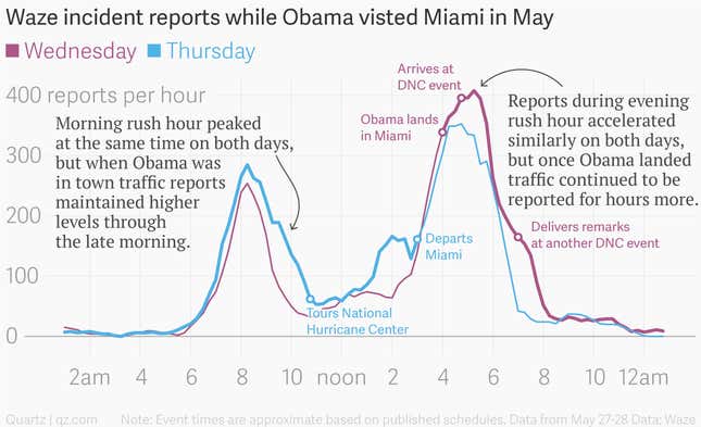
Obama was in Miami for less than 24 hours during his visit, but just looking at the number of Waze reports submitted for the area mapped above, you can see the outsized effect he exerts on traffic flows.

