As Florida struggles with the floods and winds from Hurricane Irma, another big storm in the Atlantic is being closely watched by meteorologists: Hurricane Jose, which is currently considered Category 2, though it is still too early to tell if it will make landfall.https://twitter.com/blkahn/status/906977988390121473
As Florida struggles with the floods and winds from Hurricane Irma, another big storm in the Atlantic is being closely watched by meteorologists: Hurricane Jose, which is currently considered Category 2, though it is still too early to tell if it will make landfall.
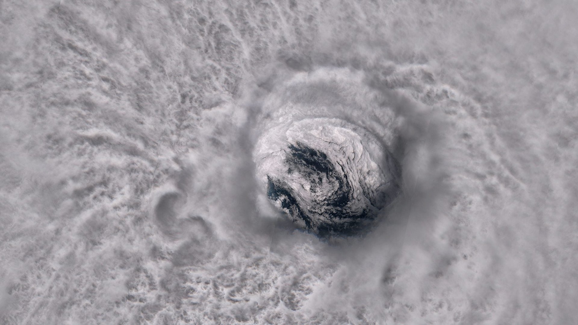
To give some sense of scale to what typically appears as a colorful splotch on maps, meteorologist Antti Lipponen used a satellite to peer straight through the eye of the storm. Through the perspective of the European Space Agency’s satellite Sentinel-2A, the Finnish researcher was able to show a turbulent sea beneath Hurricane Jose.
Join 500,000+ readers who start their day with Quartz.
By subscribing, you agree to our Terms of Service and Privacy Policy.
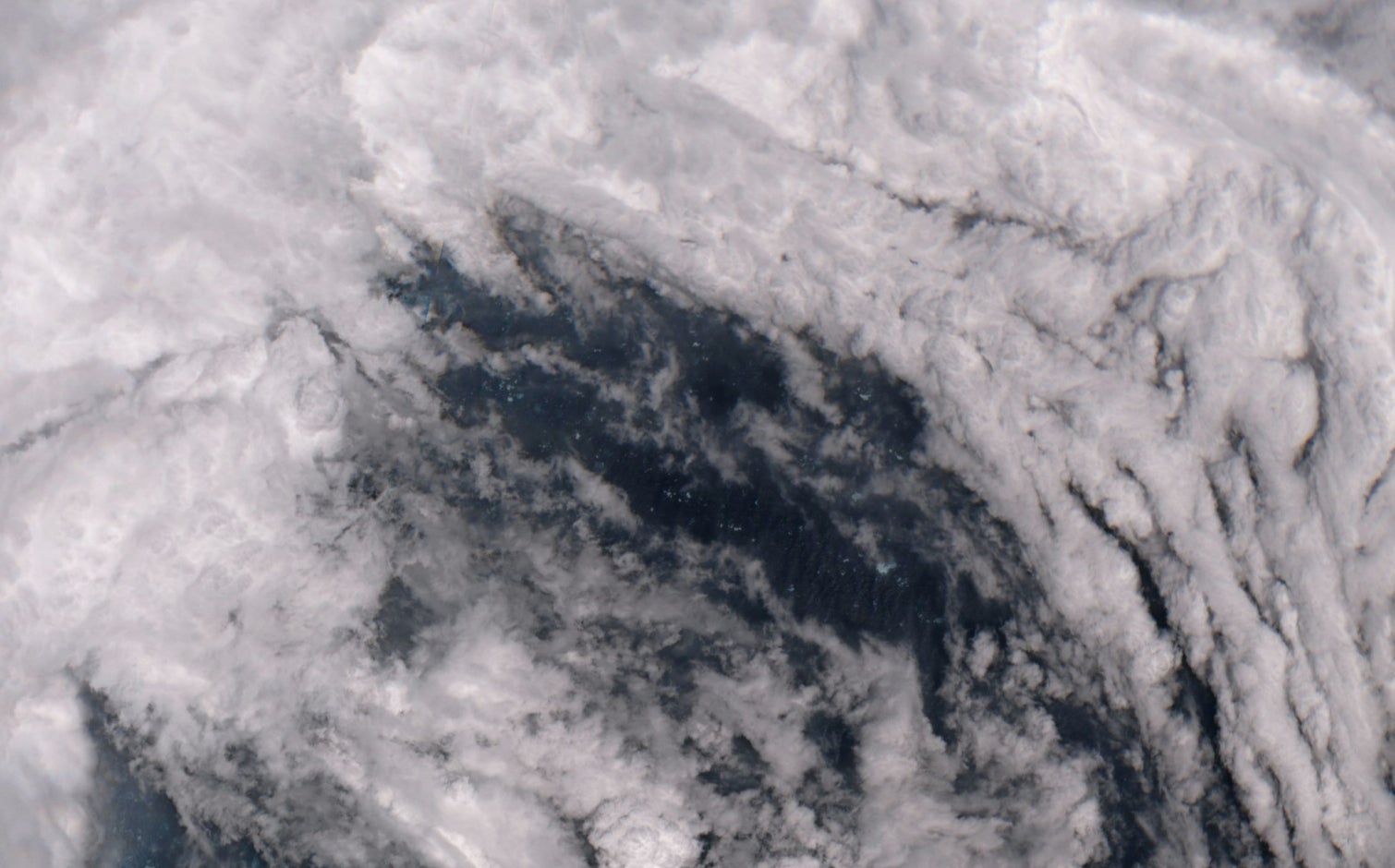
The high-resolution image was captured on Sept 9, when Jose was about 50 miles northeast (80 km) of Barbuda, one of the Caribbean islands that suffered most from Hurricane Irma. It show the contours of the eye of the storm, and even reveals white-crested waves rippling on the Atlantic Ocean.