This map shows how depressingly far from recovery Puerto Rico still is
Updated |It’s hard to fathom the destruction caused by hurricane Maria in Puerto Rico. Three quarters of the island remains without power, and more than 30% of cell towers are still down. Less than 10% of the island’s roads are open, according to the Federal Emergency Management Agency.


Updated |It’s hard to fathom the destruction caused by hurricane Maria in Puerto Rico. Three quarters of the island remains without power, and more than 30% of cell towers are still down. Less than 10% of the island’s roads are open, according to the Federal Emergency Management Agency.
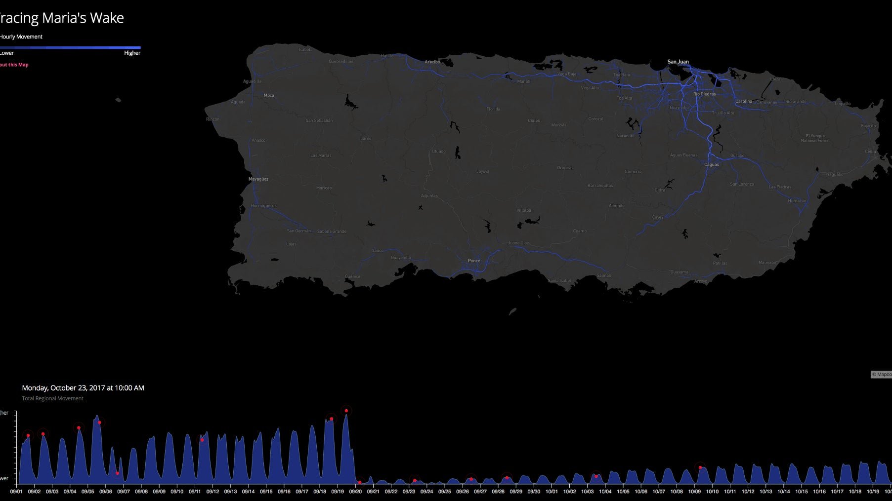
What does that do to everyday activity? You can see the effects clearly in this map, put together by Mapbox. The blue lines, which represent people’s movement throughout the island, show that Puerto Rico ground to a halt after Maria, and that big swaths of it are still very much paralyzed.
The data come from location updates Mapbox gets from the 10,000 or so apps that use its platform, from Snapchat to Weather.com. About 300 million users around the world who use those apps have enabled location services on their phones. Every time they access the location function of an app, it feeds Mapbox’s worldwide log an anonymous location point.
To be sure, the absence of blue streaks doesn’t just represent lack of movement, but lack of cell service. Mapbox can’t track people’s locations if their mobiles don’t work. Still, it serves as a pretty good proxy of how far off Puerto Rico remains from normalcy. The company, which has continued to track activity in Puerto Rico this week, says location signals remain stuck at around 25% of pre-storm levels.
This story was updated to clarify that the data Mapbox collects is anonymous.