A magnitude 7.9 earthquake in Alaska has triggered a tsunami warning
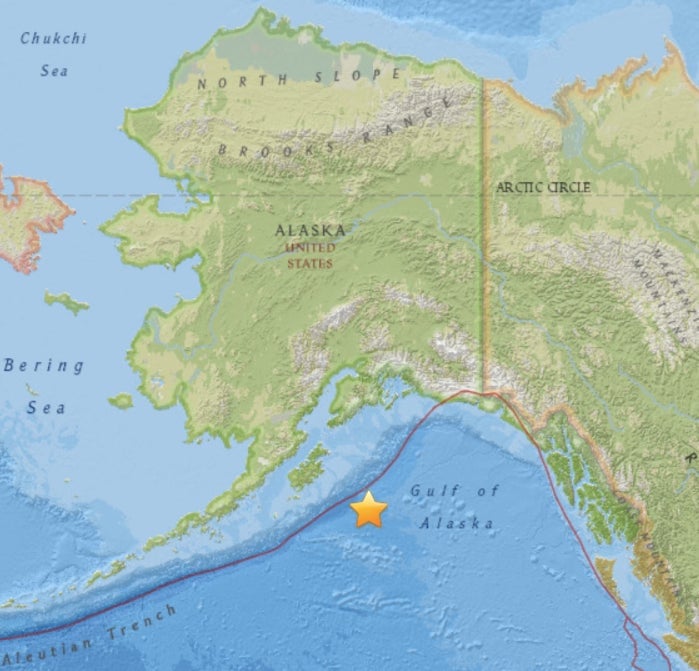
Just after midnight local time, an earthquake of magnitude 7.9 was recorded in Alaska today (Jan. 23). The US Geological Survey (USGS) says the epicenter is in the Pacific Ocean, about 300 km from the nearest large town Kodiak, which has a population of a little more than 6,000 people.

Just after midnight local time, an earthquake of magnitude 7.9 was recorded in Alaska today (Jan. 23). The US Geological Survey (USGS) says the epicenter is in the Pacific Ocean, about 300 km from the nearest large town Kodiak, which has a population of a little more than 6,000 people.
The initial data suggested that the earthquake may have been of magnitude 8.2. As more accurate measurements became available, the USGS downgraded the earthquake to magnitude 7.9.
The US National Tsunami Warning Center said that a tsunami warning had initially been issued to cover much of the western coast of North America and Hawaii.
If a tsunami were to arrive, the predicted local times are: 1.45am in Kodiak, Alaska, 4.40am in Vancouver, British Columbia, 4.55am in northwest Washington. There have been no immediate reports of damage, according to the New York Times. “The earthquake was enough to wake you. The tsunami alert alarm gets you out of bed,” tweeted JoLynn Lund, an Alaksa resident.
The US National Weather service has confirmed that a buoy located northeast of the epicenter has recorded a 10-meter wave.
Update: At 3am local time, the tsunami warning was canceled for every part except the patch of coast starting from Hinchinbrook Entrance in Alaska to Chignik Bay. At 4am local time, the tsunami warning was lifted altogether.