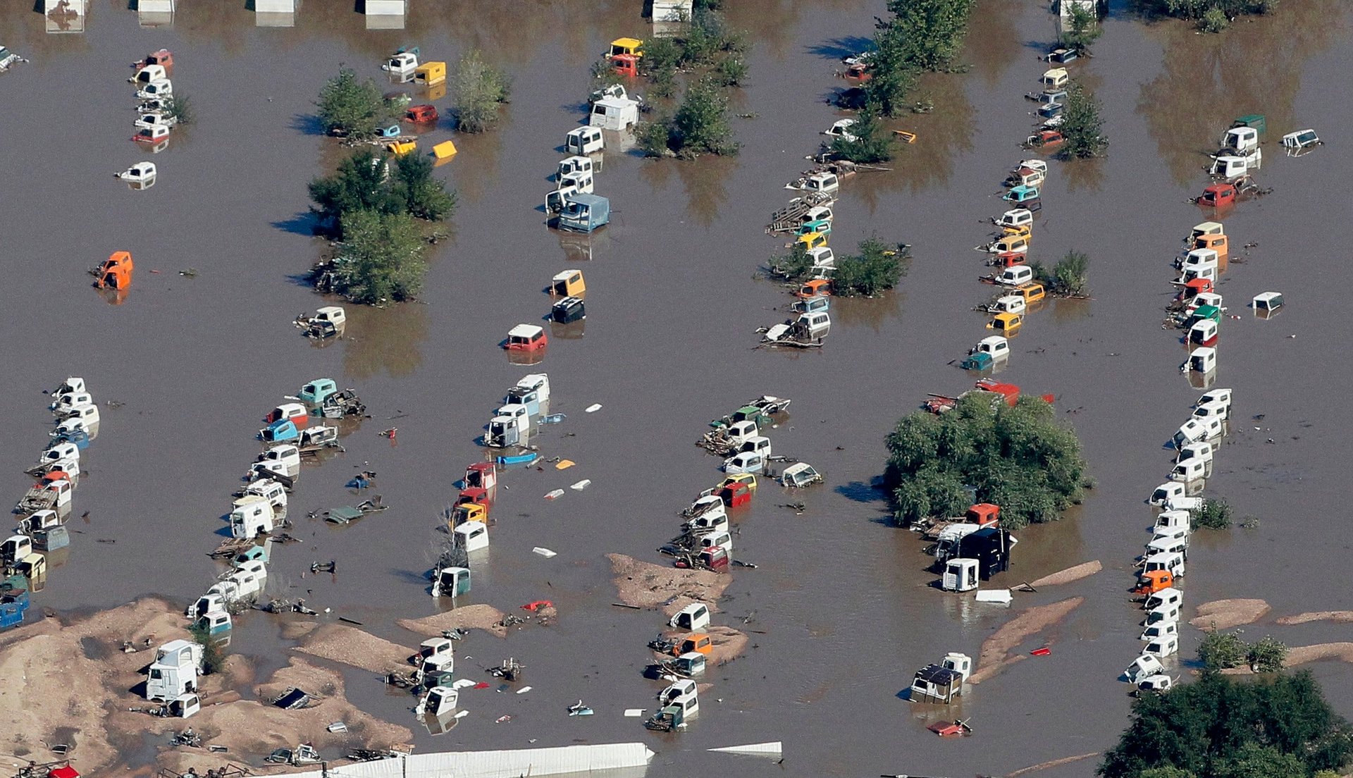
As unprecedented rains finally trickle to an end in Colorado, let’s take a step back. Hundreds of people are still missing. Many towns are cut off from the outside world. And the water is still rising in parts of the state. How bad is it?
Some quick math, for perspective, with thanks to Bob Henson, UCAR, for the methodology:
Basically, it rained a whole lot.
It’s as if a hurricane skipped over Texas and made landfall directly in the Rocky Mountains. In fact, rarely are rainfall totals like Colorado’s found outside of slow-moving hurricanes. In 2001, Tropical Storm Allison camped over the Houston area for most of a week, dumping 40 inches of rain (also 80% of the city’s annual average) and causing billions in damage. That’s the only recent event I can think of that comes close to matching this week’s rains in Colorado in terms of meteorological rarity.
How does this flood stack up against those in the past? Prior to this week, the deadliest flooding event in Colorado history was the Big Thompson River flood of 1976, which inspired a rewrite of local flash flood warning systems. That flood rose and fell within a single day. This week’s flood produced river levels near or above that flood’s peak level for more than 100 hours.
What about the human toll? The heroic air rescue by authorities in Colorado is ongoing, and the number of missing is expected to drop quickly. Authorities are reporting the vast majority of those missing may simply be out of cell phone range, or otherwise cut off from communication. More than 2,100 people (and 500 pets) have been rescued by helicopter so far. There are also reports of people climbing mountains to escape rising water.
What about economic damage? We know that many more people live in Colorado now (about 5.2 million) than at the time of the Big Thompson flood in 1976 (1.8 million). And more people means more houses, and more roads. That flood, if it occurred today, would be at least three times as expensive. The current floods will almost assuredly cost more than that. Why?
What’s clear is that the flooding was exceptionally rare, and will cause an exceptionally large impact to Colorado.
But what does this outsided impact mean to the rest of us?
As I wrote late last week, thanks in part to climate change, the odds are shifting toward more frequent extreme weather events like this. We all watched as the Hurricane Sandy relief bill languished in Congress for months. An economy on the doorstep of recovery doesn’t need yet another surprise $20 billion tab to pick up. Action on climate change would also help to prevent future disasters.
However, perhaps a more ominous takeaway is that the torrential rain in Colorado wasn’t well-forecast. The first flash flood watch was only issued by the National Weather Service on Thursday morning, less than 24 hours before the peak flooding. At the time, the forecaster on duty remarked “rainfall amounts today not expected to be as great as those observed during the past 18 hours.”
Admittedly, flash flood events are notoriously difficult to forecast, especially in mountain environments. Even small rainstorms can be channeled by canyons and spawn raging rivers. Plus, Doppler radar—a critically important tool in real-time rainfall estimation—doesn’t work well in the mountains. As a forecaster, it’s extremely risky to put your neck on the line and call for a 1-in-100 or 1-in-1000 year event. More often than not, you’ll be wrong.
After Hurricane Sandy, there was intense debate within the meteorological community over the quality of American forecast models, versus that of the largest forecasting center in Europe. Perhaps it’s time for the US to launch a crash project in improving forecasts of extreme weather.
Disasters aren’t just about the numbers. They provide a chance to pause and reflect. They are human-centric events, after all. Ultimately, disasters can help inspire change—and the potential of that can be even harder to predict than this week’s historic storm.