New aerial photos show Kilauea’s lava devouring neighborhoods

A neighborhood surrounded.
Image: Reuters/Terray Sylvester
By
We may earn a commission from links on this page.

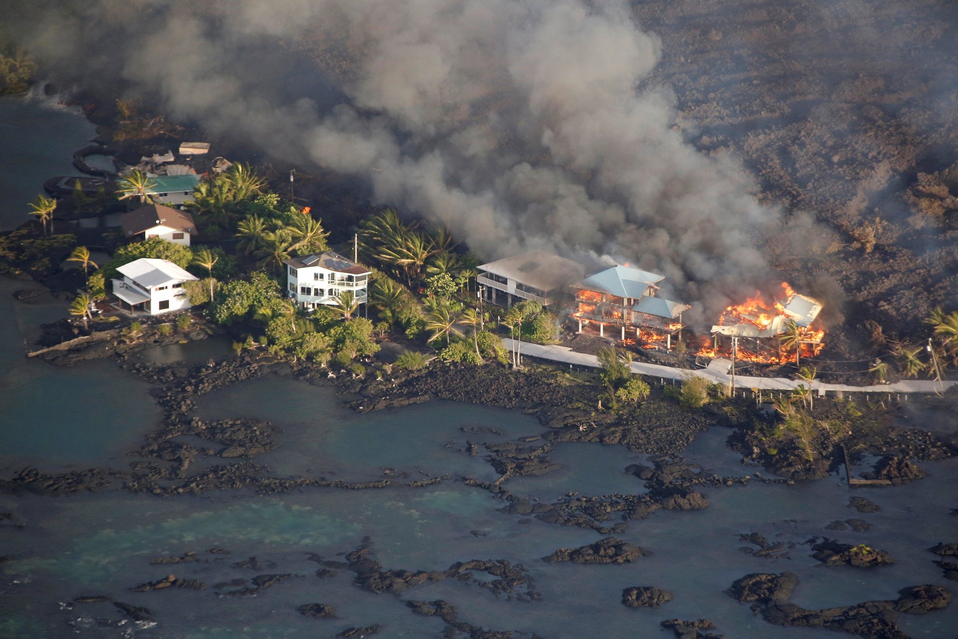
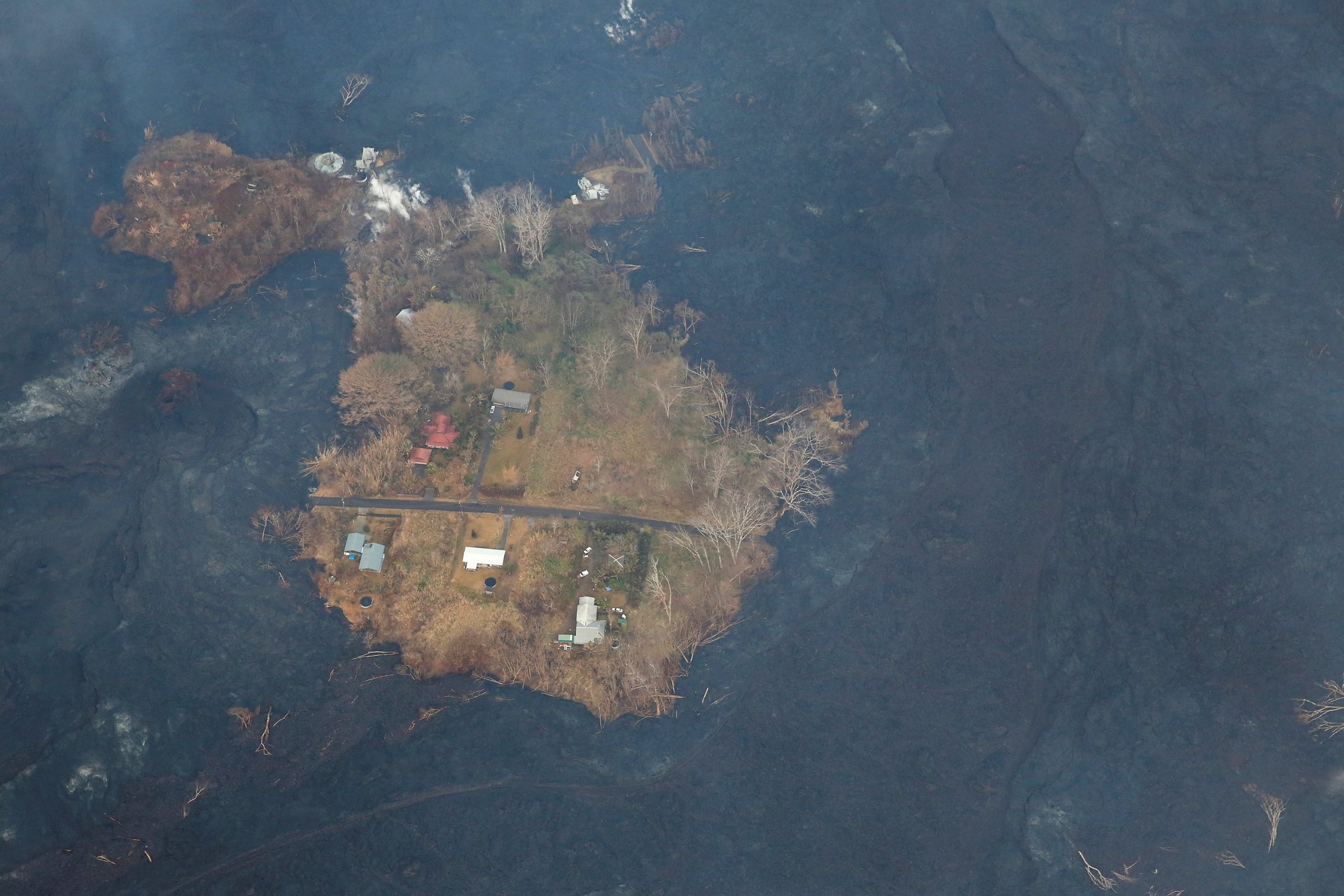
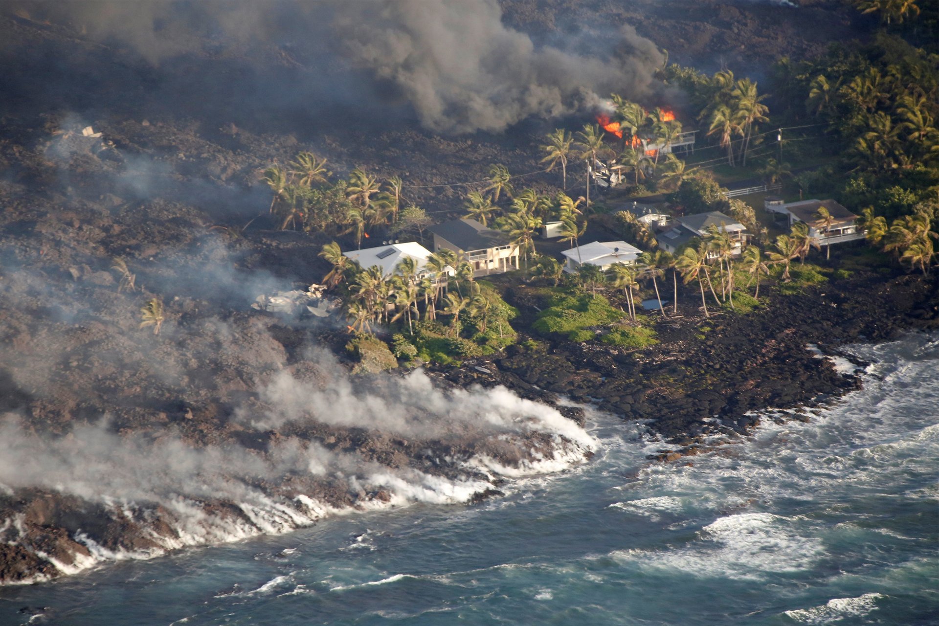
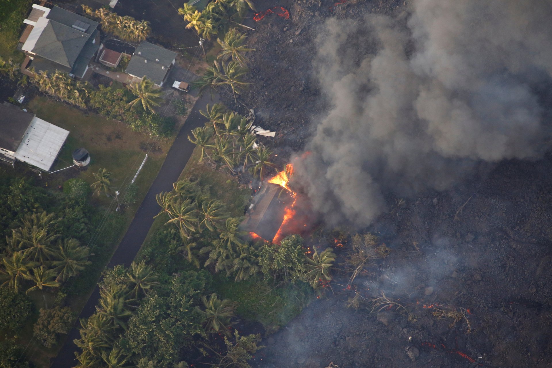
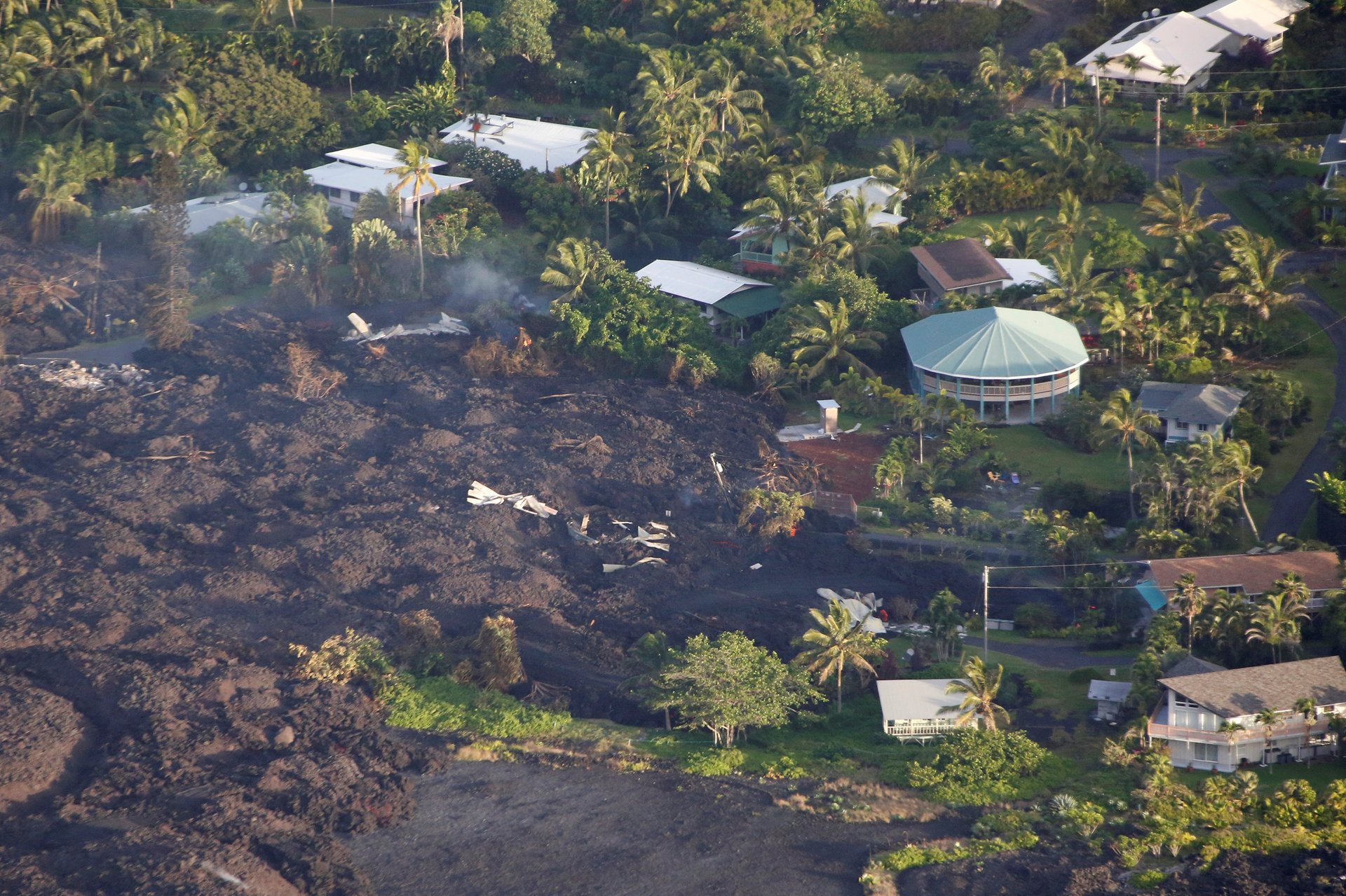
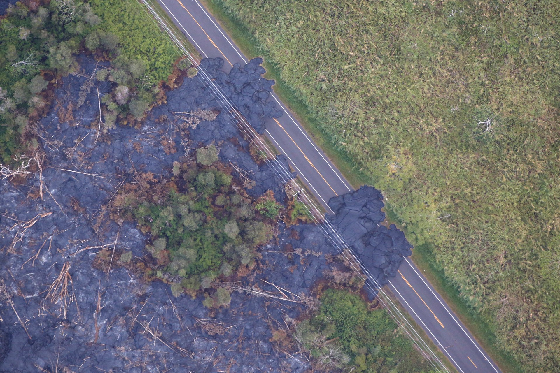
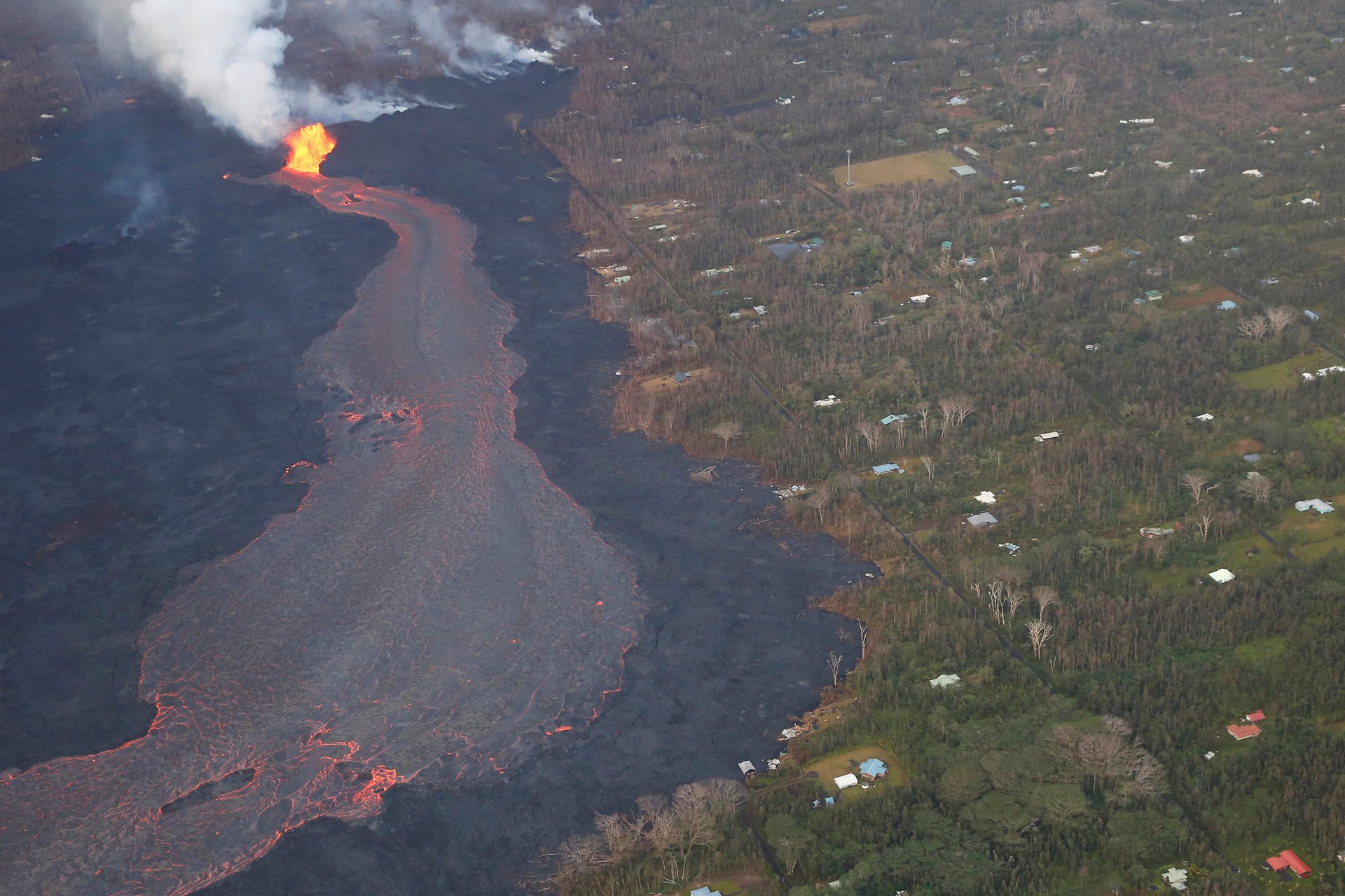
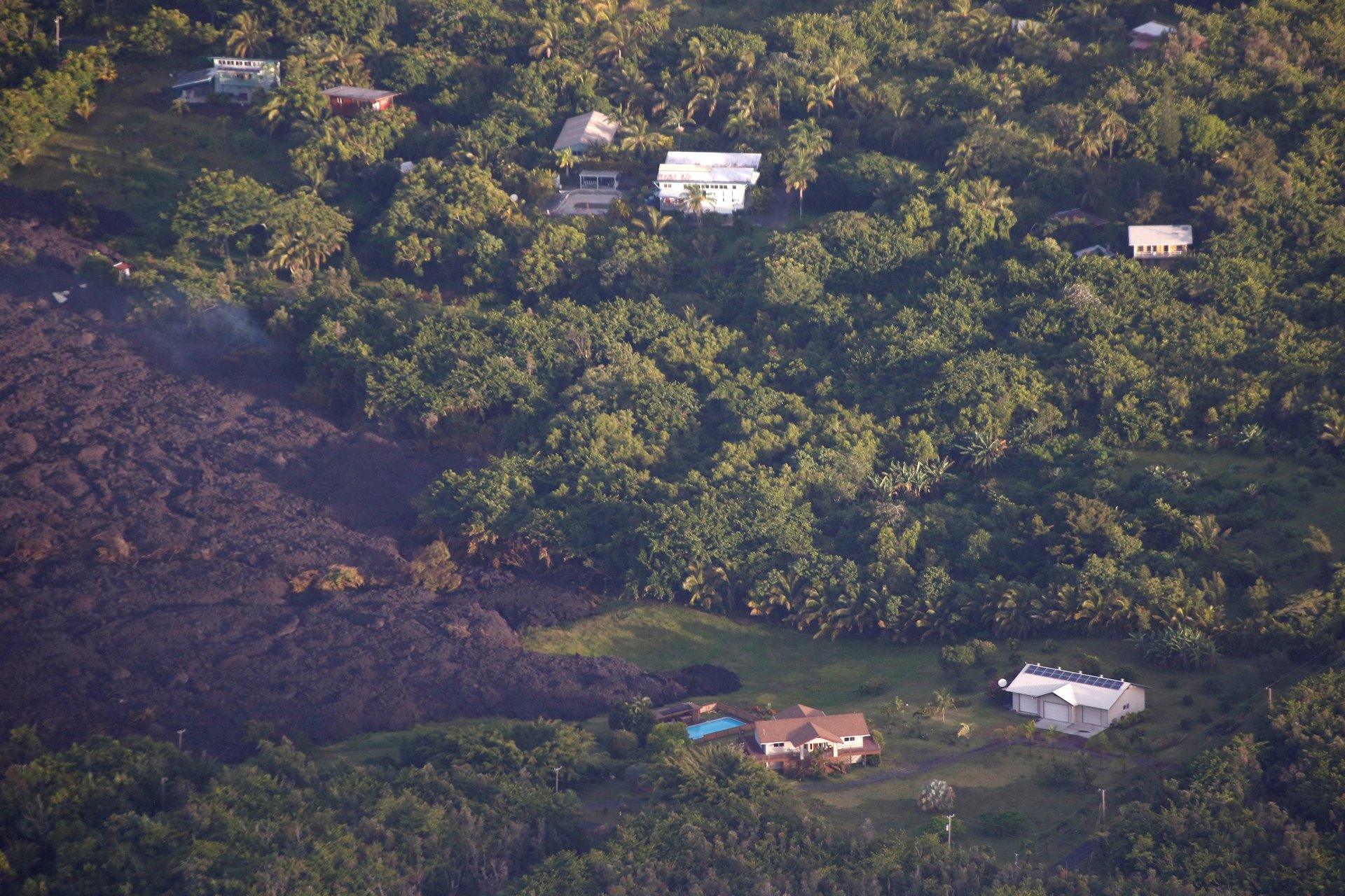
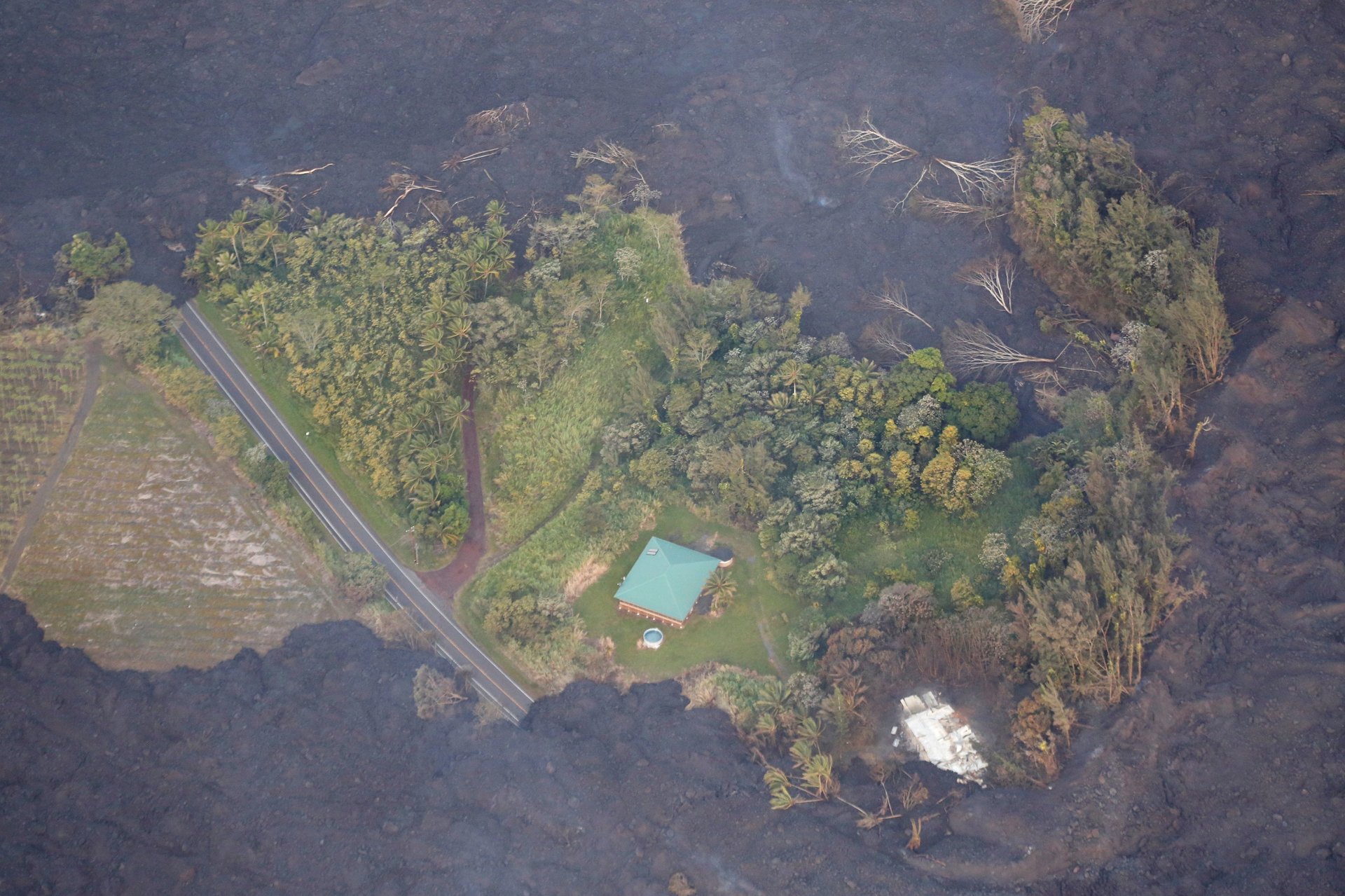
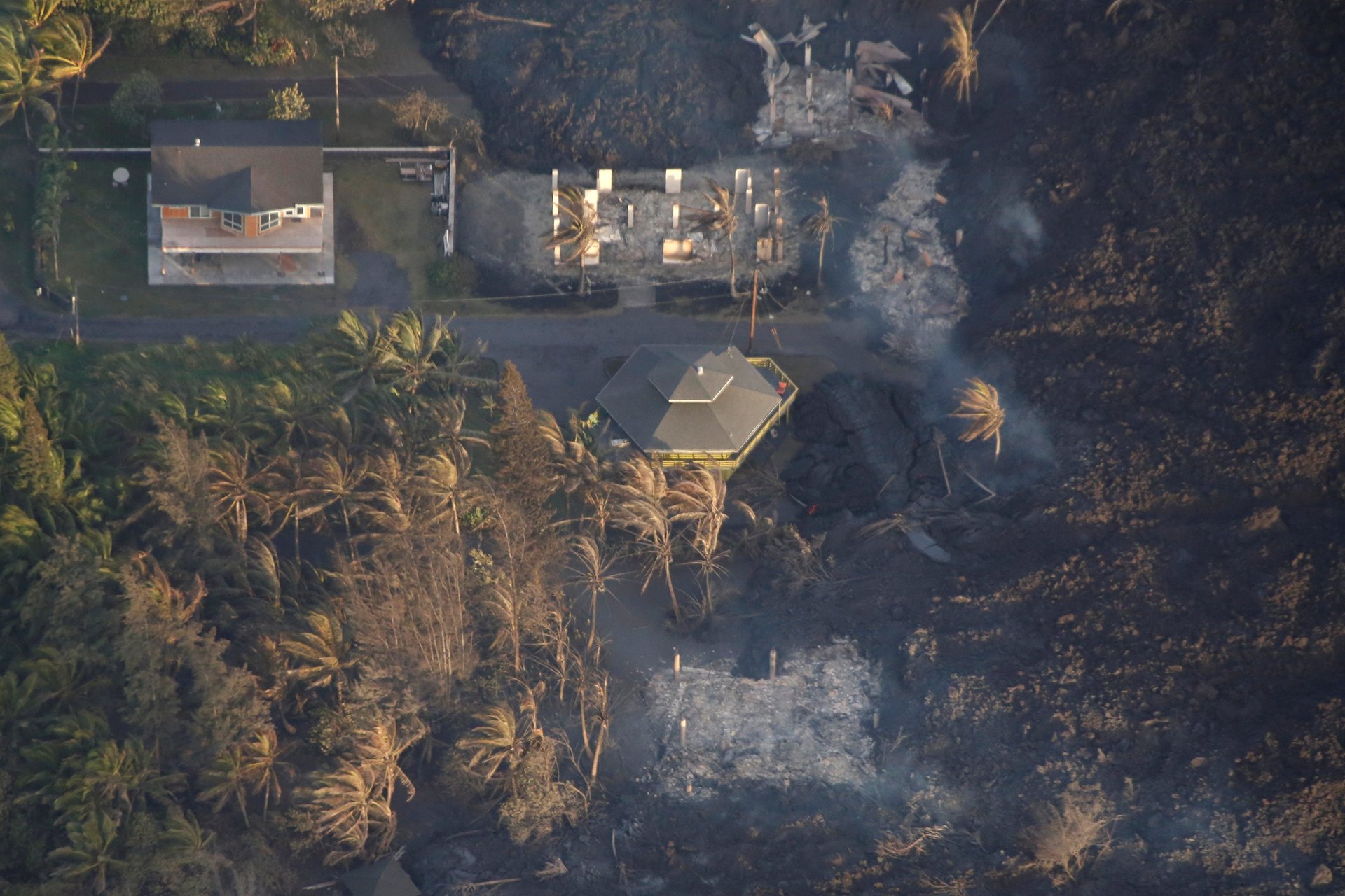
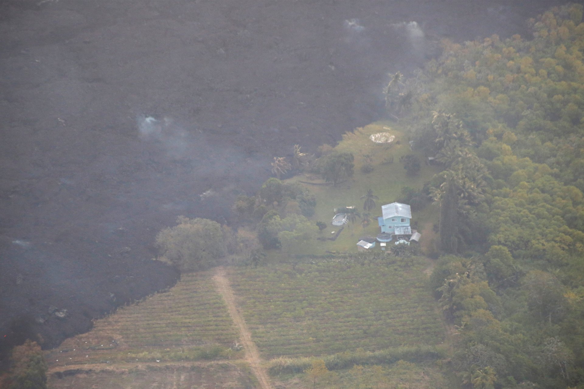
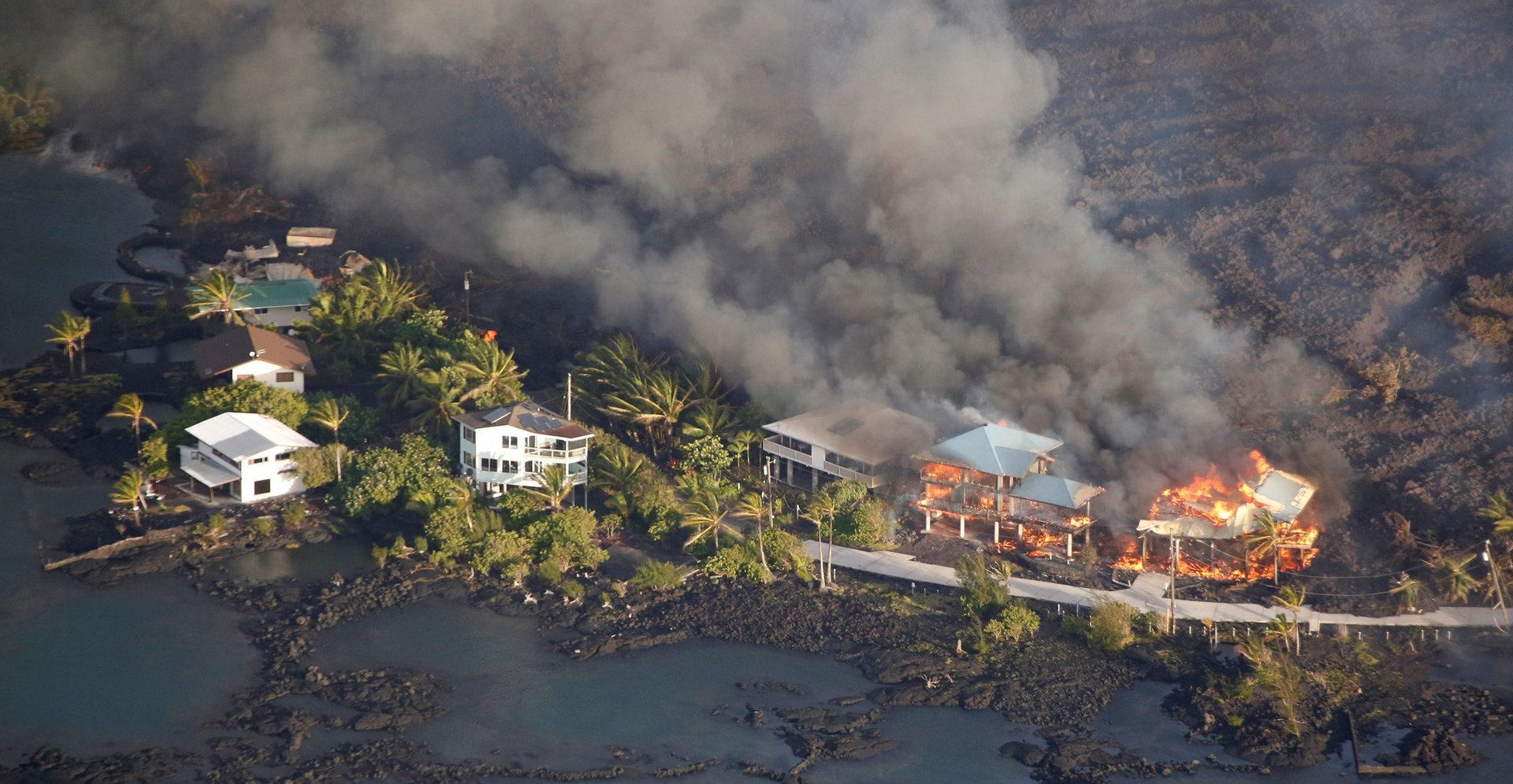
New aerial photos from Hawaii’s Big Island show homes and neighborhoods being engulfed by the river of lava flowing from Hawaii’s Kilauea volcano. The volcano, one of Hawaii’s most active, has been erupting since 1983, but the last month has seen a massive uptick in activity.

So far, the recent eruptions have destroyed at least 117 homes on the Big Island, the AP reports. On June 1, that estimate stood at 87. Officials are updating the number of homes lost as they conduct more aerial surveys to get a full view of the damage, and expect the tally to rise.

Image for article titled New aerial photos show Kilauea’s lava devouring neighborhoods