The biggest risk from Hurricane Florence isn’t the wind alone, it’s the storm surge
Hurricane Florence is expected to make landfall today, hitting the Carolinas and Maryland. In the past 12 hours, the storm has been downgraded from a potential category four storm to a category two. But the lower windspeed of a category two storm doesn’t mean that coastal areas on Florence’s path are out of danger.


Hurricane Florence is expected to make landfall today, hitting the Carolinas and Maryland. In the past 12 hours, the storm has been downgraded from a potential category four storm to a category two. But the lower windspeed of a category two storm doesn’t mean that coastal areas on Florence’s path are out of danger.
When Hurricane Sandy hit the US east coast in October 2012, the damage didn’t always come directly from the storm itself: for some of the coastal areas, it was the “storm surge” that caused the most damage.
What is storm surge?
“Storm surge” is a rising of the sea level due to winds and atmospheric pressure. Elizabeth J. Austin, the founder and CEO of meteorological consulting firm WeatherExtreme, explained to Quartz that storm surge occurs as a hurricane approaches the coast.
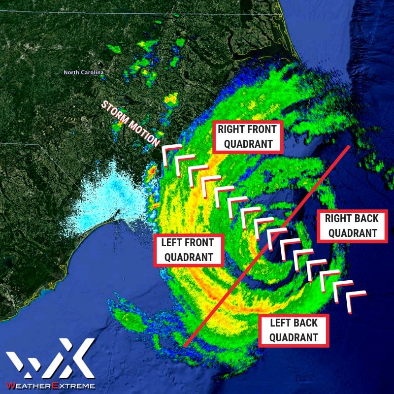
Hurricane Florence is rotating counter-clockwise, in the map below. So the combination of winds and pressure will cause tides to recede in the upper left quadrant of the storm, and to rise in the upper right quadrant of the storm—generating a surge where the hurricane passes over the coast.

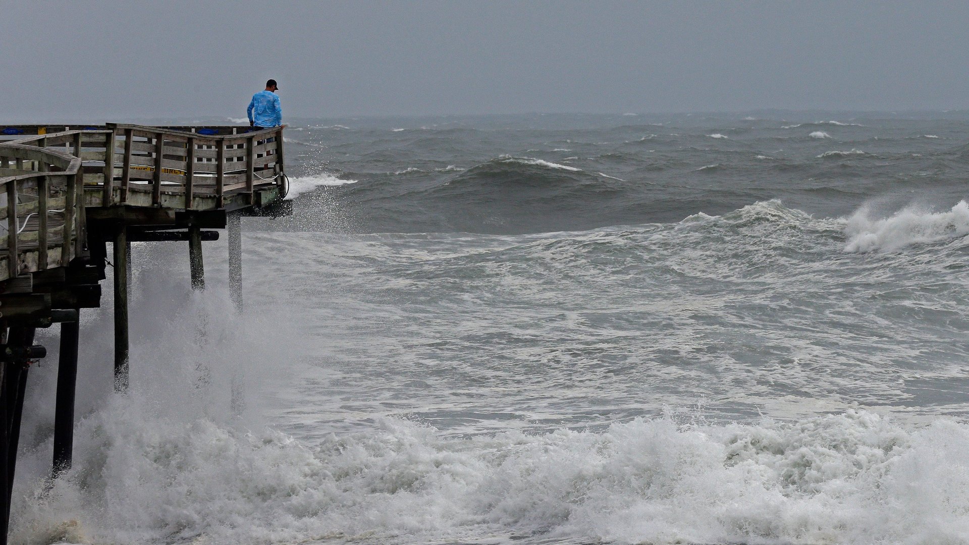
Storm surge, Austin says, doesn’t have the height or sudden impetus of a tsunami, for instance, but it can still cause powerful high waves—due to the hurricane winds—and flooding.
In North Carolina’s Pamlico Sound and Neuse River area, between Cape Fear and Cape Lookout, the storm surge created by Hurricane Florence is expected to be nine to 12 feet high, National Oceanic and Atmospheric Association (NOAA) officials said, even if the storm is only category 2. At the coastal beaches, the sea will rise six to nine feet. That will be accompanied by 20 to 30 inches of rain.
“Just because the wind speeds came down, don’t let your guard down,” Brock Long, the Federal Emergency Management Agency’s top official, said in a press conference on Thursday morning (Sept. 13). “The storm surge forecast has not changed,” he said.
“These winds are going to start pushing water up against the coast and up against the back bay and the inland areas,” Long said. “It’s going to be a major problem up into the streams and tributaries.”
The “storm surge is why many of you have been placed under evacuation,” Long said. “Your time is running out—the ocean is going to start rising within a matter of hours, and your time to get out of those areas is coming to a close.”
A widening hurricane path
Though the speed of the hurricane isn’t especially high, Austin says, Florence is a very large storm, which will still hit with a lot of power. The “wind field,” which is the area of high winds that extends out from the center of the storm, has also expanded, widening the areas that could be affected by a storm surge.
Florence’s hurricane-force winds, where the hurricane reaches its peak strength, will reach up to 80 miles width, and tropical storm-force winds, which are usually about 20 to 30 miles per hour, covering a width of 195 miles.The total area of the storm is currently four times the size of the state of Ohio, according to the National Weather Service.