See how the Palu earthquake shifted the landscape then washed away the shore
Following a 7.5 magnitude earthquake on Sept. 28, a tsunami brought 18-ft waves to Palu, pummeling the coastal town on the Indonesian island of Sulawesi. As first responders and civilians search through the wreckage, with the death toll rising past 1,200, satellite images provide a broad view of the devastation.
Following a 7.5 magnitude earthquake on Sept. 28, a tsunami brought 18-ft waves to Palu, pummeling the coastal town on the Indonesian island of Sulawesi. As first responders and civilians search through the wreckage, with the death toll rising past 1,200, satellite images provide a broad view of the devastation.
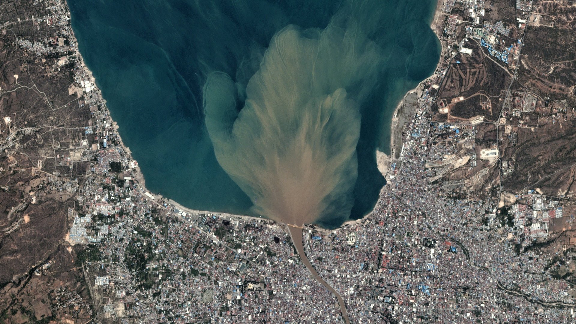
Palu is the capital city of Sulawesi and home to 300,000 Indonesians. Known as the city of the valley, it’s nestled between the archipelago ranges west and east of the city. Sitting at the end of a 20 mile (32 km) long cove, Palu is usually protected against ocean waters. It surprised disaster authorities when tsunami waves channeled down the inlet moving at speeds of 100 mph. This satellite image from Planet Labs shows sediment runoff from receding flood waters.
Taking a closer look at these images, you can see how the public parks, cafes, residences, and monuments along the coastline all but disappear from view.
Imagery provided by DigitalGlobe reveals the fate of coastal residences alongside a Palu shopping mall.
Further east along the coast, the tsunami waters destroyed a bridge, flooding nearby homes.
Closer inland the effects of the earthquake are clear. Landslides from the shear mountainsides ran through villages.
A closer look at landslide and liquefaction of the village Petobo south of Palu.
Resources for aid are already tight, as NPR reports, with relief workers still busy in Lombok, where an earthquake struck in August. Without heavy equipment, relief workers in Palu have been removing rubble by hand.