New images from NASA satellites show just how much the Florida Panhandle was impacted by Hurricane Michael, the brutal storm that slammed into the state with Category 4 strength last week. It has been blamed on at least 16 deaths in Florida and several more across southern states after it was downgraded to a tropical storm. There are still over 1,000 people who have not been accounted for.
A pair of infrared images show the US Southeast at night before and after the storm. The dotted line in the image from Oct. 12 shows the path of Hurricane Michael.
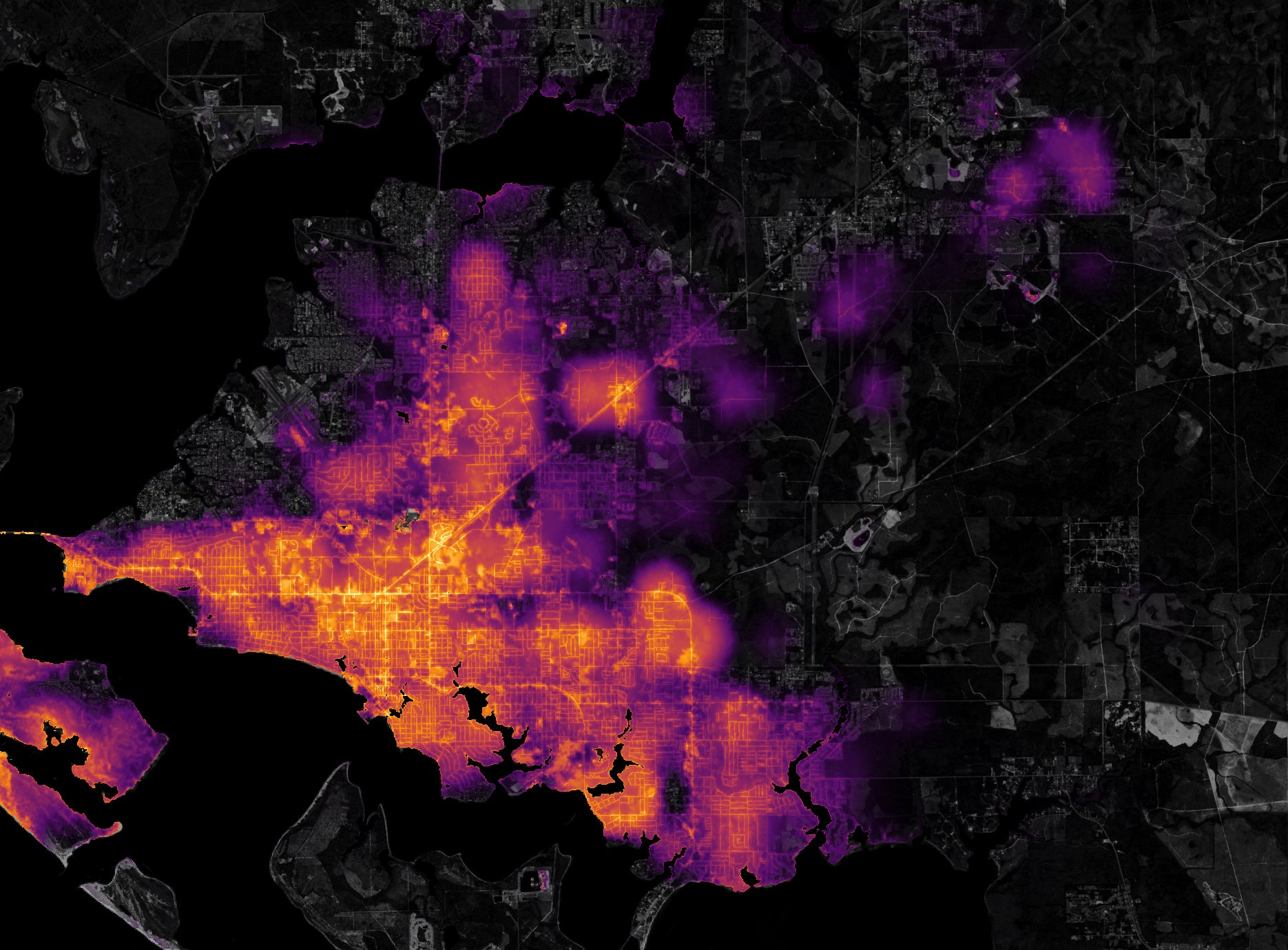
A second set of images, showing Panama City in the Panhandle, brings that into a starker relief. A visualization of changes in light detected between Oct. 6 and 12 was laid over physical and street maps to sync up changes in detected light with its real-life location, down to the city block. The data visualization shows just how strong Michael was, enough to leave nearly the entire city shrouded in darkness after the sun set.
In a post on the NASA Earth Observatory website, editor Mike Carlowicz notes that this data from several days ago is not an accurate depiction of the current state of recovery, though more than 155,000 homes and business are still without power throughout the Southeast, the majority of outages being in Florida.