A newly released image from the European Space Agency gives a stunning look at what an ice filled crater on Mars might appear like to the naked eye.
A newly released image from the European Space Agency gives a stunning look at what an ice filled crater on Mars might appear like to the naked eye.
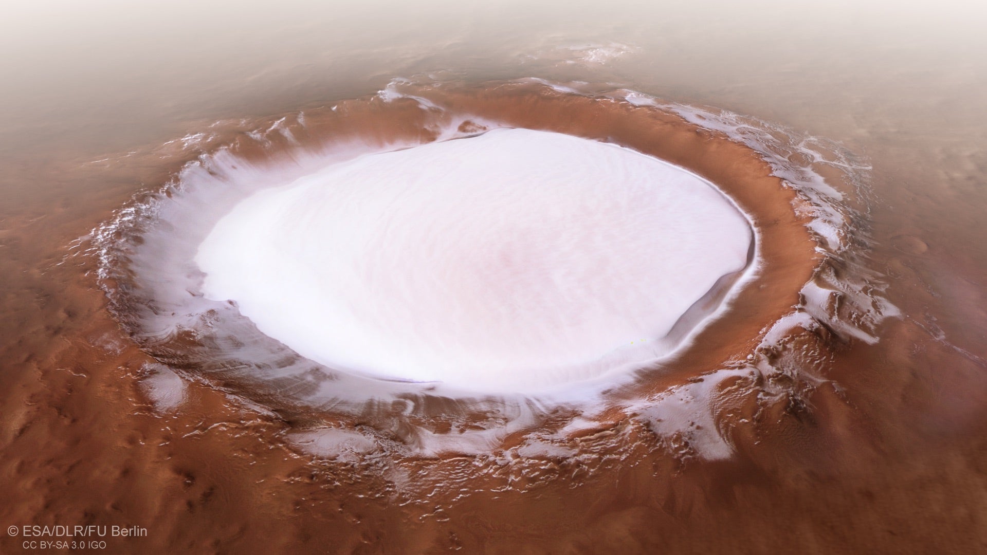
ESA scientists shared a picture of the Korolev crater, an 82-kilometer (50 miles) wide depression filled with ice that reaches nearly two kilometers deep.
Join 500,000+ readers who start their day with Quartz.
By subscribing, you agree to our Terms of Service and Privacy Policy.
What sort of device could have taken that image? At the moment, the only crafts exploring Mars’s surface close up are rovers with limited geographical scope and orbiters, exploring the surface of Mars from way up high. This image, however, appears as if it was taken from the window of plane flying through the Martian atmosphere.
As it happens, the image is actually a simulation. Flat satellite imagery from the ESA’s Mars Express orbiter was laid over existing topographical information. The shift in perspective gives the viewer a much more intimate view of Mars. Instead of a blotch of white on a two-dimensional map, we can more easily grasp how epic the Red Planet’s topography truly is.