There’s something strange happening in the US west. A blizzard blanketed Seattle. Hawaii has seen snow at possibly the lowest elevations ever recorded. And Alaskans are enjoying a relatively balmy February.
The culprit for this topsy-turvy weather: A bend in the jet stream, the band of wind that swirls around the Arctic. The meandering jet stream has created a high-pressure ridge sitting off the coast of the Pacific Northwest, sucking cold air south along the coasts of Washington state, California, and down to Hawaii. At the same time, it’s pulling warm air north up to Alaska.
Hawaiians are used to seeing snow on the peaks of their highest mountains, which climb to nearly 14,000 above sea level. Early yesterday (Feb. 11), officials reported snowfall at Polipoli State Park—which sits at just 6,200 feet.
“Perhaps the first time ever, snow has fallen in a Hawai‘i State Park,” the Hawaii Department of Land and Natural Resources said in a statement posted to Facebook $META. “Polipoli State Park on Maui is blanketed with snow. It could be the lowest elevation snow ever recorded in the state.”
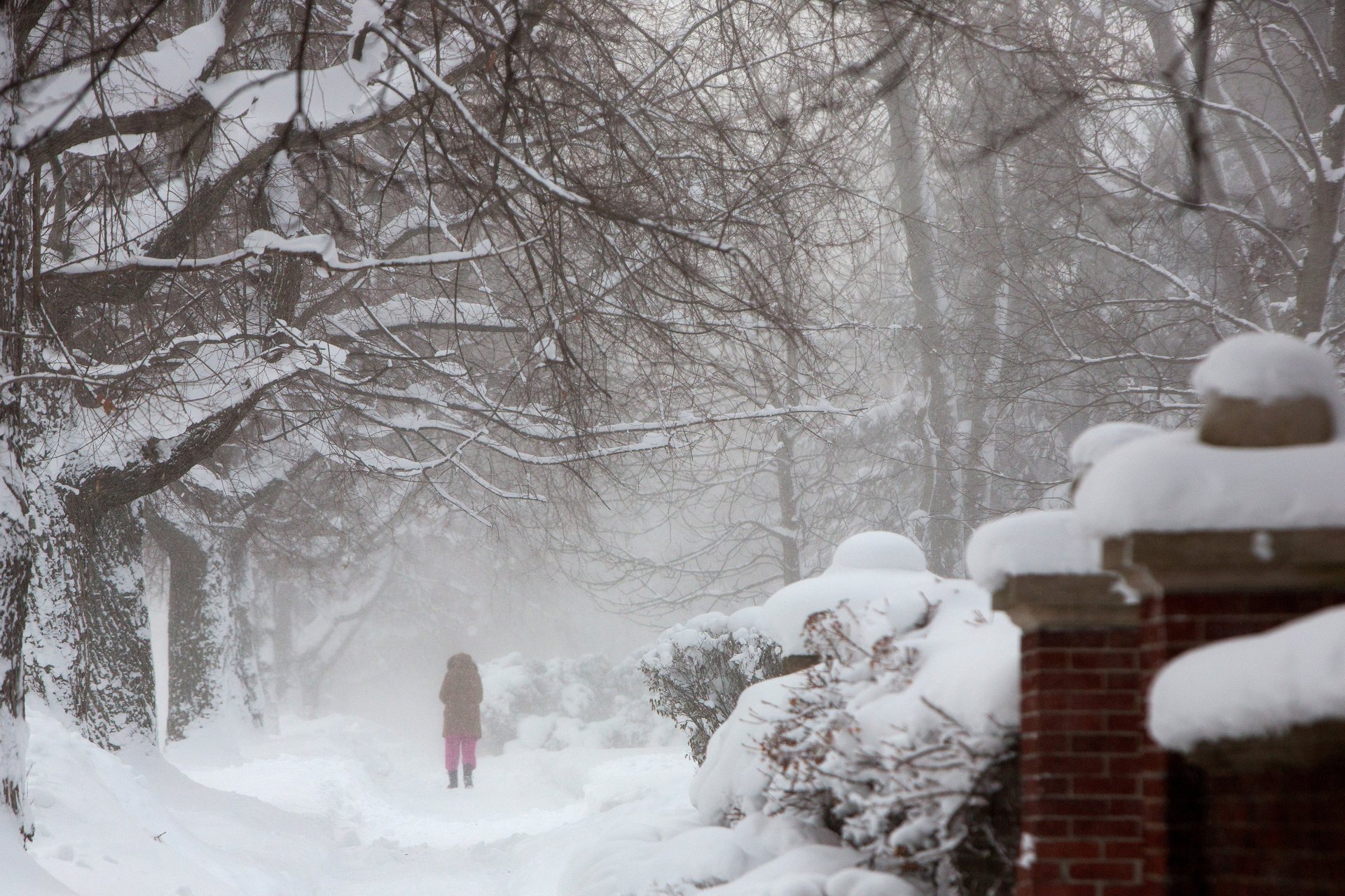
A blizzard dumped more than 10 inches of snow in normally temperate Seattle, on Sunday and into yesterday. Already, it’s the snowiest February ever recorded in the city.
Across the state, schools closed, the legislature canceled hearings, and classes were canceled at the University of Washington and Washington State University.
Meanwhile, the snow has spread all the way east to New York and the effects of the storm stretched south into Georgia, Alabama, and Florida, which saw high winds and flooding. “When you include the South, the storm is impacting almost every part of the United States in some shape or form,” AccuWeather meteorologist Tyler Roys told USA TODAY.
The only part of the US that has escaped some abominable snow is Alaska, which is going through an abnormal thaw of late.
Several dog-sled races scheduled for January and February—usually reliably cold months—have been canceled or curtailed because above-freezing temperatures have made conditions so slushy.
Two weeks ago, Alaska saw a similar wave of warmer-than-usual weather as the rest of the country shivered through a snowy winter storm caused by another aberration in the jet stream. Then, the town of McGrath, Alaska experienced record-setting January temperatures of 42°F. McGrath didn’t set any new records yesterday, but its high of 28°F is warm for February, when highs are typically 12°F.
Scientists are split on whether climate change is contributing to the snowstorms that have recently blanketed the northern US, while bringing unusually warm weather to other parts of the globe.
Jennifer Francis, a senior scientist at the Woods Hole Research Center in Massachusetts, argues that warmer temperatures in the Arctic destabilize the jet stream and the polar vortex, causing them to bend south and bring cold polar air with them. But, she has told Quartz, “this is a relatively new hypothesis that is not yet widely accepted by climate scientists.”
Other researchers argue that variations in the jet stream and polar vortex happen naturally, and that there isn’t yet enough data to lay the blame on climate change.