You may have heard that New York is hosting the Super Bowl on February 2, 2014. In point of fact, the game is being played in East Rutherford, New Jersey, at the home stadium of the confusingly named New York Giants and New York Jets, with the New York City skyline off in the background.
You may have heard that New York is hosting the Super Bowl on February 2, 2014. In point of fact, the game is being played in East Rutherford, New Jersey, at the home stadium of the confusingly named New York Giants and New York Jets, with the New York City skyline off in the background.
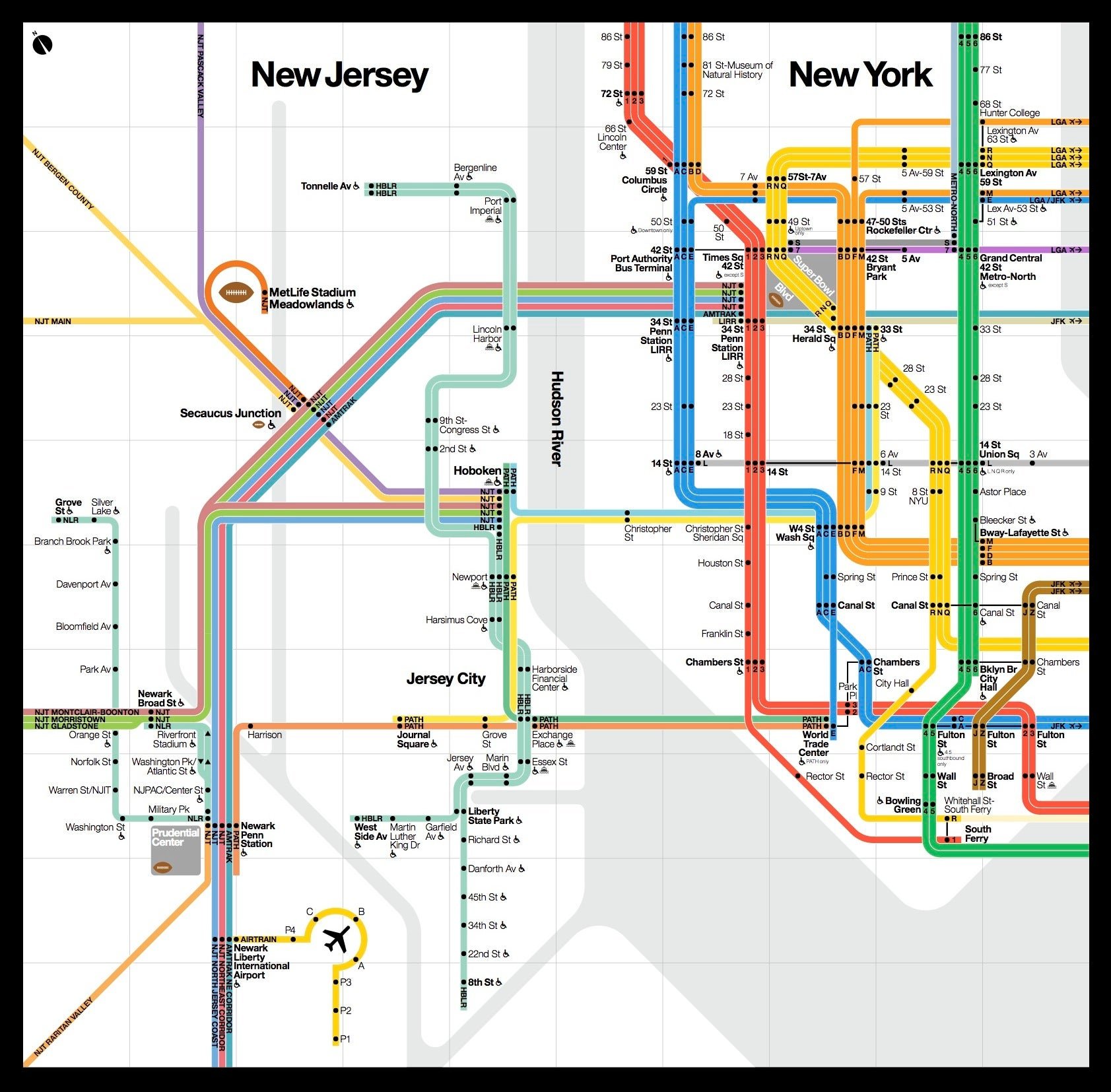
That’s why the region’s various providers of public transportation are calling it “the first mass transit Super Bowl.” To buttress their case, the agencies have just released a first-of-its-kind map of all the rail lines connecting New York and New Jersey. It’s a beautiful rendition in the style of Massimo Vignelli’s famous map of the New York City subway system that debuted in 1972 but was scrapped seven years later in favor of a more geographic than diagrammatic approach. Designers are still smarting from that decision.
Join 500,000+ readers who start their day with Quartz.
By subscribing, you agree to our Terms of Service and Privacy Policy.
This homage—it was, in fact, designed by his firm Vignelli Associates—includes New Jersey Transit, the New York City Subway, Metro-North, PATH, Long Island Railroad, and Amtrak. Click here for a full PDF of the map.
