From an island in Lake Superior to the Alaskan Arctic, these 20 national parks offer world-class scenery with far fewer crowds than their more famous counterparts
-1920x1282.jpg)
RocksterWho / Getty Images
The U.S. national park system encompasses more than 400 sites, but public attention collapses around a small number of names. Yellowstone draws nearly four million visitors a year. Grand Canyon draws six million. Great Smoky Mountains, the most visited park in the country, sees more than 13 million. Meanwhile, parks with terrain just as dramatic — and in some cases far more unusual — receive a fraction of that traffic and that attention.
This is partly a marketing problem and partly a geography one. The parks that attract the most visitors tend to be closest to major cities, most visible in popular culture, or most easily legible as a postcard image. The rest — including parks that protect some of the oldest exposed rock in the Western Hemisphere, the only living coral barrier reef in the continental U.S., and ecosystems found nowhere else on Earth — go largely unrecognized.
The consequences are real. Overcrowding at the most-visited parks has become a genuine problem. Trailhead parking lots fill before sunrise. Reservations sell out months in advance. In some places, the wilderness experience has given way to something closer to a queue. Visitors looking for solitude, unobstructed views, or any real sense of being remote have to work harder to find it.
These 20 parks offer exactly that. Some are remote by design — accessible only by floatplane or ferry, or located in states few people consider as travel destinations. Others sit in plain sight, within an hour's drive of major metro areas, yet rarely make serious itineraries. A few receive so few visitors annually that rangers can outnumber tourists on certain days.
The list below covers all corners of the country: a lake island in Michigan reachable only by boat, a canyon in Colorado deeper than its own width, a forest in South Carolina protecting one of the tallest tree canopies in the eastern U.S., and an Alaskan wilderness above the Arctic Circle that may be the most genuinely remote place in the national park system. None of these parks are secret. What they lack is attention — and that, for now, remains their advantage.
Sanya Kushak / Getty Images
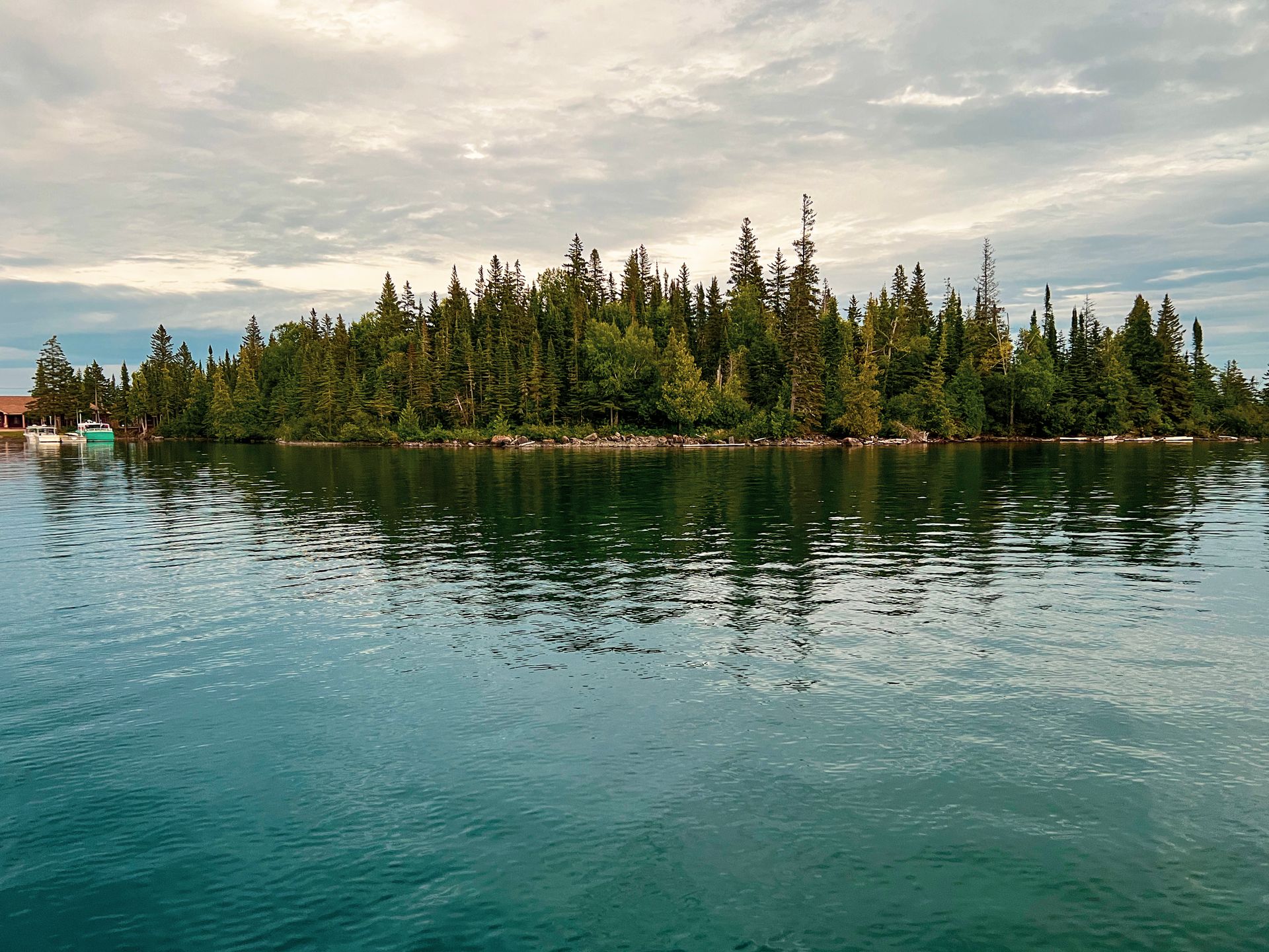
Isle Royale sits in the northwestern corner of Lake Superior, a 45-mile-long island accessible only by ferry or floatplane from Michigan or Minnesota. There are no roads connecting it to the mainland, no bridges, no casual drive-in option. That inaccessibility makes it one of the least-visited national parks in the lower 48 states — which, depending on your perspective, is either a barrier or the point entirely.
The park covers the main island and more than 400 smaller islands surrounding it, along with a portion of Lake Superior itself. The terrain is rugged and heavily forested, cut through with inland lakes, wetlands, and rocky ridgelines that offer sweeping views of the surrounding water. The island's geology is distinctive — it sits atop ancient lava flows from a billion-year-old volcanic rift, and copper deposits throughout the rock were mined by Indigenous people thousands of years before Europeans arrived. Archeological evidence suggests human presence on Isle Royale stretching back at least 4,500 years.
The island is well known among ecologists for its wolf and moose populations, which have been studied in one of the longest-running predator-prey studies in the world. The project began in 1958 and has continued nearly uninterrupted since. Because Isle Royale is an isolated ecosystem — neither species crosses to the mainland with any regularity — it offers researchers a relatively controlled environment for studying how predator and prey populations influence each other over time. The wolf population has fluctuated significantly over the decades, driven by disease, inbreeding, and climate change affecting ice bridges that once allowed occasional immigration from Canada. The park service introduced additional wolves in recent years to bolster the struggling population.
For visitors, the park is a backpacking and paddling destination. The Greenstone Ridge Trail runs the length of the island — roughly 40 miles — and offers a multi-day route through boreal forest and along rocky ridges. Dozens of campgrounds are distributed throughout the island, accessible only on foot or by water. The park closes each winter, from November through mid-April, making summer and early fall the only windows for most visitors.
Ferry service runs from Houghton and Copper Harbor in Michigan, and from Grand Portage in Minnesota. Travel times range from 90 minutes to six hours depending on the departure point. Seaplane service from Houghton cuts that to about 35 minutes. The remoteness and combined travel cost keep annual visitation below 30,000 — a number that, for comparison, Yellowstone can see in a slow weekend.
The experience on Isle Royale is categorically different from most national parks. There are no crowds at trailheads, no traffic on internal roads, and no cell service across most of the island. Loons call across the inland lakes at dusk. Moose wade through marshy shallows in the early morning. The lake is vast enough in every direction to erase the sensation of being close to anything else.
RC Victorino / Unsplash
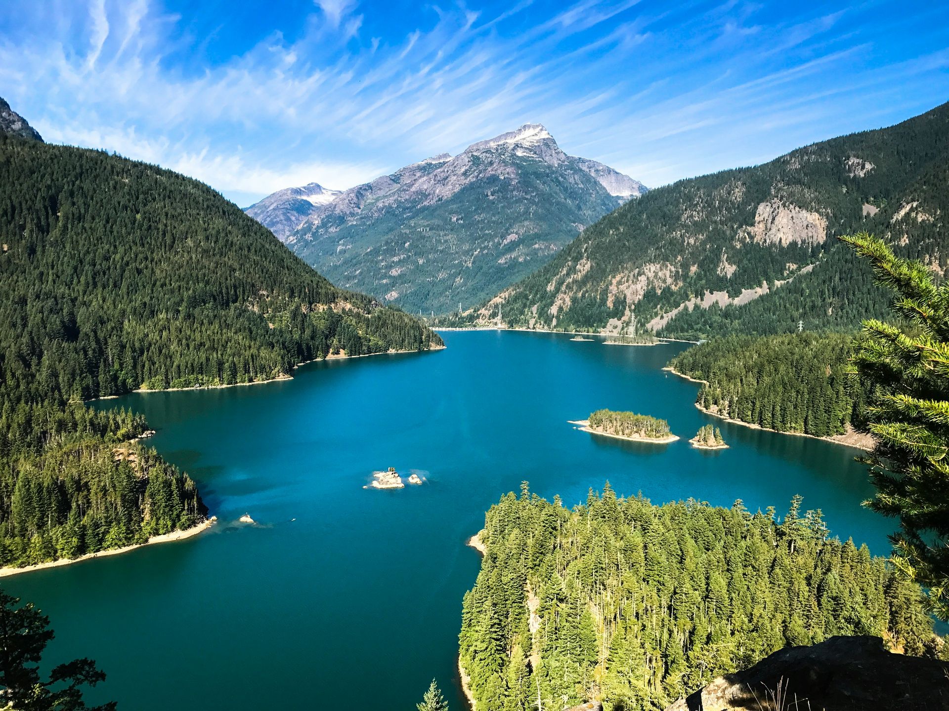
North Cascades National Park occupies a stretch of the Cascade Range in northwestern Washington state, roughly two hours east of Seattle. It is home to more glaciers than any other park in the contiguous U.S. — more than 300 named glaciers cover the peaks — yet it consistently draws fewer than 40,000 recreational visitors per year, placing it among the least-visited parks in the lower 48.
Part of the reason is access. The North Cascades Highway, State Route 20, runs through the park's southern edge and provides one of the most scenic drives in the country, but the road closes each winter due to snow and doesn't reopen until spring. The park's interior is largely roadless. There are no lodges within the main park unit, and most of the wilderness is accessible only by trail. For visitors accustomed to drive-up viewpoints and visitor centers with gift shops, North Cascades asks more.
What it offers in return is a landscape of extraordinary density. The peaks here — many exceeding 8,000 feet — are jagged and heavily glaciated in a way that distinguishes them from the rounded summits of other mountain parks. The park receives some of the highest snowfall totals in the U.S., which feeds a hydrology that includes hundreds of rivers, streams, and lakes. Diablo Lake, accessible from the highway, turns a surreal shade of turquoise from glacial flour suspended in the water — a visual that rivals anything in Banff or the Alps.
The park is divided into three administrative units: the North Cascades National Park proper, and two flanking national recreation areas — Lake Chelan and Ross Lake. Ross Lake stretches north into Canada and is navigable by boat. Lake Chelan, to the south, is one of the deepest lakes in the U.S. and is accessible by ferry from the town of Chelan.
Wildlife in the park includes grizzly bears — one of the few populations in the lower 48 — as well as black bears, mountain goats, wolverines, and gray wolves. The grizzly population here is extremely small and rarely encountered, but the presence of all four large carnivores — grizzly, black bear, mountain lion, and wolf — makes North Cascades one of the most ecologically complete parks in the country. The absence of roads through the interior has preserved wildlife corridors that are increasingly rare in the lower 48.
Hiking options range from short walks near the highway to extended backcountry routes requiring permits and technical navigation. The Cascade Pass trail, a 3.7-mile route to an alpine saddle above the valley, is one of the most rewarding moderate hikes in the park. For anyone willing to put in the time and physical effort, North Cascades consistently delivers at the level of parks that draw ten times the visitors.
UniversalImagesGroup / Getty Images
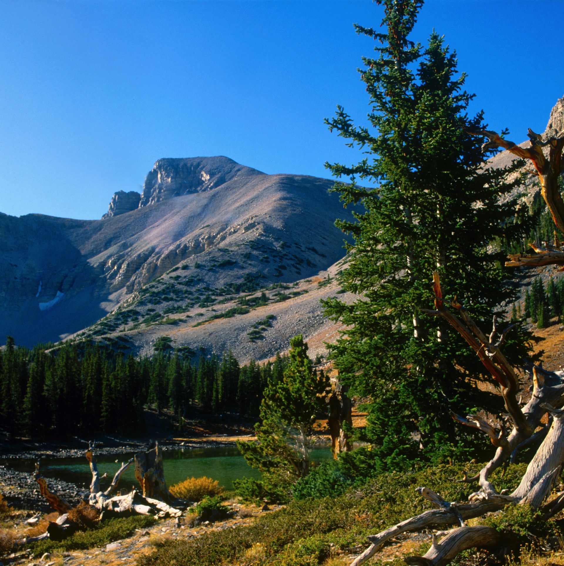
Great Basin National Park sits in eastern Nevada near the Utah border, in a remote basin-and-range landscape that most travelers pass through without stopping. The park is centered on Wheeler Peak, which rises to 13,063 feet and is the second-highest peak in Nevada. At the mountain's base, a stand of ancient bristlecone pines clings to the rocky soil — some of the oldest living organisms on Earth.
The bristlecones here are not old in a general sense. Individual trees in the Wheeler Peak grove have been dated to more than 4,000 years. Bristlecone pines survive in harsh, high-altitude conditions where other trees cannot — nutrient-poor rocky soil, extreme cold, and low moisture — and their slow growth produces extremely dense wood that resists decay. The trees look twisted and partially dead, with living tissue concentrated in narrow strips of bark. Their age has made them valuable to scientists studying paleoclimatology, because their growth rings record centuries of atmospheric and climate variation.
The park also contains Lehman Caves, a system of marble and limestone caverns first documented by Europeans in the 1880s. The caves hold an unusual density of formations — stalactites, stalagmites, helictites, and shield formations — in a relatively compact space. Guided tours run year-round, making this one of the few attractions in the park accessible in any season.
Great Basin sits in a genuine dark sky zone. The nearest significant city is Salt Lake City, more than three hours away. Light pollution is minimal, and the park holds designation as an International Dark Sky Park. On clear nights, the Milky Way is visible to the naked eye in a way that is increasingly rare anywhere in the continental U.S.
Annual visitation hovers around 130,000 — a low number for a park with this range of features. The remote location in Nevada's high desert means most visitors travel specifically to come here, rather than stopping as part of a broader itinerary. That selectivity tends to produce a visitor base that is well-prepared and unhurried, which shapes the experience on the ground.
The nearest town, Baker, has a population of around 70 people. Services are extremely limited, and visitors are advised to arrive with fuel, food, and supplies for their full stay. The isolation is not incidental — it is the dominant feature of the experience, and Wheeler Peak's summit trail rewards early starters with views across a hundred miles of Nevada basin country in every direction.
Credit: columbiametro.com
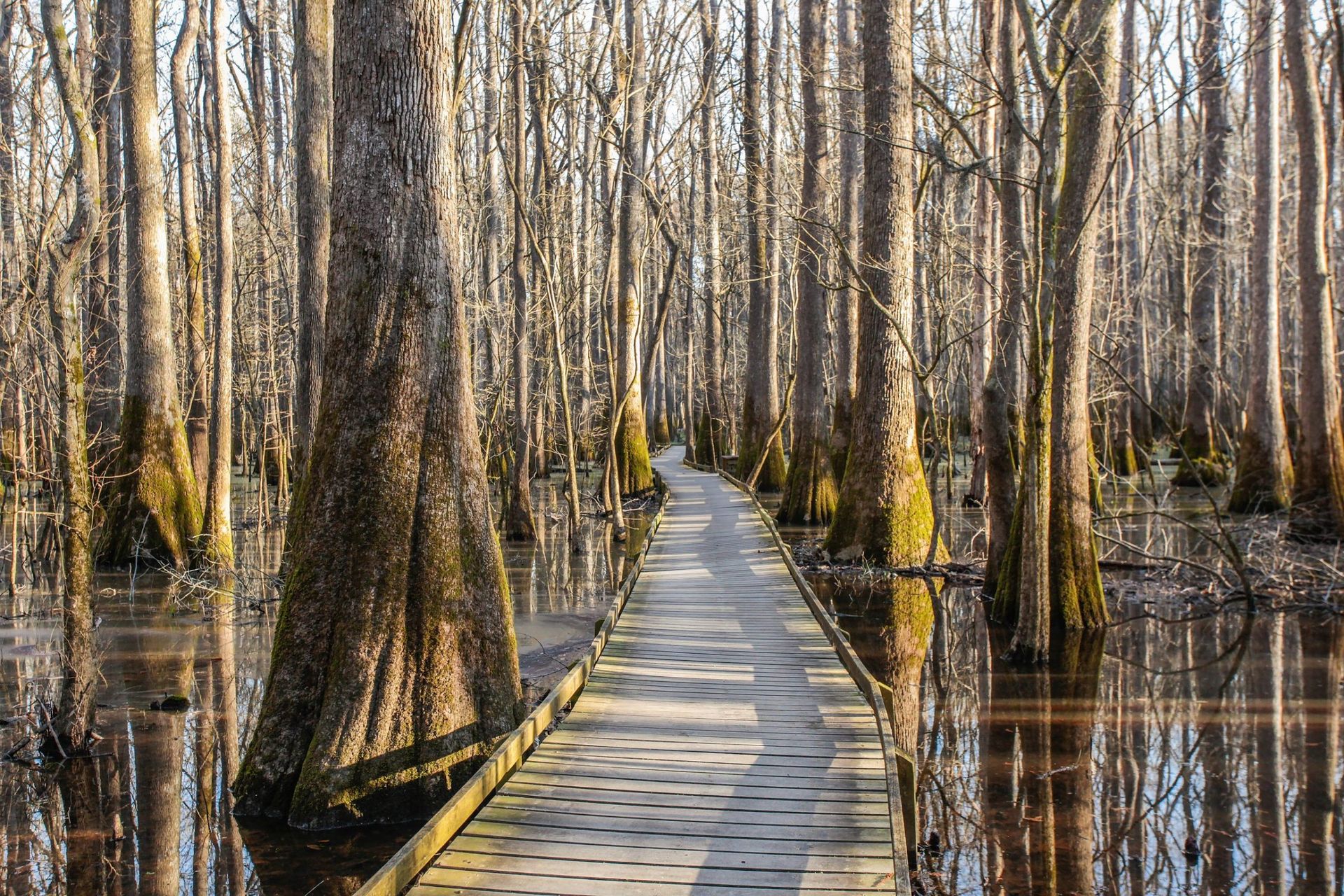
Congaree National Park protects a floodplain forest in central South Carolina, about 20 miles southeast of Columbia. It is the largest intact expanse of old-growth bottomland hardwood forest in the southeastern U.S., and it contains some of the tallest trees in the eastern half of the country. Yet the park consistently ranks among the least-visited in the system, in part because "swamp" remains an unappealing word in the vocabulary of American tourism.
Congaree is not technically a swamp, though it behaves like one seasonally. It is a floodplain — the Congaree River overtops its banks roughly 10 times a year on average, depositing nutrients across the forest floor and maintaining the wet, biodiverse conditions that define the ecosystem. The flooding suppresses development and keeps the forest intact, which is why a significant expanse of old-growth trees survives here when so much of the Southeast's forest was logged through the 20th century.
The trees are the central attraction. Champion trees — national record-holders by height and trunk circumference — include loblolly pine, cherrybark oak, American elm, and swamp tupelo. Walking through Congaree means standing beneath a canopy of trees that in some cases exceed 160 feet in height. The scale is disorienting if you're expecting a modest southern woodland. The combination of towering canopy, dark water, and cathedral-like stillness makes Congaree unlike any other park in the eastern U.S.
The primary access point is the Harry Hampton Visitor Center, which connects to a 2.6-mile elevated boardwalk loop through the interior of the forest. The boardwalk lifts visitors above the wet ground and provides a route through the canopy without requiring waterproof boots. Beyond the boardwalk, a network of backcountry trails extends deeper into the park, much of which floods periodically and requires planning around water levels.
Congaree also hosts a firefly synchronization event each spring — typically in late May or early June — during which several species of fireflies flash in coordinated patterns across the dark forest floor. The timing varies year to year depending on temperature and conditions, and the park service releases projected viewing dates in advance. Demand for the event has grown, and access is now managed by timed entry permit.
The wildlife list is substantial: white-tailed deer, feral pigs, river otters, bobcats, and more than 170 species of birds. Barred owls are common and audible at dusk. American alligators can be found in the park's water bodies. The park is easily reached from Columbia in under an hour, making it one of the most accessible old-growth forest experiences in the eastern U.S.
Linka A Odom / Getty Images
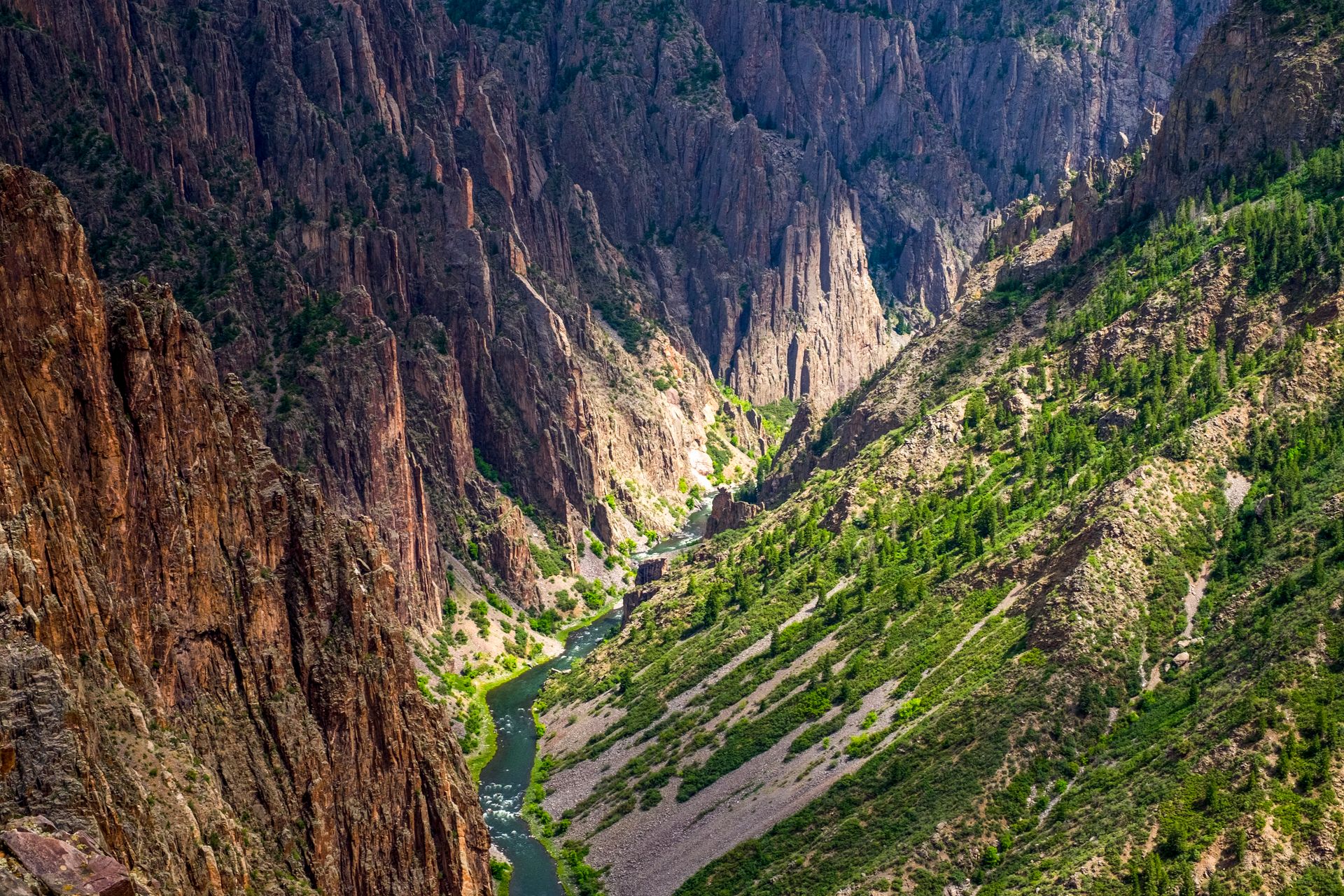
Black Canyon of the Gunnison National Park occupies a narrow, vertiginous gorge in western Colorado carved by the Gunnison River over millions of years. The canyon drops more than 2,700 feet at its deepest point — deeper than the canyon is wide in many sections — creating walls so tall and sheer that the sun reaches the bottom for only a fraction of each day. The darkness those walls create gave the canyon its name.
The dimensions here are extreme even by canyon standards. The Narrows, the tightest section of the gorge, measures just 40 feet across at river level while the walls rise 1,730 feet above. The rock is ancient — Precambrian gneiss and schist, some of the oldest exposed rock in the Western Hemisphere, formed nearly two billion years ago. Layered into that dark rock are pale pink and white dikes of pegmatite, veins of lighter stone that cut across the cliff faces in dramatic diagonal streaks. The visual contrast against the dark canyon walls is one of the more distinctive geological sights in the American West.
Despite being located in Colorado — a state with an exceptionally high-performing tourism economy — Black Canyon sees only around 350,000 visitors per year. Rocky Mountain National Park, also in Colorado, draws roughly four million. The difference comes down to accessibility and familiarity. Black Canyon sits about two hours from Denver and doesn't appear on most itineraries unless travelers are specifically seeking it out.
The park is divided by the canyon into north and south rims, with no road connection between them. The South Rim is more developed, with a visitor center, campground, and a paved road running along the edge with 12 overlooks. The North Rim is significantly less visited and requires a long detour on unpaved road to access. Both rims offer hiking along the canyon edge with open views down into the gorge.
Several steep, unmaintained routes — called painted routes by the park service — descend into the canyon itself. These require technical gear, advance registration, and a high tolerance for exposed terrain. The descent to the river involves fixed chains and loose rock, and the route back up is significantly more demanding than the way down. The bottom of the canyon, where the Gunnison runs cold and fast, is one of the least-visited locations in any park in the West.
Curecanti National Recreation Area, which borders the park to the east, provides additional lake-based recreation on Blue Mesa Reservoir, Colorado's largest body of water. The combination of the two areas makes for a full multi-day visit in a part of Colorado that most tourists skip entirely.
-1920x1280.jpg)
Mark C Stevens / Getty Images
Guadalupe Mountains National Park sits in far west Texas, on the New Mexico border, in a landscape so remote that the nearest large city — El Paso — is roughly two hours away. The park protects the highest terrain in Texas, including Guadalupe Peak, which at 8,751 feet is the tallest point in the state. It receives around 200,000 visitors per year despite containing what many geologists consider one of the most significant fossil reef systems in the world.
The reef is the defining feature. The Capitan Reef — the limestone spine of the Guadalupe Mountains — was formed roughly 265 million years ago, when a shallow inland sea covered what is now the Permian Basin. The sea was ringed by a reef built up by algae, sponges, and other marine organisms over millions of years. When the sea dried up, the reef was buried. Geological uplift eventually exposed it, and erosion carved the mountains visible today. The entire reef complex, including Carlsbad Caverns to the north, is one of the most extensively studied marine reef systems in the paleontological record.
For visitors, the park's chief activity is hiking. The terrain rises sharply from the desert floor into the Chihuahuan Desert highlands, offering dramatic elevation changes over relatively short distances. The Guadalupe Peak Trail is a 4.2-mile round trip that gains roughly 3,000 feet of elevation — steep enough to require real fitness — and rewards hikers with views stretching into New Mexico and across the salt flats to the south. The trail is well-marked and heavily used by peak-baggers seeking Texas's high point.
McKittrick Canyon, on the park's northeastern edge, contains a small seasonal stream and a riparian woodland that turns vivid colors in fall. The canyon is widely considered the best fall foliage destination in Texas, and the colors — driven by bigtooth maple, velvet ash, and Texas madrone — draw visitors in October and November who wouldn't make the trip at any other time of year. The contrast between the desert surroundings and the canyon's deciduous color is genuinely striking.
The park has no lodging and limited services. The nearest gasoline is in Whites City, New Mexico, or Van Horn, Texas. That logistical inconvenience is the primary reason so few people visit a park with this level of geological and ecological significance. The Chihuahuan Desert setting also creates temperature extremes that require planning — summer days exceed 100 degrees Fahrenheit at lower elevations, while the high ridge can be bitterly cold in winter.
Mo Eid / Pexels
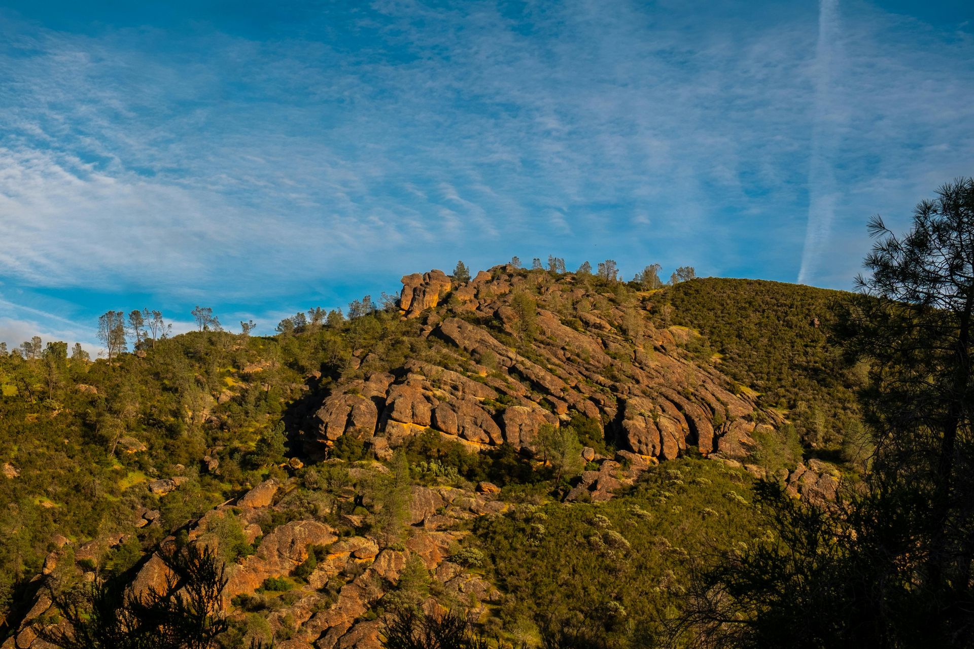
Pinnacles National Park sits in the inner Coast Ranges of California, about two hours south of San Jose and three hours north of Los Angeles. It was designated a national park in 2013 — one of the more recent additions to the system — and it has not earned the public recognition of older California parks. Yosemite sees nearly four million visitors a year. Pinnacles sees around 200,000.
The park's central feature is a volcanic landscape formed roughly 23 million years ago. Lava flows and volcanic debris accumulated here, were later faulted and displaced by the San Andreas Fault — which runs just to the west — and then sculpted by erosion into the spires, crags, and talus caves that define the park today. The rock columns rise hundreds of feet from the chaparral floor and provide some of the best rock climbing in central California. Dozens of routes are established across the formations, ranging from moderate to highly technical.
Talus caves are a defining attraction. The caves at Pinnacles were not formed by dissolution of limestone, as most caves are, but by massive boulders that fell into narrow canyons and jammed together, leaving dark passages beneath. Visitors can walk through these passages with a headlamp — flashlights are available for loan at the visitor center — navigating through the darkness and emerging on the other side. Some passages require crawling and squeeze through tight gaps.
The park is one of the few places in the world where California condors can be reliably observed in the wild. The condors — North America's largest land bird, with wingspans reaching nine and a half feet — were once on the edge of extinction. A captive breeding program began in the 1980s and has produced a viable wild population. Pinnacles serves as a release site and monitoring location for the species. On most days, condors can be seen circling the high rocks and riding thermals, identifiable by their size and the distinctive white triangles on the undersides of their wings.
The park is split by the rock formations into east and west sides, with no road connecting them — crossing requires hiking over the top through the formations. The east side has more infrastructure. The west side, accessible from Soledad, is quieter and less developed. Spring is generally the best season — wildflowers cover the hillsides in March and April, temperatures are mild before the summer heat sets in, and the condors are active throughout the day. Summer temperatures in the park regularly exceed 100 degrees Fahrenheit, making midday hiking in July and August inadvisable.
Charles Shepherd / Pexels
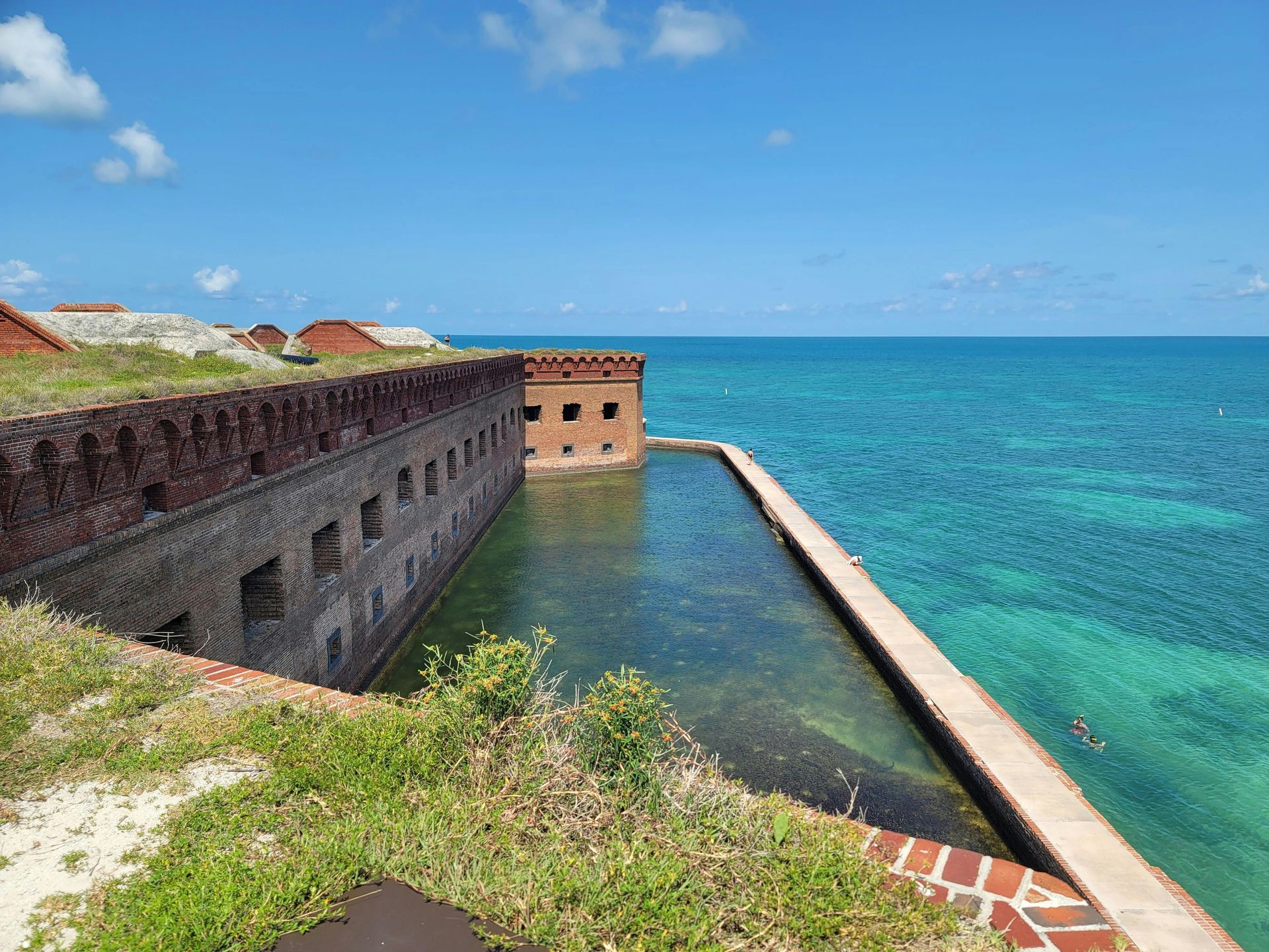
Dry Tortugas National Park sits 70 miles west of Key West, Florida, in the Gulf of Mexico — accessible only by ferry or seaplane and closed to private vehicles entirely. The park consists of seven small coral islands and the surrounding waters, covering roughly 100 square miles of which more than 99% is open water. Most visitors come for a day trip, arriving by high-speed catamaran and spending several hours before returning to Key West.
The centerpiece of the park on land is Fort Jefferson, one of the largest masonry structures ever built in the Western Hemisphere. Construction began in 1846 and continued for 30 years without the fort ever being completed. Its walls rise 50 feet above the island and enclose six acres, with bastions designed to accommodate more than 400 guns. The fort was used during the Civil War as a Union prison, most famously for Dr. Samuel Mudd, who was convicted of conspiracy in Abraham Lincoln's assassination for setting the broken leg of John Wilkes Booth. Mudd was later pardoned.
The water around the islands is warm, clear, and shallow enough in many places to wade through. Snorkeling is the primary recreational draw. The reef systems around Garden Key and Loggerhead Key are largely intact — Dry Tortugas is far enough from the Florida coast to have escaped some of the development pressure that has degraded reefs elsewhere in the Keys. Sea turtles, reef fish, rays, and nurse sharks are commonly encountered in the shallows, often within a few feet of the island's seawall.
The dry in Dry Tortugas refers to the absence of fresh water. The islands have no natural freshwater source, and Fort Jefferson's elaborate cistern system — designed to collect rainwater — was one of its most critical engineering features. Visitors must bring everything they need, including all drinking water, on the ferry from Key West.
Primitive camping is available on Garden Key for visitors willing to haul their gear aboard the morning ferry. The campground has toilets but no electricity, no running water, and no shade structures beyond what campers bring themselves. Demand for sites is high relative to supply, and reservations fill quickly. Spending a night on Garden Key puts visitors on the island after the day-trip crowd has departed — an experience of genuine isolation, with nothing visible in any direction but open water, the looming walls of the fort, and a sky full of stars.
Boogich / Getty Images
Cuyahoga Valley National Park follows the Cuyahoga River through 33,000 acres of northeastern Ohio between Cleveland and Akron — making it one of the only national parks in the country located between two major metro areas. More than five million people live within an hour's drive. Yet Cuyahoga rarely appears on lists of parks worth visiting, possibly because northeastern Ohio doesn't occupy much space in the American imagination of dramatic wilderness.
The park does not offer dramatic wilderness. What it offers is something different: a landscape of forests, farmland, wetlands, and restored river corridor embedded in the industrial Midwest. The Cuyahoga River, which famously caught fire in 1969 as a result of severe industrial pollution, runs through the center of the park. That fire — one of several over the decades — helped galvanize the modern environmental movement and contributed to the passage of the Clean Water Act in 1972. The river today is measurably cleaner, and the park's establishment in 2000 (it was a national recreation area before that) reflected a long effort to restore the valley's ecological function.
The park includes one of the few rail lines still operating through a national park. The Cuyahoga Valley Scenic Railroad offers seasonal excursions through the valley from multiple boarding points, passing through forest and farmland and providing access to trailheads without requiring a car. The line runs vintage passenger cars and connects several park destinations that would otherwise require separate drives.
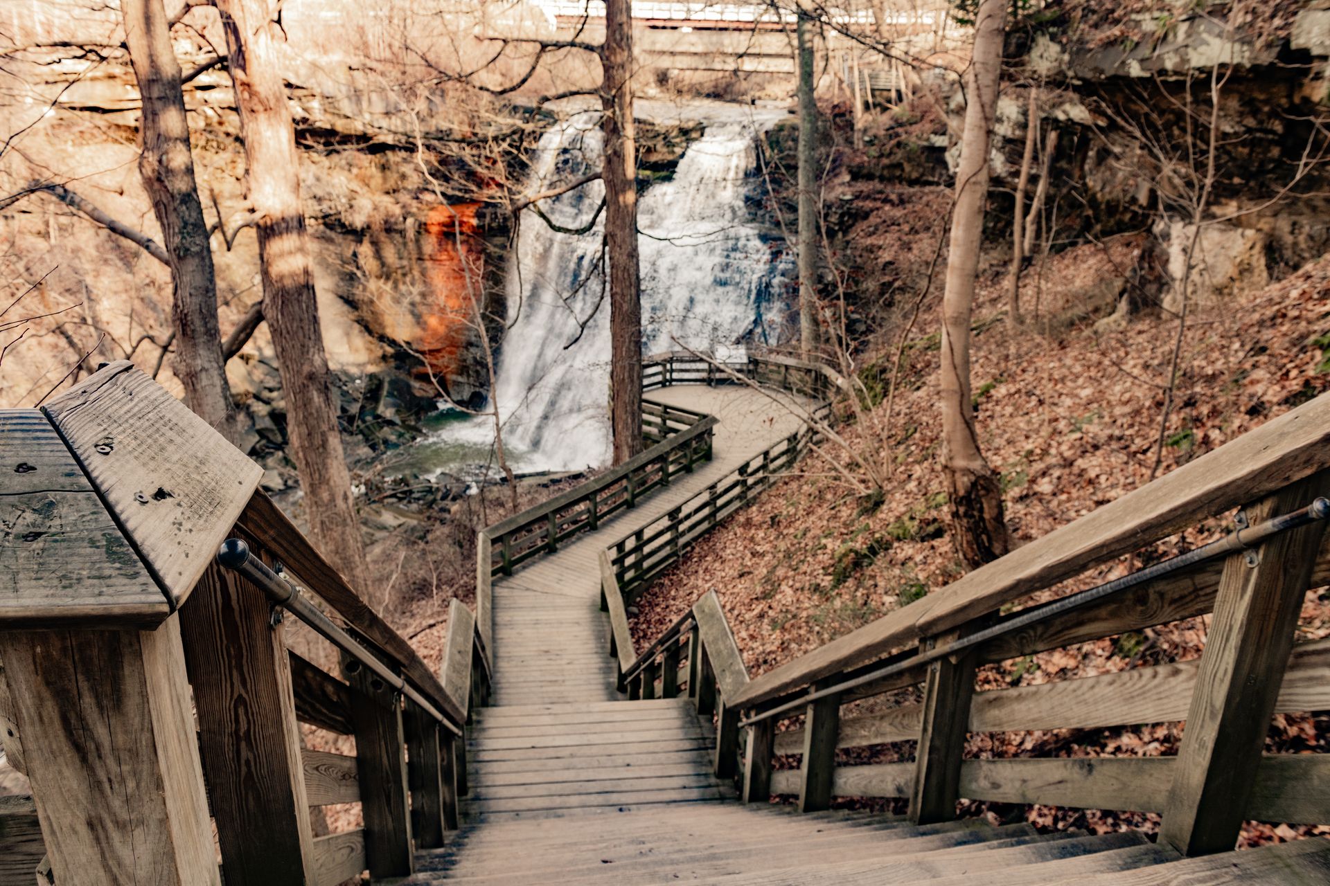
Brandywine Falls, one of the park's most visited sites, is a 65-foot waterfall that drops over shale and sandstone into a pool below. A short loop trail from the parking area reaches the falls in about 15 minutes. The Towpath Trail, which follows the old Ohio & Erie Canal corridor for more than 20 miles through the park, is accessible to hikers, cyclists, and in winter, cross-country skiers. Remnants of the original canal infrastructure — lock walls, aqueducts, and canal prisms — are visible along much of the route.
The park's seasonal programming is unusually broad: guided hikes, music events, and living history demonstrations at Hale Farm & Village, which preserves a 19th-century farm community within the park's boundaries. The seasonal farmers market at the Boston Mill Visitor Center draws local residents on weekends in summer and fall.
Cuyahoga Valley is a different kind of national park — less about remote wilderness and more about accessible nature embedded in one of the country's most densely populated corridors. Its value lies precisely in that proximity. For millions of Ohioans, it is the most easily reached experience of old-growth forest, river ecology, and open farmland within their region.
-1920x1280.jpg)
Ken Jacobsen / Pexels
Great Sand Dunes National Park sits against the jagged backdrop of the Sangre de Cristo Mountains in south-central Colorado, where the tallest sand dunes in North America have accumulated on a valley floor at roughly 7,500 feet of elevation. The dunes rise as high as 750 feet from their base — taller than any building in Colorado — and cover about 30 square miles of the San Luis Valley.
The dunes exist because of a specific combination of hydrology and wind. Sand carried by streams from the surrounding mountains reaches the valley floor and is picked up by prevailing southwest winds. When those winds hit the Sangre de Cristos and deflect back, they deposit sand in accumulating piles. Medano Creek, which runs along the eastern base of the dunes, carries sand back toward the dune field seasonally, recycling material and maintaining the system. The dune field is effectively self-sustaining, neither growing significantly nor diminishing over human time scales.
Visitors can walk directly onto and up the dunes from the main parking area with no trail infrastructure — the dunes are open terrain, and there is no marked path. Climbing to the summit of High Dune, one of the tallest in the field, takes one to three hours depending on fitness level and conditions. The sand is loose and deep, and each step on the way up requires more effort than it appears. Sand surface temperatures in direct sun can exceed 150 degrees Fahrenheit in summer — footwear is strongly recommended before noon.
Medano Creek, which flows at the base of the dunes in late spring and early summer, creates a rare natural phenomenon: surge flows. As sand builds up and releases in the streambed, pulses of water roll toward visitors wading in the shallows in irregular intervals. The creek typically dries up by midsummer, but during peak snowmelt season it runs fast enough to create something resembling a gentle beach surf at 7,500 feet of elevation.
Great Sand Dunes National Preserve, which borders the park to the north and east, is home to a large bison herd managed by The Nature Conservancy as part of the adjacent Medano-Zapata Ranch. Elk are common in the preserve and occasionally visible near the dune field at dawn.
Stargazing here is excellent — the San Luis Valley is one of the flattest, driest basins in Colorado, and light pollution from the south is minimal. Annual visitation is around 600,000 — respectable, but well below parks with comparable visual impact.
Daniel Erlandson / Pexels
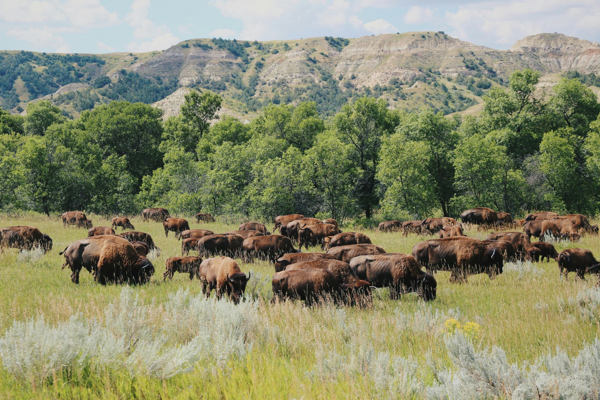
Theodore Roosevelt National Park sits in the Badlands of southwestern North Dakota, a landscape of eroded buttes, painted hills, and river breaks carved by the Little Missouri River over millions of years. The park is divided into three units — North, South, and the detached Elkhorn Ranch unit, which preserves the site of Roosevelt's cattle ranch — spread across a remote stretch of the state that most travelers pass on Interstate 94 without stopping.
The park is named for the 26th president, who ranched in this area during the 1880s following the deaths of his wife and mother on the same day in 1884. Roosevelt spent several years in the Dakota Territory, and he later credited his time in this landscape with shaping his conservation philosophy. The terrain he encountered — harsh, isolated, and visually dramatic — is largely unchanged today, and the park is unusual among those named for individuals in that its subject actually lived and worked within its boundaries.
The Badlands here differ from the more famous formations to the southeast in South Dakota. Theodore Roosevelt's terrain is greener and more varied, with grasslands interspersed among the eroded formations, cottonwood groves along the river bottoms, and a palette of colors in the buttes — red, gray, yellow, and buff — that shifts dramatically in changing light. The park also has a high density of wildlife. Bison roam freely through both the North and South units, and herds sometimes block park roads for extended periods. Wild horses, which have been present in the North Unit since the 1800s, are a consistent draw for photographers and wildlife watchers.
Prairie dogs maintain several active towns within the park and are the foundation of the local food web. Burrowing owls, ferruginous hawks, and black-footed ferrets — one of North America's most endangered mammals, reintroduced to the park — all depend on prairie dog colonies.
The South Unit, accessed from the town of Medora, is the more visited of the two. It has a visitor center, campground, and a 36-mile loop road with numerous overlooks. The North Unit, accessed from Watford City, receives far fewer visitors and provides a more remote experience. The Cannonball Concretions, a geological formation in the North Unit where spherical sandstone balls protrude from canyon walls, is a sight found nowhere else in the region.
Annual visitation is around 750,000 — a number that reflects how few people travel to this part of North Dakota — and the park offers some of the most accessible large-mammal wildlife viewing in the entire park system.
PHILIPPE SERRAND / Pexels
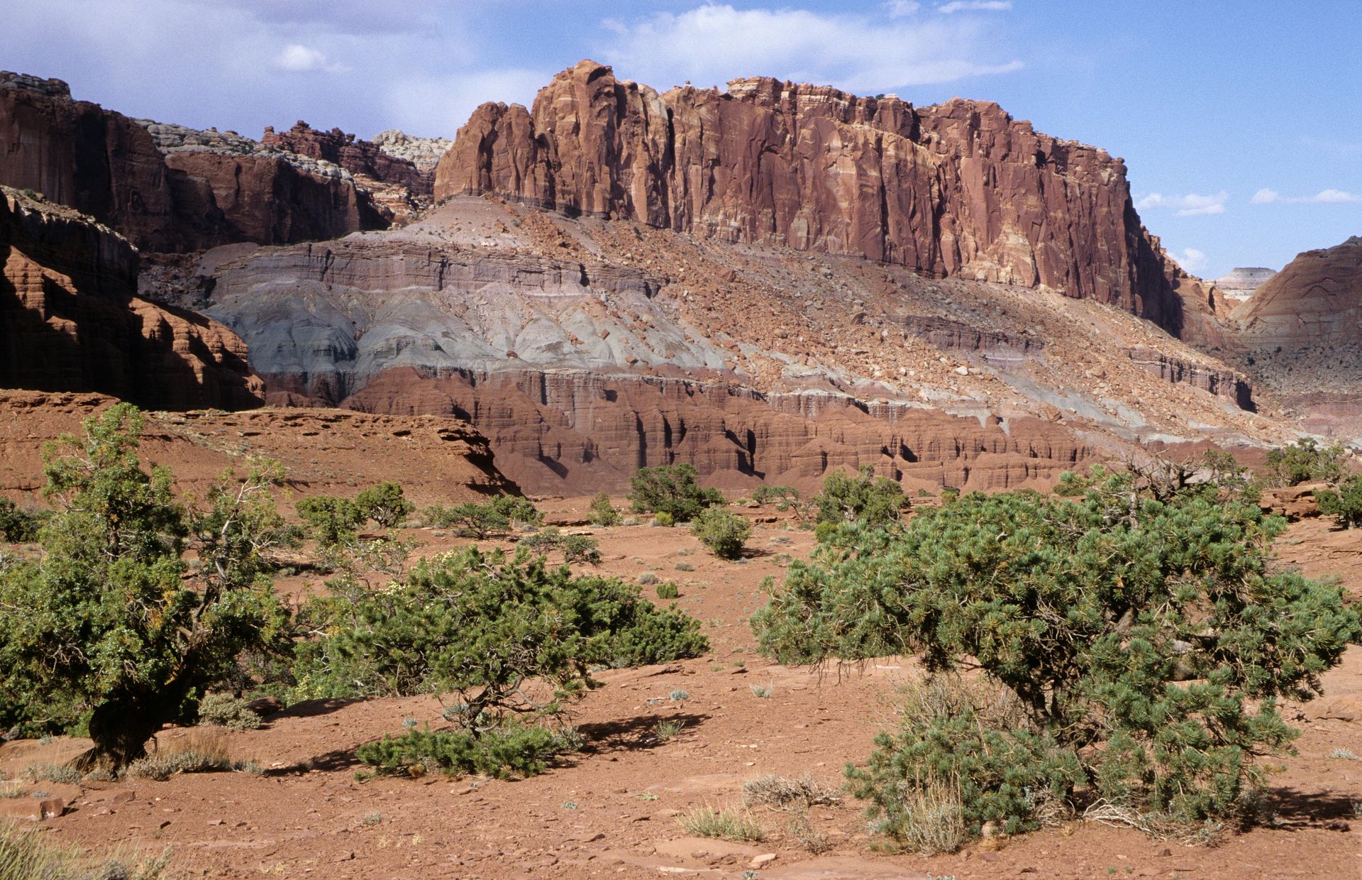
Capitol Reef National Park occupies a stretch of south-central Utah defined by the Waterpocket Fold, a nearly 100-mile-long wrinkle in the Earth's crust where layers of sedimentary rock were buckled and tilted by tectonic forces roughly 65 million years ago. The fold creates a landscape of domes, canyons, arches, and cliffs visually comparable to anything in Zion or Bryce Canyon, yet the park receives roughly 1.3 million visitors per year, compared to more than four million at Zion and three million at Bryce.
The relative obscurity of Capitol Reef is largely a product of geography. It sits between the more famous Utah parks — west of Moab and Arches, east of Zion and Bryce — on a stretch of Highway 24 that connects them. Many Utah park itineraries pass through Capitol Reef country without stopping, treating it as a through-road rather than a destination in its own right.
The park's name comes from two of its defining features: the Capitol Dome, a rounded white Navajo Sandstone formation that early settlers thought resembled the U.S. Capitol building, and the "reef" — a ranchers' term for an impassable rocky barrier. The Waterpocket Fold was, for centuries, an obstacle to east-west travel across the canyon country, and human settlement here clustered in the narrow valley where the Fremont River cuts through it.
That settlement left a remarkable legacy. Mormon pioneers planted an orchard of more than 2,700 fruit trees in the late 19th and early 20th centuries, and the National Park Service has maintained those trees ever since. Visitors can pick fruit from the orchard during harvest season at no cost, taking what they can carry. Apricots ripen in June, peaches in late July and August, and apples and pears in September and October. The Gifford Farmhouse, a preserved homestead near the orchard, sells pies and preserves made from park fruit.
Hiking in Capitol Reef ranges from the short and accessible — the Hickman Bridge trail to a natural arch takes about an hour and a half round trip — to the rugged and remote, with canyon routes that require route-finding skills and capacity to carry significant water. The park's backcountry is largely undeveloped, and the southern portion near Notom-Bullfrog Road receives very few visitors even by this park's modest standards.
The Fremont culture, which inhabited this region from roughly 600 to 1300 CE, left petroglyphs carved into cliff faces near the visitor center. The designs — human figures, bighorn sheep, and abstract shapes — are among the most accessible examples of Fremont rock art in the Southwest.
Mazin Omron / Pexels
Lassen Volcanic National Park sits in northeastern California, about three hours north of Sacramento, at the southern end of the Cascade Range. It is one of the few places in the contiguous U.S. where all four types of volcanic terrain — shield volcanoes, composite volcanoes, cinder cones, and plug domes — can be found within a single park. The park also contains active hydrothermal features: boiling springs, fumaroles, and mud pots that have been in documented continuous activity since at least the early 19th century.
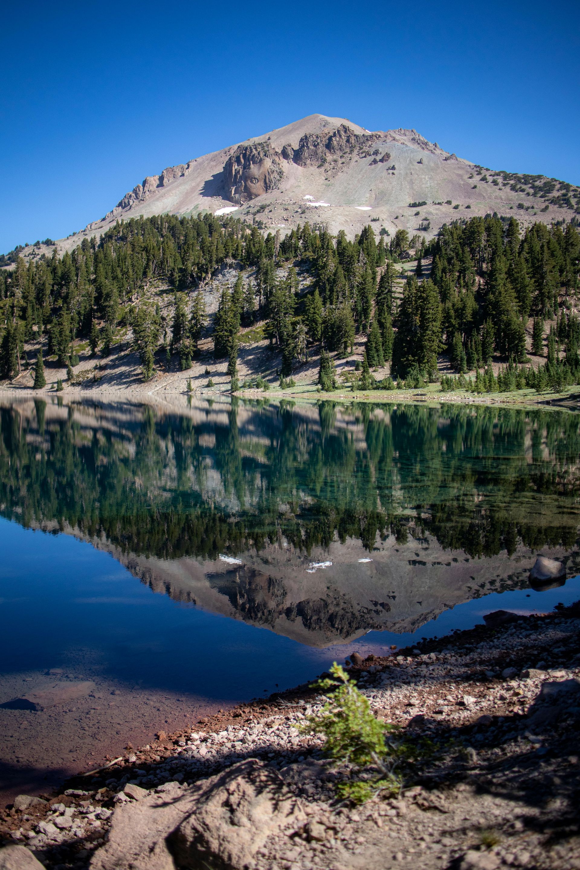
Lassen Peak, the park's central feature, last erupted between 1914 and 1917, making it one of the most recently active volcanoes in the lower 48 states. The eruption sequence damaged hundreds of thousands of acres of surrounding forest and deposited volcanic debris across a wide area. The landscape still shows clear signs of that activity: bleached and twisted forest snags persist in the Devastated Area, a stretch of the park where eruption deposits altered the terrain permanently over a century later.
Bumpass Hell, the park's largest hydrothermal area, is accessible via a three-mile round-trip trail from the main park road. The site contains a dense concentration of boiling pools, fumaroles, and mud pots spread across a barren, sulfur-stained landscape at around 8,000 feet of elevation. The boardwalk at Bumpass Hell keeps visitors on safe ground — the hydrothermal crust is thin and has collapsed on occasion, causing serious burns. The area is named for Kendall Vanhook Bumpass, a local who discovered it in the 1860s and, on a return trip, broke through the crust and scalded his leg severely enough to require amputation.
The park road, Lassen Volcanic National Park Highway, traverses the park from southwest to northeast and reaches an elevation of more than 8,500 feet at its highest point. The road is typically buried under heavy snow from November through May or June, and the short summer window contributes to annual visitation of around 500,000 — low for a park of this geological distinction.
Manzanita Lake, near the park's northwestern entrance, offers camping, paddling, and clear views of Lassen Peak reflected in calm water. The area is a strong wildlife-watching location — river otters, osprey, and bald eagles use the lake, and black bears frequent the surrounding forest.
The summit of Lassen Peak itself is accessible via a five-mile round-trip trail from the highway. The climb gains roughly 2,000 feet of elevation and passes through volcanic debris fields, sulfurous vents, and, near the top, expansive views of the Cascades to the north and the Central Valley haze to the south.
Credit: nationalparkstraveler.org
Biscayne National Park lies directly south of Miami — as close as 21 miles from the city center — yet most Floridians and most Miami visitors don't know it exists. The park encompasses Biscayne Bay and a chain of undeveloped barrier islands, with nearly 173,000 acres under protection. More than 95% of that area is water, making Biscayne one of the largest marine parks in the national park system.
The park's invisibility is almost literal. There is no road access to most of it. From the mainland visitor center at Convoy Point, the islands and reef systems are visible only by boat. The park service and a private concession operator offer tours, but anyone who doesn't specifically arrange a boat trip has no way of experiencing the park's core assets. The combination of South Florida's dense development, the park's aquatic nature, and the absence of any prominent land feature means Biscayne rarely enters the public conversation about the national parks.
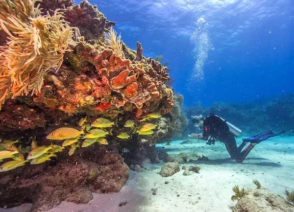
What lies beneath the water makes the park significant. The northern portion of the Florida Reef Tract — the only living coral barrier reef in the continental U.S. — runs through Biscayne's eastern waters. The reef supports hundreds of species of fish, invertebrates, and other marine life, and it has been the subject of ongoing conservation concern as rising water temperatures and ocean acidification stress coral populations throughout the Keys. Snorkeling and diving in Biscayne give visitors direct access to these reefs, with conditions that vary significantly by season and weather.
The park also protects four historic lighthouses, several shipwrecks accessible to divers, and the remnants of a 20th-century resort community on Adams Key. Boca Chita Key, once the private retreat of a Massachusetts industrialist, features an ornamental lighthouse that has become the park's most recognizable landmark. The key offers primitive camping accessible by boat.
Manatees move through Biscayne Bay seasonally, and the park waters provide habitat for sea turtles, American crocodiles, bottlenose dolphins, and a wide range of wading birds. American crocodiles — distinct from the far more common American alligator, and significantly rarer — find some of their most important U.S. habitat in the brackish waters of Biscayne Bay.
The park service offers glass-bottom boat tours, snorkel tours, and canoe rentals from Convoy Point on weekends and select weekdays. The combination of subtropical marine ecology, historical layers, and proximity to one of the country's largest cities makes Biscayne an unusually rich park — even if most of that richness requires a boat to reach.
Lynne Jablonski / Pexels
Wrangell-St. Elias National Park in south-central Alaska is the largest national park in the U.S. — at more than 13 million acres, it exceeds the size of Switzerland. It contains the largest concentration of glaciers in North America, four of the continent's highest peaks, and more than 100 glaciers that reach tidewater or near it. Yet it receives fewer than 100,000 visitors per year and remains almost entirely unknown outside Alaska and the mountaineering community.
The park's scale defies easy comprehension. The Bagley Icefield within the park is the largest non-polar icefield in North America. The Hubbard Glacier, which flows from the park toward Yakutat Bay, is one of the largest tidewater glaciers in the hemisphere. The four highest peaks within the park — Bona, Blackburn, Sanford, and St. Elias — each exceed 16,000 feet. Mt. St. Elias, at 18,008 feet, was the second peak climbed in North America after Denali and remains one of the most formidable ascents on the continent.
Two unpaved roads provide the only vehicle access into the park's interior. The McCarthy Road runs 60 miles from the town of Chitina to the gateway community of McCarthy, crossing the old Copper River and Northwestern Railway bed. The road is rough and slow, and vehicles with low clearance or thin tires are not recommended. The Nabesna Road, accessible from the north, leads 42 miles into a remote stretch of the park with little infrastructure at its end.
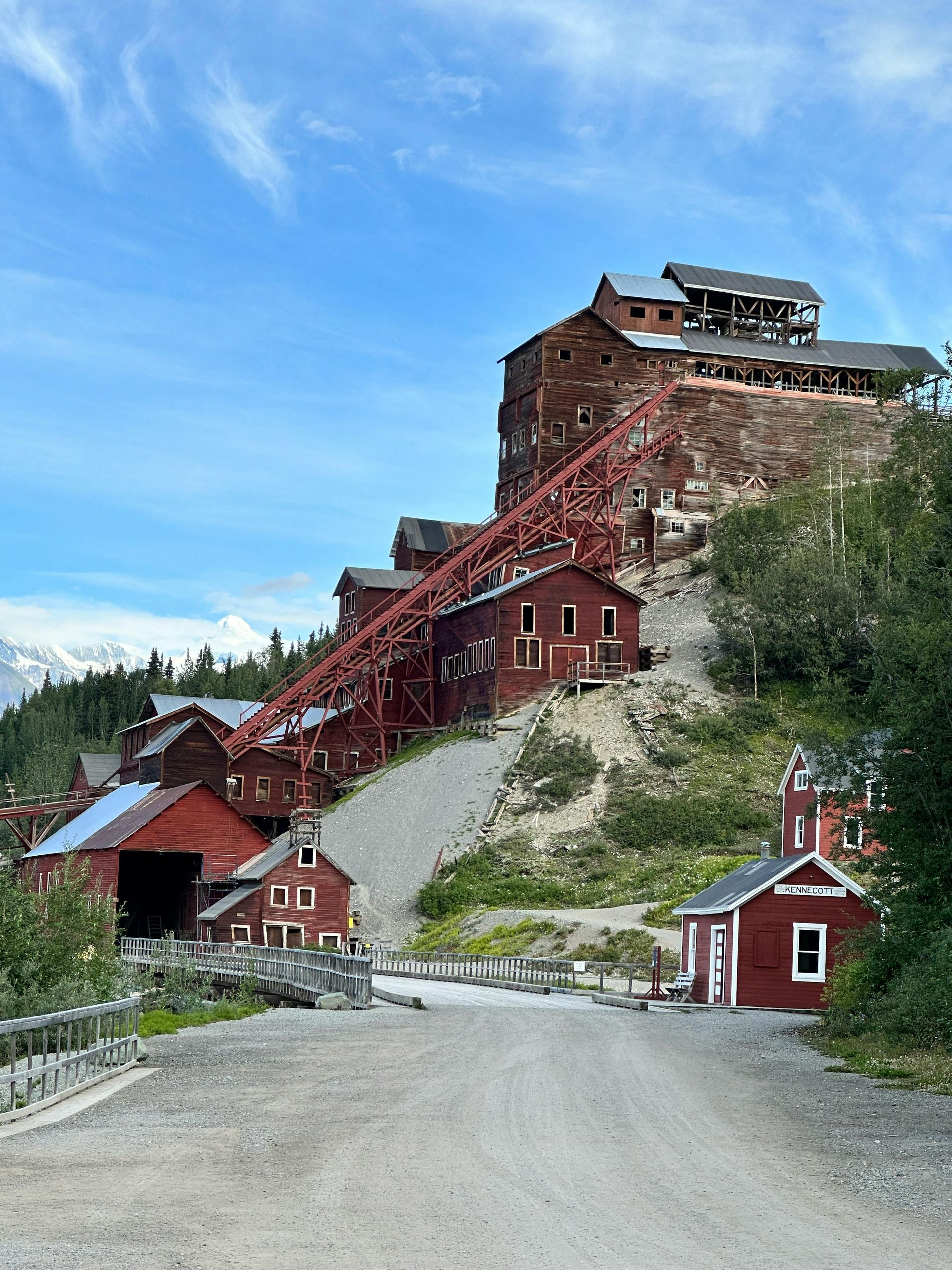
Kennecott, a former copper mining town at the end of the McCarthy Road, is one of the most intact examples of industrial heritage in the national park system. The Kennecott mines operated from 1903 to 1938, extracting copper ore from deposits in the surrounding cliffs. The mill building and several associated structures are preserved and accessible by guided tour. The site is a National Historic Landmark and is visually dramatic — a cluster of red wooden industrial buildings set against glaciers and peaks — in a way that photographs cannot fully convey.
For most visitors, Wrangell-St. Elias is a wilderness destination that requires significant logistical planning — floatplane access, packrafting supplies, bear canisters, and multiple days of provisions. The scale of the landscape means that even a week here covers a tiny fraction of the park. The result is an experience of scale and silence that has no equivalent in the lower 48.
Jackie A / Pexels
New River Gorge National Park in southern West Virginia became the newest designated national park in the system in December 2020, upgraded from its previous status as a national river. The designation drew brief national attention, and then the park returned to the relative obscurity it had occupied for most of its decades as a protected area.
The New River is, despite its name, one of the oldest rivers in North America — believed to predate the Appalachian Mountains themselves, which it cuts through rather than flowing around. The gorge it has carved drops more than 1,600 feet over a stretch of roughly 70 miles, producing whitewater that ranges from Class III to Class V. The lower portion of the gorge is one of the most popular whitewater rafting stretches in the eastern U.S., drawing paddlers from across the Eastern Seaboard each spring and summer.
The park also contains a significant rock climbing destination. The New River Gorge sandstone — hard, featured, and south-facing — has attracted climbers for decades. More than 1,400 established routes are spread across the gorge walls, covering a range of difficulty levels and styles. The Endless Wall, a long section of cliff above the river, is particularly well regarded for its concentration of high-quality moderate routes and its dramatic position above the water.
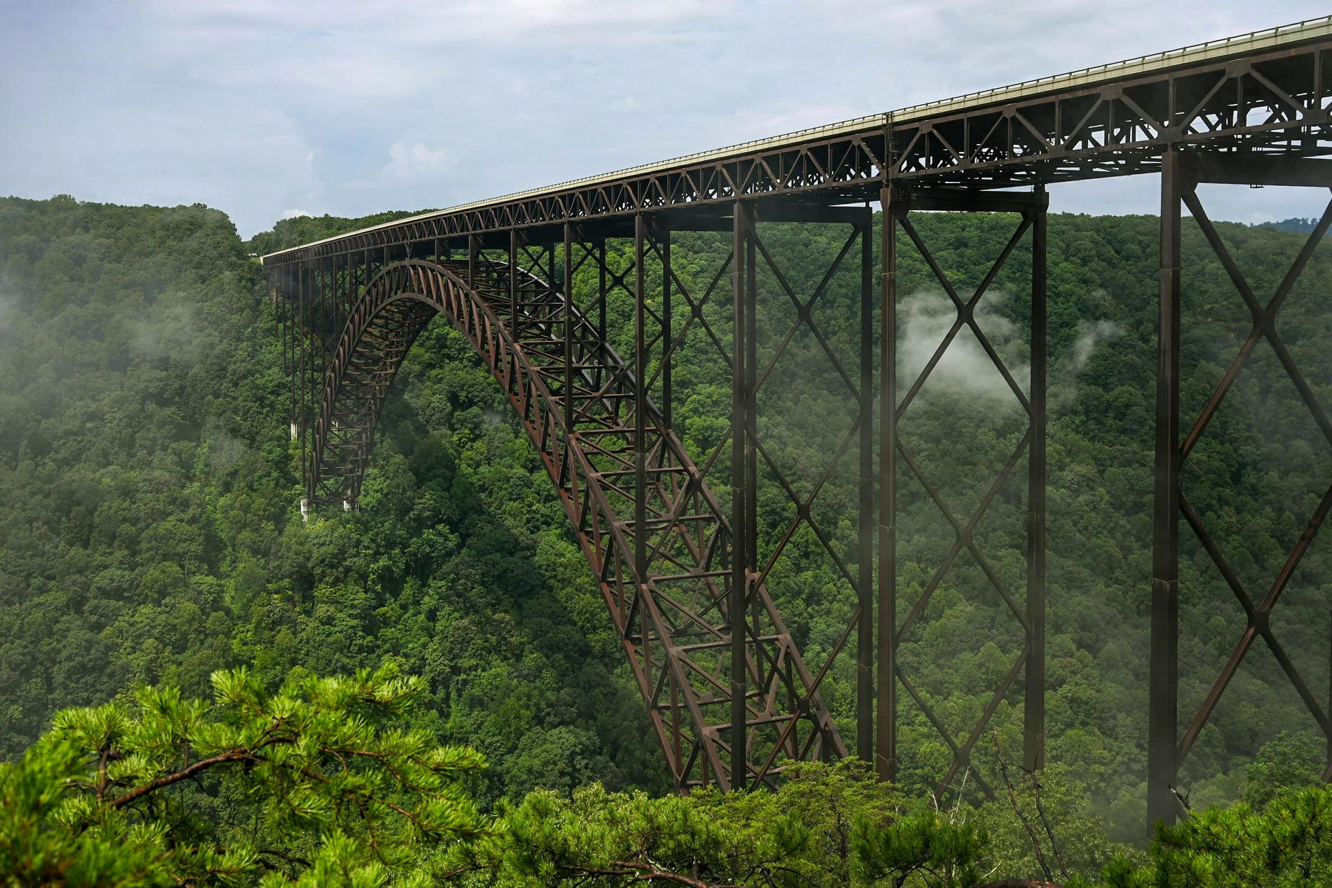
The New River Gorge Bridge, completed in 1977, spans the gorge at a height of 876 feet and for many years held the distinction of being the longest steel arch bridge in the world. It carries U.S. Route 19 across the gorge and is the site of Bridge Day each October — an annual festival in which the bridge is opened to pedestrian traffic and BASE jumpers leap from the deck. The event draws tens of thousands of people and is the largest single-day festival in West Virginia.
The park includes substantial coal mining heritage. The gorge was heavily industrialized from the 1870s through the mid-20th century, and remnants of mining towns, coke ovens, and industrial infrastructure are preserved throughout. The town of Thurmond, once a busy railroad hub that reportedly saw more freight traffic than Cincinnati in the early 20th century, is now effectively a ghost town with a few residents and a preserved depot accessible by road or trail.
Hiking in the park ranges from easy riverside walks to long ridge routes with extended views of the gorge. The Long Point Trail, a 3.2-mile round trip on the north side of the gorge, ends at a sandstone outcrop with unobstructed views of the bridge and canyon — one of the better free vistas in the eastern national park system.
VW Pics / Getty Images
Kenai Fjords National Park occupies the southeastern edge of the Kenai Peninsula in Alaska, where glaciers descend from the Harding Icefield — a roughly 700-square-mile ice cap — and calve into the North Pacific. The park covers nearly 670,000 acres, most of it accessible only by boat or small aircraft. The town of Seward, at the park's northern boundary, serves as the primary gateway and can be reached by road from Anchorage in about two and a half hours.
The Harding Icefield is the defining feature. It is one of the largest ice fields in the U.S. and the largest in Alaska that remains entirely within the country's borders. More than 40 glaciers flow from it into surrounding valleys and fjords. Exit Glacier, the park's only glacier accessible by road, offers one of the more visceral displays of glacial retreat in the national park system: roadside markers trace the glacier's historical terminus year by year, and the distance between the current ice edge and the position recorded a century ago is visible and significant.
The park's coastal waters are among the most productive in Alaska. Cold, nutrient-rich Pacific waters support dense populations of marine mammals — Steller sea lions, harbor seals, Dall's porpoises, orcas, and humpback whales — along with millions of seabirds that nest on rocky cliffs and sea stacks throughout the fjords. Puffins — both tufted and horned — nest in large colonies along the coast and are a consistent highlight of wildlife boat tours.
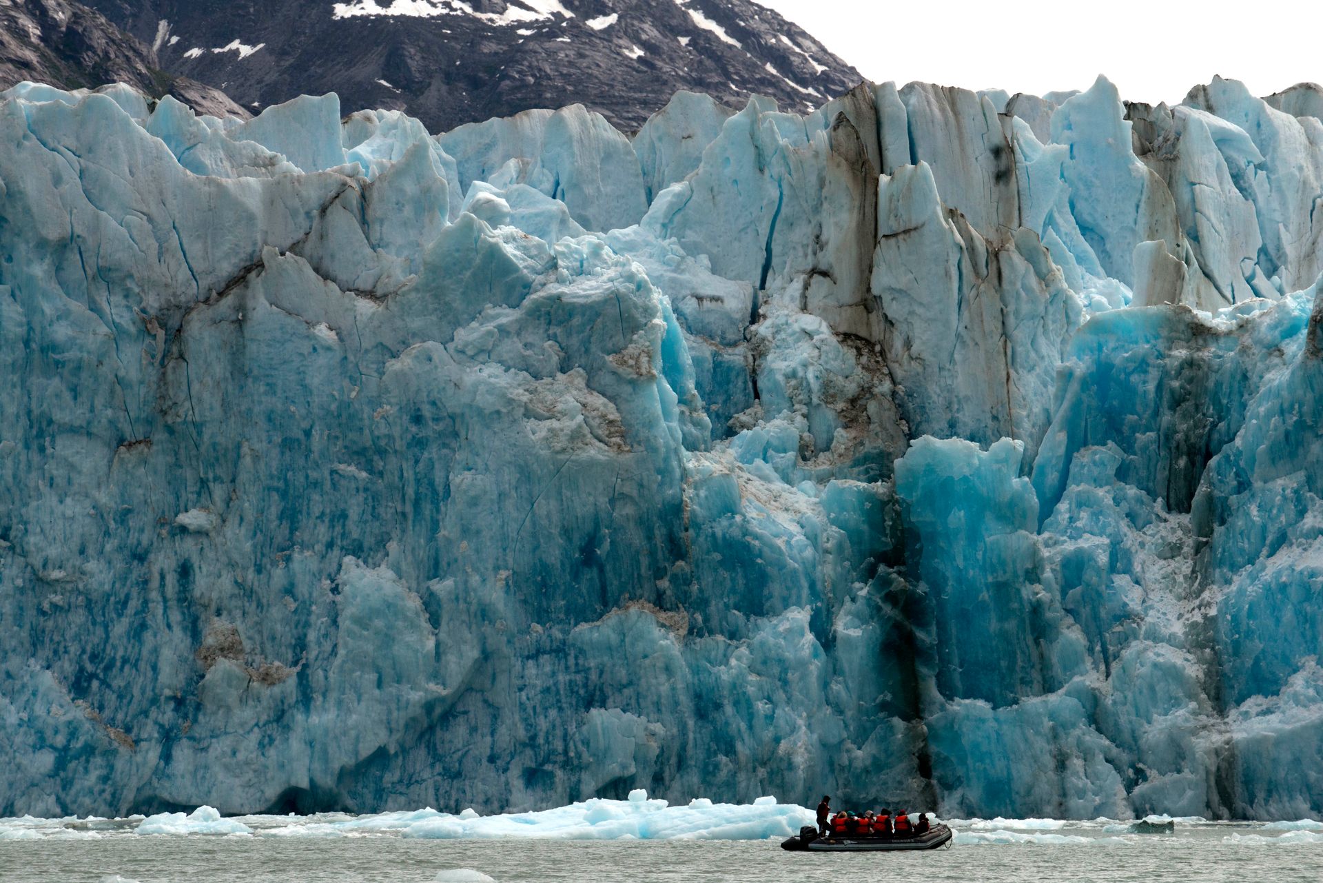
Day boat tours from Seward reach the most visited sections of the park's coastline, including the face of Aialik Glacier, where ice calves into the fjord in irregular intervals throughout the day. Passengers watch from boat decks as blocks of ice — sometimes the size of buildings — topple into the water and send waves across the bay. The sound, which arrives a few seconds after the visual, is deep and percussive.
Multi-day kayaking trips are the primary way to experience the park in depth. Outfitters in Seward organize water taxi drops to remote coves where paddlers can spend several days moving through the fjords with minimal human contact. The season runs from May through September, with the shoulder months offering fewer crowds but more variable weather and sea conditions.
The park also provides access to a rich cultural history. Alutiiq people have lived along this coastline for thousands of years, and the park's waters and islands remain important subsistence areas for Alaska Native communities. That continuity of use distinguishes Kenai Fjords from parks created on land cleared of its original inhabitants.
Tom Fisk / Pexels
Voyageurs National Park sits on the northern border of Minnesota, defined more by water than by land. The park consists of four large interconnected lakes — Rainy Lake, Kabetogama Lake, Namakan Lake, and Sand Point Lake — along with hundreds of smaller water bodies, covering roughly 218,000 acres. There are no roads into the park's interior. All access beyond the four visitor centers on the lake shores requires a boat or, in winter, a snowmobile or skis.
The park is named for the French-Canadian voyageurs — the fur traders and canoe men who navigated this border lake country between the 17th and early 19th centuries, moving pelts from the interior of the continent to eastern markets. The border between the U.S. and Canada runs through the middle of the park, following the waterways that the voyageurs used as trade routes. Much of what is now the park's water surface was once a commercial artery for the North American fur trade.
The landscape is boreal lake country — granite outcroppings, boreal forest, bogs, and thousands of islands, many small enough to circumnavigate by kayak in minutes. The park contains the Kabetogama Peninsula, a large roadless land mass accessible only by water that provides one of the most isolated interior experiences of any national park in the lower 48. Wildlife includes wolves, black bears, moose, otters, loons, bald eagles, and osprey. The gray wolf population in the broader Boundary Waters region — which Voyageurs borders — is among the healthiest in the contiguous U.S.
In winter, the park transforms. Once the lakes freeze to sufficient depth, the ice becomes the access infrastructure. The park service grooms a network of snowmobile trails across the ice, and several sections of the park become accessible in winter that are difficult to reach in summer. Ice fishing is a significant draw in January and February, when anglers set up shelters on the frozen lake surface above walleye and northern pike populations.
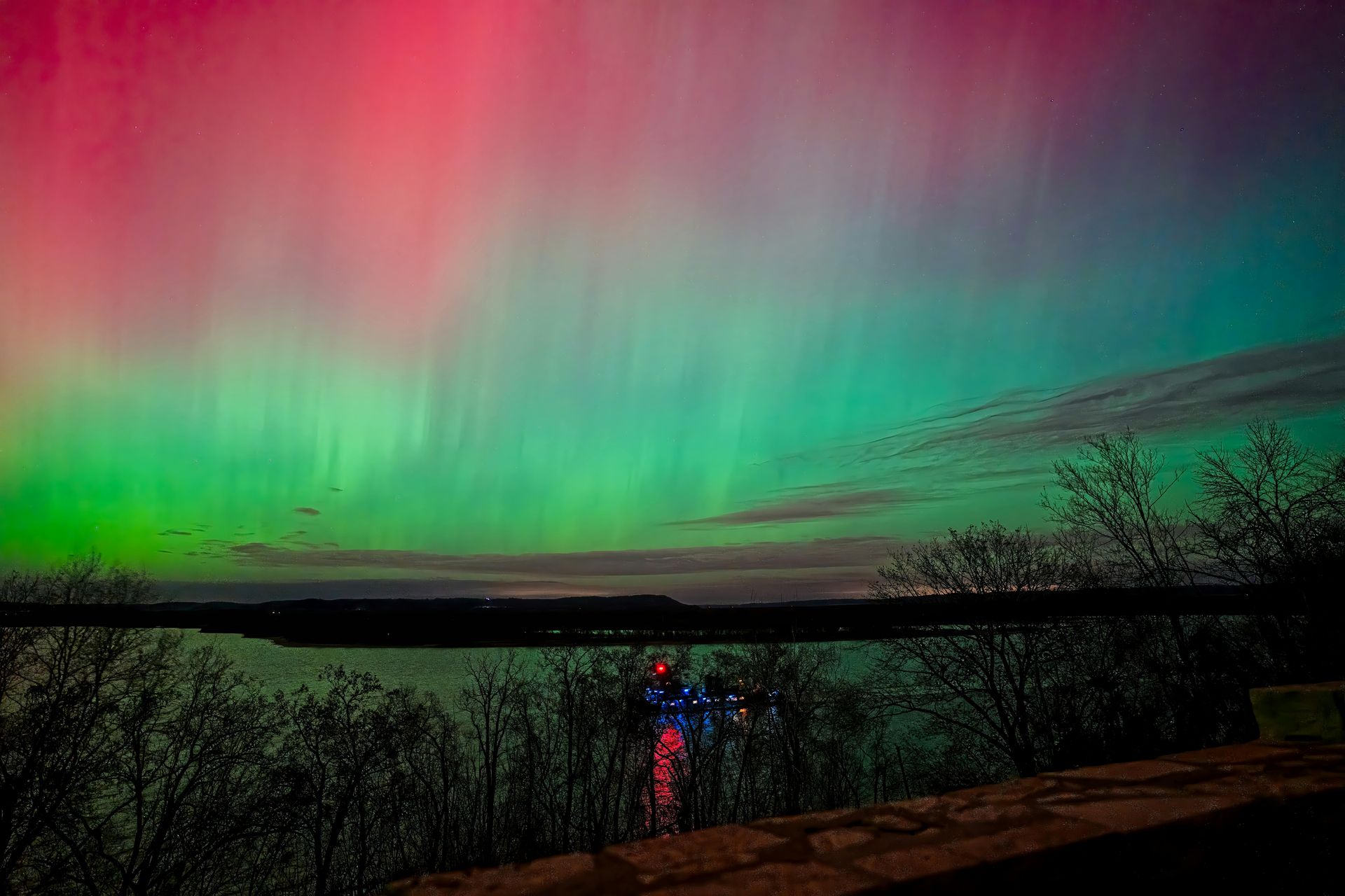
Voyageurs is also one of the country's premier locations for viewing the northern lights. The park's latitude — close to 49 degrees north — and its distance from major population centers means light pollution is negligible on clear nights. During periods of heightened solar activity, the aurora is visible from the park on a regular basis. Annual visitation is around 270,000, mostly concentrated in summer, with the shoulder seasons of spring and fall offering lower crowds and vivid seasonal transitions in the boreal forest.
Nate Hovee / Pexels
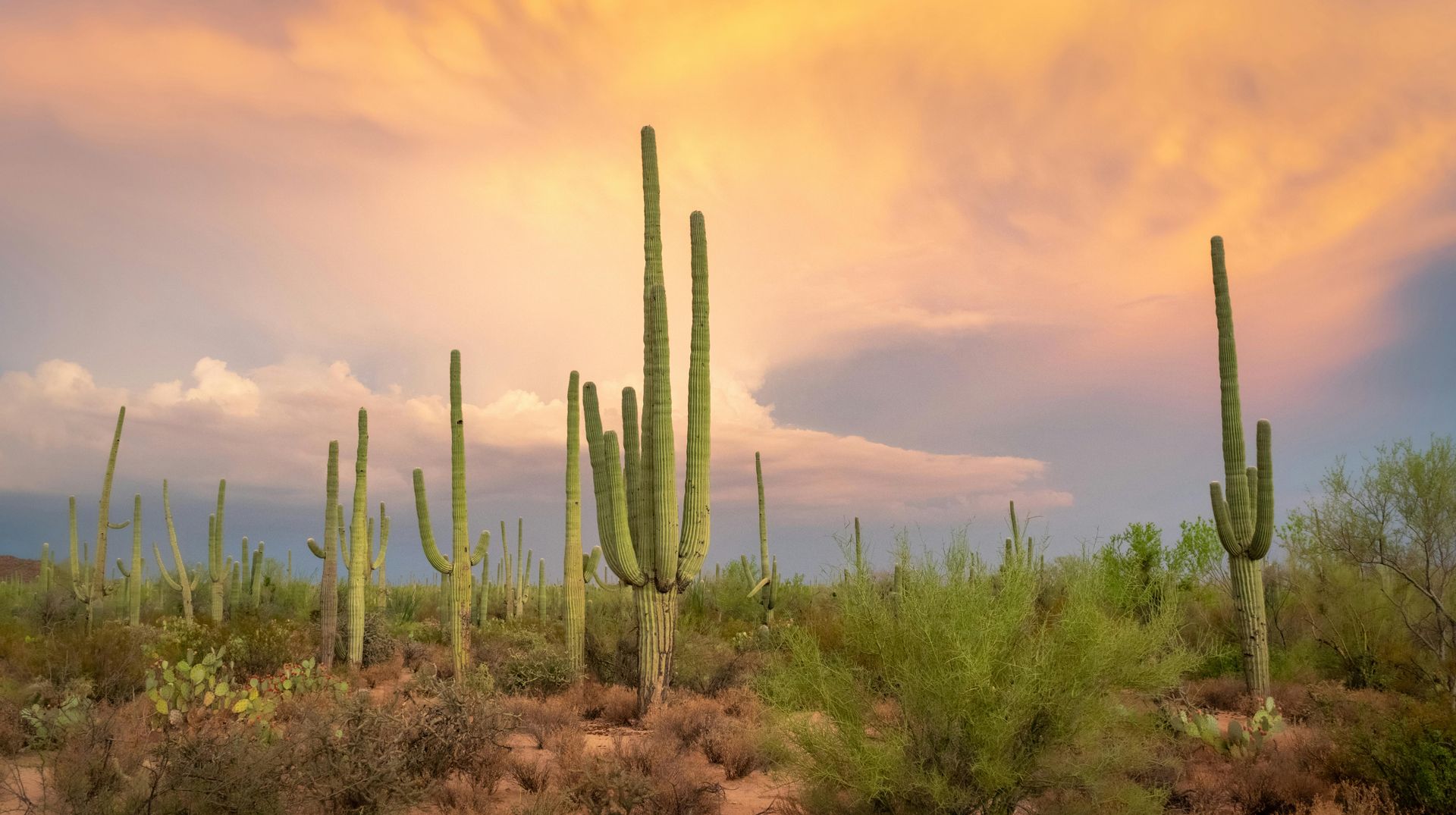
Saguaro National Park sits on the outskirts of Tucson, Arizona, in two separate districts — one east of the city and one west — that together protect the largest forests of saguaro cactus in the world. The saguaro is the defining plant of the Sonoran Desert and one of the most recognizable silhouettes in the American West, yet the national park that bears its name receives less visitor attention than nearly any other park in the Southwest.
The oversight is partly a product of Tucson's position in the regional tourism economy. The city has a major university, a regional airport, and a well-developed visitor infrastructure, but it is consistently passed over in favor of Phoenix and the Grand Canyon corridor. Travelers $TRV routing through Arizona tend to follow the I-17 and I-40 corridors, bypassing Tucson and the mountain ranges that bracket the park on both sides.
The saguaro itself is a remarkable organism. A mature saguaro — one that has developed the multiple arms most often depicted — is typically well over 100 years old. The plant doesn't begin to grow its first arm until it is at least 75 years old in many cases, and can live to 150 years or more. Height at maturity can reach 40 feet. After a wet winter, saguaros bloom with white flowers at their crowns, each flower opening for roughly 24 hours. The bloom, which occurs in late May and June, is designated the official state wildflower of Arizona.
The Rincon Mountain District, east of Tucson, includes higher elevation terrain — the Rincon Mountains rise above 8,000 feet — with pine and mixed-conifer forest at the upper elevations, a dramatic contrast to the desert at the base. The Cactus Forest Loop Drive, a paved eight-mile one-way route through the eastern district, provides access by car through some of the densest saguaro stands in the park. Hiking trails from the loop road lead into denser backcountry and up toward the mountain summit zone.
The Tucson Mountain District, to the west, has more accessible terrain at lower elevation, making it the more visited of the two. Arizona-Sonora Desert Museum, which sits just outside the western district boundary and functions simultaneously as a zoo, botanical garden, and natural history museum, draws more visitors annually than the park itself — an inversion that says something about how the park has been positioned in Tucson's visitor economy.
Wildlife in the park includes Gila woodpeckers, elf owls, gilded flickers, Harris's hawks, coyotes, javelinas, desert tortoises, and Gila monsters. Dawn and dusk are the most active periods for wildlife, when temperatures drop enough for desert animals to move.
lightphoto / Getty Images
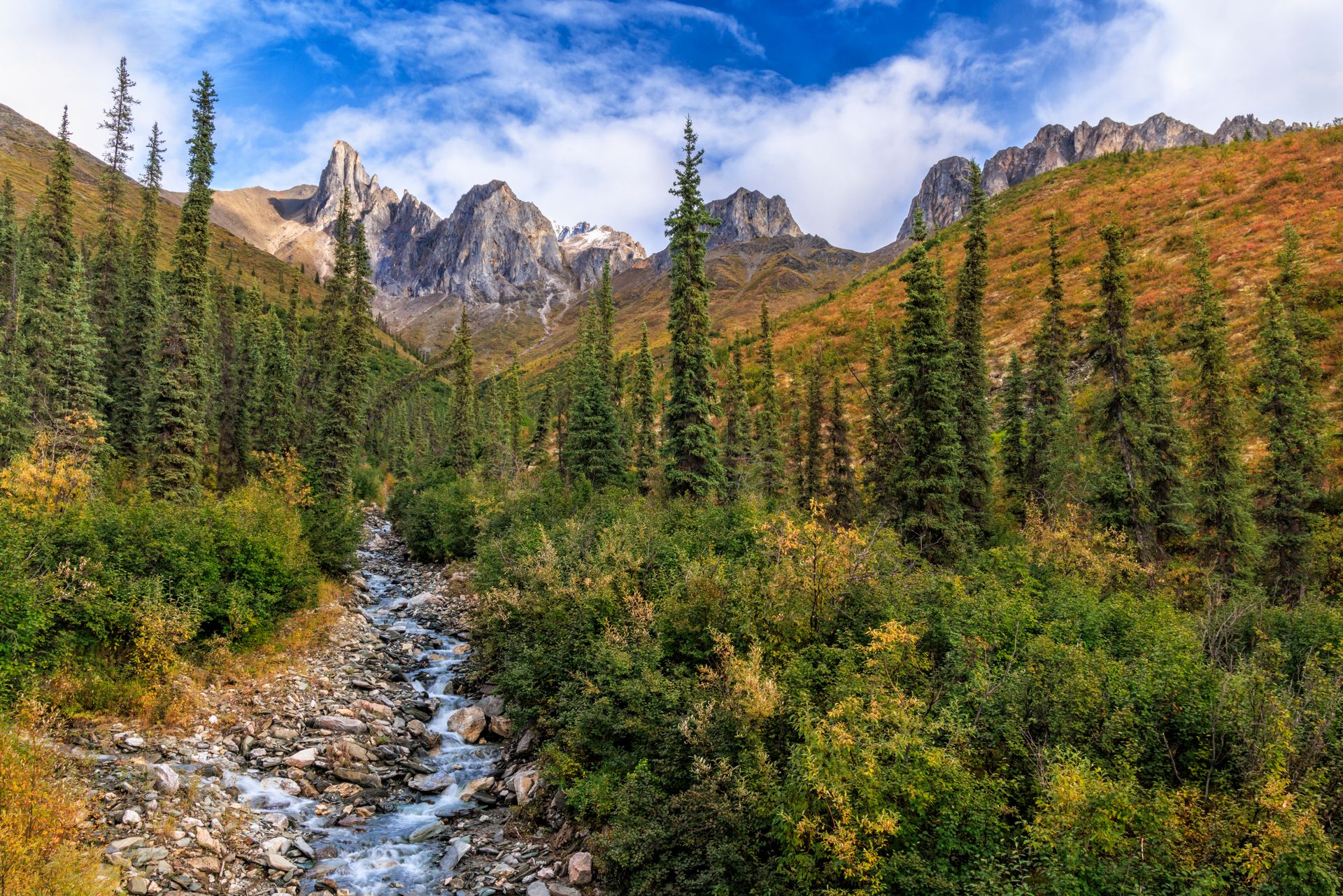
Gates of the Arctic National Park is the northernmost national park in the U.S. — and the most remote. It sits above the Arctic Circle in north-central Alaska, roughly 200 miles north of Fairbanks, and it has no roads, no trails, no visitor center, and no infrastructure of any kind. The few thousand visitors who enter the park each year arrive by floatplane from Fairbanks or Bettles, land on gravel bars or tundra flats, and navigate entirely on their own from there.
The park covers more than 8.4 million acres of the Brooks Range, a mountain chain that runs east-west across Alaska. The terrain is genuinely arctic: permafrost, tundra, braided glacial rivers, and valleys that receive snow in any month of the year. Vegetation is low and sparse — sedges, mosses, and dwarf willow — and the treeline lies at the park's southern boundary. North of the treeline, the landscape opens into pure tundra and rock, with peaks rising sharply from broad, flat-floored valleys carved by glaciation.
The name comes from a 1929 expedition by naturalist Robert Marshall, who explored the Brooks Range and named two peaks flanking a pass — Frigid Crags and Boreal Mountain — as the "gates" to the wilderness beyond. Marshall's writings about this region helped establish the intellectual foundation for wilderness preservation in the U.S. and directly influenced the eventual designation of the Arctic National Wildlife Refuge and the establishment of Gates of the Arctic as a park in 1980.
Wildlife in the park includes caribou — the Western Arctic herd, one of the largest caribou herds in the world, passes through the park during its annual migration — as well as grizzly bears, wolves, Dall sheep, wolverines, and musk oxen. Musk oxen were absent from Alaska for much of the 20th century following historical overhunting but were reintroduced and have expanded their range northward into the Brooks Range.
Visiting Gates of the Arctic requires preparation that most national park trips do not: wilderness first aid training, bear canisters, satellite communication devices, and navigation skills sufficient for trackless terrain. The park service maintains no facilities, and there is no fee to enter. Annual visitation is typically below 15,000, and the park service estimates that most visitors encounter no other park visitors during their stay.
The solitude here is absolute in a way that no other unit of the national park system can offer. There are no other people, no sounds of distant traffic, no contrails overhead on most days. The Brooks Range surrounds visitors in every direction, and the nearest human settlement is hours away by air. For those who make the logistical investment, it is an experience without a comparable alternative in the park system.
