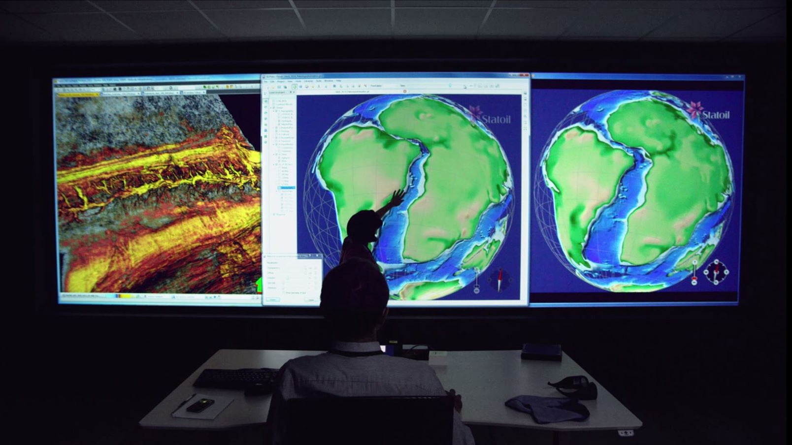
How 4D modelling by scientists maps a pre-historic earth
The tectonic plates beneath the Earth’s surface are moving at about the same pace that your finger nails grow. Whilst that might not sound like much it adds up; in the history of the Earth, North America and Europe have drifted over 3,000 miles apart. Understanding these shifting forces is essential to mapping the world’s energy reserves and predicting future exploration.


The tectonic plates beneath the Earth’s surface are moving at about the same pace that your finger nails grow. Whilst that might not sound like much it adds up; in the history of the Earth, North America and Europe have drifted over 3,000 miles apart. Understanding these shifting forces is essential to mapping the world’s energy reserves and predicting future exploration.
Add to this changing dynamics such as climate, river flows, and gradience and this means that discovering where petroleum lies becomes a jigsaw puzzle with incomplete pieces.
4D modelling
4D modelling, known as Earth Systems Modelling technology, has fundamentally altered scientists’ ability to map what lies deep beneath our feet. The technology factors in the plethora of geographic conditions and maps a seemingly distorted Earth. By “rewinding” the Earth’s geographic make-up the technology enables geologists to predict where economically viable petroleum currently lies.
Scenario planning using 4D modelling requires a multi-disciplinary team. The scenarios the technology can produce must be analysed by experts versed in topics such as tectonics, climatology, sedimentology, and geochemistry. In effect, the technology is a tapestry of a whole range of scientific disciplines and it takes a great deal of visionary work to integrate the various strings to make it possible. Never before has modelling the Earth’s past been so achievable.
It wasn’t always this complex. In the early years of oil extraction knowing where to drill was a trial and error process. This led to large and lucrative discoveries at a relatively low cost. However, if the early days of energy exploration were characterised by predictability, the modern era is about uncertainty.
As the easy to reach reserves are already discovered, today’s energy explorers are forced to operate in new frontiers and must do so without the solid data they’ve come to rely on: they are searching further, deeper, and for longer than ever before. Exploration has become a case of piecing together the data we do have and approaching the petroleum system holistically. While this isn’t a new concept, it is a challenge to apply. You can’t address source, seal, or reservoir without understanding their relationship to each other; yet the scientific disciplines still tend to work in individual silos.
A multi-disciplinary approach
Traditionally, structural geologists will work on the seal, geochemists on the source, and stratigraphers on the reservoir. Adopting a multi-disciplinary approach, in which disciplines learn to speak one and others’ language, marks one of the greatest shifts in terms of how we approach modern energy exploration from an organisational perspective.
Approaching exploration in this way allows scientists to minimise risk, ensuring theories that stem from a particular discipline are checked against others. This is a new way of working and it means the brilliance of human thinking must collaborate to overcome the frontiers of nature. It also means using innovative technology to plug gaps in our thinking and reduce uncertainty. Modern exploration is the perfect storm of resource scarcity, technological innovation, and most importantly, multi-disciplinary brilliance.
Learn more about the technology that is changing oil and gas exploration.
This article was produced by Statoil and not by the Quartz editorial staff.