While last week’s international news was dominated by the terrorist attacks in Paris that left 17 dead, a larger massacre in a less-watched part of the world went relatively unnoticed. Until now. Human rights groups released satellite images this week that show what they say is indisputable proof of deadly attacks carried out during early January by the Islamist militants from Boko Haram in northeastern Nigeria.
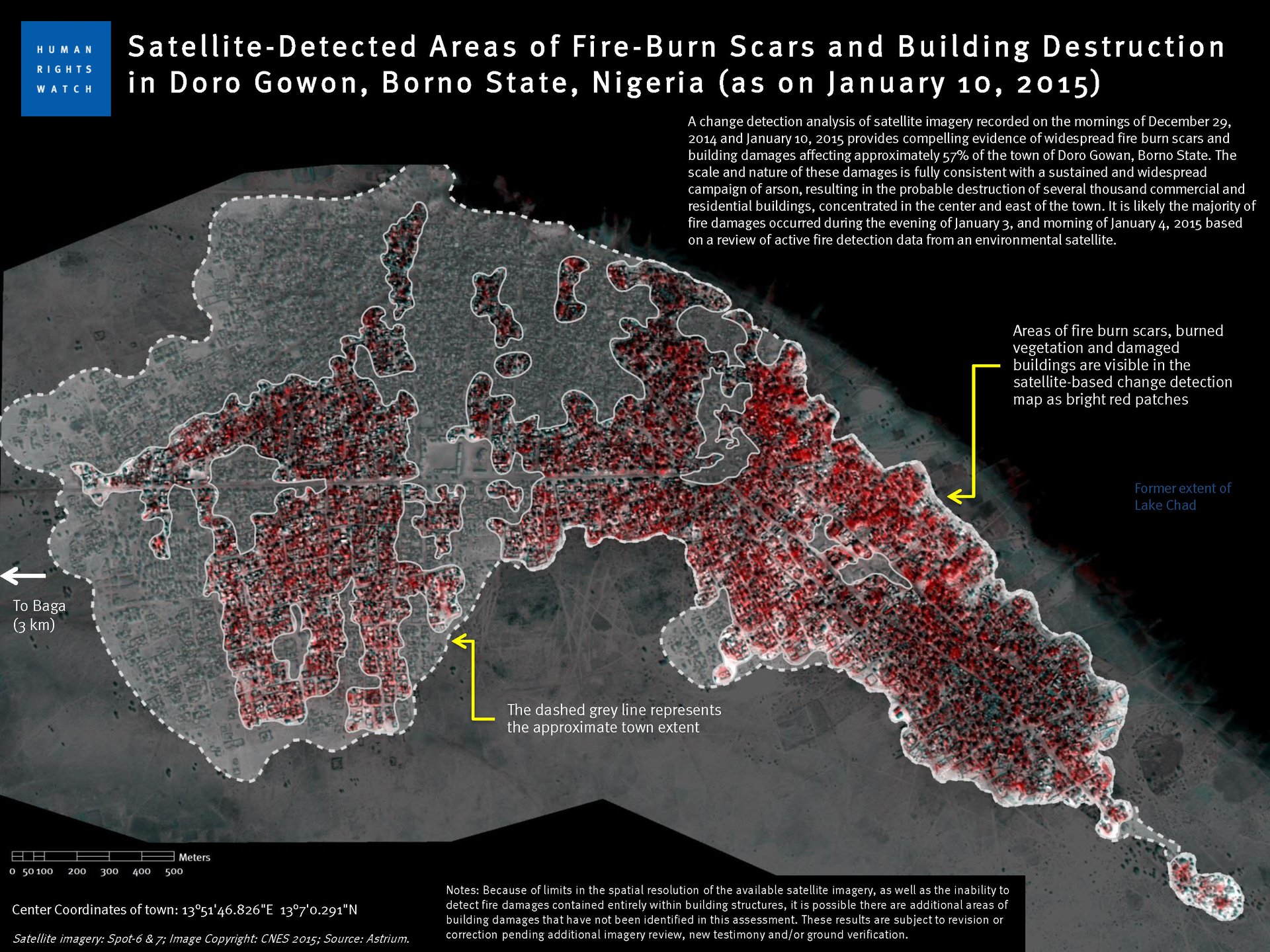
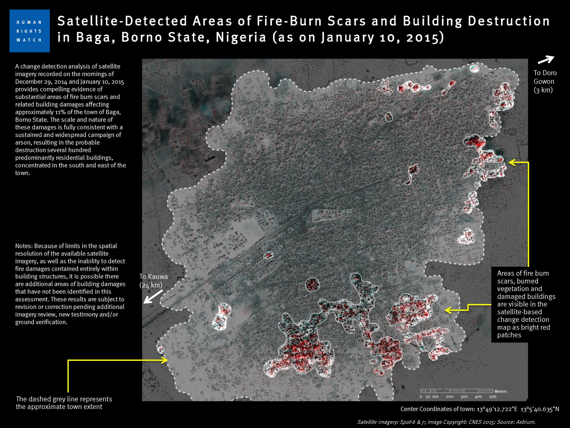
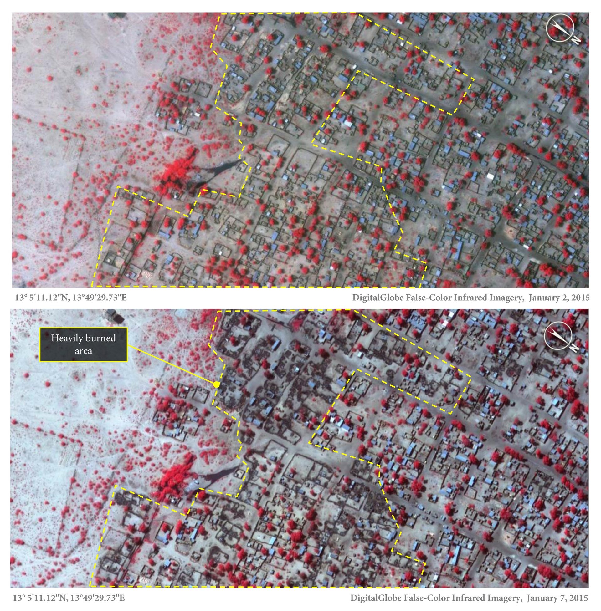
The before-and-after images show the extent of the scorched-earth tactics used by Boko Haram, the watch groups said. An analysis by Amnesty International of images taken on Jan. 2 and Jan 7. found that 3,700 structures were damaged or completely destroyed in the town of Baga and the neighboring Doron Baga (also known as Doro Gowon). According to Human Rights Watch, the exact death toll in Baga and 16 surrounding villages is difficult to establish, with estimates ranging from “dozens to 2,000.”
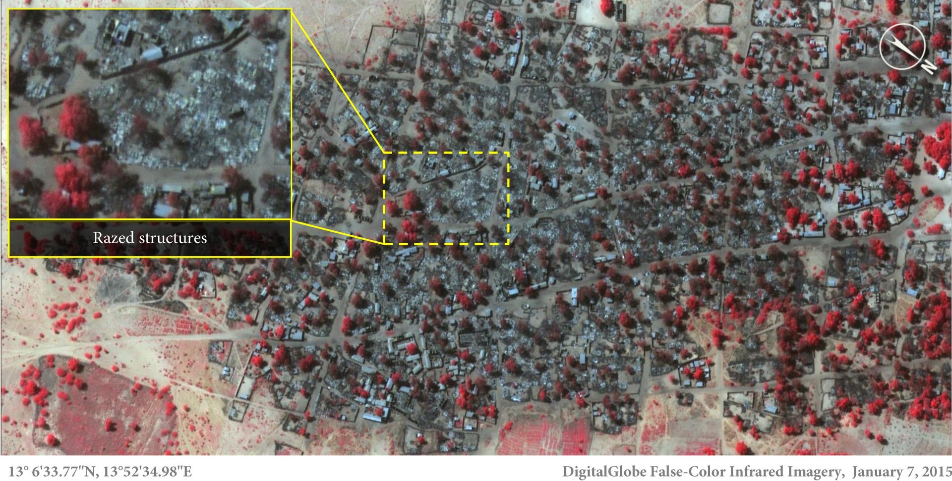
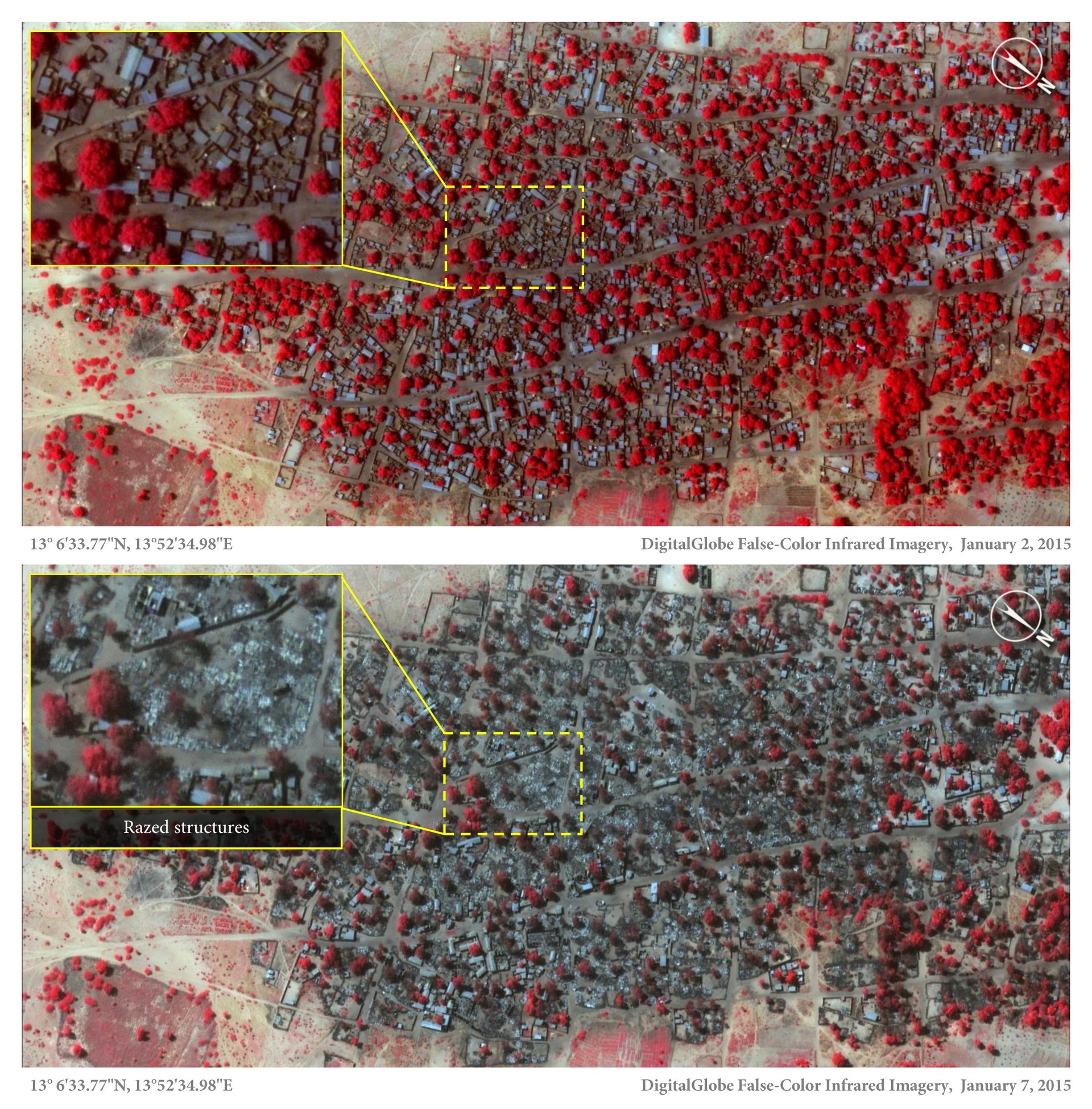
Red in these images, taken five days apart, represents healthy vegetation, and gray the burned ground:
“Up until now, the isolation of Baga combined with the fact that Boko Haram remains in control of the area has meant that it has been very difficult to verify what happened there. Residents have not been able to return to bury the dead, let alone count their number. But through these satellite images combined with graphic testimonies a picture of what is likely to be Boko Haram’s deadliest attack ever is becoming clearer,” Daniel Eyre, Nigeria researcher for Amnesty International, said in a statement.
The town of Doro Gowon, the site of an international military base, was hardest hit, according to Human Rights Watch, with as much as 57% of the town devastated. The death toll is difficult to verify largely because Boko Haram quickly took control of the area. But Human Rights Watch estimates that Boko Haram killed more than 2,000 civilians in northern and central Nigeria in the first six months of 2014.