For commuters in a hurry, some of London’s more cavernous and convoluted Tube stations can be a chore to navigate. (Ugh, King’s Cross.)
For commuters in a hurry, some of London’s more cavernous and convoluted Tube stations can be a chore to navigate. (Ugh, King’s Cross.)
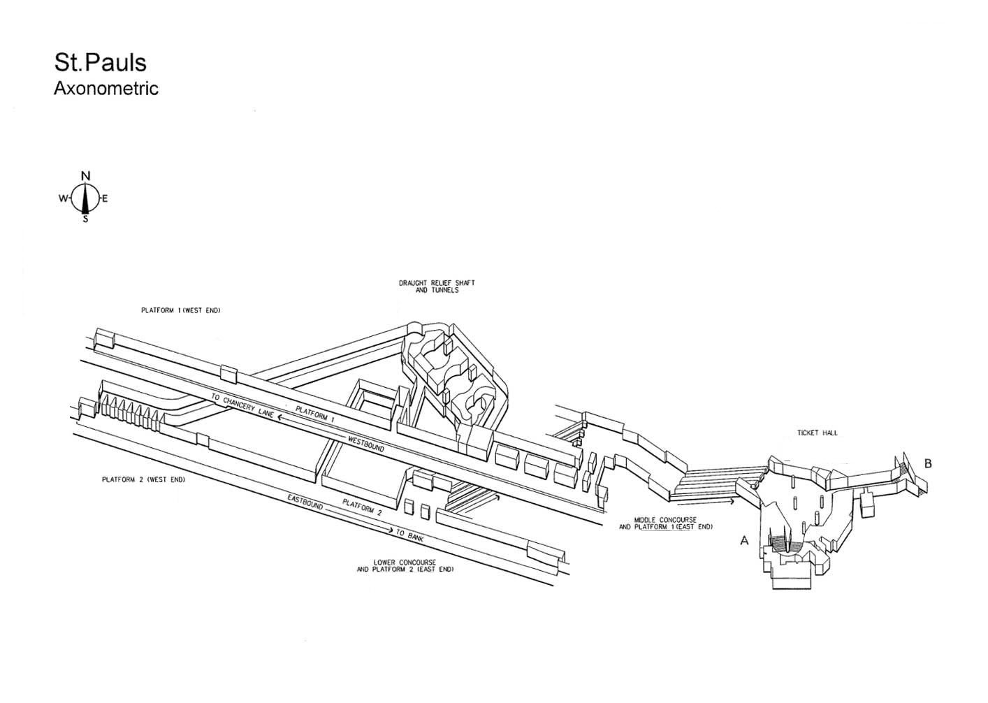
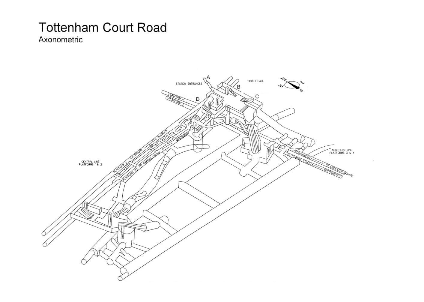
But it’s worth taking a step back to appreciate the engineering and architectural achievements of the huge and sprawling network that snakes beneath the capital’s crowded streets. Indeed, many people have created 3D maps of Tube stations, for fun and for profit. But nothing beats the official drawings.
Join 500,000+ readers who start their day with Quartz.
By subscribing, you agree to our Terms of Service and Privacy Policy.
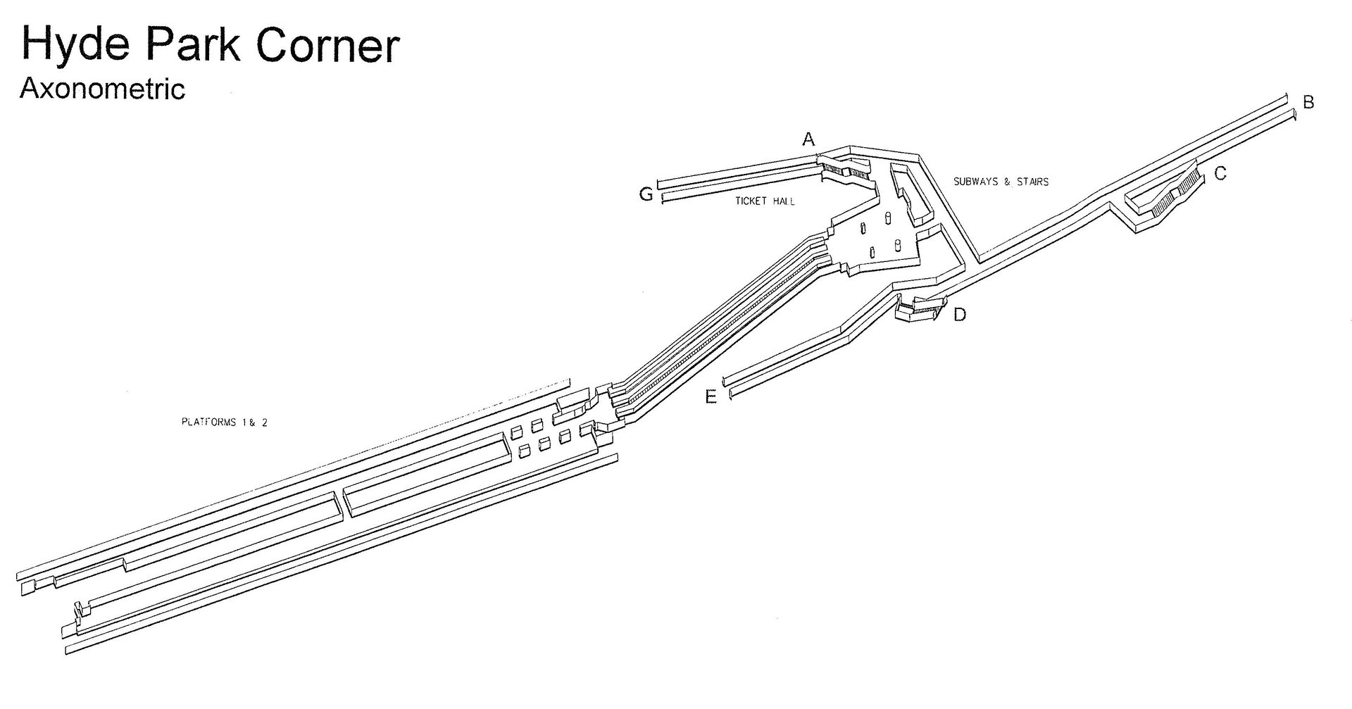
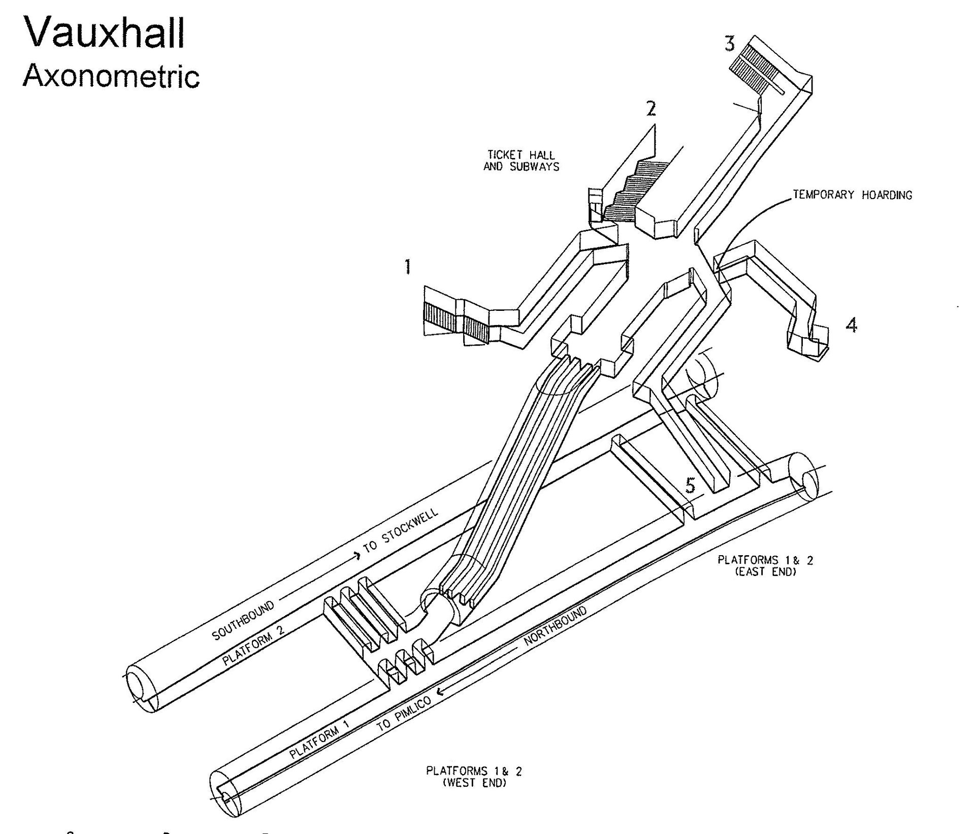
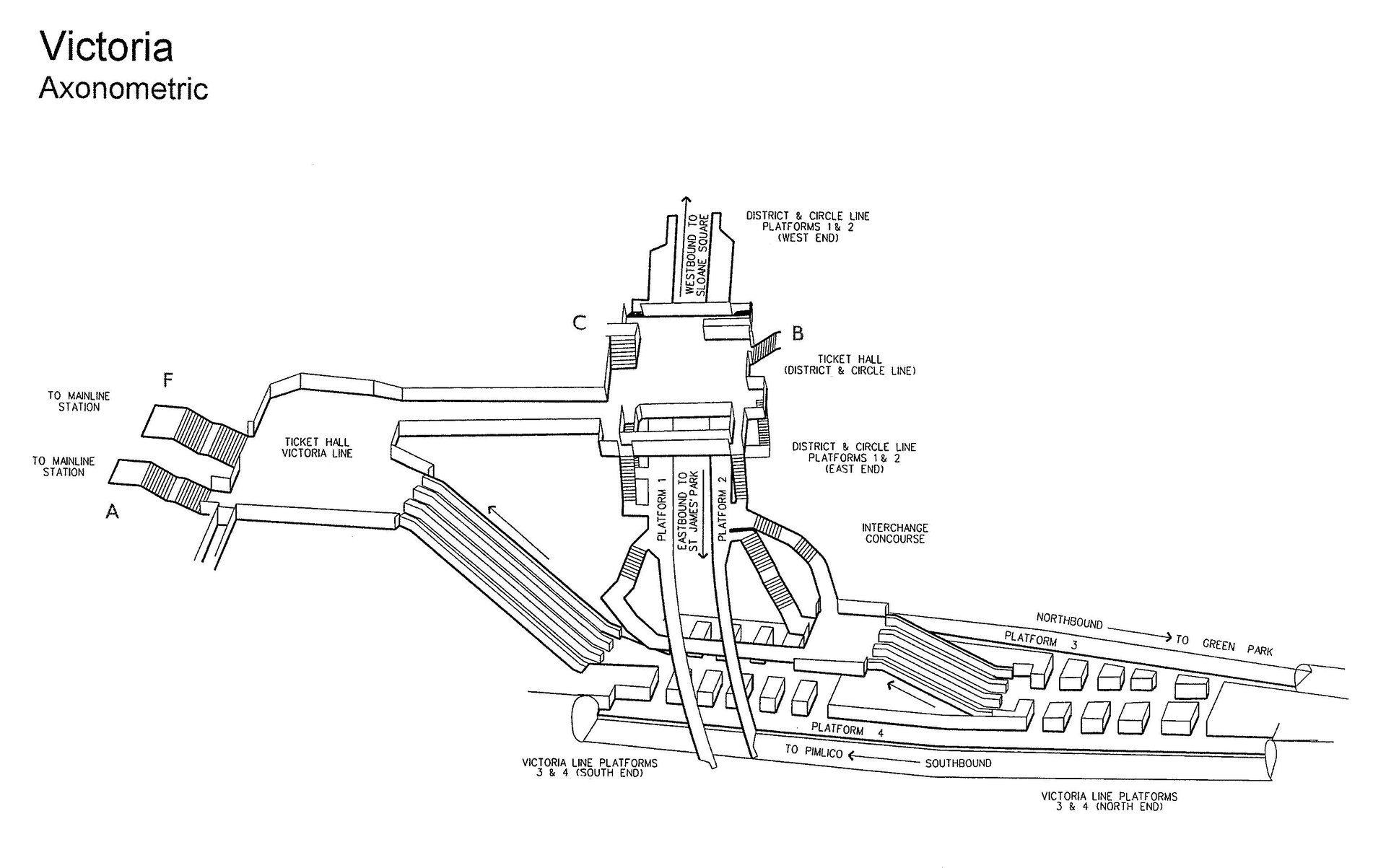
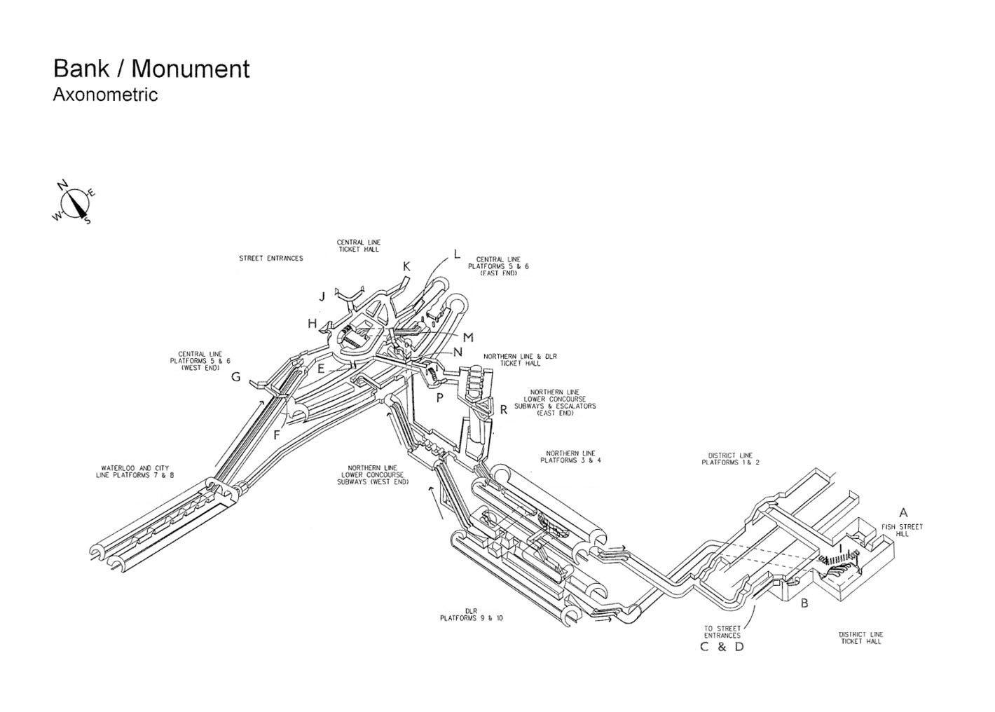
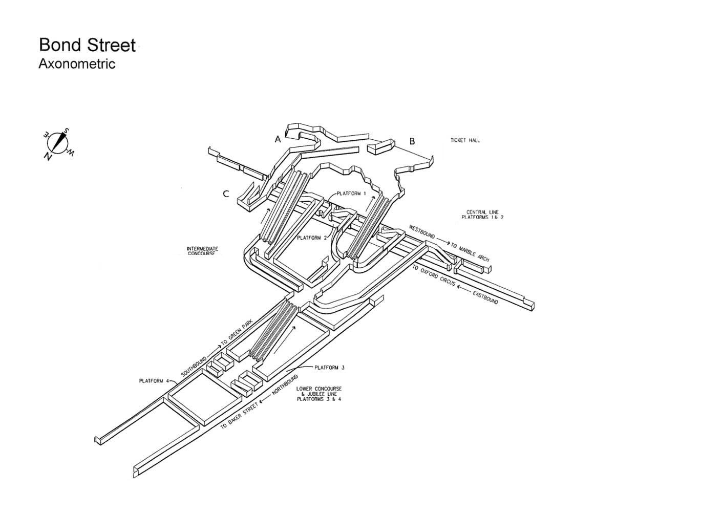
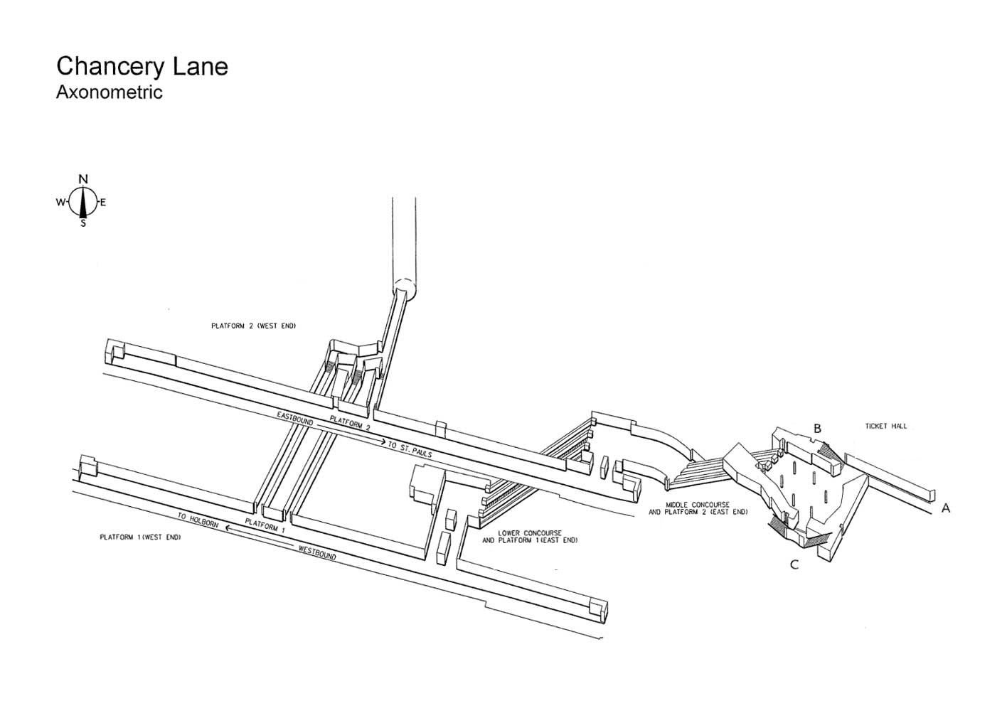
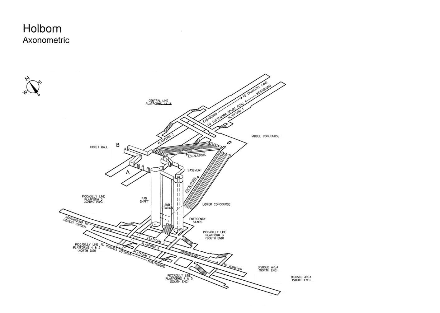
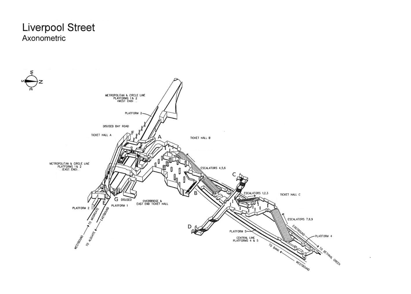
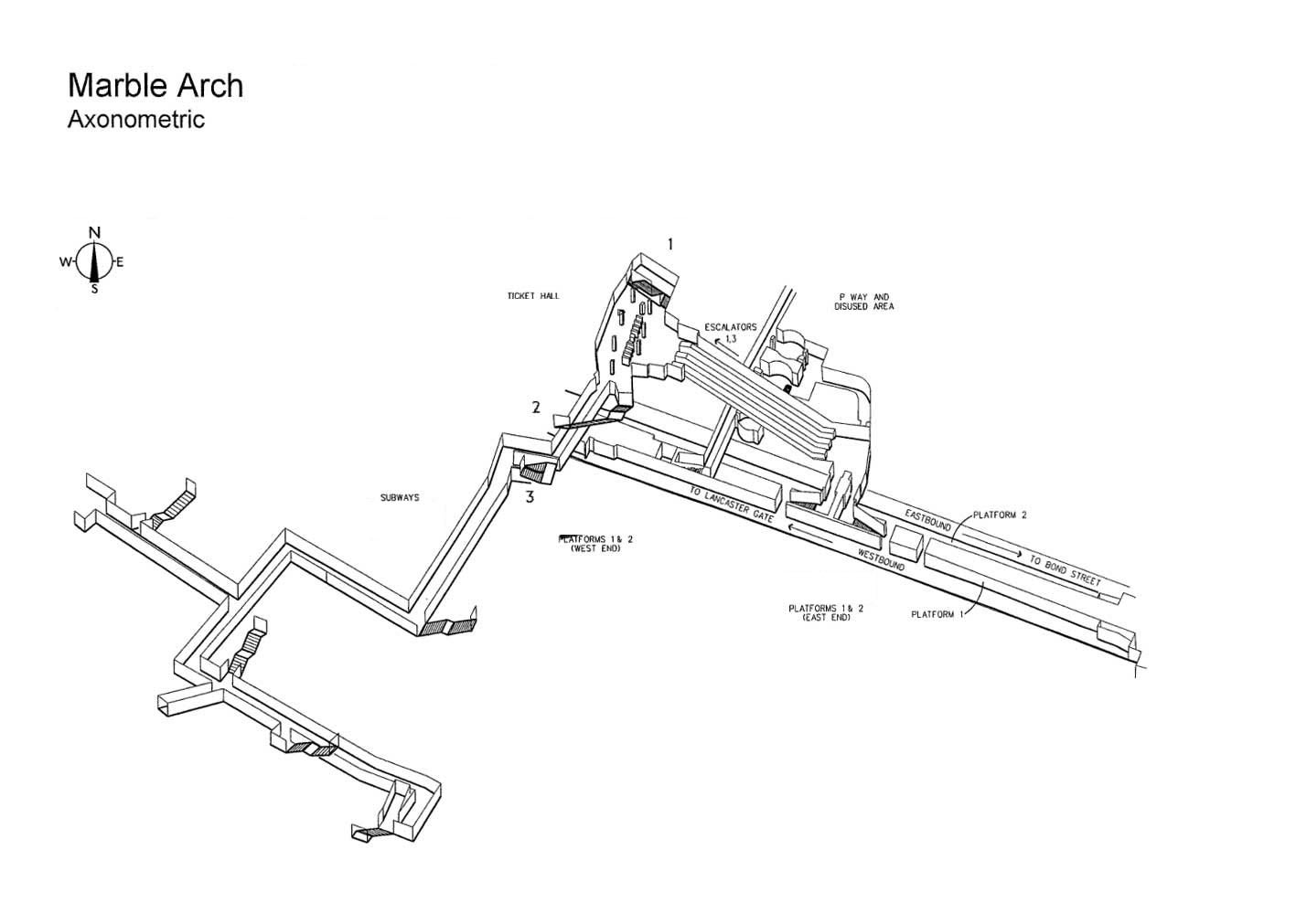
Following a freedom of information request, this month Transport for London released a bunch of 3D maps of Tube stations on the Central and Victoria lines. These were cleaned up by IanVisits.co.uk, and a selection of Central line stations are below:
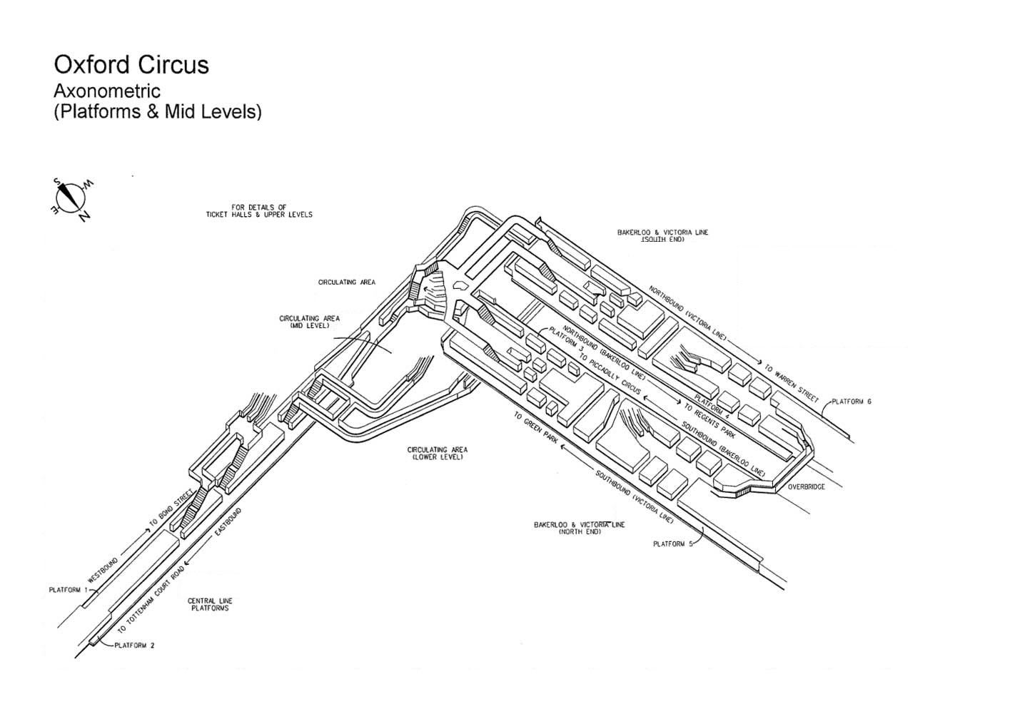
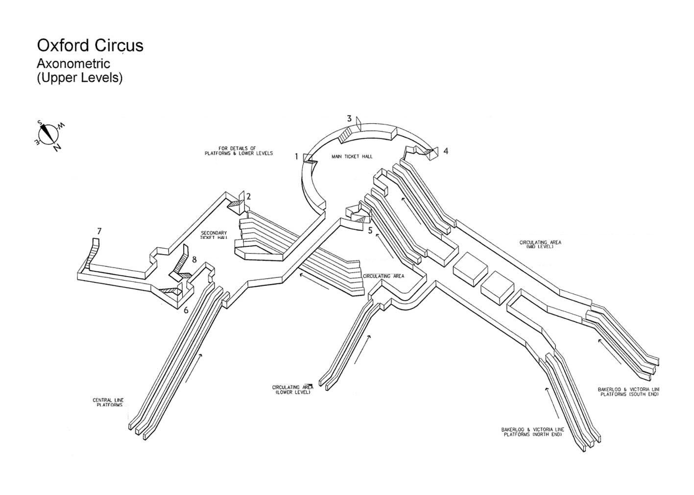
We touched up the Victoria line drawings in a similar way. Enjoy: