From the Sahara to the Andes, these 15 ancient civilizations built cities, traded across continents, and vanished — yet most people have never heard their names
Planet One Images / Getty Images
The civilizations that fill history textbooks — Egypt, Rome, Greece, China — occupy that space because their stories were preserved, translated, and absorbed into the Western academic tradition. But for every empire that made it onto the syllabus, dozens more rose, flourished, and disappeared without making the cut. Their cities are still being excavated. Their scripts are sometimes still undeciphered. Their names rarely appear outside specialist journals.
This is not a gap in ancient history. It is a gap in how history has been taught and transmitted. The civilizations in this list were not minor footnotes. Some built cities larger than anything in contemporary Europe. Some developed writing systems independently. Some engineered infrastructure — irrigation networks, road systems, urban planning — that rivals the achievements of better-known cultures. Their absence from mainstream historical consciousness says less about their significance than about which stories got amplified and which got buried, sometimes literally.
The civilizations here span six continents and five millennia. They include a Bronze Age culture in Central Asia that traded with both Mesopotamia and the Indus Valley. A sophisticated society in coastal Louisiana that built the largest earthwork complex in North America thousands of years before Columbus. A Saharan civilization that survived for centuries by engineering underground water systems in one of the most inhospitable landscapes on Earth. A city on the Peruvian coast that was already ancient when the pyramids of Giza were being built.
What unites these civilizations is not obscurity for its own sake. Each one left physical evidence — architecture, artifacts, trade goods, burial sites — that archaeologists are still working to understand. In several cases, major excavations began only in the last few decades, meaning the full picture is still incomplete. In others, the evidence has existed for a century but the culture never captured popular attention.
Each entry in this list stands on its own. Together, they suggest that the history of human civilization is far wider, stranger, and more geographically distributed than any single textbook could contain.
-1920x1280.jpg)
Kelly Cheng / Getty Images
Caral-Supe is the oldest known civilization in the Americas, with its main city — also called Caral — dated to around 3000 BCE, placing it contemporaneous with the early Old Kingdom of Egypt and the Sumerian city-states of Mesopotamia. It sits in the Supe Valley on the Pacific coast of Peru, about 200 kilometers north of Lima, in a landscape that receives almost no rainfall.
The discovery that Caral was this old came relatively recently. For most of the 20th century, archaeologists assumed complex civilization in the Americas began much later — in the first millennium BCE at the earliest. Radiocarbon dating conducted in the early 2000s revised that picture dramatically and repositioned South America in global discussions of where and when urban life first developed.
The city covered roughly 65 hectares and housed an estimated 3,000 people at its peak, though the wider Norte Chico region — encompassing about 30 urban settlements along several river valleys — supported a population in the tens of thousands. Unlike many ancient cities, Caral shows no evidence of warfare in its archaeological record. There are no defensive walls, no weapons, no depictions of conflict in its art. Whether this reflects a genuinely peaceful society or simply a gap in what has survived is still debated among researchers.
What Caral did have was monumental architecture on a significant scale. The city contains six large platform mounds, the largest of which — the Pirámide Mayor — stands about 18 meters tall and measures roughly 160 by 150 meters at its base. Sunken circular plazas used for public gatherings are another defining feature of the site. Construction of these structures would have required coordinated labor on a scale that implies sophisticated social organization, even if its exact form remains unclear.
The economy appears to have been built largely on a trade relationship between coastal fishing communities and inland agricultural settlements. Cotton was a key commodity — it was used to make nets for deep-sea fishing, creating an economic link between the sea and the river valleys inland. The absence of ceramic pottery is notable; Caral predates pottery use in the Andes, which makes it unusual among early urban sites worldwide.
No writing system has been identified at Caral, but researchers have studied quipus — knotted string devices — found at the site, which may have been used for recording information. The city was abandoned around 1800 BCE for reasons that remain unclear. Ongoing excavations, led primarily by the Peruvian archaeologist Ruth Shady Solís, continue to refine the picture.
Credit: Wikipedia
The Jiroft civilization came to the world's attention in the early 2000s, when severe flooding along the Halil River in southeastern Iran exposed thousands of artifacts that local people began selling on the black market. When Iranian archaeologists investigated, they found something that had been missed for over a century of regional survey: a major Bronze Age civilization centered on the city of Konar Sandal, dating to roughly 2500–2200 BCE.
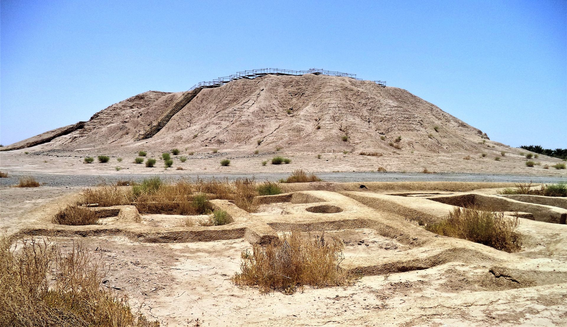
The site sits in the Halil Rud basin in Kerman Province, a region not previously associated with early urban development. What emerged from excavations was a city with a monumental mud-brick ziggurat — a stepped tower similar in form to those found in Mesopotamia — along with a sophisticated material culture that included distinctive carved chlorite vessels unlike those produced anywhere else in the ancient world.
These chlorite vessels are among the most striking artifacts associated with Jiroft. They are decorated with complex imagery: mythological scenes, animals intertwined with architectural forms, figures that appear divine or royal. Similar vessels had turned up at Mesopotamian sites for decades before Jiroft was identified, labeled as objects of unknown origin. The Jiroft excavations provided a credible production center for at least some of them and prompted researchers to revisit assumptions about Bronze Age trade.
The civilization appears to have been a significant hub in a network that connected Mesopotamia to the Indus Valley. Lapis lazuli, carnelian, and other semi-precious materials moved through this corridor. Jiroft's geographic position — at the intersection of routes connecting the Iranian plateau to the Persian Gulf and to Central Asia — made it a natural intermediary for goods and ideas traveling between major cultural centers.
Some researchers have proposed that Jiroft may be the location of Aratta, a wealthy city mentioned in ancient Sumerian texts as a source of luxury goods and skilled craftspeople. The identification is not settled, and mainstream scholarship treats it as speculative, but the geographic and material parallels have kept the argument alive.
The Jiroft script is another unresolved question. Inscribed tablets found at the site use symbols that do not match any known writing system. Whether they represent a fully developed writing system, a proto-writing notation, or something else entirely has not been determined. If it is a writing system, it would be among the earliest discovered anywhere.
CristianChirita / Wikipedia
The Cucuteni-Trypillia culture occupied a large stretch of what is now Romania, Moldova, and Ukraine between roughly 5500 and 2750 BCE — a span of nearly 3,000 years that makes it one of the longest-lasting prehistoric cultures in European history. At its peak, it produced some of the largest settlements in the world at the time, with populations in individual sites potentially exceeding 10,000 people.
These mega-sites, as archaeologists call them, covered areas of up to 320 hectares. They were laid out in concentric oval or circular patterns, with streets radiating outward from a central open space. Houses were arranged in rows and were often two stories tall. Then, apparently on a regular cycle, the settlements were burned to the ground — and rebuilt on the same spot, sometimes multiple times. The reason for this practice has been debated extensively. Proposed explanations include ritual renewal, pest control, or the end of a structure's practical useful life. No consensus has been reached.
The culture is named twice because it was discovered independently in Romania — at the site of Cucuteni — and in Ukraine — at Trypillia — before researchers realized both names referred to the same culture. The dual name has persisted in academic usage ever since.
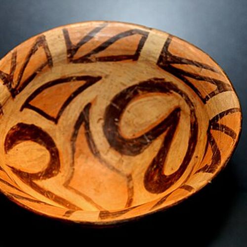
Cucuteni-Trypillia pottery is among the most recognizable in European prehistory. The vessels are painted with elaborate geometric and spiral designs in red, black, and white — a visual tradition that appears strikingly consistent across a wide geographic area and multiple centuries. That consistency implies a shared cultural identity maintained across distances that would have taken days or weeks to travel on foot.
Agriculture was central to the economy. Wheat, barley, and legumes were cultivated. Cattle, pigs, sheep, and goats were kept in quantity. The communities were apparently relatively egalitarian, at least in earlier periods — burial evidence does not show dramatic differentiation in wealth or status of the kind visible in contemporary Near Eastern sites.
The culture declined around 2750 BCE. Genetic and archaeological evidence now links this decline to the arrival of steppe pastoralists moving westward from the Pontic-Caspian grasslands — a migration that reshaped the population of Europe more fundamentally than any event since the first farmers arrived from Anatolia thousands of years earlier.

Credit: wmf.org
The Moche civilization flourished on the northern coast of Peru from roughly 100 to 800 CE, building an economy on fishing, agriculture supported by irrigation, and long-distance trade. They left behind some of the most distinctive art in the ancient Americas — ceramic portrait vessels that depict individual human faces with a degree of naturalism rare in ancient art anywhere in the world.
The Moche were not a unified state. Archaeologists generally describe them as a series of regional polities sharing a common artistic and religious tradition rather than a single political entity governed from one center. Two major sites — Huacas del Sol y de la Luna in the Moche Valley and Pampa Grande further north — were the largest, but significant complexes existed across several river valleys running down from the Andes to the Pacific.
At Huaca de la Luna, murals cover interior walls with elaborate scenes depicting sacrifice and supernatural figures. The site also yielded evidence of human sacrifice on a significant scale. During drought years driven by El Niño events, the Moche appear to have conducted mass ritual killings, apparently intended to appease forces responsible for the disruption of the agricultural cycle. Skeletal remains show cut marks and patterns of disarticulation consistent with sacrifice rather than battlefield death.
The wealth of elite Moche individuals is visible in their tombs. The Lord of Sipán — a ruler buried in the Lambayeque Valley around 300 CE — was interred with extraordinary quantities of gold, silver, and copper objects, including elaborate headdresses, ear ornaments, and chest plates. The tomb was discovered in 1987 by Peruvian archaeologist Walter Alva and is considered one of the richest intact ancient burials found in the Western Hemisphere.
Moche ceramic vessels function both as everyday objects and as visual records of a culture. They depict warfare, hunting, ceremonies, disease, childbirth, and sexual acts with a directness unusual in ancient art. Some vessels appear to depict specific rulers or mythological narratives in enough detail to suggest that the Moche had a form of visual storytelling comparable in complexity to written narrative.
The civilization collapsed around 800 CE, likely due to a combination of prolonged drought and the southward expansion of the Wari Empire from the Peruvian highlands.
Eric Lafforguev / Art in All of Us / Getty Images
The Garamantes were a Saharan civilization that developed in the Fezzan region of what is now southwestern Libya, reaching their height roughly between 500 BCE and 700 CE. They are almost entirely absent from popular history, which is striking given that they maintained a sophisticated urban society in one of the world's most extreme environments for more than a millennium.
Their survival in the Sahara depended on an engineering system called foggara — a network of underground aqueducts that channeled groundwater from beneath the desert to the surface. The Garamantes dug thousands of kilometers of these tunnels, some stretching several kilometers in length, to bring water to their fields and cities. The system was labor-intensive to build and required specialist knowledge passed across generations. Without it, permanent settlement in the Fezzan would have been impossible.
At their height, the Garamantes controlled key trade routes through the central Sahara, connecting sub-Saharan Africa to the Mediterranean world. They traded in slaves, gold, and exotic animals with Carthage, Rome, and later Byzantium. Classical writers including Herodotus, Strabo, and Pliny mention the Garamantes, typically as formidable desert warriors. Roman armies fought campaigns against them in the first century CE, and Roman forts were established along the frontier with Garamantian territory.
The capital was Garama, located near the modern oasis town of Germa. Archaeological work there has revealed a planned city with stone buildings, streets, and a substantial urban population. Royal tombs outside the city — hundreds of conical stone mounds — cover an area of several square kilometers and remain visible from satellite imagery. The scale of the royal necropolis suggests a civilization with both the organizational capacity and the cultural motivation for major public construction.
The decline came in the seventh and eighth centuries CE, when the foggara system began to fail as underground water tables dropped. Centuries of intensive extraction had depleted the aquifers that made agriculture possible. The arrival of Arab armies from the east accelerated the collapse. The irrigation tunnels were gradually abandoned, and the desert reclaimed land that had been cultivated for over a thousand years.
John Elk / Getty Images
Dilmun was an ancient civilization centered on the island of Bahrain in the Arabian Gulf, with settlements also on the adjacent Saudi Arabian coast and on the island of Failaka in modern Kuwait. It flourished from roughly 3000 to 800 BCE and played a central role in Bronze Age trade linking Mesopotamia, the Indus Valley, and Oman.
The civilization appears in Sumerian texts dating to around 2000 BCE, where it is described as a kind of paradise — a pure, clean land associated with the origins of the world and with immortality. One Sumerian myth places the creation of humanity in Dilmun. In the Epic of Gilgamesh, the flood survivor Utnapishtim lives in a distant blessed land that some scholars have identified with Dilmun. These literary references gave the civilization a pronounced mythological resonance in Mesopotamian culture that outlasted its political and economic significance.
In material terms, Dilmun was a trading hub of considerable importance. Its location in the middle of the Gulf made it a natural waypoint for ships carrying copper from Oman, carnelian and cotton from the Indus Valley, and textiles and grain from Mesopotamia. Dilmun merchants appear as regular counterparts in cuneiform trade records from Ur and other Sumerian cities. The volume of trade that passed through suggests a prosperous commercial class and an administrative structure capable of managing long-distance commerce.
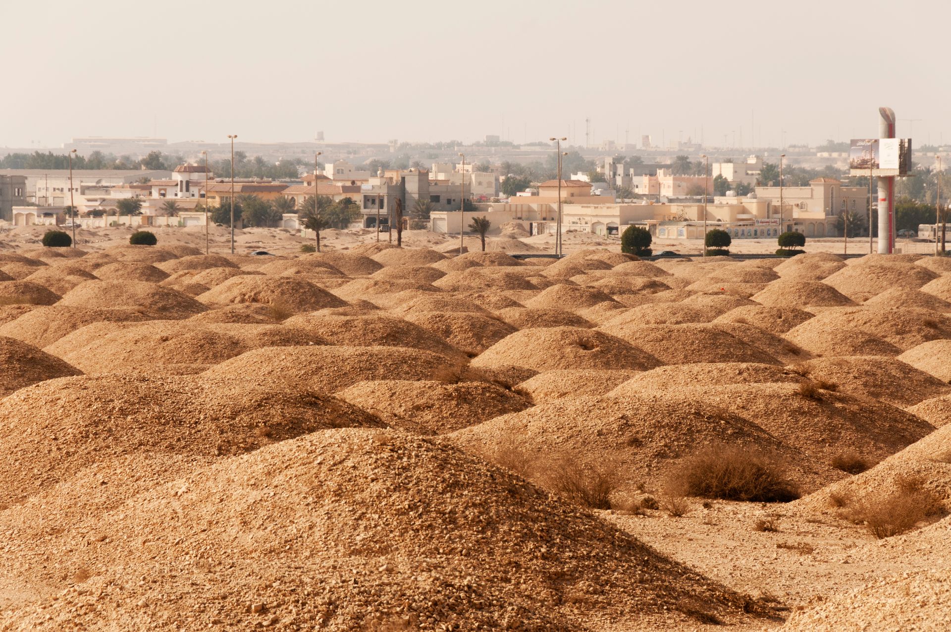
Burial mounds are the most visible archaeological feature of ancient Bahrain. The island contains over 170,000 burial mounds — one of the highest concentrations of ancient tumuli anywhere in the world relative to land area. They date primarily from the early and middle Dilmun period, roughly 2200 to 1700 BCE, and contain grave goods that reflect both local tradition and the civilization's trade connections.
The Qal'at al-Bahrain archaeological tell, the main urban center of Dilmun, has been excavated intermittently since the 1950s and is now a UNESCO World Heritage Site. Occupation layers span roughly 4,500 years, from the Bronze Age through the Islamic period. Dilmun's significance declined after Mesopotamian trade routes shifted away from Gulf shipping around 1800 BCE, a change tied to political disruptions on the subcontinent and in southern Mesopotamia that reduced the volume of east-west commerce.

scaliger / Getty Images
Funan is the name Chinese chroniclers gave to a kingdom that dominated the lower Mekong Delta — in what is now southern Vietnam and Cambodia — from roughly the first to the seventh century CE. It is considered the earliest complex polity in mainland Southeast Asia, predating the Angkor Empire by several centuries. Despite that distinction, it rarely appears in popular accounts of the ancient world.
The name "Funan" is a Chinese transliteration whose original pronunciation and meaning are uncertain, and the kingdom's own inhabitants likely used a different name. The evidence for Funan comes from a combination of Chinese dynastic records, archaeological excavations, and later Khmer inscriptions that reference earlier ruling dynasties. Chinese envoys visited the kingdom in the third century CE and left written accounts of its cities, governance, and customs — among the earliest detailed outside observations of mainland Southeast Asia.
The main port city was Óc Eo, located in what is now An Giang Province in southern Vietnam. Excavations there have recovered Roman coins, Indian seals, Sassanid Persian objects, and Chinese bronze mirrors alongside locally produced goods — a concentrated material record of a civilization plugged into trade networks spanning from the Mediterranean to East Asia. The breadth of these connections places Funan at the center of an ancient globalization that most histories ignore.
The economy rested on maritime trade, rice agriculture, and the management of the Mekong Delta's waterways. The kingdom constructed an extensive canal system to drain wetlands for cultivation and to move goods between inland settlements and the coast. Sections of this canal network were identified through aerial and satellite surveys in the 20th century and have been partially confirmed by excavation.
Indian cultural influence was strong in Funan. Sanskrit was used for official inscriptions. Hindu and Buddhist religious practices were observed, and the ruling class adopted Indian concepts of divine kingship. This process — sometimes called Indianization — involved the selective adoption of South Asian cultural, religious, and political forms by Southeast Asian elites, and Funan represents its earliest documented case in the mainland. The mechanisms by which these ideas spread — trade, diplomacy, intermarriage, the movement of priests and merchants — are still being studied.
The kingdom declined in the sixth century CE, giving way to the Chenla polities that would eventually evolve into the Khmer Empire.
yurybirukov / Getty Images
Tiwanaku was a pre-Columbian civilization centered on the southern shores of Lake Titicaca in what is now Bolivia, with its influence extending into parts of Peru, Chile, and Argentina. It flourished from roughly 500 to 1000 CE and represents one of the most significant pre-Inca civilizations in South America — one that left architectural and religious legacies that the Inca would later incorporate into their own culture.
The city of Tiwanaku sat at an elevation of about 3,850 meters above sea level — one of the highest urban centers in the ancient world. Agriculture at this altitude is genuinely difficult. The Tiwanaku developed a system of raised field cultivation called sukakollu — rectangular platforms of earth separated by water-filled channels — that created a microclimate warm enough to sustain crops at altitudes where killing frosts occur regularly. The channels absorbed solar heat during the day and released it at night, buffering the surrounding fields against temperature extremes that would otherwise destroy harvests.
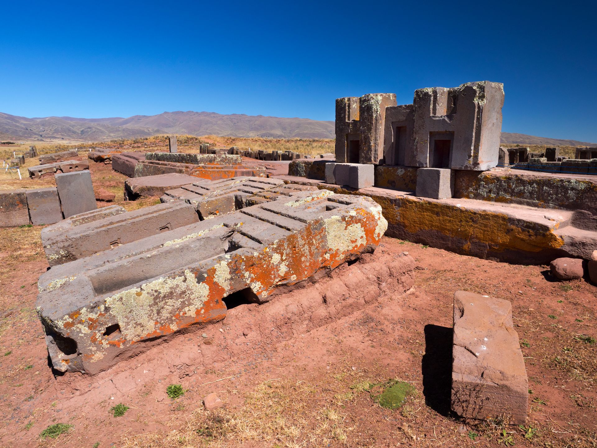
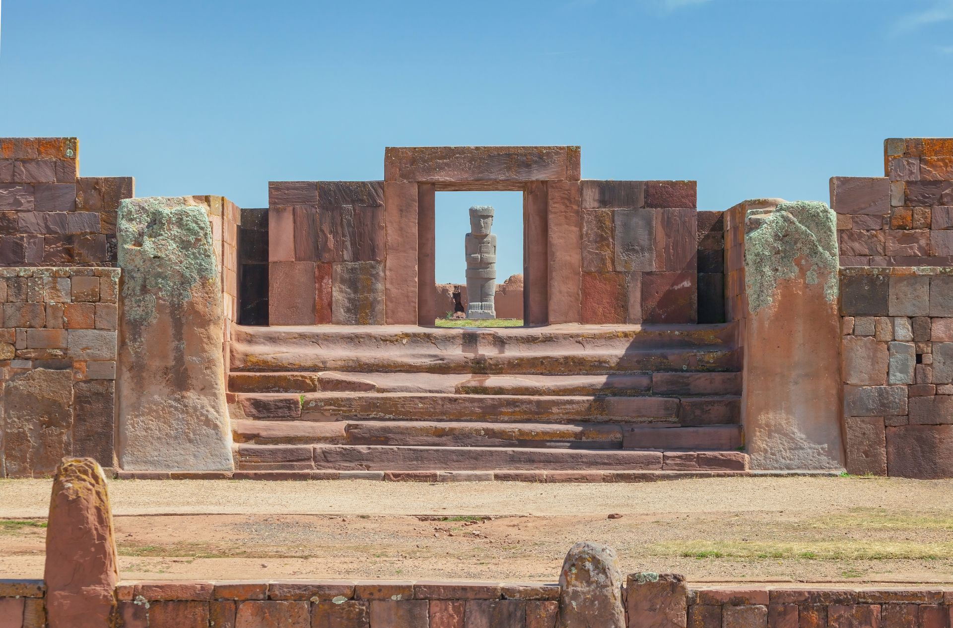
The architecture at the core city is monumental. The Akapana pyramid, the Kalasasaya platform, and the Pumapunku complex are the most studied structures. Pumapunku in particular draws attention because of its precisely cut stone blocks — large pieces of sandstone and andesite shaped with geometric accuracy that required advanced planning and execution. Some stones weigh tens of tons and were transported from quarries several kilometers distant. The methods used to cut and fit them remain a subject of archaeological study.
The Gateway of the Sun, a monolithic stone arch carved from a single block of andesite, is one of the most recognizable objects in pre-Columbian archaeology. The carved figure at its center — a radiating deity holding two staffs — appears across a wide geographic area in Andean iconography, suggesting that Tiwanaku's religious imagery influenced cultures well beyond its direct political control.
Tiwanaku was not primarily a military empire. Its expansion appears to have been driven by the spread of a religious ideology and by trade relationships, with colonies established across a wide region. The relationship between the core city and these peripheral settlements was complex. Archaeological evidence suggests negotiation and exchange rather than simple conquest and extraction.
The civilization collapsed around 1000 CE, most likely following a prolonged drought that disrupted the agricultural systems dependent on stable lake levels and predictable rainfall.

José Luiz Bernardes Ribeiro / Wikipedia
Tartessos was an ancient civilization centered in the lower Guadalquivir River valley of southwestern Iberia — in what is now Andalusia, Spain — that flourished roughly between 900 and 500 BCE. It was wealthy, literate, and integrated into Mediterranean trade. By the third century BCE it had largely vanished, leaving behind a legacy that ancient writers found compelling but that modern scholarship has struggled to define precisely.
Greek writers were fascinated by Tartessos. Herodotus described its king, Arganthonius, as extraordinarily wealthy and long-lived — a figure who embodied the distant, prosperous west in the Greek geographical imagination. Other Greek and Phoenician sources described Tartessos as a source of silver, tin, and other metals, traded through the Phoenician colonial network established at Gadir — modern Cádiz. The wealth of Tartessos was tied directly to the mineral deposits of the surrounding region, including what is now the Río Tinto mining area, which has been worked continuously for roughly 3,000 years.
Archaeological evidence for Tartessos is substantial but not straightforward to interpret. Burial sites contain objects of Phoenician, Greek, and indigenous manufacture mixed together, reflecting a civilization that absorbed outside influences while maintaining a distinct material identity. The Carambolo Treasure — a hoard of gold objects found near Seville in 1958 — is among the most visually compelling artifacts associated with the culture, featuring large pectoral pieces and bracelets that show both Phoenician and local stylistic elements.
The Tartessian script is one of the more puzzling problems in European epigraphy. It is attested on stone inscriptions, mostly from southwestern Iberia, and appears to have been derived from the Phoenician alphabet but adapted for a different language — possibly related to the pre-Roman languages of the Iberian Peninsula, possibly something else entirely. The language behind the script has not been fully deciphered, though progress has been made in understanding its phonological structure.
The disappearance of Tartessos around 500 BCE coincides with the decline of Phoenician trade networks in the western Mediterranean following the consolidation of Carthaginian power. Whether the civilization was absorbed, transformed beyond recognition, or simply lost its coherence without external trade contacts is still actively debated by researchers working in southwestern Spain.
Konstantin_Novakovic / Getty Images
The Kingdom of Kerma was an African civilization that developed along the upper Nile in what is now northern Sudan, with its capital near the third cataract of the Nile. It flourished from roughly 2500 to 1500 BCE — contemporaneous with the Egyptian Middle Kingdom and Second Intermediate Period — and at various points was powerful enough to challenge Egypt militarily and extract tribute from its northern neighbor.
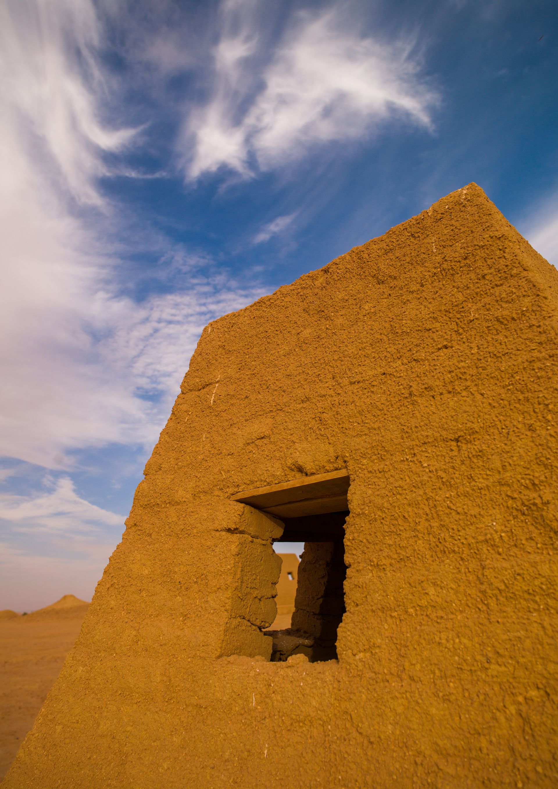
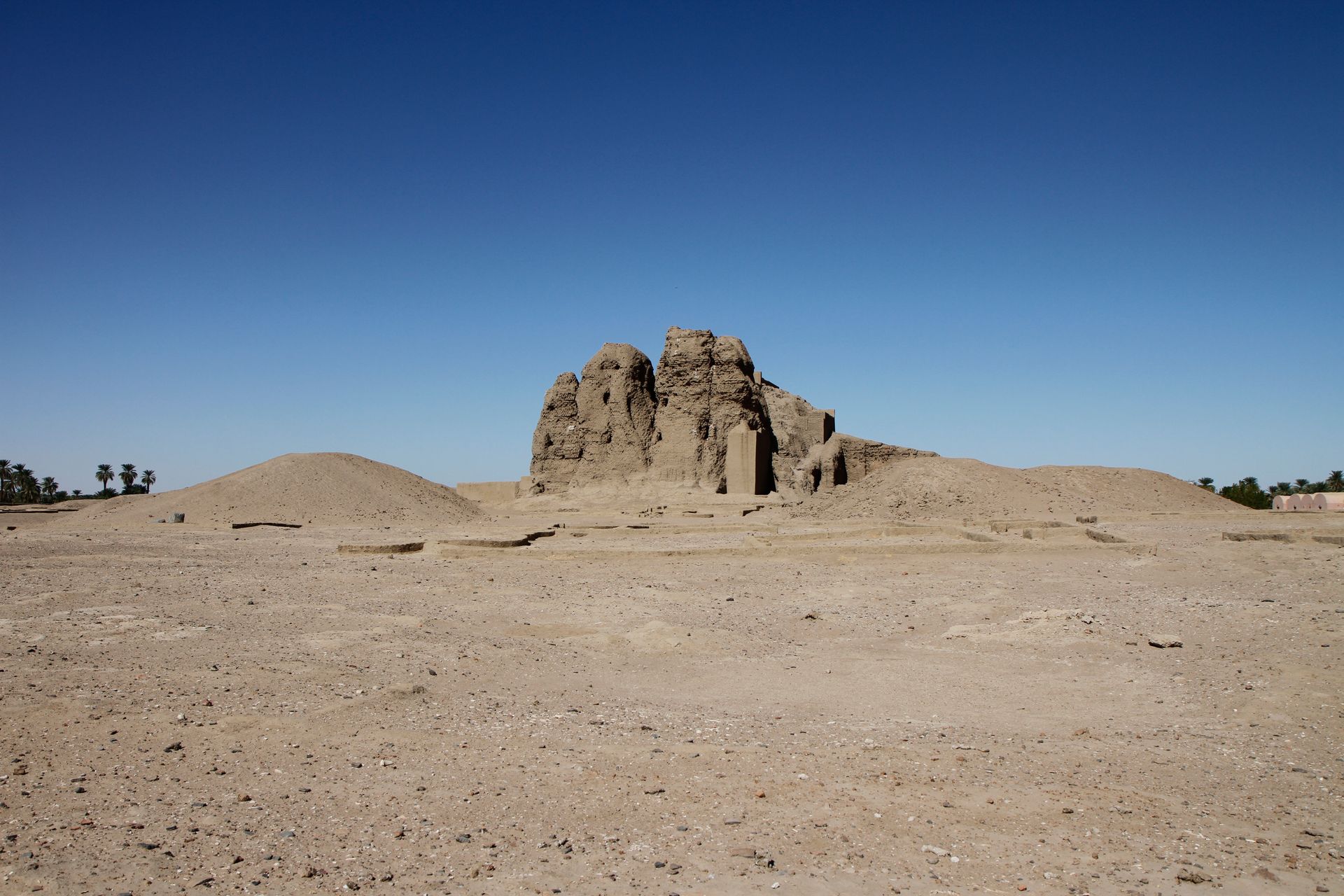
Kerma is often described as the earliest sub-Saharan African state with a demonstrable urban center, though this designation is contested and depends on how state-level organization is defined. The city of Kerma itself was substantial. It had a planned layout, monumental public buildings, and a population that archaeologists estimate in the thousands. The Western Deffufa — a large mud-brick structure that served as the main religious building — still stands to a significant height, making it one of the oldest standing buildings in Africa outside Egypt.
The burial ground at Kerma is among the most extensively excavated in Africa. Thousands of graves have been documented over more than a century of excavation, primarily by Swiss archaeologist Charles Bonnet. Elite burials are marked by enormous circular tumuli, some exceeding 90 meters in diameter, and contain evidence of human sacrifice — servants and retainers buried alongside the primary individual. The number of sacrificed individuals in the largest tombs runs into the hundreds, indicating that the Kerma elite commanded the kind of absolute authority over human life associated with the most powerful ancient states.
The kingdom's economy was built on cattle herding and on trade. Kerma sat at the intersection of routes connecting Egypt to the African interior, and luxury goods — ivory, gold, ebony, and exotic animals — moved through the city in both directions. Egyptian texts from the period refer to Kerma as Kush and describe it with a mixture of commercial interest and military concern.
Egypt conquered Kerma under the New Kingdom pharaoh Thutmose I around 1500 BCE. The region was incorporated as the Egyptian province of Kush. That name survived the conquest and became the basis for later Nubian kingdoms, including one that would reverse the power relationship entirely — conquering Egypt and ruling it as the 25th Dynasty in the eighth and seventh centuries BCE.
STR / Getty Images
The Bactria-Margiana Archaeological Complex — known by the acronym BMAC, or sometimes as the Oxus civilization — was a Bronze Age urban culture that occupied parts of what are now Turkmenistan, Afghanistan, Uzbekistan, and Tajikistan, from roughly 2300 to 1700 BCE. Its cities were sophisticated, its material culture distinctive, and its geographic position uniquely central — sitting between Mesopotamia to the west, the Indus Valley to the southeast, and the Eurasian steppe to the north.
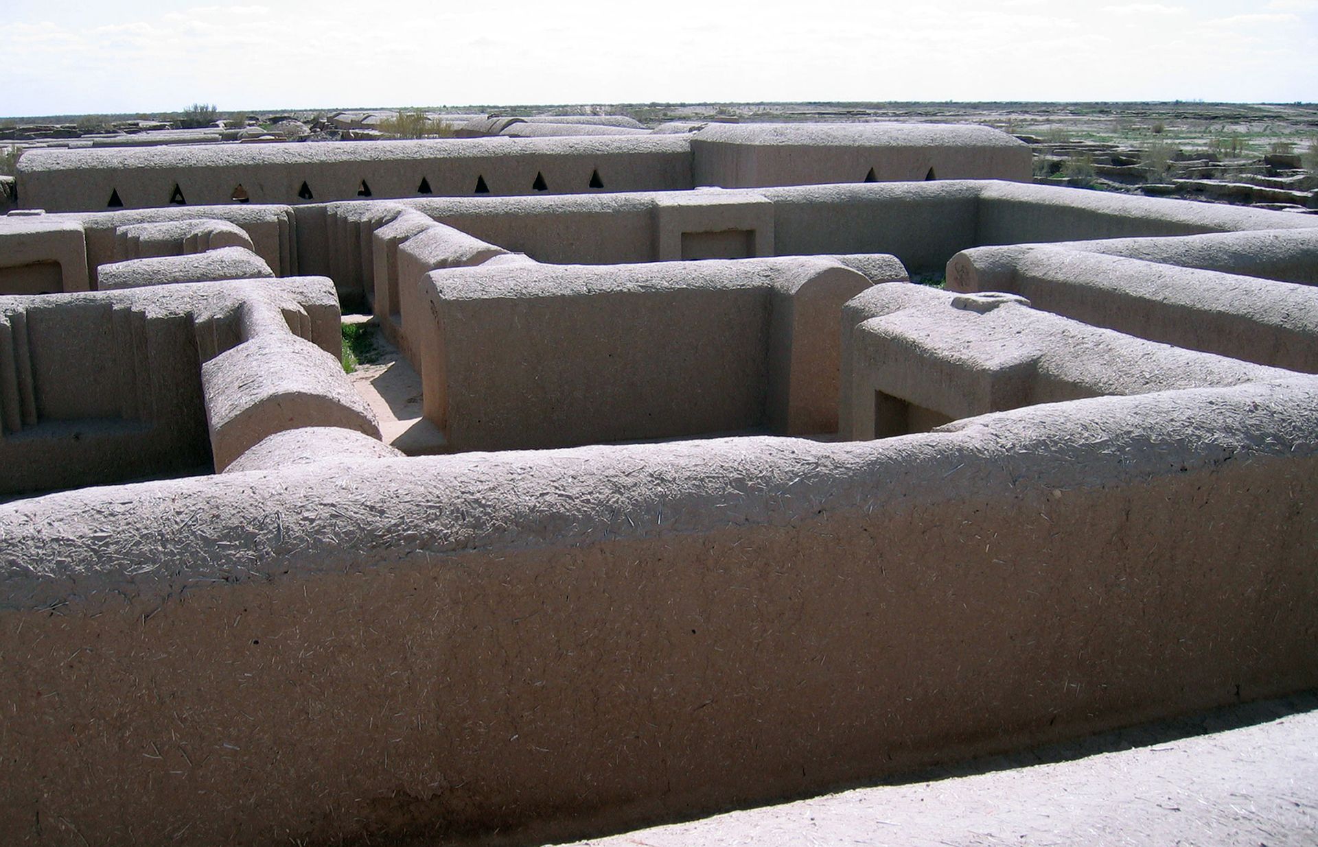
The main sites — Gonur Tepe in Turkmenistan and Dashly 3 in Afghanistan, among others — share a consistent urban design: a central palace or temple complex enclosed within walls, with residential neighborhoods radiating outward. The architecture is monumental in scale and well-preserved in places, partly because the civilization built in mud brick that survives well in the dry Central Asian climate. Gonur Tepe was excavated extensively by the Soviet-era archaeologist Viktor Sarianidi beginning in the 1970s, and the site continues to be studied.
BMAC artifacts have appeared at sites across a vast geographic area, indicating deep integration into Bronze Age trade networks. Distinctive BMAC objects — carved chlorite vessels, bronze tools of specific forms, a characteristic style of compartmented stone seals — have been found at Mesopotamian, Indus Valley, and Persian Gulf sites. The direction of trade was bidirectional. Goods from as far as the Mediterranean have turned up in BMAC contexts, suggesting merchants or intermediaries moving through the Central Asian corridor.
The civilization is also central to debates about the origins of the Indo-Iranian language branch. The timing and location of the BMAC overlap with proposed migration routes of early Indo-Iranian speakers moving south into Iran and the Indian subcontinent. Some researchers have proposed that the BMAC represents either the Indo-Iranian homeland or a culture with which early speakers of these languages interacted closely before their southward dispersal. Genetic and linguistic evidence is still being analyzed.
The BMAC declined around 1700 BCE, coinciding with broader disruptions that affected urban cultures across the region — possibly tied to climate shifts, the movement of steppe pastoralists, or the collapse of trade networks that had sustained the cities. The population dispersed rather than vanished, with communities in modified forms persisting into the second millennium BCE.
Herb Roe / Wikipedia
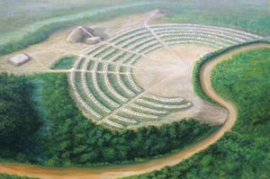
Poverty Point is a large archaeological site in northeastern Louisiana that was constructed and occupied by a hunter-gatherer society between roughly 1700 and 1100 BCE. The site contains a series of concentric earthwork ridges, large mounds, and a central plaza, covering an area of about 400 hectares. It is the largest and most complex earthwork site in North America from this period, and it was built by people who, according to the conventional model linking monumental construction to agriculture, should not have been in a position to build it.
The complexity of Poverty Point challenges the long-held assumption that large-scale construction requires agricultural surplus and hierarchical social organization. The people who built it were primarily hunter-gatherers, subsisting on fish, game, and wild plants from the Mississippi River floodplain. They did not depend on cultivated crops. Yet they organized the labor required to move millions of cubic meters of earth into a site that is clearly the product of deliberate planning.
The site's ridges — six of them, arranged in concentric arcs facing a central open area — were built up gradually over centuries. Each ridge would have supported residential structures, suggesting that Poverty Point was a permanent or semi-permanent settlement rather than a seasonal gathering place. The central mound, known as Mound A, stands about 22 meters tall and is among the largest pre-Columbian earthen structures in North America. A second major mound, Mound B, sits to the northwest.
Trade at Poverty Point extended across a territory that would have taken weeks to cross on foot. Excavations have produced objects made from stone that does not occur anywhere near Louisiana — copper from the Great Lakes region, quartz crystals from the Ozarks, soapstone from the Appalachian piedmont. These materials arrived through exchange networks that stretched for hundreds and in some cases over a thousand kilometers.
Poverty Point is a UNESCO World Heritage Site and a Louisiana state historic site. Systematic archaeological research began there in the 1950s and continues. The site remains one of the most debated in North American archaeology precisely because it resists easy categorization. It does not fit comfortably into narratives that tie monumental construction to settled agriculture, which means that understanding Poverty Point requires revising those narratives rather than simply adding a new data point to them.
marktucan / Getty Images
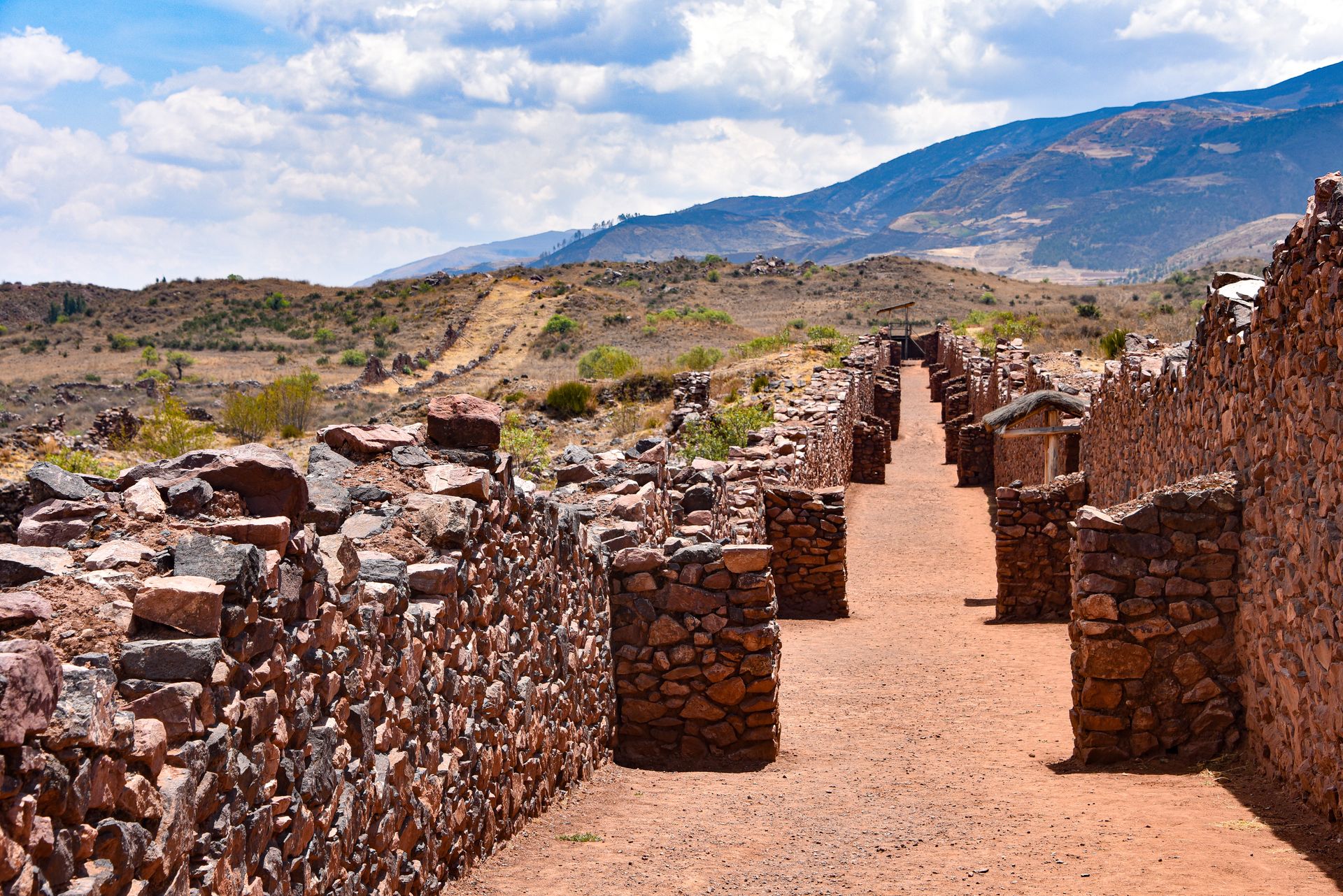
The Wari Empire — sometimes spelled Huari — was a Middle Horizon civilization that dominated much of the Peruvian Andes from roughly 600 to 1000 CE, predating the Inca by several centuries. At its height, Wari controlled territory stretching from northern Peru to the south-central highlands, and it left behind administrative and infrastructural systems that the Inca would later adapt and expand.
The Wari capital, also called Wari, sits near the modern city of Ayacucho in the central Peruvian highlands. At its peak, the city covered roughly 15 square kilometers and may have housed between 10,000 and 20,000 people, making it one of the largest cities in the pre-Columbian Americas. The urban layout includes massive stone enclosures, administrative buildings, temples, and residential compounds arranged in a planned configuration quite different from the organic growth visible at many ancient cities.
The Wari were skilled weavers, and their textiles are among the most technically complex produced anywhere in the ancient world. Using tapestry weave techniques, artisans created geometric designs of considerable precision in vivid dyed colors. These designs — built from interlocking stepped and diagonal forms — were not purely decorative. Many researchers interpret Wari textiles as carrying administrative or symbolic content, functioning as a kind of visual recording system alongside or in place of written records.
The Wari administered their empire through a network of provincial centers — planned cities built at key points along road corridors that anticipated the better-known Inca highway system. These centers stored and distributed food, goods, and labor across the state through a system that resembled the mit'a labor tribute the Inca would later formalize and expand.
D-shaped ceremonial structures, found at Wari sites across a wide geographic area, point to a standardized religious practice promoted or enforced from the capital. The central deity in Wari iconography — a frontal figure with radiating attributes holding two staffs — is closely related to the figure carved on the Tiwanaku Gateway of the Sun, suggesting deep cultural connections between the two highland civilizations that co-existed and may have competed during the same period.
The Wari state fragmented around 1000 CE. Drought and political instability are the most commonly cited factors, though the relative weight of each remains a subject of ongoing research.
Credit: metmuseum.org
The Liangzhu culture flourished in the Yangtze River Delta region of what is now Zhejiang and Jiangsu provinces in eastern China, between roughly 3300 and 2300 BCE. It was among the most developed Neolithic cultures in East Asia and produced a jade-working tradition that would influence Chinese art and ritual for thousands of years after the culture itself disappeared. Its main city, excavated systematically beginning in the late 20th century, was a walled urban center larger than many contemporary cities elsewhere in the world.
The city at Liangzhu covered an area of about three square kilometers within its inner walls, and the broader urban complex extended considerably further. A sophisticated hydraulic system — including dams, canals, and reservoirs — managed water flow around the site. The dam complex, dated to around 3000 BCE, is among the oldest large-scale hydraulic engineering works identified anywhere. A 2019 study in the journal Nature Plants confirmed that the dams date to the Liangzhu period and represent a level of hydrological planning not previously documented for this era in East Asia.
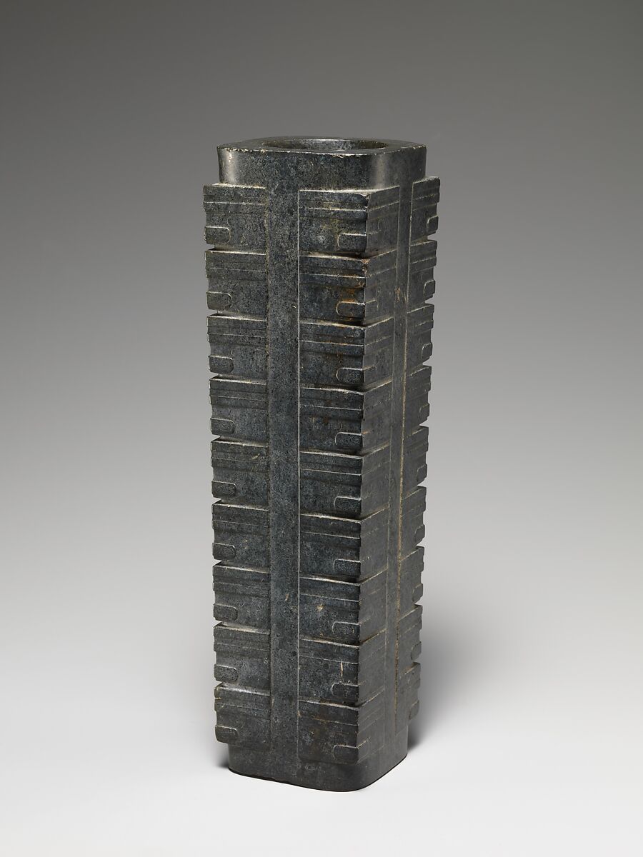
Liangzhu jade defines the culture's artistic legacy. The most iconic forms are the cong — a cylinder with a square outer cross-section — and the bi — a flat circular disc with a central hole. These objects appear in elite burials in large quantities. Their exact function is debated, but their consistent association with high-status interments across a wide geographic area indicates a shared symbolic vocabulary maintained over centuries.
The precision of Liangzhu jade carving is exceptional even by later standards. Working nephrite — one of the hardest stones encountered by ancient craftspeople — artisans cut and polished pieces using abrasives and string-cutting techniques, producing intricate masks and geometric patterns at millimeter scale without metal tools.
Social stratification is starkly visible in the burial record. Elite graves contain hundreds of jade objects alongside lacquerware, ivory, and ceramics. Ordinary graves contain almost nothing comparable. The gap between the wealthiest and poorest burials at Liangzhu is among the most pronounced documented in Neolithic archaeology, implying a degree of social inequality that challenges narratives of Neolithic egalitarianism.
The culture ended abruptly around 2300 BCE. Geological evidence from sediment cores in the region suggests a catastrophic flood event may have been a contributing factor. The Yangtze Delta, with its low elevation and dense hydraulic infrastructure, would have been acutely vulnerable to large-scale flooding driven by prolonged heavy rainfall.
Anadolu / Getty Images
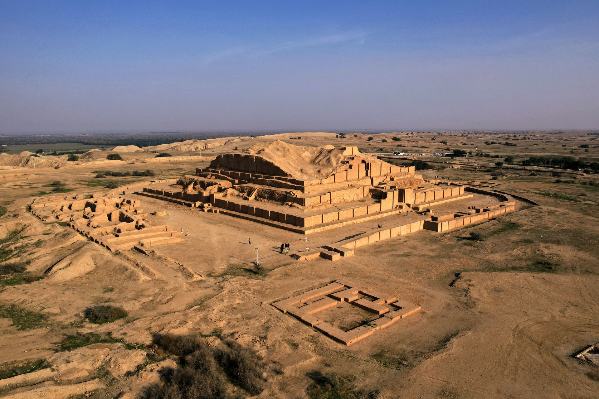
The Elamites were one of the oldest and most durable civilizations in the ancient Middle East, occupying the region of southwestern and central Iran — roughly corresponding to modern Khuzestan Province and the adjacent highlands — from at least 3200 BCE to around 640 BCE, when the Assyrian king Ashurbanipal sacked their capital, Susa. That span of roughly 2,500 years makes Elamite civilization one of the longest-running in the ancient world, outlasting the Sumerian city-states, the Old Babylonian kingdom, and the Egyptian Middle Kingdom.
Despite this, the Elamites occupy a marginal position in popular history. They appear in Mesopotamian sources primarily as adversaries — a people who raided, invaded, and periodically disrupted the Sumerian, Akkadian, and Babylonian states to their west. The perspective of hostile sources has shaped how the Elamites have been characterized, a problem that afflicts many ancient civilizations whose own records have not survived in sufficient volume.
Susa — their principal city — was one of the most continuously occupied urban sites in the ancient world. It was already a major center by 4000 BCE and remained important well into the Islamic period. The site has been excavated since the 1880s, primarily by French archaeologists, and has produced a vast body of material. Among the most famous objects found there is the basalt stele bearing the Code of Hammurabi — which ended up at Susa because the Elamites had seized it from Babylon as war spoils, a detail that captures something of their relationship with Mesopotamia.
Elamite religion centered on a pantheon that included Inshushinak, associated with both royal power and the underworld. Their language — Elamite — is a language isolate with no demonstrated relationship to any known language family. Three writing systems were used by the Elamites at different points in their history: proto-Elamite, which remains undeciphered; Linear Elamite, which has been partially deciphered in recent years; and cuneiform borrowed from Mesopotamia.
The Elamites' material culture reflects their geographic position between Mesopotamia, the Iranian Plateau, and Central Asia. Bronze figurines, glazed brick friezes, and large-scale monumental sculpture all show a distinct artistic tradition that absorbed influences from multiple directions while remaining recognizably its own.
