From Petra to Angkor Wat, these 20 sites were built without modern tools, survived centuries of neglect, and still manage to stop people in their tracks
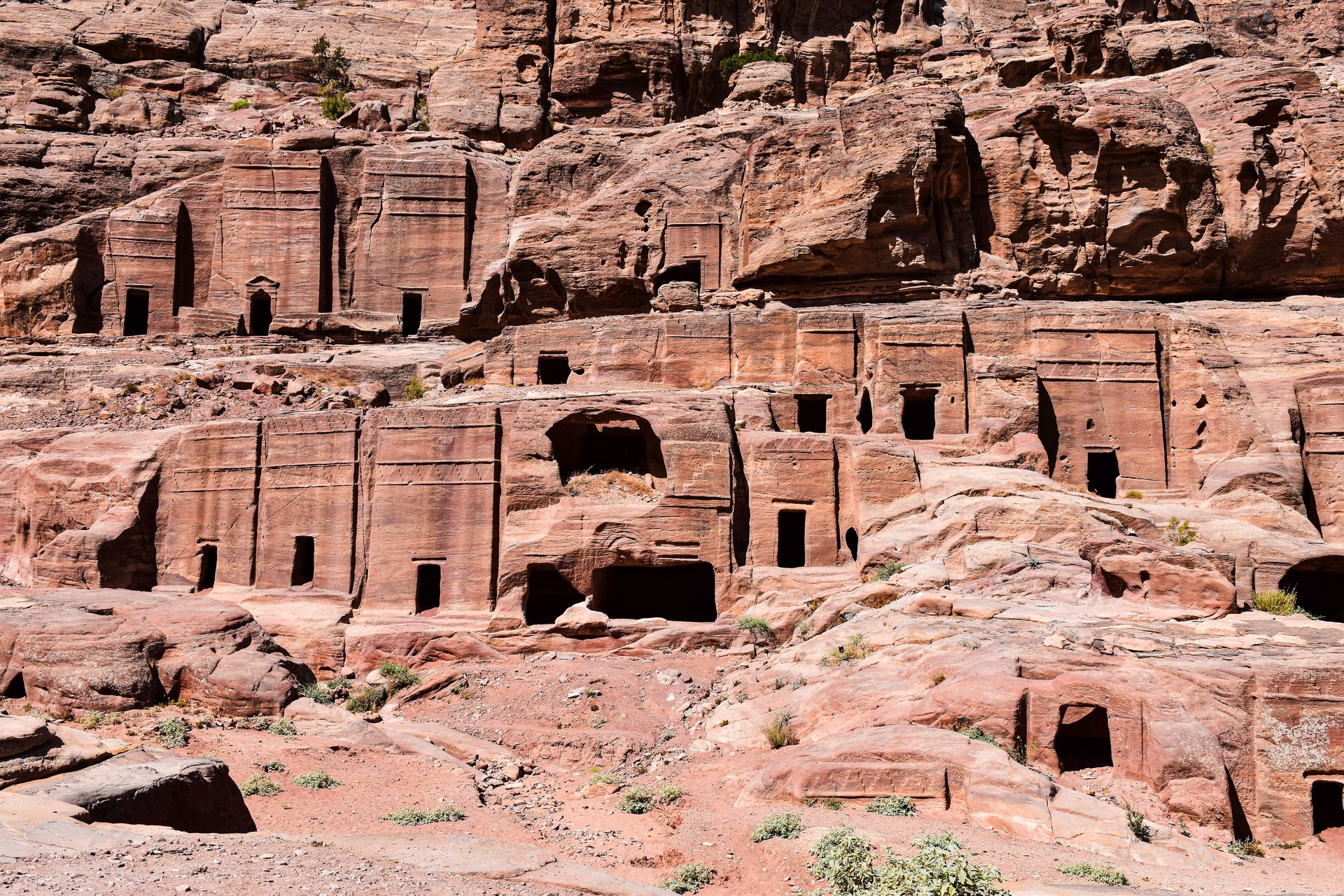
AXP Photography / Pexels
There is a specific feeling that ancient ruins produce in most people who stand in front of them — a feeling that is not quite the same as any other aesthetic or emotional experience and that is difficult to name precisely. It is partly awe at the scale and the craft. It is partly vertigo at the depth of time — the awareness that what you are standing in front of was already old when Rome was young, or that the people who built it left no written language, only the building itself. It is partly a recalibration of assumptions about the past — the correction of the comfortable assumption that ancient people were simpler, less capable, less sophisticated than the people of the present.
The ruins on this list produce that feeling reliably. They were chosen not primarily for their fame — though many are famous — but for the specific quality of the experience they provide to someone standing in front of them. Some are famous and frequently photographed and still manage to exceed their photographs. Some are relatively unknown outside specialist travel and archaeological communities and produce the specific pleasure of discovering something remarkable without the crowd infrastructure of the more celebrated sites. Some are difficult to reach and some are accessible in an afternoon from a major city, and the effort required to see them is noted for each.
The list spans the full range of ancient civilizations — Mesoamerican, Mediterranean, South Asian, Southeast Asian, Andean, North African, Anatolian, Central Asian, and European — and covers a time range from approximately 9600 BCE to the 15th century CE. The oldest sites on the list predate writing by millennia. The most recent predate the European Renaissance by decades. All of them are the products of human ingenuity, human organization, and human ambition operating within constraints of technology that modern observers find difficult to fully appreciate.
A note on visiting: most of the sites on this list are actively managed heritage sites with entrance fees, visitor limits, and conservation requirements. Several are UNESCO World Heritage Sites under pressure from overtourism. The recommendation to visit them comes with the implicit recommendation to do so responsibly — staying on designated paths, following guide instructions, and treating the sites with the respect that their age and their cultural significance deserve.
Jennifer / Pexels
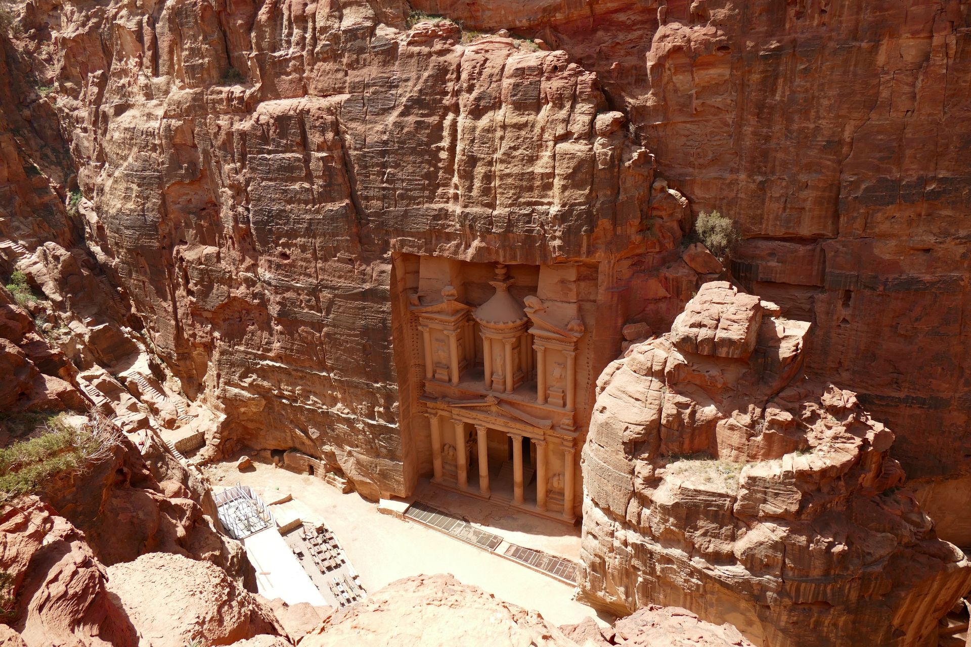
Petra is the ancient Nabataean city carved into the rose-red sandstone cliffs of southern Jordan, and its defining image — the Treasury, Al-Khazneh, seen at the end of the narrow Siq gorge after a kilometer of dark, winding passage — is one of the most powerful first views in travel. The photographs are familiar. The experience of walking the Siq, the canyon narrowing to a few meters wide in places, the sandstone walls rising 80 meters above you, and then the sudden opening of the view to the 40-meter facade carved directly from the cliff face — is not fully conveyed by any photograph.
The Treasury is the entrance to a city that most visitors see only partially. Beyond it, the city extends for 60 square kilometers — a vast complex of tombs, temples, a colonnaded street, a Roman theater, a Byzantine church with intact mosaic floors, and high places of sacrifice accessible by steep mountain trails. The Great Temple and the Monastery, accessible after a 45-minute climb up 800 rock-cut steps, is larger than the Treasury and sees a fraction of the visitors. Petra is not a single sight but a landscape, and a full day gives only a partial experience of it.
The Nabataeans — the Arab trading civilization that built Petra between approximately the 4th century BCE and the 1st century CE — controlled the incense trade routes between Arabia and the Mediterranean with a commercial sophistication that their carved city reflects. The hydraulic engineering of Petra — a system of dams, channels, and cisterns that managed flash flood water in an otherwise arid canyon — is among the most impressive pre-modern water management systems known.
Petra was unknown to the Western world until Swiss explorer Johann Ludwig Burckhardt disguised himself as an Arab and persuaded local Bedouin to guide him into the city in 1812. It appeared as a UNESCO World Heritage Site in 1985 and became globally known through its appearance in Indiana Jones and the Last Crusade in 1989. The Bedouin families who lived within Petra until 1985 were relocated at UNESCO's insistence; some continue to work as guides and horse handlers in the site.
Alberto Capparelli / Pexels
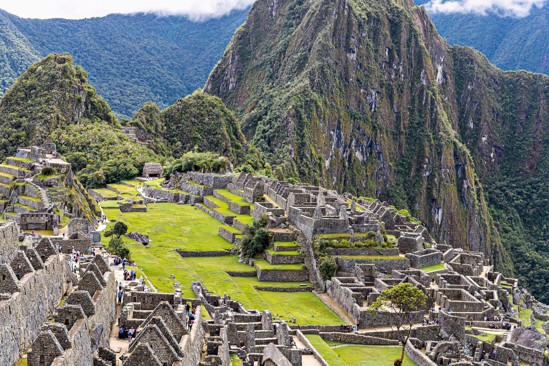
Machu Picchu sits on a ridge above the Urubamba River in the Peruvian Andes at an elevation of approximately 2,430 meters, surrounded by cloud forest on three sides and overlooked by the steep peak of Huayna Picchu, and its setting alone would be extraordinary without the city on it. The city — built in the mid-15th century CE by the Inca emperor Pachacuti and abandoned approximately a century later, possibly due to a smallpox epidemic that preceded the Spanish conquest — covers 13 square kilometers of terraced platforms, agricultural fields, temples, plazas, and residential compounds constructed from precisely fitted dry stone masonry without mortar or metal tools.
The precision of the Inca stonework at Machu Picchu — massive granite blocks shaped to interlock so exactly that a knife blade cannot be inserted between them, achieved with stone tools and an engineering knowledge that archaeologists are still working to understand fully — is the detail that most consistently astonishes visitors who have read about it but have not seen it. The Temple of the Sun, built around a natural boulder whose curvature the Inca incorporated into the building's design, and the Intihuatana stone — a ritual stone pillar whose shadow position tracked the sun's movement — are the most refined examples of the integration of architecture and natural topography that characterizes the best Inca building.
Hiram Bingham III, the Yale historian and explorer who brought Machu Picchu to international attention in 1911, described it as a lost city, though local farmers knew of its existence and a local boy, Pablito Richarte, guided him to the site. The question of whether Machu Picchu was a royal estate, a religious retreat, an administrative center, or some combination is still debated. Bingham's artifacts, removed to Yale, were returned to Peru in 2012 after a protracted negotiation.
The site receives approximately 5,000 visitors per day at its current permitted level, and the Peruvian government has debated lowering the limit to protect the fragile terrace structures from visitor pressure. The Classic Inca Trail walk, which arrives at Machu Picchu through the Sun Gate on the second or third morning, is widely cited as one of the great multi-day hikes in the world.
Serg Alesenko / Pexels
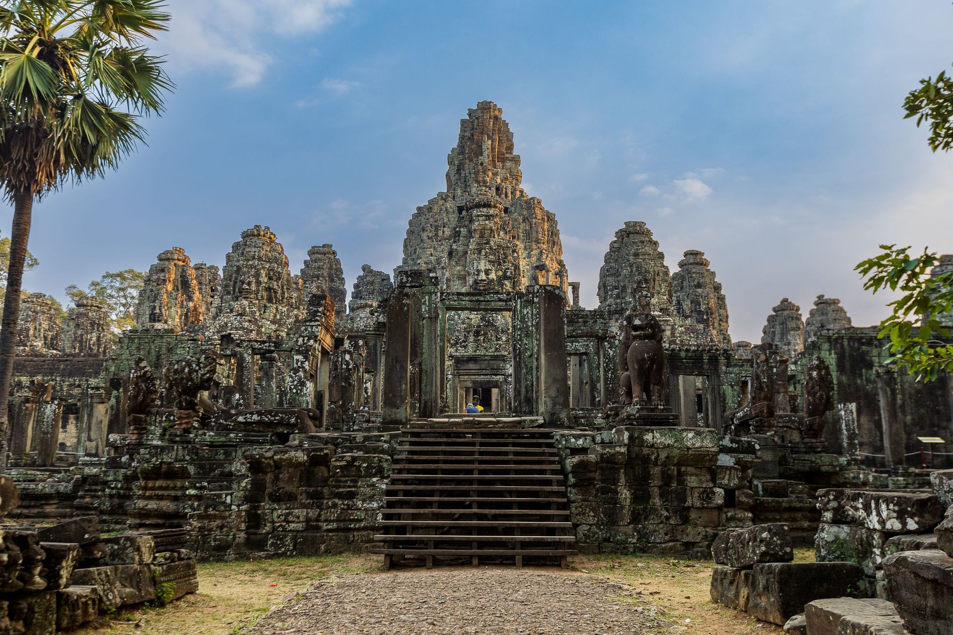
Angkor Wat is the largest religious monument in the world — a 12th-century Hindu temple complex covering 162 hectares, surrounded by a moat 190 meters wide, and built as a representation of Mount Meru, the sacred mountain at the center of Hindu cosmology. It was built by King Suryavarman II between approximately 1113 and 1150 CE as his state temple and mausoleum, dedicated to Vishnu, and its scale and completeness — the temple has been in continuous use, never fully abandoned — make it unique among the major temple complexes of Southeast Asia.
The outer wall of Angkor Wat is 3.6 kilometers in circumference and would require more than an hour to walk. The bas-relief galleries that line its inner corridors run for nearly 800 meters and depict, in extraordinary detail, scenes from Hindu mythology and from the military campaigns of Suryavarman II — the largest known continuous bas-relief in the world. The central tower, 65 meters tall, is visible from kilometers away across the surrounding rice paddies.
The broader Angkor Archaeological Park covers 400 square kilometers and contains over 1,000 temples and other structures built between the 9th and 15th centuries by the Khmer Empire. Ta Prohm — the temple where massive fig and silk-cotton trees have grown through and around the stone structures over the centuries, their roots splitting the walls and their trunks embracing the towers — is the site most visited after Angkor Wat itself, partly because it was left intentionally unrestored when the park was developed and provides an image of how all the temples appeared before excavation.
Angkor Wat's lotus-bud towers at sunrise — reflected in the moat, with morning mist over the surrounding landscape — is the image that appears in most photographs and on the Cambodian national flag. The experience requires arriving at 5am and is worth every minute of the early start.
Cristian Aragón / Pexels
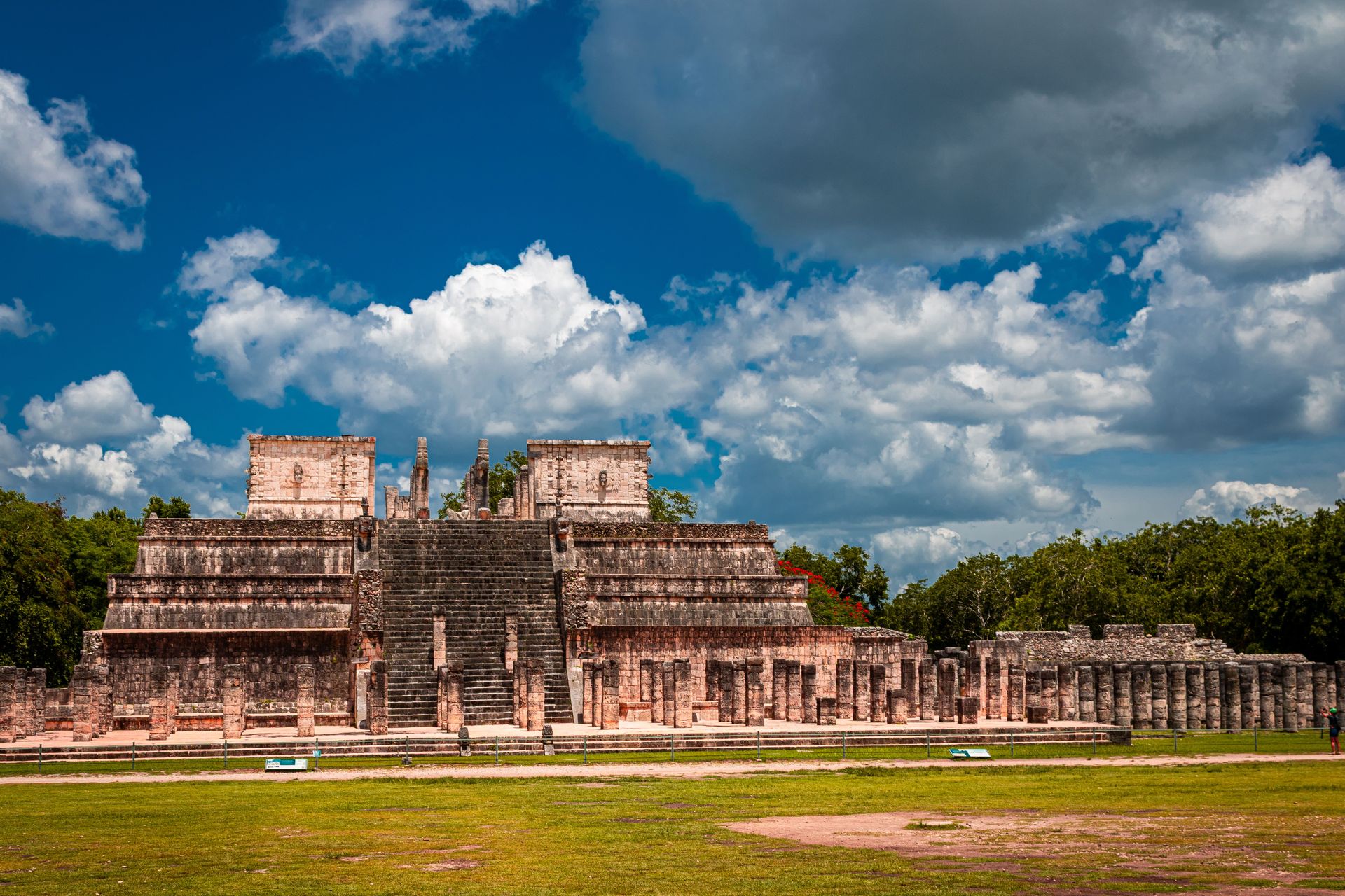
Chichen Itza is the most visited archaeological site in Mexico and one of the New Seven Wonders of the World, and its central pyramid — El Castillo, or the Temple of Kukulcan — is the most recognizable structure in Mesoamerican archaeology. The pyramid is 30 meters tall, constructed with a precision that produces a specific astronomical effect on the spring and autumn equinoxes: the angle of the afternoon sun creates a shadow pattern on the northern staircase that produces the appearance of a serpent descending the pyramid, its body formed by triangular shadows and its head defined by the stone serpent heads at the base.
The site was one of the most powerful cities of the Maya world from approximately the 9th to the 13th centuries CE and shows strong Toltec influence that suggests significant contact or conquest by the central Mexican culture during that period. The Great Ball Court — the largest known ball court in Mesoamerica, 168 meters long and 70 meters wide — is acoustically extraordinary: whispers at one end are audible at the other, 168 meters away, a property that researchers believe was engineered deliberately. The Temple of the Warriors, flanked by a forest of carved columns, and the Sacred Cenote — a natural sinkhole 60 meters in diameter into which offerings and sacrificial victims were thrown — are the other primary structures.
The site's famous astronomical alignment to the equinox attracted 80,000 visitors on the most recent spring equinox celebration, producing a crowd density incompatible with the quiet contemplation the site deserves on ordinary days. The Mexican government has restricted the ability to climb the pyramid since 2006, following a series of accidents and in response to conservation concerns about the impact of millions of visitors' feet on the limestone steps.
Eren Cebeci / Pexels
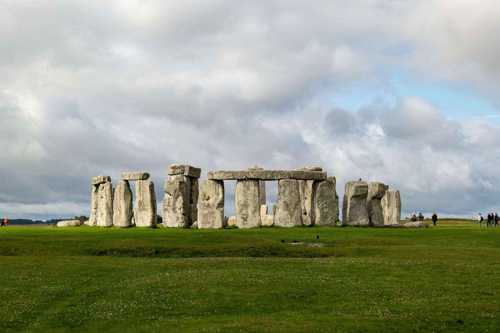
Stonehenge is among the most studied and most debated ancient structures in the world, partly because it is so early — the monument's construction began approximately 5,000 years ago, in Neolithic Britain — and partly because its builders left no written record, making the purpose and the process of construction subjects of continuous archaeological inquiry. The standing sarsen stones, each weighing approximately 25 tonnes, were transported from Marlborough Downs approximately 25 kilometers away. The bluestones of the inner circle, each weighing two to five tonnes, were transported from the Preseli Hills in Wales — approximately 250 kilometers away — by a process that archaeologists still debate.
The site as it appears today is a partial ruin of a more complete structure. At its peak, approximately 3,500 years ago, the monument consisted of an outer ring of 30 sarsen stones capped by lintels, an inner horseshoe of trilithons (pairs of uprights with a capping lintel), and concentric rings of bluestones, surrounded by a circular bank and ditch and aligned to the midsummer sunrise and midwinter sunset. The midwinter sunset alignment — which fills the central axis of the monument with direct sunlight through the trilithon horseshoe on the solstice — is now considered by many archaeologists to be the primary orientation.
Stonehenge is set in a landscape of other monuments — the Avebury stone circle, the West Kennet long barrow, Silbury Hill — that together constitute one of the most significant prehistoric ceremonial landscapes in Europe. The current visitor center, opened in 2013, significantly improved the experience by removing the road that had run adjacent to the stones and restoring a more natural landscape setting. The stones are accessible at close range only on specially arranged dawn access visits during the solstices and equinoxes.
John Tekeridis / Pexels
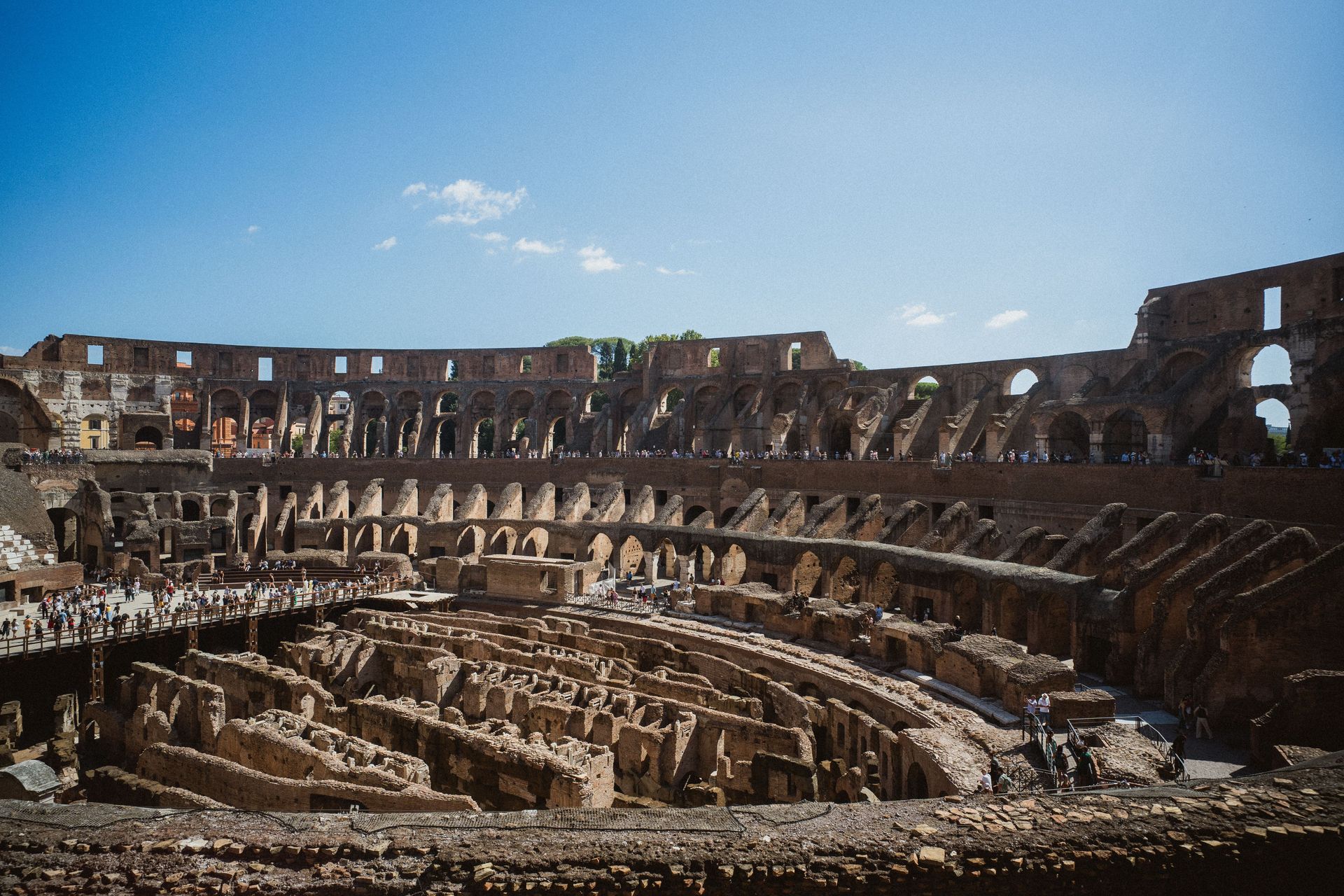
The Colosseum — the Flavian Amphitheatre, constructed between 70 and 80 CE under emperors Vespasian and Titus — is the largest amphitheatre ever built, capable of seating between 50,000 and 80,000 spectators, and its construction represents a feat of Roman engineering and logistics that remains impressive by any standard. The concrete and stone structure, 48 meters tall at its highest surviving point, was built in approximately ten years using an estimated 100,000 tonnes of travertine limestone, 300 tonnes of iron clamps, and volcanic tuff — materials organized and assembled by a workforce that included enslaved people brought to Rome after the Jewish-Roman War.
The internal organization of the Colosseum was sophisticated by modern event management standards. The 80 entrances allowed 50,000 spectators to fill the seating within minutes and disperse equally quickly after events — a crowd management design that the venue's modern equivalents do not consistently match. The underground hypogeum — a network of corridors, holding cells, and mechanical lift systems beneath the arena floor — is partially accessible to visitors and gives the most direct physical sense of the mechanics of the spectacle that took place above.
The structure's survival to the present is partly a result of its long post-Roman use: it served as a quarry for building materials through the medieval period, a fortress, a Christian shrine, and an apartment complex before its archaeological value was recognized. The missing outer sections — approximately two-thirds of the original outer ring are gone — were removed for use in the construction of St. Peter's Basilica, the Palazzo Venezia, and other Renaissance buildings. What remains is approximately one-third of the original structure.
The Colosseum is the most visited paid monument in Italy, with approximately 7.6 million visitors per year. The arena floor — removed in medieval times, exposing the hypogeum — has been reconstructed over approximately one-third of the arena since 2023, allowing visitors to stand on a surface approximately equivalent to the gladiatorial arena.
Balázs Gábor / Pexels
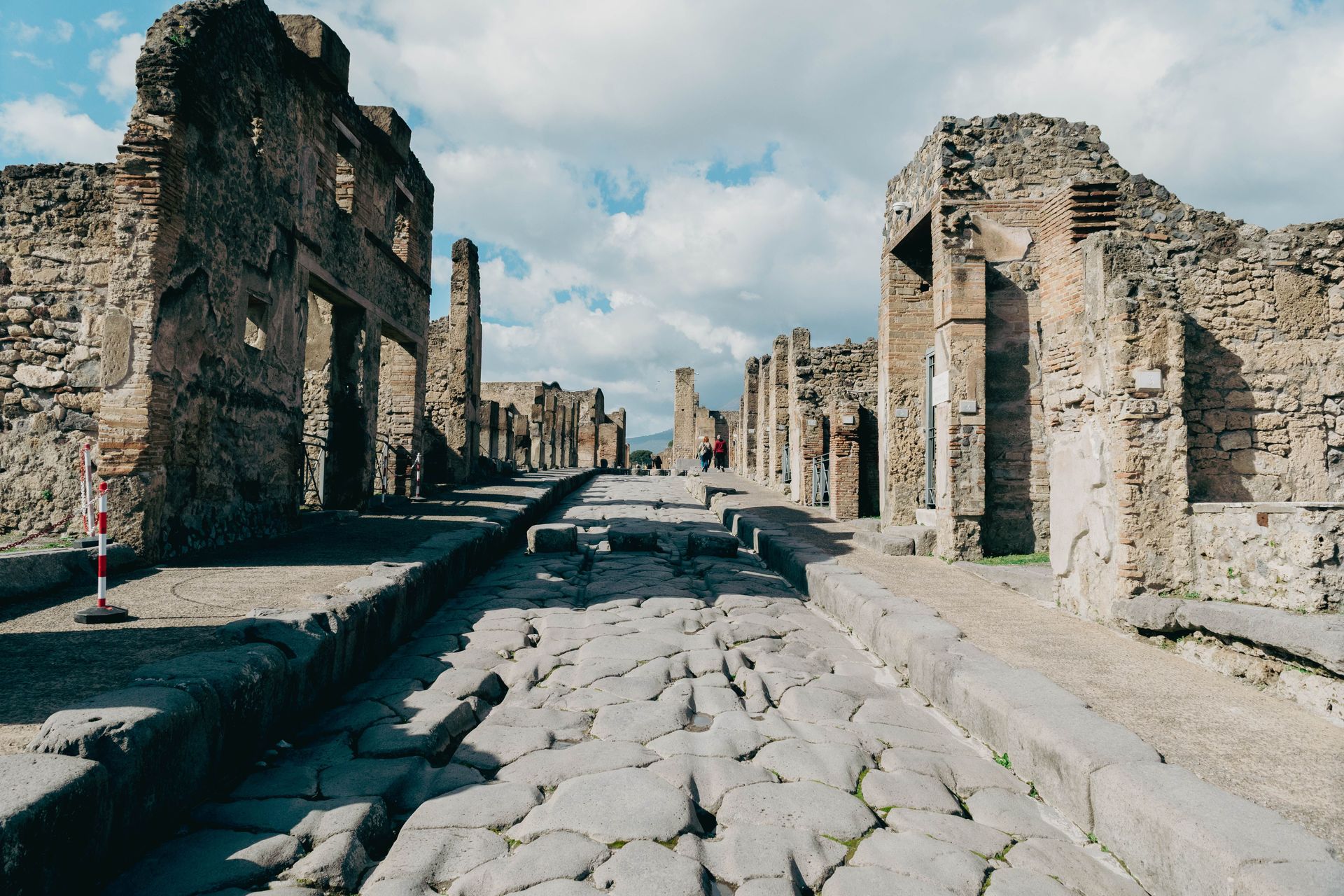
Pompeii is unlike any other ancient ruin because it is not a ruin in the conventional sense — it is a city frozen at a specific moment, August 24, 79 CE, preserved under meters of volcanic ash from Vesuvius in a state of completeness that provides a more detailed picture of Roman provincial daily life than any other site. The streets have their original paving and the ruts worn by cart wheels. The thermopolia — fast food counters — still have traces of the food they were serving when the eruption began. The election slogans painted on exterior walls are still legible. The plaster casts of the people who died in the ash are still in the positions in which they were found.
Walking Pompeii is different from walking other ancient sites because the domestic scale is preserved — the house rather than the temple, the bakery rather than the palace — in a way that makes the daily life of first-century Romans physically accessible rather than abstract. The House of the Faun, with its Alexander Mosaic floor — a copy; the original is in the Naples Archaeological Museum — and its atrium of approximately 3,000 square meters, demonstrates the wealth of Pompeii's upper class. The Via dell'Abbondanza, the main commercial street, demonstrates what a Roman urban center looked like in operation.
Pompeii covers approximately 66 hectares, of which approximately one-third remains unexcavated. The excavated portions receive approximately 3.5 million visitors per year, creating conservation challenges that the site authorities have addressed through visitor routing, restored structures, and the Great Pompeii Project, which has produced significant new discoveries since 2012 including a thermopolium with intact food residue, a ceremonial chariot, and elite frescoes in an unexcavated district.
The companion site of Herculaneum, a smaller and wealthier town buried by the same eruption, is frequently overlooked by visitors who come only to Pompeii. It is significantly better preserved, smaller and therefore more navigable in a half day, and contains the only intact Roman library ever discovered — the Villa of the Papyri, whose carbonized scrolls are still being read using X $TWTR-ray tomography.
Diego F. Parra / Pexels
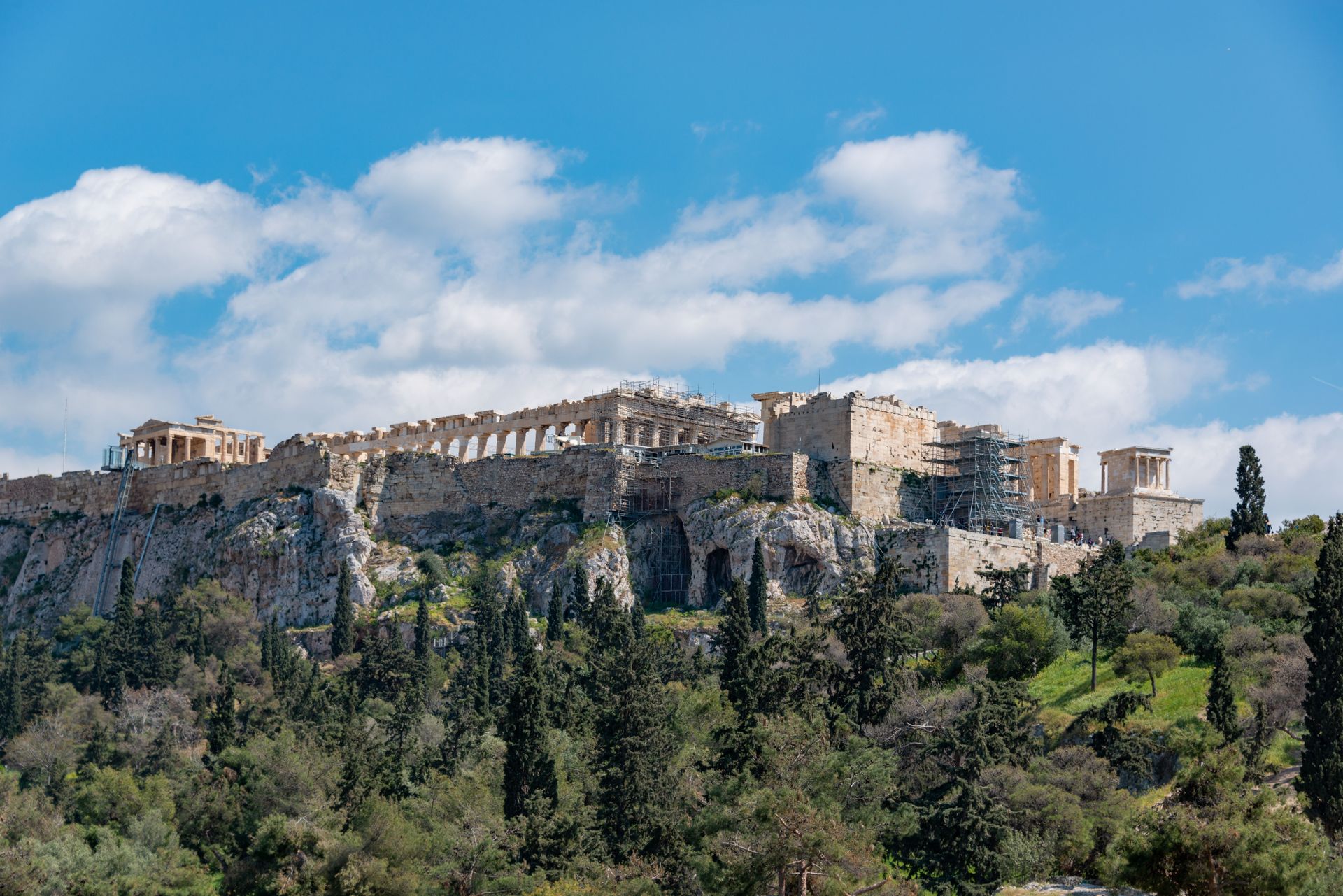
The Acropolis of Athens — the rocky outcrop above the city on which the Athenians built their most important religious monuments in the 5th century BCE — is the site that most directly connects the physical remains of antiquity to the intellectual and cultural traditions that Western civilization identifies as foundational. The Parthenon, built between 447 and 432 BCE under the direction of the sculptor Phidias during the political leadership of Pericles, was not merely a temple but a statement of Athenian power, wealth, and cultural ambition at the peak of the city's golden age.
The Parthenon's proportions — the deliberate subtle corrections for optical illusion, including the slight upward curve of the stylobate that prevents the horizontal lines from appearing to sag under their own weight, and the slight inward lean of the columns that prevents them from appearing to diverge at the top — are evidence of an architectural sophistication that is not apparent from descriptions but becomes unmistakable when you begin to look for it. The building was designed to be seen, and every aspect of its design was calculated to optimize what the viewer would see from the approach.
The Elgin Marbles — approximately half of the Parthenon's surviving sculptural decoration, removed by Thomas Bruce, 7th Earl of Elgin, between 1801 and 1812 and now in the British Museum — are the most prominent international heritage dispute in archaeology. The Acropolis Museum, opened in 2009 at the foot of the hill, was designed specifically to house the Greek-held sculptures alongside the spaces where the British-held pieces should be, making the case for reunification in the most direct possible architectural terms.
The Erechtheion, the Propylaea gateway, and the Temple of Athena Nike $NKE complete the Acropolis complex and are frequently passed quickly by visitors focused on the Parthenon. Each is remarkable in its own right. The Erechtheion's Porch of the Caryatids — six female figures serving as columns, the originals now in the Acropolis Museum — is one of the most original architectural ideas in the ancient world.
Shuping Zhao / Pexels
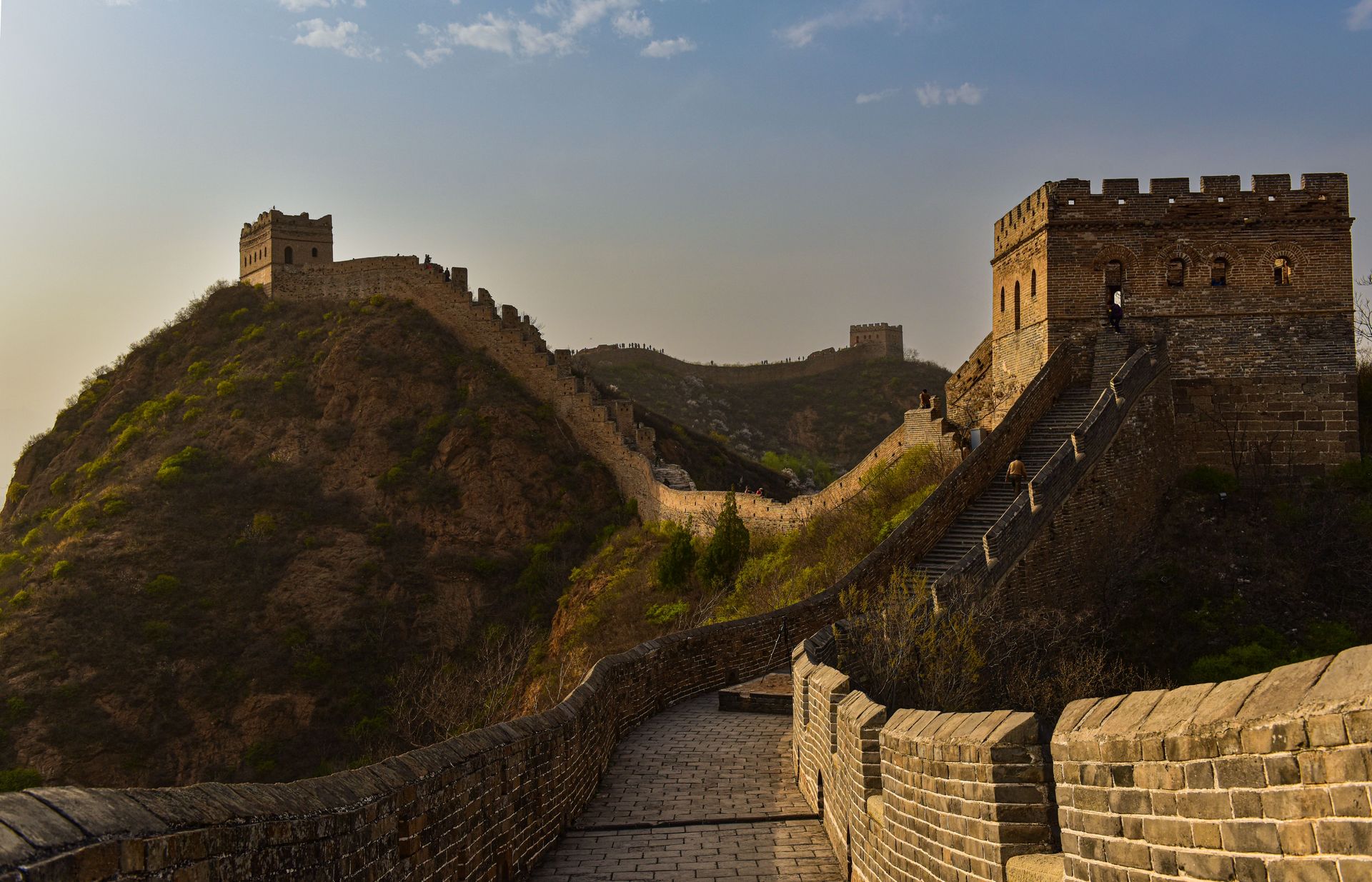
The Great Wall of China is not a single wall but a series of walls, barriers, and fortifications built and rebuilt over approximately 2,000 years by successive Chinese dynasties, stretching in total — including all branches and parallel sections — approximately 21,196 kilometers across northern China. The sections that most visitors see are primarily the Ming Dynasty walls, built between the 14th and 17th centuries CE, which are the most intact, the most dramatically situated, and the most photographically familiar.
The wall's purpose evolved over the centuries. The earliest walls, built in the 7th century BCE by individual states during the Warring States period, were defensive barriers between rivals. Qin Shi Huang, who unified China in 221 BCE, connected and extended those walls to create a northern frontier defense, using a labor force that included soldiers, peasants, and prisoners in numbers that some historians estimate at hundreds of thousands. The deaths from overwork, exposure, and disease during construction were enormous, and Chinese legend holds that the bones of workers who died were incorporated into the wall itself.
The most visited sections near Beijing — Badaling and Mutianyu — are heavily restored and accessible by cable car. The sections further from Beijing — Jinshanling, Simatai, Jiankou — are less restored and more dramatic, with watchtowers perched on precipitous ridges and sections where the wall narrows to a meter wide above a drop of hundreds of feet. The experience of walking the unreconstructed sections — crumbling crenellations, collapsed towers, views across the mountain ranges that the wall follows for its entire length — is qualitatively different from the tourist infrastructure sections and is worth the additional effort of reaching them.
Han Sen / Pexels
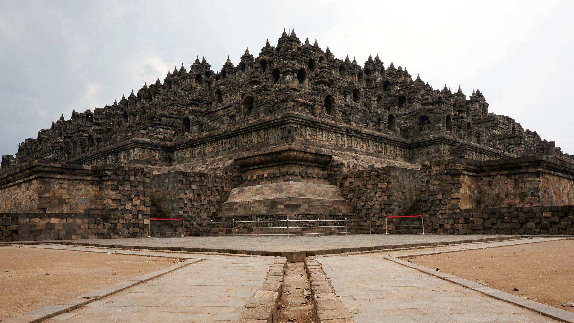
Borobudur is the largest Buddhist monument in the world and one of the greatest monuments of any kind in Southeast Asia — a 9th-century Mahayana Buddhist temple on the island of Java built in the form of a mandala, with nine stacked platforms representing the Buddhist cosmological model of the universe, rising to a central stupa 35 meters above the base. It was built during the Sailendra dynasty between approximately 750 and 842 CE, using approximately 55,000 cubic meters of stone blocks arranged without mortar, and decorated with 2,672 relief panels and 504 Buddha statues.
The relief panels, running in continuous narrative bands around the walls of each terrace, depict the Buddhist path from desire through enlightenment in an encyclopedic visual program that takes hours to walk in its entirety. The panels are among the most extensive and most accomplished Buddhist narrative sculpture in the world, representing scenes from the Jataka tales of the Buddha's previous lives and the Gandavyuha sutra's account of the pilgrim Sudhana's path to enlightenment. Walking the monument in the correct ritual circumambulation — clockwise, ascending through the terraces — is a physical meditation on the Buddhist path that no amount of reading produces.
Borobudur was abandoned approximately a century after its construction, possibly due to a volcanic eruption, and was buried under volcanic ash and jungle growth for centuries. It was rediscovered by a survey team under Sir Thomas Stamford Raffles, the British administrator of Java, in 1814. A major restoration project, completed in 1983 with UNESCO support, stabilized the structure, which had been sinking unevenly into the underlying ground.
The monument is most commonly visited at sunrise, when the morning mist fills the valleys below the terraces and the stupas emerge through the clearing fog in conditions that no photograph fully captures. Prambanan, the great Hindu temple complex built at approximately the same period by the rival Sanjaya dynasty, is 40 kilometers away and makes a natural complement to a visit.
Masih Shahbazi / Pexels
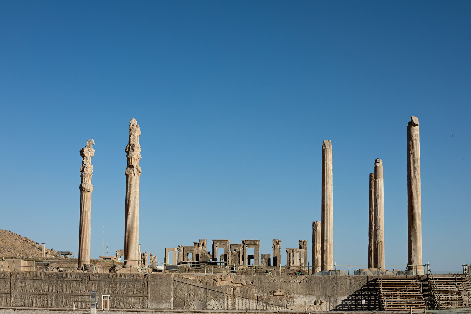
Persepolis — Takht-e Jamshid in Persian, meaning "throne of Jamshid" — was the ceremonial capital of the Achaemenid Persian Empire, built by Darius the Great from approximately 518 BCE and expanded under Xerxes and subsequent rulers until its destruction by Alexander the Great in 330 BCE, an act that Alexander later reportedly regretted. The site covers 135,000 square meters on an artificial terrace cut from the base of a mountain in the Marvdasht plain of southern Iran, and what remains after more than 2,300 years of exposure, plunder, and neglect is still sufficient to communicate the ambition of an empire that at its peak ruled approximately 44% of the world's population.
The Apadana — the great audience hall of Darius, capable of accommodating 10,000 people — is represented by 13 of its original 72 columns, standing to their full height of 24 meters and supporting the remains of the elaborate stone capitals that topped them. The staircase bas-reliefs of the Apadana, which depict delegations from the 23 nations of the empire bringing tribute — Lydians with gold cups, Armenians with a horse, Ethiopians with an okapi — are among the most remarkable historical documents in stone, recording the ethnic diversity of the Achaemenid world in extraordinary detail and still largely intact.
The Gate of All Nations — the ceremonial entrance to the terrace, flanked by massive bull-headed guardian figures — is the site most completely preserved, and its inscription in the name of Xerxes ("I am Xerxes, great king, king of kings, king of lands of many peoples, king of this great broad earth far and wide") is readable in three languages: Old Persian, Elamite, and Babylonian.
Iran's designation as a travel destination is complicated for citizens of many Western countries due to visa restrictions, and visitors from some nationalities require a guide. Those who navigate the logistics describe Persepolis and the surrounding sites — the tombs of Darius and Xerxes at Naqsh-e Rostam, carved directly into a cliff face five kilometers from the terrace — as among the most moving archaeological experiences in the world.
Matthias Stutzman / Pexels
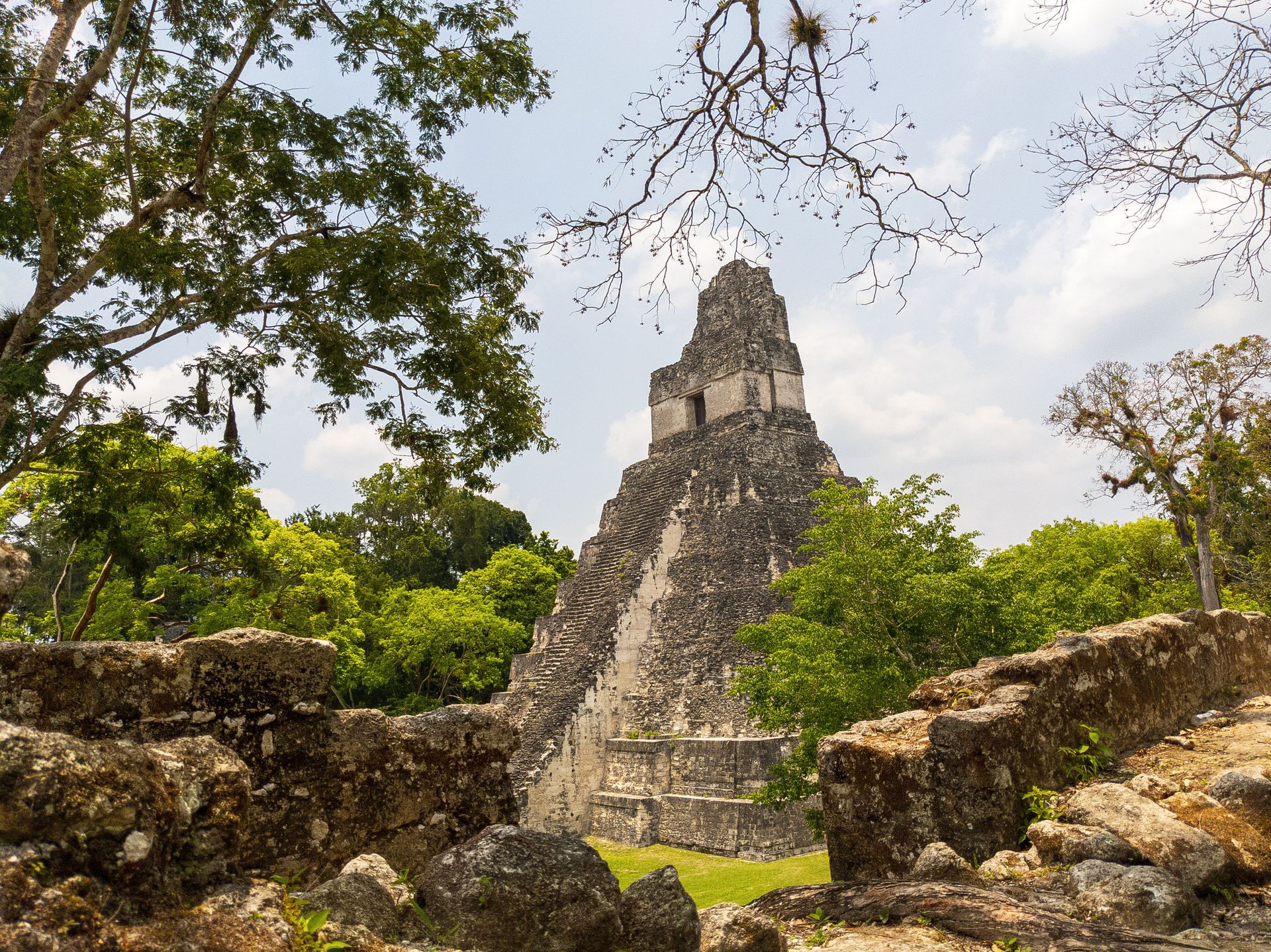
Tikal is the largest excavated Maya site in the world and one of the most dramatic, set within the lowland tropical rainforest of the Petén region of northern Guatemala in a national park that protects both the archaeological site and one of the largest continuous tropical forests in Central America. The site was one of the dominant cities of the Classic Maya period, with a population estimated at between 60,000 and 120,000 people at its peak between approximately 200 and 900 CE, and its temples — rising above the forest canopy on limestone platforms — are visible from kilometers away.
Temple IV, the tallest pre-Columbian structure in the Western Hemisphere at 70 meters above the forest floor, can be climbed via wooden staircases constructed along its side, and the view from the top is one of the great views in Mesoamerican archaeology: the jungle canopy extending to the horizon in every direction, broken by the peaks of three other major temples rising above the trees, their stone silhouettes catching the early morning or late afternoon light. The experience appeared in the original Star Wars film, where Tikal's temples served as the rebel base on Yavin 4 — a detail visible to anyone who recognizes the skyline.
The wildlife density of Tikal — spider monkeys in the ceiba trees above the plazas, toucans on the temple parapets, coatis rooting through the undergrowth, howler monkeys whose dawn calls carry across the site before the visitors arrive — gives it a quality that purely urban ruins do not have. Walking the site at dawn, before the day-trip buses arrive from Flores, in the specific quality of early light in tropical forest, with the sounds of the wildlife and the stone temples emerging from the mist, is an experience that visitors consistently describe as among the most extraordinary of their travels.
Ahmed Almakhzanji / Unsplash
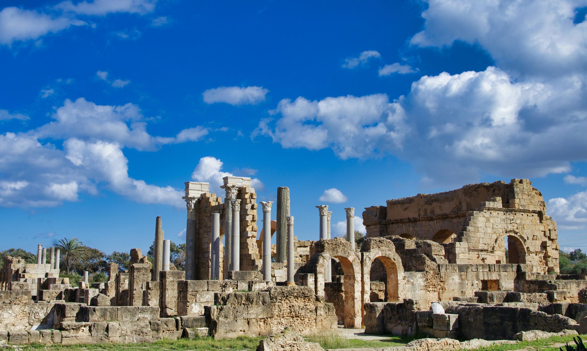
Leptis Magna is the largest and best-preserved Roman city in Africa and one of the finest Roman sites in the world — a port city on the coast of what is now Libya that reached its peak under the emperor Septimius Severus, who was born there, and contains a theater, a forum, baths, a basilica, an arch of triumph, a harbor complex, and residential streets in a state of preservation that rivals Pompeii but receives a fraction of its visitors. The site was UNESCO World Heritage listed in 1982 and is among the most significant and least visited major Roman sites in existence.
The Arch of Septimius Severus, the Severan Forum, and the Severan Basilica — built at the emperor's personal instruction when he visited the city in approximately 203 CE — are the most impressive structures. The basilica's interior, with its pilasters decorated with pilasters of Bacchic processions in a style that mixes Roman and North African aesthetic traditions, is among the most remarkable interiors in Roman architecture. The harbor complex, which included a lighthouse, warehouses, and temple, is partially submerged and partially excavated.
Access to Leptis Magna has been severely restricted since the Libyan civil war that began in 2011, and the site's current condition and accessibility for international visitors varies with the political situation. At the time of writing, organized tours from Malta and Tunisia occasionally visit the site, and the archaeological significance of what is there — largely unlooted due to its remoteness — makes it one of the most compelling destinations for anyone able to reach it safely.
Sami Aksu / Pexels
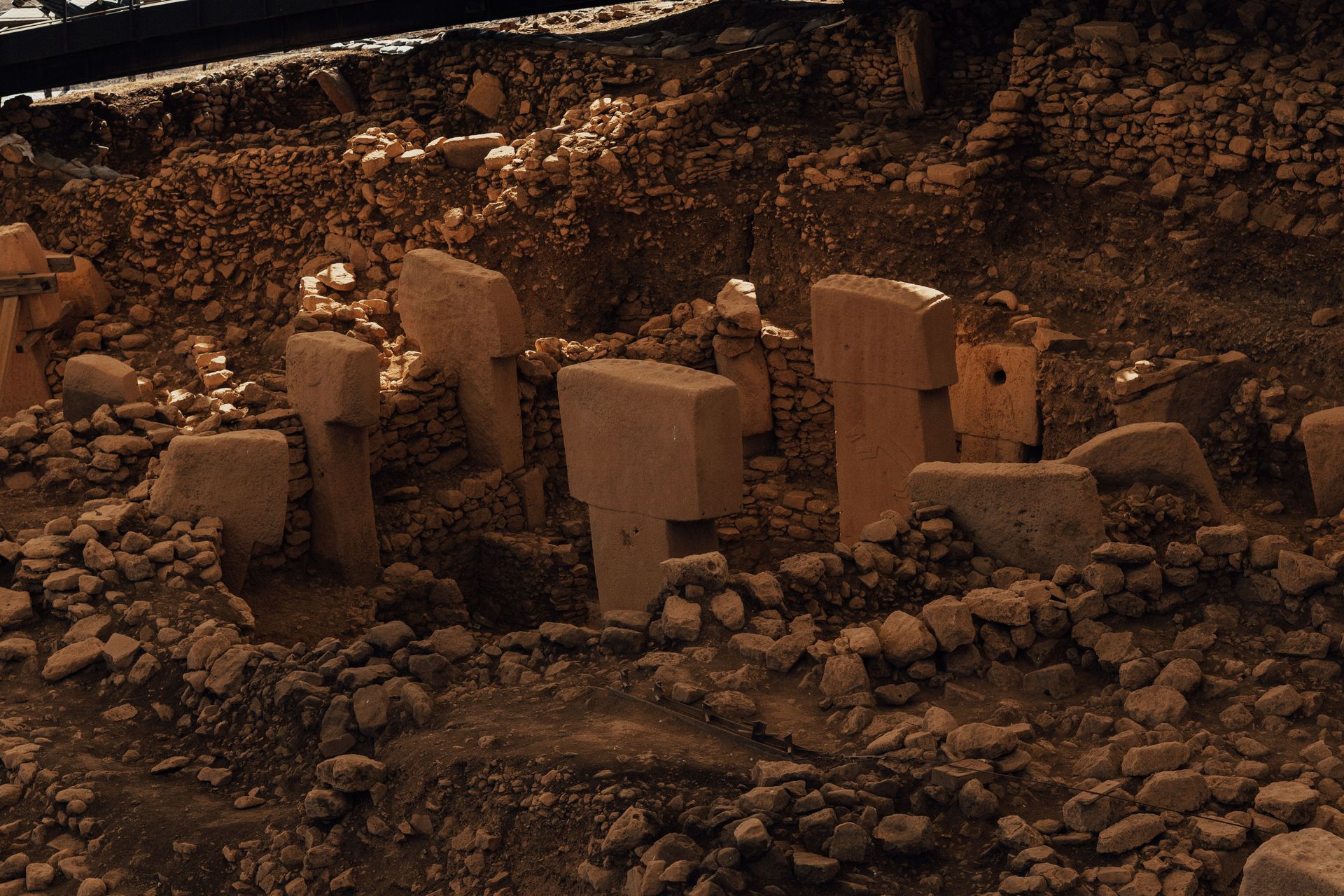
Göbekli Tepe is the oldest known human-built religious structure in the world, a complex of carved stone pillars arranged in circles on a hilltop in southeastern Turkey, built by hunter-gatherers approximately 11,500 years ago — predating Stonehenge by 6,500 years, predating the earliest known writing by 5,000 years, and predating the development of agriculture by approximately 1,000 years. Its existence required a fundamental reconsideration of the relationship between human cognitive complexity, organized religion, and the development of settled civilization.
Before Göbekli Tepe's excavation — begun by German archaeologist Klaus Schmidt in 1994 — the accepted model of early human development held that settled civilization, requiring the food surpluses of agriculture, was the precondition for the social organization and labor coordination required to build monumental structures. Göbekli Tepe demonstrated that the relationship might be inverted: that the construction of the monument was itself the organizing project that drew people together and that agriculture may have been developed to feed the labor force assembled for the building.
The T-shaped pillars — up to 6 meters tall and weighing up to 20 tonnes, carved with reliefs of animals including foxes, snakes, boar, crane, and predatory birds — required quarrying, transport, and erection by people with no metal tools and no domesticated animals, assembled from hunter-gatherer bands that had not yet developed permanent settlements. The social complexity required to coordinate that labor is itself evidence of cognitive and organizational capacities that the pre-agricultural timeline of the site does not permit under older models of human development.
The site was deliberately buried approximately 8,000 years ago — filled with sediment and debris in a process that appears to have been intentional rather than natural — which accounts for its preservation. Only approximately 5% of the site has been excavated; ground-penetrating radar surveys have revealed at least 16 additional stone enclosures beneath the surface.
Setu Chhaya / Pexels
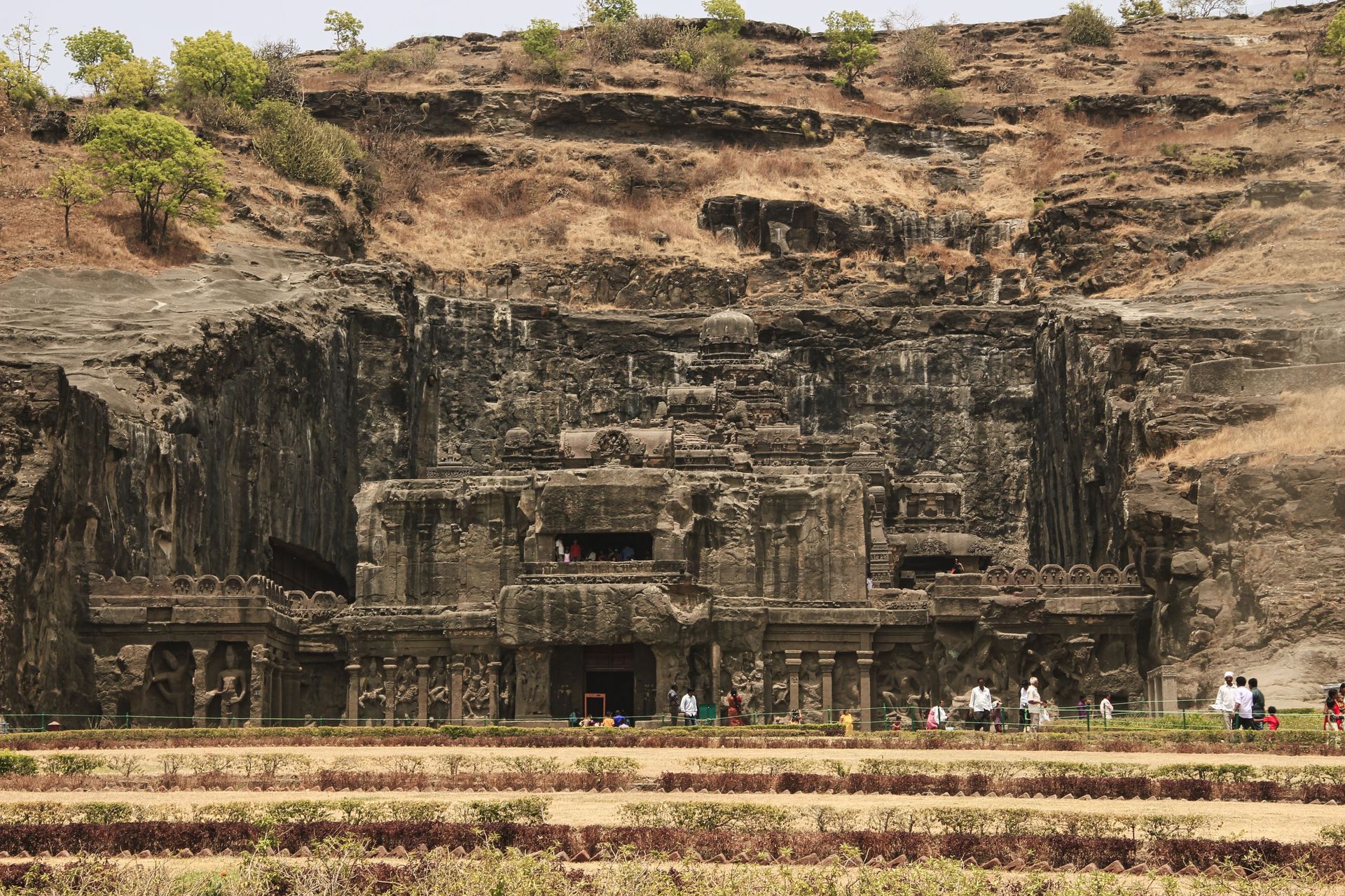
The Ellora Caves are a complex of 34 monasteries and temples cut directly into the face of a basalt cliff in Maharashtra state, western India, representing approximately 600 years of continuous religious monument building — Buddhist, Hindu, and Jain — between approximately the 6th and 11th centuries CE. The caves are not natural formations but entirely human-made — excavated from the living rock, top to bottom, by teams of craftspeople working downward from the cliff face and removing enormous quantities of basalt to create the carved interiors.
Cave 16, the Kailasa Temple, is the most remarkable structure in the complex and one of the most extraordinary feats of monumental architecture in the world. It is a freestanding temple carved from a single block of basalt — the largest monolithic sculpture in the world — occupying a courtyard 58 meters deep, 33 meters wide, and 30 meters tall, created by removing approximately 200,000 tonnes of rock from the surrounding cliff. The temple, dedicated to Shiva and built during the reign of the Rashtrakuta king Krishna I in the 8th century CE, is covered in elaborate sculptural decoration including scenes from the Ramayana, the Mahabharata, and the Puranas, and its overall effect — a temple-mountain emerging from the surrounding rock as if it had always been there and the cliff had simply been removed to reveal it — is unlike any other architectural experience.
The Buddhist caves of Ellora, earlier than the Hindu and Jain ones, include multi-story monasteries with cells, assembly halls, and chaitya (prayer) halls carved with the same downward-excavation technique. The scale and consistency of the work across six centuries and three religious traditions reflects the sustained patronage of successive dynasties and the accumulated technical tradition of the craftspeople who worked the site.
Daniel Erlandson / Pexels
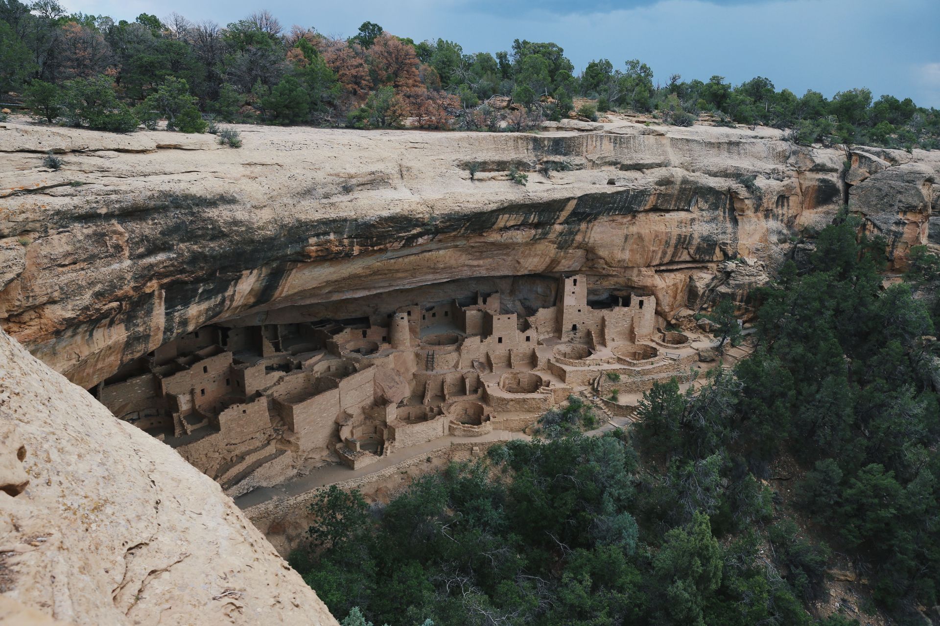
Mesa Verde National Park in southwestern Colorado contains the most extensive and best-preserved collection of Ancestral Puebloan cliff dwellings in North America — villages built into the natural alcoves of the canyon walls between approximately 550 and 1300 CE, with the most elaborate dwellings constructed in the century before the site was abandoned. The abandonment around 1300 CE — following a period of severe drought, resource depletion, and likely social stress — is one of the best-documented cases of societal collapse in pre-contact North American archaeology.
Cliff Palace, the largest cliff dwelling at Mesa Verde and the largest in North America, contains 150 rooms and 23 kivas (circular ceremonial rooms), built into an alcove 26 meters deep, 90 meters wide, and 19 meters tall. The construction used sandstone blocks, mortar made from soil and water, and wooden beams — the wood has been dendrochronologically dated to determine precisely when specific rooms were constructed and renovated. The towers, some rising to four stories, served functions that archaeologists continue to debate: defensive, astronomical, ceremonial, or some combination.
The engineering logic of cliff dwelling construction — building in natural alcoves that provided protection from rain, solar gain in winter and shade in summer, and a degree of natural defense — reflects an intimate understanding of the canyon environment that the Ancestral Puebloans had developed over centuries of occupation. The integration of the architecture with the natural rock is so complete in some dwellings that the buildings appear to have grown from the cliff face rather than been constructed against it.
Mesa Verde requires a guide for entry to Cliff Palace and Balcony House, the two most significant dwellings. The guided tours, which involve climbing ladders and crawling through passageways in the original scale of the buildings, produce an experience of the domestic architecture that purely visual observation cannot.
Son Tung Tran / Pexels
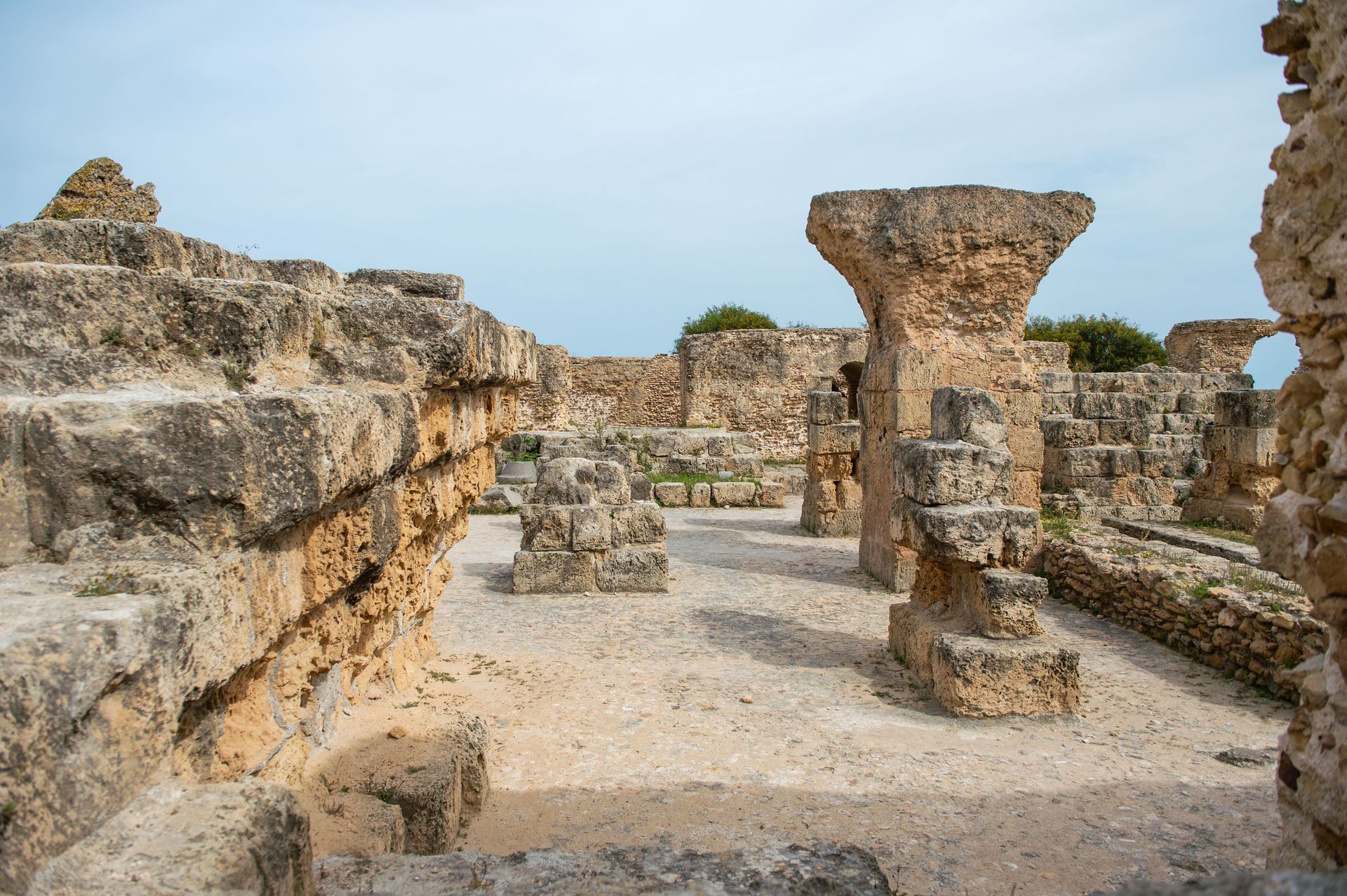
Carthage — the great Phoenician city on the coast of what is now Tunisia, which challenged Rome for dominance of the Mediterranean in three Punic Wars and was finally destroyed by Rome in 146 BCE with a thoroughness that gave the phrase "Carthago delenda est" its historical resonance — is one of the most historically significant ancient sites and one of the most comprehensively destroyed. When Scipio Aemilianus's forces finally breached the city after a three-year siege, they burned it, demolished it, and salted the earth, a process that took 17 days. What remains is largely Roman-era construction built over the Punic ruins and an archaeological landscape that requires some imagination to reconstruct.
The Tophet — the Phoenician sacred precinct where, according to Roman and Biblical sources, children were sacrificed to the god Baal Hammon — is the most controversial of Carthage's excavated sites. The urns found here contain the cremated remains of children and animals, and the debate about whether the site represents child sacrifice or an alternative burial ground for children who died of natural causes has produced significant academic controversy since the 1970s. The site is accessible to visitors and provides direct contact with the religious practices of a civilization that left no surviving literature — Carthage's written culture was destroyed along with the city.
The Baths of Antoninus — the third largest Roman bath complex in the empire, built on the Carthage seafront in the 2nd century CE — are the most visually impressive surviving structures, their massive column bases and underground service corridors giving a sense of the scale of Roman Carthage, which was one of the largest cities in the Roman world. The Carthage National Museum, housed in a 19th-century seminary, holds the most significant Punic and Roman material from the site.
Diana Reyes / Pexels
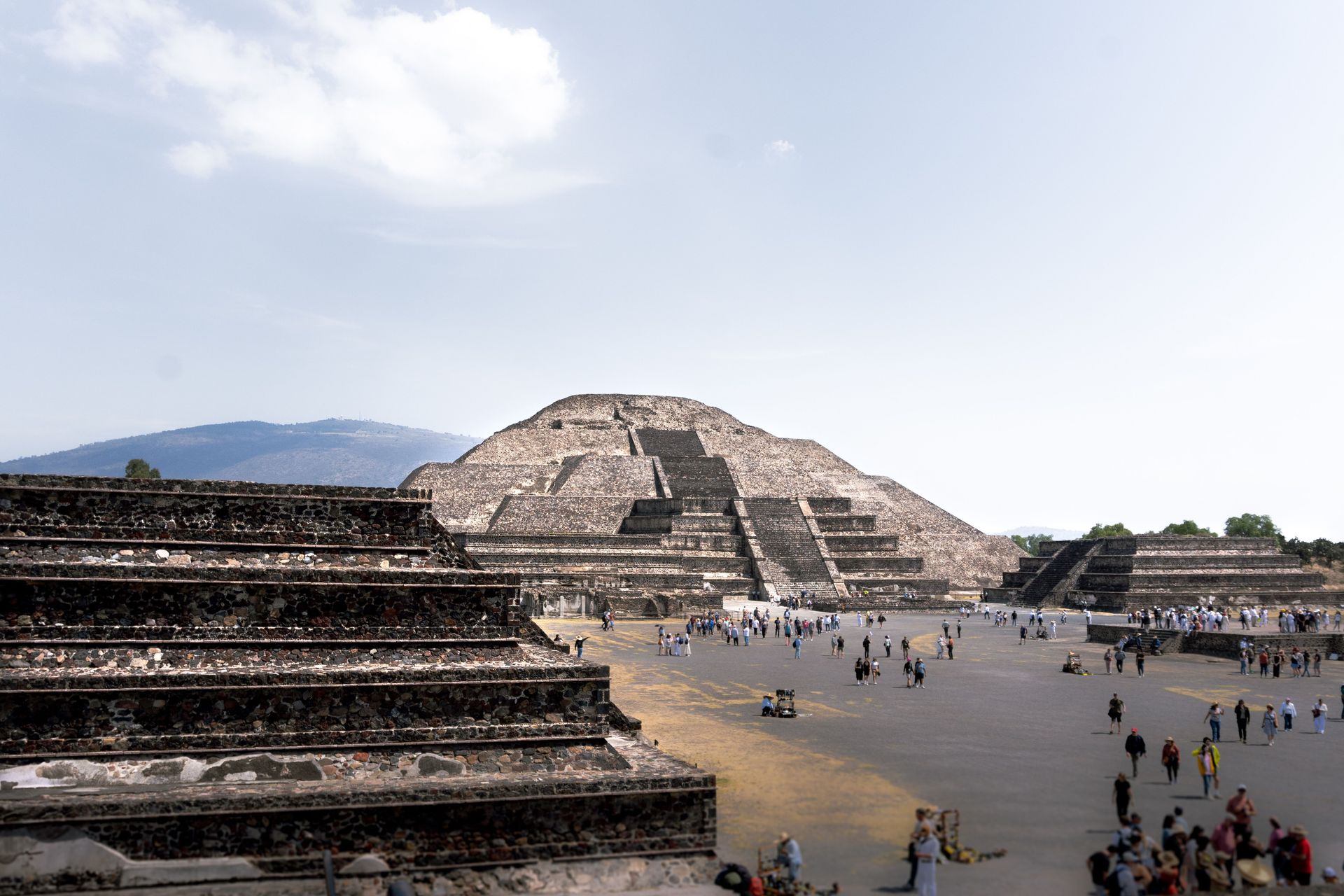
Teotihuacan — the pre-Aztec city in the Valley of Mexico, 50 kilometers northeast of Mexico City — was the largest city in the pre-Columbian Americas at its peak between approximately 100 BCE and 550 CE, with a population estimated at between 125,000 and 200,000 people and an urban plan of extraordinary regularity. The Avenue of the Dead, running 2.4 kilometers from the Pyramid of the Moon to the Ciudadela, is the spine of a grid plan that organizes the entire city — temples, palaces, apartment compounds, workshops, and markets — in a geometrically precise arrangement whose organizing logic archaeologists are still working to understand.
The Pyramid of the Sun — the third largest pyramid in the world by volume, 65 meters tall and 225 meters on each side at its base, built over a natural cave that the builders clearly considered sacred — is still climbable by the 248 steps of its primary staircase, providing a view of the entire city and the surrounding valley that communicates the scale of the urban project more directly than any ground-level perspective. The pyramid was built in a single construction phase around 100 CE, requiring an estimated 29,000 workers over an estimated 30 years.
The identity and language of Teotihuacan's builders is unknown — the city preceded the Aztec civilization by centuries, and the Aztecs named the ruins but did not know who built them. The name Teotihuacan means "birthplace of the gods" in Nahuatl, the Aztec language, reflecting the Aztec belief that the gods had created the universe at this location. The murals in the Palace of Tepantitla, depicting the paradise of the rain god Tlaloc in extraordinary polychrome detail, are among the finest surviving examples of pre-Columbian painting.
Boris Ulzibat / Pexels
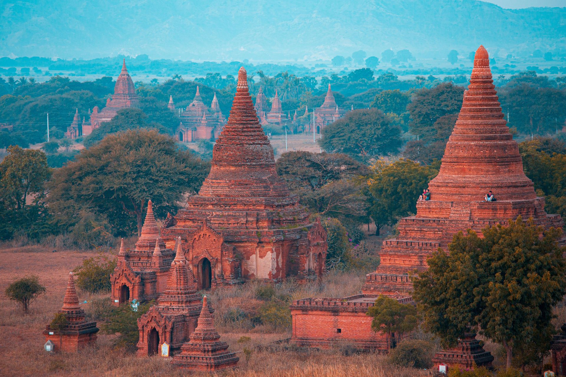
Bagan is one of the most extraordinary archaeological landscapes in Asia — a plain in central Myanmar dotted with more than 3,500 Buddhist temples, pagodas, and monasteries built between the 9th and 13th centuries CE during the Pagan Kingdom, spread across an area of approximately 104 square kilometers along the Irrawaddy River. At the kingdom's peak in the 12th and 13th centuries, an estimated 10,000 religious structures stood on this plain; the 3,500 that survive constitute the largest concentration of Buddhist temples in the world.
The experience of Bagan is defined by its landscape as much as by any individual structure. The temples are not clustered but distributed across the plain — brick towers and spires emerging from scrub forest and farmland as far as the eye can see, in every direction, in a density that makes the horizon itself architectural. Sunrise over Bagan — the plain filling with golden light, the temples emerging from the morning mist, the Irrawaddy visible in the distance — is consistently cited by visitors as one of the most beautiful things they have ever seen, and the scale of the landscape makes it unlike any other ancient site.
The most significant individual temples — the Ananda Temple, with its 9.5-meter standing Buddha figures; the Dhammayangyi, the largest temple on the plain, built by a king reportedly as atonement for patricide and fratricide; the Shwezigon Pagoda, the model for all subsequent Burmese pagoda design — reward individual attention. But the full Bagan experience requires an e-bike or horse cart to move between sites, and the discovery of smaller, unrestored temples in the gaps between the famous ones is its own reward.
A 6.8-magnitude earthquake in 2016 damaged several hundred structures, and the subsequent restoration work has been criticized by UNESCO for using inappropriate materials and techniques. The site's heritage management is an ongoing challenge.
Mori Dad / Pexels
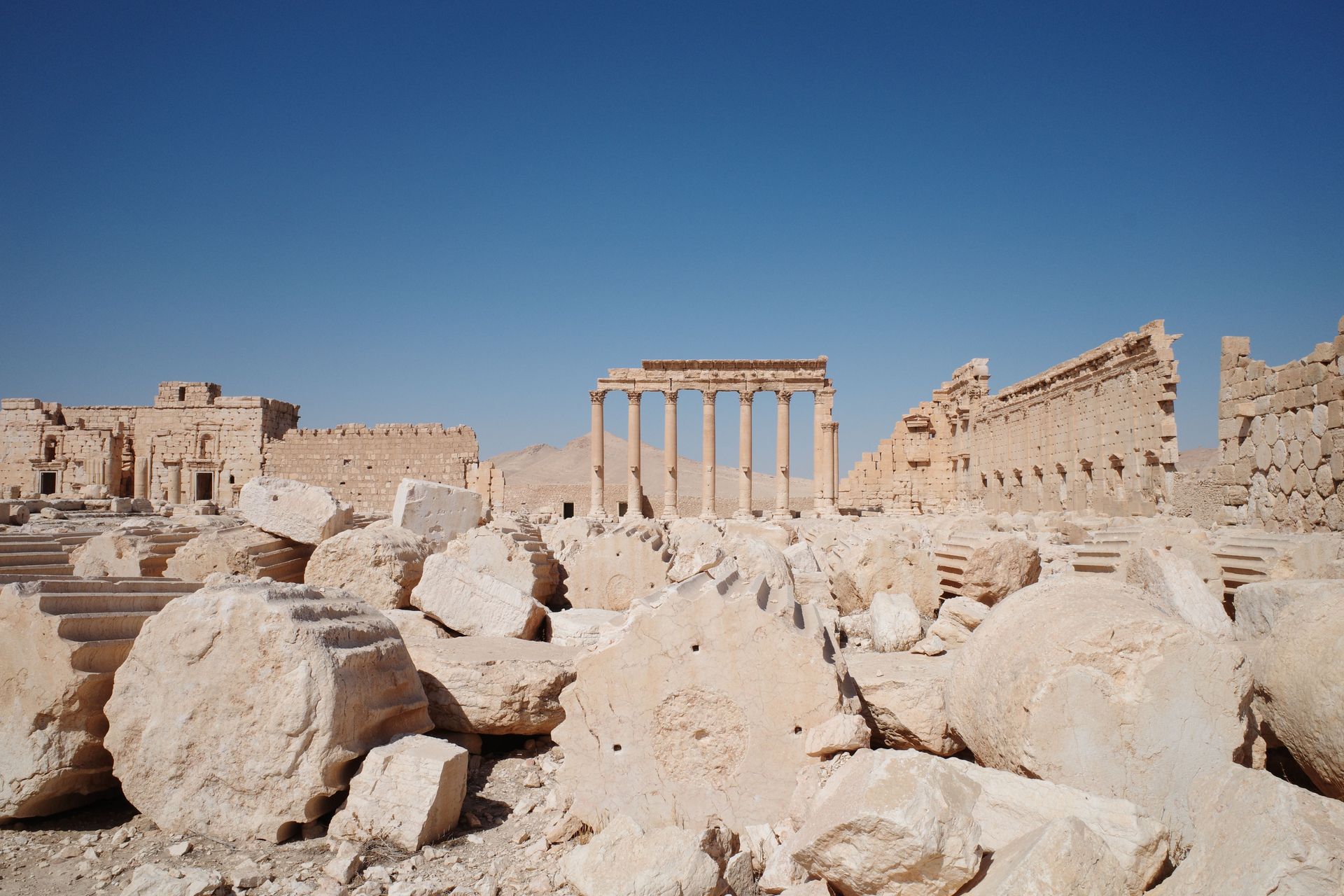
Palmyra — the ancient oasis city in the Syrian desert whose queen Zenobia briefly challenged the authority of Rome in the 3rd century CE — was, before its partial destruction by the Islamic State in 2015, one of the best-preserved Roman-era cities in the Near East and one of the great archaeological sites of the world. The destruction of the Temple of Bel, the Temple of Baalshamin, and the monumental arch of the colonnaded street — along with the murder of Khaled al-Asaad, the 83-year-old scholar who devoted his life to the site — brought global attention to the scale of what was lost.
What survives is still significant. The colonnaded street — 1.1 kilometers of columns lining the main thoroughfare, with the remains of the tetrapylon at its intersection — remains largely intact. The Valley of the Tombs, a necropolis of funerary towers on the outskirts of the city, survived the destruction period substantially. The amphitheatre was damaged but not destroyed. The Palmyra Archaeological Museum, which held the most significant portable artifacts, was looted but not completely destroyed, and efforts to recover and repatriate objects have produced partial results.
Palmyra's position as a caravan oasis — the meeting point between the Roman world and the Parthian and Sassanid Persian worlds to the east — gave it an architectural character that blends Roman, Persian, and indigenous Semitic traditions in ways visible in the surviving structures. The funerary portraits from the tower tombs, now scattered in museums globally, show individuals dressed in a blend of Roman and Parthian fashion that reflects the city's cultural position.
Access to Palmyra has been restricted and variable since 2011, and conditions at the site continue to evolve with the political situation in Syria. The site is included here not only for what can currently be seen but as a statement about what has been lost and why the care of ancient heritage matters.
