
The 10 best hikes in U.S. national parks
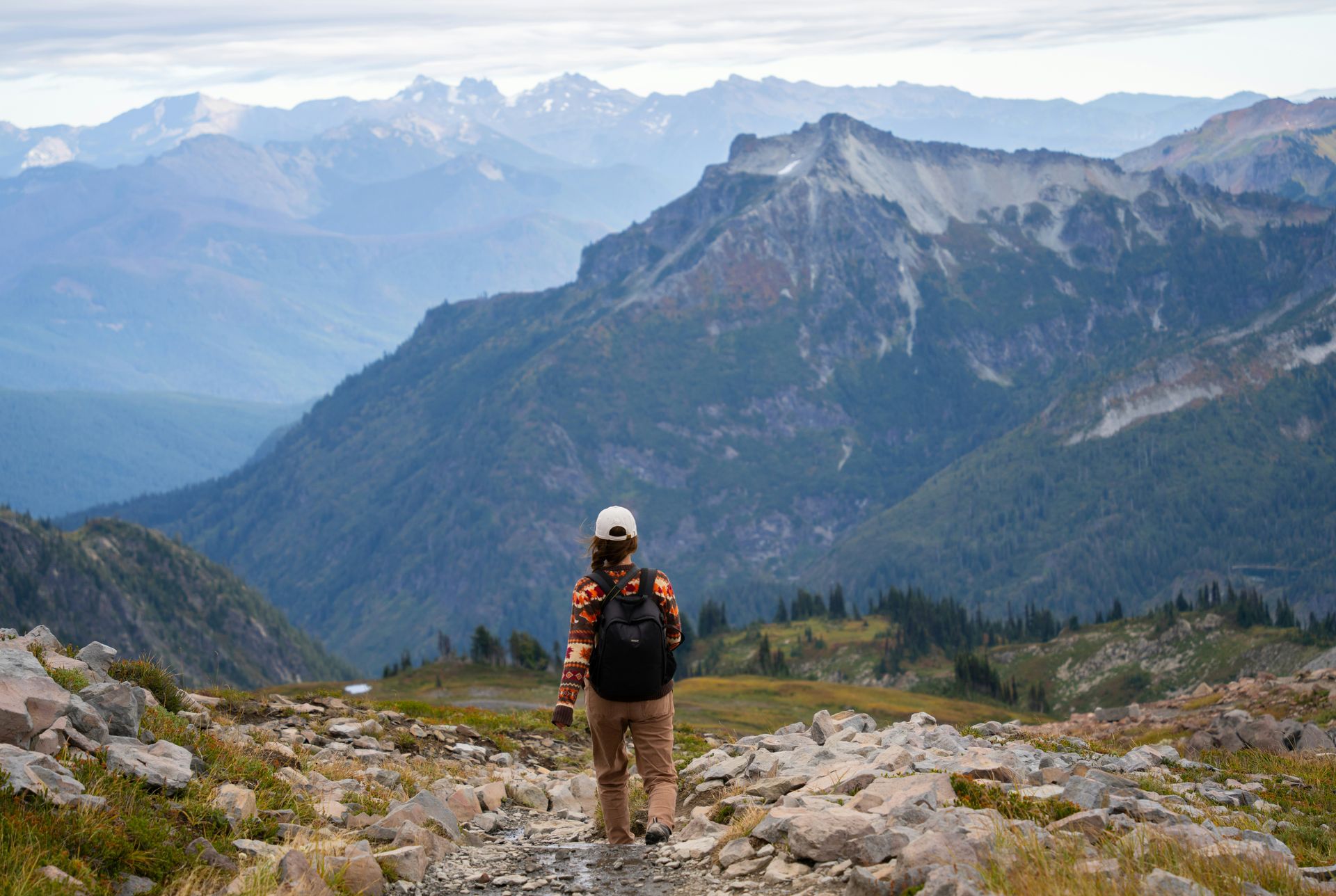
From Yosemite's Clouds Rest summit rising 1,000 feet above Half Dome to Zion's Narrows where canyon walls press 20 feet apart above chest-deep water
Alex Moliski / Unsplash
Choosing which trail to actually hike inside a major US national park can feel genuinely overwhelming, especially once a park’s full trail map, crowd patterns, and seasonal conditions all get factored into the decision at once. Matching a specific trail to a traveler’s fitness level, available time, and tolerance for crowds matters just as much as picking a scenic-sounding name off a map, and the difference between a great day on the trail and a miserable one often comes down to this kind of upfront planning well before anyone actually laces up their boots.
America’s national parks rank among the most visited places on Earth, and that popularity shows in genuinely serious crowding at the most famous trailheads during peak season throughout the summer months. Several parks have recently dropped their timed-entry reservation systems, though the absence of a reservation requirement doesn’t mean there are no crowds at the most popular destinations. Arriving early, hiking on weekdays when possible, checking official park alerts before setting out, and simply being considerate toward rangers and fellow hikers all make a genuinely significant difference to how a day on the trail actually unfolds from start to finish.
The 10 standout hikes below appear in Lonely Planet and cover trails recommended across the US National Park System. Downloading offline trail maps before arriving matters considerably, too, since cell service inside most national parks remains notoriously unreliable, and having a backup option ready means a crowded trailhead never has to derail an entire day of hiking. Checking real-time trail conditions and typical crowd patterns before setting out, rather than relying solely on a guidebook description written months or years earlier, gives hikers a genuinely up-to-date picture of what to expect once they arrive at the trailhead.
1. Clouds Rest earns Yosemite’s finest panorama for free
René Holst / Unsplash
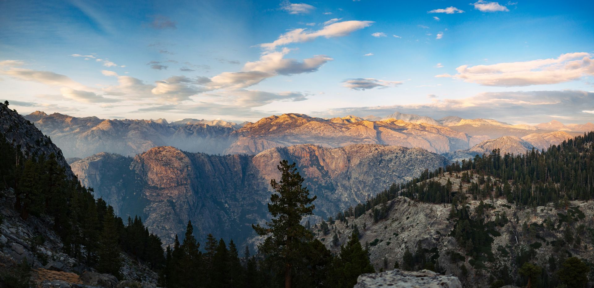
Clouds Rest, reaching 9,926 feet in Yosemite National Park, California, ranks as the park’s largest expanse of exposed granite and arguably its single finest panoramic viewpoint, rising 4,500 feet above Tenaya Creek and standing more than 1,000 feet higher than nearby Half Dome. Unlike Half Dome, which demands a permit lottery and long queues, Clouds Rest asks nothing of hikers beyond the will to actually climb it across the full 12.5-mile round trip, rated hard and typically requiring eight to 10 hours.
The hike begins at the Sunrise Lakes Trailhead near the west end of Tenaya Lake off Tioga Road, where parking fills early enough that visitors staying in Tuolumne Meadows should take the free shuttle bus instead of driving directly. Following Tenaya Creek delivers the first glimpses of Clouds Rest and the shining granite walls of Tenaya Canyon, and steady switchback climbing gradually reveals Mt Hoffmann and Tuolumne Peak to the north, framed by blooming paintbrush, lupine, and wandering daisy.
Around the five-mile mark, the trail bears southwest up the ridgeline and narrows dramatically in one memorable stretch, never dropping below five feet wide but demanding real focus for the five to 10 seconds it takes to cross, before opening onto a summit view of Half Dome, Yosemite Valley, Sawtooth Ridge, and Matterhorn Peak. No permit is required for this day hike, though summer traffic through Yosemite remains genuinely heavy even without vehicle reservations, and the park now uses real-time traffic management, including temporary diversions once parking lots reach capacity.
The creek crossing near mile five marks the last reliable water source before the summit, and hikers should filter water there and pack serious sun protection given the intense UV exposure near 10,000 feet. Plan to descend before early afternoon in summer, and stay off the exposed summit ridge entirely if thunderstorms appear to be building nearby. Afterward, the Tuolumne River offers excellent high-country swimming at several sandy-bottomed pools reachable via the trail past Pothole Dome, giving tired hikers a genuinely well-earned reward.
2. Oconaluftee River Trail wanders through Cherokee heritage
Credit: U.S. National Park Service
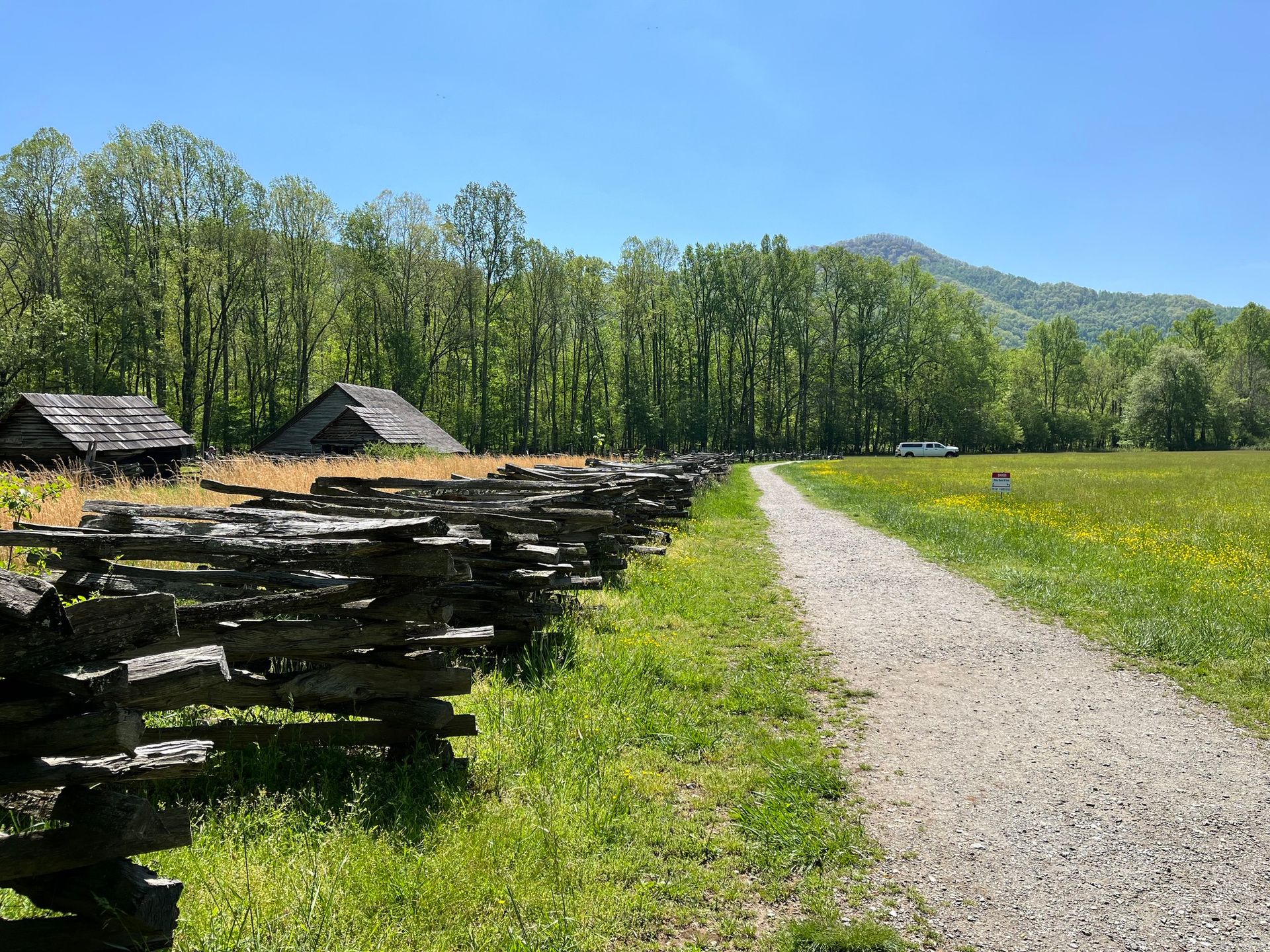
The 3.2-mile Oconaluftee River Trail, rated easy and taking roughly one to one and a half hours, connects the Oconaluftee Visitor Center with the town of Cherokee on the quiet North Carolina side of Great Smoky Mountains National Park. Regularly spaced plaques along the route explore Cherokee spirituality, artwork, and tradition, with all text presented in both English and the flowing Cherokee script, turning a simple riverside stroll into a genuine cultural document that winds through the ancestral lands of the Eastern Band of the Cherokee.
The trail threads through an open meadow before joining the leafy banks of the broad, tranquil Oconaluftee River, and arriving near dawn or dusk gives visitors the best chance of spotting elk grazing in the surrounding meadows, since the Oconaluftee Valley ranks among the park’s most reliable wildlife-viewing spots following a successful reintroduction effort. This particular trail also allows both cyclists and leashed dogs, a genuinely rare pairing of access anywhere within Great Smoky Mountains National Park.
The Mountain Farm Museum, adjacent to the visitor center at the trailhead, deserves at least an hour of any visitor’s time before or after the walk, recreating a 19th-century Smokies farmstead complete with furnished buildings and a working gristmill. No entrance fee applies to the park itself, though vehicles parking 15 minutes or longer need a parking tag, purchasable online or directly at the visitor center.
This entrance is on a completely different side of the park from the busier Tennessee and Gatlinburg approach most visitors use, so travelers should plan their route accordingly. Afterward, the town of Cherokee offers a growing food scene rooted in Eastern Band Cherokee culture, while Bryson City, roughly 15 minutes west, serves as the Smokies’ most inviting gateway town, complete with taprooms and cafes well-suited to a post-hike meal. Few trails anywhere in the Smokies combine this much accessible, flat terrain with such a genuinely rich cultural and wildlife-viewing experience.
3. Jordan Pond Path mirrors Acadia’s gentler side
Credit: U.S. National Park Service
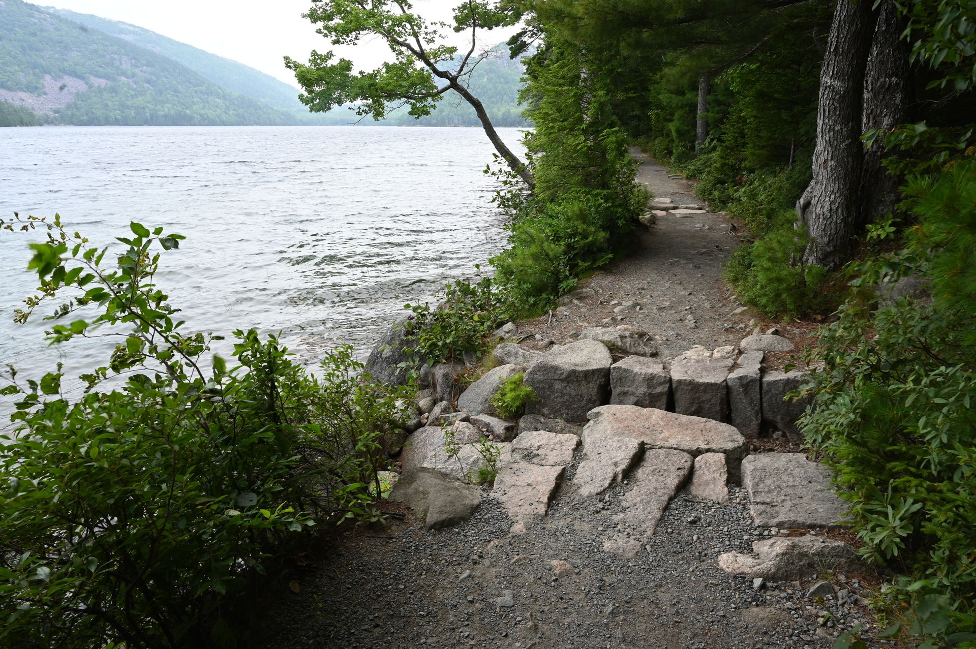
On clear days, the glassy waters of Jordan Pond reflect Penobscot Mountain like a genuine mirror, making the 3.3-mile Jordan Pond Path loop, rated easy and taking roughly one to one and a half hours, one of Acadia National Park’s most photographed and family-friendly walks. This represents the gentler side of a park more commonly associated with iron-rung ladder trails, anchored by one of the most beloved afternoon tea traditions found at any American national park.
The loop circles the shoreline through a mix of boardwalk, gravel path,, and occasional rocky terrain on its northern end, with the southern side following a wide, flat shore and the northern side growing slightly more adventurous as it crosses the head of the pond beneath the rounded summits known as the Bubbles. A short but genuinely challenging spur up to South Bubble adds roughly 20 extra minutes in exchange for a commanding view back over the water, and since the pond itself serves as a water supply, swimming and motorized watercraft stay off-limits, keeping the reflections perfectly still.
A seven-day vehicle pass, priced at $35, covers park entry. The Jordan Pond House parking lot fills quickly during peak season, making the Island Explorer shuttle from Bar Harbor a genuinely reliable alternative that drops visitors directly at the trailhead. Leashed dogs remain welcome throughout the loop, and while the trail stays open year-round, the rocky northern sections can turn icy in winter.
The Jordan Pond House itself has served afternoon tea since the late 1800s, pairing steaming pots of Earl Grey with hot popovers and strawberry jam eaten on the broad lawn overlooking the water. Booking tea in advance during peak season avoids long walk-in waits, and visiting in the evening rewards patient hikers with the finest light on the mountain’s reflection alongside noticeably thinner crowds. Few short walks anywhere in the national park system pair this much natural beauty with such a beloved, century-old dining tradition.
4. Dark Hollow Falls tumbles through Shenandoah’s Blue Ridge
Credit: U.S. National Park Service
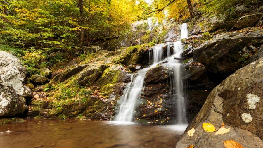
Dark Hollow Falls, a moderate 1.4-mile round trip taking roughly one to one and a half hours near the Byrd Visitor Center in Shenandoah National Park, Virginia, drops 70 feet through layered rock into a pool surrounded by some of the finest Blue Ridge woodland found anywhere along the park’s 105-mile Skyline Drive. Even accounting for the inevitable crowds this proximity brings, the trail retains a genuine sense of enchantment as slick rocks and thick moss gradually take over the scene.
Shenandoah’s Central District holds an impressive collection of additional waterfalls beyond Dark Hollow, and Rose River Falls offers a good wildflower-lined alternative when Dark Hollow gets busy, expanding into several parallel cascades after rainfall. Cedar Run Falls delivers 34 feet of drama across a four-mile round trip for hikers seeking more solitude, while Whiteoak Canyon Falls, at 86 feet, the park’s second highest, sits at the end of a 2.3-mile trail widely considered the park’s most well-known waterfall hike.
A seven-day vehicle pass costs $30 per car, and no permit is required specifically for Dark Hollow Falls. Leashed dogs remain welcome, and there is no in-park shuttle, making a car essential to reach the trailhead. The climb back up to Skyline Drive after viewing the falls takes noticeably longer than the descent, and shoes with a solid grip are essential, given how genuinely slick the rocks near the falls can get.
Big Meadows, right at the trailhead near mile 51 on Skyline Drive, functions as the park’s practical epicenter, holding a gas station, campground, lodge, and restaurant all within easy reach for picking up picnic supplies beforehand. The historic lodge here ranks among Shenandoah’s most atmospheric places to stay, and the surrounding meadow offers some of the finest stargazing anywhere on the East Coast once night falls. Few waterfall hikes anywhere on the East Coast deliver this much genuine reward for such a genuinely short overall walking distance.
5. The Narrows wades straight up Zion’s Virgin River
Salomé Guruli / Unsplash
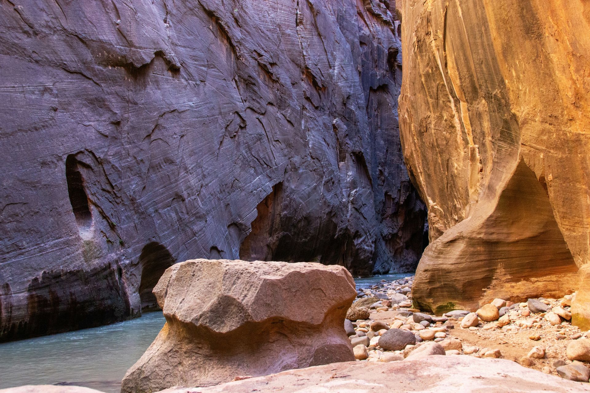
Hiking directly through the Virgin River in ankle- to chest-deep water, with canyon walls rising as much as 1,000 feet tall and pressing in to just 20 feet wide in places, defines the essence of the Narrows in Zion National Park, Utah, a hard route running up to 9.4 miles round trip to Big Spring and taking four to eight hours depending on how far a hiker chooses to go. After the paved Riverside Walk from the Temple of Sinawava shuttle stop, stairs lead down to the water, and the actual wading begins.
Most visitors never walk more than a mile or two into the canyon, leaving genuinely quieter stretches for those willing to continue further, and the entire experience rewards hikers regardless of how far they ultimately travel, since turning around after a short distance remains a completely valid choice. Roughly two miles in, the Orderville Canyon tributary joins from the east, and continuing north through Wall Street brings the sheerness and height of the surrounding cliffs into genuinely dramatic focus.
Renting canyoneering shoes, neoprene socks, and a wooden walking stick from outfitters in the gateway town of Springdale before setting out meaningfully improves the overall experience, and checking current conditions with rangers at the Zion Canyon Visitor Center remains absolutely essential, since the Narrows closes entirely once the Virgin River exceeds 150 cubic feet per second, a threshold that can occur during April, May, or June specifically.
From mid-March through November, private vehicles cannot access Zion Canyon Scenic Drive, making the free park shuttle mandatory to reach the trailhead during that period. Packing a dry bag for electronics and a warm outer layer, since the canyon runs noticeably cooler than the rest of the park, rounds out the essential preparation. Afterward, Southern Utah’s first microbrewery sits mere feet from the park entrance, offering a genuinely well-earned pint after wading upstream for hours against the current.
6. Longs Peak tests hikers on the Rocky Mountain’s classic climb
Credit: U.S. National Park Service
Longs Peak’s 14,259-foot summit in Rocky Mountain National Park, Colorado, draws a genuine crowd throughout summer, with parked cars often stretching well down the road from the trailhead for this hard, 15-mile round trip typically requiring 10 to 15 hours as a full alpine day. Despite that popularity, the technical nature of the climb means underestimating it can genuinely backfire on unprepared hikers.
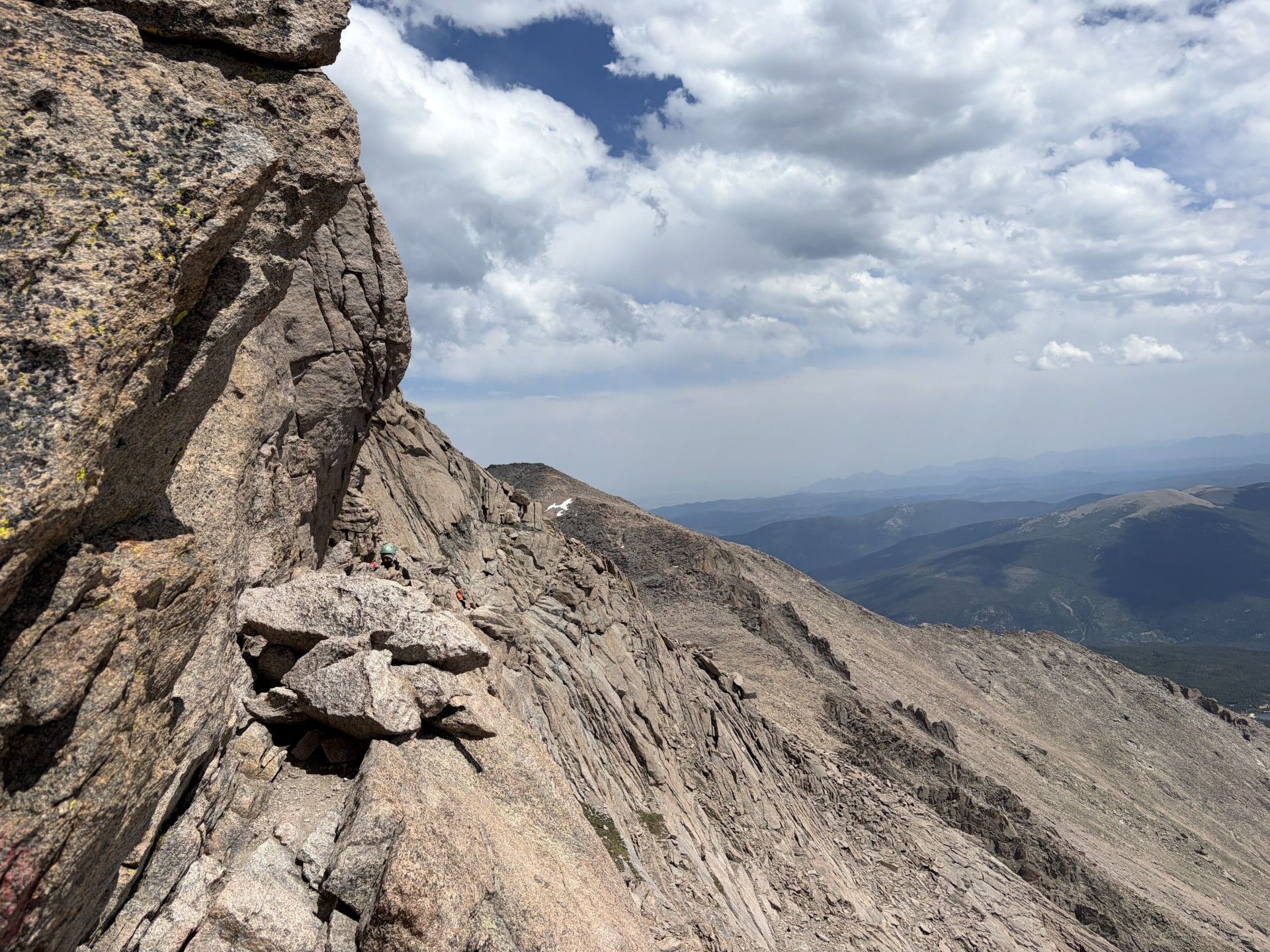
After an initial six miles of moderate trail leading to the Boulder Field at 12,760 feet, the path steepens sharply at the start of the Keyhole Route, marked by painted bull’s-eyes, where a narrow ledge system resembling a handrail-free cliffside stairway slows even genuinely fit, altitude-acclimated hikers before a final scramble reaches the summit boulders. Hikers not ready for that full commitment can instead aim for Chasm Lake, a high-alpine wonder at 11,760 feet sitting below Longs Peak’s sheer Diamond face, reachable via an 8.4-mile round trip that captures the peak’s scenery without the same risk.
Rocky Mountain National Park remains one of the few parks still requiring a timed-entry reservation during peak season, which runs from Memorial Day weekend through mid-October and is bookable in advance at recreation.gov. Standard summit attempts start between 2am and 3am specifically to get hikers off exposed terrain before noon, avoiding the lightning that regularly builds over Colorado’s high peaks by early afternoon. Microspikes or crampons become genuinely necessary during the shoulder season.
Acclimatizing for a day or two in nearby Estes Park before attempting the summit meaningfully reduces the real risk of altitude sickness for visitors arriving from lower elevations. Setting a firm, non-negotiable turnaround time and actually honoring it, regardless of how close the summit feels, matters more on this particular trail than almost anywhere else on this list, and packing full rain gear even during clear weather remains a genuinely wise precaution. Few climbs anywhere in Colorado demand this much genuine preparation while still drawing crowds substantial enough to require a formal reservation system.
7. Skyline Loop circles Mount Rainier’s wildflower meadows
Credit: Washington Trails Association
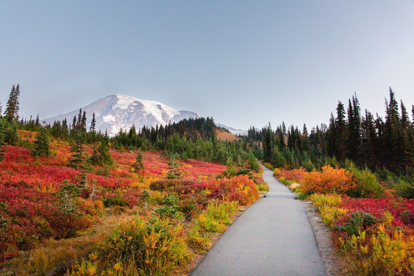
Seattle locals talk reverently about “the Mountain” whenever the conversation turns to Mount Rainier, and the 6.2-mile Skyline Loop, rated moderate and taking roughly three and a half hours, ranks as the single top-rated hike anywhere in the state of Washington according to nearly 30,000 AllTrails reviews. Starting behind the historic Paradise Inn at 5,400 feet on the mountain’s southern slopes, the loop climbs roughly 1,900 feet toward Panorama Point, delivering some of the closest views available anywhere of Rainier itself alongside the more distant Tatoosh Range.
Hiking the loop clockwise brings glacier views, above-treeline paths patrolled by whistling marmots, and expansive flower meadows filled with lupine, paintbrush, asters, and bistort into view in a naturally rewarding sequence. A short spur to Myrtle Falls, where the cascade frames Mount Rainier in the background like a genuine postcard, adds barely any extra time and remains unmissable for anyone passing nearby. Late July and early August bring peak wildflower season alongside the year’s busiest crowds.
A seven-day vehicle pass costs $35, and Paradise parking fills completely by 7:45am on summer weekdays, even earlier on weekends, making an early start genuinely essential instead of optional. Cell service throughout the area remains inconsistent, and GPS apps frequently suggest routes that lead to closed gates or washed-out roads, so carrying paper maps alongside a downloaded offline map is essential.
Mountain weather here can shift rapidly and dramatically, and the park receives genuinely extraordinary precipitation even when the surrounding lowlands stay sunny, making full rain gear essential regardless of the forecast. Snow on the upper loop can persist well into July, requiring microspikes for safe passage through icy sections. Afterward, the historic 1916 Paradise Inn offers a fitting lunch or post-hike drink, and Reflection Lakes on the drive back down reward patient visitors with Rainier’s perfect cone mirrored in the still water on calm evenings. Few loop hikes anywhere in the Pacific Northwest combine this much reliable wildflower spectacle with such consistently close views of a single massive peak.
8. Hall of Mosses hushes visitors in Olympic’s rainforest
Brianna Parks / Unsplash
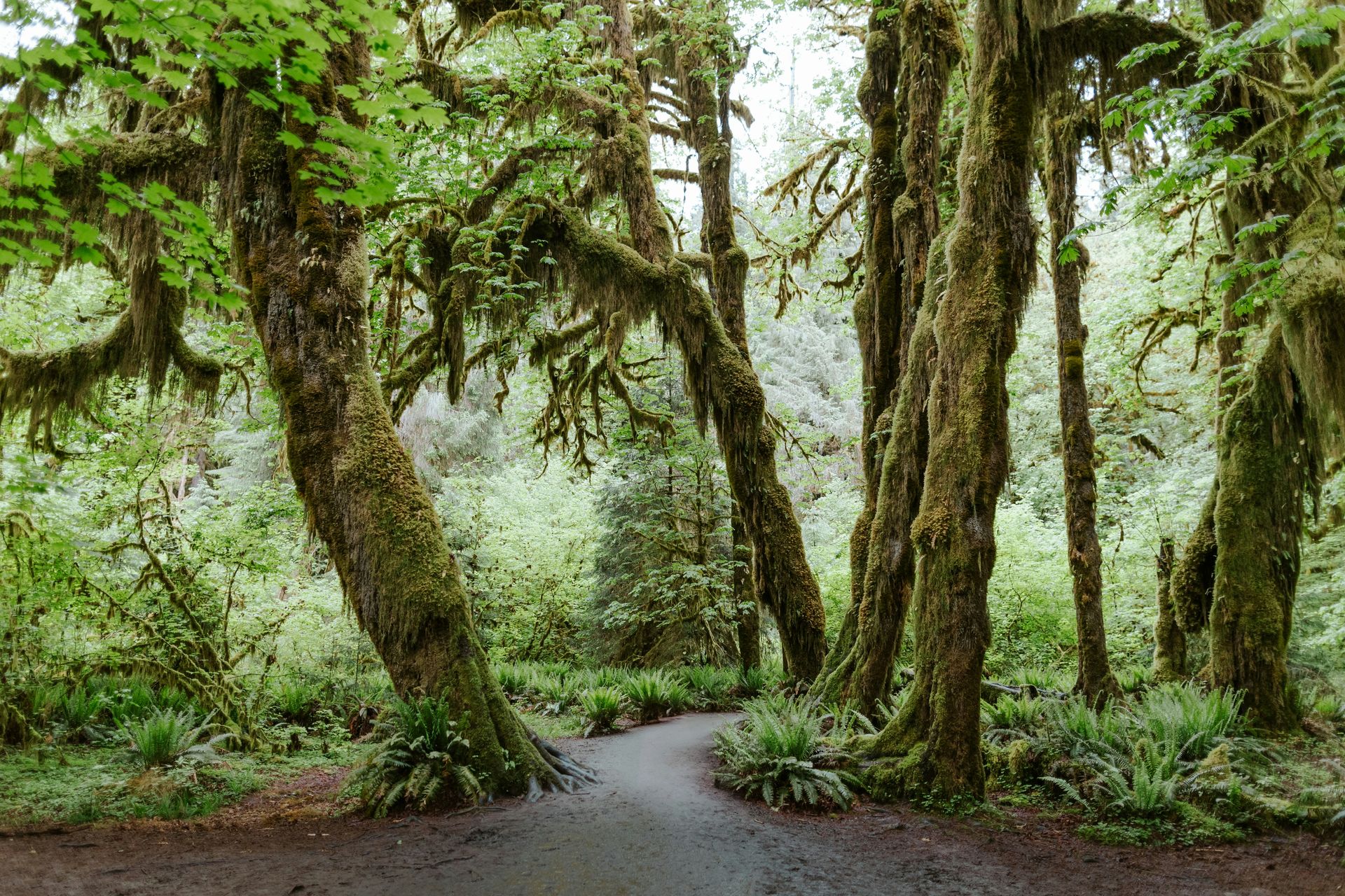
The Hoh Rain Forest in Olympic National Park, Washington, holds what sound-recording expert Gordon Hempton once identified as the quietest place in the continental United States: a mossy log roughly 1.8 miles from the visitor center. The easy 0.8-mile Hall of Mosses Trail, taking 30 to 60 minutes, still delivers genuine magic despite its fame, winding past old-growth cedar and spruce trees that host up to 2,000 pounds of moss, lichen, and fungi apiece.
Epiphytic club mosses and ferns completely overwhelm the massive trunks of maples and Sitka spruces throughout this misty forest, creating scenery unlike anywhere else on this list, and the short, gentle loop remains accessible to virtually everyone, including families with young children. Nurse logs, fallen ancient trees serving as the biological foundation for new rows of saplings, appear throughout the walk alongside interpretive signs explaining the forest’s remarkable ecology, and a separate wheelchair-accessible nature trail winds through a nearby rainforest marsh.
A seven-day vehicle pass costs $35, and reaching the remote visitor center takes roughly one and a half hours by car from Port Angeles, the park’s main gateway. Cell service disappears entirely throughout the Hoh Valley, making a downloaded offline map and screenshotted directions genuinely essential before leaving the highway behind. The forest receives up to 14 feet of rainfall annually, so waterproof footwear and a waterproof jacket matter regardless of season or forecast.
Combining the Hall of Mosses with the 1.2-mile Spruce Nature Trail gives visitors a fuller sense of the Hoh, and extending the visit further along the Hoh River Trail offers strong odds of spotting Roosevelt elk moving quietly through the understory. Sol Duc Hot Springs Resort, roughly one and a half hours north, rewards a longer stay with mineral pools fed by natural hot springs, open from April through October and best visited midweek to avoid weekend crowds. Few short walks anywhere in the national park system deliver this much genuine atmosphere in such a compact, family-friendly loop.
9. Avalanche Lake Trail opens Glacier’s ancient wilderness
Miguel Angel Sanz / Unsplash
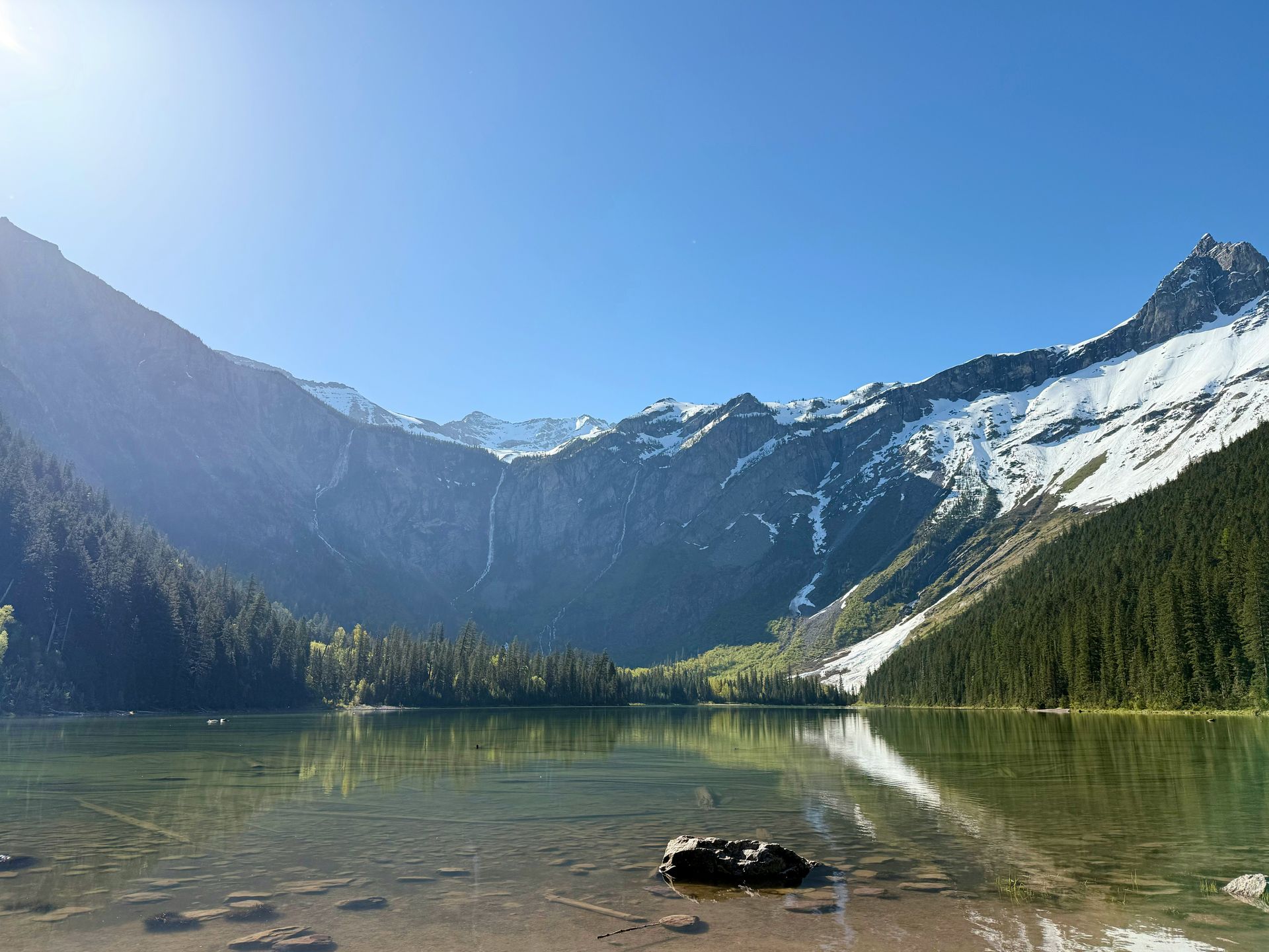
Just north of Lake McDonald Lodge off Going-to-the-Sun Road, the moderate, 4.6-mile round-trip Avalanche Lake Trail, taking roughly two and a half to three hours, threads through ancient woods and a narrow gorge before reaching a charming amphitheater lake, making it an ideal introduction to a park home to roughly 1,000 bears, 700 miles of trails, and 2,000 lakes. This trail is where most visitors first begin to properly understand the scale of Glacier National Park in Montana.
The hike begins along the Trail of the Cedars, a wheelchair-accessible, one-mile boardwalk loop past cedar trees rising to 100 feet with trunks up to seven feet wide, well-suited to families with children. From there, a short but steep climb through humid, moss-covered woods leads to Avalanche Creek, where a narrow gorge carved through purple argillite bedrock looks genuinely cinematic from the bridge crossing above it. The lake itself, formed 12,000 years ago by retreating glaciers, sits beneath looming Bearhat Mountain and reflects it in an emerald-green mirror of still water.
A seven-day vehicle pass costs $35, and Going-to-the-Sun Road access has changed significantly for 2026: visitors planning to spend more than three hours in the alpine area now need a ticketed shuttle reservation, available first-come, first-served at recreation.gov, since Logan Pass parking remains capped at three hours. Booking these shuttle tickets as early as possible matters considerably, since they sell out quickly during peak season.
Roughly 1,000 bears live within the park’s boundaries, according to researcher estimates, making it genuinely important to hike in a group, make noise approaching blind bends, and carry bear spray learned and practiced before the trip instead of on the trail itself. Huckleberries ripen along this trail in late summer and attract bears directly, so staying particularly alert during late August and September matters considerably for anyone hiking during that specific window. Few introductory hikes anywhere in the national park system pack this much dramatic scenery into such a genuinely manageable round trip.
10. Cascade Canyon climbs toward Grand Teton’s Lake Solitude
Credit: U.S. National Park Service
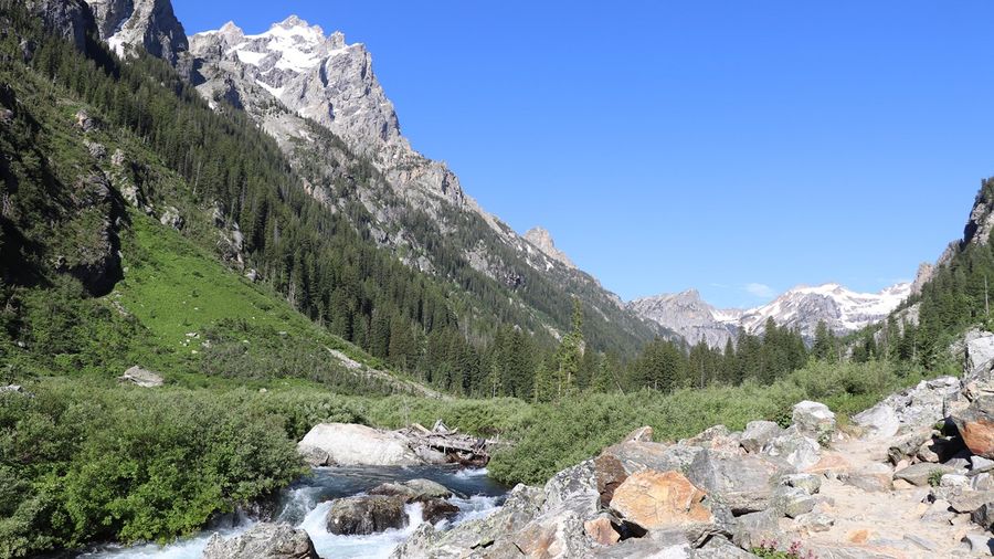
This hard route through Grand Teton National Park, Wyoming, runs 14.4 miles round trip with a shuttle boat or 18.3 miles without, and typically takes six and a half to eight hours, delivering a rewarding challenge without especially punishing grades despite its considerable length and elevation gain. Moose and bears frequent the surrounding area, and steep sections wait near Inspiration Point and again just before Lake Solitude itself.
Taking the Jenny Lake Boating shuttle from the east dock, which runs from 7am to 7pm for a small fee each way, significantly reduces mileage and remains well worth the cost for the distance saved. From the dock, a half-mile climb reaches Hidden Falls, followed by another 0.3 miles of switchbacks up to Inspiration Point, with sweeping views over Jenny Lake, before the crowds thin considerably and the trail’s best section begins another half-mile further into Cascade Canyon proper.
Inside the canyon, Cascade Creek gradually transforms from a trickling stream into a gushing waterfall beneath soaring, glacially carved peaks, with aspen-lined banks that become particularly striking each fall. At the Forks, 4.5 miles from the dock, a right turn leads gently upward for 30 minutes into the Cascade Camping Zone, followed by another 10 minutes to reach Lake Solitude at 9,035 feet, rimmed by fir and pine and often holding ice well into midsummer beneath the diagonal slash of Paintbrush Divide.
A seven-day vehicle pass costs $35, and wilderness permits are required for backcountry camping anywhere in the Cascade Canyon area, though camping remains prohibited at Lake Solitude itself. Bears stay active throughout the canyon, making bear spray essential gear, and hikers should plan to descend from the upper canyon by early afternoon to avoid the thunderstorms common there during summer. Afterward, the 30-minute drive into Jackson rewards a long day with genuinely excellent craft beer and dining options well suited to celebrating the accomplishment. Fewer longer hikes anywhere in the Tetons consistently reward the extra mileage, especially for hikers willing to push past the crowds near the dock.