
From Skara Brae's 5,000-year-old stone furniture on Orkney to Dunrobin Castle, built on profits from the Highland Clearances
Bjorn Snelders / Unsplash
Few landscapes anywhere pack as many layers of human history into so small a footprint as the Scottish Highlands and Islands. A single day of travel across this rugged corner of Scotland can carry a visitor past Neolithic villages, Iron Age fortresses, medieval castles, and the battlefields where a rebellion died, all sitting within sight of dramatic lochs, moors, and sea cliffs. This density of history rewards travelers who plan carefully, since many of the most significant sites sit far from major roads and demand a bit of extra effort to reach. Anyone who makes that effort gains access to places where entire eras of Scottish life remain visible on the ground rather than locked away in a museum case.
Human settlement in the Highlands and Islands stretches back at least 5,500 years, a span that opens with Neolithic toolmakers and stone circle builders and runs through Bronze Age and Iron Age communities, Viking raiders, feuding medieval kings, and the doomed Jacobite rebellion. Each wave of settlers and conquerors left physical traces that still stand today, often within walking distance of ruins from an entirely different era. This layering means a single region can hold a 5,000-year-old tomb, an Iron Age tower and a 19th-century castle within a few miles of each other, a concentration of history that few other parts of Europe can match. The islands scattered off the mainland, particularly Orkney and Shetland, hold some of the richest concentrations, preserved in part by their isolation from mainland development. This isolation cuts both ways for travelers, since reaching these sites often demands a ferry crossing or a flight, but the payoff comes in the form of ruins that have escaped the kind of development pressure that has erased comparable sites elsewhere in Britain.
The nine sites below appear in Lonely Planet and cover historic destinations across the Scottish Highlands and Islands, from Neolithic settlements in Orkney to Jacobite battlefields near Inverness.
William Gibson / Unsplash
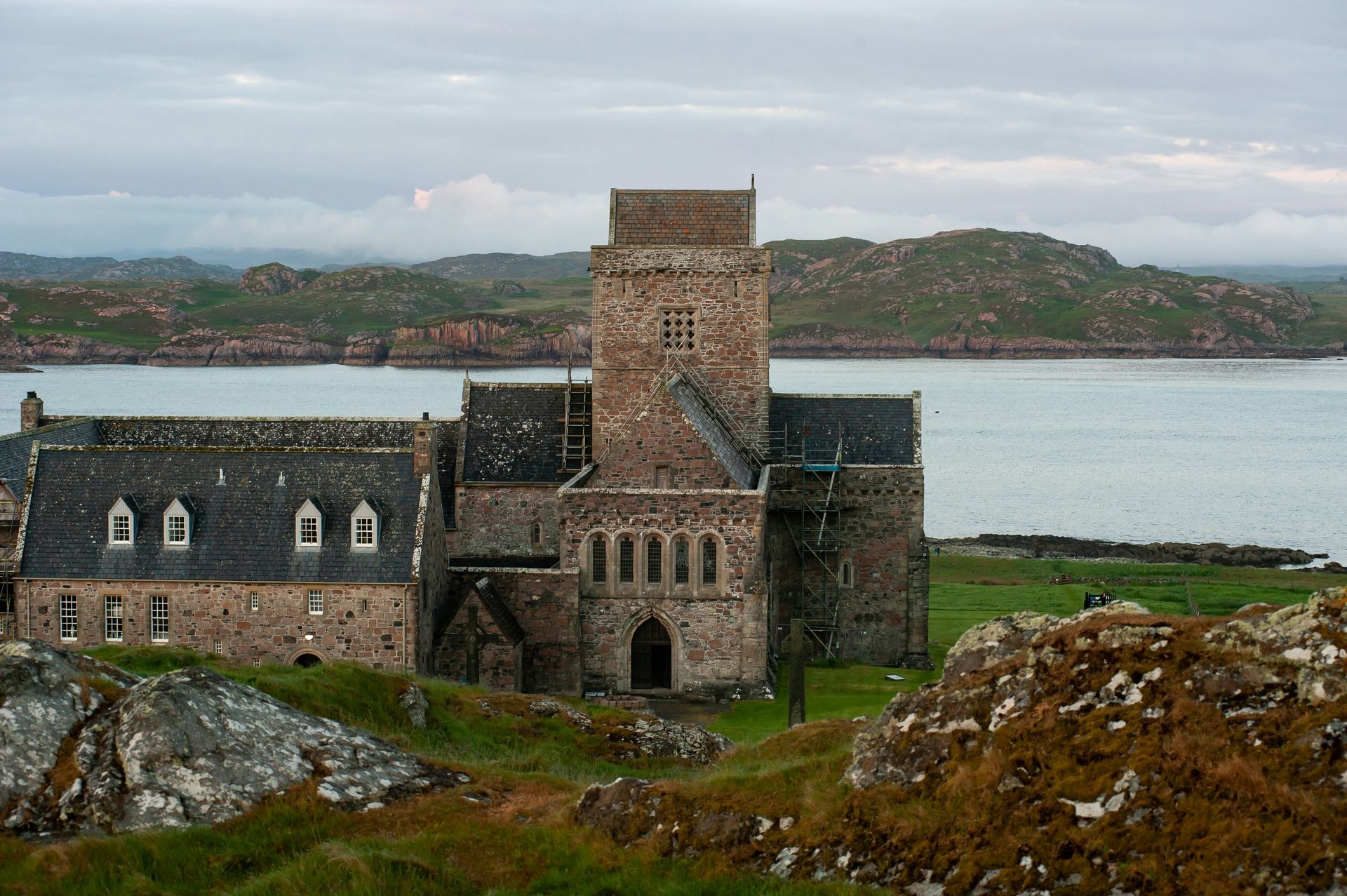
St. Columba landed at Southend on the Kintyre peninsula in 563 CE, carrying a mission to convert the Kingdom of Dál Riata to Christianity, and the monastery he later established on the Isle of Iona grew into the 13th-century abbey that stands on the same site today. Iona has functioned as a place of pilgrimage since the seventh century, making it one of the oldest continuously significant religious sites in Scotland. Visitors who walk its grounds are tracing the same path that carried Christianity into a land still dominated by pagan belief systems.
Scholars believe monks created the Book of Kells, one of the most elaborately illustrated manuscripts to survive from early medieval Europe, on Iona in the ninth century before it eventually made its way to Trinity College Dublin, where it remains on display in the Old Library. The manuscript's survival, despite Iona's remote location and centuries of Viking raids along this coast, speaks to the determination of the monks who safeguarded it. This determination mirrors the broader story of Christianity's foothold in Scotland, which took root on this small island long before it spread across the mainland.
Iona's natural setting adds another dimension to the visit beyond its religious significance. The island's coastline holds beaches that feel wildly out of place in Scotland, including the aquamarine waters and pale sand of White Strand of the Monks, along with Bay at the Back of the Ocean and the sheltered, cliff-edged Port Bàn. Reaching these beaches typically means walking or cycling to the island's North End, a trip that rewards visitors with scenery as striking as the abbey itself.
Iona's blend of spiritual weight and physical beauty explains why it continues to draw pilgrims and travelers with no religious motivation at all. Few places in Scotland let visitors stand where a single monk's arrival reshaped the religious future of an entire nation, and fewer still pair that weight with a coastline this dramatic. A place that has drawn worshippers continuously since the seventh century offers a continuity that even Scotland's grandest cathedrals struggle to match, as Iona's significance has never depended on royal patronage or architectural scale.
Aleksander Korobczuk /Unsplash
On a moor east of Inverness in 1746, the forces of the Duke $DUK of Cumberland crushed the Jacobite army loyal to Bonnie Prince Charlie, ending any realistic hope of restoring the Stuart monarchy to the British throne. The clash at Culloden stands as the last pitched battle ever fought on British soil, and the site has changed remarkably little in the centuries since the fighting stopped. Walking the moor today puts visitors directly on the ground where that final confrontation unfolded.
Culloden's significance extends well beyond the battle itself. The defeat triggered the Highland Clearances, a prolonged campaign in which thousands of Highlanders lost their crofts and fishing villages to make way for large-scale sheep farming. This connection between a single afternoon of fighting and decades of forced displacement gives Culloden a weight that few other battlefields carry, since the consequences reshaped Highland society for generations instead of ending with the last shot fired.
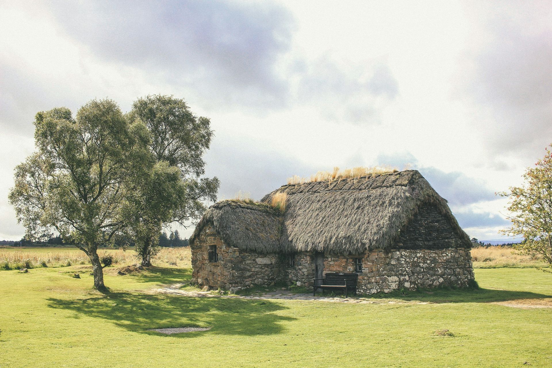
A visitor center on the site uses interactive displays to walk guests through the events leading up to the battle and its aftermath, while a memorial cairn marks the ground where so many Jacobite soldiers fell. A stone cottage nearby, once used as a field hospital for the wounded, offers a more intimate and unsettling connection to the human cost of the fighting than the open moor alone can provide.
Nearby attractions extend the historical thread further back and forward in time. The Bronze Age Clava Cairns, familiar to fans of Diana Gabaldon's Outlander novels, sit within a short drive of the battlefield, as does Cawdor Castle, famous for its association with Macbeth, even though the historical thane died roughly 300 years before the castle's construction began. Together, these nearby sites turn a single visit to Culloden into a broader survey of Highland history spanning thousands of years, connecting a single afternoon of 18th-century violence to burial practices from millennia earlier and to a castle whose fame rests on Shakespearean fiction rather than documented fact.
-1-900x675.jpg)
Bewahrerderwerte / Wikimedia Commons (CC BY-SA 4.0)
Storms buried the Neolithic village of Skara Brae on Orkney's Mainland around 2500 BCE, and it stayed hidden until fresh storms in 1850 stripped away the sand and turf covering it, exposing one of the best-preserved Neolithic settlements anywhere in Europe. The village forms part of the "Heart of Neolithic Orkney" UNESCO World Heritage designation, which recognizes four of the islands' most significant prehistoric sites. Few places on Earth offer this direct a window into how people lived nearly 5,000 years ago.
Skara Brae's stone-walled houses cluster tightly together, a layout that suggests the people who lived here formed a close-knit community instead of scattered, independent households. Inside the dwellings, visitors can see hearthstones positioned for warmth and cooking, primitive drainage systems that carried waste away from living spaces, and stone furniture built directly into the walls, including box beds and dresser-like storage units. This furniture has survived intact for five millennia largely because builders carved it from stone rather than wood, a choice driven by Orkney's scarcity of trees.
The level of domestic detail visible at Skara Brae sets it apart from many other prehistoric sites, which often preserve only foundations or scattered artifacts. Here, an entire way of life comes through in the arrangement of a single room, down to where a Neolithic family might have stored food or slept. Archaeologists have used these details to piece together a surprisingly rich picture of Neolithic domestic life on Orkney.
Visitors exploring Skara Brae can extend the trip to nearby Yesnaby for a walk along dramatic sea cliffs, or to the Ring of Brodgar and the Stones of Stenness, standing stone monuments that formed part of the same ceremonial landscape roughly 5,000 years ago. Seeing the settlement alongside its ceremonial neighbors gives a fuller sense of how Neolithic Orkney's communities organized both their daily lives and their spiritual practices, and the short distance between the village and these monuments suggests the people who lived at Skara Brae likely took part in ceremonies at both sites.
Beep boop beep / Wikimedia Commons (CC BY-SA 4.0)
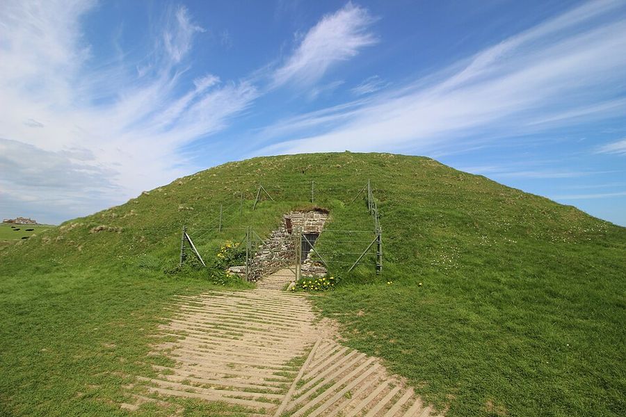
Built from massive sandstone blocks roughly 5,000 years ago, Maeshowe stands as the finest chambered tomb in Western Europe, though its unassuming grass-covered exterior gives little hint of what lies inside. A narrow stone passageway leads visitors to the central chamber, and the physical act of stooping and crawling underscores just how much time separates the modern world from the people who built this structure. Archaeologists still don't know exactly how many bodies were originally interred within its walls.
Maeshowe's story took an unexpected turn roughly 4,000 years after its construction, when Viking raiders returning from the Crusades in the 12th century broke into the tomb, likely in search of treasure. Finding little of value, these medieval intruders left behind something arguably more valuable to modern historians: an extensive collection of runic graffiti carved directly into the tomb's stone walls. The inscriptions range from boasts about sexual conquests to melancholic odes addressed to lovers left behind, offering a startlingly human counterpoint to the solemn purpose the tomb originally served.
This graffiti gives Maeshowe a dual identity that few ancient monuments share. Visitors come partly to experience a genuine Neolithic burial chamber and partly to read the unfiltered, occasionally crude thoughts of Norse adventurers who treated a 5,000-year-old sacred site as a convenient place to leave their mark. The contrast between the tomb's original solemnity and the irreverence of its later visitors captures something essential about how successive cultures have interacted with the Highlands' ancient past.
Orkney holds several other chambered tombs worth exploring alongside Maeshowe. The Quoyness Chambered Cairn on the island of Sanday, reachable by ferry from Kirkwall, offers another intact example, while the Midhowe Tomb on the island of Rousay stretches some 98ft in length and once held the remains of 25 people, viewable today from a suspended walkway built above the ancient stone stalls. A well-preserved broch stands nearby as well, adding an Iron Age counterpoint to the tomb's much older Neolithic construction.
Jack Anstey / Unsplash
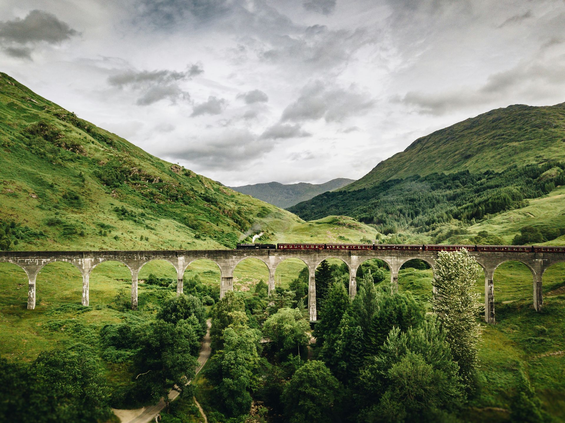
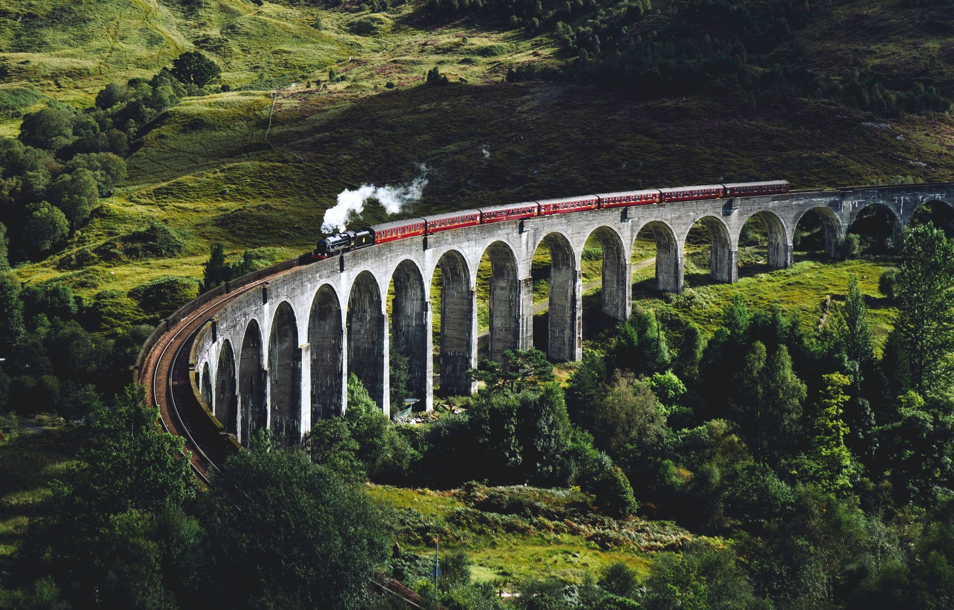
Engineers completed the Glenfinnan Viaduct at the close of the 19th century, and its sweeping curve of stone arches has overlooked Loch Shiel ever since as a testament to Victorian-era engineering ambition. For roughly a century, the viaduct's fame remained largely confined to engineering circles and Highland travelers. This changed dramatically at the start of the 21st century, when the structure appeared in the Harry Potter films, turning an already impressive feat of construction into a global tourist attraction.
The Jacobite Steam Train, nicknamed the Hogwarts Express by fans of the films, crosses the viaduct several times a day on its route between Fort William and Mallaig, giving visitors the chance to ride across the same tracks featured on screen. Watching the train cross from outside the carriage windows offers an experience many visitors find even more rewarding than riding aboard it. The Glenfinnan Viewpoint, positioned behind the site's visitor center, provides the clearest vantage point for photographing the train as it sweeps across the arches.
Glenfinnan's appeal extends beyond its film connections. The viaduct sits within a landscape of genuine natural drama, framed by Loch Shiel's dark waters and the surrounding hills, and the site rewards visitors who linger beyond the moment a train passes. Rail engineering enthusiasts continue to study the structure for its innovative use of mass concrete construction, a technique still relatively novel when the viaduct went up, and the same qualities that made it structurally significant in the 1890s continue to keep it standing under the weight of modern steam locomotives more than a century later.
Travelers $TRV already in the area can extend their visit toward Fort William to see Ben Nevis, Britain's highest mountain at 4,409ft, without necessarily attempting the climb. A view across Loch Linnhe from Corpach, roughly two miles north of Fort William, offers a low-effort way to take in the heather-cloaked massif that draws serious hikers and climbers from around the world.
Duncan McNab / Unsplash
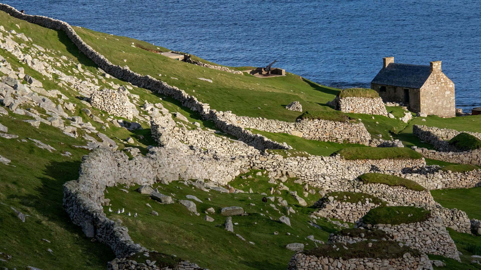
Separated from the rest of the Outer Hebrides by 40 miles of rough Atlantic seas, the St Kilda archipelago stands as one of the most isolated inhabited places Scotland has ever known, and its history captures both the resilience and the eventual limits of that isolation. On the main island of Hirta, the population peaked at 180 residents in the 17th century before entering a steady decline due to the harshness of island life.
Islanders on St Kilda survived largely on seabirds and their eggs, which residents harvested by scaling the archipelago's steep sea cliffs, a practice that speaks to just how few alternatives the island's environment offered. Repeated food shortages eventually pushed the remaining community past the breaking point, and in 1930, the last 36 residents requested evacuation from the island altogether, ending centuries of continuous habitation. Their departure left behind a landscape now populated only by seabirds and the crumbling remains of the homes they abandoned.
Reaching St Kilda today requires a boat trip from Leverburgh on the Isle of Harris, typically arranged through operators such as Kilda Cruises or Sea Harris, and the crossing itself has a reputation for rough, wave-lashed conditions that mirror the isolation islanders once endured. Arriving passengers find dramatic sea crags that appear almost sculpted, alongside the hauntingly empty stone houses where generations of islanders once lived out a way of life that no longer exists anywhere else in Scotland.
St Kilda's evacuation represents a different kind of historical loss than the violent battles or forced clearances found elsewhere in the Highlands, since no army or landlord drove these islanders out. Instead, the environment itself made survival unsustainable, and the community's own request for evacuation adds a layer of quiet tragedy that distinguishes St Kilda from almost every other historic site in this region. The abandoned village on Hirta stands today as a rare monument to a way of life that ended not through conquest but through the slow accumulation of hardship, a distinction worth keeping in mind while walking among the empty houses.
Sourav Bhaduri / Unsplash
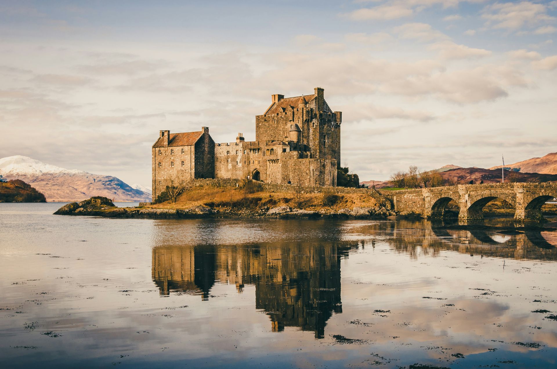
Builders raised Eilean Donan Castle in the 13th century to defend the Earl of Ross against Norse raiding parties launched from the surrounding islands, choosing a small tidal island in Loch Duich specifically for its defensible position. Centuries of destruction and reconstruction followed, and the castle that greets visitors today, complete with its arched stone footbridge, largely dates to a 20th-century rebuilding instead of the medieval original. Even so, the site's long defensive history remains visible in its layout and setting.
Local legend holds that the island supported a monastery dedicated to the Irish saint Donnán of Eigg as far back as the sixth or seventh century, predating the castle by hundreds of years. This older, half-remembered history adds a layer of mystery to a site already famous for its dramatic silhouette against the waters of Loch Duich.
Eilean Donan's visual drama has made it one of the most photographed buildings in the Highlands, and filmmakers have taken full advantage of that appeal for decades. The castle appeared in Highlander in 1986, Rob Roy in 1995, and the James Bond film The World Is Not Enough in 1999, cementing its status as an unofficial ambassador for Scottish castle architecture on movie screens worldwide. Few Highland landmarks pair a genuine medieval pedigree with this kind of instantly recognizable modern celebrity.
The castle's location near the main route to the Isle of Skye makes it a natural stop for travelers continuing westward across the Skye Bridge. Hikers who press on toward the Quiraing, in Skye's north, follow paths that climb past dramatic rock formations to a high plateau once used by crofters to hide cattle from Viking raiders, extending the theme of defense against seaborne threats that defines Eilean Donan itself. This shared thread of coastal defense links a 13th-century castle to a landscape feature with no formal construction date, showing how the Highlands' geography shaped defensive strategy for both castle builders and ordinary crofters facing the same threat from the sea.
-1920x1280.jpg)
Colin Horn / Unsplash
Dunrobin Castle's chateau-like turrets and manicured grounds near Inverness give little outward indication that the building's grandeur grew directly out of one of the darkest chapters in Highland history. In the years following the Jacobite defeat at Culloden, landowners loyal to the British crown moved to strip the northern Highlands of its traditional clan culture and, in many cases, its people as well.
Between 1807 and 1821, roughly 10,000 residents of the Sutherland Estate lost their homes and crofting communities as part of the Highland Clearances, a campaign of eviction carried out to convert the land to more profitable sheep farming. Families displaced by the Clearances faced a stark choice: relocating either to harsh, exposed fishing villages along the coast or boarding ships bound for colonies overseas with little prospect of ever returning to the Highlands. The scale of that displacement, spread across more than a decade, ranks among the largest single episodes of forced relocation in Scottish history.
The Duke $DUK of Sutherland, who orchestrated much of this displacement, used the profits generated by sheep farming on the newly cleared land to fund extensive renovations to Dunrobin Castle, transforming it into the ornate structure visitors see today. This direct financial link between the castle's beauty and the suffering behind its construction sets Dunrobin apart from castles whose histories center on battle or siege rather than on the economic exploitation of tenants. Few Highland landmarks make the connection between architectural grandeur and human displacement as explicit as Dunrobin does.
Visiting Dunrobin today means holding two realities in mind simultaneously, appreciating the architectural achievement while recognizing the human cost that financed it. Guides and interpretive materials at the site increasingly foreground this history rather than presenting the castle purely as an aristocratic showpiece, giving visitors a fuller and more honest picture of how the Sutherland family accumulated the wealth that funded its grandest building. This reckoning with a difficult past has become part of what makes a visit to Dunrobin worthwhile, since the castle's manicured grounds carry more weight once a visitor understands what they were paid for.
Bob Embleton / Wikimedia Commons (CC BY-SA 2.0)
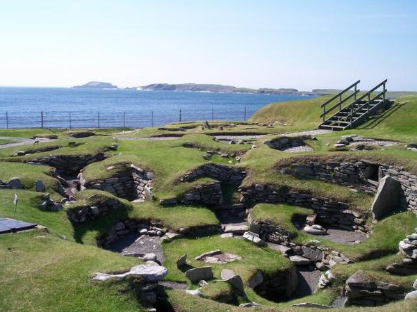
Winter storms exposed the ruins of Jarlshof on Shetland's Mainland in the late 1800s, revealing a site so continuously occupied that it now stands as one of the clearest records anywhere in Scotland of how successive cultures built on top of one another's foundations. Nearly every era of Scottish prehistory and early history appears somewhere within the site's boundaries, spanning the Neolithic through the Bronze Age, the Iron Age, the medieval period, and beyond.
Stone Age roundhouses sit near the remains of an Iron Age broch and a cluster of wheelhouses, structures whose interior "spokes" once divided the space into separate chambers radiating from a central hearth. Viking longhouses occupy another section of the site, evidence of Norse settlers who arrived centuries after the roundhouses were first built. Medieval farmhouses cluster nearby, and the 16th-century Old House of Sumburgh, constructed by the notoriously harsh Earl of Orkney, Patrick Stewart, caps off the site's timeline with a reminder of just how recently, in archaeological terms, people continued to build here.
Jarlshof's proximity to Shetland's small airport puts one of Scotland's most historically layered sites within easy reach of visitors flying into the islands, a convenience that sets it apart from more remote Highland attractions that require long ferry crossings or hikes. This accessibility hasn't diminished the site's ability to convey genuine archaeological depth, since walking a short distance across the grounds can carry a visitor across several thousand years of continuous habitation. Few archaeological sites anywhere let visitors move so quickly between such distant chapters of human history within a single short walk.
Shetland's Norse heritage, so visible in Jarlshof's longhouses, still shapes island culture today. Residents mark their Viking ancestry each January with the Up Helly Aa festival, a spectacle of costumed parades that culminates in the ceremonial burning of a wooden longship in Lerwick. The festival offers a living counterpoint to Jarlshof's silent ruins, showing how Shetland's Norse past continues to animate the islands' present instead of existing only as an archaeological curiosity.