
From Alaska's roadless Gates of the Arctic to Minnesota's Voyageurs, where boats replace trails across four connected border lakes
Tavita Togia, National Park Service / Wikimedia Commons
Millions of travelers flock to Yellowstone, Yosemite and the Grand Canyon each year, drawn by iconic landmarks and decades of relentless promotion. Meanwhile, a considerable number of equally spectacular national parks sit largely overlooked, offering genuinely comparable natural beauty without the crowds, traffic and reservation systems that increasingly define America’s most famous parks throughout peak season.
These underrated parks reward travelers willing to put in a bit of extra effort to reach them, whether that means a bush plane, a ferry or simply a long drive down a remote highway. Solitude itself becomes part of the genuine appeal, giving visitors a considerably more intimate connection with landscapes that busier parks can’t offer anymore, regardless of how spectacular those more famous parks genuinely remain.
The 10 parks below appear in Lonely Planet, covering the least-visited national parks throughout the United States. They range from roadless Alaskan wilderness accessible only by bush plane to a Pacific island park south of the equator, giving adventurous travelers genuine range across some of the country’s most remote protected landscapes. Several of these parks also reward specific seasonal timing, whether that means catching a massive caribou migration, watching brown bears fish for salmon, or witnessing the northern lights dance above a frozen lake. Most require considerably more planning than a typical national park visit, since limited transport options, whether a single daily ferry or a small number of bush pilots, mean travelers should confirm logistics well before finalizing a specific trip date. The reward for this extra effort is considerable, since visitors to these particular parks routinely encounter wildlife, night skies, and truly untouched wilderness that heavily developed, considerably more famous parks cannot replicate for modern travelers seeking real solitude.
Credit: U.S. National Park Service
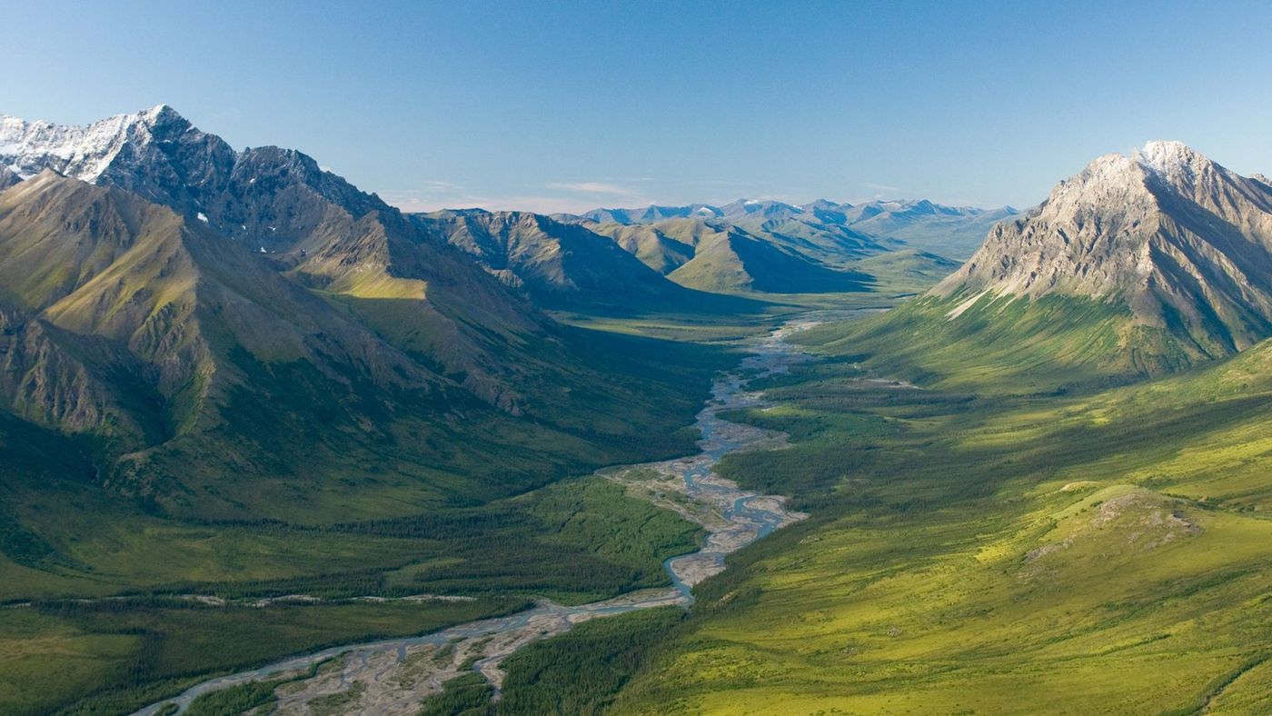
Sitting entirely above the Arctic Circle in northern Alaska, Gates of the Arctic National Park and Preserve holds the distinction of having no roads, trails, or facilities of any kind within its considerable boundaries. Visitors reach this genuinely remote wilderness exclusively by bush plane or by hiking in directly from outlying villages, making it one of the least accessible parks in the entire national park system.
Established in 1980 under the Alaska National Interest Lands Conservation Act, the park protects more than 8 million acres of pristine Brooks Range wilderness, giving it a footprint considerably larger than many entire states found elsewhere in the country. Caribou herds migrate through the park in massive numbers each year, and the complete absence of infrastructure means wildlife throughout the region behaves with a genuinely wild, undisturbed character rarely seen in more developed parks.
Backcountry travel throughout Gates of the Arctic requires genuine wilderness skills, since no marked trails exist to guide hikers between destinations. Visitors navigate purely by topographic map and compass, or increasingly by GPS, across terrain that shifts between tundra, river valleys, and considerable mountain passes throughout the Brooks Range.
Travelers $TRV planning a Gates of the Arctic trip should book bush plane transport well in advance, since a genuinely limited number of pilots operate flights into this specific region, and availability during the short summer season fills up considerably faster than travelers might expect. Visitors should pack considerably more supplies than a typical backcountry trip elsewhere would require, since no resupply points exist anywhere within the park’s boundaries once a trip actually begins. The park’s short summer season, running roughly from June through early September, gives visitors a genuinely narrow window for planning a trip before winter weather returns to the Brooks Range. A satellite communication device also helps considerably given how completely cell service disappears throughout the entire park. Sturdy waterproof boots also help considerably given how much stream crossing backcountry travel throughout the park genuinely involves.
Credit: U.S. National Park Service
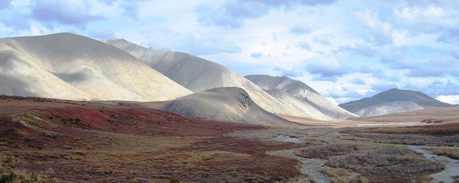
North of the Arctic Circle in northwestern Alaska, Kobuk Valley National Park protects a genuinely surprising landscape of massive dunes, some reaching more than 100 feet tall, set incongruously against the surrounding Arctic tundra. These Great Kobuk Sand Dunes formed from glacial sediment deposited thousands of years ago, giving the park a genuinely unexpected desert-like character despite its considerable distance from any conventional desert region.
Established in 1980 alongside Gates of the Arctic, Kobuk Valley has no roads or maintained trails and, like its neighboring park, requires bush plane access for the vast majority of visitors. The Kobuk River, which gives the park its name, serves as the primary travel corridor for both wildlife and the small number of visitors who make the journey each year.
Half a million caribou migrate through the valley twice annually, crossing the Kobuk River at specific points that have remained genuinely consistent for thousands of years, based on archaeological evidence found throughout the surrounding region. This migration represents one of the largest wildlife spectacles in North America, though the park’s remote location means few visitors ever witness it firsthand.
Visitors hoping to see the caribou migration specifically should time a trip around the animals’ seasonal movement patterns, since missing this narrow window means encountering a considerably quieter landscape without the massive herds passing through. Summer temperatures atop the dunes can climb considerably higher than the surrounding tundra might suggest, since the exposed sand absorbs and radiates heat far more intensely than the region’s typical Arctic terrain. Onion Portage, a specific site along the Kobuk River, holds considerable archaeological significance, since Indigenous communities have used this exact crossing point to intercept migrating caribou for thousands of years. Sturdy footwear also helps considerably given how difficult walking across loose dunes genuinely proves over longer distances. Insect repellent also helps considerably given how persistent mosquitoes genuinely stay throughout the Arctic summer months.
Credit: U.S. National Park Service
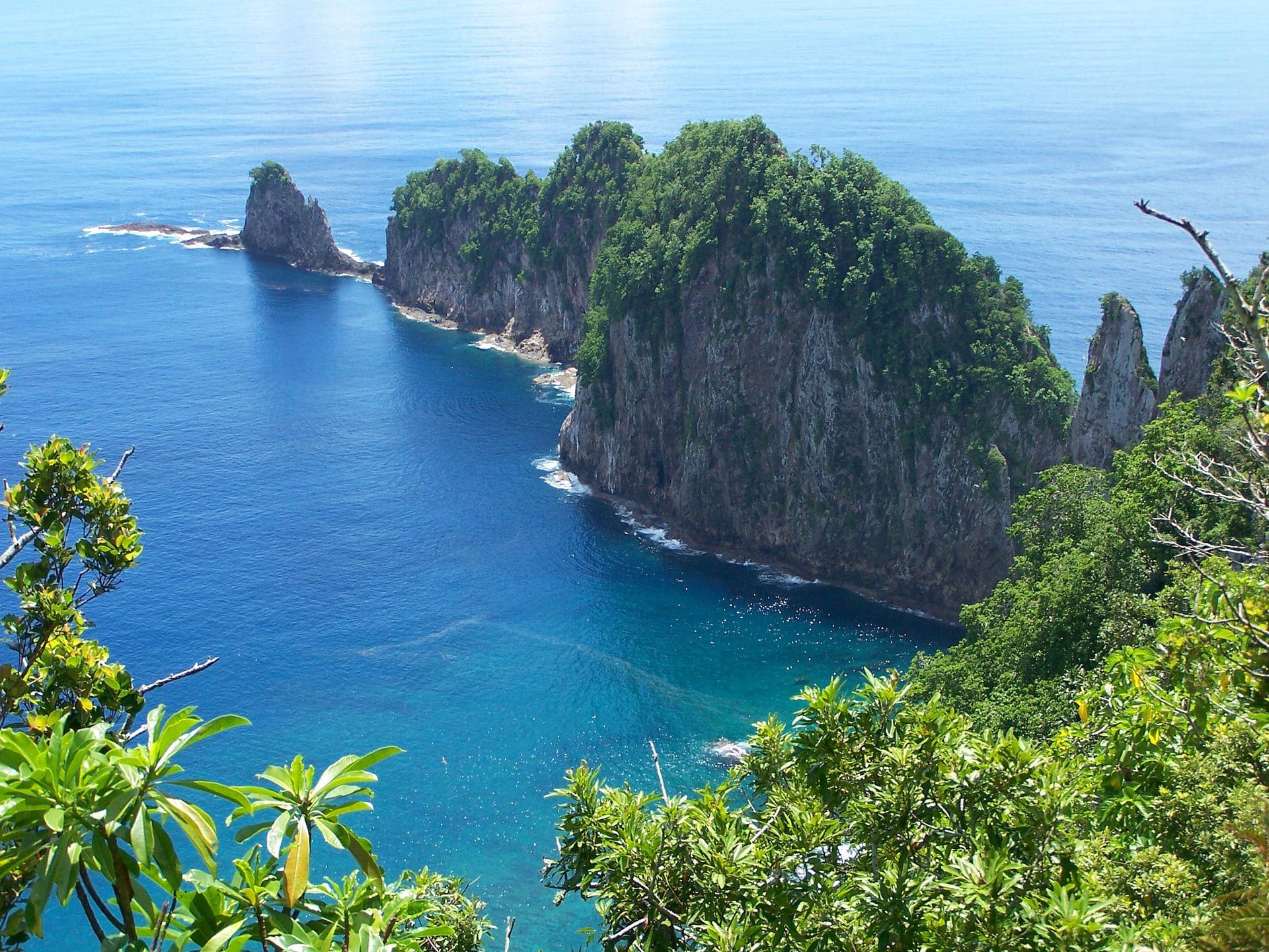
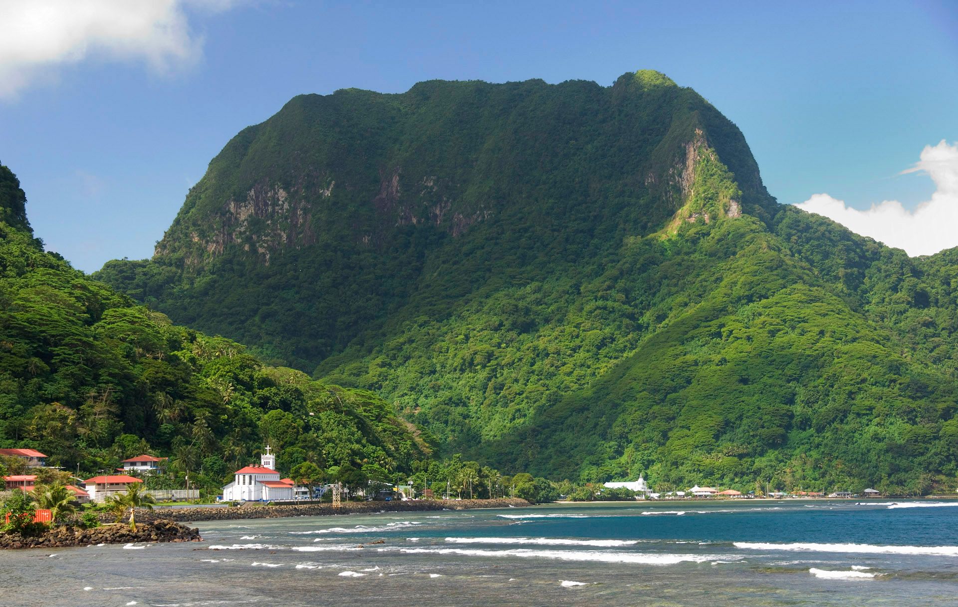
The only US national park located south of the equator, the National Park of American Samoa protects paleotropical rainforest, coral reefs and traditional Samoan village life spread across three separate islands in the South Pacific. Established in 1988, the park represents a genuinely unique partnership between the National Park Service and local Samoan communities, who retain ownership of much of the land the park actually occupies.
Visitors reach the park via a genuinely long flight to Pago Pago, American Samoa’s capital, followed by additional travel to reach the more remote islands of Ta’ū and Ofu, both of which hold considerable portions of the park’s total protected area. This journey’s sheer length and cost help explain why the park ranks among the least-visited units in the entire national park system despite its genuinely spectacular scenery.
Coral reefs surrounding the islands hold considerable biodiversity, rewarding snorkelers and divers with genuinely vibrant underwater ecosystems largely undisturbed by the mass tourism found throughout much of the broader Pacific region. The park’s rainforest-covered volcanic peaks rise directly from the ocean, creating dramatic elevation changes within remarkably short distances from the coastline.
Travelers $TRV should research current flight schedules to American Samoa well in advance, since limited service to this remote US territory means booking flexibility stays considerably more constrained than for domestic mainland destinations. Travelers should research current ferry schedules between islands specifically, since interisland transport within the territory itself can run considerably less frequently than travelers accustomed to mainland connections might expect. The park’s fruit bats, a genuinely important pollinator species throughout the islands, rank among the largest bat species found anywhere in the world, rewarding wildlife-focused visitors with a uniquely Pacific wildlife encounter. Reef-safe sunscreen also helps considerably given how pristine and sensitive the surrounding coral ecosystems genuinely stay. A rain jacket also helps considerably given how frequently tropical showers genuinely pass through the islands. A snorkel mask brought from home also helps considerably, since rental gear options stay genuinely limited throughout the remote islands.
Credit: U.S. National Park Service
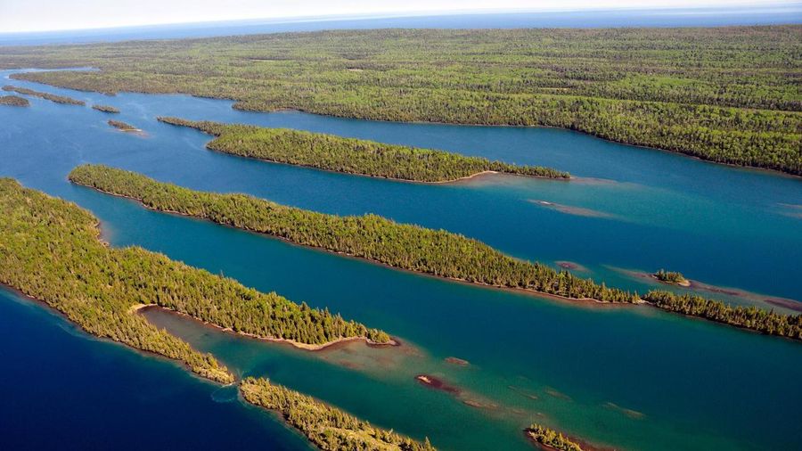
An island wilderness sitting in Lake Superior near the Canadian border, Isle Royale National Park closes entirely during winter months. It remains accessible only by boat or seaplane throughout its short operating season. Established in 1940, the park has become genuinely famous among wildlife biologists for hosting one of the longest continuously studied predator-prey relationships anywhere in the world, tracking wolves and moose across the isolated island ecosystem since 1958.
This isolation, which initially allowed both moose and later wolves to reach the island by crossing ice bridges from the mainland, has created a genuinely unique closed ecological system that researchers have studied continuously for more than six decades. Wolf populations on the island have fluctuated dramatically over the decades, at times nearly disappearing entirely before recent reintroduction efforts helped stabilize the population.
Hiking throughout Isle Royale’s considerable trail network rewards visitors with genuinely rugged, undeveloped wilderness scenery, and backcountry camping remains the primary way to experience the island beyond a brief day visit. The park’s remote location and limited ferry schedule mean visitors should plan trips considerably further in advance than for more accessible national parks.
Travelers $TRV should confirm current ferry or seaplane schedules directly before finalizing any Isle Royale trip, since service to the island varies considerably by season and weather conditions on Lake Superior can delay or cancel scheduled crossings. Visitors should pack layers regardless of the specific season, since Lake Superior’s considerable size genuinely moderates temperatures and can bring surprisingly cool conditions even during the height of summer. Rock Harbor and Windigo, the park’s two main entry points, each offer considerably different access depending on which specific Great Lakes port a traveler departs from to reach the island. A water filtration system also helps considerably for backcountry hikers relying on the island’s lakes and streams. A detailed trail map also helps considerably given how limited cell service genuinely stays throughout the island’s interior. A first-aid kit also helps considerably given how far the island’s interior trails genuinely sit from emergency medical services.
National Park Service, Deby Dixon / Wikimedia Commons
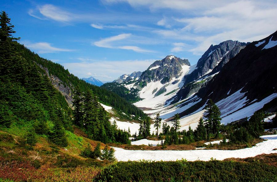
Despite sitting just a few hours from Seattle, North Cascades National Park ranks among the least-visited parks in the contiguous United States, holding more glaciers than any other park outside Alaska. Established in 1968, the park protects a genuinely dramatic landscape of jagged peaks, alpine lakes and old-growth forest throughout Washington’s northern Cascade Range.
The park’s considerable glacier count, more than 300 by some counts, reflects the region’s genuinely heavy winter snowfall and steep, high-elevation terrain that preserves ice throughout even the warmest summer months. Diablo Lake’s strikingly turquoise water, colored by glacial sediment known as rock flour, ranks among the park’s most photographed features, rewarding visitors who make the drive along the North Cascades Highway specifically for this view.
Unlike many national parks, North Cascades holds relatively few maintained roads penetrating its interior, meaning the vast majority of the park’s considerable acreage remains accessible only on foot. This limited road access helps explain the park’s low visitation numbers relative to its genuinely spectacular scenery, since casual visitors often overlook it in favor of more accessible parks elsewhere in the state.
Travelers $TRV should check current road conditions along the North Cascades Highway before visiting, since seasonal closures due to snow can genuinely limit access to certain parts of the park well into late spring. Travelers hoping to see the park’s glaciers up close should research specific trailheads leading toward them, since many require considerable elevation gain and genuine backcountry navigation skills to reach safely. The Stehekin Valley, accessible only by boat, floatplane, or a considerable hike, holds a small, genuinely remote community within the park’s boundaries, giving visitors an unusual glimpse of year-round wilderness living. A detailed topographic map also helps considerably given how limited cell service and trail signage genuinely are throughout the backcountry. Trekking poles also help considerably given how steep and uneven many of the park’s backcountry trails genuinely prove. A satellite messenger also helps considerably given how completely cell coverage disappears throughout much of the park’s rugged interior.
Credit: U.S. National Park Service
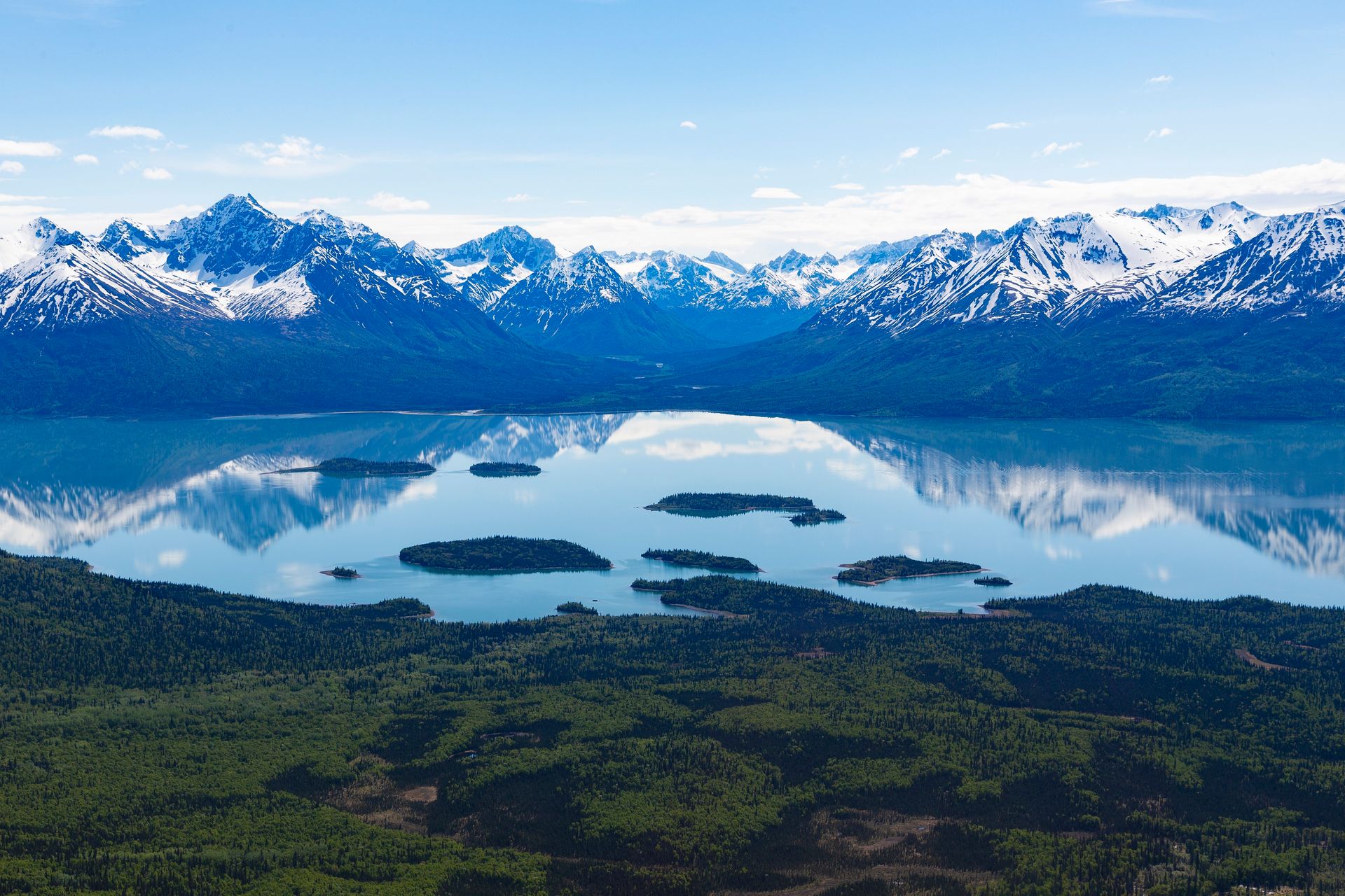
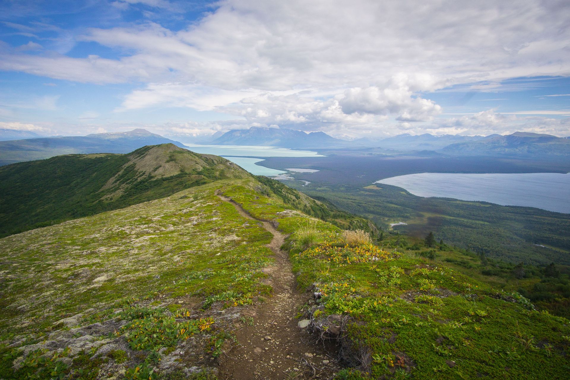
Southwest of Anchorage across Cook Inlet, Lake Clark National Park and Preserve protects a genuinely dramatic landscape of volcanoes, glaciers, turquoise lakes and considerable brown bear habitat throughout its Alaskan wilderness. Established in 1980, the park holds no road access whatsoever, requiring visitors to arrive exclusively by small plane or boat. This logistical barrier keeps annual visitation numbers genuinely low compared with more accessible parks.
The park’s active volcanoes, including Mount Redoubt and Mount Iliamna, occasionally send ash plumes visible from considerable distances, giving the landscape a genuinely dynamic, still-forming character. Brown bears throughout the park gather along coastal areas and salmon streams during specific seasonal runs, rewarding visitors who time a trip correctly with genuinely close wildlife viewing opportunities.
Lake Clark itself, the park’s namesake, stretches more than 40 miles through the surrounding mountains, its waters holding a genuinely striking turquoise color derived from glacial silt suspended throughout the lake. This considerable body of water also supports a significant sockeye salmon run that feeds directly into the broader Bristol Bay fishery, one of the most productive salmon fisheries found anywhere in the world.
Travelers $TRV should book bear-viewing excursions well in advance during peak salmon season specifically, since the limited number of authorized guides and lodges throughout the park fill up considerably faster than the park’s overall low visitation numbers might otherwise suggest. Travelers should confirm current weather conditions with their specific air taxi operator before departure, since Alaska’s notoriously unpredictable weather can delay flights into the park for days at a time. The park’s Twin Lakes area holds genuine historical significance as the former home of naturalist Richard Proenneke, whose decades spent living alone in the wilderness became the subject of considerable documentary attention. Bear spray also helps considerably given how frequently brown bears roam throughout the park’s coastal and inland habitats. A reliable rain jacket also helps considerably given how quickly weather genuinely shifts throughout coastal Alaska.
Credit: U.S. National Park Service
Home to the famous Brooks Falls bear cams that draw millions of online viewers each summer, Katmai National Park and Preserve protects a genuinely dramatic volcanic landscape shaped by the massive 1912 eruption of Novarupta, one of the largest volcanic eruptions of the twentieth century. Established in 1980, though first protected as a national monument back in 1918, the park holds the Valley of Ten Thousand Smokes, a still-visible testament to that eruption’s considerable scale.
Brown bears gather at Brooks Falls each July specifically to catch salmon leaping upstream, creating one of the most reliably spectacular wildlife viewing opportunities found anywhere in North America. This particular phenomenon has made Katmai genuinely famous online despite the park’s remote location and the considerable cost and effort required actually to visit in person.
Like most Alaskan parks on this list, Katmai holds no road access connecting it to the state’s broader highway system, requiring visitors to arrive via floatplane from nearby communities such as King Salmon or Anchorage. This access barrier keeps in-person visitation numbers genuinely low relative to the park’s considerable online fame through its live-streamed bear cameras.
Travelers $TRV hoping to visit Brooks Falls in person during peak bear season should book lodging and permits considerably far in advance, since the park strictly limits daily visitor numbers at this specific viewing location to protect both bears and people. Travelers should complete the park’s mandatory bear safety orientation before hiking near Brooks Falls, since rangers require this briefing for every visitor before allowing access to the viewing platforms. The Valley of Ten Thousand Smokes still releases visible steam from numerous fumaroles more than a century after the Novarupta eruption, giving hikers a genuinely otherworldly volcanic landscape to explore on foot. Waterproof boots also help considerably given how muddy the trail to Brooks Falls genuinely gets during the peak salmon run. A telephoto camera lens also helps considerably for photographing bears from the safe viewing distances rangers genuinely enforce.
Credit: U.S. National Park Service
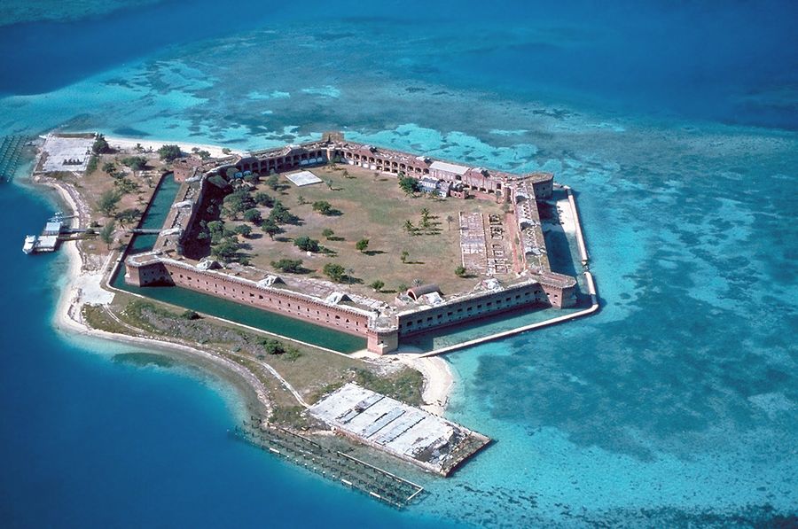
Roughly 70 miles west of Key West, Florida, Dry Tortugas National Park protects a cluster of remote islands and coral reefs surrounding the massive, unfinished Fort Jefferson, a nineteenth-century military fortification built directly on Garden Key. Established in 1992, the park remains accessible only by boat or seaplane, giving it a genuinely isolated character despite sitting within the considerably more developed Florida Keys region.
Fort Jefferson itself, construction of which began in 1846 and was never fully completed, ranks as one of the largest masonry structures ever built in the Western Hemisphere, giving visitors a genuinely striking historical landmark rising directly from the turquoise Caribbean waters surrounding it. The fort later served as a military prison, most notably holding Dr. Samuel Mudd, convicted for his role in treating John Wilkes Booth following the assassination of President Lincoln.
Snorkeling around the fort’s surrounding coral reefs rewards visitors with genuinely clear water and abundant marine life, including sea turtles and considerable numbers of tropical fish species throughout the protected waters. Camping on Garden Key gives especially dedicated visitors a chance to experience the park’s genuine isolation after the day-trip ferries and seaplanes depart for the evening.
Travelers $TRV should book ferry tickets to Dry Tortugas considerably far in advance, since the single daily ferry service holds genuinely limited capacity and sells out regularly during peak winter tourist season in the Florida Keys. Travelers hoping to camp overnight on Garden Key should reserve a specific campsite well in advance, since the island holds only a genuinely limited number of designated camping spots available to visitors. The fort’s considerable brick walls, built to withstand nineteenth-century artillery, now serve as habitat for nesting seabirds, including a significant sooty tern colony that returns to the fort each breeding season. Sun protection also matters considerably given how little natural shade exists across the park’s exposed coral islands. A reusable water bottle also helps considerably given how limited fresh water access genuinely is across the remote islands.
Credit: U.S. National Park Service
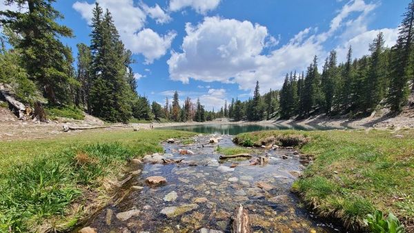
In eastern Nevada near the Utah border, Great Basin National Park protects Wheeler Peak, extensive limestone caves and groves of ancient bristlecone pines, some among the oldest living organisms found anywhere on Earth. Established in 1986, the park’s considerable remoteness from any major metropolitan area helps explain its persistently low visitation numbers despite genuinely spectacular high-desert scenery.
The park’s bristlecone pines, some more than 4,000 years old, grow at high elevation along Wheeler Peak’s exposed ridgelines, their gnarled, weathered form reflecting millennia of harsh mountain weather throughout their considerable lifespans. Lehman Caves, a system of marble caverns beneath the park, rewards visitors with guided tours showcasing formations that took thousands of years to develop underground.
Great Basin’s considerable distance from major cities and light pollution has also made it a genuinely renowned destination for stargazing, with the park hosting regular astronomy programs specifically taking advantage of its exceptionally night skies. This pairing of ancient trees, underground caverns, and pristine night skies gives Great Basin genuine range for travelers interested in multiple distinct natural phenomena within a single park.
Travelers $TRV should check current road conditions before attempting to reach Wheeler Peak specifically, since snow can close the summit road well into early summer depending on that particular year’s winter snowfall. Travelers hoping to tour Lehman Caves specifically should book tickets in advance during peak summer season, since the cave system limits group sizes and popular tour times can genuinely sell out. The park earned International Dark Sky Park designation for its exceptional night skies, reflecting genuinely minimal light pollution found throughout this remote stretch of eastern Nevada. Warm layers also help considerably for stargazing programs, since desert nights can turn genuinely cold even after warm summer days. A flashlight also helps considerably for navigating Lehman Caves and any evening stargazing programs throughout the park. Warm gloves also help considerably for evening astronomy programs, since temperatures genuinely drop fast once the desert sun fully sets.
Credit: U.S. National Park Service
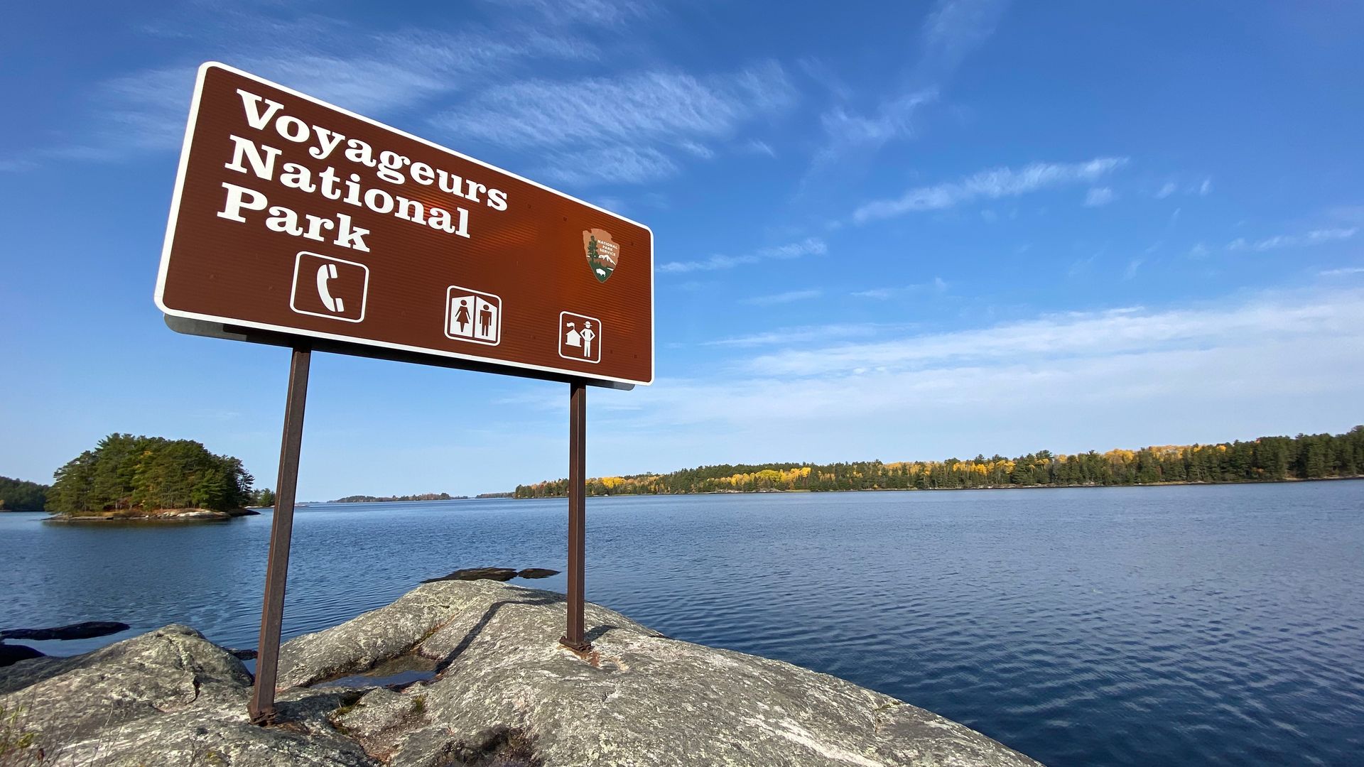
Along the Minnesota-Canada border, Voyageurs National Park protects a landscape defined almost entirely by water, with four major lakes and countless smaller waterways making boat travel essential for accessing most of the park’s interior. Established in 1975, the park takes its name from the French-Canadian fur traders who once paddled these same waterways centuries ago, connecting the region’s Indigenous trade routes to the broader North American fur trade.
Unlike many national parks built around hiking and driving, Voyageurs requires visitors to genuinely embrace water-based travel, whether by canoe, kayak or motorboat, to reach the majority of the park’s considerable acreage. This water-centric design keeps visitation numbers genuinely lower than land-based parks of comparable size, since the logistical barrier of arranging watercraft deters casual visitors who might otherwise stop by a more accessible destination.
The park’s dark skies have earned genuine recognition for exceptional aurora borealis viewing during winter months, when the northern lights occasionally dance directly above the frozen lake surfaces. Winter visitors can also explore the park via snowmobile or cross-country ski trails, giving Voyageurs a genuinely different character depending on the specific season chosen for a visit.
Travelers $TRV without their own boat should book a guided tour or water taxi well in advance during peak summer season, since the limited number of authorized outfitters throughout the park can fill their available slots considerably faster than travelers accustomed to more developed parks might expect. Travelers unfamiliar with the park’s specific waterways should hire a local guide for a first visit, since navigating between the park’s four major lakes without prior experience can genuinely prove disorienting. The park’s Kabetogama Peninsula has no roads, meaning visitors exploring this section must travel entirely by water or on foot along the peninsula’s limited trail network. A personal flotation device also matters considerably given how much of a typical visit genuinely takes place directly on the water. Waterproof storage bags also help protect gear during longer canoe or kayak trips between the park’s lakes.