Credit: Swiss National Park
Europe packs an extraordinary range of landscapes into a relatively compact continent, and its many national parks capture nearly all of that range within protected boundaries built specifically to preserve it for future generations of visitors. A single summer trip could easily carry a visitor from glacier-capped Alpine peaks to volcanic moonscapes to boreal forest so quiet that rushing water becomes the only sound for miles, all without leaving the continent or even needing more than a handful of flights and train rides to connect the dots. Few regions anywhere on Earth offer this much ecological and geological diversity within such manageable travel distances, and fewer still protect that diversity across so many individually distinct national parks.
Summer specifically transforms these parks in ways that matter for planning a visit, since snow clears from high mountain passes, wildlife becomes more active and visible, and marked trails that stay buried under snow for much of the year finally become passable on foot. Marmots, ibex, golden eagles, brown bears, and wild horses all become easier to spot once the warmer months arrive, and glacier hikes, river rafting trips, and multi-day treks that would be dangerous or simply impossible in winter open up across the continent. Choosing among these parks comes down to matching a specific kind of landscape and activity level to what a traveler actually wants from a summer outdoors, since wildlife tours, remote solo hikes, and geological sightseeing all demand very different approaches once a visitor arrives, and packing for one kind of trip rarely prepares a visitor for another.
The 10 parks below appear in Lonely Planet and cover standout national parks recommended across the Alps, Scandinavia, Finland, Germany, France, Portugal, and Italy, each offering a genuinely different kind of memorable summer outdoor experience.
1 / 10
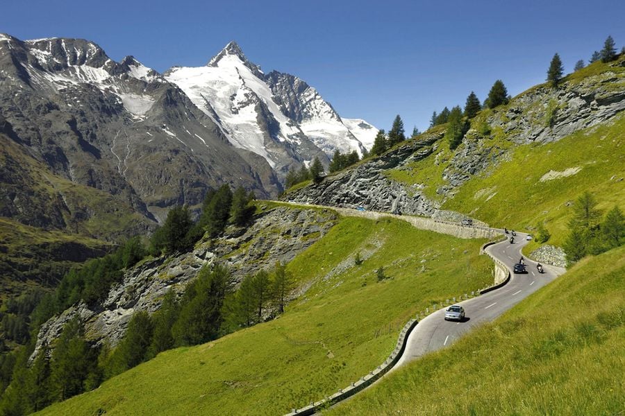
Hohe Tauern National Park spans 1,856 square kilometers, or 717 square miles, across the Austrian states of Tyrol, Carinthia, and Salzburgerland, making it one of Europe’s largest nature reserves and a genuine showcase of the Alps at their most dramatic. Grossglockner, Austria’s highest peak at 3,798 meters, or 12,461 feet, caps the park’s skyline, while the surrounding terrain climbs past 3,000 meters, or 9,843 feet, in dozens of other snow-capped summits scattered across the reserve.
The park’s superlatives extend well beyond its highest point. The Pasterze glacier stretches 8.4 kilometers, or 5.2 miles, making it the longest glacier in the Eastern Alps, while the Krimmler Wasserfälle plunges 380 meters, or 1,247 feet, earning its status as Austria’s highest waterfall. Mist rising from the falls regularly catches sunlight, producing visible rainbows that add a genuinely photogenic bonus to an already impressive natural landmark.
Wildlife draws just as many visitors to Hohe Tauern as the scenery itself. Marmots, chamois, ibex, golden eagles, and bearded vultures all live within the park’s boundaries, and ranger-led tours or self-guided hikes along the park’s trail network give visitors a real chance at spotting several species in a single outing. Visitors who prioritize wildlife over scenery alone should specifically seek out these guided options, since rangers know exactly where recent sightings have clustered, information rarely available to visitors exploring entirely on their own.
Driving the Grossglockner High Alpine Road ranks among the park’s signature experiences, connecting Bruck in Salzburgerland to Heiligenblut in Carinthia across 48 kilometers, or 30 miles, of hairpin turns with an average gradient of 9%. The road demands a driver’s full attention through its tightest bends, but the payoff comes in the form of constant, shifting views of the surrounding peaks that a passenger in any other seat gets to enjoy without worrying about the road at all, making the drive itself a shared experience for everyone in the car.
2 / 10
Credit: Jotunheimen National Park
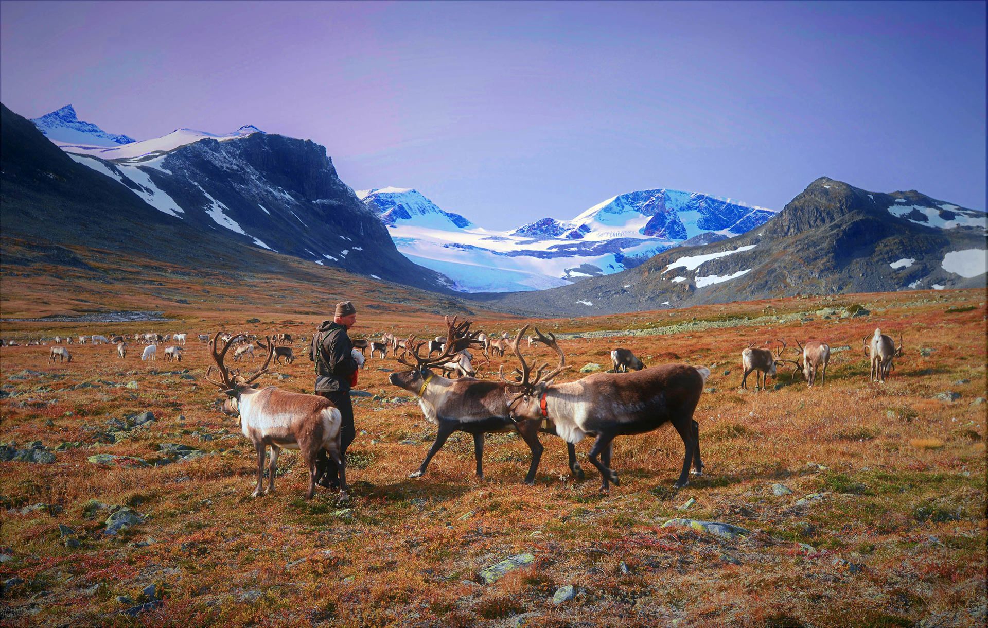
Jotunheimen, whose name translates to “Home of Giants,” covers 1,151 square kilometers, or 444 square miles, in southern Norway, and the park lives up to its name with a landscape defined by glaciers, piercing blue lakes, and dark, jagged mountains. Norway’s two highest peaks both rise within the park’s boundaries, Galdhøpiggen at 2,469 meters, or 8,100 feet, and Glittertind at 2,452 meters, or 8,045 feet, giving serious hikers two genuine summit challenges within the same protected area. Few national parks anywhere let visitors attempt a country’s two tallest mountains during the same trip.
Wildlife thins out considerably the deeper a visitor travels into the park’s quieter reaches, but reindeer, elk, mink, and wolverines all inhabit these remoter zones for patient visitors willing to search. Fifty marked hiking trails make the park considerably more accessible than its wild reputation might suggest, giving both casual day hikers and serious backcountry trekkers clearly defined routes to follow through otherwise untamed terrain, without needing advanced navigation skills just to stay on course.
Beyond standard hiking, Jotunheimen offers via ferrata routes equipped with permanent cables and ladders for climbers seeking vertical challenges, along with river rafting and horseback riding through the park’s more dramatic landscapes. This range of activity options means a single trip to the park can combine multiple types of adventure, rather than limiting visitors to hiking alone, giving even a short stay a genuinely varied itinerary.
Besseggen ridge stands out as one of Norway’s most celebrated hikes, and the ascents of Falketind and Galdhøpiggen both deliver views serious enough to justify the physical effort required to reach them. Visitors attempting any of these routes should come prepared for genuinely demanding terrain, since Jotunheimen’s reputation for difficulty applies just as much to its marked trails as to its unmarked backcountry, and underestimating any of these hikes can turn a scenic day out into a genuinely dangerous situation.
3 / 10
Credit: Switzerland Tourism
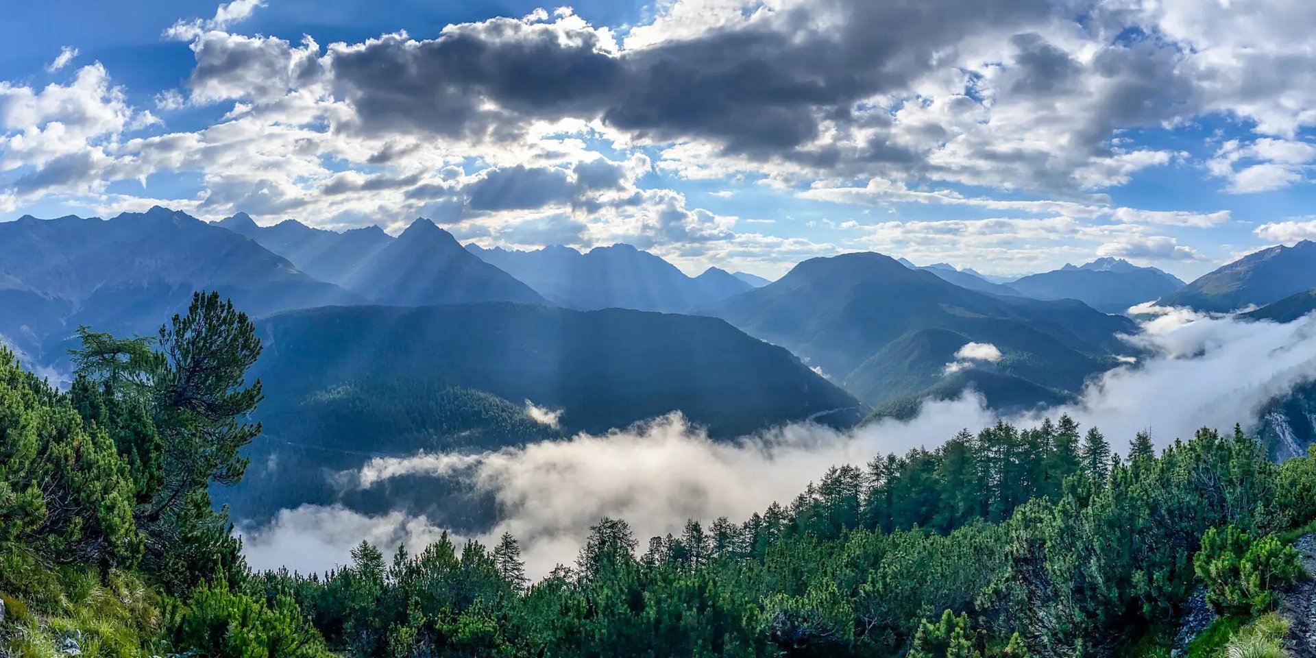
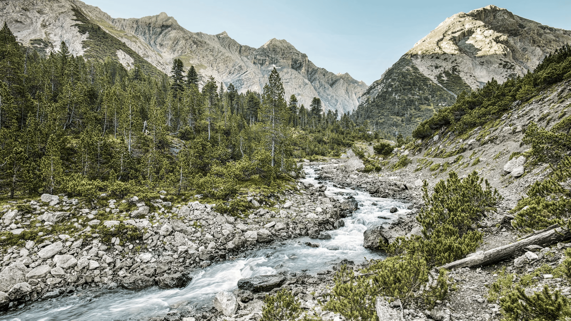
Switzerland maintains only a single national park, and the fact that the country chose to concentrate its conservation efforts entirely into one 172-square-kilometer, or 66-square-mile, reserve in Graubünden’s Lower Engadin valley speaks to how seriously the Swiss National Park takes its mission. Bordering Italy, the park delivers glacier-frosted peaks, rushing streams, pastures, and high moors dotted with jewel-colored lakes, offering a preview of what the Alps looked like before tourism reshaped so much of the surrounding region. This singular focus has allowed Switzerland to concentrate its conservation resources rather than spread them thin across multiple smaller reserves.
Founded in 1914, the park has operated under a strict hands-off policy ever since, with no trees felled, no meadows cut, and no animals hunted across more than a century of continuous protection. This level of non-intervention has let the landscape develop entirely on its own terms, producing an ecosystem that feels noticeably wilder than more actively managed parks elsewhere in the Alps.
Guided ranger walks give visitors the best chance of spotting the park’s signature wildlife, including ibex, chamois, golden eagles, and bearded vultures, as well as elusive alpine flowers such as edelweiss growing in the park’s higher meadows. Visitors hoping to see the rarer species should prioritize these guided walks over solo hiking, since rangers track sighting patterns that casual visitors cannot anticipate, and local knowledge often makes the difference between a fleeting glimpse and a genuine sighting.
The Lakes of Macun hike stands out as the park’s essential single-day trek for visitors with limited time. Starting in Zernez, this 21-kilometer, or 13-mile, day hike climbs to a 2,600-meter, or 8,530-foot, alpine plateau scattered with 23 lakes that shift between turquoise, topaz, and sapphire depending on the angle of the sunlight, making it one of the most visually rewarding single hikes available anywhere in the park, and arguably in the wider Alps region as a whole.
4 / 10
Nicolas Messifet / Unsplash
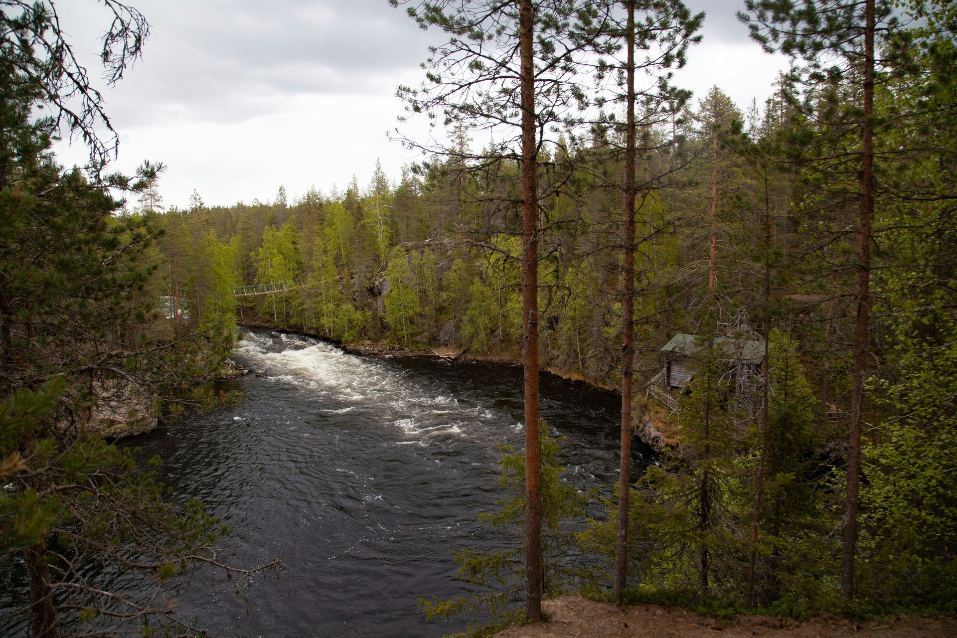
Oulanka National Park sits along Finland’s little-visited eastern border with Russia, stretching from the Koillismaa region up into Lapland, and delivers a level of quiet that visitors from more crowded parks rarely experience. This territory belonged to the Sámi people until the 17th century, and something of that nomadic, deeply connected relationship with the land still shapes how the park feels to visitors today, from the absence of heavy infrastructure to the general sense that the land remains only lightly touched by outside development.
Rivers and rapids cut through fells, cliffs, gorges, moors, swamps, and dense boreal forest packed with pine, birch, and spruce, and the sound of rushing water often becomes the only noise a hiker, cyclist, canoeist, or rafter hears for extended stretches of a visit. This near-total silence, broken only by water, gives Oulanka an atmosphere genuinely different from that of busier parks further south in Europe, where crowds and infrastructure noise rarely disappear entirely, even in the quietest corners of those more-visited reserves.
Brown bears, moose, reindeer, lynx, and wolverine all live within the park, though their elusiveness means visitors should bring binoculars and temper their expectations, since sightings depend heavily on luck rather than guaranteed encounters. Patient visitors who spend multiple days in the park’s quieter zones improve their odds considerably compared with those passing through on a single short visit, since repeated time in the same territory increases the chances of a genuine encounter.
The Karhunkierros, or Bear’s Ring, trail delivers the park’s most immersive experience for visitors with the time to commit. Running 82 kilometers, or 51 miles, from Hautajärvi to Rukatunturi fell across three to four days, the trail passes through the steep-sided Oulanka Canyon and past the crashing Jyrävä falls, giving multi-day trekkers a genuine sense of the park’s wildest terrain that day-trippers sticking to shorter loops simply never get to experience firsthand, no matter how early they start their walk.
5 / 10
Hajott59 / Wikimedia Commons (CC BY-SA 3.0)
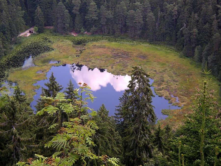
Black Forest National Park covers a modest 100 square kilometers, or 39 square miles, in Germany’s southwestern corner, but its glacier-scoured valleys, heather-covered moors, glassy lakes, and dense fir forests pack an outsized fairy-tale atmosphere into that relatively compact footprint. Visitors hiking or cycling through the park often find themselves genuinely alone with drumming woodpeckers and calling cuckoos, a fitting soundtrack given that the surrounding region claims the title of birthplace of the cuckoo clock, a piece of local heritage that adds an extra layer of storybook charm to an already atmospheric landscape.
The park’s smaller scale compared with Alpine giants elsewhere on this list makes it considerably more approachable for visitors without extensive backcountry experience or multiple days to dedicate to a single hike. Deer occasionally dart across trails, adding a fleeting wildlife encounter to what already feels like a landscape pulled directly from a Grimm brothers story, dark fir trees and all, and the manageable size means even a short weekend visit can cover a meaningful portion of the park.
The national park center at Ruhestein serves as the essential starting point for visitors unfamiliar with the trail network, offering maps and up-to-date information on trail conditions and recent wildlife activity. Visitors who skip this stop often miss trail options that aren’t obvious on standard hiking maps available online before a trip, and on-site staff can often suggest routes tailored to a visitor’s specific fitness level and time constraints.
Driving the B500 Schwarzwaldhochstrasse, or Black Forest Highway, connects the elegant spa town of Baden-Baden to Freudenstadt and ranks among the park’s most rewarding self-guided experiences for visitors without time for a full day of hiking. Stopping at the glacial cirque lake of Mummelsee along the route and hiking up to Hornisgrinde afterward rewards visitors with sweeping views across the forest that capture the entire park’s fairy-tale character in a single vista, making the drive a practical option for those with limited time.
6 / 10
Nuno Alves / Wikimedia Commons (CC BY-SA 4.0)
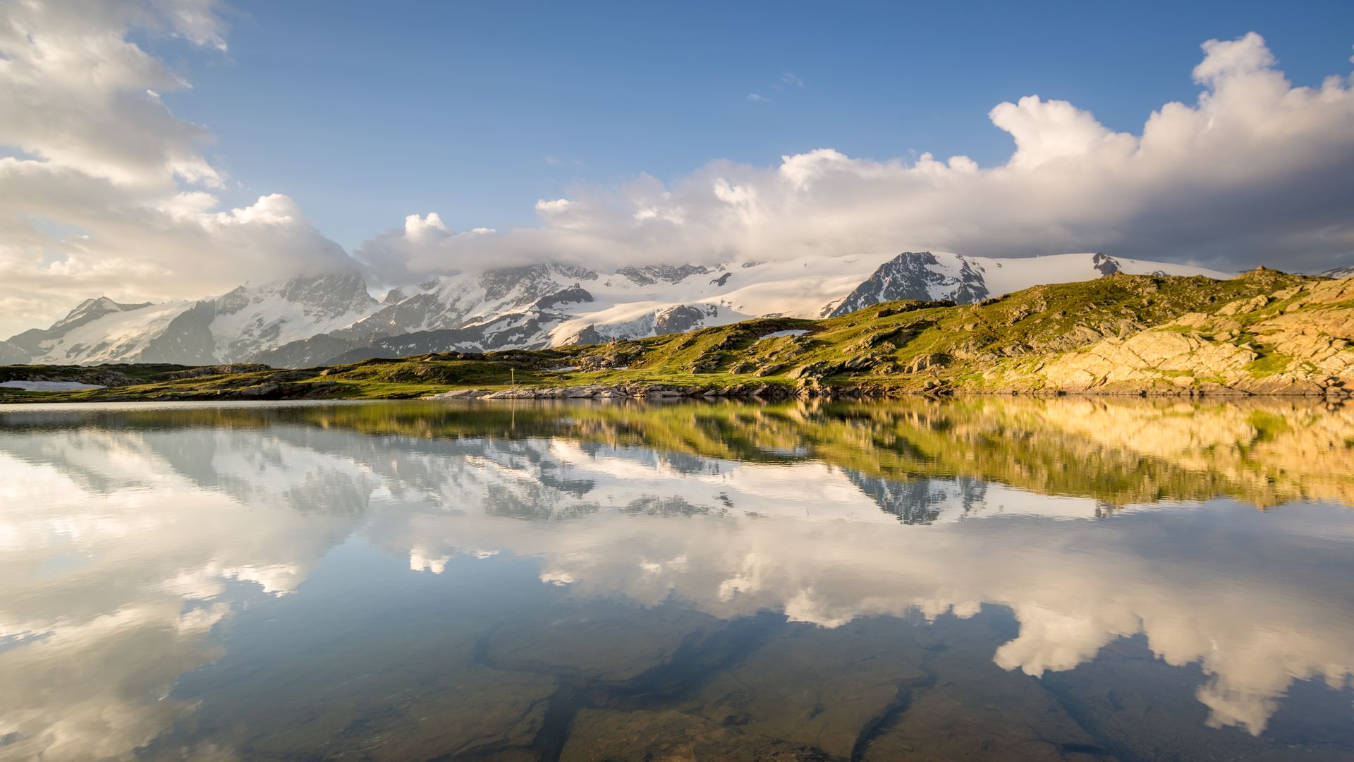
Parc National des Écrins ranks as France’s second-largest national park at 918 square kilometers, or 354 square miles, and represents the French Alps at their most genuinely untamed, with glacier-carved forests, alpine meadows, crystal-blue lakes, and peaks that repeatedly punch past 4,000 meters, or 13,123 feet. Barre des Écrins, the park’s highest point at 4,102 meters (13,458 feet), anchors a landscape shaped by glaciers that are still actively carving the terrain today, a reminder that the park’s dramatic scenery remains a work in progress rather than a fixed, finished landscape.
More than 740 kilometers, or 460 miles, of trails wind through the park, giving hikers enough route variety to return repeatedly without ever repeating the same path twice. Local shepherds have walked many of these routes for centuries, and the trails are at their best between mid-June and mid-September, when snow has cleared enough to make the higher passes safe for hikers without specialized winter mountaineering equipment.
Dormillouse stands as the park’s only inhabited hamlet, an isolated pocket of permanent human presence surrounded by otherwise uninhabited wilderness, while mountaintop refuges scattered throughout the park let ambitious hikers string together long-distance treks spanning multiple days without needing to descend to a town each night, extending what would otherwise be a single-day hike into a genuine multi-day expedition through the high country.
Several standout hikes give experienced visitors a genuine test of skill and endurance. The Glacier Blanc route and the high-altitude hike from Dormillouse both push hikers into serious alpine terrain, while a technical climb to the glaciated summit of Barre des Écrins demands real mountaineering experience instead of standard hiking fitness. For visitors seeking a gentler introduction to the park’s biodiversity, the five-hour Grande Cabane trail into the Fournel valley offers a more manageable alternative that still captures much of what makes the park special, without requiring the technical skills the higher summit routes genuinely demand.
7 / 10
Michael Rodrigues / Unsplash
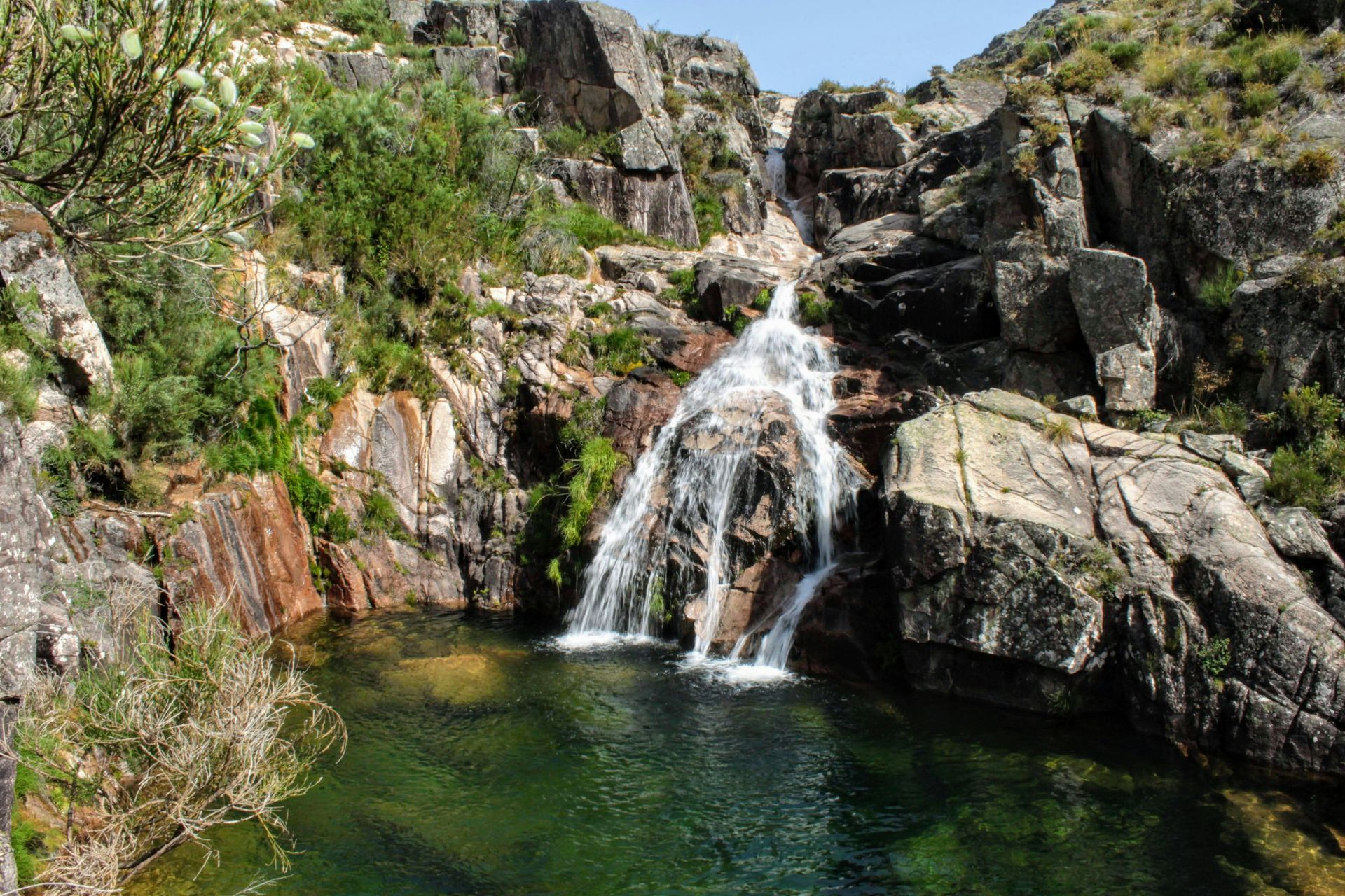
Parque Nacional da Peneda-Gerês covers 703 square kilometers, or 271 square miles, in Portugal’s far northern reaches, and delivers exactly the kind of off-grid isolation that draws visitors specifically looking to disappear from civilization for a stretch. Granite mountains tower above oak and pine forests, mountain streams carve through valleys, and espigueiros, granaries built on stilts, perch on hillsides overlooking terraced fields in a landscape that feels genuinely removed from modern life, a quality that becomes more apparent the deeper a visitor travels into the park’s interior.
Ibex, deer, wild horses, and Iberian wolves all find ample hiding places within this relatively undisturbed terrain, and the park’s northern reaches, accessed through the Lamas de Mouro gateway, see noticeably fewer visitors than the more accessible southern sections. Travelers $TRV hoping for the deepest possible sense of solitude should target this northern approach rather than the busier entry points near major towns, since crowd levels drop noticeably the farther a visitor travels from the main tourist gateways.
Hiking opportunities span glacially eroded mountains that roll into wildflower prairies, waterfalls dropping into deep ravines, and open savannah where wild horses graze freely without fencing or obvious human management. This mix of terrain types within a single park gives hikers genuine variety across even a short multi-day visit, moving from forest to open grassland without needing to leave the park’s boundaries or arrange transport between separate protected areas.
Peneda itself, with its domed peak, pilgrimage church, and ruined Moorish castle, makes an excellent base for tackling the Trilho Castrejo, a 17-kilometer, or 11-mile, seven-hour loop that follows some of the park’s oldest footpaths. Visitors who base themselves in Peneda specifically for this hike get both a historically rich starting point and direct access to one of the park’s most rewarding full-day routes, combining cultural sightseeing with genuine physical exertion in a single well-planned stay that few other bases in the park can match.
8 / 10
Credit: Jostedalsbreen National Park
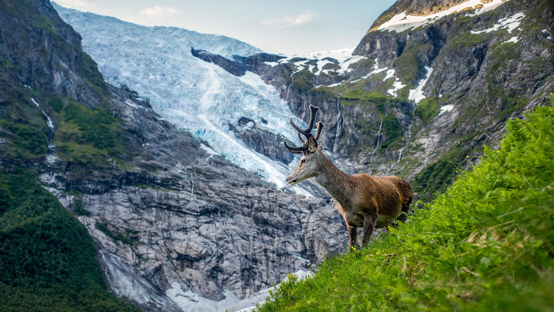
Jostedalsbreen National Park, in Norway’s Western Fjords, centers entirely on the Jostedalsbreen glacier itself, a 60-kilometer (37-mile) sweep of ice that holds the title of the largest ice cap in mainland Europe. The glacier’s sheer scale draws visitors regardless of whether they plan to simply admire it from a distance or attempt to hike across its surface with proper equipment and guidance, and the ice cap remains visually striking from nearly any vantage point within the surrounding park, whether viewed from a valley floor or a distant ridge line above the tree cover.
This vast ice sheet separates two of the world’s longest fjords, the Sognefjord and the Nordfjord, and the shapely peaks and ice-blue waters surrounding both fjords add dramatic scenery to what would already be an impressive glacial landscape on its own. Most first-time visitors head straight for Briksdalsbreen, an arm of the main glacier reachable via a five-kilometer (three-mile) hike through the valley that offers an accessible introduction to the ice cap without requiring technical glacier-travel experience, making it a practical choice for families and casual hikers alike.
Visitors willing to venture beyond the park’s most obvious attraction find considerably quieter alternatives nearby. Kjenndalsbreen, another arm of the same glacier, draws a fraction of Briksdalsbreen’s crowds while offering comparably impressive views, making it the better choice for visitors who prioritize solitude over convenience and don’t mind a slightly longer journey to reach a quieter stretch of ice.
Lovatnet, the turquoise lake nestled beneath surrounding peaks near Kjenndalsbreen, rounds out the area with opportunities for kayaking, boating, canoeing, and lakeside picnicking. Visitors who dedicate a full day to this quieter corner of the park often come away with a more memorable experience than those who stick exclusively to the more famous glacier arm closer to the main visitor facilities, since the added effort tends to filter out the largest crowds entirely, leaving a noticeably calmer setting for anyone willing to make the trip.
9 / 10
Credit: Dolomiti Bellunesi
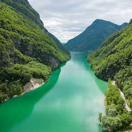
Parco Nazionale delle Dolomiti Bellunesi turns geology into a genuine spectacle, with grass-carpeted valleys giving way suddenly to a jagged line of pale, almost luminescent mountains that rise like a fortified wall above the surrounding pastures. The dramatic contrast between soft valley curves and sudden vertical rock faces defines the park’s visual identity, and that contrast becomes more striking the longer a visitor moves between the two types of terrain, since neither the valleys nor the peaks alone would carry the same impact in isolation.
Different consistencies and brittleness within the local rock have produced this dramatic erosion pattern over time, carving jagged formations, hollowing out wide valleys, and cutting corridor-narrow gorges through terrain that looks almost sculpted by intention rather than shaped by natural weathering alone. Each mountain prong within the park rises like an individual cathedral tower, giving the skyline an almost architectural quality despite being entirely the product of geological forces acting over an immense span of time.
Wildlife and plant life fill the spaces between these dramatic rock formations, with birds calling from bottle-green forests and streams cutting through the valley floors below the peaks. The park rewards visitors who take time to notice these quieter details alongside the more obvious dramatic scenery, since the contrast between gentle valley life and stark mountain geology forms much of what makes a visit memorable, and rushing past the smaller details risks missing half of what makes the park worth visiting.
The Alta Via 1 stands as the park’s signature hike, a demanding 125-kilometer (78-mile) route stretching from Dobbiaco to Belluno, with overnight stays at rifugi (mountain huts) perched at high altitudes along the way. Hikers who commit to the full route experience the park’s geological drama from multiple angles over several days, a far more complete picture than any single day hike could realistically provide, since the terrain shifts noticeably in character from one stage of the route to the next.
10 / 10
Ingo Mehling / Wikimedia Commons (CC BY-SA 4.0)
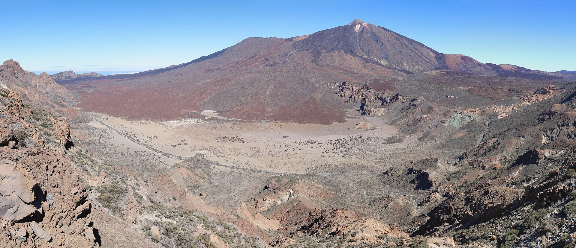
Parque Nacional del Teide centers on Pico del Teide, a 3,718-meter, or 12,198-foot, volcano that stands as Spain’s highest peak and one of Tenerife’s most significant natural landmarks. The volcano rises above a crater-blasted, rust-red landscape shaped entirely by past eruptions, giving the park a genuinely otherworldly appearance that sets it apart from the greener, more temperate parks found elsewhere on mainland Europe, and that contrast alone makes Teide worth visiting even for travelers who have already seen several other parks on this list.
Most visitors reach the summit area by cable car, though hikers willing to trek up on foot avoid the crowds that gather at the easier access point. Visitors who prefer not to attempt the summit at all still have plenty to explore, since easier walks along TF-21, the single road circling the base of the peak, wind past otherworldly volcanic terrain, including the bizarre rock formations at Roques de García, giving less adventurous visitors a genuine sense of the volcanic landscape without the physical demands of a summit attempt.
Stargazing sets Teide apart from virtually every other park on this list, and clear, moonless nights here rank among the best stargazing conditions anywhere in the northern hemisphere. Visitors can spot meteor showers, the Milky Way, and 83 of the 88 officially recognized constellations using nothing more than a simple pair of binoculars, without needing specialized equipment to appreciate the show unfolding overhead on a genuinely clear night.
Visitors seeking a deeper astronomical context beyond what the naked eye reveals can book a guided tour at Observatorio del Teide, where trained guides explain the science behind what visitors are actually looking at overhead. Combining a daytime hike through the volcanic landscape with an evening stargazing session gives visitors a genuinely complete sense of what makes Teide unique among Europe’s national parks, blending dramatic geology with an equally dramatic night sky that few other parks on this list can genuinely match.