
The 9 best places to visit in Greece in 2026
The best places to visit in Greece in 2026 range from ancient ruins and cliffside sunsets to quiet island beaches most travelers still overlook
Credit: Eleni Afiontzi / Unsplash
Greece rewards a traveler willing to look past the postcard shot. The country has more than 6,000 islands and islets, only around 200 of which are inhabited. Its mainland holds ruins, gorges, and fortress towns that get a fraction of the attention Santorini and Mykonos receive. Anyone searching for the best places to visit in Greece in 2026 will find the familiar names still worth it. They will also find a set of destinations that reward a bit more planning and a bit less crowding.
This list mixes both. Athens remains the logical starting point for its museums and its Acropolis. Santorini and Mykonos earn their reputations even as local authorities work to manage the volume of visitors arriving by cruise ship. Crete offers enough range in a single island, mountains, gorges, Minoan ruins, and beaches, to fill a two-week trip on its own. Meteora puts monasteries on top of rock towers in a way no photograph fully prepares you for.
The list also makes room for islands that get less coverage than they deserve. Naxos and Milos sit in the same island group as Santorini and Mykonos but move at a slower pace and cost less. The Peloponnese, anchored here by Nafplio, holds some of the oldest and best preserved ruins in the country. That includes a theater still used for live performances more than 2,300 years after it was built. Rhodes rounds out the list with a walled medieval old town that survived centuries of sieges.
None of these nine places require insider knowledge to reach. Ferries, budget flights, and a well developed tourism infrastructure connect nearly all of them from Athens in a matter of hours. What follows is a practical rundown of what makes each one worth the trip in 2026, and what a first-time visitor should know before booking.
Athens is the gateway to any Greek itinerary
Credit: Margo Evardson / Pexels
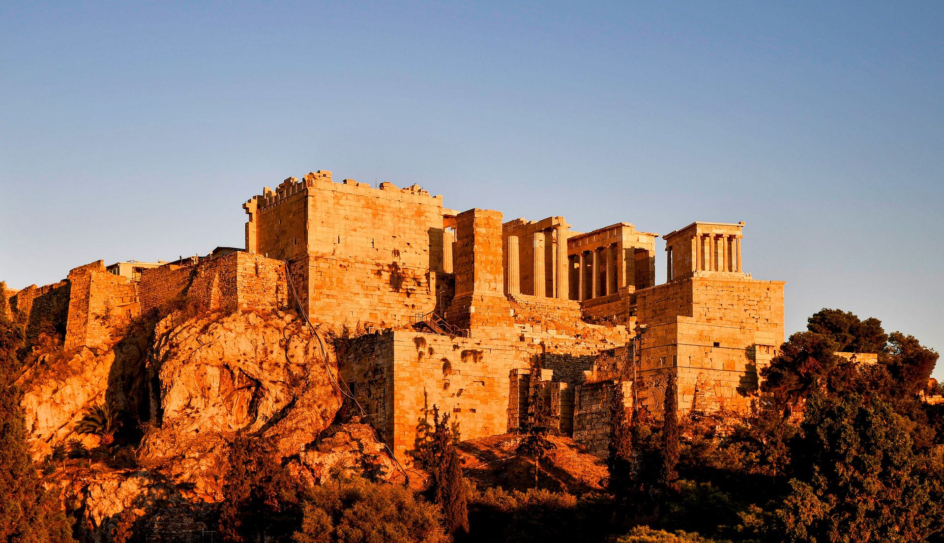
Athens is the practical starting point for almost any trip to Greece, and its Acropolis remains the country's single most recognizable landmark. The hilltop citadel holds the Parthenon, a temple to Athena completed in 438 BC under the statesman Pericles, along with the smaller Erechtheion and its six carved caryatid columns.
The Acropolis Museum, at the base of the hill, displays artifacts recovered from the site. That includes surviving sections of the Parthenon marbles that remained in Greece after other pieces were removed to the British Museum in the early 19th century. The museum's glass floors reveal an excavated ancient neighborhood beneath the building itself.
Plaka, the old neighborhood that wraps around the northern and eastern slopes of the Acropolis, has narrow pedestrian streets, neoclassical houses, and small tavernas. It sits within walking distance of the ancient Agora, the civic and commercial heart of classical Athens, where Socrates is said to have debated with fellow citizens.
Athens works well as a base because of its transport links rather than in spite of them. The city's international airport connects directly to most of Europe and to several U.S. and Asian cities, and the port of Piraeus, a short metro ride from the center, handles ferries to nearly every inhabited Greek island. A traveler can land in Athens in the morning and be on a boat to the Cyclades or the Saronic Gulf islands by afternoon.
Beyond the ancient sites, Athens has built out a substantial contemporary art and food scene over the past decade. The National Archaeological Museum holds one of the largest collections of Greek antiquities in the world. Neighborhoods like Psiri and Metaxourgeio have filled with restaurants and small galleries that did not exist a generation ago.
Summer temperatures in Athens regularly climb past 35 degrees Celsius. Visitors touring the Acropolis are better served arriving at opening time, generally 8 a.m., before both the heat and the tour groups build through the day. Spring and fall bring milder weather and shorter lines at the major sites. Hotel rates in those shoulder seasons run well below the peak summer months of July and August.
Santorini's caldera views come from an ancient eruption
Credit: AXP Photography / Pexels
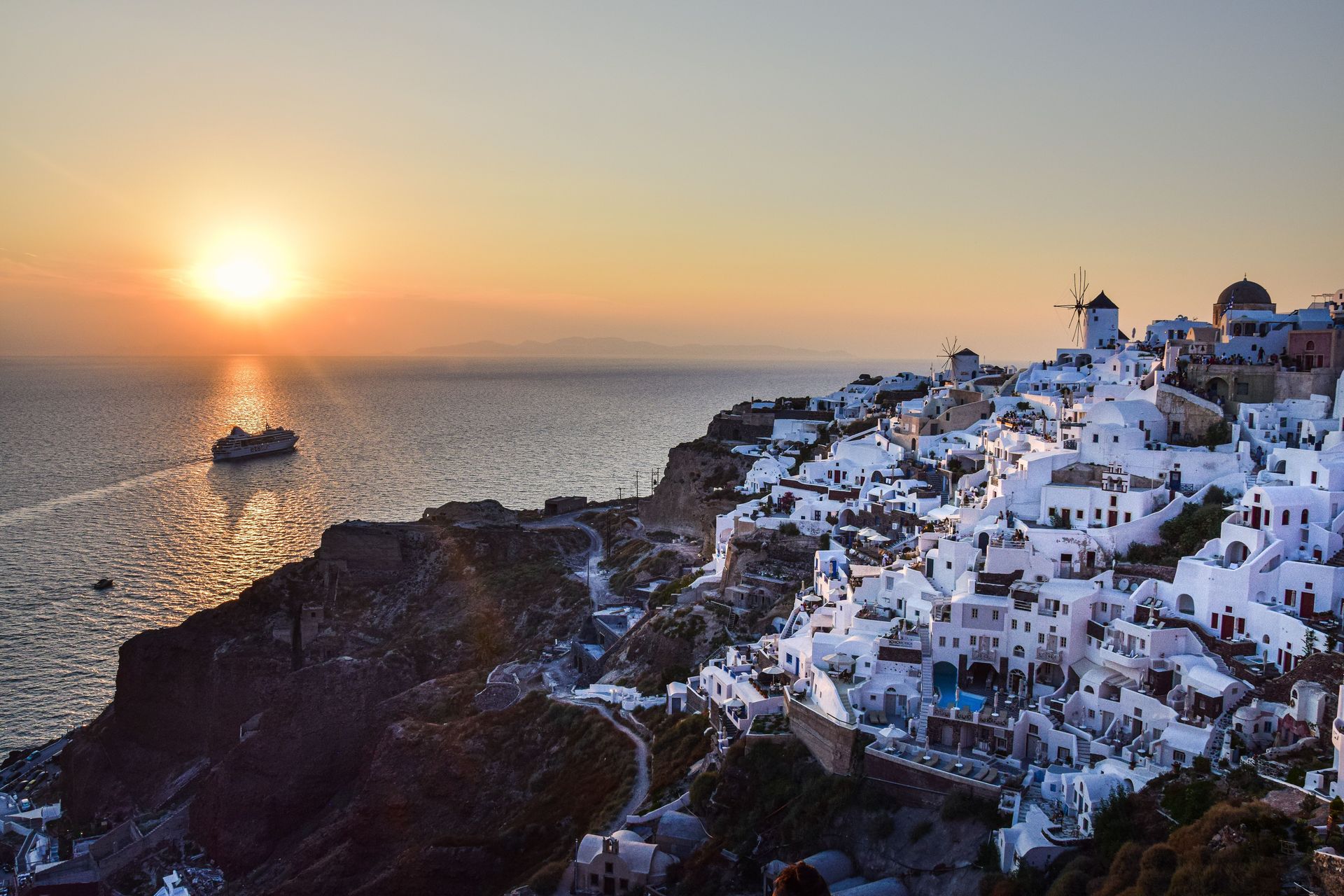
Santorini's caldera views exist because of a catastrophic volcanic eruption around 1600 BC. It collapsed the center of what was once a round island, leaving the crescent-shaped landmass and steep cliffs visitors photograph today. The villages of Oia and Fira sit directly on the rim of that collapsed caldera, which is why their whitewashed buildings appear to hang over open water.
Oia, at the island's northern tip, draws crowds specifically for sunset, when the sun drops behind the caldera and lights up the town's blue-domed churches. Fira, the island's capital, has a similar view with more restaurants, shops, and a cable car down to the old port. That cable car is an alternative to the 588 steps or the donkey ride some visitors still choose.
Akrotiri, on the island's southern coast, holds the ruins of a Bronze Age Minoan settlement buried by the same eruption that shaped the caldera. Archaeologists have nicknamed it the Minoan Pompeii, since ash preserved multi-story buildings, frescoes, and streets in enough detail to reconstruct daily life more than 3,000 years ago. The site is covered by a roof and walkway system that lets visitors walk through it.
Not every beach on Santorini is the white sand a first-time visitor might expect. The island's volcanic geology produced black sand at Perissa and Kamari and red sand at Red Beach, near Akrotiri, where iron-rich cliffs give the shoreline its color.
Santorini's popularity has created real strain. Local authorities have discussed and in some cases implemented caps on daily cruise ship arrivals. The move came after summer days brought more than 15,000 cruise passengers ashore at once, overwhelming the narrow streets of Fira and Oia. Visitors arriving by ferry or staying overnight generally encounter a calmer island than the midday cruise crowds suggest. Shoulder season months like May and October offer the same views with a fraction of the foot traffic.
Crete packs mountains, gorges, and ruins into one island
Credit: Eleni Afiontzi / Unsplash
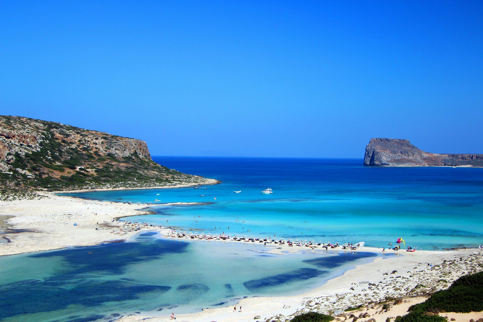
Crete is Greece's largest island and the only one on this list that can function as a complete trip by itself. It combines mountains, gorges, ancient ruins, and beaches across a landmass roughly 260 kilometers long. Visitors who treat it as a quick stopover typically end up choosing between regions rather than seeing what makes the island distinct.
The Samaria Gorge, in the White Mountains of western Crete, is one of the longer gorges in Europe at around 16 kilometers. Hiking its full length takes most visitors between five and seven hours. The trail is only open seasonally, typically from May through October, since winter rains and rockfall make it unsafe the rest of the year.
Chania, on the northwest coast, has a Venetian harbor lined with 14th-century buildings and a lighthouse the Venetians built and the Ottomans later rebuilt. Its old town of narrow streets mixes Venetian, Ottoman, and Cretan architecture in a way no other Greek city quite matches.
Knossos, just outside the city of Heraklion, holds the ruins of the largest Bronze Age Minoan palace complex on the island. The British archaeologist Arthur Evans excavated and partially reconstructed it in the early 1900s. The site is tied to the Greek myth of the Minotaur and the labyrinth. Its restored frescoes and columns give visitors a clearer picture of Minoan life than most other archaeological sites in Greece.
Elafonissi, on Crete's southwestern tip, is known for a shallow lagoon and a beach where crushed shell fragments give the sand a pink tint. The color is particularly visible after rain has cleared the surface. The area is protected under the European Union's Natura 2000 conservation network, which limits development around it.
Crete's size also means better value. Rental cars are inexpensive relative to the islands' other regions, and distances between major sites run 30 minutes to two hours by road. The island's agricultural economy also keeps restaurant prices for olive oil, cheese, and produce noticeably lower than in the Cyclades.
Meteora sets monasteries on top of rock pillars
Credit: Maarten van den Heuvel / Pexels
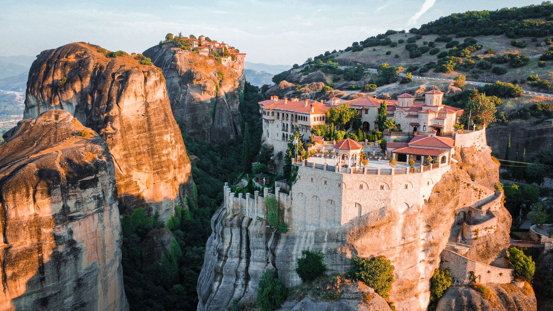
Meteora puts six active Eastern Orthodox monasteries on top of sandstone rock pillars in central Greece. UNESCO added the landscape to its World Heritage list in 1988 for both its geology and its architecture. The pillars themselves formed roughly 60 million years ago as a river delta eroded, leaving isolated columns of rock rising above the plain near the town of Kalambaka.
Monks began settling the caves and crevices of these pillars as early as the 11th century, seeking isolation for prayer, and organized monastic communities followed in the 14th century. The Great Meteoron, the largest and oldest of the surviving monasteries, was founded by a monk named Athanasios Koinovitis. Tradition holds that he reached the summit by ladder rather than by any built path.
Of the original 24 monasteries built into these rocks, only six remain active today, four inhabited by monks and two by nuns. Holy Trinity Monastery, one of the more dramatic of the six, appeared in the 1981 James Bond film "For Your Eyes Only." It remains one of the more strenuous to reach, requiring a climb of around 140 steps cut into the rock.
Visiting all six monasteries in a single day is possible but rushed. Most visitors choose two or three, since each charges a small entry fee and enforces a dress code: long pants for men and covered shoulders and knees for women. Wraps are available for rent at the entrance for anyone arriving unprepared.
Kalambaka and the smaller village of Kastraki, both at the base of the rock formations, serve as the practical places to stay. Kastraki sits closer to the walking paths between monasteries. The region connects to Athens by a direct train that takes around four and a half hours, and to Thessaloniki by a shorter rail and road trip. That makes Meteora reachable as a long day trip or a more relaxed overnight stay.
Sunset draws photographers to a handful of viewpoints along the ridge above Kastraki, where the rock pillars catch orange light without any monastery entrance fee required.
Mykonos pairs its nightlife with the ruins of Delos
Credit: ryo f / Pexels
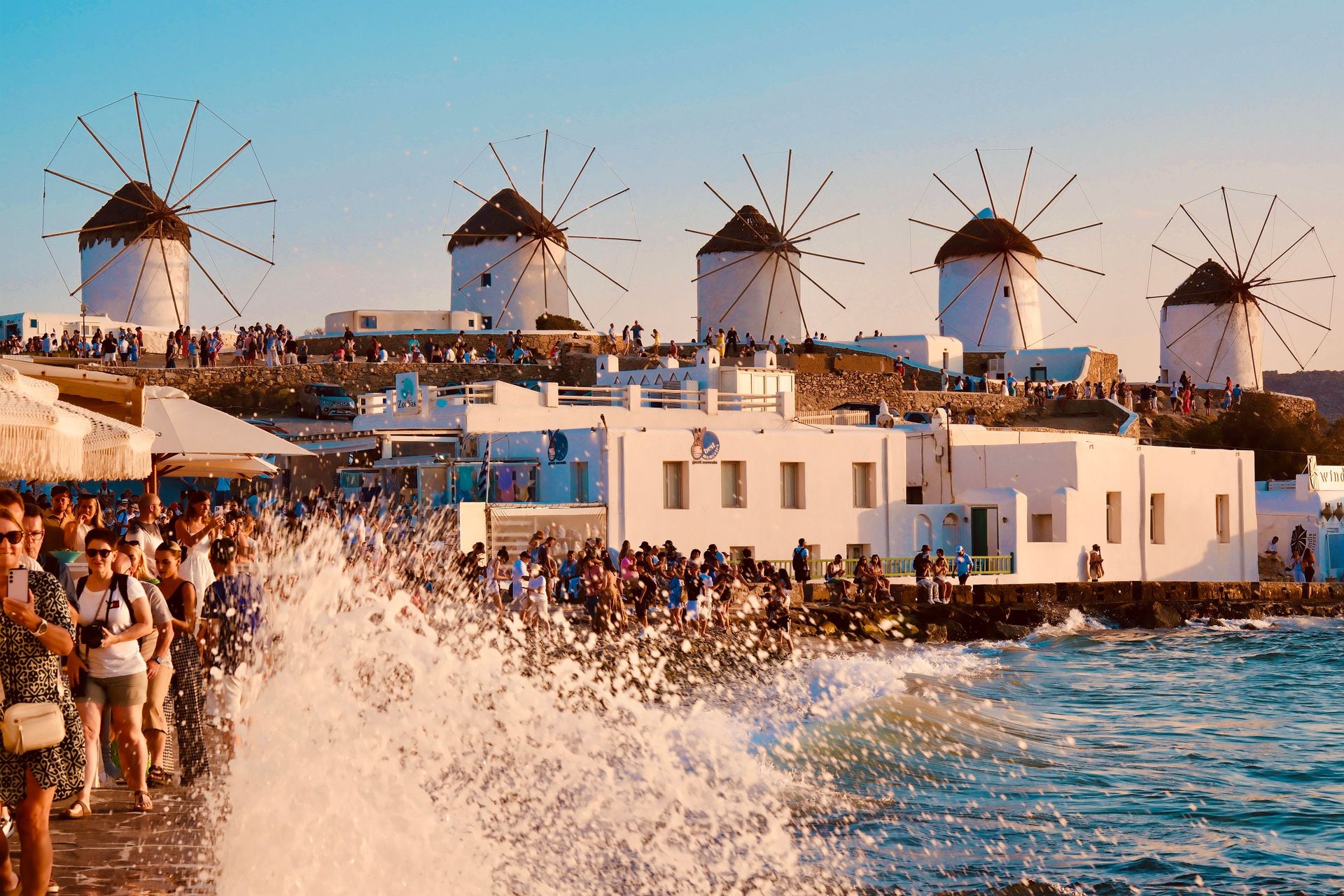
Mykonos built its reputation on nightlife and beach clubs, and that reputation remains largely accurate. The island also holds quieter architecture and easy access to one of the most significant archaeological sites in the Aegean. Chora, the main town, has a row of 16th-century windmills along its waterfront and a dense district known as Little Venice, where balconies extend directly over the water.
Paradise and Super Paradise, on the island's south coast, remain the two beaches most associated with Mykonos' club scene. Both have sunbed rentals, DJ sets that start in the afternoon, and prices that run higher than beaches on most other Greek islands. Visitors looking for a quieter shoreline generally head to the island's north coast, where wind and smaller crowds keep beaches like Fokos more subdued.
Delos, a short boat ride from Mykonos' old port, is an uninhabited island that ancient Greeks considered the mythological birthplace of the twin gods Apollo and Artemis. The site holds one of the most extensive archaeological excavations in Greece. That includes the Terrace of the Lions, a row of marble lion statues dating to around the 7th century BC. Delos has held UNESCO World Heritage status since 1990. No overnight stays are permitted on Delos, so visits are limited to day trips that typically run three to four hours.
Mykonos airport receives direct seasonal flights from several European cities in addition to connections through Athens. Ferries from Piraeus take anywhere from two and a half to five hours, depending on whether the boat is a high-speed catamaran or a conventional ferry.
Prices on Mykonos run higher across the board, for hotels, restaurants, and beach club entry, than on most other islands on this list. That is worth planning around rather than a surprise to discover on arrival. Late June through early September brings the highest prices and the largest crowds. May, early June, and October offer noticeably lower rates, with most restaurants and beach clubs still open.
Naxos offers Cycladic scenery without the Mykonos prices
Credit: George Bek / Pexels
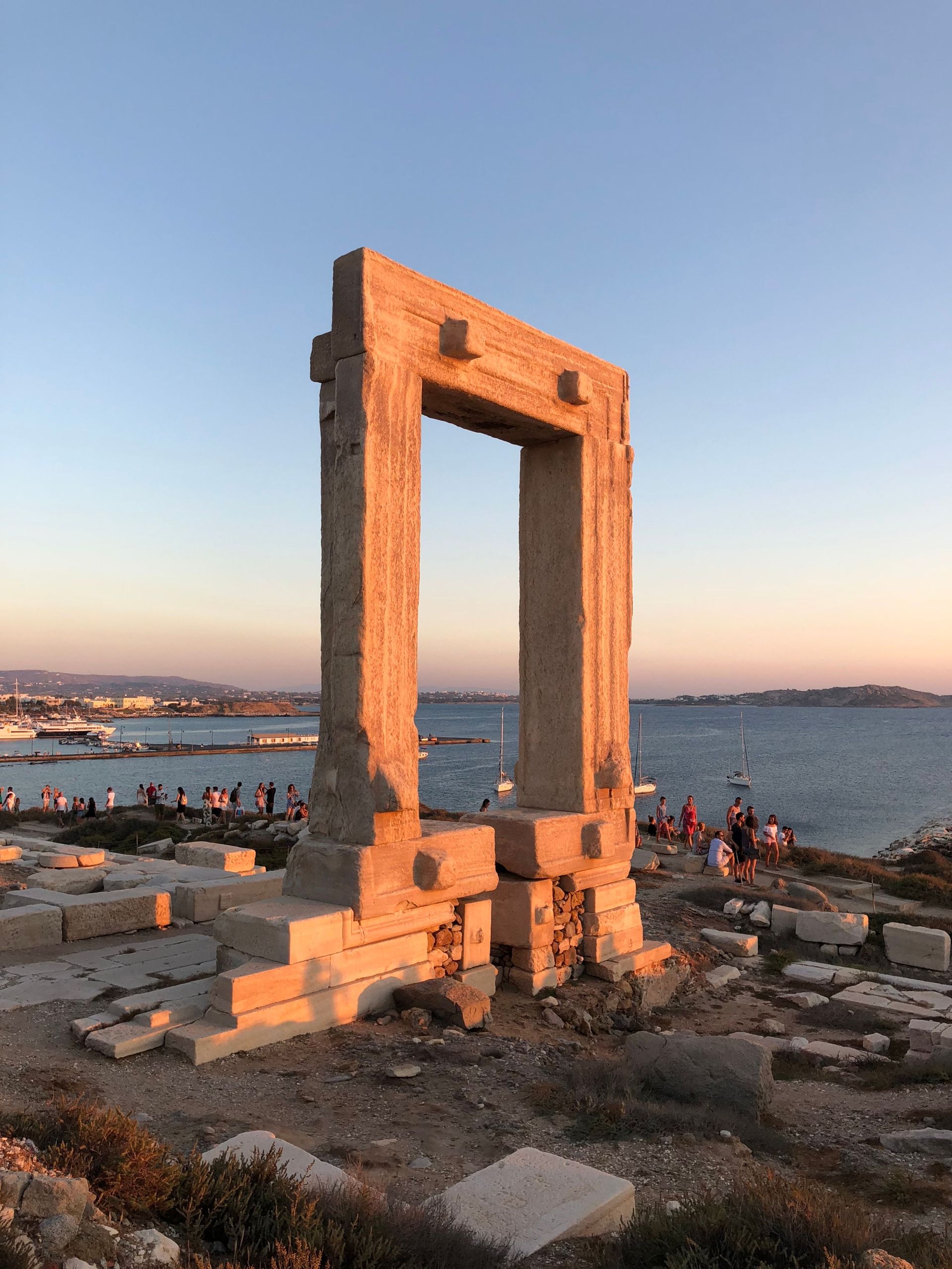
Naxos is the largest island in the Cyclades group, and it offers a version of the same whitewashed architecture and blue water as Santorini and Mykonos. It moves at a noticeably slower pace and lower cost. The island's most recognizable landmark, the Portara, is a massive marble doorway standing alone on an islet just off the harbor. It is the sole surviving piece of an unfinished 6th-century BC temple planned for the god Apollo.
Naxos Town, also called Chora, spreads up a hillside from the harbor into a Venetian-era kastro, or castle district. It was built in the 13th century when the island was under Venetian rule as the seat of the Duchy of the Archipelago. Narrow stone streets wind between houses built directly into the old fortress walls.
Inland, Naxos has more mountain villages than any other Cycladic island. They include Halki, once the island's commercial center and now known for a citrus liqueur called kitron. Apiranthos, a marble-built village higher in the mountains, has its own small archaeological and folklore museums.
The island's interior farmland, unusual for the generally dry Cyclades, supports potato and cheese production. Naxos potatoes in particular are sold and served across the rest of Greece as a recognized regional product. That agricultural base also means restaurant menus lean more heavily on local produce and less on imported goods than on islands with less farmland.
Naxos' beaches run along a long western coast, with Agios Prokopios and Agios Georgios closest to town and better for swimmers. Plaka and Mikri Vigla, further south, offer wider stretches of sand that also attract windsurfers and kitesurfers thanks to consistent summer winds.
Ferries reach Naxos from Piraeus in roughly three and a half to six hours depending on the vessel. The island also connects directly to Santorini and Mykonos, making it a practical addition to an existing Cyclades itinerary rather than a destination requiring a separate trip.
Nafplio anchors a Peloponnese loop through ancient ruins
Credit: Vasilis Karkalas / Pexels
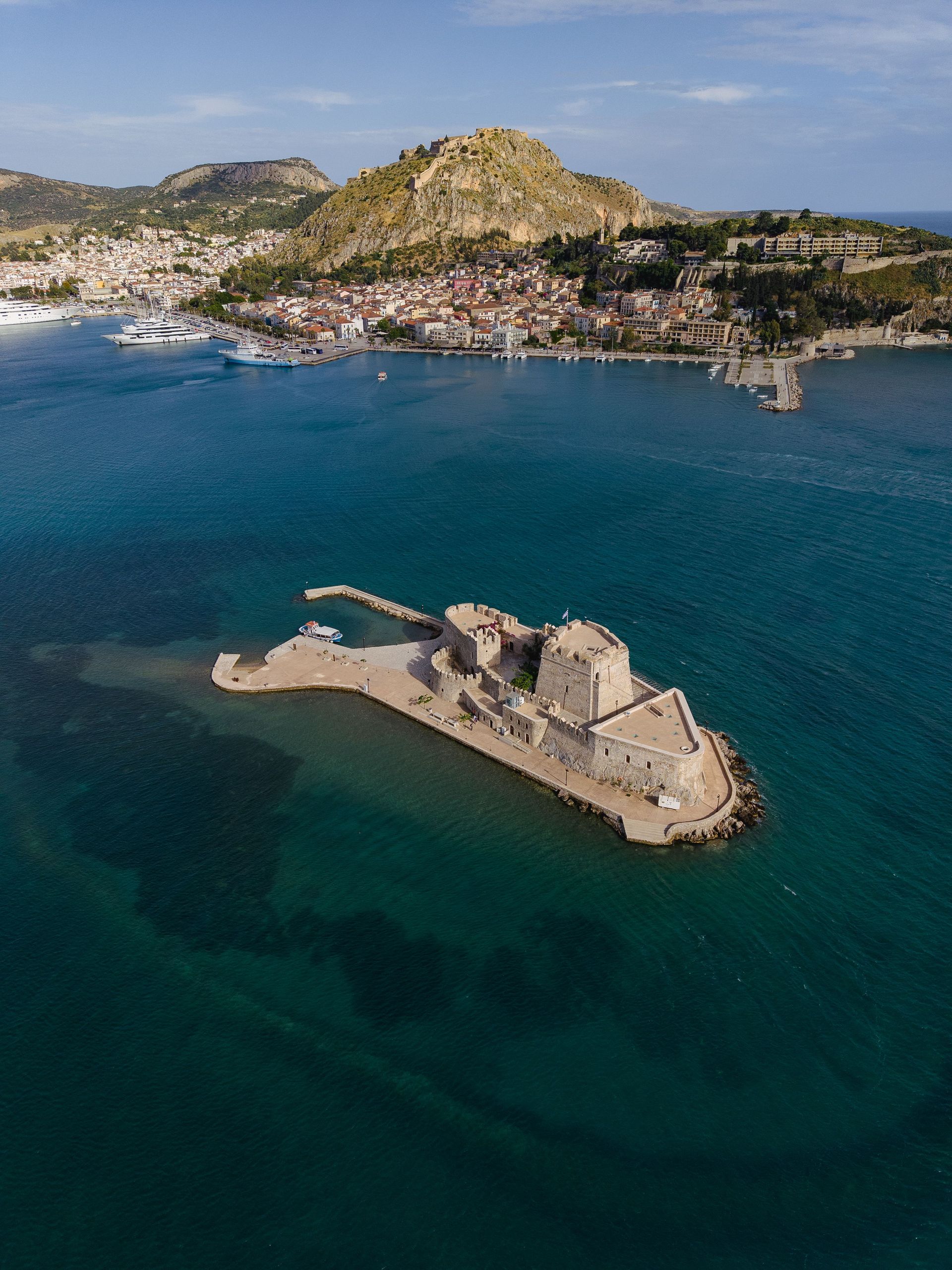
Nafplio served as the first capital of modern Greece, from 1829 to 1834, before the government moved to Athens. The town still carries that history in its architecture and its two fortresses. Palamidi, an 18th-century Venetian fortress, sits atop a hill above town and requires climbing 857 steps for visitors who skip the road access. Bourtzi, a smaller fortress, occupies a tiny island in the harbor itself.
The old town's streets mix Venetian, Ottoman, and neoclassical buildings, a layered history that reflects Nafplio's changing rulers over several centuries. Its harborfront restaurants make it a common overnight base for visitors touring the wider Peloponnese region.
Epidaurus, around 30 kilometers from Nafplio, holds an ancient theater built in the 4th century BC and dedicated to Asclepius, the god of healing. His sanctuary once drew the sick from across the ancient Greek world. The theater's acoustics remain functional enough that performers can be heard clearly from the back row without amplification. Visitors can test this detail by dropping a coin or striking a match from center stage. The Athens and Epidaurus Festival still stages ancient drama there each summer.
Mycenae, about 20 kilometers north of Nafplio, was the seat of a Bronze Age civilization. It gave its name to the Mycenaean period of Greek history, roughly 1600 to 1100 BC. Its Lion Gate, a monumental entrance carved around 1250 BC and topped with two carved lionesses flanking a column, is one of the oldest surviving monumental sculptures in Europe. The site's shaft graves produced gold masks and jewelry now displayed in the National Archaeological Museum in Athens.
The Peloponnese connects to Athens by highway, with Nafplio reachable in around two hours by car or bus. That makes the region practical as a multi-day loop rather than a single day trip, since Epidaurus, Mycenae, and Nafplio's own sites easily fill two full days.
Rhodes Old Town survives as Europe's largest inhabited medieval city
Credit: Frosa Katsis / Pexels
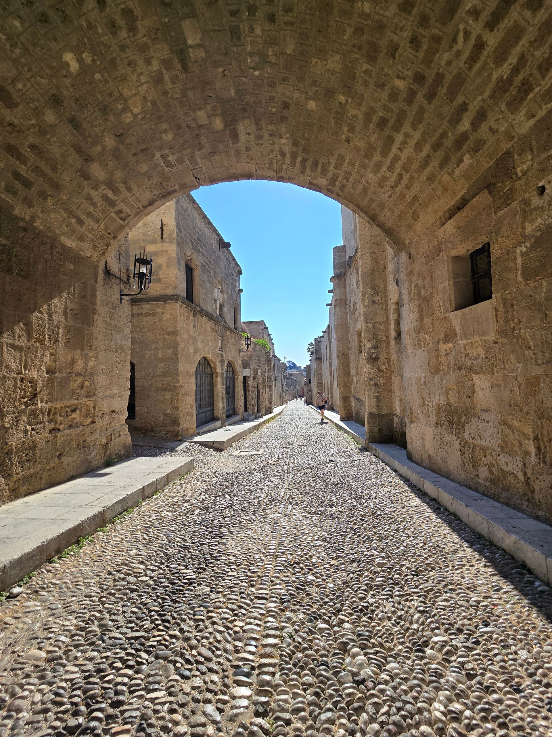
Rhodes Old Town is the largest inhabited medieval town in Europe, a walled district built largely by the Knights of St. John after they took control of the island in 1309. UNESCO listed it as a World Heritage Site in 1988. The Palace of the Grand Master, rebuilt in the 20th century after an explosion destroyed the original structure, anchors one end of the Street of the Knights. That cobbled avenue is lined with the former lodgings of the knights' various national divisions.
The island takes its name from an ancient bronze statue, the Colossus of Rhodes, built around 280 BC to celebrate a successful defense against a siege. It counted among the Seven Wonders of the Ancient World. An earthquake toppled it in 226 BC, and the statue's exact original location remains debated among historians since no ruins survive today.
Lindos, on the island's east coast around an hour from Rhodes Town, combines a whitewashed village of narrow lanes with an acropolis rising above it. That acropolis holds a 4th-century BC temple to Athena Lindia, built on a site with religious use dating back centuries earlier. The climb up, either on foot or by donkey, ends with views over Lindos' bay that rank among the best on the island.
Rhodes' beaches vary by coast, with the east side generally calmer and better for swimming. The west side catches stronger winds that draw windsurfers to spots like Prasonisi, at the island's southern tip, where two seas meet.
The island's airport takes direct flights from numerous European cities in summer, in addition to connections through Athens. Ferries link Rhodes to nearby Dodecanese islands like Symi and Kos as well as to Turkey's Marmaris, a short crossing that makes a multi-country add-on possible within the same trip.
Peak season runs July through August, with high temperatures and correspondingly high hotel rates. April, May, September, and October offer warm weather with noticeably thinner crowds at both the Old Town and Lindos.
Milos draws travelers to Sarakiniko's white rock coastline
Credit: Thomas Tsopanakis / Unsplash
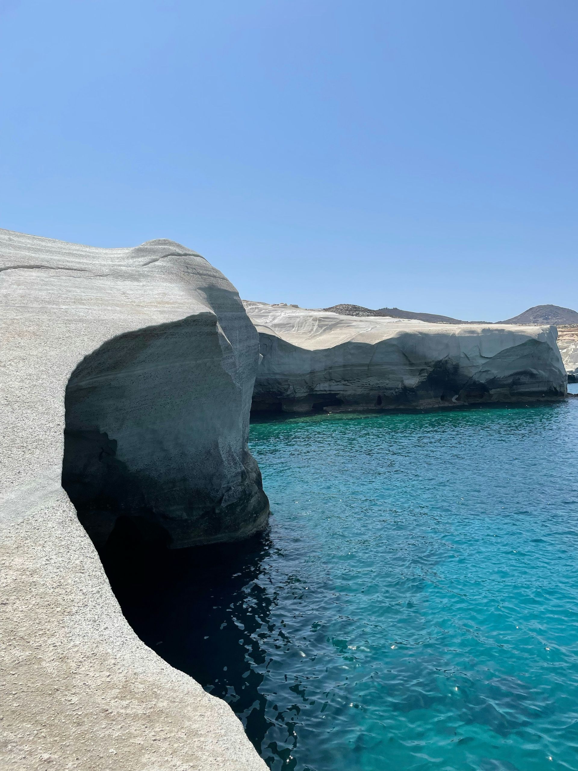
Milos is best known today for Sarakiniko, a stretch of coastline where wind and sea have carved white volcanic rock into smooth, moon-like formations. No sand or vegetation is in sight, a landscape unlike any other beach in the Cyclades. The island counts more than 70 named beaches across its coastline, shaped by the same volcanic activity that produced Sarakiniko's white rock and other beaches' black or multicolored sand.
Milos also holds a direct connection to one of the most famous sculptures in the world. A farmer discovered the statue now known as the Venus de Milo on the island in 1820. French naval officers acquired it shortly afterward and shipped it to France, where it has remained on display at the Louvre ever since. No original stands on Milos today, though the island's archaeological museum in Plaka displays a plaster cast alongside artifacts from the island's ancient history.
Klima, a small fishing village on Milos' west coast, is built around syrmata, colorful boathouses with living quarters on top and a boat storage space at water level. It is a building style specific to a handful of Milos villages. Plaka, the island's capital, sits on a hill above Klima and holds a Venetian castle ruin along with some of the best sunset views on the island.
Milos' economy has historically centered on mining, and the island still produces bentonite, perlite, and other industrial minerals. That legacy is visible in the pale mineral cliffs along parts of the coastline that give some beaches their unusual white or gray coloring.
Ferries connect Milos to Piraeus in around three and a half hours by high-speed boat or up to seven hours by conventional ferry. The island also links directly to Santorini, a shorter hop that makes it practical to combine with a longer Cyclades itinerary. Milos draws noticeably fewer visitors than Santorini or Mykonos, and its beaches, restaurants, and hotel rates reflect that smaller scale.