
25 small towns in America worth a weekend trip
From coastal Maine to the Texas Hill Country, these 25 small towns offer genuine character, good food, and scenery worth the drive
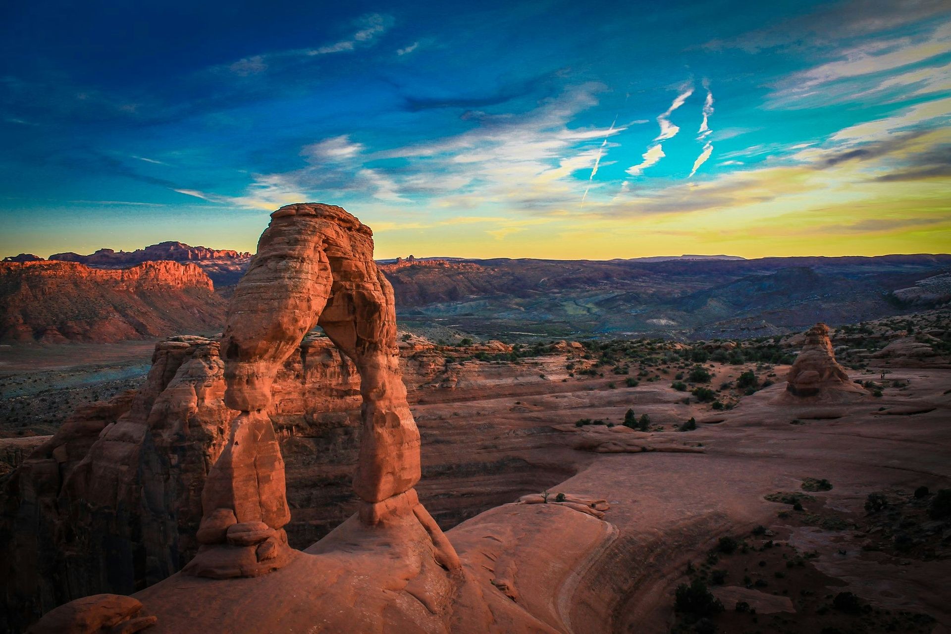
Credit: SoloTravelGoals / Unsplash
America's most rewarding weekend escapes are rarely its most famous ones. The well-worn circuit of major cities — New York, Chicago, Los Angeles, Miami — delivers everything expected and little that surprises. But the country's small towns are where American culture was actually shaped: in mill towns along New England rivers, in mountain communities settled by miners who never left, in Gulf Coast fishing villages that still pull their economy from the water. These are the places where regional cooking survived intact, where Main Streets were never fully paved over by strip malls, and where a single afternoon can fill a notebook.
The appeal of the small-town weekend trip has grown partly because it is genuinely different from what a city offers. There are no reservation queues that stretch three months out. There is no pressure to hit the landmarks in a predetermined order. A town of 8,000 people is navigable on foot, which means the discoveries tend to be accidental — a bakery operating out of someone's converted garage, a bookshop where the owner has strong opinions and the time to share them, a viewpoint that appears around a corner without any signage. These encounters are rarer in places optimized for mass tourism.
Geography matters here. The U.S. contains multitudes of terrain — the Appalachian ridges, the high desert of the Southwest, the flat Gulf plain, the Pacific fog coast — and small towns tend to express that terrain more faithfully than large cities do. Marfa, Texas, would not make sense anywhere else. Neither would Bar Harbor, Maine, or Telluride, Colorado. Part of what makes these trips worthwhile is arriving somewhere that could not have been transplanted.
Not every small town on this list is obscure. Some have been written about for decades. What they share is that they reward a full weekend of attention — two nights minimum, without rushing — and that they offer something genuinely worth making a detour for, whether that is architecture, food, landscape, art, or some combination of all four. The list spans every major region of the country, from the coast of Maine to the high desert of New Mexico, from the Blue Ridge Mountains to the Oregon coast. Most can be reached within a few hours of a regional airport. All of them are worth the drive.
1 / 25
Marfa, Texas
Credit: Shelby Cohron / Unsplash
Marfa sits in the high Chihuahuan Desert of far west Texas, more than 200 miles from the nearest major city, at an elevation of about 4,700 feet. The town has roughly 1,800 permanent residents. It is, by almost any conventional measure, remote. That remoteness is exactly what makes it work.
The town's transformation into a destination began with the artist Donald Judd, who moved there in 1971 and spent the following two decades converting the grounds of an old U.S. Army fort into one of the largest permanent art installations in the world. The Chinati Foundation, which Judd established, now houses permanent collections from Judd, Dan Flavin, and a rotating group of other artists, spread across converted military buildings on 340 acres. The scale of the work — Judd's aluminum pieces filling two entire artillery sheds, Flavin's fluorescent light installations in six former barracks — is not reproducible anywhere else. Visiting requires a guided tour, which runs on a schedule and books out well in advance.
Beyond Chinati, the town has accumulated a population of artists, writers, and architects who have built or renovated structures throughout the downtown core. The result is a genuinely unusual streetscape where adobe commercial buildings sit beside Marfa Public Radio, a bookshop called Marfa Book Company, and restaurants drawing from both the local Mexican-American culinary tradition and influences that arrived with the creative community. Ballroom Marfa, a nonprofit arts space in a converted ballroom, runs rotating contemporary exhibitions and film programming throughout the year.
The drive out is part of the trip. U.S. Route 67 and Texas State Highway 17 run through terrain that empties the mind: volcanic mountains, vast cattle ranches, the occasional pronghorn antelope on a ridge. The light changes throughout the day in ways that explain why photographers and painters keep returning. At night, with almost no light pollution for 50 miles in any direction, the sky becomes a different kind of installation entirely.
The Marfa Lights, a reported optical phenomenon visible from a viewing area east of town on U.S. Highway 67, remain unexplained to the satisfaction of scientists. The phenomenon has been documented in the area since the 1880s. Whether the lights are atmospheric refractions or something else, the viewing platform draws visitors on clear nights, and the experience of standing in complete silence on the desert floor while lights shift on the horizon is not easily categorized.
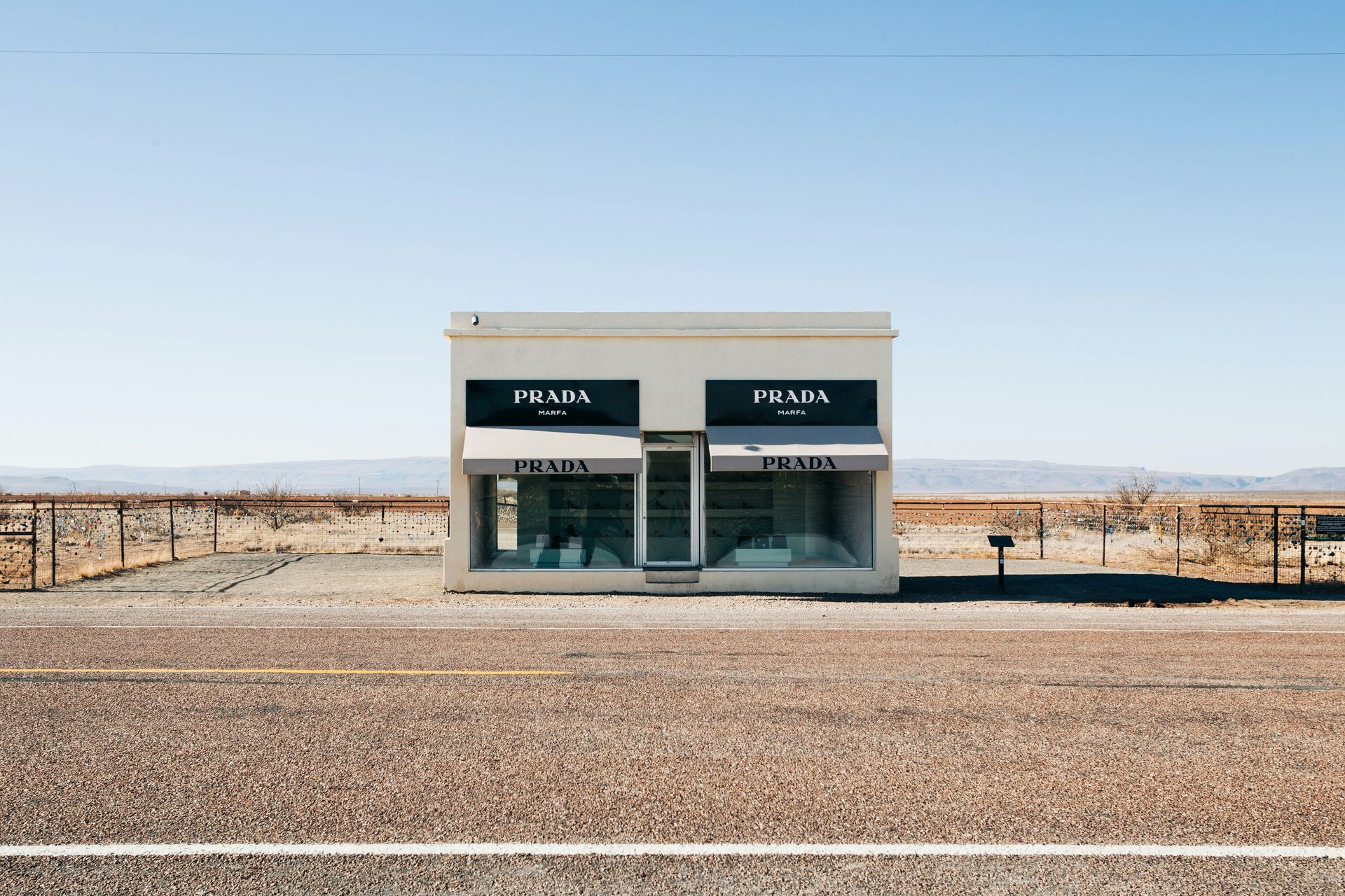
The Prada Marfa sculpture — a permanent installation by artists Elmgreen and Dragset designed to resemble a Prada storefront — stands about 26 miles northwest of town near the community of Valentine. It is one of the most photographed objects in west Texas and encapsulates in a single image the cultural logic of Marfa: high concept, radical context, middle of nowhere.
Accommodation in Marfa is limited but distinctive. El Cosmico, a campground and hotel built around trailers, yurts, and safari tents on a flat field west of downtown, offers one of the more original lodging experiences in the U.S. Hotel Saint George, a converted historic hotel in the center of town, is the more conventional option. Book both well in advance, particularly for spring and fall weekends.
2 / 25
Taos, New Mexico
Credit: Canva Images
Taos sits at the edge of the Sangre de Cristo Mountains in northern New Mexico, at an elevation of about 6,970 feet. The town has roughly 6,000 residents, though the broader Taos County population is significantly larger. It has been an artists' colony since the early 20th century, when a group of painters arrived from the East Coast and stayed, drawn by the quality of the high-altitude light and the presence of Taos Pueblo, the continuously inhabited Native American community two miles north of the plaza.
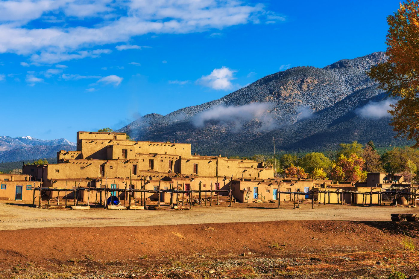
Taos Pueblo is one of the oldest continuously occupied settlements in North America, with adobe structures that have been inhabited for more than a thousand years. It is a UNESCO World Heritage Site and operates as a living community, not a museum. Visitors are permitted on designated days, and the protocols around photography and access reflect the fact that this is not a historic site frozen in amber but an active community maintaining its own governance and cultural practices. The architecture — multi-story adobe buildings rising from the valley floor against a backdrop of mountains — is the most photographed image in New Mexico for reasons that are apparent on first view.
The Taos art scene has depth beyond the galleries clustered around the plaza. The Taos Society of Artists, founded in 1915, produced painters whose work now fills major museum collections, and the Harwood Museum houses an extensive collection of their paintings alongside contemporary New Mexican work. The Millicent Rogers Museum holds one of the better collections of Native American and Spanish Colonial art in the Southwest, including jewelry, textiles, and santos — the carved wooden devotional figures produced by New Mexican craftspeople over several centuries.
New Mexican cooking in Taos differs from Tex-Mex and from the border cuisine of El Paso. The red and green chile stews are made with varieties of chile grown in the Rio Grande valley, particularly in the Hatch and Chimayó areas, and the heat level and flavor profile are specific to those varieties. The Christmas plate — a dish served with both red and green chile — is the local benchmark for a restaurant's chile quality, and the better restaurants in Taos take it seriously.
The surrounding landscape includes the Rio Grande Gorge, an 800-foot-deep canyon carved by the river about 12 miles west of town. The gorge is visible only when you are nearly at its edge, which makes the first view across the sage-flat mesa to the sudden canyon drop genuinely disorienting. The bridge spanning the gorge at that point is one of the higher suspension bridges in the U.S. The drives north toward Taos Pueblo and along the High Road to Taos from Santa Fe — which passes through the weaving village of Chimayó and the mountain community of Truchas — are worth building into any itinerary.
3 / 25
Telluride, Colorado
Credit: Terry Foote / Wikimedia Commons (CC BY-SA 3.0)
Telluride sits at the end of a box canyon at 8,750 feet in the San Juan Mountains of southwest Colorado, with peaks rising to nearly 14,000 feet on three sides. The town of about 2,600 permanent residents was founded as a silver and gold mining camp in the 1870s. The canyon's geography — no through road, only a single entrance — has shaped the character of the town throughout its history and keeps it from ever feeling like a pass-through destination.
U.S. News ranks Telluride the number one small town to visit in America, and the case is easy to make. The historic downtown is a 16-block National Historic Landmark district, and the Colorado Avenue commercial strip retains much of its late-Victorian brick and wood-frame architecture. Butch Cassidy is said to have robbed his first bank in Telluride in 1889. The Sheridan Opera House, opened in 1913 and still operating, hosts film screenings and live performances throughout the year.
The Telluride Film Festival, held each Labor Day weekend since 1974, brings filmmakers and serious film audiences from around the world to the box canyon. The festival's programming reputation — it is where several Best Picture Oscar winners have had their first public screenings — draws both film industry attendees and general audiences who come for the combination of the screenings and the setting. Screenings take place in multiple venues including an outdoor stage at Mears Park.
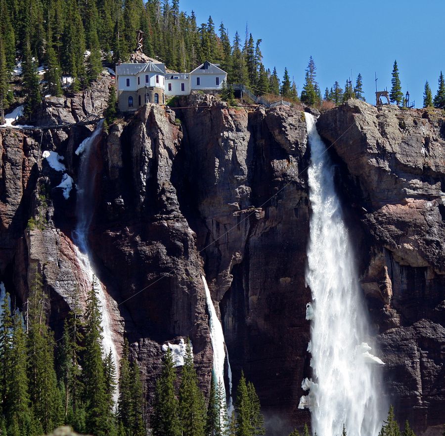
Outside the festival weekend, Telluride's summer calendar includes a bluegrass festival, a jazz festival, and a mushroom festival that draws foragers and chefs to the San Juan high country. The gondola connecting Telluride to Mountain Village on the mesa above runs year-round and provides access to hiking trails above the treeline. The hike from Mountain Village to Bridal Veil Falls — the highest free-falling waterfall in Colorado at 365 feet — is accessible throughout the summer and remains one of the defining walks in the San Juan Mountains.
Winter brings more than 300 inches of annual snowfall and over 2,000 acres of skiable terrain. The ski resort consistently ranks among the top in Colorado for the combination of terrain quality and the experience of skiing directly into a Victorian downtown rather than a purpose-built resort village. The après-ski culture in Telluride operates at a different register from larger Colorado ski towns — more intimate, more likely to end with a conversation with a local.
4 / 25
Moab, Utah
Credit: SoloTravelGoals / Unsplash
Moab sits in a narrow valley carved by the Colorado River in eastern Utah, surrounded by the canyon country that defines this part of the Colorado Plateau. The town of about 5,200 residents serves as the primary gateway to two of the most visually dramatic national parks in the U.S. — Arches and Canyonlands — and the landscape within a short drive of town is among the most otherworldly terrain on the continent.
Arches National Park, five miles north of town, preserves more than 2,000 natural sandstone arches, fins, and balanced rocks in a landscape that changes color throughout the day as the angle of the sun shifts across the red rock. Delicate Arch, the most photographed, requires a three-mile round-trip hike with 480 feet of elevation gain. The view of the arch against the La Sal Mountains behind it is worth the effort in any season, though the summer heat requires an early start. Canyonlands National Park, about 30 miles southwest, divides into districts separated by the confluence of the Colorado and Green rivers. The Island in the Sky mesa district offers the most accessible views — a sheer-walled plateau with overlooks extending hundreds of miles across canyon country.
The Colorado River corridor through Moab supports Class III and IV whitewater rafting from spring through early summer, when snowmelt raises the river level. The same stretch of river provides calmer flatwater paddling in late summer. The slickrock terrain around town has made Moab one of the established destinations for mountain biking in the U.S., with trail systems ranging from the technical Slickrock Trail — one of the most famous mountain bike routes in the country — to more accessible routes through the canyon corridors.
Downtown Moab has the character of a working western town that has grown into tourism without fully converting to it. The independent restaurants, outfitters, and gear shops along Main Street serve both locals and the steady stream of visitors heading to the parks. The Moab Folk Festival in November draws a serious music crowd to the canyon. The town sits at about 4,000 feet, which keeps summer temperatures lower than the desert floor — but the exposed rock terrain means that May through early June and September through October remain the most comfortable months to visit.
Dead Horse Point State Park, 35 miles southwest of town, sits at the tip of a narrow mesa 2,000 feet above the Colorado River. The view from the point encompasses a gooseneck bend in the river and the Canyonlands basin beyond — one of the most reproduced landscape photographs in the American Southwest, and worth the short drive from town even without visiting the national parks.
5 / 25
Bisbee, Arizona
Credit: Canva Images
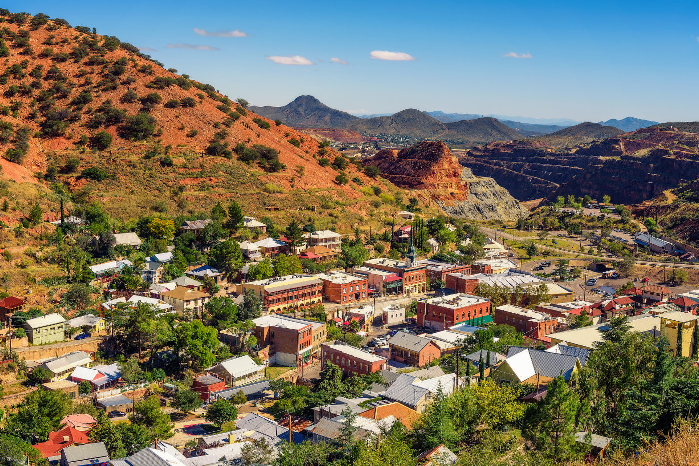
Bisbee is a former copper mining town tucked into a narrow canyon in the Mule Mountains of southeastern Arizona, about six miles north of the Mexican border. At its peak in the early 20th century, the mines beneath Bisbee produced more copper than anywhere else in the world, and the town grew to nearly 20,000 people. The mines closed in 1975. Today, Bisbee has about 5,000 residents and an economy built largely on tourism, art, and the same counter-cultural community that began arriving in the 1970s when the miners left.
The physical layout of the town is unlike anything else in Arizona. Bisbee was built vertically into canyon walls, with stairs cut into the rock connecting residential neighborhoods above the main commercial street. The Brewery Gulch neighborhood runs uphill from the central plaza, lined with Victorian-era brick buildings that have been converted into bars, galleries, and shops. Staircases with names — the 175-step Laundry Stairs, the Brewery Gulch stairs — serve as neighborhood streets and are listed as points of interest. The result is a town that requires actual climbing to explore, and rewards that effort with views down into the canyon from terraced porches.
The Queen Mine Tour descends into one of the original copper shafts, still accessible via mine car. Guides are former miners who explain the technical and human history of copper extraction in a way that no museum exhibit replicates. The temperature underground drops sharply from the desert air above, and visitors are issued miners' gear for the descent. The tour runs daily and is one of the more distinctive underground experiences available anywhere in the American Southwest.
The Copper Queen Hotel, opened in 1902 and still operating, is worth at least a drink at the bar even if you are staying elsewhere. It has the slightly formal lobby architecture and thick-walled coolness of a hotel built to impress visiting mine executives, and it still functions as the social center of the town. The mix of longtime locals, artists, weekenders from Tucson, and cross-border visitors from Sonora creates demand for restaurants that take their sourcing seriously.
The drive from Tucson takes about 90 minutes on U.S. Highway 80, passing through the grasslands of Sulphur Springs Valley and the Dragoon Mountains. The approach to Bisbee through the Mule Mountains gives no indication of what lies in the canyon until the road curves around a final ridge and the town appears below, packed tightly against the rock walls — an arrival that remains one of the more memorable in the Southwest.
6 / 25
Bar Harbor, Maine
Credit: Skyler Ewing / Pexels
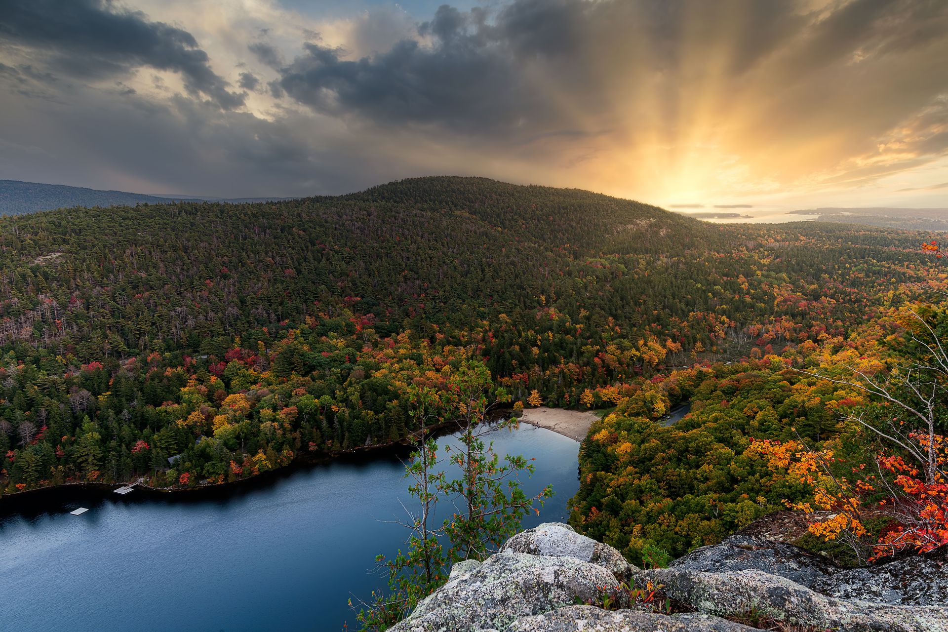
Bar Harbor sits on the eastern shore of Mount Desert Island, the largest island on the Atlantic Coast of the U.S. The town of about 5,500 year-round residents serves as the primary gateway to Acadia National Park, which covers roughly half of Mount Desert Island and includes the Cadillac Mountain range, accessible by both road and trail. U.S. News ranks Bar Harbor among the top five small towns to visit in the country, and the combination of the national park, the working harbor, and the particular quality of the Maine coast justifies that ranking.
Cadillac Mountain, at 1,530 feet, is the highest point on the U.S. Atlantic coast north of Rio de Janeiro, and from October through March it is the first place in the contiguous U.S. to receive direct sunlight each morning. The sunrise from the summit has become one of the more sought-after experiences in Acadia, to the degree that a timed entry reservation system now governs access during peak season. The summit itself — open granite with views of the Porcupine Islands, Frenchman Bay, and the peaks of the Schoodic Peninsula — is accessible by foot on several trails.
Acadia's carriage road system, a network of 45 miles of broken-stone roads built by John D. Rockefeller Jr. between 1913 and 1940, is closed to motor vehicles and provides surfaces for cycling, hiking, and horse-drawn carriage rides that thread through the park's interior. The stone bridges Rockefeller commissioned for the road crossings are examples of early 20th-century landscape architecture and are individually worth seeking out.
The working waterfront of Bar Harbor remains active alongside the tourist economy. Lobster boats go out before dawn and return by midmorning, and the restaurants along Cottage Street and the waterfront serve the lobster, crab, and clams that come directly off those boats. The combination of the park, the water, and the food makes Bar Harbor a place where two full days disappear without effort.
The Jordan Pond House, a park concession operating in a meadow at the southern end of Jordan Pond since the 1870s, serves popovers and tea on its lawn with the Bubbles mountains as a backdrop. The menu is not elaborate, but the setting is one of the better lunch spots in New England, and the popover tradition is worth experiencing at least once.
7 / 25
Astoria, Oregon
Credit: William Jacobs / Pexels
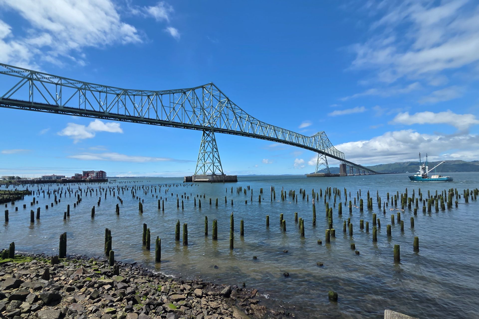
Astoria occupies a hilltop at the mouth of the Columbia River in the northwest corner of Oregon, where the river meets the Pacific. With about 10,000 residents, it is one of the older American settlements west of the Rocky Mountains — the first permanent U.S. settlement on the Pacific Coast, established by John Jacob Astor's fur trading company in 1811. The geography is specific and unusual: the river mouth is four miles wide at Astoria, with the state of Washington on the opposite bank, and the Pacific fog and rain define the town's atmosphere for much of the year.
The architecture reflects the town's Victorian-era prosperity as a port and cannery center. The residential hills above downtown are covered with Queen Anne and Craftsman houses, many of them restored, spreading up steep streets with views across the river to Washington. The Flavel House Museum, a Queen Anne mansion built in 1885 for a Columbia River bar pilot, is among the best-preserved examples of the style in the Pacific Northwest and is open for tours. The Heritage Museum in the former City Hall building covers the history of the Clatsop people, the fur trade era, and the salmon canning industry that made Astoria prosperous through the late 19th century.
The Astoria Column, a 125-foot tower on Coxcomb Hill, is painted with a spiral mural depicting events in the exploration and settlement of the Pacific Northwest. It dates to 1926 and is one of the more unusual historic structures in Oregon. The view from the top takes in the Columbia River, the Pacific, the Coast Range to the south, and Mount Rainier and Mount St. Helens on clear days to the north.
The local food and drink scene reflects both the maritime location and the Pacific Northwest food culture. Several restaurants draw on the seafood available from the Columbia River and the adjacent Pacific: Dungeness crab, Pacific oysters, Chinook salmon, and albacore tuna. The brewery scene has developed substantially over the past decade, and the Astoria Sunday Market runs from May through October with local producers, food vendors, and craft makers.
The drive from Portland along U.S. Highway 30, which follows the south bank of the Columbia, passes through the river gorge and the towns of St. Helens and Clatskanie. The return on U.S. Highway 26 over the Coast Range connects at Seaside. Both routes offer different experiences of the landscape, and combining them into a loop makes for a more complete circuit of the lower Columbia region.
8 / 25
Cannon Beach, Oregon
Credit: Kanishk Gabel / Pexels
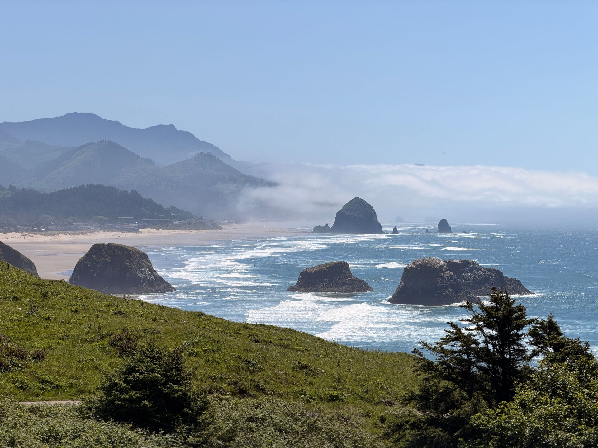
Cannon Beach sits on the northern Oregon coast, about 80 miles west of Portland, where the Pacific pounds a wide beach backed by the Coast Range. The town of about 1,700 year-round residents is built around Haystack Rock — a 235-foot sea stack rising from the intertidal zone that is among the most recognizable natural landmarks on the West Coast. The combination of the rock, the beach, and the surrounding headlands has made Cannon Beach the defining image of the Oregon coast for more than a generation of photographers and travelers.
Haystack Rock is accessible on foot at low tide, when the intertidal zone around its base exposes tidal pools thick with sea stars, anemones, hermit crabs, and purple urchins. The rock is designated as a marine garden and bird sanctuary, and the tufted puffins that nest in burrows near the summit are visible from below during their summer nesting season from April through August. The Haystack Rock Awareness Program operates interpretive stations on the beach throughout the season and provides context for what is visible at any given tide.
Ecola State Park, two miles north of town, covers 1,300 acres of headland forest and coastline between Cannon Beach and Seaside. The trails from the park's main viewpoint look south over the full length of Cannon Beach and north to Tillamook Head, and the hike down to Indian Beach passes through Sitka spruce and western hemlock forest to a secluded cove popular with surfers. The view of Haystack Rock from the Ecola headland — looking south across the full crescent of the beach — is the version of the image that appears in most Oregon travel photography.
The town itself is compact and walkable, with a concentration of galleries on Hemlock Street that has made Cannon Beach one of the more established arts communities on the Oregon coast. The Coaster Theatre Playhouse has been staging productions in a converted skating rink since 1972. The Cannon Beach Sandcastle Contest, held each June, draws competitors and spectators from across the Pacific Northwest.
Haystack Rock is visible from a public beach with no entry fee, and the town's restaurants and galleries are within easy walking distance of the water. The combination of the landscape, the accessible wildlife, and the functioning arts community makes Cannon Beach worth a full weekend rather than the day trip most Portland visitors treat it as.
9 / 25
Port Townsend, Washington
Credit: William Jacobs / Pexels
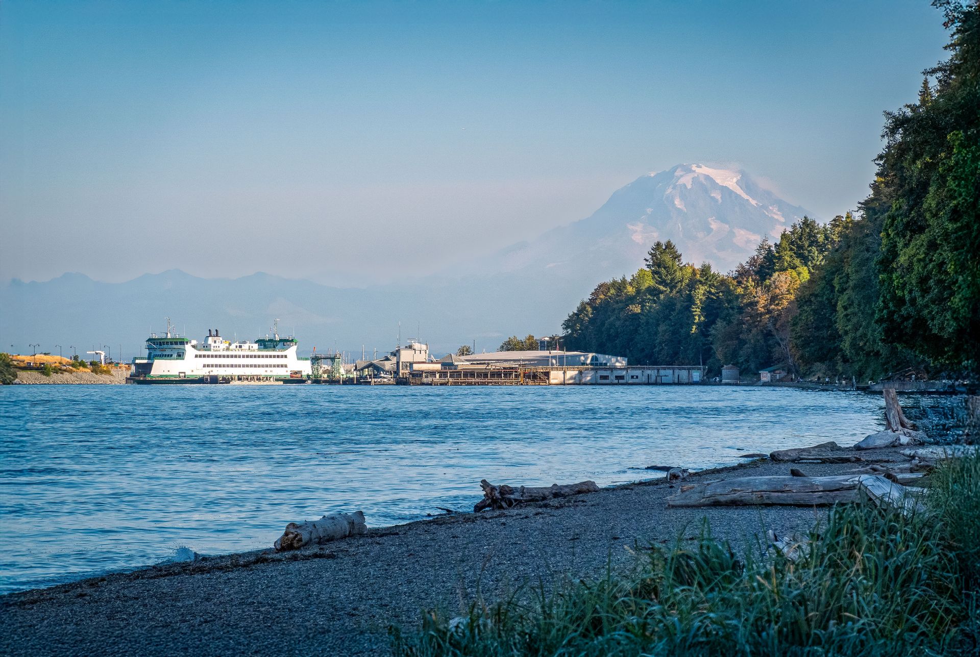
Port Townsend sits at the northeast tip of the Olympic Peninsula in Washington state, where the Strait of Juan de Fuca meets Hood Canal and Puget Sound. The town of about 10,000 people has the largest concentration of Victorian commercial and residential architecture in the Pacific Northwest, a result of an unusual history: it was expected to become the major port of the Pacific Northwest in the 1880s, attracted significant investment in civic and commercial buildings, then lost the railroad connection to Tacoma in 1890 — leaving it with an extraordinary collection of period architecture and no population growth to demolish it.
The uptown residential district, built on the bluff above the downtown waterfront, contains dozens of Queen Anne and Eastlake houses that have been carefully maintained. The view from the bluff looks across the water to the Cascade Range and, on clear days, to Mount Baker and Mount Rainier. The walkability of the uptown neighborhood, combined with the quality of the architecture and the water views, makes it one of the more pleasant residential environments in Washington state. The distance between uptown and downtown is navigable by a flight of wooden stairs that has served as the primary pedestrian connection since the 1890s.
The Wooden Boat Festival, held in Port Townsend each September since 1977, is the largest wooden boat show in North America. The Port Townsend Shipwright's Co-op and the Northwest School of Wooden Boatbuilding maintain an active tradition of wooden boat construction and repair that gives the town's working waterfront a practical identity beyond tourism. The marina is occupied by working boats alongside pleasure craft, and the smell of wood and salt water is present throughout the waterfront district.
Fort Worden State Park, on the north edge of town, occupies the grounds of a coastal artillery fort built in the 1890s and decommissioned in 1953. The park includes a campground, a conference center in the restored officers' quarters, and batteries and parade grounds open to exploration. The 1982 film An Officer and a Gentleman was filmed here. The park's combination of military history, beachfront, and accessible trails makes it worth several hours of exploration independent of the town.
The food scene in Port Townsend benefits from the proximity to Olympic Peninsula farms and the waters of Puget Sound and Hood Canal — Dungeness crab, Pacific oysters, and the berries and root vegetables that thrive in the cool, wet climate. The Saturday farmers' market runs from April through December and reflects the quality of the surrounding agricultural land.
10 / 25
Sandpoint, Idaho
Credit: LeeAnn Cline / Unsplash
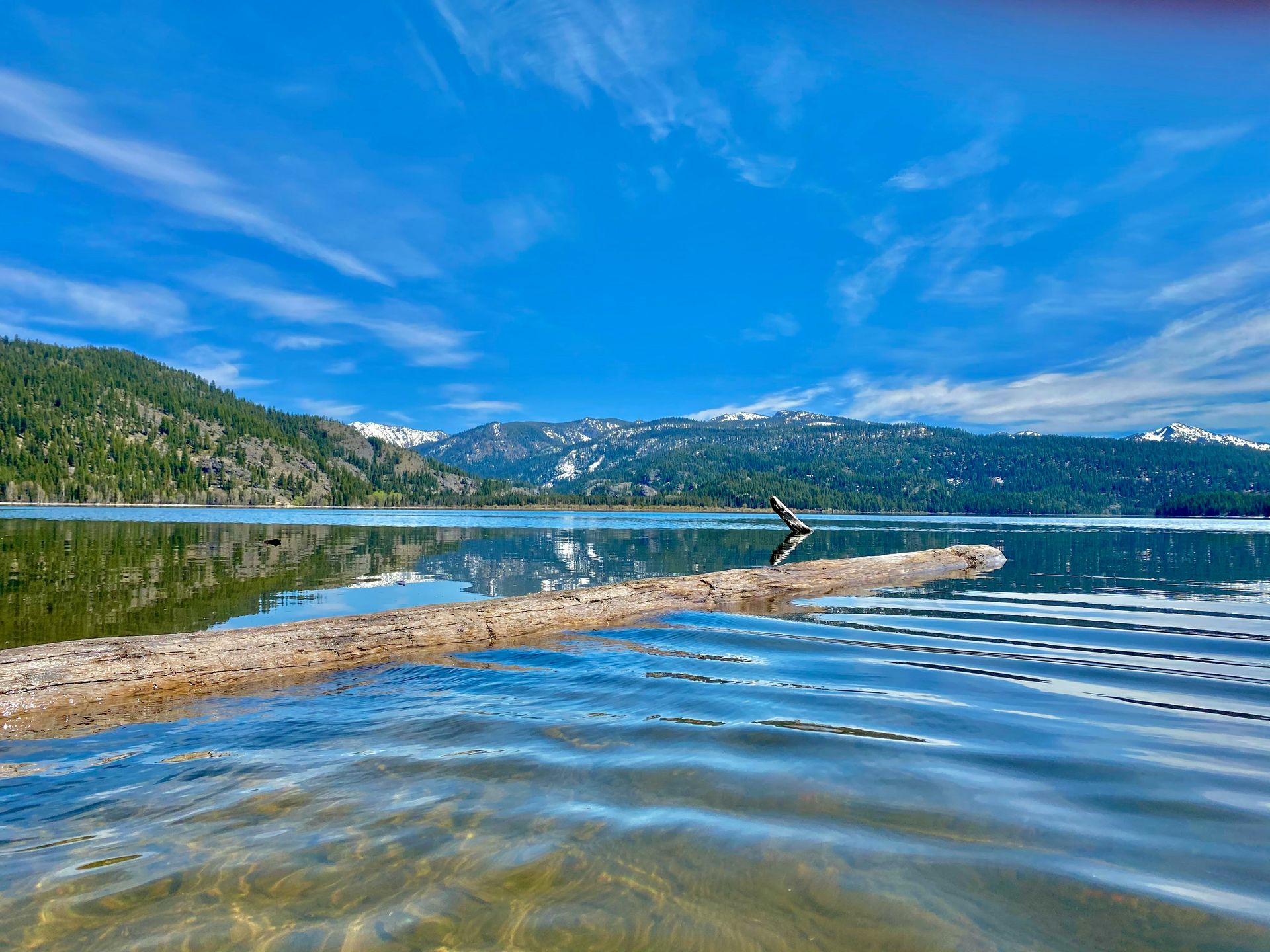
Sandpoint sits on the north shore of Lake Pend Oreille, the largest lake in Idaho, at the base of the Cabinet and Selkirk mountain ranges in the Idaho Panhandle. The city of about 8,000 people is surrounded by a landscape that combines the lake — 65 miles long and over 1,100 feet deep, the deepest lake in the Pacific Northwest — with a mountain environment that includes Schweitzer Mountain Resort to the north and the Selkirk Mountains extending into Canada.
The lake is central to summer life in Sandpoint. City Beach, a half-mile of sand and grass at the foot of the downtown, provides swimming access to water that warms enough in July and August for extended use. The Long Bridge — a 5,700-foot wooden road bridge connecting Sandpoint to the lake's south shore, the longest wooden bridge in the U.S. — offers a walk or bike ride across the water with the Cabinet Mountains as a backdrop and a full sense of the lake's scale visible on both sides.
The downtown is a compact grid of streets a few blocks from the lake, with independent businesses, restaurants, and galleries that reflect the creative and outdoor-sports community that has grown here over the past generation. The Panida Theater, a 1927 movie house with its original Spanish Colonial Revival interior, operates as a community arts center and is one of the more intact vintage theaters in the Pacific Northwest.
The hiking within driving distance of Sandpoint is extensive. The Selkirk Crest trail system climbs into alpine terrain above the lake with views extending into both Canada and Montana on clear days. The Pack River delta, at the northern end of the lake, is a productive wildlife corridor for waterfowl, osprey, and the occasional moose working the shallows. In winter, Schweitzer Mountain Resort offers more than 2,900 acres of skiable terrain with views of the lake from the upper lifts — one of the better ski views in the continental U.S.
The Cedar Street Bridge Public Market occupies a covered pedestrian bridge over Sand Creek and functions as a year-round indoor farmers' market and artisan vendor space. The Bonner County Historical Society Museum covers the history of the Kalispel people, the fur trade era, and the Great Northern Railway construction that shaped the modern identity of the Idaho Panhandle.
11 / 25
Hot Springs, Arkansas
Credit: Yash Mannepalli / Unsplash
Hot Springs occupies a narrow valley in the Ouachita Mountains of central Arkansas, about 55 miles southwest of Little Rock. The town has about 38,000 residents and has been a destination since the early 19th century, when the thermal springs that gave it the name were first promoted as having medicinal properties. Hot Springs National Park — the oldest land reservation in the U.S. federal system, set aside by Congress in 1832, decades before the national park system existed — preserves the springs and the bathhouse row built to deliver spring water to visitors.
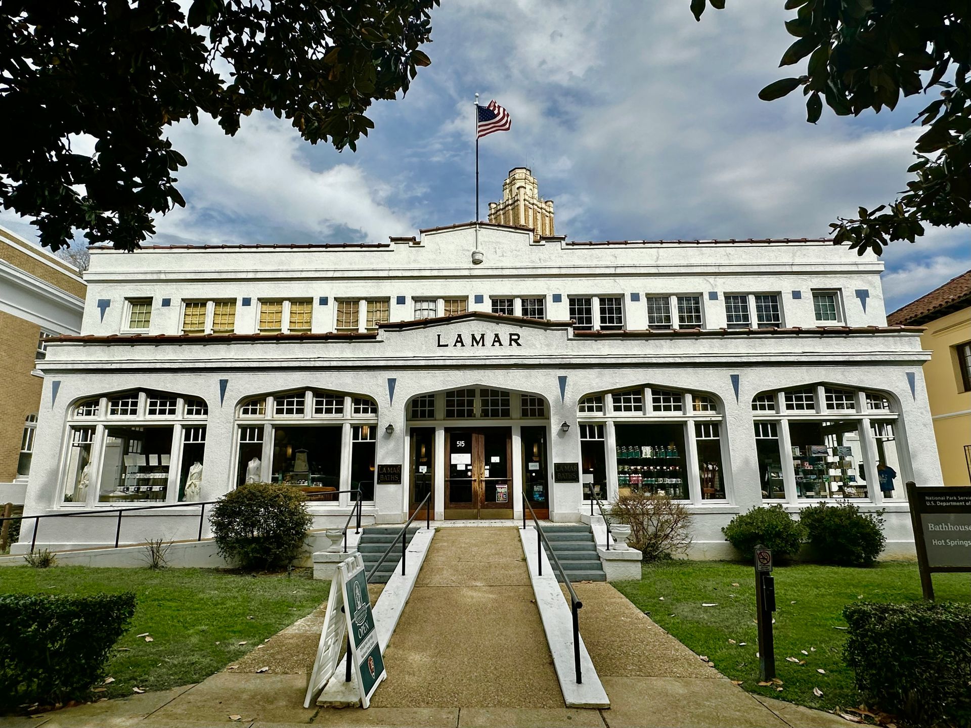
Bathhouse Row is the physical heart of the historic town: eight historic bathhouses built along Central Avenue between 1912 and 1936, in Classical Revival and Spanish Colonial Revival styles, backed by the wooded slopes of Hot Springs Mountain. Several of the bathhouses have been repurposed — one is now a brewery, one is a gallery — but the Buckstaff Bathhouse is still operating as a traditional bathhouse offering thermal baths and hydrotherapy. The row as an ensemble is one of the more complete examples of early 20th-century resort architecture in the American South.
The Fordyce Bathhouse, the grandest of the eight, is now the park visitor center. Its interior — marble floors, stained glass, bronze fixtures, a gymnasium with period equipment — has been restored to its 1915 appearance and gives a detailed picture of what a wealthy visitor would have experienced when it opened. The mix of hydrotherapy, mechanical massage, and elaborate bathing ritual reflected the popular medical thinking of the early 20th century and made Hot Springs one of the most visited destinations in the country during its peak years.
Hot Springs has a documented history of illegal gambling and organized crime that extended from Prohibition through the 1960s. The Gangster Museum of America on Central Avenue covers this history with artifacts, photographs, and oral history recordings from the era when figures including Al Capone used the town as a neutral territory. The history is presented straightforwardly rather than romanticized, and it adds a dimension to the town that most resort destinations lack.
The Garvan Woodland Gardens, administered by the University of Arkansas, occupy 210 acres on the shores of Lake Hamilton south of town and are particularly worth visiting in spring when the native azalea and wildflower plantings peak. Lake Hamilton itself is ringed with the mid-century resort architecture of vacation Arkansas, including lakefront restaurants and boat rental facilities that have operated in the same locations for decades.
12 / 25
Bentonville, Arkansas
Credit: Michael Barera / Wikimedia Commons (CC BY-SA 4.0)
Bentonville sits in the Ozark Mountains of northwest Arkansas, near the Missouri border. The city of about 50,000 residents is known internationally as the headquarters of Walmart $WMT, but it has built a cultural infrastructure over the past 20 years that would be remarkable in a city five times its size. Travel + Leisure named Bentonville one of its 50 Best Places to Travel in 2026, and the Wall Street Journal has called it the new capital of cool in the American South. The engine behind the transformation is Crystal Bridges Museum of American Art, and the Walton family philanthropy that funded it.
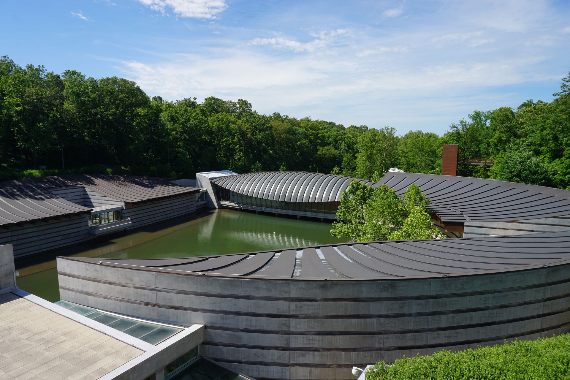
Crystal Bridges, opened in 2011 in a building designed by architect Moshe Safdie on 120 acres of Ozark forest, houses a permanent collection spanning five centuries of American art — from colonial portraiture through the Ashcan School, Abstract Expressionism, and contemporary work. Admission is permanently free, funded by an endowment from Alice Walton. The collection includes Georgia O'Keeffe's Jimson Weed/White Flower No. 1, Norman Rockwell $ROK's Rosie the Riveter, and works by Winslow Homer, Jackson Pollock, and Andy Warhol. The building itself, with glass pavilions set over a spring-fed pond, integrates into the forest in a way that makes the walk between galleries as much a part of the experience as the art inside. More than five miles of walking trails connect the museum grounds to the wider Bentonville trail network.
The Momentary, a sister institution to Crystal Bridges housed in a former 63,000-square-foot cheese factory, focuses on contemporary visual, performing, and culinary arts. It opened in 2020 and has become a venue for major contemporary exhibitions, live music, and food programming that draws national talent to northwest Arkansas. The combination of the two institutions gives Bentonville a cultural depth per capita that rivals cities with far larger populations and budgets.
The mountain biking infrastructure around Bentonville is among the most developed in the country. More than 300 miles of trails thread through the Ozark hills surrounding the city, ranging from beginner loops to technical single-track. The Slaughter Pen trail system north of Crystal Bridges connects directly to the museum grounds and is accessible from downtown on a bike. The town has invested seriously in making the cycling network navigable and well-marked.
The downtown square retains the character of a working Arkansas county seat, with the original Walton's 5&10 store — now the Walmart Museum — anchoring one corner. The restaurant scene has developed considerably, with the Hive at 21c Museum Hotel and Eleven inside Crystal Bridges among the better dining options in the region.
13 / 25
Oxford, Mississippi
Credit: Ken Lund / Wikimedia Commons (CC BY-SA 2.0)
Oxford sits in Lafayette County in northern Mississippi, about 80 miles south of Memphis. The town of about 25,000 residents — swelled significantly by the University of Mississippi student population — has built a reputation over the past three decades as one of the strongest small-town food and literary destinations in the American South. Lonely Planet, multiple food publications, and several James Beard Award recognition cycles have put Oxford on the national map in a way that its size alone would not predict.
The literary connection begins with William Faulkner, who lived in Oxford from 1930 until his death in 1962. Rowan Oak, his home on the southern edge of town, is owned by the University of Mississippi and open for tours. The outline of his novel A Fable is written in his own hand on the study wall, and the house is preserved with original furnishings that give a clear picture of where one of the 20th century's major novelists actually worked. The Bailey Woods trail connects Rowan Oak to the University museum, passing through a second-growth forest that Faulkner walked regularly.
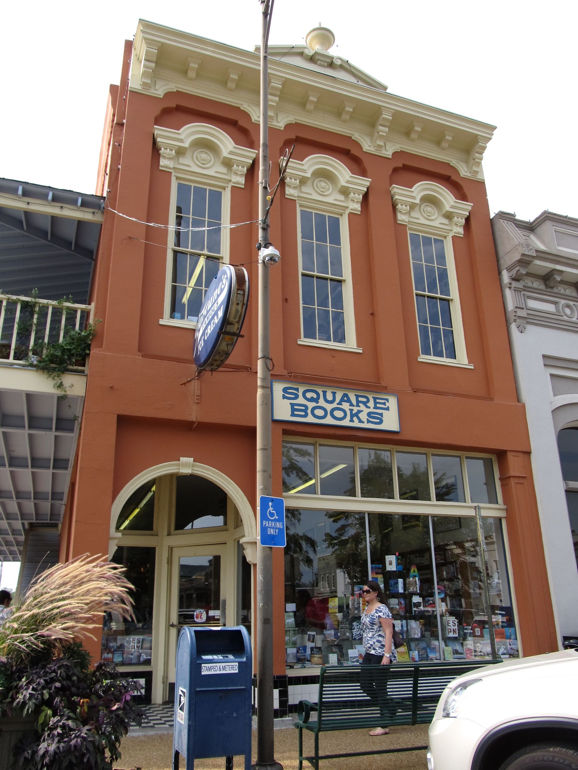
Square $SQ Books, on the Courthouse Square, has been operating since 1979 and is consistently ranked among the best independent bookstores in America. The store occupies three floors in a building on the square and hosts a year-round schedule of author readings and signings that reflects Oxford's position as a literary community in the original sense — writers live here, not just tourists who read about them.
The food scene is exceptional by any standard. City Grocery, James Beard Award-winning chef John Currence's flagship restaurant, has been operating on the square since 1992 and helped establish the template for what Oxford cooking looks like: Southern technique, high-quality local sourcing, serious cocktails. Snackbar, a collaboration between Currence and fellow James Beard Award winner Vishwesh Bhatt, blends Southern and South Asian cooking in a way that is specific to this place and this partnership. Taylor Grocery, a few miles south of town in a historic country store, serves fried catfish and has received Michelin recognition.
The Ole Miss Grove, the tree-covered area in the center of the university campus, fills with tens of thousands of people on football Saturdays in a tailgating tradition that is specific to Oxford and unlike the stadium parking lot experience common elsewhere. The combination of the literary history, the food scene, and the particular social culture of the town makes Oxford one of the more layered small-town destinations in the South.
14 / 25
Apalachicola, Florida
Credit: Dave Mungai / Pexels
Apalachicola sits at the mouth of the Apalachicola River on Florida's Forgotten Coast, a stretch of Gulf shoreline between Panama City Beach and Tallahassee that has largely escaped the high-rise resort development that defines most of Florida's coastline. The town of about 2,300 residents is built on a grid of streets running to the river and the bay, with more than 900 buildings on the National Register of Historic Places — a density that reflects the town's role as a prosperous cotton and seafood shipping port throughout the 19th century.
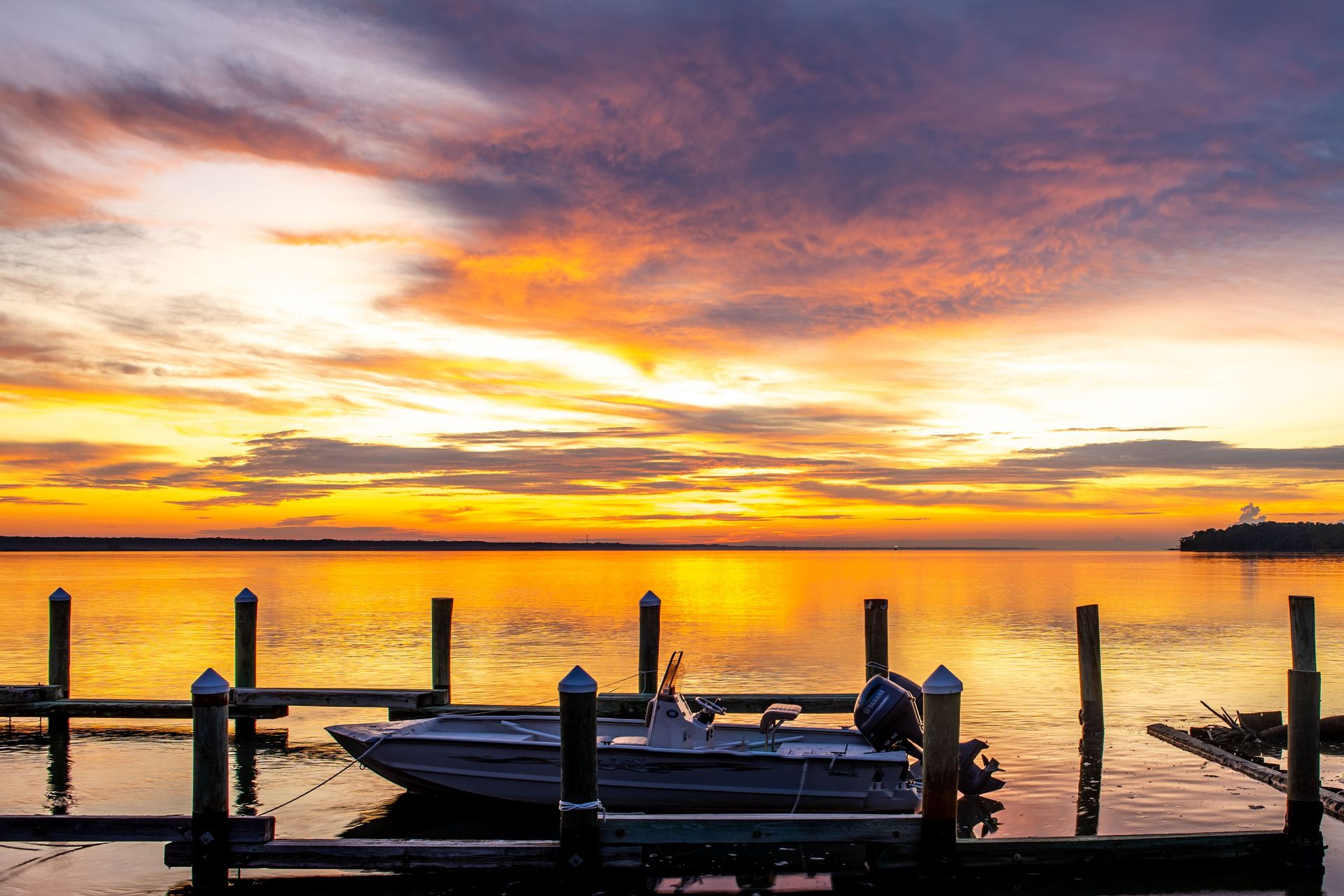
The waterfront along Water Street faces the Apalachicola River as it enters the bay, and the view from Riverfront Park — working fishing boats, the river bending south toward the Gulf, the Gorrie Bridge in the middle distance — has the quality of a working waterfront that has not been redesigned for tourism. The town is walkable from one end to the other in about 20 minutes, with independent shops, galleries, and restaurants occupying the historic commercial buildings on Market Street and the surrounding blocks.
Apalachicola Bay was historically one of the most productive oyster estuaries in the world, at one point supplying roughly 90% of Florida's oyster harvest. A five-year moratorium on wild harvesting, imposed to allow oyster reef recovery, ended in January 2026 with signs of recovery in the bay's oyster population. The town's identity has been built around oysters, and the return of the harvest marks a significant recovery for the local economy. The annual Oyster Cook-Off, held at Riverfront Park each January, is the town's signature event.
The Apalachicola National Estuarine Research Reserve protects over 246,000 acres of marshes, tidal creeks, forests, and barrier islands surrounding the bay. The reserve supports manatees, dolphins, ospreys, Gulf sturgeon, and large concentrations of wintering waterfowl. Guided tours and paddling access are available through the reserve's nature center in Eastpoint, across the bridge from town.
St. George Island, a barrier island accessible by bridge about 10 miles south of Apalachicola, has no high-rise development and protects seven miles of undeveloped Gulf beach at St. George Island State Park. The combination of the working waterfront town, the protected estuary, and the undeveloped barrier island makes this corner of Florida unlike anything else in the state.
15 / 25
Beaufort, South Carolina
Credit: Ken Lund / Flickr (CC BY-SA 2.0)
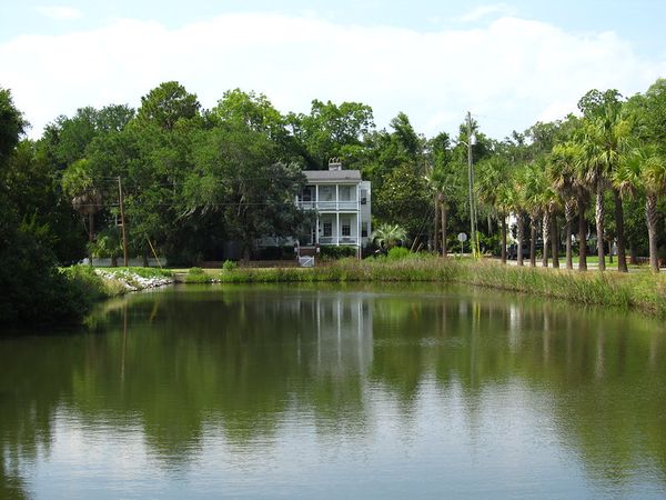
Beaufort sits on Port Royal Island in the South Carolina Lowcountry, about midway between Charleston and Savannah. With about 13,000 residents, it is the second oldest city in South Carolina, incorporated in 1711, and its historic district contains one of the densest concentrations of antebellum architecture in the American South. The combination of the physical environment — live oaks draped in Spanish moss, tidal creeks running between barrier islands, the broad reach of the Beaufort River — and the depth of the cultural history makes this one of the more layered small-town destinations in the region.
The historic downtown is compact enough to cover on foot in an afternoon, and the architecture rewards slow attention. The homes along Bay Street and the side streets running to the waterfront are mostly Greek Revival and Federal-style buildings from the first half of the 19th century, built by planters who grew wealthy on Sea Island cotton. During the Civil War, Union forces occupied Beaufort early in the conflict, which is the primary reason the buildings survived. The town served as a hospital base and administrative center for the Union army throughout the war, and its physical fabric was largely preserved rather than destroyed.
The Gullah Geechee cultural heritage is central to understanding Beaufort and the broader Sea Islands region. The descendants of enslaved West Africans who worked the sea island plantations developed a distinct creole culture, language, and culinary tradition that has persisted across generations in the coastal communities of South Carolina, Georgia, and northern Florida. The Gullah Museum in downtown Beaufort documents this history, and the local food scene — particularly at restaurants serving traditional Lowcountry cooking — reflects the culinary legacy of that culture, including shrimp and grits, she-crab soup, and various preparations of rice and greens.
The waterways around Beaufort are accessible by kayak and small boat, and the tidal marshes and sea island creeks provide habitat for bottlenose dolphins, loggerhead sea turtles, and large concentrations of wading birds. Several outfitters in town offer guided paddling tours. The drive across the Sea Islands — through St. Helena Island, Ladies Island, and out toward Hunting Island State Park — passes through a landscape of marsh grass, live oak forest, and working Gullah Geechee communities that has remained largely intact.
16 / 25
Deadwood, South Dakota
Credit: Amaury Michaux / Pexels
Deadwood sits at the bottom of a gulch in the Black Hills of South Dakota, 50 miles northwest of Rapid City. The town of about 1,300 permanent residents was founded as a gold mining camp in 1876, in land reserved for the Lakota Sioux by the Fort Laramie Treaty of 1868 but opened to white settlement after gold was discovered. Its history includes Wild Bill Hickok, Calamity Jane, the Deadwood Stage, and a documented record of violence, gambling, and rapid economic change that defined the early Black Hills mining era.
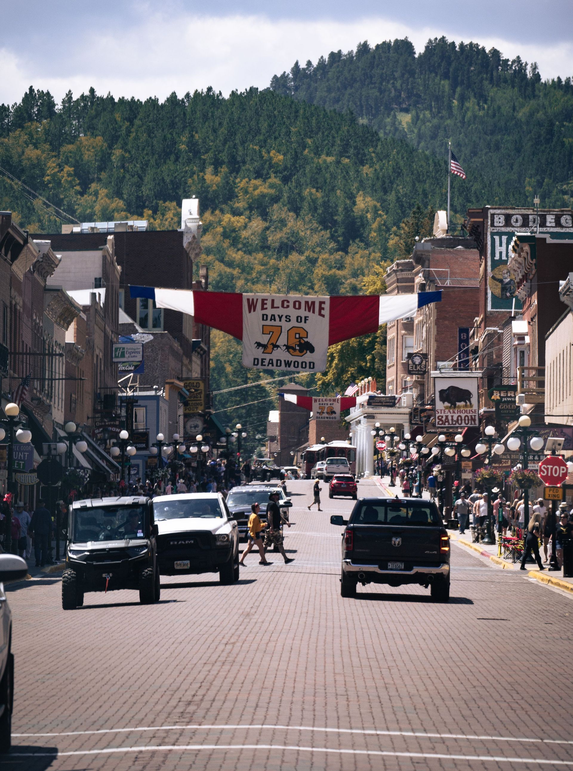
The historic district along Main Street has been preserved as a gaming destination since South Dakota legalized limited-stakes gambling in Deadwood in 1989. The town is now lined with casinos operating from historic buildings — 19th-century hotels, saloons, and commercial structures — that create an architecturally authentic streetscape wrapped around slot machines. The Adams Museum and House, a nonprofit historical museum in a 1930 building near Main Street, provides the historical depth that the casino environment does not, with collections covering the Black Hills gold rush era and the broader history of the Lakota.
Mount Moriah Cemetery, on the hill above town, holds the graves of Wild Bill Hickok and Calamity Jane, along with a substantial portion of the 19th-century population of Deadwood. The cemetery is walkable from downtown and interpretive markers at the graves provide context for the actual historical record, which is considerably more complicated than the mythologized versions familiar from television and film. Hickok was shot in the back of the head during a poker game at Nuttal and Mann's Saloon in 1876. He had been in Deadwood for three weeks.
The restoration of the built environment in Deadwood has been done with serious attention to the physical record, and several of the buildings on Main Street are restored rather than reconstructed, retaining original fabric that was preserved through the lean decades when nobody had a commercial motive to demolish it. The Broken Boot Gold Mine offers tours of the original shaft and surface workings.
Deadwood serves as a practical base for exploring the broader Black Hills region. Mount Rushmore, the Crazy Horse Memorial, Jewel Cave National Monument, and Wind Cave National Park are all within an hour's drive. The Lakota cultural and historical context for all of these sites is documented at the Adams Museum and at the Crazy Horse Memorial's museum complex.
17 / 25
Staunton, Virginia
-1920x1264.jpg)
Credit: Manicpixiedreamworld / Wikimedia Commons (CC BY-SA 4.0)
Staunton sits in the Shenandoah Valley of Virginia, roughly midway between Charlottesville and Lexington, at an elevation of about 1,400 feet in the Blue Ridge foothills. The city of about 25,000 people is the birthplace of Woodrow Wilson and is home to the American Shakespeare Center, which operates a reconstruction of the Blackfriars Playhouse — the indoor theater that Shakespeare's company used in London — as a year-round performance venue. That theater alone puts Staunton on a list no other American small town can match.
The Blackfriars Playhouse, opened in 2001, is the world's only re-creation of the original Blackfriars and operates under the same conditions as the original: shared lighting between actors and audience, no electronic amplification, the same staging conventions that Shakespeare's company used. The American Shakespeare Center runs a rotating repertory season from February through December, staging Shakespeare alongside other plays from the early modern period. Watching a Shakespeare play in a space designed to replicate the original performance conditions is a categorically different experience from any other Shakespeare production.
Downtown Staunton has a concentration of historic architecture in the Wharf and Beverley Street districts that was almost demolished in the urban renewal era of the 1960s and 1970s. The survival of the downtown fabric — Victorian commercial buildings, late 19th-century residences, and civic structures — reflects the advocacy of local preservation groups who made the case for rehabilitation rather than demolition. The result is a walkable commercial center with independent restaurants, a well-stocked used bookshop, and galleries that function within a physical environment continuous with the 19th century.
The Woodrow Wilson Presidential Library and Museum, housed in the restored birthplace of the 28th president, covers both Wilson's life and the broader history of his presidency, including the period surrounding World War I and the failed effort to bring the U.S. into the League of Nations. The museum's treatment of Wilson's complex legacy — including his re-segregation of the federal workforce — has become more candid in recent revisions to the interpretive program.
Staunton's location puts it within easy reach of Shenandoah National Park to the northeast and the George Washington National Forest to the west. The valley floor between Staunton and Lexington passes through some of the better-preserved agricultural landscape in Virginia, with large farms, stone walls, and periodic views of both the Blue Ridge and Allegheny ridgelines.
18 / 25
Jim Thorpe, Pennsylvania
Credit: Ramakanth Chilekampalli / Pexels
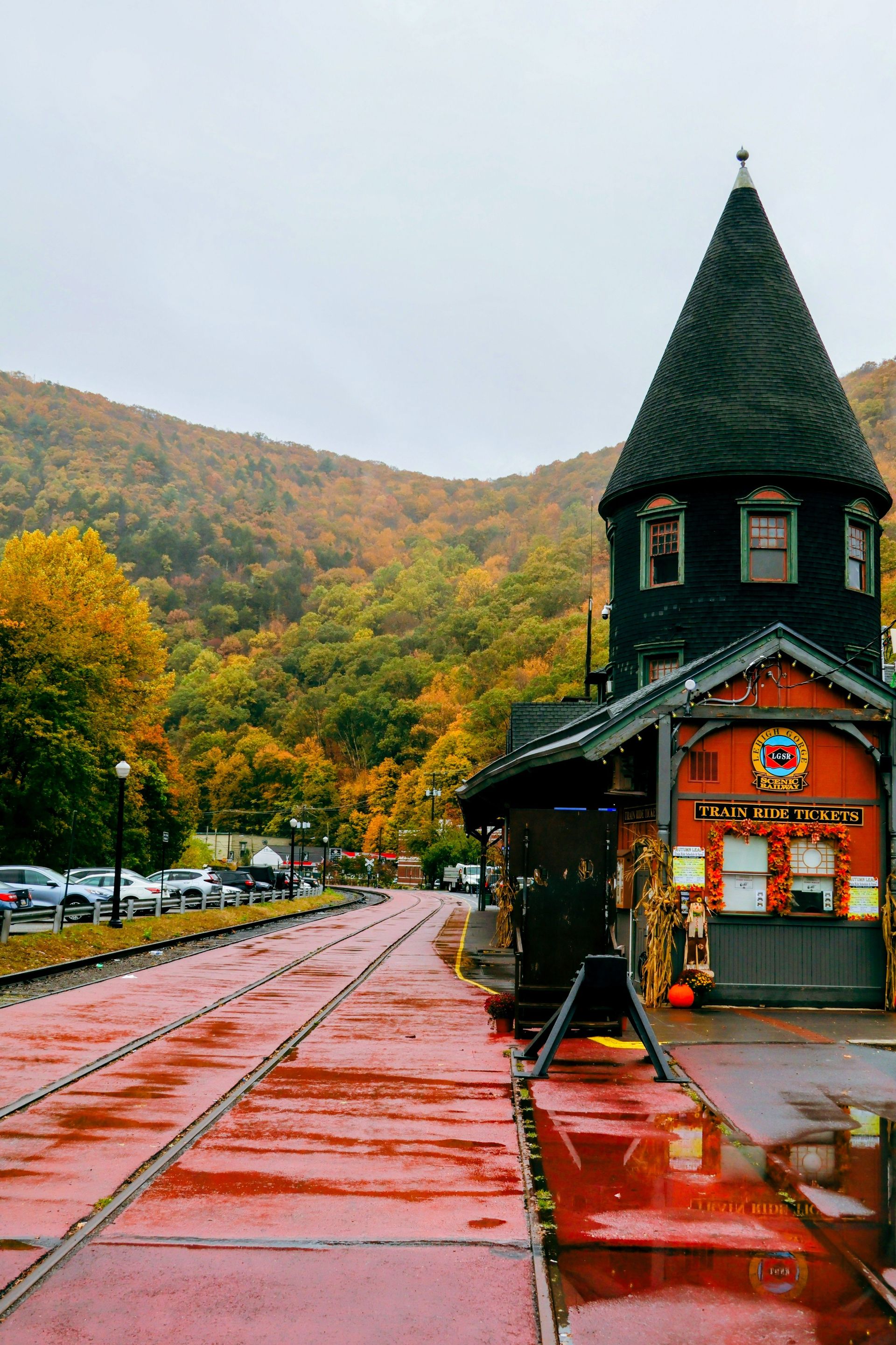
Jim Thorpe sits in a steep-sided valley in the Lehigh Gorge of Carbon County, Pennsylvania, about 80 miles north of Philadelphia and 90 miles west of New York City. The town of roughly 4,800 people was formed in 1954 from the merger of two former coal-era communities, Mauch Chunk and East Mauch Chunk. The physical setting is what draws most visitors: the Lehigh River runs at the bottom of the gorge, and the town climbs the valley walls in layers of Victorian and Second Empire architecture built when the anthracite coal industry was at its peak in the late 19th century.
The Asa Packer Mansion, home of the railroad baron who founded the Lehigh Valley Railroad and Lehigh University, stands on a rise above the town center and is open for tours. The mansion is furnished with original pieces and gives a detailed picture of the wealth that the coal and railroad economy generated in this part of Pennsylvania during its industrial peak. The house is one of the best-preserved examples of its type in the northeastern U.S. and has not been converted or updated in ways that reduce its authenticity.
The Lehigh Gorge State Park runs for 26 miles along the river, with a rail trail along the former rail bed passing through terrain that alternates between open water meadows and dense hemlock forest. The trail is accessible at Jim Thorpe and runs north to White Haven. The Lehigh River itself runs Class III and IV whitewater in spring and early summer, and outfitters in Jim Thorpe run guided rafting trips and equipment rentals. The combination of the gorge trail and the whitewater gives the town a strong outdoor draw across multiple seasons.
The downtown commercial district on Broadway Street has filled with independent restaurants, wine bars, a Belgian-style ale house in a converted industrial building, and antiques dealers. The mix is typical of towns that have been discovered by weekend visitors from nearby metros without yet losing the rougher edges that make them interesting. The proximity to Philadelphia and New York means enough demand to support serious food and drink businesses, while the distance from both cities keeps the tourist pressure from homogenizing the town.
The fall foliage along the Lehigh Gorge is among the better displays in the mid-Atlantic region. The maple and oak canopy that covers the valley walls turns in mid-October, visible from both the rail trail below and the hillside roads above.
19 / 25
Hudson, New York

Credit: Sarah O'Shea / Pexels
Hudson sits on the eastern bank of the Hudson River in Columbia County, New York, about two hours north of New York City by train from Penn Station. The city of about 6,000 residents has become one of the most written-about small-town arts destinations in the Northeast over the past 20 years, drawing gallerists, designers, chefs, and artists from New York City who have built a cultural infrastructure in the historic buildings of Warren Street that is genuinely distinctive rather than a pale echo of the city they left.
Warren Street is the commercial spine of Hudson, a six-block stretch of 19th-century commercial and residential buildings now occupied by antiques dealers, contemporary galleries, restaurants, and boutiques that reflect the sensibility of a community shaped by people with serious aesthetic commitments. The density of gallery space on a single street in a city of 6,000 is unusual by any measure — Warren Street has more galleries per block than most American cities of any size — and the quality of what is shown reflects the caliber of the dealers and artists who have made Hudson their base.
The Hudson Whaling Museum, now the Olana State Historic Site, sits on a hillside south of town. Olana was the home and studio of Hudson River School painter Frederic Church, who designed the house and its 250-acre landscape as a unified artistic work. The views from the grounds across the river to the Catskills are the views that Church painted, and standing at the site gives a direct understanding of why the Hudson Valley produced the first major school of American landscape painting.
The food scene in Hudson has developed substantially alongside the gallery culture. The combination of access to Hudson Valley farms and a population with strong food literacy has produced restaurants that work at a level disproportionate to the city's size. The farmers' market at the Greenport Conservation Area on Saturdays from May through November draws producers from throughout Columbia and Greene counties.
The LGBTQ community has been central to Hudson's cultural transformation, and the city has a visible and active queer arts and nightlife scene that gives it a social diversity unusual in small Hudson Valley cities. The combination of the arts, the food, the river, the architecture, and the train connection to New York makes Hudson one of the most practical and rewarding weekend destinations in the Northeast.
20 / 25
Galena, Illinois
Credit: rboed / Wikimedia Commons (CC BY 2.0)
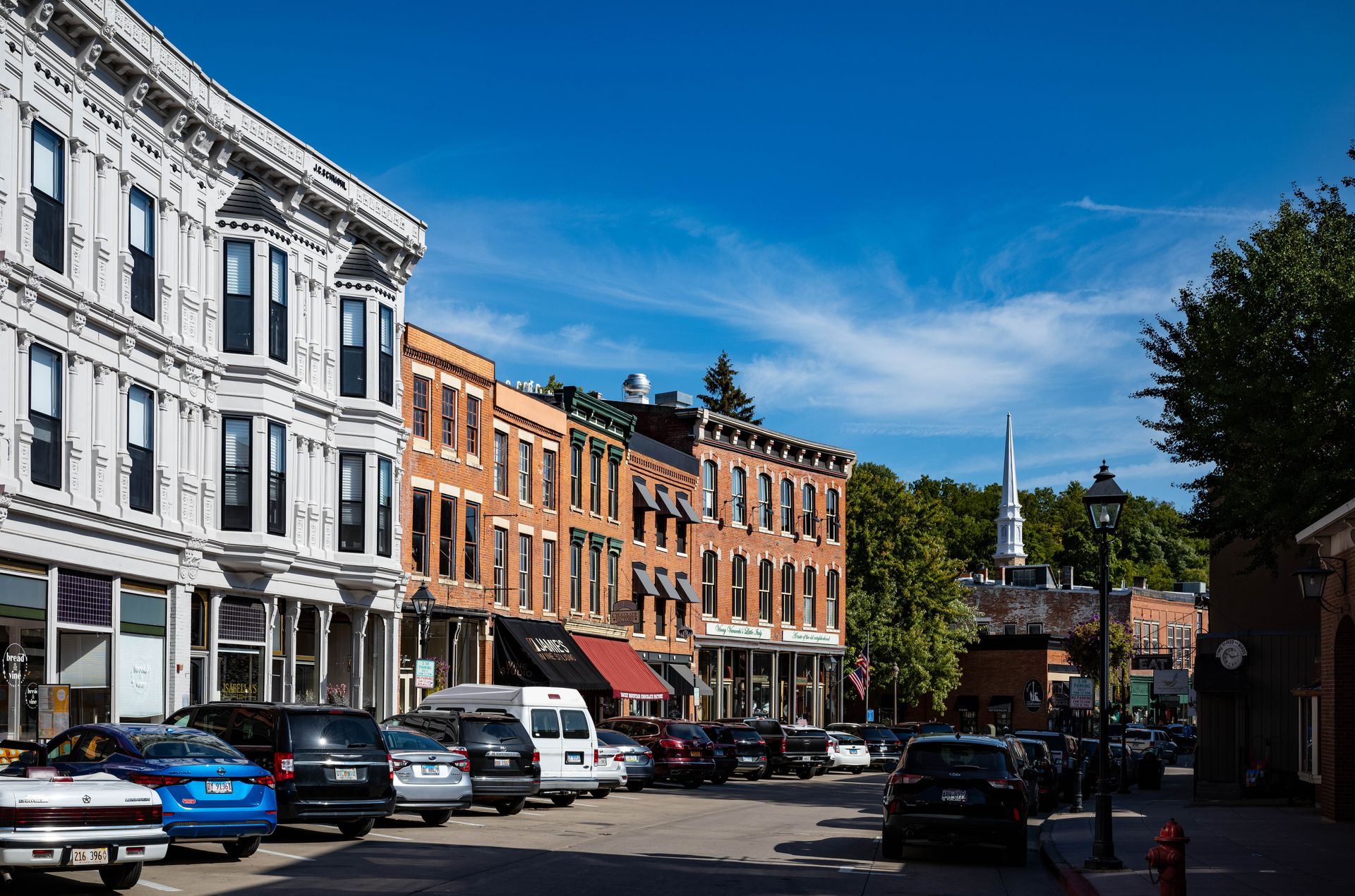
Galena sits in the far northwest corner of Illinois, in a region of rolling hills and river bluffs that looks more like the Driftless Area of Wisconsin than the flat agricultural landscape most people associate with the state. The town of about 3,000 people is built on a steep hillside above the Galena River, a tributary of the Mississippi, and its historic Main Street has been preserved largely intact since the mid-19th century. Eighty-five percent of Galena is listed on the National Register of Historic Places — a proportion that gives the town a remarkable architectural coherence found in few American towns of any size.
The town's commercial wealth in the 1840s and 1850s came from lead mining — galena is a lead sulfide mineral, and the name reflects that history. By 1845, the region produced roughly 80% of the lead mined in the U.S. That prosperity funded the construction of a downtown commercial district and a residential neighborhood of Victorian homes on the hill above, many of which are still standing and still privately owned. The view of the downtown from the top of the hill, looking down over church steeples and brick storefronts to the river valley below, is the image most associated with the town.
Ulysses S. Grant lived in Galena before the Civil War, working in his father's leather goods store, and returned after the war to a house presented to him by the town's citizens. The Ulysses S. Grant Home State Historic Site preserves the house as it appeared in the period after Grant's presidency, with original furnishings and interpretive materials. The house itself — a substantial Italianate villa on a residential street — is of architectural interest independent of the presidential connection.
Main Street's commercial mix skews toward antiques, galleries, and independent food and drink businesses that have resisted the uniform chain retail common in similarly sized towns. Several of the buildings on the street date to the 1840s, with cast-iron facades and pressed tin ceilings that remain in place behind updated storefronts. The Jail Hill Inn, a converted 1878 county jail operating as a luxury bed and breakfast, is one of the more original accommodation experiences in the Midwest.
The surrounding countryside — rolling hills, limestone outcroppings, and the broad Mississippi floodplain a few miles to the west — is well suited to cycling. The Mississippi Palisades State Park, about 20 miles south along the river, offers dramatic bluff views from trail systems that are considerably less visited than comparable landscapes elsewhere in the Midwest.
21 / 25
Woodstock, Vermont
Credit: Vanessa Sezini / Pexels
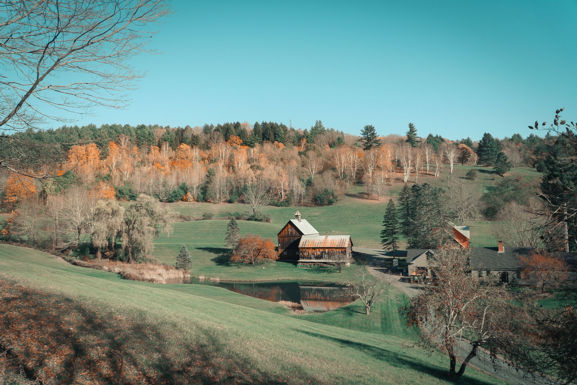
Woodstock sits in the Ottauquechee River valley of Windsor County, Vermont, about 13 miles west of the Connecticut River. The village of about 3,200 people has the most photographed village green in Vermont — a formal commons surrounded by Federal and Greek Revival buildings, including a covered bridge at its west end — and has appeared on lists of beautiful American towns with enough regularity that its reputation is fixed. That reputation is not unearned, but the deeper case for Woodstock rests on substance rather than aesthetics.
Woodstock was home to Frederick Billings, a San Francisco lawyer who made his fortune in the 1850s gold rush era and returned to Vermont to build a scientific farm on the 1790 estate of Congressman Charles Marsh. Billings planted the hillsides above his farm with thousands of trees in one of the earliest systematic forest conservation efforts in the U.S. His granddaughter later married Laurance Rockefeller, and the Rockefellers continued the conservation work and eventually donated the farm to the public.
The Billings Farm and Museum, open April through November, is a working Jersey dairy farm that also operates as a living history museum, demonstrating farming practices from the 1890s era of the original Billings farm. The quality of the interpretive program and the experience of a working farm with genuine agricultural activity rather than staged demonstration makes it one of the more honest agricultural museums in New England.
Marsh-Billings-Rockefeller National Historical Park, adjacent to the farm, protects the mansion, gardens, and forested hillsides that Billings planted in the 1870s. The park's trails climb through a forest that represents a century and a half of active management, and the interpretive program connects the Marsh-Billings-Rockefeller land stewardship to the broader history of American conservation thinking — from George Perkins Marsh's foundational 1864 book Man and Nature through the present day.
The village itself functions most visibly in summer and fall. The Woodstock Farmers' Market runs on Wednesdays from June through October. The covered bridge at the west end of the green is the easternmost covered bridge in Vermont, and the drive south through Reading and Cavendish, or north along Route 12 toward Barnard, passes through some of the most unchanged village landscape in the state.
22 / 25
Highlands, North Carolina
Credit: Francisco Cornellana Castells / Pexels
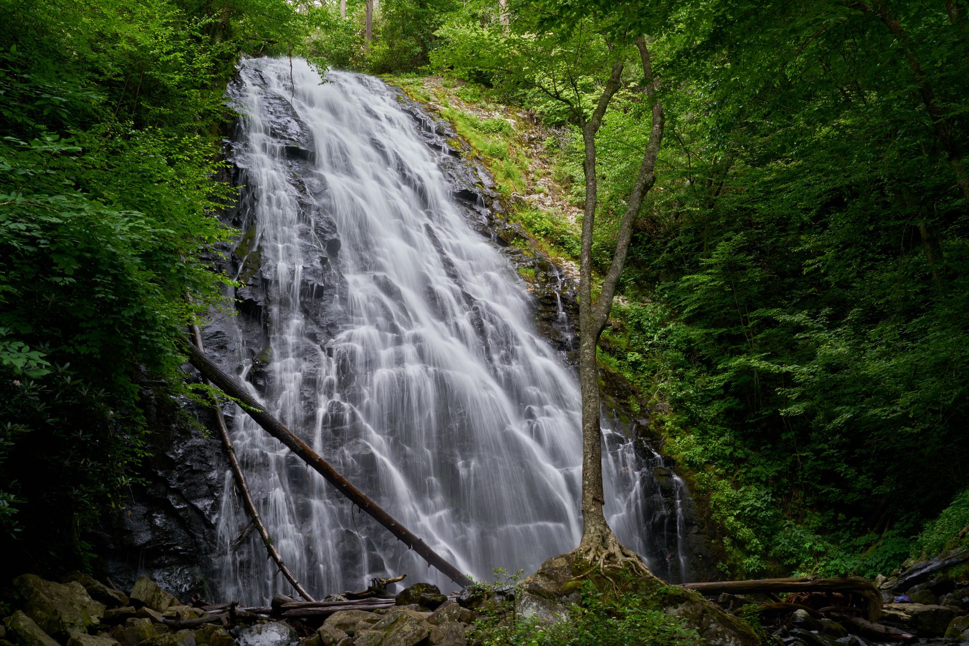
Highlands sits on a plateau in the southern Appalachian Mountains of Macon County, North Carolina, at an elevation of 4,118 feet — the highest incorporated town east of the Mississippi River. The town of about 3,000 permanent residents is located in the Nantahala National Forest, within a region that receives more annual rainfall than almost anywhere else in the eastern U.S. That combination of elevation, rainfall, and steep terrain has created an unusually dense concentration of waterfalls within a few miles of the downtown, and the surrounding forest has the lush, layered quality of a genuine temperate rainforest.
The waterfall circuit accessible from Highlands is one of the best in the East. Dry Falls, about three miles west of town on U.S. Highway 64, allows visitors to walk behind a 65-foot cascade on a paved path — one of the most accessible behind-the-falls experiences in the region. Bridal Veil Falls, a mile further west, drops 120 feet directly beside the road and forms ice formations at its base during cold spells. Whitewater Falls, about 25 miles south near the North Carolina-South Carolina border, drops more than 400 feet in a series of cascades — the tallest waterfall east of the Rocky Mountains — with a paved overlook accessible to most visitors. The concentration of waterfalls within an hour's drive of town gives Highlands a natural draw that fills a weekend without effort.
The town itself has the character of a mountain community that has attracted a second-home and retirement population without losing its working identity. Main Street runs for several blocks with galleries, independent restaurants, and shops occupying buildings that reflect the early-20th-century prosperity of a mountain resort community. The Bascom, a visual arts center housed in a renovated building on a creek below the downtown, hosts exhibitions, artist residencies, and public programs throughout the year.
The Highlands Performing Arts Center stages productions from spring through fall in a venue that draws visiting performers and companies from across the region. The combination of the performing arts programming and the Bascom gives Highlands a cultural depth that is unusual for a mountain town of its size. Fly fishing on the Cullasaja River and the surrounding trout streams is a year-round draw for anglers, and the surrounding trails — including the hike to Whiteside Mountain, a granite dome with sheer cliffs and views extending into Georgia and South Carolina — add outdoor options beyond the waterfall circuit.
23 / 25
Dahlonega, Georgia
Credit: Alex Diaz / Unsplash
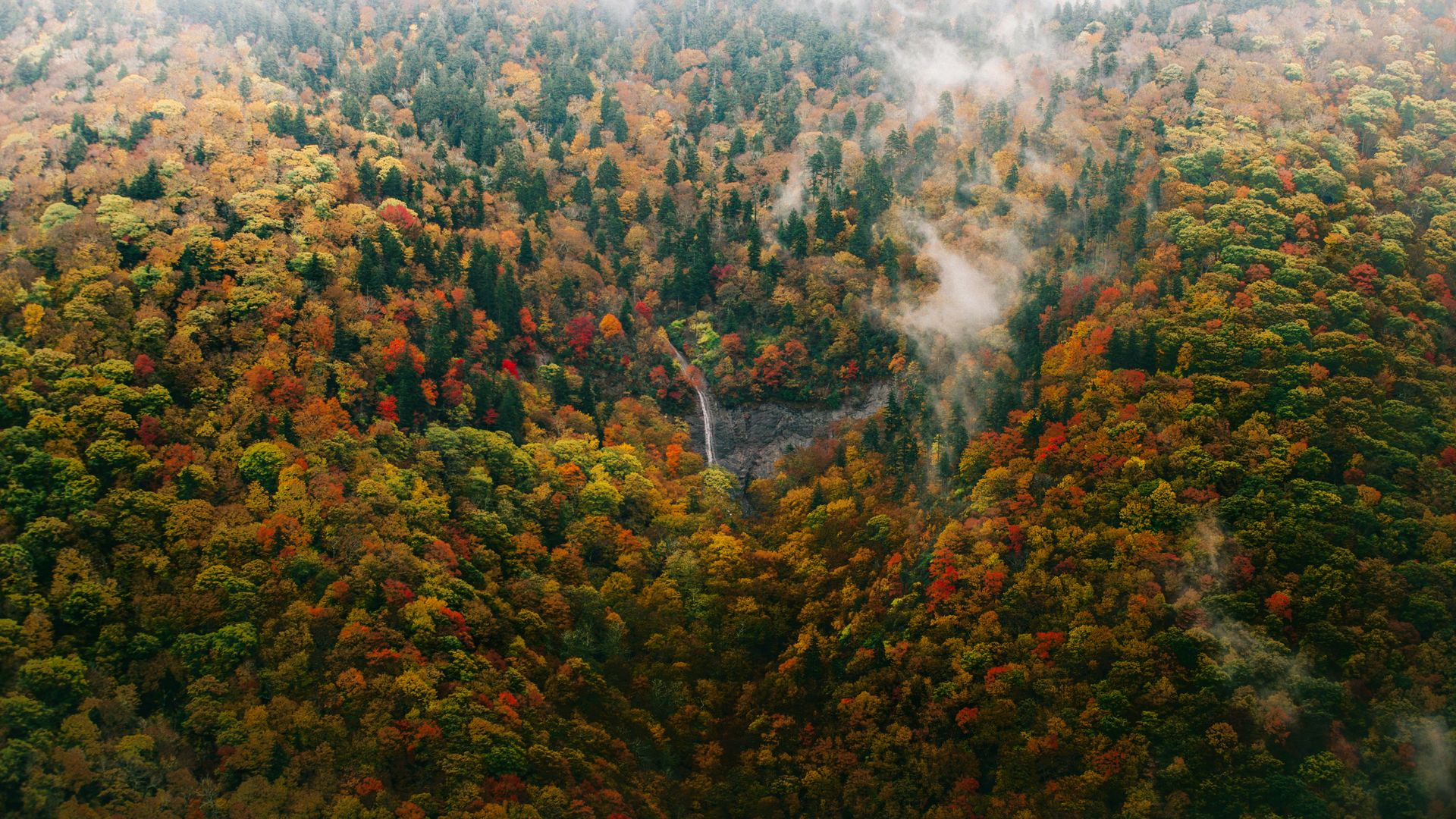
Dahlonega sits in the foothills of the Blue Ridge Mountains in Lumpkin County in north Georgia, about 65 miles northeast of Atlanta. The town of about 7,000 people was the site of the first major U.S. gold rush — gold was discovered in the Georgia mountains in 1828, more than 20 years before the California discovery — and the Gold Museum in the old county courthouse documents that history in detail.
The Dahlonega Gold Museum State Historic Site, housed in the 1836 courthouse on the town square, holds the original building's courtroom and jail alongside exhibits covering the gold rush era, the U.S. Branch Mint that operated in Dahlonega from 1838 to 1861, and the broader history of the Cherokee Nation whose land was seized to permit the gold rush to proceed. The Cherokee removal — forced by the Indian Removal Act of 1830 and conducted beginning in 1838, the Trail of Tears — is directly addressed in the museum's interpretive materials, giving context that is sometimes absent from similar Gold Rush narratives.
The Dahlonega Wine Trail extends through the Georgia wine region of the Blue Ridge foothills, with more than 20 wineries operating within a short drive of the town square. The combination of elevation, well-drained granitic soil, and warm growing seasons with cool nights creates conditions particularly suited to Viognier, Cabernet Franc, and Tempranillo. Several of the wineries have been operating since the 1980s, when winemakers first began testing the potential of the north Georgia mountains.
The Appalachian Trail passes about 12 miles north of Dahlonega at the Blood Mountain wilderness, and Blood Mountain itself — at 4,458 feet the highest point on the Georgia section of the trail — is accessible from the Byron Reece trailhead on U.S. Highway 19. The trail to the summit passes through one of the better examples of old-growth forest on the southern Appalachian Trail corridor, and the stone shelter at the summit is one of the oldest on the trail.
The Appalachian Trail Approach Trail, which begins at Amicalola Falls State Park about 20 miles west of Dahlonega, is the most commonly used starting point for northbound through-hikers. The culture of long-distance hiking is present in the town's restaurants and outfitters throughout the spring and early summer, and the town square has the energy of a community that functions both for locals and for the steady flow of people heading into the mountains.
24 / 25
Fredericksburg, Texas
Credit: J. Amill Santiago / Unsplash
Fredericksburg sits at the center of the Texas Hill Country in Gillespie County, about 70 miles west of Austin and 80 miles north of San Antonio. The town of roughly 11,000 people was founded in 1846 by German immigrants — members of the Adelsverein colonization society — and that founding culture remains visible in the limestone Fachwerk architecture of the original town, the German-American cooking traditions still practiced in several restaurants, and the place names on the surrounding ranches and farms.
The National Museum of the Pacific War, formerly the Admiral Nimitz Museum, is Fredericksburg's most visited attraction. Admiral Chester Nimitz, commander of Allied Pacific forces in World War II, was born here, and the museum has grown into one of the most comprehensive Pacific theater museums in the country, covering everything from the attack on Pearl Harbor to the occupation of Japan with full-scale recreations, artifact collections, and oral history installations. The museum occupies several buildings across a city block and requires at least half a day to visit properly.
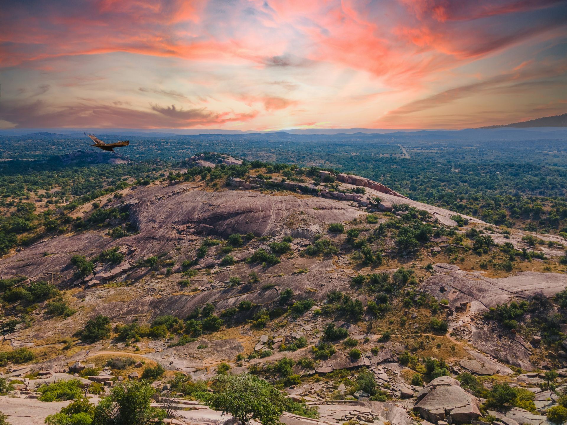
Enchanted Rock State Natural Area, about 18 miles north of Fredericksburg, preserves a massive pink granite dome that rises 425 feet above the surrounding Hill Country. The summit hike is short but steep, and the view from the top — across miles of live oak and cedar hillside to the distant escarpment — is one of the defining landscapes of central Texas. The rock has significant cultural importance to the Tonkawa and Comanche peoples who inhabited the region before European settlement.
The Hill Country around Fredericksburg produces both wine and peaches in quantity. The peach season runs from late May through August, with roadside stands selling fruit directly from the surrounding orchards. The Texas Hill Country wine region now includes dozens of operating wineries within a short drive of town, with the limestone-based soil and extreme climate creating conditions suited to Spanish and Italian varieties. The Vereins Kirche — an octagonal community building reconstructed in 1935 to match the original 1847 structure — stands in the center of Main Street as the focal point of the historic downtown.
25 / 25
Abingdon, Virginia
Credit: Amanda Kevin / Pexels
Abingdon sits in the Great Appalachian Valley in the far southwest corner of Virginia, three miles from the Tennessee border. The town of about 8,000 people is the seat of Washington County and has been continuously occupied since the 1770s. It is best known as the home of the Barter Theatre — the oldest state theater in America, which has been in continuous operation since 1933 and serves as the State Theatre of Virginia.
The Barter Theatre's founding story is specific to the Depression era. Robert Porterfield, a Virginia actor working in New York, returned to Abingdon in 1933 with a company of unemployed New York actors and proposed that audiences pay for admission with farm produce — hams, vegetables, eggs — which the company would eat to sustain themselves. The barter arrangement, entered into by necessity, gave the theater its name and a founding mythology that still frames how the institution presents itself. The theater has since grown into a year-round professional regional theater with two stages, a season ranging from Shakespeare to new American plays, and a national reputation for the quality of its productions.
Downtown Abingdon's Main Street is one of the better-preserved streetscapes in Virginia's southwestern mountains. The buildings from the 1820s through the 1900s reflect the town's role as a commercial center for the agricultural counties of the upper Holston River valley. The conversion of several historic buildings to restaurant and retail use has been done with more care for the physical fabric than is common in comparable Virginia towns.
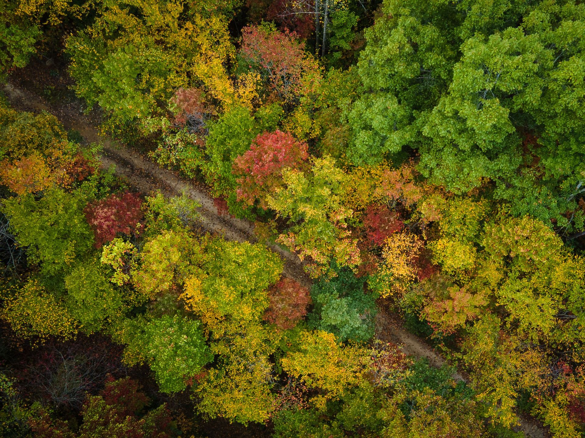
The Virginia Creeper Trail, a 34-mile rail trail extending from Abingdon east to the North Carolina border at White Top Mountain, is the most visited trail in the Virginia Highlands. The upper portion, which descends from Whitetop station to Damascus over the course of several miles, is one of the more popular downhill cycling routes in the Southeast, with outfitters in Abingdon and Damascus providing shuttle service and bike rentals. The lower portion, from Damascus west to Abingdon, follows Laurel Creek through a second-growth forest of hemlock and hardwood that peaks in color in mid-October.
The food culture in Abingdon reflects both the agricultural traditions of Appalachian Virginia and the more recent influence of chefs drawn to the region's raw material quality. Wolf Hills Brewing Company, named for the original 18th-century name of the settlement, is one of several food and drink businesses that have opened in the historic buildings downtown in recent years.