
20 American road trips where the journey beats the destination
From the Pacific Coast Highway to the Natchez Trace, these 20 drives cover the full range of American landscape — and all of them are better experienced at road-trip pace than any other way
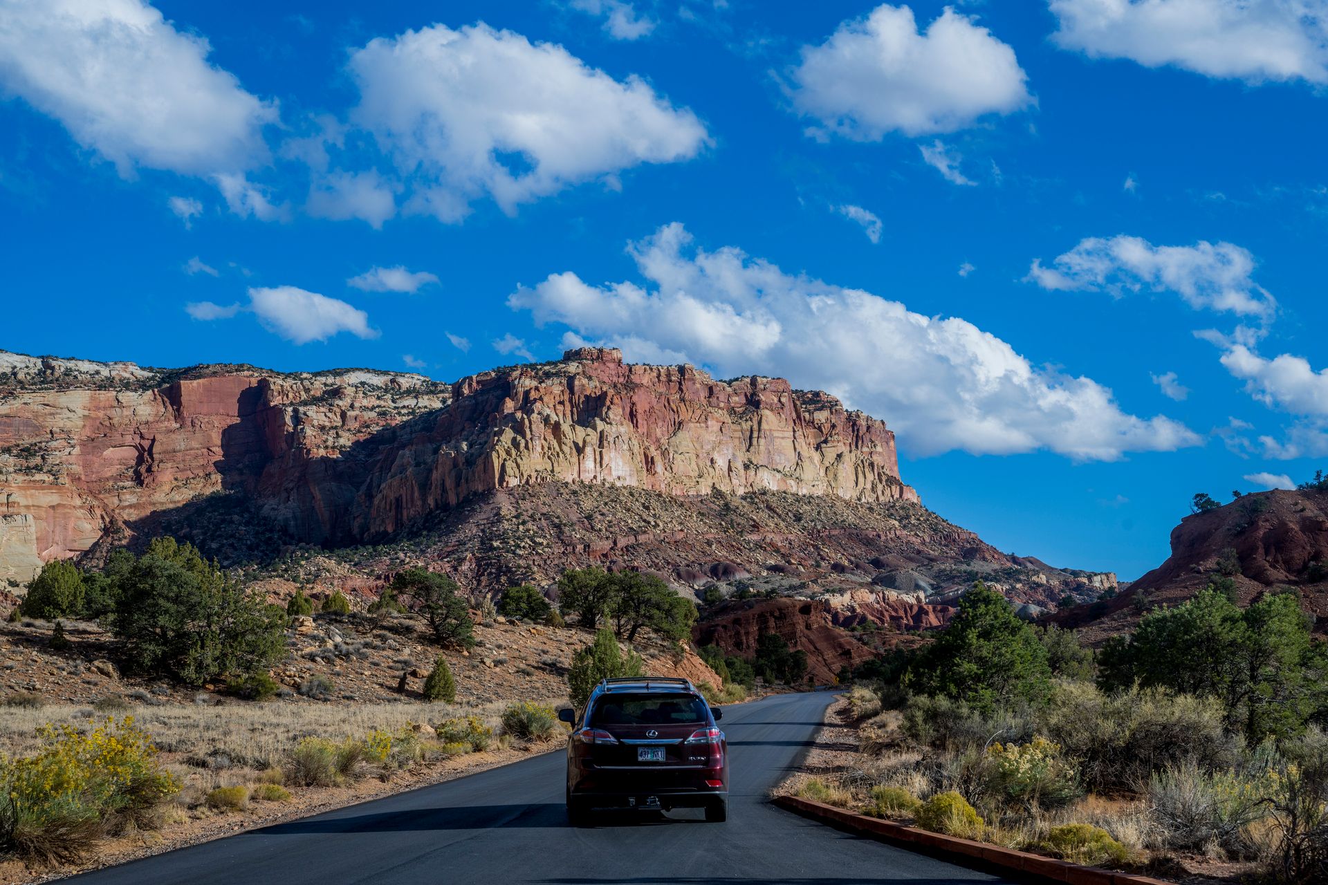
Wolfgang Kaehler / Getty Images
The road trip is the American travel format — not because Americans invented driving, but because the country was built at a scale and with a geography that makes the car the most natural way to encounter it. A flight from New York to Los Angeles takes five hours and delivers you from one coastal city to another with 2,800 miles of continent entirely bypassed. The same journey by road takes five days and passes through the Appalachians, the Ohio River Valley, the Great Plains, the Rocky Mountains, and the Mojave Desert — five distinct landscapes, five distinct regional cultures, and a physical understanding of the country's scale that no other mode of travel provides.
That is the case for the road trip as a format. The case for the specific roads on this list is different: each one was chosen because the drive itself — the specific sequence of landscapes, the quality of the light on a particular stretch, the towns and stops along the way — is the experience, not merely the mechanism for reaching an experience. These are not drives you take to get somewhere. They are drives you take because the road is the point.
The 20 trips here range from iconic routes that have been driven by millions to regional roads that are largely unknown outside the states they pass through. They span every region of the country: the Pacific coast, the desert Southwest, the Rocky Mountain states, the Great Plains, the Deep South, New England, the mid-Atlantic, and the upper Midwest. Several are short enough to complete in a day. Several justify a week or more. All of them reward the traveler who is willing to stop — at the overlook that is not on the itinerary, at the diner that looks right from the road, at the geological formation that deserves more than a drive-by glance.
Pacific Coast Highway, California
Joe Sohm/Visions of America / Getty Images
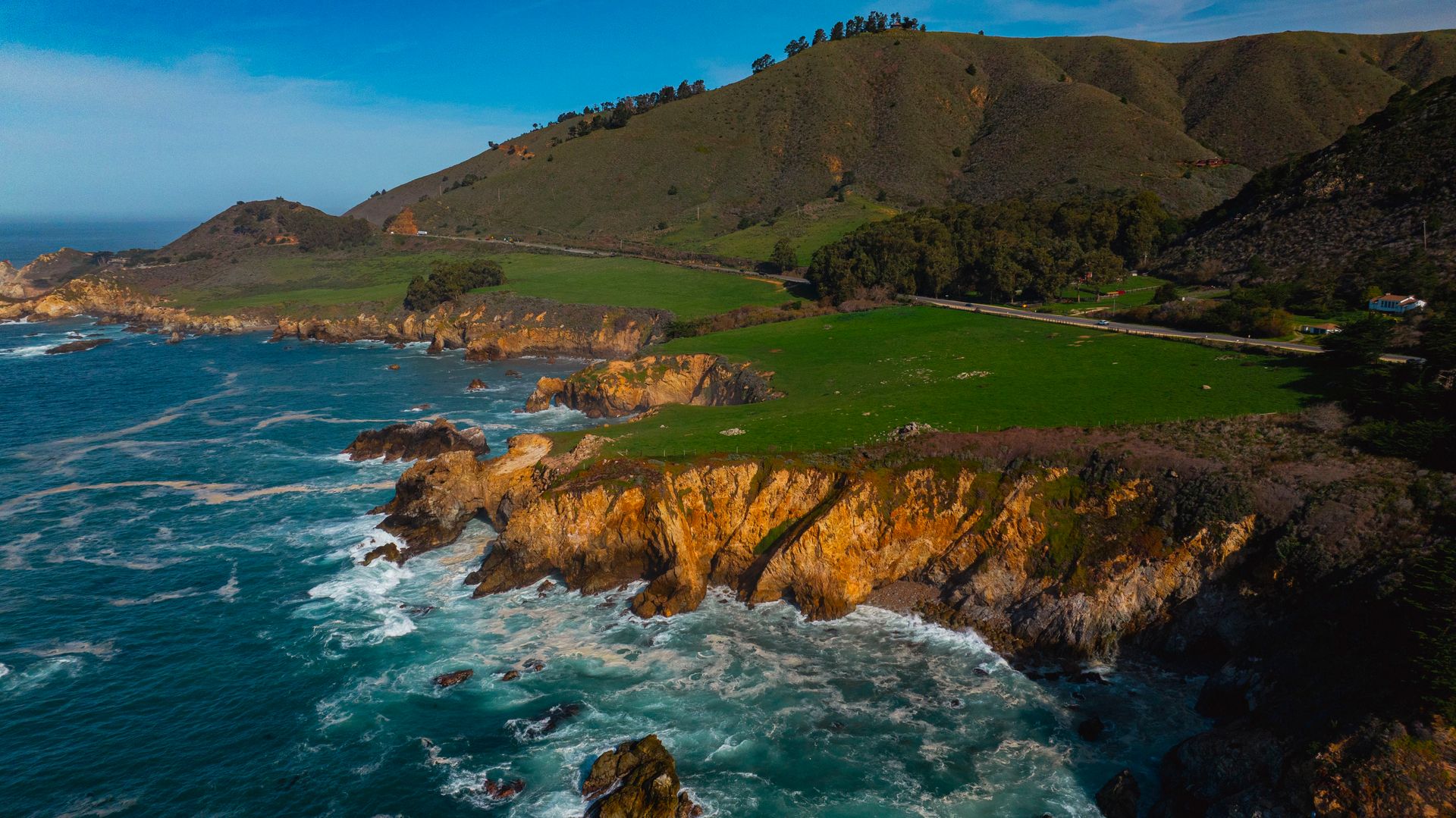
Highway 1 along the California coast — the Pacific Coast Highway, though that name technically applies to a longer route — is the most driven scenic road in the United States and has earned that status. The stretch from San Luis Obispo north through Big Sur to Carmel and on to San Francisco, roughly 250 miles, offers a sustained sequence of coastal drama — cliffs falling to the Pacific, sea stacks rising from the surf, the road carved into the rock hundreds of feet above the water — that has no equal on the American coast.
Big Sur is the section that defines the drive. The 90-mile stretch of coastline between San Simeon and Carmel has been largely undeveloped because the topography — steep mountains meeting a turbulent ocean, with no natural harbor and no flat land — made development impractical. The result is one of the last stretches of undeveloped Pacific coast in California, accessible by a road that was blasted and carved into the cliffs over a period of 18 years and completed in 1937. The Bixby Bridge, a single-arch concrete span completed in 1932, is the most photographed bridge in California and offers, on a clear day, a view of coast and ocean that justifies stopping on its own.
The drive is best done northbound — San Luis Obispo to San Francisco — because the ocean is on your left, keeping it in direct view throughout rather than across the car. Allow three days at minimum: one day from San Luis Obispo to Big Sur, a full day in Big Sur with stops at McWay Falls, the Henry Miller Library, and Pfeiffer Beach, and a final day from Big Sur to San Francisco via Carmel and the 17-Mile Drive through Pebble Beach. Fog is present year-round but most common in June and July — what Californians call June Gloom. September and October offer the clearest skies and the warmest temperatures.
Highway 1 is subject to closures from landslides, which are common after heavy rain seasons. Check current conditions through Caltrans before departure and have an alternative inland route via US-101 as a backup.
Going-to-the-Sun Road, Montana
The Washington Post / Getty Images
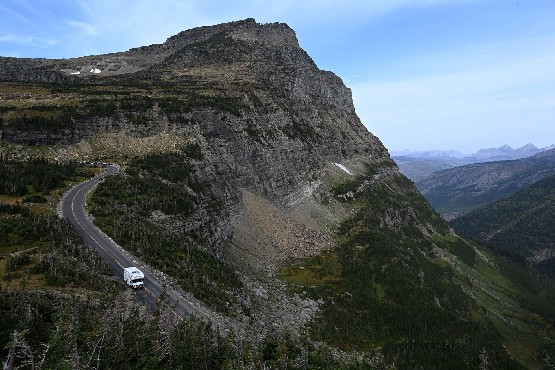
Going-to-the-Sun Road, which crosses the Continental Divide through Glacier National Park in Montana, is 50 miles long and takes a minimum of two hours to drive — not because traffic is heavy, though it can be, but because the landscape demands that you stop. The road climbs from the valley floor at Lake McDonald through dense cedar forest, past waterfalls, across alpine meadows, and over Logan Pass at 6,646 feet, with views of hanging glaciers, thousand-foot rock faces, and the particular quality of high-altitude light that makes mountain photography look like overprocessed images even in person.
The road was completed in 1932 and is itself a feat of engineering that merits attention. The narrow two-lane road was carved into cliff faces in sections where no other alignment was possible, with the outboard lane extending over drops of hundreds of feet with only a low stone wall between the car and the void. Vehicles over 21 feet in length are prohibited on the central section. The Gardner Wall section, where the road traverses a near-vertical cliff face high above the valley, is the stretch that passengers tend to grip the door handle through, regardless of their normal attitude toward heights.
The road is typically open from late June to mid-October, with the exact dates varying by snowpack. The park's popularity has necessitated a timed entry permit system for private vehicles during peak season — check the National Park Service website for current requirements before arrival. The best strategy is to drive the road at dawn, before the day-use permits have filled and before the tour buses arrive at Logan Pass. The light at 6am on a clear July morning at Logan Pass, with the peaks above catching the first sun and the valley still in shadow below, is the kind of thing people describe years afterward.
Blue Ridge Parkway, Virginia and North Carolina
George Rose / Getty Images
The Blue Ridge Parkway runs 469 miles from Shenandoah National Park in Virginia to the Great Smoky Mountains National Park in North Carolina, following the crest of the Blue Ridge Mountains through terrain that is among the most beautiful in the eastern United States. It was designed specifically as a scenic drive — no commercial vehicles, no billboards, no intersections with grade crossings — and that design intention, executed over a construction period that ran from 1935 to 1987, produces a road that is as close as the American highway system comes to a work of landscape architecture.
The parkway has no entrance fee and no permit requirements. It passes through farmland, forest, and open ridgeline, with overlooks positioned at intervals that give views east over the Virginia Piedmont and west into the Appalachian valleys, depending on which side of the ridge the road is on. Mabry Mill, near Meadows of Dan in Virginia — a restored 19th-century grist mill beside a pond, photographed in autumn so frequently that it appears in every collection of American landscape photography — is the most visited single stop on the parkway, and genuinely worth the stop even accounting for the crowds.
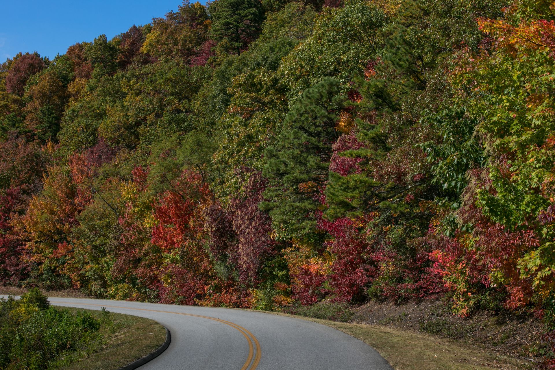
The fall color season — mid-October in the northern Virginia sections, late October in the North Carolina sections — is the peak period, when the hardwood forest turns amber and red and the views from the ridge are defined by the color rather than the haze that limits visibility in summer. Allow four to five days for the full parkway at a pace that permits stops; three days is achievable but leaves little time for the hiking trails that access terrain the road cannot reach.
The southern terminus near Asheville, North Carolina, gives access to one of the most interesting small cities in the South — Asheville's food scene, music culture, and proximity to the Smokies make it an excellent base for the southern end of the parkway.
Route 66, Illinois to California
David McNew / Getty Images
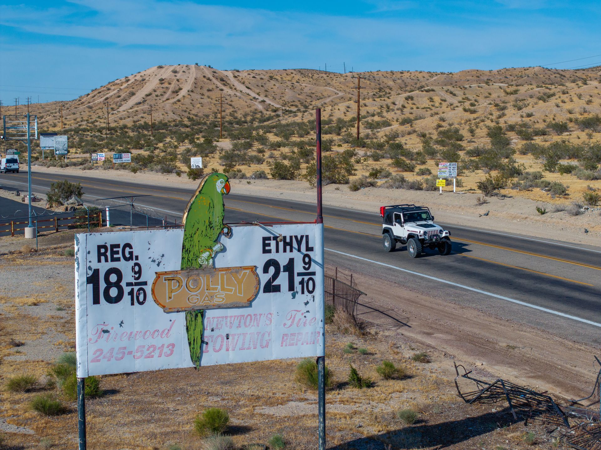
Route 66 — the original "Main Street of America," running 2,448 miles from Chicago to Santa Monica — is no longer a functional highway in most of its length. It was decommissioned as a U.S. highway in 1985, replaced by the interstate system that made it obsolete. What remains is a patchwork of historic alignments — some well-maintained, some crumbling, some disappearing into the desert — and a mythology so powerful that the road attracts a specific category of traveler who is not driving from Chicago to Los Angeles but driving Route 66 as a thing in itself.
The mythology is partly earned. The route passes through a cross-section of American landscape and culture — the Illinois flat lands, the Missouri Ozarks, the Oklahoma plains, the Texas Panhandle, the New Mexico high desert, the Arizona plateaus and the Painted Desert, the Mojave Desert — in a sequence that feels like a compressed America. The towns along the route were built for the road and declined when the interstate bypassed them; many are caught in a specific period of American vernacular architecture — the motor court, the neon diner sign, the drive-in — that has been preserved partly by decline and partly by the tourism the Route 66 mythology itself generates.
The essential stretch for a first drive is New Mexico and Arizona — from Albuquerque through the Petrified Forest, past the Painted Desert, through the canyon town of Williams, and on to the Hackberry General Store in Arizona, the last authentic roadside general store on the route. Plan for Oklahoma City's Route 66 Museum and for the stretch through Amarillo, Texas, where the Cadillac Ranch — ten Cadillacs nose-first in the ground, covered in spray paint that changes with every passing day — is the most photographed public art installation on the road.
Overseas Highway, Florida
Joe Sohm/Visions of America / Getty Images
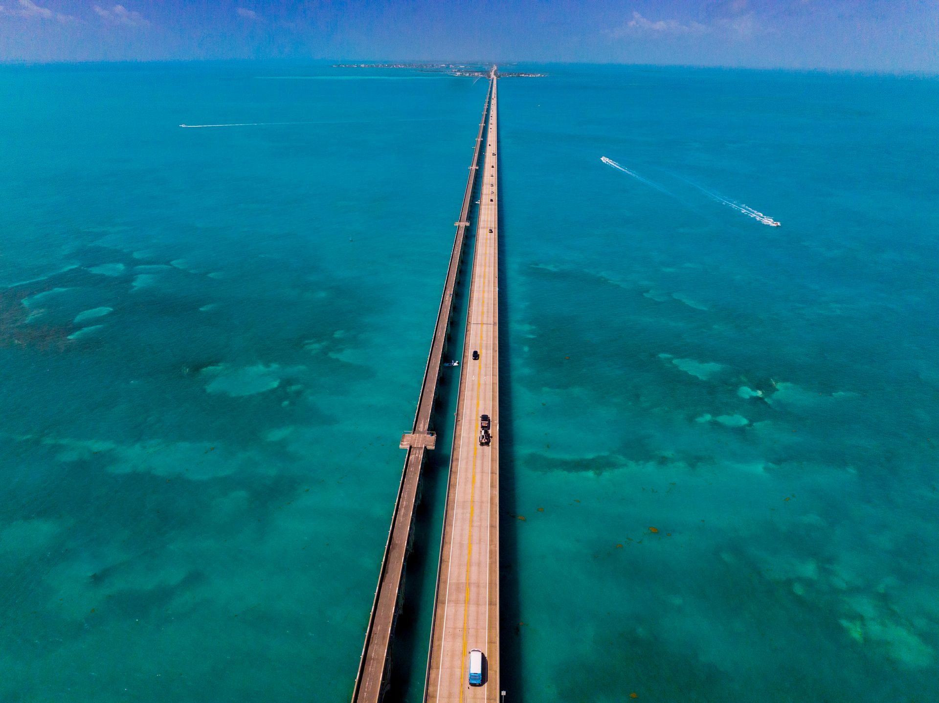
The Overseas Highway — US-1 from Miami to Key West, 113 miles of road built over and between the islands of the Florida Keys — is the most unusual driving experience in the continental United States: a road that spends more than half its length over water, crossing 42 bridges over the Gulf of Mexico and the Atlantic Ocean simultaneously, with the sea visible in every direction and the horizon replacing the landscape that all other roads provide. The Seven Mile Bridge, the longest of the Keys bridges, is the section that most clearly communicates what the road is: a thin line of asphalt connecting two dots in a very large ocean.
The original road was built on the infrastructure of Henry Flagler's Florida East Coast Railway, which extended to Key West in 1912 and was destroyed by the Labor Day Hurricane of 1935 — still the most intense Atlantic hurricane to make landfall on record. The railway bridges became the road bridges, and the Overseas Highway opened in 1938. The old Seven Mile Bridge, which runs parallel to the current bridge, is now a pedestrian walkway and the longest fishing pier in the world.
The drive from Miami to Key West takes three to four hours without stops. The stops that make it worth doing slowly are the John Pennekamp Coral Reef State Park at Key Largo, where glass-bottom boat tours give access to the only living coral reef in the continental United States; Bahia Honda $HMC State Park on Bahia Honda Key, whose beach is consistently rated among the most beautiful in Florida; and Key West itself, whose particular combination of 19th-century Conch architecture, sunset ritual at Mallory Square $SQ, and literary history justifies at least one night.
Drive early morning to avoid the afternoon heat and the traffic that builds through midday in summer.
The Loneliest Road, Nevada
UCG / Getty Images
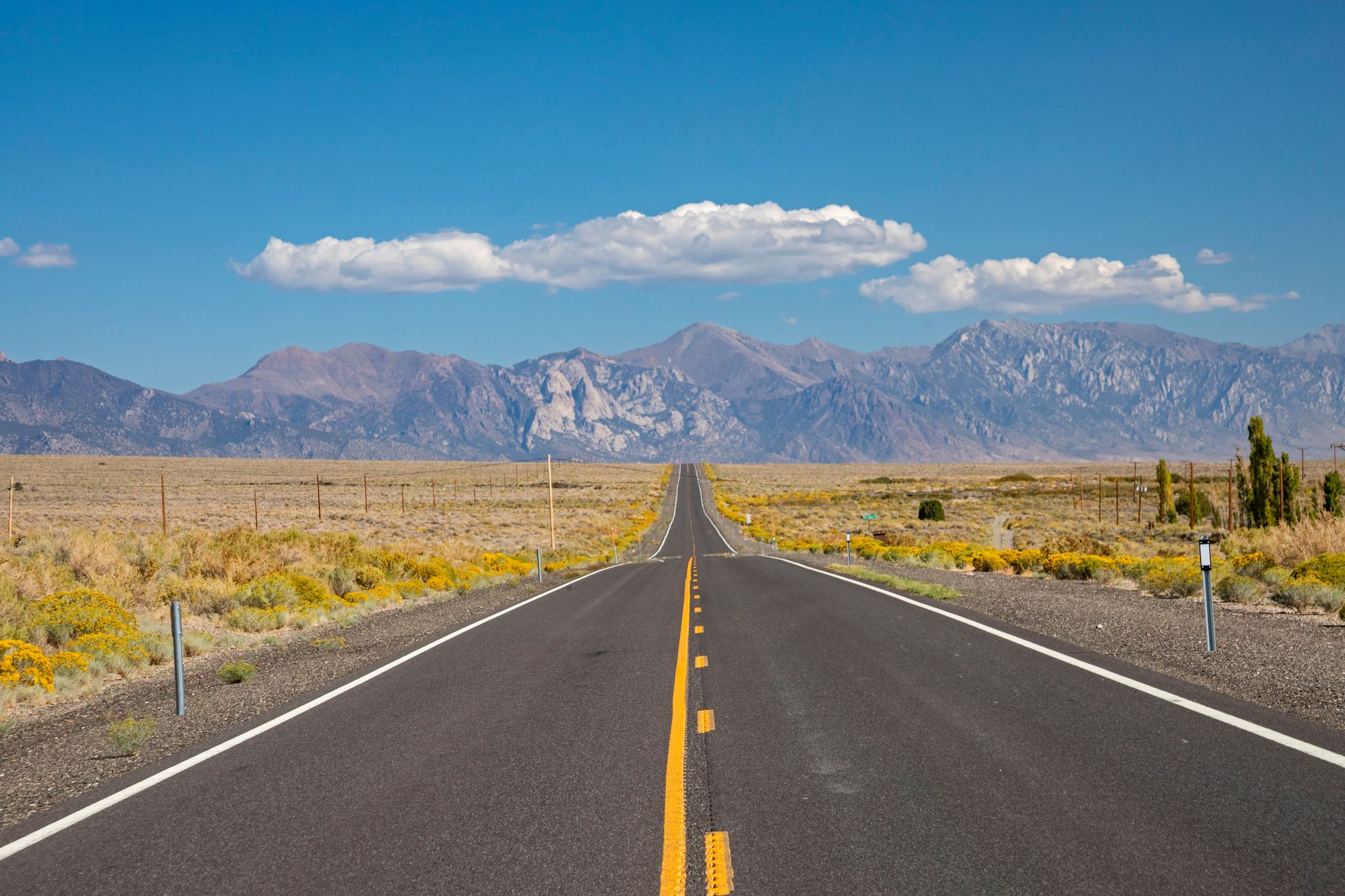
US-50 across Nevada — officially designated "The Loneliest Road in America" by Life magazine in 1986, after the magazine suggested that travelers needed survival skills to drive it — runs 287 miles from Ely in eastern Nevada to Fernley near Reno, crossing four mountain ranges and three desert basins in terrain that is so sparsely populated that the highway department erected signs in the 1980s encouraging travelers to collect passport stamps from the handful of towns along the route as proof of survival.
The designation is accurate in one sense and misleading in another. The road is genuinely empty — passing through Austin, with a population of around 200, and Eureka, with fewer than 600, as its primary population centers — and the landscape is the particular kind of Nevada emptiness that is not desolate so much as vast: sagebrush desert interrupted by mountain ranges, long straight grades climbing to passes at 7,000 feet, and the Basin and Range topography that makes Nevada the most mountainous state in the contiguous U.S. by number of mountain ranges.
What the designation misses is that the emptiness is the point. US-50 across Nevada is one of the few roads in the lower 48 states where you can drive for an hour without seeing another vehicle and feel, in a genuinely physical way, how large and how empty much of the American West still is. The Great Basin National Park, accessed from Baker just south of the highway, contains Lehman Caves — limestone caverns decorated with rare shield formations — and the bristlecone pine grove on Wheeler Peak, where individual trees are among the oldest living organisms on Earth.
Allow two days minimum from Ely to Reno — the drive is only 287 miles but the stops, the terrain, and the quality of the light in the late afternoon make rushing it a specific kind of waste.
Beartooth Highway, Montana and Wyoming
Education Images / Getty Images
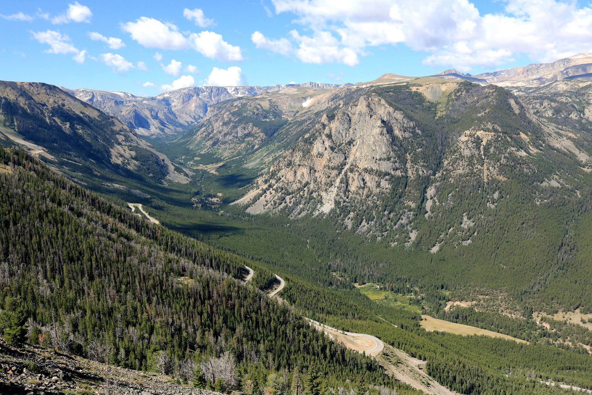
The Beartooth Highway — US-212 from Red Lodge, Montana, to the northeast entrance of Yellowstone National Park, 68 miles — is regularly cited by motorcyclists and driving enthusiasts as the most spectacular road in the United States. That citation is not hyperbole. The road climbs from 5,500 feet at Red Lodge to 10,947 feet at Beartooth Pass — the highest elevation of any U.S. highway — through a series of switchbacks and exposed ridgeline sections with views of the Beartooth Plateau that extend for 50 miles in every direction and that, on a clear day in July, include snowfields that persist year-round at altitude.
The drive is short enough — 68 miles, roughly three hours with stops — to be part of a larger Yellowstone itinerary rather than a destination in itself, though the road between Red Lodge and the pass is reason enough to plan a day around it. The approach from Red Lodge involves a series of tight switchbacks that gain 5,000 feet in elevation over roughly 20 miles, with the road visible in multiple tiers above and below simultaneously — the kind of road geometry that gives passengers who prefer not to look directly at the drop a case for keeping their eyes forward.
The top of the pass is above treeline, with a visitor center, a parking area, and a short walk to a viewpoint that gives a 360-degree panorama of the Beartooth Plateau — a high-altitude landscape that looks more like Alaska than Montana. Snowfields visible from the viewpoint include some that do not melt in most years.
The road is typically open from late May to mid-October, with the dates varying by year. It closes immediately and without much warning in early-season storms. Check road conditions through Montana DOT before departure and have a full tank of fuel in Red Lodge — there are no services on the road itself.
The Enchanted Circle, New Mexico
UCG / Getty Images
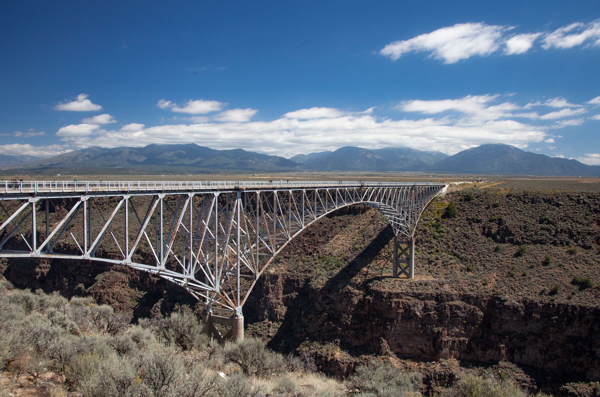
The Enchanted Circle is an 84-mile loop drive in northern New Mexico that connects Taos to a sequence of mountain towns — Arroyo Seco, Questa, Red River, Eagle Nest, Angel Fire — through terrain that encompasses the Rio Grande Gorge, the Wheeler Peak Wilderness (whose peak at 13,161 feet is the highest in New Mexico), and the high mountain valley of the Moreno Valley, which has the quality of an Alpine landscape set in the American Southwest at an altitude that produces spectacular clear-day light.
The drive is short enough to complete in a half day but rewards a full day or two. The Rio Grande Gorge Bridge, eight miles northwest of Taos, crosses the gorge 650 feet above the river — the second highest highway bridge in the U.S. system — and the view into the gorge from the bridge is one of the more abrupt landscape transitions in the Southwest, where the flat sagebrush mesa simply stops and a 650-foot slot canyon begins with no preparation.
Taos itself — the adobe town whose art colony was established in the early 20th century by painters who came to capture the light and largely never left — justifies a full day before or after the circle. The Taos Pueblo, continuously inhabited for over a thousand years and a UNESCO World Heritage Site, is the oldest continuously occupied building in North America and the most significant cultural site in northern New Mexico.
The fall aspens of the Sangre de Cristo Mountains — which line the road from Taos through the mountains — turn gold in late September and early October and produce a color display that rivals the New England fall, with the additional context of adobe architecture and red rock landscape that New England does not offer.
Great River Road, Minnesota to Louisiana
Credit: Illinois Office of Tourism
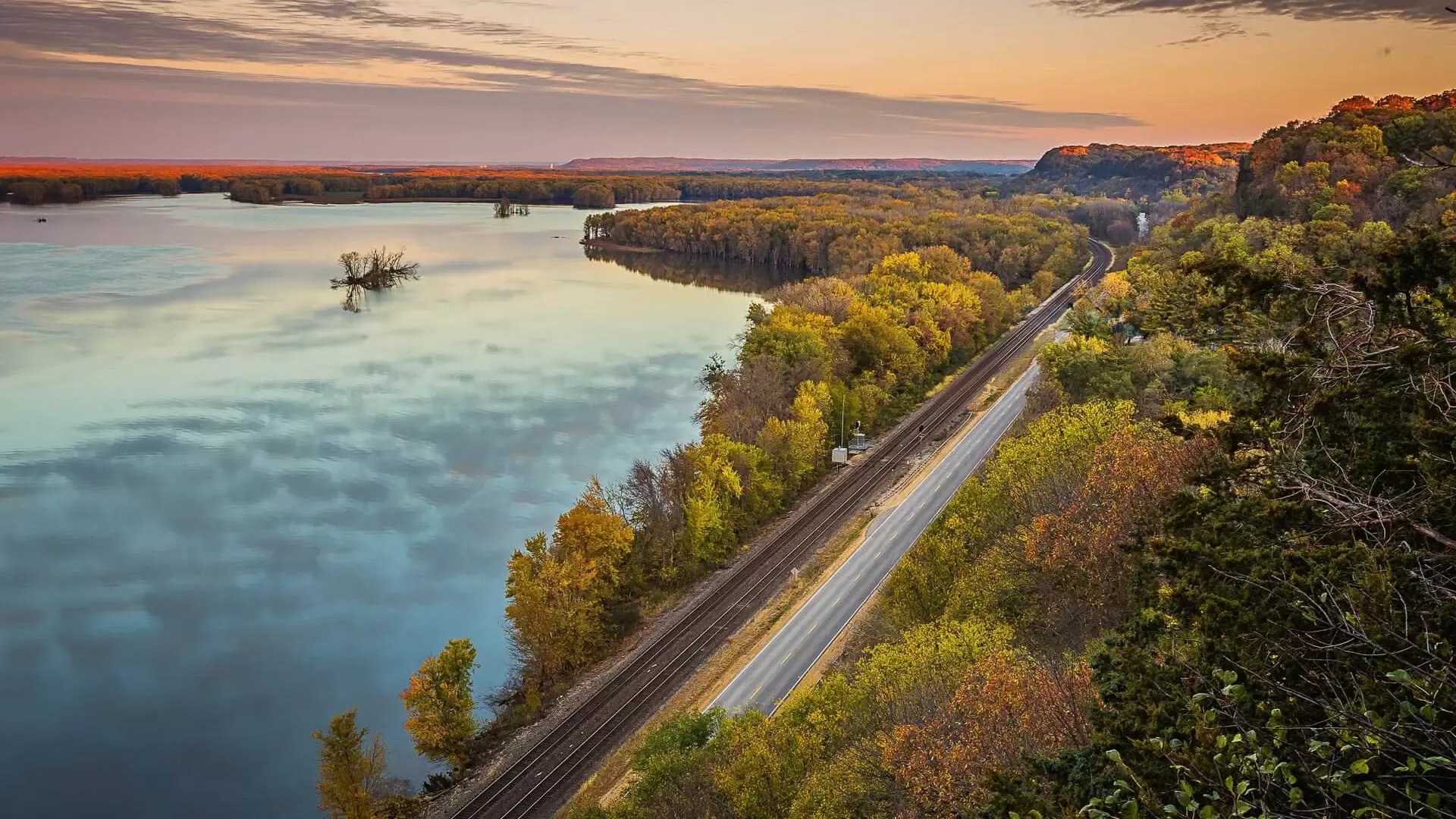
The Great River Road is a designated scenic byway that traces the Mississippi River from its headwaters at Lake Itasca in northern Minnesota to the Gulf of Mexico in Louisiana — a distance of roughly 3,000 miles through ten states. It is the longest scenic drive in this list and the one that most rewards a multi-week commitment. No other drive gives a more complete picture of the American interior, the river that shaped it, and the range of cultures that developed along it.
The Minnesota section — from Lake Itasca south through the Bluff Country of the Driftless Area, where the Mississippi runs through steep wooded bluffs and the road winds along the river's edge through towns that look like illustrations from a 19th-century travel account — is the most scenic of the northern sections. Winona, La Crosse, and Prairie du Chien all reward stops. The Illinois section, where the road passes through the American Bottom — the broad floodplain below St. Louis where the great Cahokia Mounds civilization built North America's largest pre-Columbian city — is the most historically significant.
The southern sections, through Missouri, Arkansas, Mississippi, and Louisiana, are where the landscape and culture become specifically Delta: the flat alluvial plain, the oxbow lakes, the cypress swamps, the blues-country towns of the Mississippi Delta, and eventually New Orleans, where the river and the culture it carried reach their most complex and most distinctly American expression.
A full drive from Lake Itasca to New Orleans rewards three weeks. A more manageable commitment is the Wisconsin-Iowa bluff country in fall, or the Mississippi Delta section from Memphis to New Orleans, which covers the most culturally rich stretch in a week.
Natchez Trace Parkway, Tennessee to Mississippi
The Washington Post / Getty Images
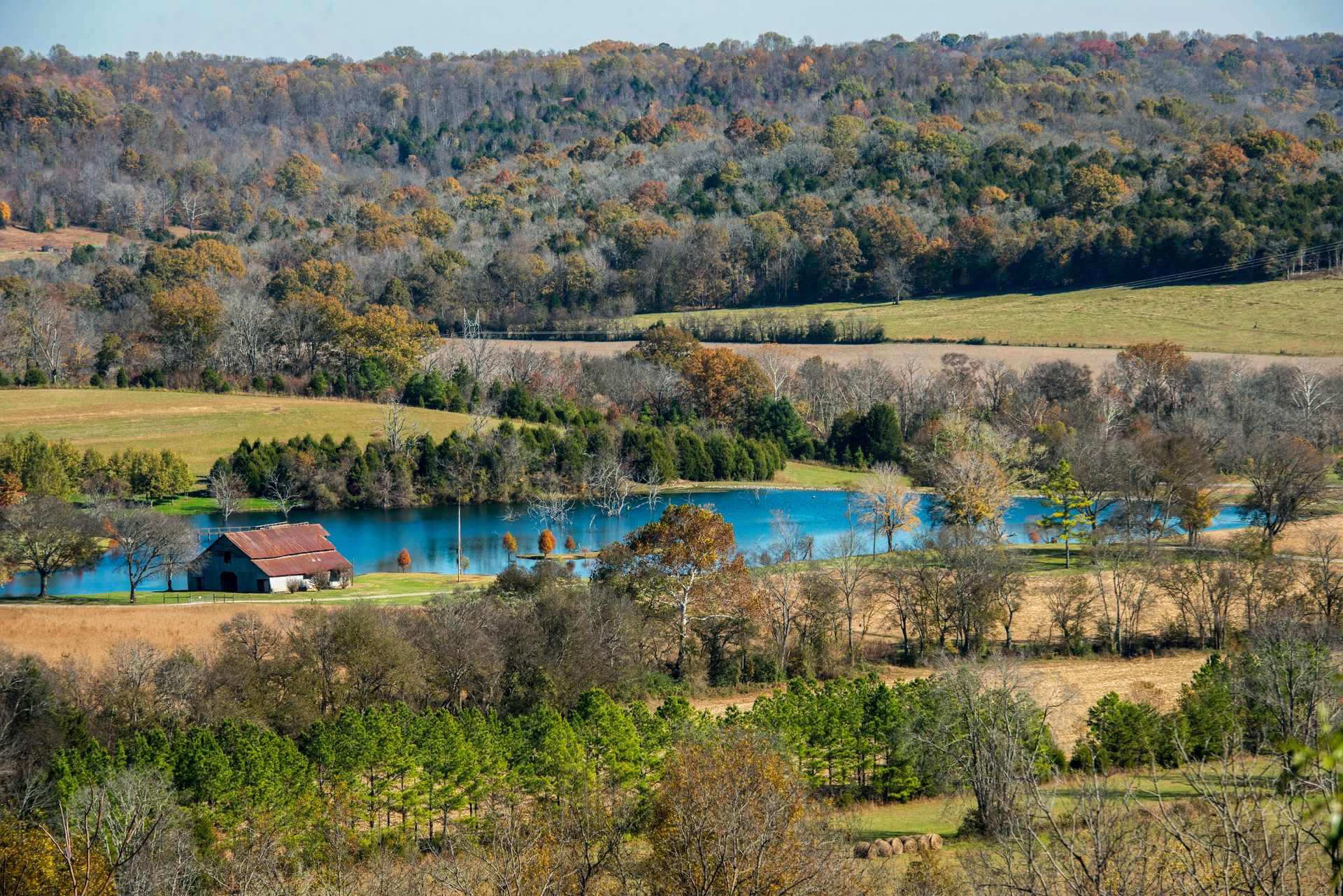
The Natchez Trace Parkway follows the route of a 10,000-year-old trail — used by Native Americans, then by traders, soldiers, and settlers moving between Nashville and Natchez — for 444 miles through Tennessee, Alabama, and Mississippi. Like the Blue Ridge Parkway, it was designed as a scenic drive with no commercial traffic, no billboards, and no at-grade intersections, which gives it a quality of seclusion and unhurried pace that the interstate highway system was specifically designed to eliminate.
The Trace passes through a succession of landscapes that are specific to the Deep South: hardwood forest, bottomland swamp, open pasture, and the particular quality of light in the Mississippi hill country that is different from light anywhere else in the United States — heavy with humidity, green-tinged from the canopy, and in autumn, lit by the specific gold of sweetgum and tupelo. The road surface is excellent, the speed limit is 50 miles per hour throughout, and the parkway's design encourages a pace that makes it genuinely different from any other long drive.
The significant stops are distributed across the full length. The Meriwether Lewis Monument and campsite in Tennessee, where Lewis died under circumstances that have been disputed for two centuries, is one of the few sites on the road that carries a story of genuine historical weight. Pharr Mounds in Mississippi — a complex of eight burial mounds dating from roughly 1 to 200 CE — is one of the largest mound complexes in the Southeast and one of the least visited significant archaeological sites in the region. Natchez itself, at the southern terminus, is the oldest city on the Mississippi River and has the most intact antebellum architecture in the South.
Highway 12, Utah
George Frey / Getty Images
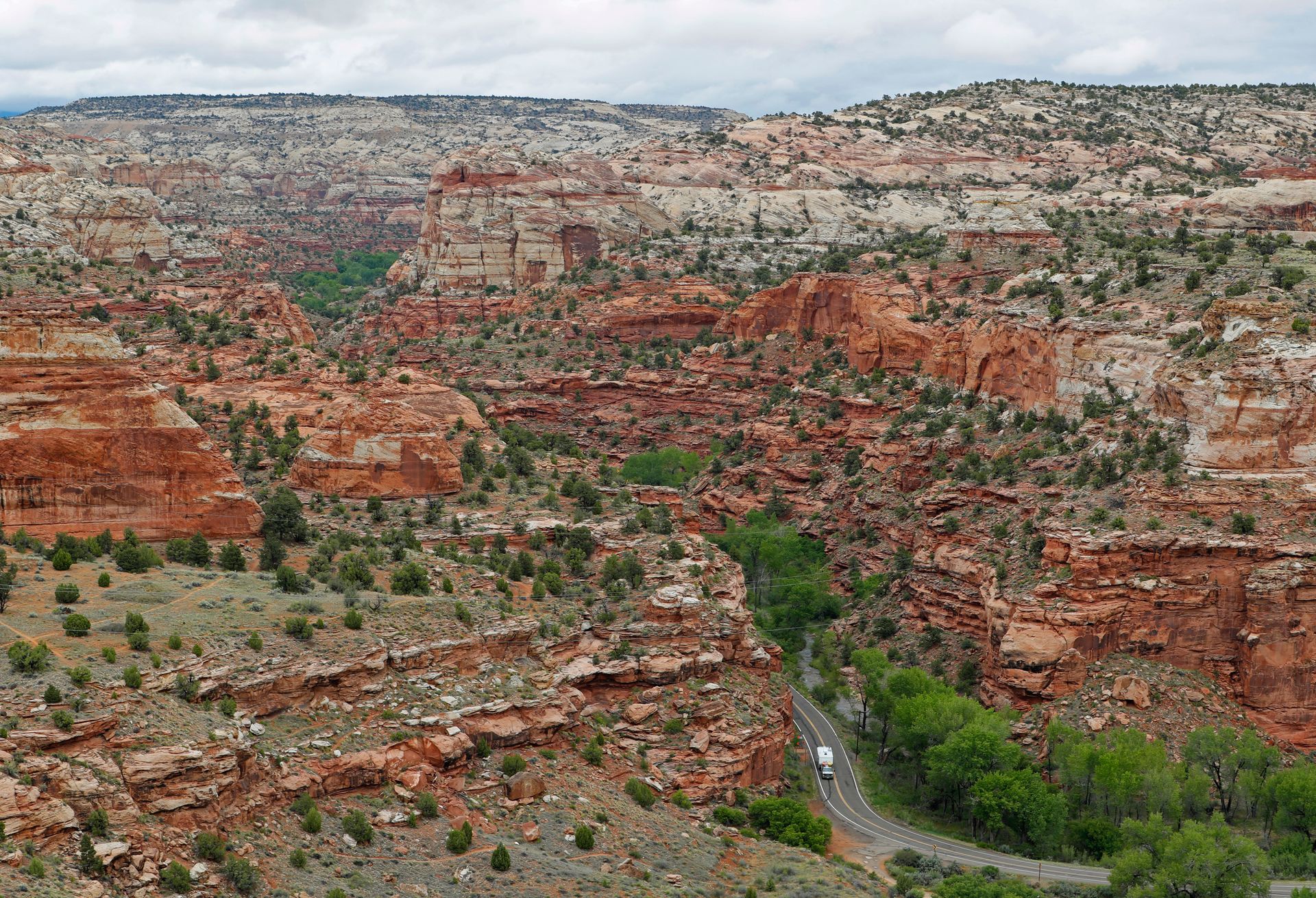
Utah Highway 12 runs 124 miles from Panguitch in the west to Torrey in the east, connecting Bryce Canyon National Park to Capitol Reef National Park through terrain that the Utah Travel Council calls "a journey through time" — a phrase that is, for once, accurate rather than promotional. The road passes through six distinct geological formations, crosses a ridge so narrow that the road runs along its spine with thousand-foot drops on both sides, and traverses the Grand Staircase-Escalante National Monument, whose canyon country contains some of the most remote and least-visited landscape in the continental United States.
The Hogsback section — the stretch of road that runs along the top of a slickrock ridge with the Escalante canyons falling away on both sides — is the section that appears in every photograph of the route and that produces the specific sensation, in the passenger seat, that the road has no business being where it is. It is narrow, exposed, and without guardrails for most of its length, and the view from either edge is a vertical drop into canyon country that extends to the horizon.
The town of Boulder, the only town in the lower 48 states to receive its mail by mule until 1940, sits roughly in the middle of the route and has a restaurant — the Hell's Backbone Grill and Farm — that is one of the better restaurants in Utah and worth planning around. The Anasazi State Park Museum in Boulder contains archaeological material from a significant Ancient Puebloan village site discovered on the town's edge.
Allow two full days minimum — one for the western section through Bryce and Red Canyon, one for the eastern section through the Escalante and on to Capitol Reef. The road is open year-round but is subject to ice in winter and occasional flash flood closures in summer.
Hana Highway, Maui, Hawaii
Paul Mounce - Corbis / Getty Images
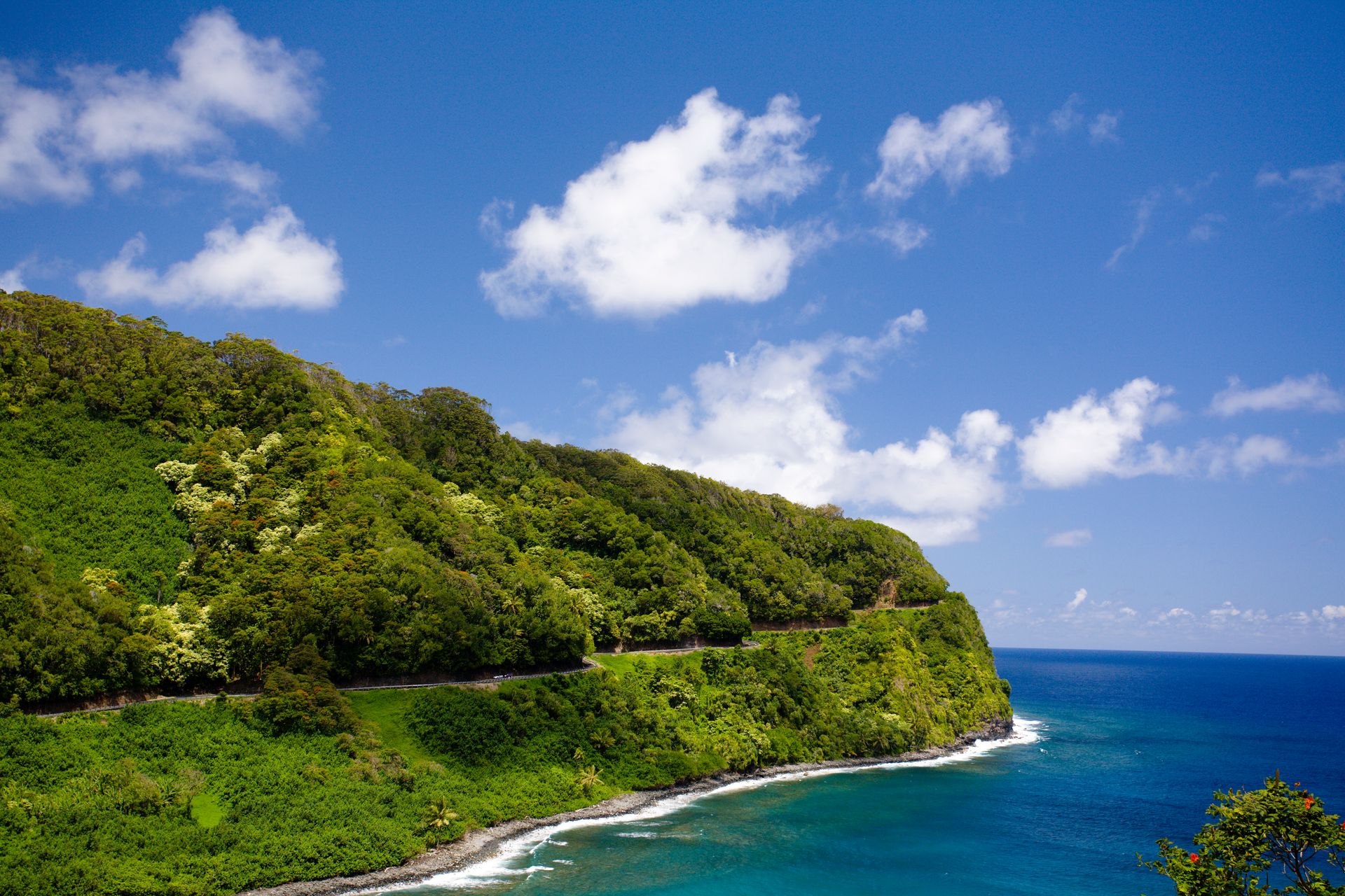
The Road to Hana — Hawaii Route 360, running 64 miles from Kahului to the town of Hana on Maui's eastern coast — is technically a road trip only if the Hawaiian Islands count as American road-trip territory, which they do in the most literal sense and which the quality of the drive fully justifies. The road crosses 54 bridges and passes 600 curves in its 64 miles, most of them through tropical rainforest that receives over 300 inches of rain per year and produces a density of green — bamboo, giant ferns, African tulip trees, waterfall after waterfall — that feels different in kind from any mainland American landscape.
The drive is most commonly done as a day trip from Kaanapali or Wailea, which is the wrong approach. The best stops — the Pools of Ohe'o, the Wainapanapa Black Sand Beach, the Pipiwai Trail through the bamboo forest, the Hana Cultural Center — require more time than a day trip allows, and the drive back on the same road after dark is genuinely dangerous. Stay in Hana for at least one night.
The road itself is the experience as much as any specific stop. The sequence of one-lane bridges, each requiring you to stop and yield to oncoming traffic, creates a pace that is impossible to hurry and that produces, after an hour or two, a quality of attention to the immediate landscape that faster roads prevent. The ocean appears and disappears behind the vegetation. Waterfalls cross the road. The asphalt ends in places and resumes without explanation.
Drive eastbound in the morning — the light is better from that direction, and the majority of day-trippers drive out and back on the same road, meaning that traffic is lighter going east in the early hours.
The Kancamagus Highway, New Hampshire
DEA / G. SIOEN / Getty Images
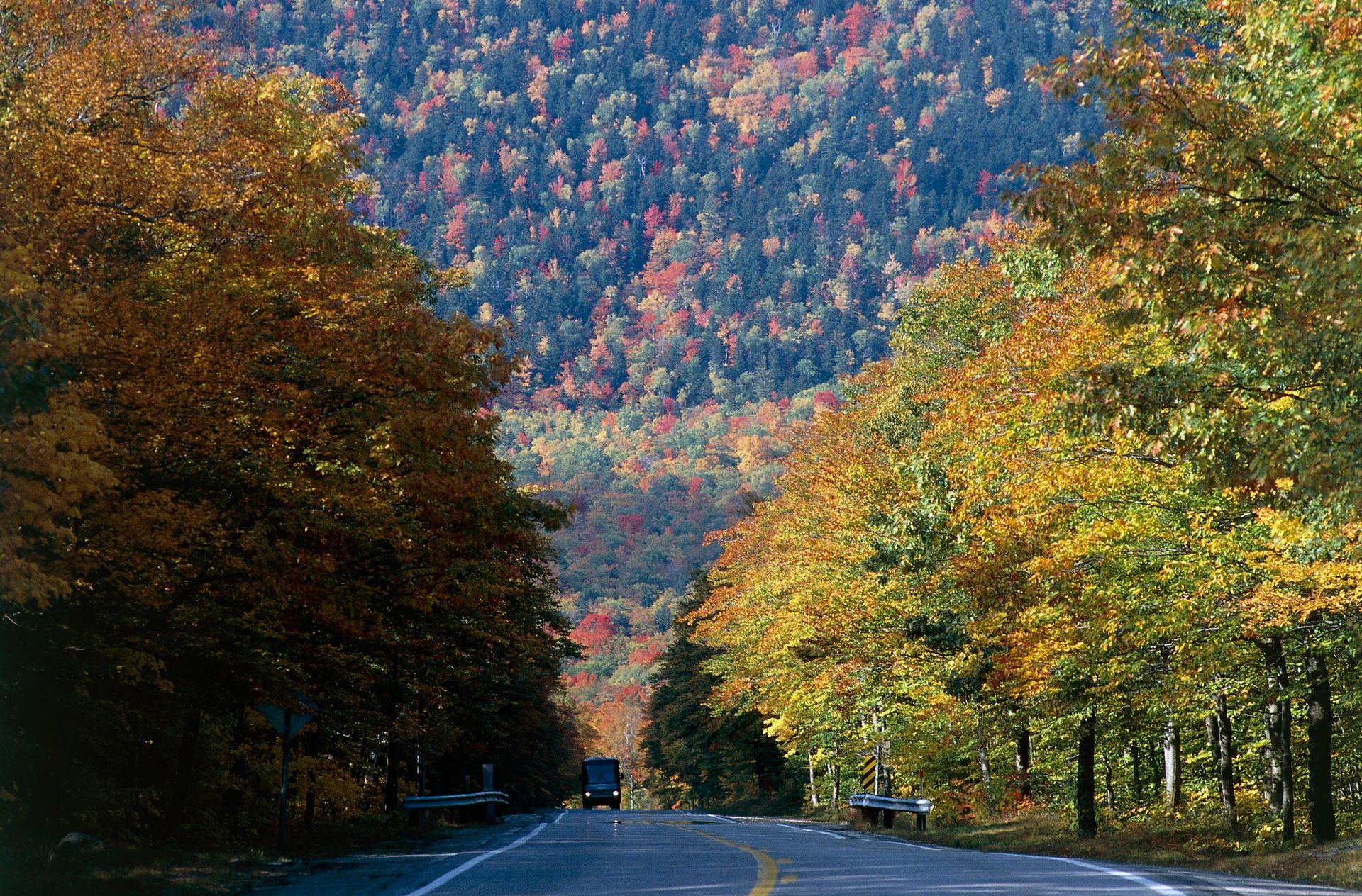
The Kancamagus Highway — New Hampshire Route 112, running 34.5 miles from Conway to Lincoln through the White Mountain National Forest — is the quintessential New England fall foliage drive, and in early to mid-October, when the sugar maples and birches of the White Mountains reach peak color, it is one of the most visually concentrated stretches of seasonal landscape in North America. The road reaches its highest point at Kancamagus Pass at 2,855 feet, high enough to see above the forest canopy and across the valley to mountain ridges that in mid-October are entirely covered in color.
The road is free of commercial development — no billboards, no gas stations, no development of any kind — by virtue of running entirely through National Forest land. The Swift River, which parallels the road for much of its eastern section, is accessible at Rocky Gorge and Lower Falls, two swimming holes that are well-used by summer visitors and largely deserted in October. The Sabbaday Falls, a short walk from the road, are a three-tiered cascade that the surrounding fall color makes particularly photogenic in October.
The drive takes roughly 90 minutes without stops and three to four hours with them. It connects to the Mount Washington Auto Road — the toll road that climbs to the summit of the highest peak in the northeastern United States — which is accessible from the north end of the Kancamagus via Route 16 north to Pinkham Notch. The summit of Mount Washington, at 6,288 feet, has recorded the highest wind speed ever measured on the Earth's surface before satellite-era meteorology — 231 miles per hour in 1934 — and has weather severe enough to be treated as a genuine mountain summit rather than a scenic overlook.
The Lonesome Highway, Nebraska
Credit: Sandhills Journey
US-20 across the Nebraska Sandhills — running roughly from Valentine in the west to O'Neill in the east, about 200 miles — is the most unknown drive on this list and, for travelers who have spent time in the American West, one of the most memorable. The Sandhills are a 19,600-square-mile region of grass-stabilized sand dunes that constitute the largest sand dune complex in the Western Hemisphere. The landscape is entirely unlike the flat agricultural Nebraska of popular imagination: gently rolling hills covered in native grassland, interrupted by lakes, marshes, and rivers, with a sky so large and so unobstructed by trees or development that it produces the specific sensation of being at the bottom of an inverted bowl.
Valentine, at the western end of the recommended section, is the gateway to the Niobrara National Scenic River — a stretch of river between steep cedar canyon walls that has the quality of a hidden landscape, unexpected in a Great Plains context and worth a day of canoeing or kayaking in summer. The Fort Niobrara National Wildlife Refuge, east of Valentine, is home to bison, elk, and prairie dog towns that provide the closest approximation of pre-settlement Great Plains ecology available in the region.
The drive east from Valentine through Ainsworth, Bassett, and O'Neill passes through ranchland where cattle operations have continued largely unchanged for a century, through towns that exist to serve those ranches and nothing else, and across a landscape that is as close to genuinely empty as anything in the lower 48 states while remaining accessible without four-wheel drive or special preparation.
Drive this road in June, when the Sandhills grasses are green and the waterfowl are nesting on the lakes, or in September, when the grasses have gone gold and the light is specific to the Great Plains in early fall.
Trail Ridge Road, Colorado
RJ Sangosti / Getty Images
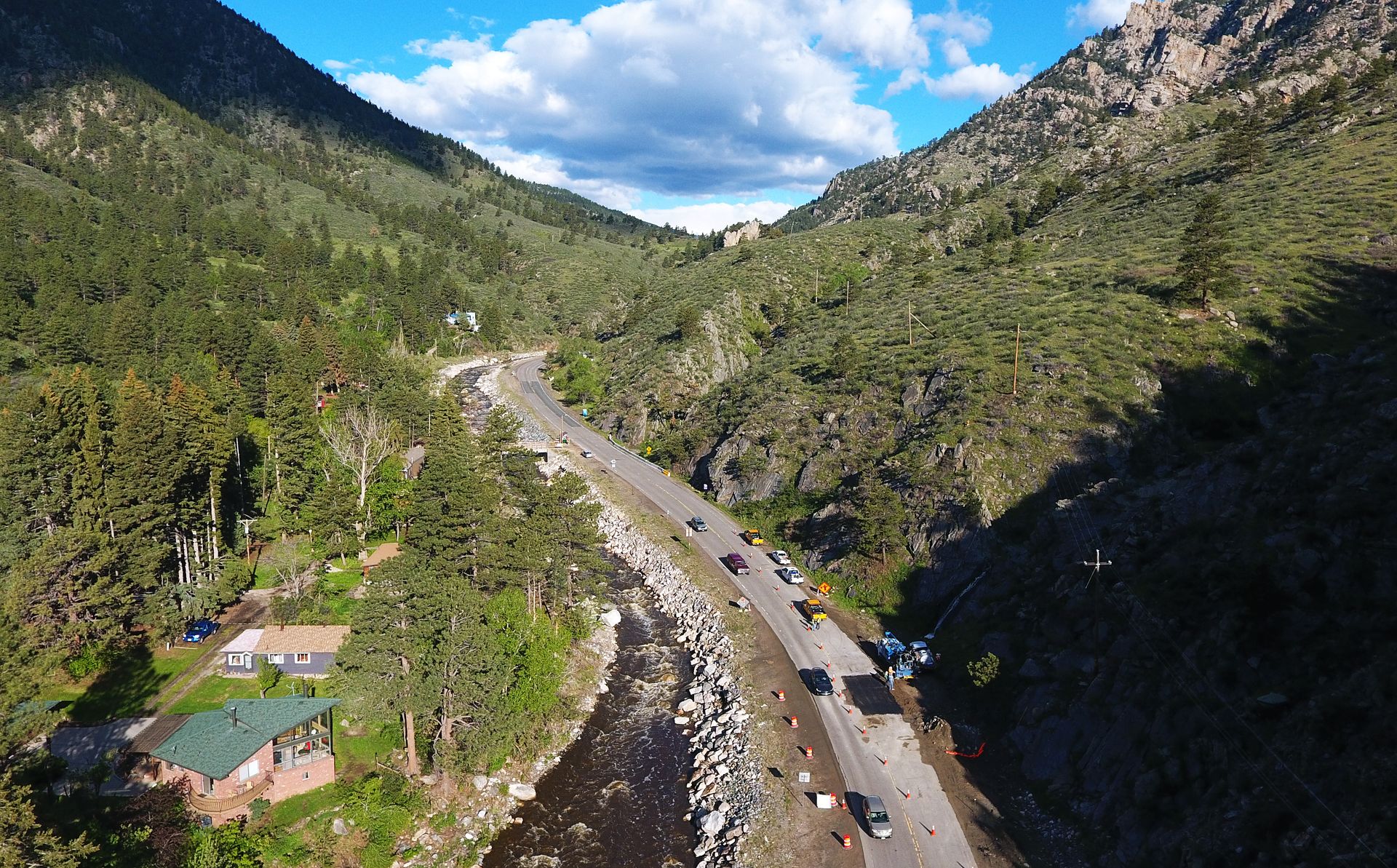
Trail Ridge Road — US-34 through Rocky Mountain National Park, running from Estes Park on the east side to Grand Lake on the west — is the highest continuous paved road in the United States, spending more than 11 miles above 11,000 feet and reaching 12,183 feet at its highest point. Above treeline for most of its length, the road crosses alpine tundra — a landscape of tiny, ancient plants growing in the thin soil above the tree line, exposed to wind and UV radiation that produces conditions more similar to the Arctic than to the mountain forests below — with views of the Never Summer Mountains to the west and the Mummy Range to the north.
The tundra itself rewards a stop and a short walk. The plants visible from the road are decades old despite being only a few inches tall — growing conditions at altitude are severe enough that the pika, a small mammal that lives in the boulder fields, must harvest and store grass for winter at a frantic pace because the window of green growth is so short. A half-mile walk from the Alpine Visitor Center at Fall River Pass gives a direct encounter with this landscape at a pace that the road alone cannot provide.
The road crosses the Continental Divide at Milner Pass, where a short walk to a small lake at the pass gives the specific experience of standing at the point where water flowing east toward the Atlantic and water flowing west toward the Pacific divide — a geographical concept that the landscape makes physically legible in a way that no description achieves.
Trail Ridge Road is typically open from Memorial Day to mid-October. The park requires a timed entry permit for private vehicles during peak summer months — check NPS.gov for current requirements. Drive it in both directions if possible: the views change completely depending on which way you are traveling.
Acadia All-American Road, Maine
Portland Press Herald / Getty Images
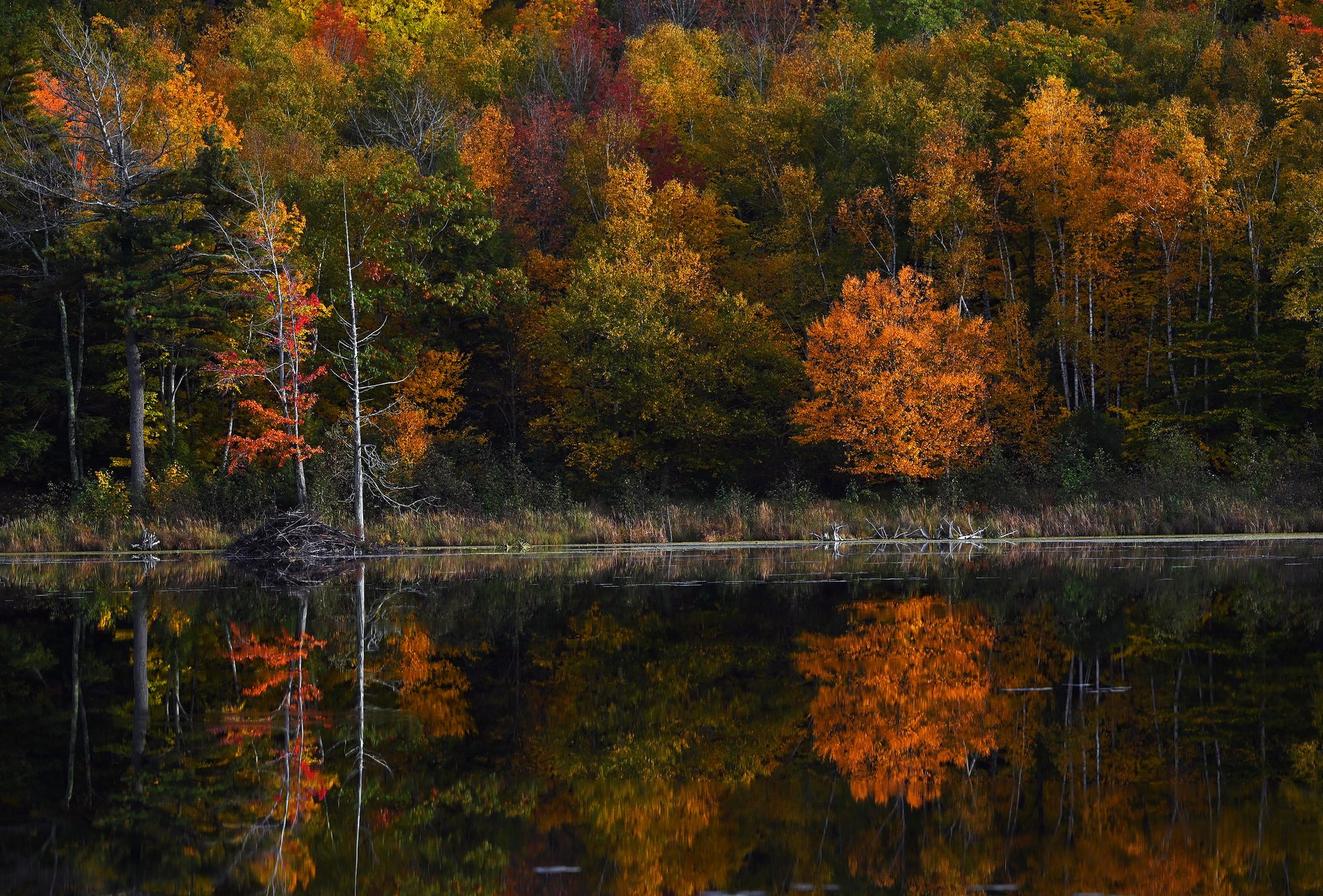
The network of carriage roads, park roads, and the summit road to Cadillac Mountain in Acadia National Park on Mount Desert Island, Maine, constitutes one of the most concentrated scenic driving experiences in New England — not in the length of the roads but in the density of what they pass through. Acadia is a small park by western standards — roughly 49,000 acres — but its combination of rocky coastline, freshwater lakes, spruce-fir forest, and mountains that rise directly from the sea produces a landscape variety that parks ten times its size sometimes do not match.
The Park Loop Road, 27 miles in total, is the primary scenic drive and circles the eastern portion of the island, passing Thunder Hole — a narrow inlet where the surf compresses and detonates against the rock with a noise audible from some distance — Sand Beach, the only traditional sand beach in the park, and the Jordan Pond, where the Jordan Pond House has been serving popovers and tea since 1895 in a setting of such deliberate New England pastoral correctness that it functions as a parody of itself while remaining genuinely pleasant.
The Cadillac Mountain summit road — the only road to the summit of the highest peak on the eastern seaboard north of Rio de Janeiro — is the essential drive in Acadia. From October through March, the summit of Cadillac Mountain is the first place in the United States to receive the sunrise, a fact that attracts dedicated predawn visitors and that the summit, at 1,530 feet with 360-degree views of the islands and the bay, fully justifies. The reservation system for sunrise visits books weeks in advance in fall.
Bar Harbor, the gateway town, has enough good restaurants and accommodations to support a three to four day visit, which is the right amount of time for a thorough Acadia experience.
Dalton Highway, Alaska
Lance King / Getty Images
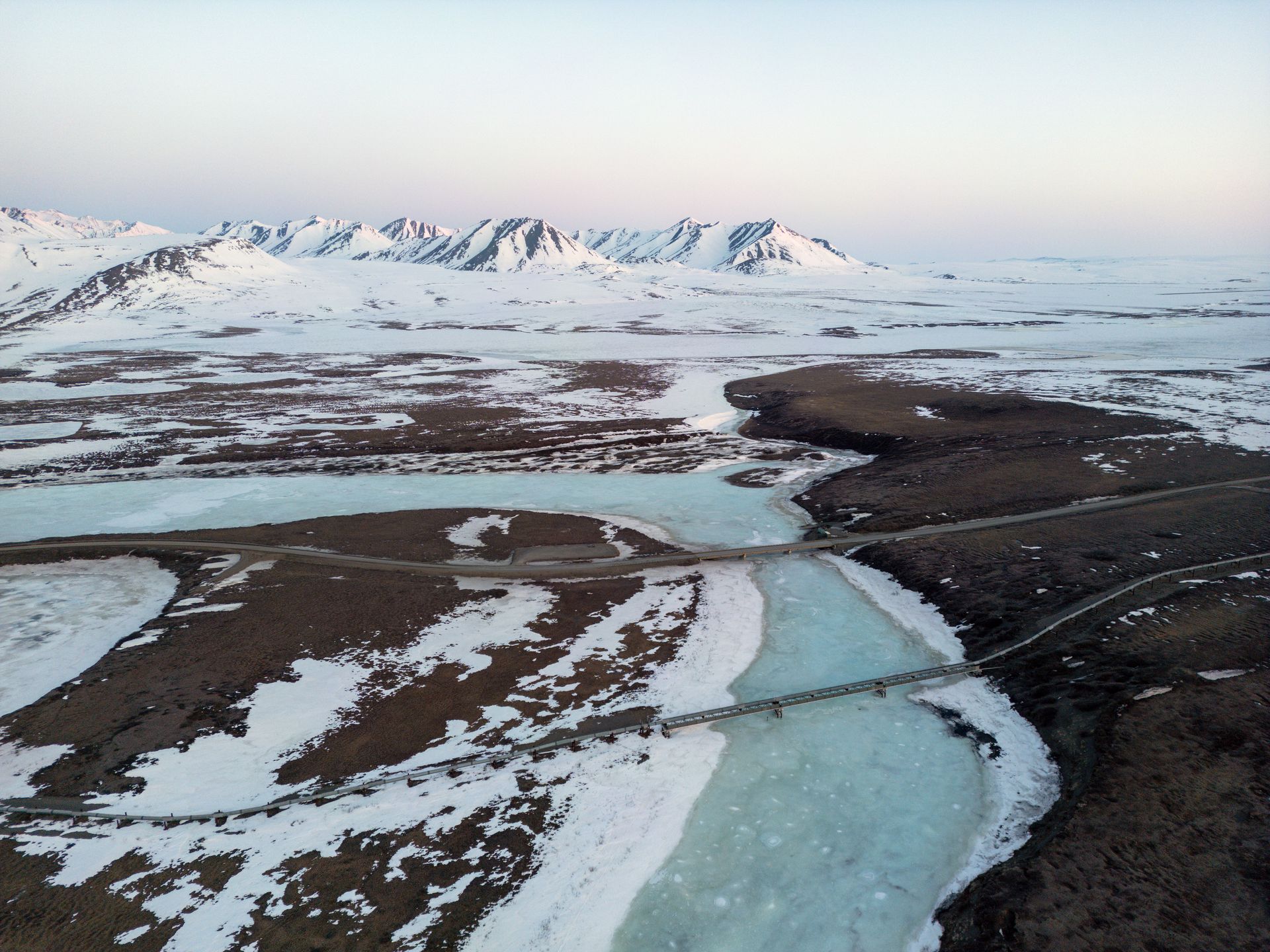
The Dalton Highway — Alaska Route 11, running 414 miles from Livengood, north of Fairbanks, to Deadhorse at Prudhoe Bay on the Arctic Ocean — is included on this list as the most extreme and most remote road drive accessible to a standard vehicle in the United States, with the caveat that "standard vehicle" is relative and that the road's conditions in sections require judgment about whether your specific vehicle and your specific driving experience are appropriate. It is a gravel road for most of its length, designed for the haul trucks serving the Trans-Alaska Pipeline, and it crosses the Arctic Circle, the Brooks Range, and the North Slope tundra before reaching the Arctic Ocean.
The Brooks Range crossing — over Atigun Pass at 4,739 feet, the highest highway pass in Alaska — is the single most dramatic section of the drive. The mountains rise from the flat boreal forest of the south in a wall of rock and ice, and Atigun Pass itself, in good weather, gives views of a mountain landscape that has the quality of a landscape before human history — peaks with no trails, no names known to most visitors, no visible human presence except the road itself.
The drive requires preparation that most road trips do not. Carry at least two spare tires — the gravel road surface punctures tires at a rate that surprises drivers unused to it. Carry extra fuel — services are available only at Coldfoot (175 miles from Livengood) and Deadhorse. Carry emergency gear appropriate for the section of Alaska you are in. The road is open year-round, and a winter drive — northern lights, deep cold, the particular silence of the Arctic — is a completely different experience from the summer midnight-sun drive, and for the right traveler, the more extraordinary one.
Highway 89, Arizona to Montana
Joe Sohm/Visions of America / Getty Images
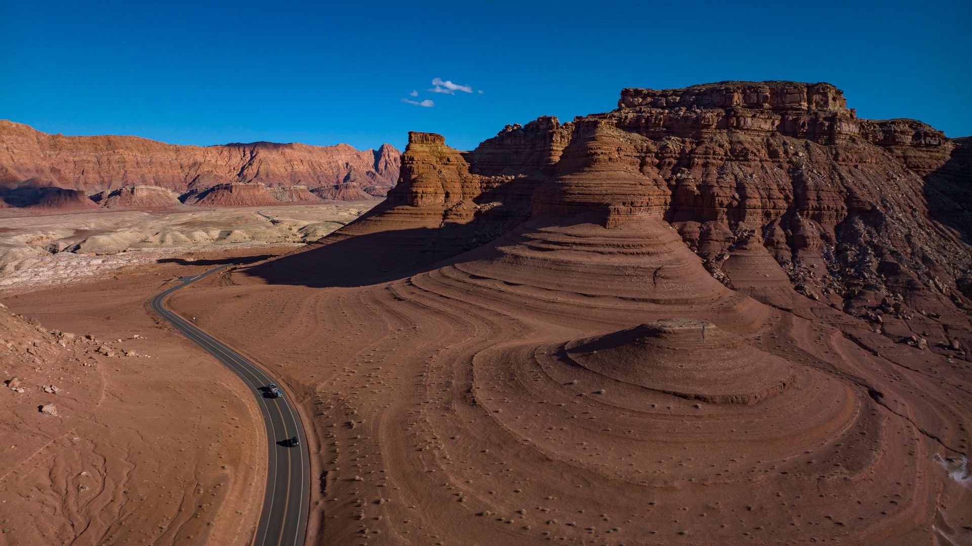
US-89 runs from Flagstaff, Arizona, to the Canadian border in Montana, passing through a sequence of American landscapes so complete that the drive has been described by travel writers as the best single highway in the country. The 1,800-mile route takes in the Painted Desert and the Navajo Nation in Arizona, the canyon country around Page and Lake Powell, Zion National Park in Utah, the Grand Staircase-Escalante, Capitol Reef, the Salt Lake Valley, the Wasatch Front, the Bear River Range, Yellowstone National Park, and the Paradise Valley in Montana before reaching Glacier National Park and the Canadian border.
The Arizona section — from Flagstaff north through the Echo Cliffs and on to Page — passes through the Navajo Nation, the largest Native American reservation in the United States, with the San Francisco Peaks visible to the south for much of the drive and the Vermilion Cliffs rising to the east in stratified bands of orange, white, and red sandstone. The side trip to Antelope Canyon — the photographic slot canyon near Page — requires a guided tour but is accessible from the highway and justifies a full day. Horseshoe Bend, three miles south of Page, is a three-quarter-mile walk from a parking area to a viewpoint above a 1,000-foot meander of the Colorado River that is one of the most reproduced landscape photographs in the American Southwest.
Allow ten days to two weeks for the full Arizona-to-Montana drive at a pace that permits stops. The sections from Page, Arizona, to Bryce Canyon, Utah, and from Yellowstone to Glacier in Montana are the two most concentrated stretches of extraordinary landscape on the route, and both reward at least two days rather than a single pass-through.
The Cascade Loop, Washington
UCG / Getty Images
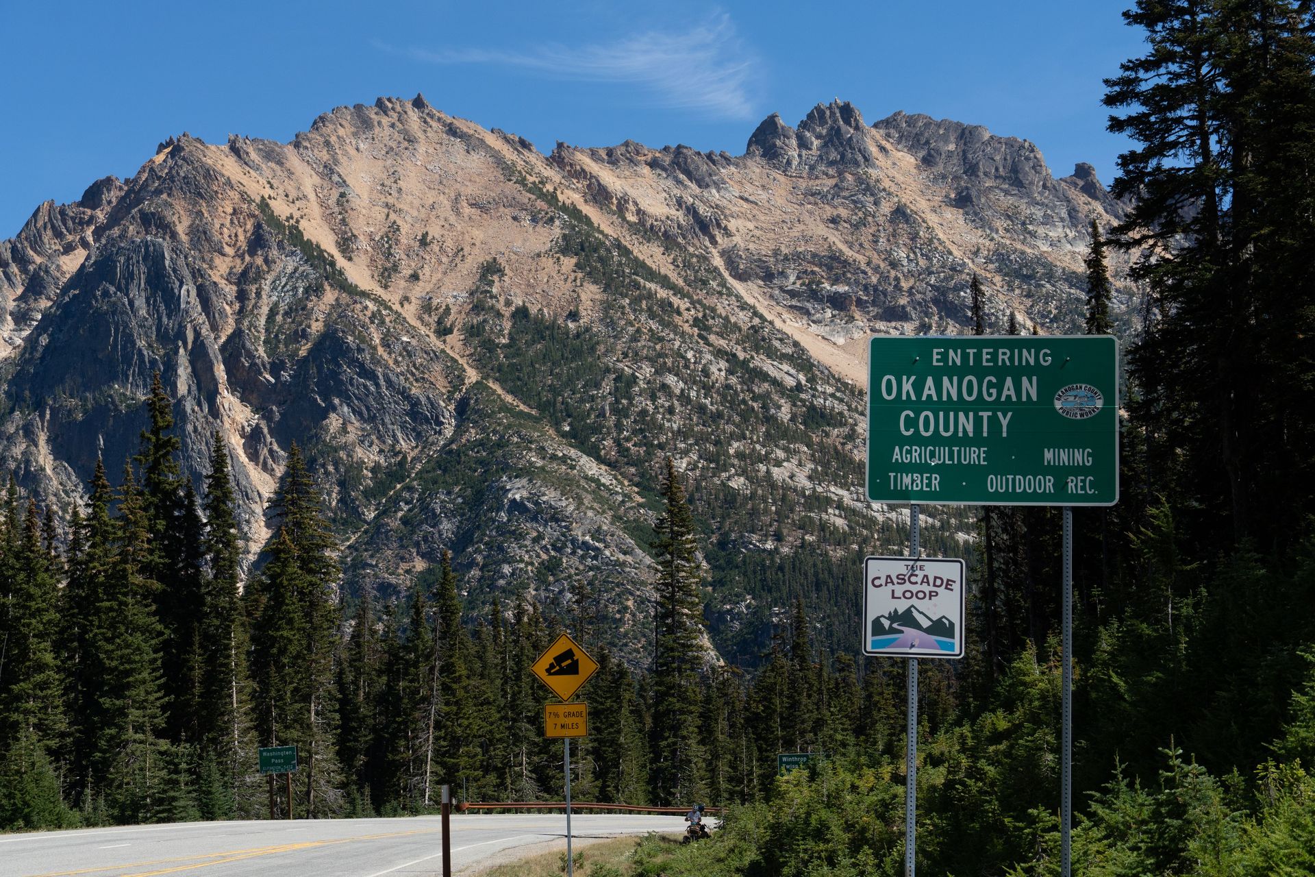
The Cascade Loop is a 440-mile circular route through north-central Washington state that connects the Seattle area with the Cascades, the Okanogan Highlands, and the Columbia River Wine Country in a drive that passes through five distinctly different Washington landscapes in a sequence that makes the state's geographical variety physically legible. It is the best-organized scenic loop drive in the Pacific Northwest and one of the most underappreciated in the country.
The drive goes clockwise from Everett: north through the Tulip fields of the Skagit Valley in April, east over the North Cascades Highway through the most remote and most spectacular section of the Cascade Range, south through the Methow Valley — a high, dry, sun-filled valley with orchards and ranches that feels unlike western Washington in every respect — through the Wenatchee fruit country, across the Columbia River, and back over Stevens Pass to the Puget Sound. Each section is a different Washington: the wet, green western slopes, the high rock and glacier of the crest, the dry eastern rain shadow.
The North Cascades Highway — Washington Route 20, the only highway crossing of the Cascades in the northern part of the state — is closed from mid-November to mid-April by snow and is the primary seasonal constraint on the loop. The wildflower meadows of the North Cascades — accessible from the road at several trailheads in July and August — are among the best high-alpine wildflower displays in the Pacific Northwest. The Methow Valley in October, when the larches turn gold, is one of the specific seasonal travel experiences in the Pacific Northwest that rewards planning around.