
20 border crossings where the contrast itself is the destination
The places where two countries meet are some of the most revealing on Earth — and most travelers never think to visit them
Yihan Wang / Pexels
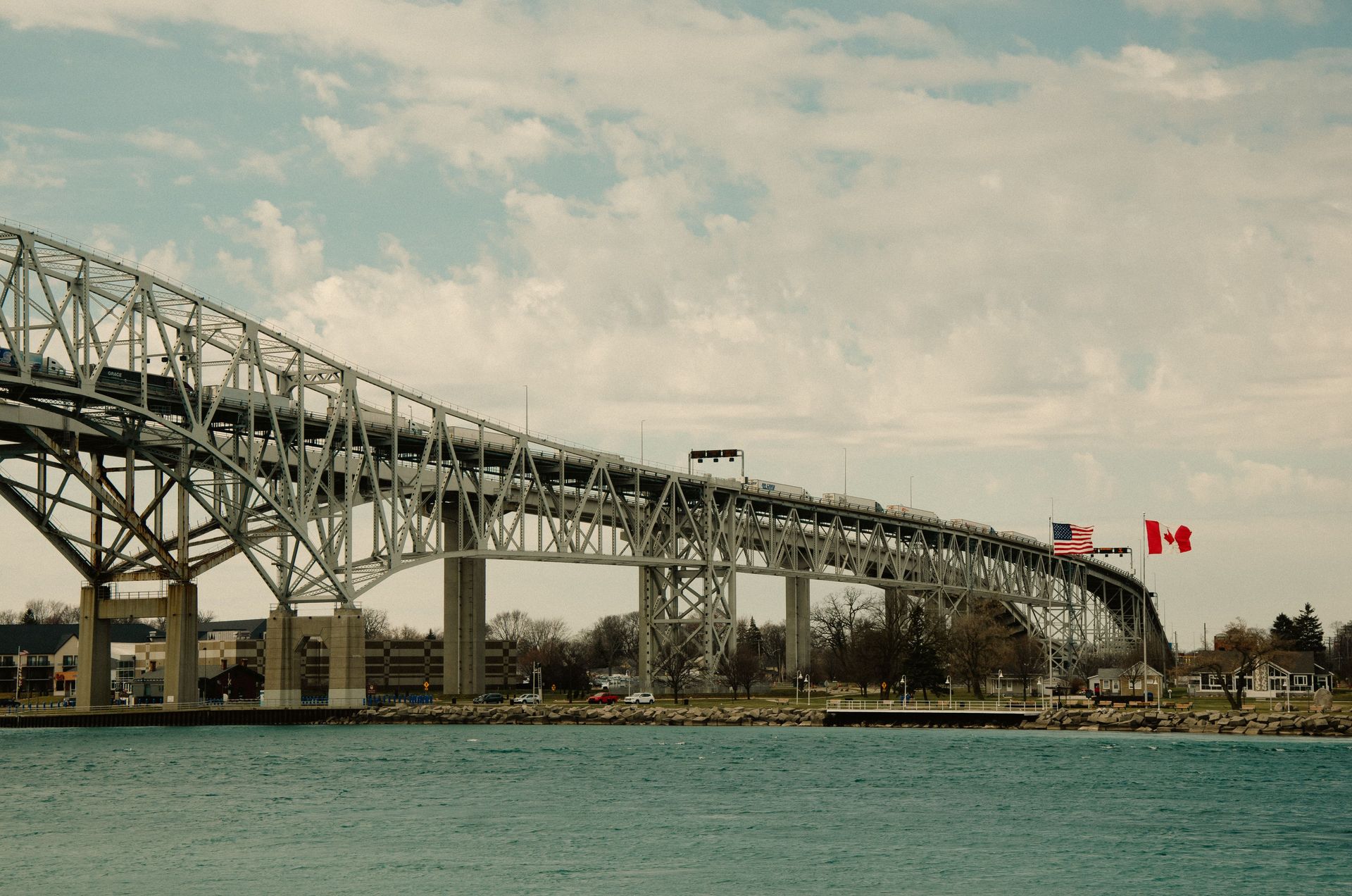
A border is the most compressed version of what a country is: the place where one set of laws, one currency, one language, one history of violence and negotiation and compromise stops and another begins. In most of the world, that stopping and starting happens in the middle of nowhere — a checkpoint between two stretches of highway, a bridge across a river, a marker in a field. But in some places, cities grew up on both sides of that line, and the border became a membrane rather than an edge: permeable, constantly crossed, generating the specific hybrid culture and the specific contrast that only a divided geography can produce.
The border towns in this list were selected for the quality of the contrast they offer — the degree to which crossing the line produces a genuinely different experience, and the degree to which that difference is itself interesting rather than merely logistical. A border crossing between two prosperous Western European countries whose residents speak different languages is interesting. A border crossing between a wealthy American city and a large Mexican border city is interesting for different reasons. A border between two African countries where the same ethnic group was divided by a colonial boundary and developed two distinct national identities in the century since is interesting in a third way.
Most travel writing treats borders as obstacles — the administrative inconvenience between the place you are leaving and the place you are going. This list treats the border as the destination. The specific character of a border town is not available anywhere else: the mix of languages in the market, the dual price systems, the architecture that expresses two aesthetic traditions across a narrow street, the history of the specific negotiation that drew the line in this particular place.
Each entry covers both sides of the border, the specific nature of the contrast, and what the visit reveals that neither side would reveal alone. Several of these crossings are open and easy; several require current research on visa requirements and travel advisories. Several are among the safest and most accessible destinations in the world; several require careful planning. All of them are, in the specific sense this list intends, worth visiting.
Tijuana and San Diego — Mexico and United States
Abraham Moreno / Pexels
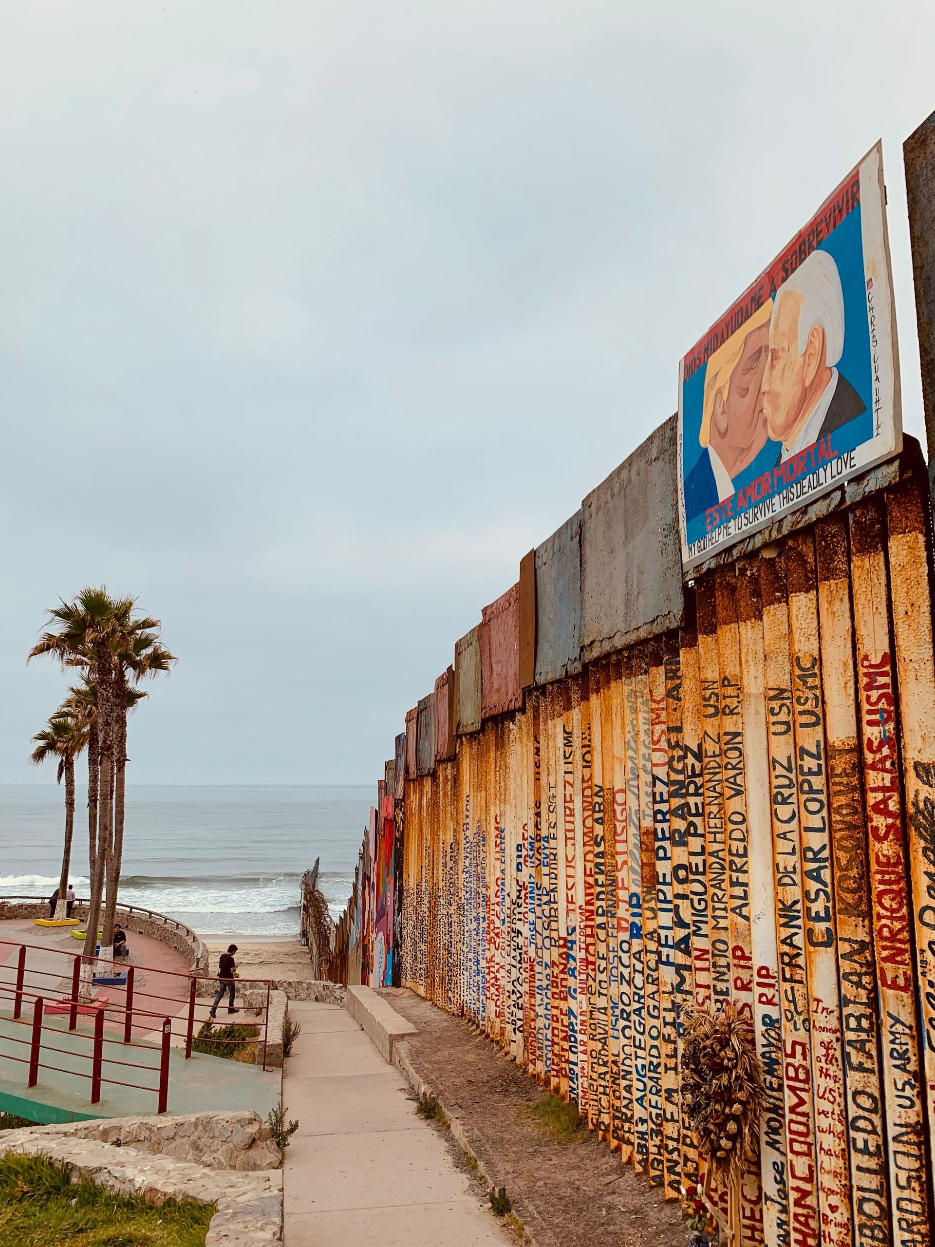
The Tijuana-San Diego border crossing is the busiest land border crossing in the world, handling approximately 300,000 crossings daily, and it produces the starkest first-world-to-developing-world contrast available within a single day trip of a major American city. San Diego is one of the wealthiest cities in the United States; Tijuana is a city of approximately 2 million people that has grown rapidly through maquiladora manufacturing and internal Mexican migration, producing a specific urban character — dense, noisy, commercially intense, architecturally improvised — that is completely unlike the managed sprawl of San Diego.
The contrast produces something more interesting than simple inequality tourism. Tijuana has a serious contemporary art scene centered on the Tijuana Cultural Center (CECUT), a restaurant and craft beer culture that has attracted international food media attention (the specific Baja California cuisine — ceviches, seafood tacos, Ensenada-style fish tacos — is available in more authentic form in Tijuana than anywhere in the United States), and a nightlife culture that has historically served American visitors for whom Tijuana's permissiveness relative to San Diego's was the primary draw.
The border itself — the Otay Mesa crossing, the San Ysidro crossing, the new Cross Border Xpress terminal that allows passengers to walk directly from San Diego to the Tijuana airport — is a physical demonstration of asymmetric permeability: Americans cross into Mexico easily; Mexicans crossing into the United States face documentation requirements that make the same crossing unavailable to most of Tijuana's population.
Baarle-Nassau and Baarle-Hertog — Netherlands and Belgium
-1920x1080.jpg)
Romaine / Wikimedia Commons (CC0)
Baarle-Nassau is a Dutch town of approximately 7,000 people in the southern Netherlands. Baarle-Hertog is a Belgian municipality of approximately 2,500 people whose territory exists as 26 separate enclaves entirely surrounded by Dutch territory — with some of those enclaves containing Dutch counter-enclaves, producing the most complex border geography in the world. The border between the two countries runs through houses, through the middle of streets, through restaurant dining rooms, and through shop fronts, marked by brass lines in the pavement and small crosses where corners of enclaves meet.
The historical origin of the enclave geography is a series of 12th and 13th-century feudal land grants and purchases that were never regularized as national borders were drawn and redrawn around them. The specific legal consequences have produced some extraordinary situations: a house whose front door falls on the Belgian side is a Belgian house, regardless of which country most of the house is physically located in; during World War I, Belgian businesses that straddled the border moved their front doors to the Belgian enclave side to avoid Dutch neutrality restrictions on Belgian trade.
The contemporary experience of visiting Baarle is the experience of watching borders become absurd: the same street has Dutch shops on one side and Belgian shops on the other, Dutch and Belgian postal boxes alternating on the same block, and the specific philosophical comedy of a border that nobody can justify but everybody has accommodated. It is one of the most genuinely strange places in Europe and one of the most worthwhile.
Goma and Gisenyi — Democratic Republic of Congo and Rwanda
Nzemerimanan / Wikimedia Commons (CC0)
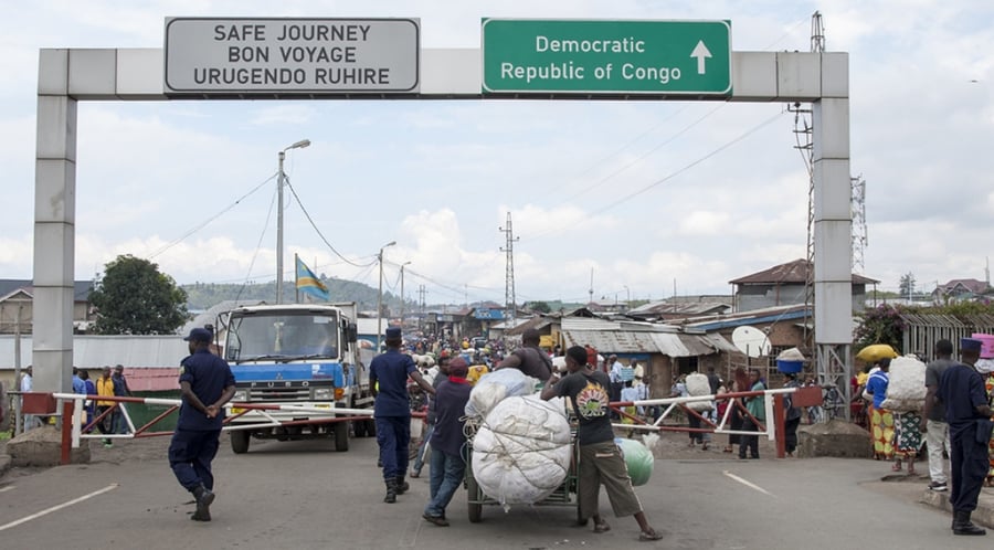
Goma (DRC) and Gisenyi (Rwanda, now part of Rubavu) face each other across the northern shore of Lake Kivu, separated by a border crossing that is one of the most historically freighted in Africa. The border between the DRC and Rwanda runs through the center of a region that experienced the Rwandan genocide of 1994 (in which approximately 800,000 people were killed, with many perpetrators subsequently fleeing into the DRC), several subsequent wars, and the ongoing conflict between the Congolese army and armed groups in the Kivu provinces.
The contrast between the two sides of this border is striking in ways that reflect the divergent trajectories of two countries that share an ethnic population (the Hutu and Tutsi groups who were central to the genocide narrative are present on both sides), a colonial history (both were Belgian colonies), and a violent recent past. Kigali's Rwanda has become one of the most well-governed, cleanest, and most rapidly developing countries in sub-Saharan Africa; Goma and the DRC's eastern provinces remain among the most conflict-affected areas in the world.
Visiting this border requires careful current research: the eastern DRC has been in a state of active conflict for decades, and travel advisories from major governments reflect genuine security concerns. The crossing is included here not as a casual tourist recommendation but as one of the most geopolitically revealing border contrasts on Earth — the physical proximity of two cities that represent two of Africa's most divergent post-colonial trajectories.
Nogales — Arizona and Sonora
Salvador Vitanza / Wikimedia Commons (CC BY-SA 2.5)
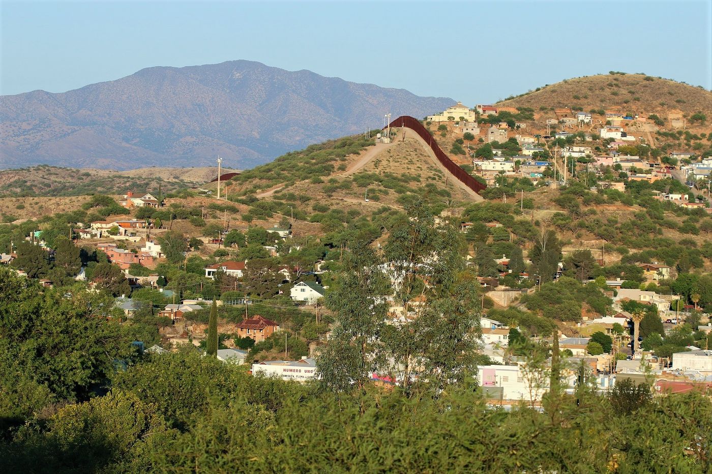
Nogales, Arizona (population approximately 20,000) and Nogales, Sonora (population approximately 220,000) share a name and a fence and almost nothing else. The Arizona Nogales is a small American border community whose economy depends substantially on cross-border trade; the Sonoran Nogales is one of the largest cities in Sonora state, an important industrial and commercial center, and the most significant gateway for produce from the Sonoran agricultural heartland into the United States.
The Nogales crossing is the busiest commercial port of entry on the US-Mexico border for fresh produce: approximately 75% of all fresh vegetables consumed in the United States during winter months pass through Nogales, making it the most food-consequential border crossing in the Americas. The specific geography of the crossing — the fence that runs through the urban fabric, visible from both sides, running up the hills on either side of the port — is one of the most photographed border images in North America.
The visit is most interesting for what it reveals about the asymmetry of the US-Mexico agricultural relationship: the Sonoran farms that supply American supermarkets are visible from the American side, and the specific infrastructure of inspection, documentation, and the trade relationships that make the winter vegetable economy work is centered on this crossing in ways that make Nogales a more instructive place to understand US-Mexico economic interdependence than any textbook.
Narvik and Riksgränsen — Norway and Sweden
-900x617.jpg)
Swedish National Heritage Board / Wikimedia Commons
The border between Norway and Sweden in the Arctic Circle runs through some of the most dramatic mountain and fjord landscape in Scandinavia, and the specific crossing between Narvik (Norway) and Riksgränsen (Sweden) is one of the most scenically extraordinary and most logistically unusual border crossings in Europe: the two communities are connected by a railway that crosses the border twice, was originally built by Sweden to give Norwegian iron ore a port (Narvik), and passes through mountain terrain that is above the tree line for most of its route.
The contrast between the Norwegian and Swedish sides of this border is not dramatic in the geopolitical sense — both are wealthy, stable Scandinavian countries with broadly similar cultures — but is revealing in smaller ways: the specific Norwegian character (wilder, more seafaring, more dramatic in its landscape orientation) and the specific Swedish character (more orderly, more industrialized, more focused on the domestic interior) are perceptible within a few kilometers of the border in the architecture, the commercial culture, and the way public space is organized.
The Ofoten railway that connects Narvik to Riksgränsen and on to Kiruna (Sweden) is itself a destination: one of the most scenic rail journeys in Scandinavia, operating through landscapes that most visitors to Norway or Sweden never see, and crossing a border that most tourists to the region would not think to approach from this direction.
El Paso and Ciudad Juárez — Texas and Chihuahua
Jidanni / Wikimedia Commons (CC BY-SA 4.0)
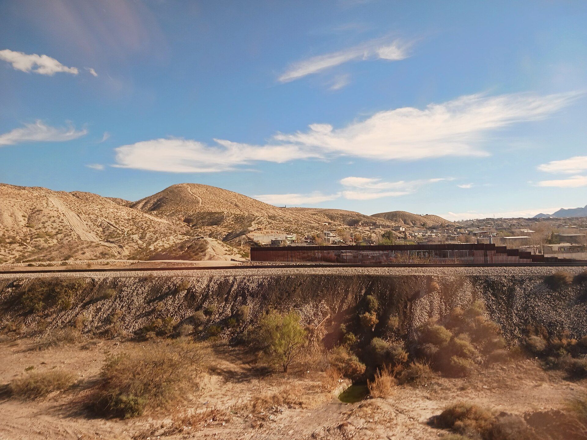
El Paso and Ciudad Juárez face each other across the Rio Grande at one of the most historically freighted locations on the US-Mexico border — the crossing that was both the major gateway for migration and trade for a century and the center of the cartel violence that made Juárez the world's most dangerous city between 2008 and 2012, when the murder rate exceeded 300 per 100,000 people.
The recovery of Juárez from that period of extreme violence — through a combination of federal security intervention, cartel power shifts, and municipal reconstruction — is one of the most dramatic urban turnarounds in recent Mexican history, and the city in 2024 is dramatically safer than a decade ago. The specific cultural contribution of Juárez to Northern Mexican border culture — the norteño music that developed along this border, the maquiladora economy that has made it a major industrial center, the specific hybrid food culture of the paso del norte region — is more accessible to visitors than at any time in the recent past.
The El Paso-Juárez metropolitan area is the largest binational metropolitan area in the Western Hemisphere and functions in many respects as a single city divided by a river and an international boundary: families routinely live on both sides, the economies are deeply interdependent, and the specific character of the region — its geology, its history, its food — is inseparable from its binational reality.
Trieste — Italy (formerly Austria-Hungary, Yugoslavia, Free Territory)
Leonhard Lenz / Wikimedia Commons (CC0)
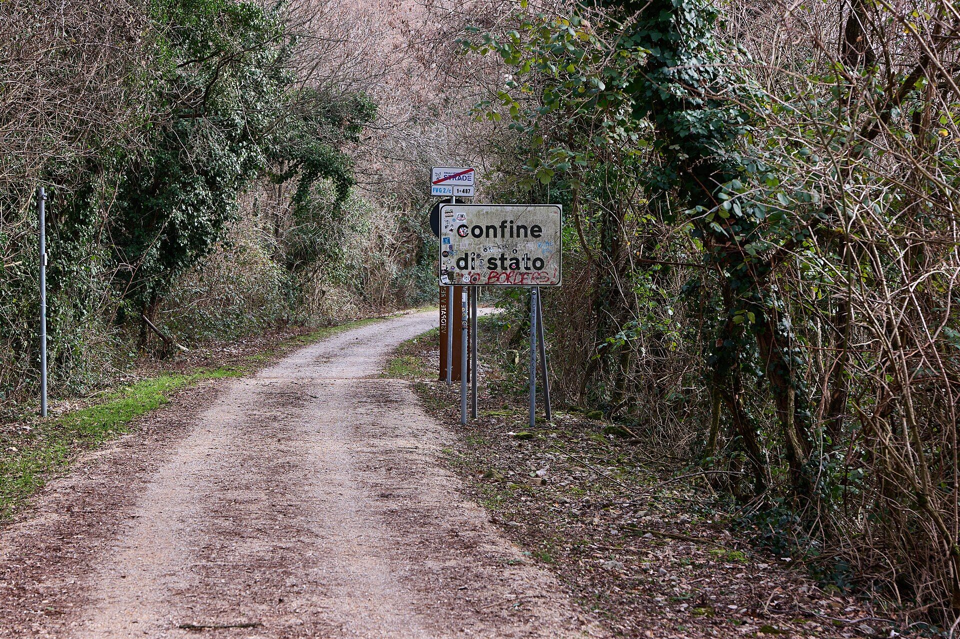
Trieste is less a border crossing than a city that has been defined by borders — by being the primary port of the Austro-Hungarian Empire (giving it a Central European architectural and cultural character that is unlike any other Italian city), by being contested between Italy and Yugoslavia after World War II (producing the Free Territory of Trieste, which existed as a quasi-independent entity from 1947 to 1954), and by its current position at the northeastern edge of Italy, a few kilometers from Slovenia and Croatia.
The specific character of Trieste that results from this layered border history is visible in everything: the architecture (grand Habsburg public buildings alongside Italian bourgeois housing alongside Slovenian vernacular structures in the surrounding hills), the food (the sausages and strudels of the Austrian tradition alongside the seafood and pasta of the Italian Adriatic coast alongside the coastal Slovenian and Croatian influences that come across the border daily), and the specific cultural melancholy of a city that was once the empire's gateway to the world and is now a medium-sized Italian city at the edge of Europe.
Visiting Trieste with awareness of its border history — and crossing into Slovenia or Croatia within a few kilometers of the city center — is the most direct way to understand a city whose character is entirely the product of its position at the intersection of multiple European worlds.
Haparanda and Tornio — Sweden and Finland
Mikko J. Putkonen / Wikimedia Commons (CC BY 4.0)
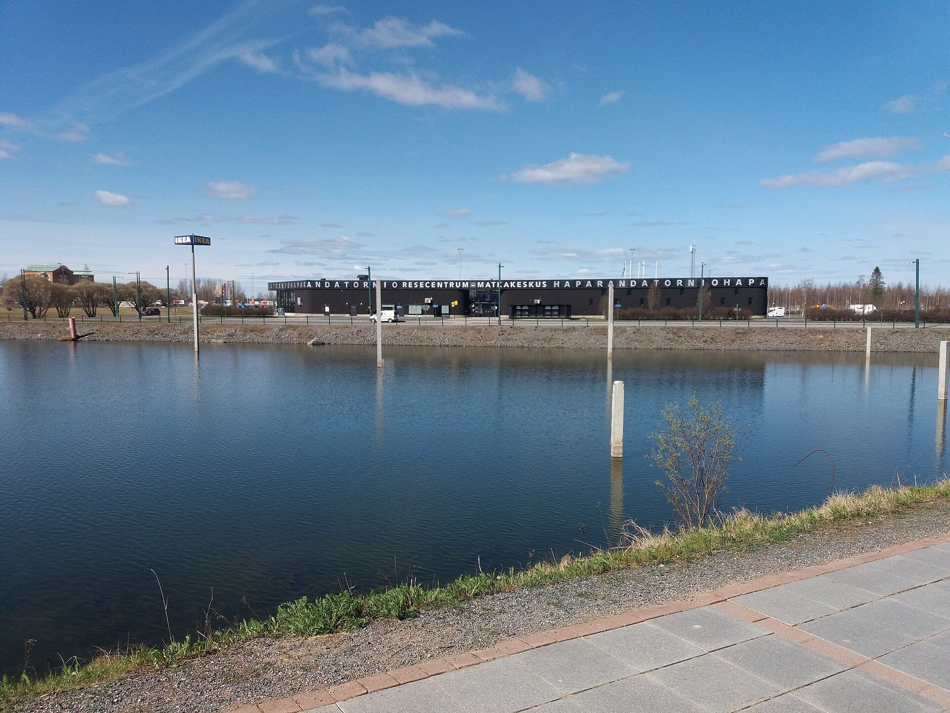
Haparanda (Sweden) and Tornio (Finland) are twin cities on opposite banks of the Torne River, connected by a bridge, sharing a IKEA store (the only IKEA in the world shared by two countries), and constituting a functional single urban area whose residents move between countries daily for work, shopping, and social life. The border between Sweden and Finland runs through the middle of the river, and the two cities have actively pursued integration since the 1990s as a model of European cross-border urban cooperation.
The contrast between the two sides is not stark in the way of more dramatically different border pairs: Sweden and Finland are both Nordic EU member states with broadly similar cultures. But the differences are genuine and visible: Swedish and Finnish are completely unrelated languages (Finnish is a Uralic language with no connection to the Germanic languages of its Scandinavian neighbors), the architectural traditions differ, and the specific cultural characteristics of Finland (the sauna culture, the relationship with Russia, the particular Finnish temperament) and Sweden (the specific Swedish social norms, the relationship with Denmark and Norway) are perceptibly different within a few blocks of the border.
The Haparanda-Tornio crossing is the most genuinely integrated twin-city border in Europe and is worth visiting specifically for the evidence it provides that borders can be managed in ways that produce genuine urban cooperation rather than merely coexistence.
Ceuta — Spain and Morocco
Mario Sánchez Bueno / Wikimedia Commons (CC BY-SA 2.0)
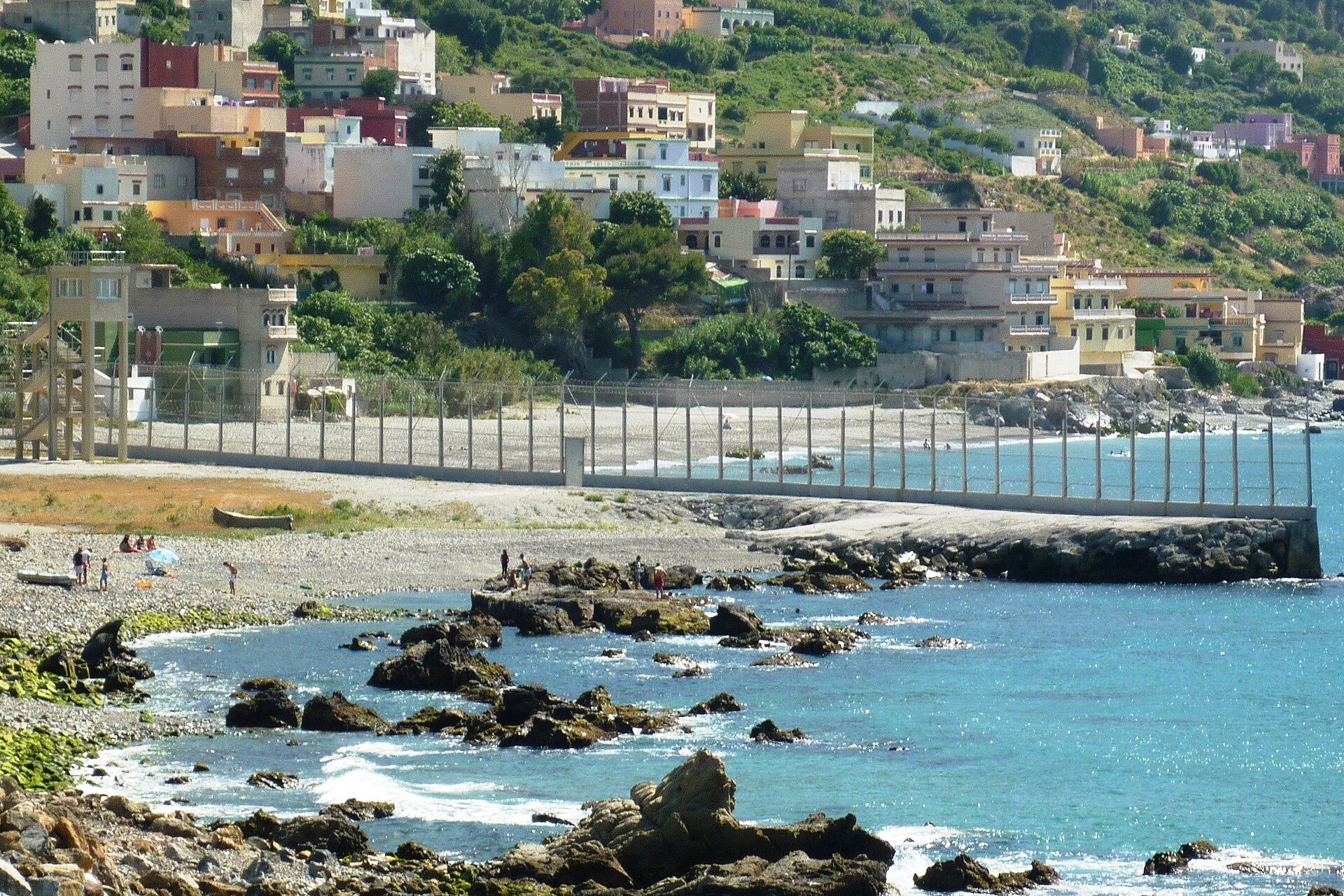
Ceuta is a Spanish autonomous city of approximately 85,000 people on the northern tip of Africa, physically connected to Morocco and separated from it by a border fence that is one of the most asymmetrically controlled in the world. The city is Spanish territory, part of the European Union, using the euro; Morocco surrounds it on three sides and the Mediterranean lies to the north. The border fence between Ceuta and Morocco is the only EU land border with Africa.
The contrast at Ceuta's border is one of the most viscerally stark in the world: on the Spanish side, the EU's regulatory and economic standards; on the Moroccan side, the completely different economy, built environment, and social organization of northern Morocco. The queue of Moroccan workers crossing into Ceuta for employment each morning — and the queue of people attempting to cross into the EU for migration rather than daily work — makes the fence simultaneously a labor market mechanism and a migration control infrastructure.
The city itself contains the specific cultural layering of a Spanish enclave in Africa: Catholic churches, mosques, a synagogue, and a Hindu temple exist within walking distance of each other; the architecture is Spanish colonial on the main streets and Moroccan vernacular in the market areas; the specific food culture combines Spanish tapas with Moroccan tea service and North African spice markets. It is one of the most concentrated border contrasts available anywhere.
Melilla — Spain and Morocco
Ongayo / Wikimedia Commons (CC BY-SA 4.0)
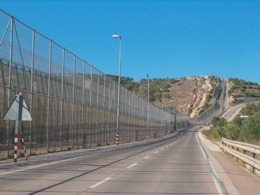
Melilla is Ceuta's smaller equivalent — another Spanish autonomous city on the Moroccan coast, with a population of approximately 87,000 and the same EU-Africa border fence dynamic. The two cities are often discussed together, but Melilla has a specific character that distinguishes it: a smaller old town with a remarkable Renaissance military fortress (the Melilla la Vieja, built in tiers on a promontory), a specific Jewish cultural heritage from its historical Sephardic community, and a more compact and less touristed character than Ceuta.
The border dynamic at Melilla is similar to Ceuta but the scale of cross-border informal trade — Moroccan women who carry goods across the border as porteadoras (porter women), sometimes in elaborate body packaging that evades customs detection — is more visible and more anthropologically documented than at Ceuta. The porteadora trade, which effectively functions as an informal economic relationship between the Spanish city and the surrounding Moroccan economy, is a specific border economy that has no equivalent elsewhere in Europe.
Visiting Melilla specifically for the border contrast — spending time at the crossing, watching the flow of people and goods, exploring both the Spanish old town and the cross-border market area on the Moroccan side — is the most direct way to understand the specific character of a Spanish-African border that exists nowhere else in the world.
Derby Line and Stanstead — Vermont and Quebec
-1920x1080.jpg)
Lea-Kim / Wikimedia Commons (CC BY-SA 2.0)
Derby Line, Vermont and Stanstead, Quebec share something that almost no other US-Canada border community has: the Haskell Free Library and Opera House, a building deliberately constructed in 1904 to straddle the international border, with the reading room in the United States and the stage in Canada. The building is a monument to the specific border culture of the US-Canada frontier at a point where the two countries were friendly enough — in 1904 — to treat a border as an opportunity for a shared civic institution rather than a security concern.
The contemporary border reality at Derby Line-Stanstead is more fraught: the post-9/11 security hardening of the US-Canada border created new fences and new restrictions in communities that had previously functioned as essentially integrated, and the Haskell Library now requires visitors to check in with US Customs before entering on the American side. The library's reading room, which straddles the border (a line of tape on the floor marks the international boundary), is accessible to both American and Canadian residents but the informal cross-border community life that existed before 2001 has been significantly curtailed.
The specific story of Derby Line-Stanstead is the story of what happens when a border that was managed permissively suddenly becomes a security infrastructure — and the library and opera house straddling the line is the most eloquent physical monument to what was lost.
Hong Kong and Shenzhen — China
Payton Chung / Wikimedia Commons (CC BY 2.0)
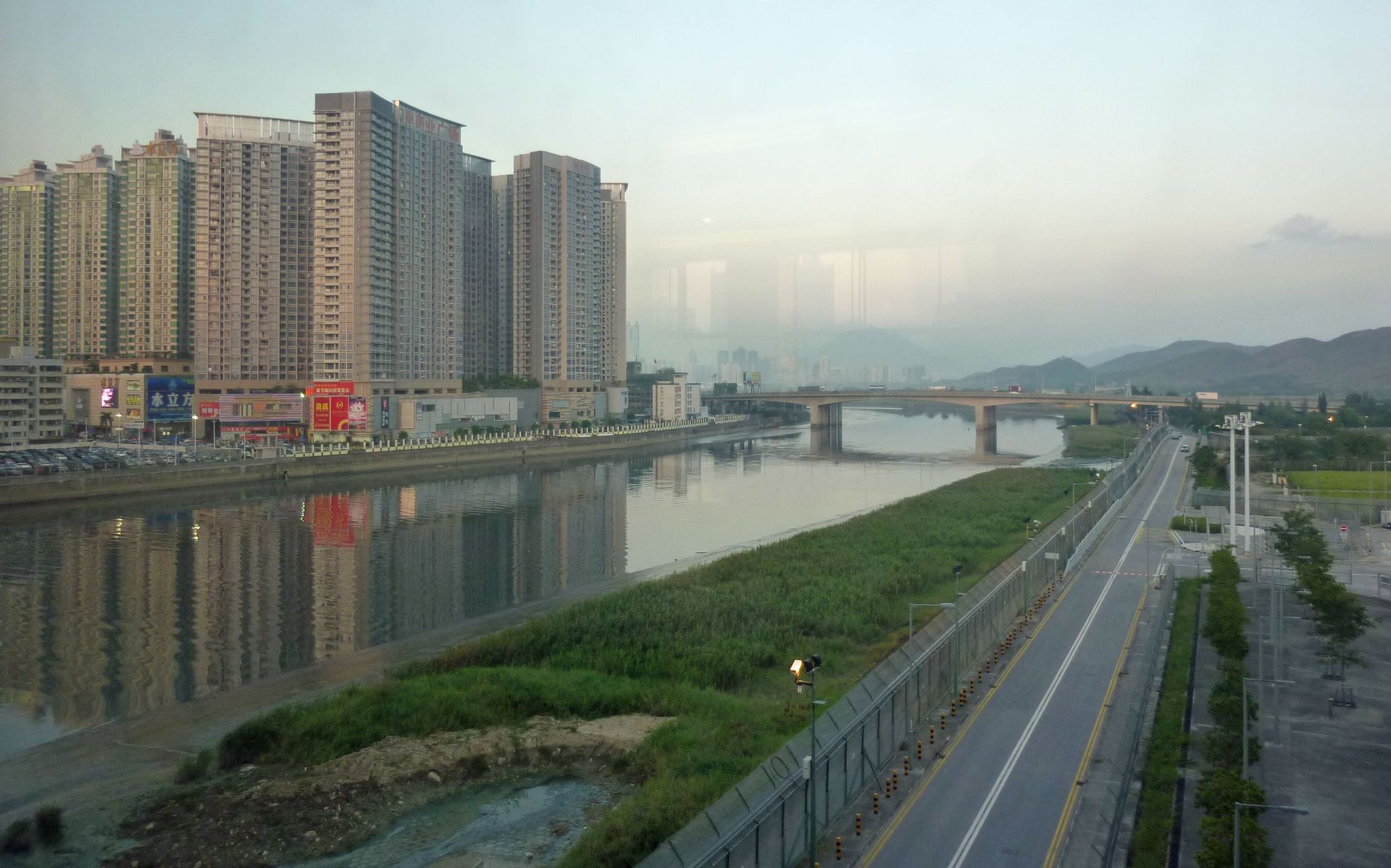
The crossing between Hong Kong and Shenzhen across the Shenzhen River is one of the most economically revealing border crossings in the world: the two cities that face each other across this border represent two of the most dramatic economic transformations in modern history. Hong Kong was the window through which Western business accessed China for over a century; Shenzhen was a fishing village of approximately 30,000 people in 1979 and is now a city of approximately 17 million, built in 45 years as China's first Special Economic Zone, the laboratory for the economic reforms that transformed the country.
The contrast between the two sides of the Shenzhen River is both the contrast between two different political and economic systems (the "one country, two systems" arrangement that governed Hong Kong until 2020) and the contrast between two different moments in Chinese economic development. Hong Kong's built environment, legal system, and social organization reflect its colonial and post-colonial British heritage; Shenzhen's reflect the specific aesthetic and organizational character of Chinese megacity development at unprecedented speed.
The specific crossing — from the MTR to Lo Wu station and across to the Shenzhen side — is itself a remarkable experience in the density and organization of movement: hundreds of thousands of people cross this border weekly for work, shopping, and family visits, and the crossing infrastructure handles this volume with a specificity and a scale that is worth experiencing as a demonstration of what border infrastructure can look like when it is genuinely high-capacity.
Mariscal Estigarribia and Cañada Oruro — Paraguay and Bolivia
_-_Cañada_Oruro_(Bolivia),_en_el_final_de_la_Ruta_Nacional_PY09__Trans-Chaco_-1920x1440.jpg)
Ulises Icardi / Wikimedia Commons (CC BY-SA 4.0)
The crossing between Paraguay and Bolivia in the Gran Chaco — the vast, hot, sparsely populated lowland plain that covers northwestern Paraguay and southwestern Bolivia — is one of the most remote and most logistically challenging border crossings in South America, and one of the most revealing about what borders mean in landscapes where the state has historically had minimal presence.
The Gran Chaco was the site of the Chaco War between Paraguay and Bolivia from 1932 to 1935, one of the most devastating conflicts in South American history, fought over territory that both countries believed contained oil and that turned out to be of limited economic value. The border between the two countries in this region was drawn as a result of that war, and the Mennonite communities that settled in the Paraguayan Chaco in the 1920s and 1930s — creating productive agricultural settlements in conditions that the indigenous population managed with very different techniques — are one of the most remarkable cultural communities in South America.
The crossing is included here not as a comfortable tourist destination (it requires a 4WD vehicle, significant preparation, and current research on road conditions) but as one of the most genuinely frontier border crossings remaining in the Americas — a place where the border itself is barely marked, the landscape is extraordinary, and the specific human history of the Chaco War and its aftermath is visible in the landscape and the communities on both sides.
Iguazú and Foz do Iguaçu — Argentina and Brazil
Rosendo Velarte / Pexels
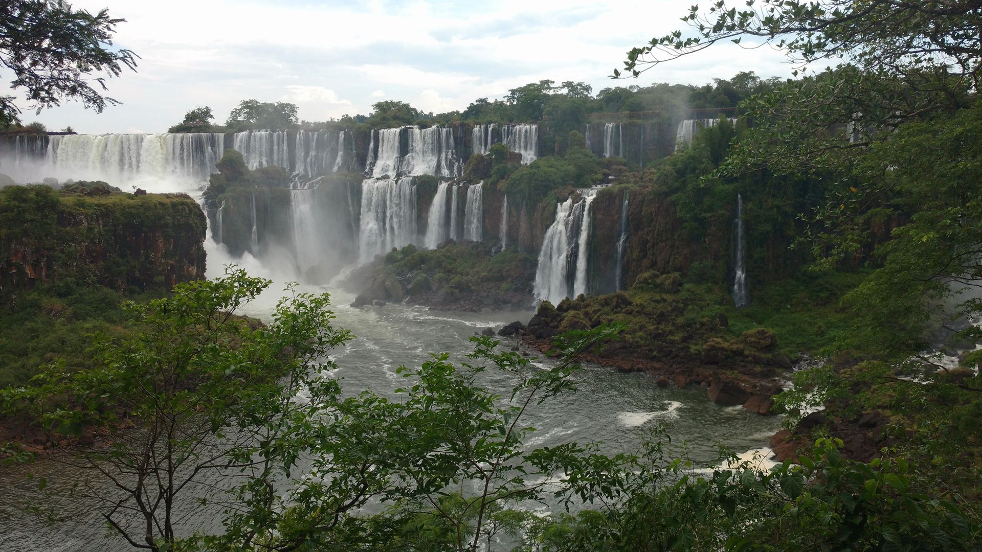
The Iguazú Falls — one of the most spectacular natural wonders in the world, wider than Victoria Falls and taller than Niagara — straddle the border between Argentina and Brazil, with the Argentine side offering the closer and more immersive view from the catwalks above the falls and the Brazilian side offering the panoramic view from across the canyon. The falls themselves are the destination; the border is the mechanism by which two genuinely different experiences of the same natural phenomenon are available within the same visit.
The Argentine town of Puerto Iguazú and the Brazilian city of Foz do Iguaçu demonstrate the specific cultural contrast of the two countries in concentrated form: the Argentine town is smaller, calmer, and organized around the natural park; the Brazilian city is larger, more commercially intense, and contains the specific Brazilian urban energy of a medium-sized city. Paraguay is visible across the Paraná River from Foz do Iguaçu, making this one of the only places in the world where three national territories are visible simultaneously from a single point.
The triple border (Argentina-Brazil-Paraguay) at this crossing has historically been associated with significant informal trade and tax arbitrage, as the different tariff regimes of three countries created opportunities for commerce that the border geography made feasible. The specific character of Foz do Iguaçu as a border city — with its large Arab-Brazilian community (mostly of Lebanese and Syrian origin), its duty-free shopping infrastructure, and its position at the intersection of three countries — is as interesting as the falls.
Mostar — Bosnia and Herzegovina (internal border)
Muhammed Fatih Beki / Pexels
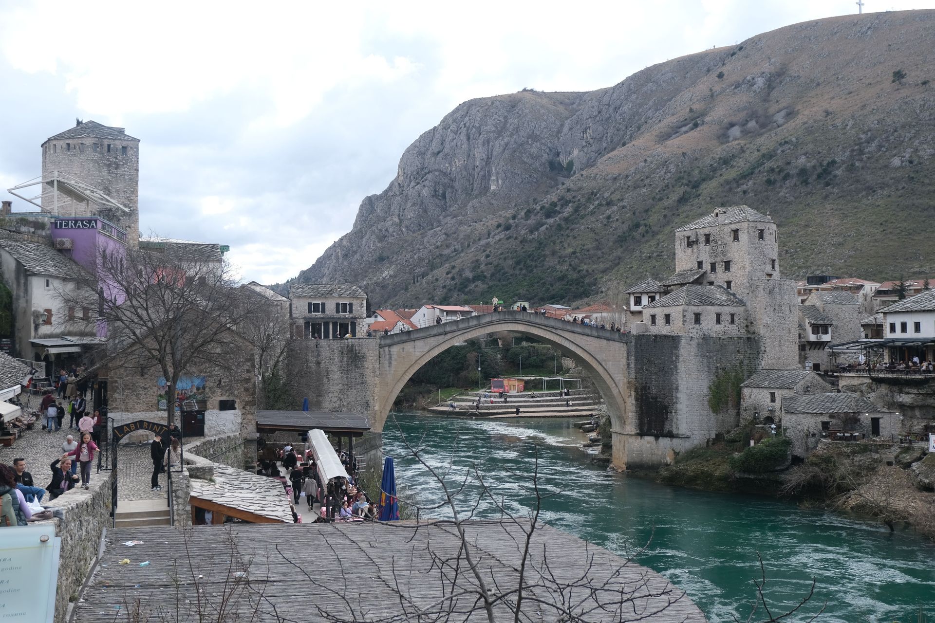
Mostar is not a conventional international border town but a city divided by an internal ethnic border — the confrontation line of the 1993 to 1994 Bosnian-Croat war that separated the city along the Neretva River into a Bosniak (Bosnian Muslim) east and a Croat west. The Stari Most (Old Bridge), destroyed by Croat forces in 1993 and rebuilt by 2004, is the physical symbol of that division and its partial healing; crossing it is the act that makes the division visible.
The contrast between the two sides of the Neretva in Mostar is visible in the architecture (Ottoman-influenced buildings on the Bosniak east; more Austro-Hungarian and contemporary Croat construction on the west), in the religious infrastructure (mosques on the east, Catholic churches on the west, with a large cross on a hilltop visible from the city that was erected by Croat nationalists during the war and remains a point of sensitivity), and in the specific atmosphere of the two sides, which feel meaningfully different despite the physical proximity.
Mostar is included in this list as a reminder that borders are not only between countries: the most revealing border contrasts sometimes occur within them, at the fault lines where ethnic, religious, or political divisions have been inscribed into the urban fabric by conflict and never fully erased.
Laredo and Nuevo Laredo — Texas and Tamaulipas
-1920x1280.jpg)
U.S. Customs and Border Protection / Wikimedia Commons
Laredo, Texas and Nuevo Laredo, Tamaulipas face each other across the Rio Grande at the most valuable single commercial border crossing in the United States — the World Trade Bridge at Laredo handles approximately 45% of all US-Mexico surface trade, more than any other crossing, with over $300 billion in goods crossing annually. The economic interdependence of the two cities is more complete than at any other crossing on the border: Laredo's economy is almost entirely oriented toward international trade logistics; Nuevo Laredo's is similarly structured around the maquiladora manufacturing and trade infrastructure that serves the crossing.
The contrast is significant despite the interdependence: Laredo is a Texas city with the specific Hispanic-American character of the South Texas border region, where the majority of the population is of Mexican origin and Spanish is the primary community language; Nuevo Laredo is a Mexican industrial city with the specific energy of a city that has been subject to severe cartel violence (the Zetas cartel originated in Nuevo Laredo) and that has undergone its own security transformation in recent years.
The Laredo crossing is the most economically important border in this list and one of the least visited for tourism specifically because its scale and industrial orientation are less accessible to casual visitors than other crossings. Understanding what happens at this crossing — the volume of goods, the inspection infrastructure, the economic geography of US-Mexico manufacturing — is understanding a significant proportion of how the North American economy works.
Kasumbalesa — Democratic Republic of Congo and Zambia
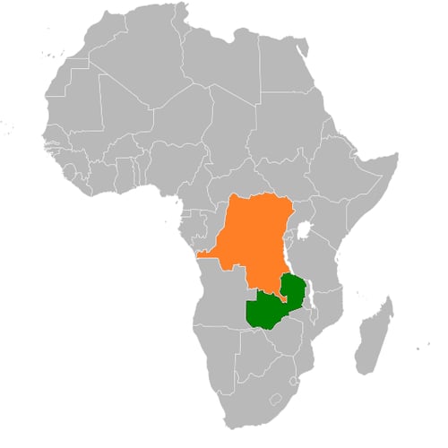
Andrys8 / Wikimedia Commons (CC0)
Kasumbalesa is a small border town on the DRC-Zambia border that functions as the primary crossing point for copper and cobalt from the DRC's Katanga Province — the world's largest copper-producing region and the source of approximately 70% of global cobalt supply — to the Zambian rail network and onwards to the ports of East Africa for export. The specific economic significance of this crossing is extraordinary: the cobalt and copper that passes through Kasumbalesa are essential components of the electric vehicle batteries, smartphones, and electronics that constitute the material foundation of the contemporary digital economy.
The border town itself reflects this significance in a specific way: the queue of trucks waiting to cross — sometimes stretching for kilometers — is the physical manifestation of the supply chain whose upstream end is the Congolese mines and whose downstream end is the factories of China, South Korea, and elsewhere. The informal economy that serves the truckers waiting in the queue, the specific border commerce that develops wherever a constrained crossing point creates a captive population, and the physical contrast between the Congolese town (less developed, less formal infrastructure) and the Zambian side (better road infrastructure, more formal commercial organization) are all visible at this crossing.
Kasumbalesa is not a tourist destination in any conventional sense. It is included here as the most economically revealing border in this list — the physical place where the resource extraction economy of central Africa connects to the global manufacturing economy, in a way that visiting makes visceral.
Nikel and Storskog — Russia and Norway
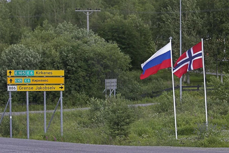
ByMaJILHbli Archive / Wikimedia Commons (CC0)
The crossing between Nikel, Russia and Storskog, Norway in the Arctic was, until Russia's invasion of Ukraine in 2022, one of the most unusual international border crossings in the world: a single land border crossing between Russia and Norway in the far north, open to local residents for visa-free crossings, connecting the nickel-smelting industrial town of Nikel to the Norwegian border post and the road to Kirkenes.
The contrast was extraordinary for its proximity: Nikel, with its Soviet-era heavy industry (a nickel smelter that polluted the surrounding landscape for decades), its specific post-Soviet urban character of apartment blocks and industrial infrastructure, and its Russian Arctic town culture, was accessible within a short drive of Kirkenes (Norway), a small Norwegian town of approximately 3,500 people with the specific character of a Norwegian fishing and administrative community.
The crossing has been effectively closed since February 2022, when Norway suspended visa-free crossings for Russian citizens following the invasion of Ukraine. It is included here as a border that demonstrated, when it was open, the specific character of contact between Western Europe and Russia at their most accessible point — and whose closure is itself a statement about what borders mean when the political relationships that frame them change.
Basel — Switzerland, Germany, France
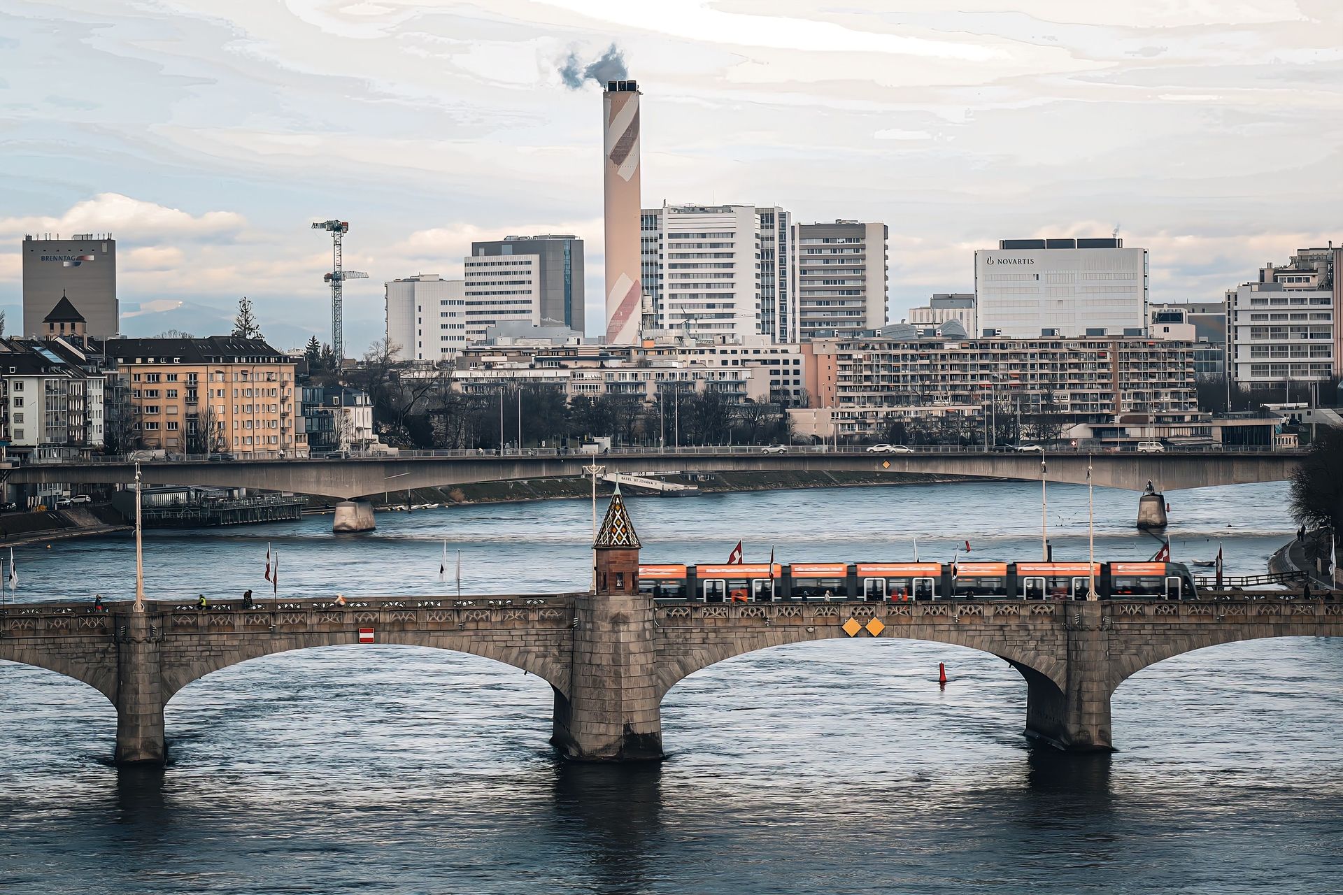
Sevi Schiegg / Pexels
Basel is a Swiss city of approximately 180,000 people in the extreme northwest of Switzerland, at the point where the Rhine bends north and the borders of Switzerland, Germany, and France meet within the city's metropolitan area. The Basel-Mulhouse-Freiburg Euro Airport is the only international airport in the world jointly operated by two countries (France and Switzerland), with separate French and Swiss terminals. The tram system crosses into Germany and France. The Rhine port is in Switzerland; the French and German suburbs are accessible by tram.
The specific experience of Basel as a border city is the experience of three very different European cultures in tight proximity: Swiss German Basel with its specific prosperity, its Art Basel connection, and its chemical and pharmaceutical industry; the Alsatian French character of Mulhouse and the surrounding region, with its specific Franco-German hybrid culture produced by the Alsace region's history of alternating between French and German rule; and the Baden-Württemberg German character of Freiburg, a university city of the Upper Rhine.
A single day in Basel that crosses into France for lunch and into Germany for a walk along the Rhine is the most compressed European cultural comparison available within a single urban area, and the specific character of each of the three countries' urban culture is legible within a few blocks of each crossing.
Paso del Norte and the Santa Fe Bridge — historical
-900x577.jpg)
SMU Central University Libraries / Wikimedia Commons
The crossing at Paso del Norte — now the El Paso-Ciudad Juárez crossing described earlier — was, from the 16th century to the 19th century, the most important crossing on the Rio Grande, the gateway through which Spanish colonial expedition into the American Southwest passed and the site of the 1680 Pueblo Revolt's aftermath, when the Tiwa-speaking population of the El Paso region was settled. The Santa Fe Bridge that now spans the river at this location carries approximately 25,000 pedestrian crossings daily.
The historical depth of this crossing distinguishes it from most other entries in this list: Paso del Norte is not merely a contemporary border crossing but a place where the border itself is a recent imposition on a much older pattern of human movement. The Rio Grande was a river in a landscape that the Manso and Tiwa peoples inhabited for centuries before the Spanish arrived; it became a national boundary only in 1848, when the Treaty of Guadalupe Hidalgo ended the Mexican-American War and drew the line through the middle of a connected community.
The historical crossing is worth including as a corrective to the contemporary border narrative: the Rio Grande boundary between the United States and Mexico is a 175-year-old line through a landscape where human movement had been occurring for millennia and where the border continues to generate the consequences — legal, economic, cultural, human — that this list explores.