Credit: Ollie Craig / Pexels
Cities almost never die. Researchers who study urban history have noted a stubborn pattern: settlements flattened by earthquakes, fires, floods, and bombs are nearly always rebuilt on the same ground, often within a generation. Ports stay where the harbors are. Rivers keep flowing through the same valleys. The economic logic that put a city somewhere in the first place usually survives whatever destroyed the buildings.
What changes is everything else. Destruction forces a city to answer questions that normal politics lets it avoid. Should the streets follow the old medieval tangle or a modern grid? Should the skyline be restored stone by stone or replaced with something new? Who gets to come back, and who gets priced or zoned out? The answers reveal what a society values, and they tend to outlast the people who made them.
Some of the modern world's most consequential inventions came out of these moments. Building codes as we know them emerged from the ashes of London in 1666. Earthquake engineering was born in Lisbon in 1755 and matured in Tokyo and Kobe. The steel-frame skyscraper rose from the mud of post-fire Chicago. Warsaw's reconstruction changed how the world thinks about heritage, forcing UNESCO to accept that a faithful replica can carry authentic meaning. New Orleans rewrote American disaster policy. Christchurch is still testing how much of a downtown a country can redesign from scratch.
The 15 cities on this list span four centuries and five continents' worth of catastrophe: two atomic contexts, three great fires, five major earthquakes, a flood, and the deliberate razing of a European capital. Each entry explains what destroyed the city, how the rebuilding actually unfolded, and what permanently changed as a result — in the streets, in the law, or in the way the rest of the world builds. Together they make a simple case: a city is not its buildings. It is the decision, made over and over, to stay.
1 / 15
Credit: Ollie Craig / Pexels
The fire started in a bakery on Pudding Lane in the early hours of September 2, 1666, and burned for four days. It destroyed about 13,200 houses, 87 parish churches, and the medieval St. Paul's Cathedral — roughly the entire City of London inside the old Roman walls. Tens of thousands of people were left homeless in a city built almost entirely of timber, thatch, and pitch.
The rebuilding that followed is often remembered for the grand plans that never happened. Christopher Wren, John Evelyn, and others submitted schemes for a rationalized city of boulevards and plazas. Property owners wanted their land back where it had been, and Parliament sided with them. London kept its tangled medieval street pattern, which is why the modern financial district still follows lanes laid out centuries before the fire.
What did change was the law. The Rebuilding Act of 1667 required new houses to be built of brick or stone rather than timber, standardized them into four classes with fixed heights and wall thicknesses, and widened key streets to act as firebreaks. It was one of the first comprehensive building codes in the modern sense, and it worked. London never again suffered a citywide fire on the 1666 scale, even through centuries of dense growth.
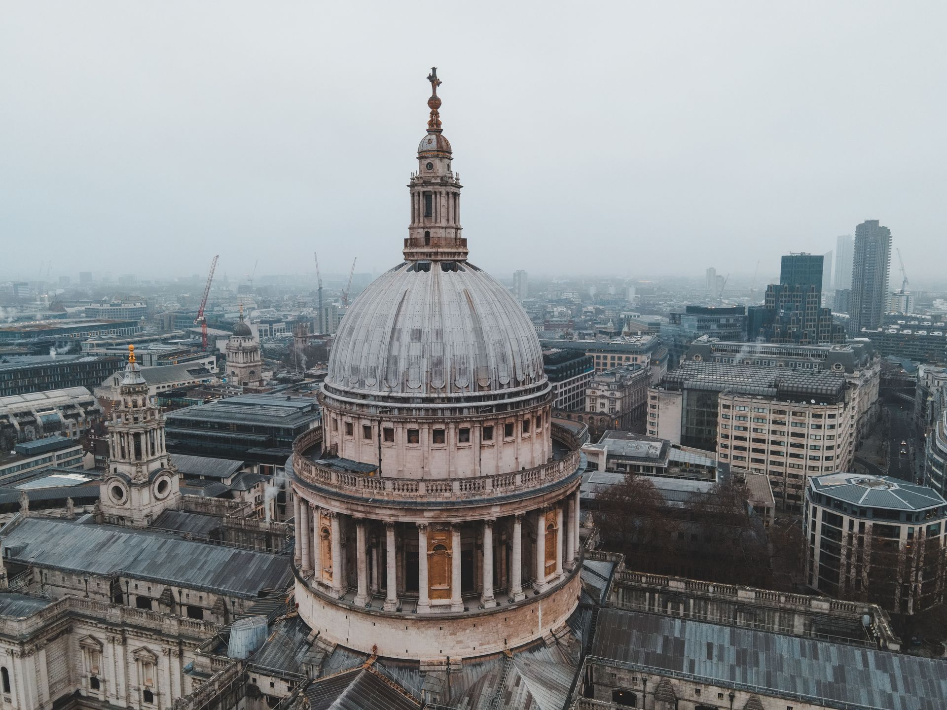
The fire also gave the city its architectural signature. Wren rebuilt St. Paul's Cathedral over 35 years, topping it with the dome that defined London's skyline into the 20th century, and he designed dozens of replacement parish churches. A coal tax funded much of the work, an early example of disaster reconstruction financed through dedicated public revenue.
One more legacy is easy to miss. The fire helped spur the growth of property insurance. Fire insurance offices appeared in London within two decades, some operating their own private fire brigades. The idea that risk could be pooled and priced — a foundation of modern finance — grew directly out of the rubble.
2 / 15
Credit: Matej Simko / Pexels
On the morning of November 1, 1755 — All Saints' Day, with churches full — an earthquake now estimated at magnitude 8.5 or higher struck off the Portuguese coast. The shaking collapsed buildings across Lisbon, a tsunami swept the waterfront, and fires burned for days. Tens of thousands of people died, and most of the lower city was destroyed. It was one of the deadliest disasters in European history.
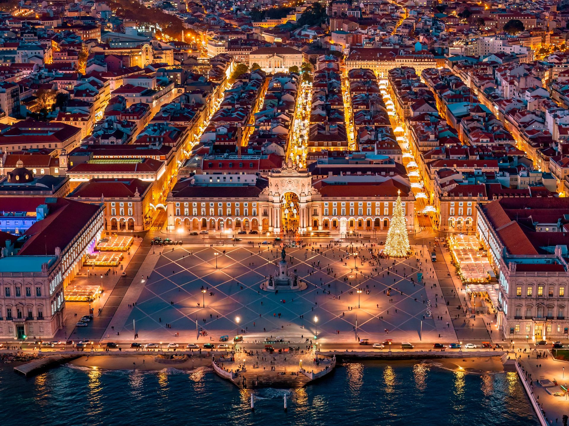
The response belonged largely to one man: Sebastião José de Carvalho e Melo, later the Marquis of Pombal, the king's chief minister. His reported instruction — bury the dead and feed the living — set the tone for a reconstruction that was fast, centralized, and ruthlessly practical. Rather than restore the medieval maze of the old Baixa district, Pombal's engineers imposed a rational grid of wide, straight streets running between two great squares, the Rossio and the riverside Praça do Comércio.
The engineering inside the buildings mattered even more than the plan. New structures used the gaiola pombalina, a flexible timber cage embedded in masonry walls, designed to sway rather than shatter in a quake. Builders reportedly tested models by having troops march around them to simulate seismic vibration. Construction elements were standardized and prefabricated off-site, which sped the work and kept quality consistent. The Pombaline downtown is widely considered the first large-scale example of earthquake-resistant urban construction in Europe.
The disaster's intellectual aftershocks reached even further. Pombal circulated questionnaires to parishes across Portugal asking what people had observed — how long the shaking lasted, how the sea behaved, how animals reacted. That survey is often cited as a founding moment of modern seismology. The earthquake also shook European philosophy. Voltaire made it the centerpiece of his attack on optimism in Candide, and the argument it triggered about why catastrophe strikes the innocent helped push natural disaster out of theology and into science.
3 / 15
Credit: K / Pexels
The fire that began on the evening of October 8, 1871, near the O'Leary family's barn burned for two days, killed an estimated 300 people, and left about 100,000 residents — a third of the city — homeless. It destroyed roughly 17,000 buildings across more than three square miles, including nearly the entire central business district. Chicago in 1871 was a boomtown built fast and cheap out of wood, and it burned accordingly.
The rebuilding was immediate and frantic. Rail lines, stockyards, and grain elevators on the city's edges had largely survived, so the economic engine kept running while the core was rebuilt. Within a few years the downtown had been reconstructed, this time under ordinances that pushed builders toward brick, stone, and iron. Land values in the compact business district kept climbing, and that pressure created a problem: the only way to grow was up, but traditional masonry walls had to get impossibly thick to support real height.
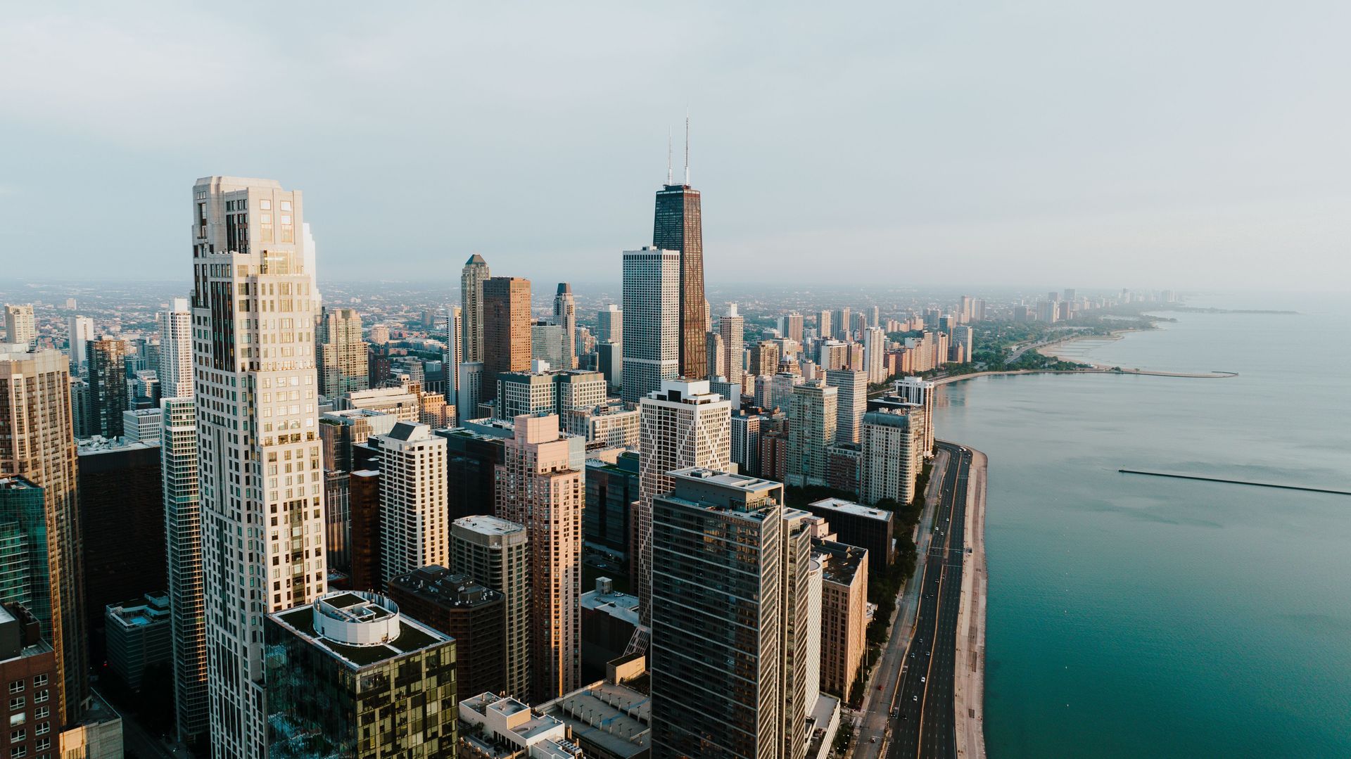
The answer arrived in 1885, when William Le Baron Jenney's Home Insurance Building rose on a load-bearing metal frame — a skeleton of iron and steel that carried the structure's weight and freed the walls to become thin curtains. It is commonly cited as the world's first skyscraper. A generation of architects and engineers, including Louis Sullivan, Daniel Burnham, and John Root, followed with taller and more refined steel-frame towers. Their work became known as the Chicago School, and it set the template for the modern high-rise city everywhere from New York to Shanghai.
The fire's legacy extended beyond structure. Chicago's recovery culminated in the 1893 World's Columbian Exposition, which announced the rebuilt city to the world and helped launch the City Beautiful movement in American planning. A city that had been a smoldering ruin 22 years earlier hosted one of the most influential world's fairs ever staged, on the strength of an urban form it had been forced to invent.
4 / 15
Credit: David McElwee / Pexels
At 5:12 a.m. on April 18, 1906, an earthquake of roughly magnitude 7.8 ruptured the San Andreas Fault along nearly 300 miles of Northern California. The shaking wrecked buildings across San Francisco, but the fires that followed did far more damage. Broken gas lines fed flames, shattered water mains left firefighters helpless, and dynamited firebreaks sometimes spread the burning instead of stopping it. The fires raged for roughly three days and destroyed most of the city's core — more than 28,000 buildings across some 500 city blocks. Modern research puts the death toll at more than 3,000, far above the official count of the era, and well over half the city's roughly 400,000 residents were left homeless.
The rebuilding was defined by speed over reform. Daniel Burnham had delivered an ambitious plan to remake San Francisco with grand diagonal boulevards and civic plazas just months before the quake. Property owners and business leaders, desperate to reopen, brushed it aside. The city was rebuilt largely on its old street grid, and much of it went up quickly enough to reopen for business within a few years. By 1915, San Francisco was confident enough to host the Panama-Pacific International Exposition, a world's fair staged partly to prove the city was back.
Civic boosters also worked to rebrand the disaster itself. Insurance covered fire more reliably than earthquake, and business interests preferred that the event be remembered as the great fire rather than the great earthquake, playing down the seismic risk that remained under the city.
The disaster still left lasting marks. It pushed the study of earthquakes forward — the state's investigation produced the elastic rebound theory of how faults store and release strain, a foundation of modern seismology. It reshaped the city's geography of neighborhoods, scattering residents and helping shift Chinatown's fate into a deliberately rebuilt tourist-friendly district designed by its own leaders. And it made the fire hydrant and the auxiliary water system civic priorities in a way few cities had considered before.
5 / 15
Credit: LoboStudio Hamburg / Unsplash
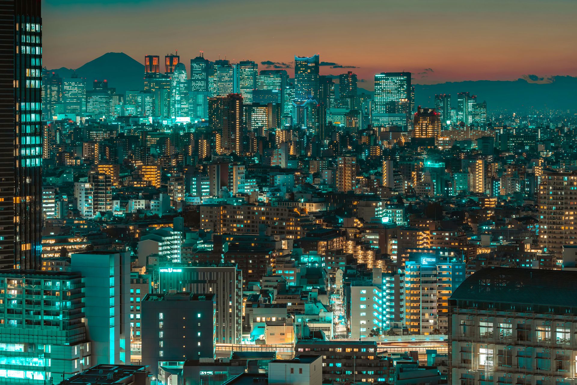
Few major cities have been leveled twice within living memory. On September 1, 1923, the Great Kanto earthquake struck the Tokyo region at lunchtime, when cooking fires were lit across a city of wooden houses. The quake and the firestorms that followed killed more than 100,000 people in Tokyo, Yokohama, and the surrounding prefectures and destroyed much of the capital. Just over two decades later, on the night of March 9–10, 1945, American B-29s firebombed Tokyo in one of the deadliest air raids in history, killing an estimated 100,000 people and burning roughly 16 square miles of the city. By the war's end, repeated raids had reduced much of Tokyo to ash.
Both reconstructions favored speed and pragmatism over grand design. After 1923, planners led by Shinpei Goto proposed a sweeping modernization; budget politics shrank it, though the city still gained wider avenues, new bridges, parks designed as refuge areas, and reinforced-concrete schools. After 1945, an even more ambitious plan collapsed under postwar poverty, and Tokyo rebuilt itself largely through millions of small private decisions. The result is the dense, fine-grained, low-rise-and-high-rise patchwork that still defines the city.
What Tokyo institutionalized instead of a master plan was preparedness. September 1 is now Disaster Prevention Day, marked by nationwide drills. Japan's building codes have been repeatedly tightened since 1923, with major revisions after subsequent earthquakes, and Tokyo's newer towers stand on some of the world's most advanced seismic isolation systems. Neighborhoods maintain evacuation routes, schools run regular drills, and households are urged to keep emergency kits.
The economic lesson endured, too. Tokyo's rebuilding after 1945 fed into Japan's postwar growth, and the city became the center of the world's largest metropolitan economy. The catastrophes did not push Japan's capital elsewhere. They convinced it to engineer for the next one, and to treat the memory of destruction as a permanent civic institution rather than a closed chapter.
6 / 15
Credit: Miguel Saddi Vitorino / Pexels
On May 14, 1940, German bombers attacked Rotterdam to force the Netherlands to surrender. The raid lasted minutes, but the fires it started burned out the city's historic core. Around 900 people were killed, roughly 80,000 lost their homes, and nearly the entire medieval center — churches, guild halls, canal houses — was gone. The Dutch capitulated the next day.
Rotterdam's response set it apart from almost every other bombed European city. Within days of the attack, city officials commissioned a reconstruction plan, and the plan they eventually adopted made a radical choice: the old city would not come back. Instead of reconstructing gabled facades, Rotterdam expropriated the ruined land, redrew the street plan, and committed to building a modern city on the cleared ground.
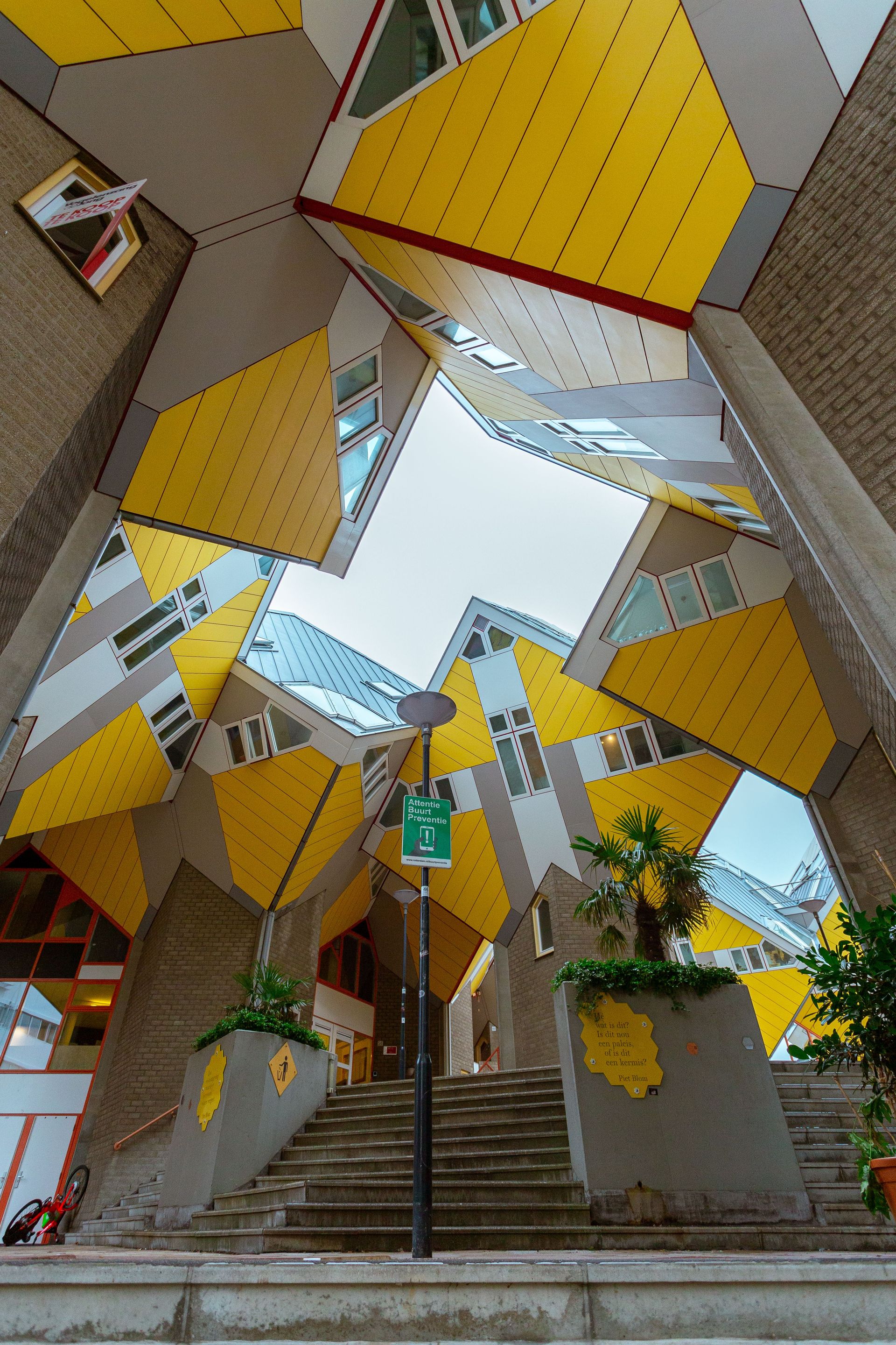
The results arrived in stages. The Lijnbaan, completed in 1953, was one of Europe's first purpose-built pedestrian shopping streets and was studied by planners around the world. Later decades brought increasingly experimental architecture: Piet Blom's tilted Cube Houses in the 1980s, the swan-necked Erasmus Bridge in 1996, and the vast arched Markthal, an apartment building wrapped around a food market, in 2014. A city that had lost its historic identity manufactured a new one as the Netherlands' laboratory for bold architecture.
The trade-offs are still debated locally. Rotterdam lacks the intimate old-town charm that draws tourists to Amsterdam or Delft, and postwar planning left the center windswept and car-oriented for decades before later projects softened it. The city marks what it lost with the brandgrens, a line of markers embedded in pavements tracing the boundary of the 1940 fires.
Rotterdam's port, rebuilt and relentlessly expanded after the war, grew into the largest in Europe. The city's story became the strongest counterexample in the debate every destroyed city faces: it proved that refusing to rebuild the past can, over time, become an identity of its own.
7 / 15
Credit: Andrew Walke / Wikimedia Commons ( CC BY-SA 3.0)
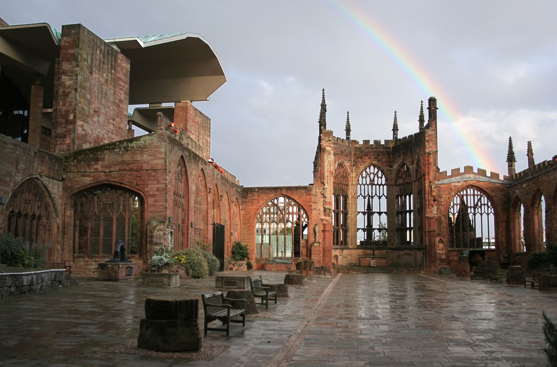
The German air raid on Coventry on the night of November 14, 1940, lasted more than 10 hours and was one of the most concentrated attacks on a British city during the war. It killed more than 500 people, destroyed or damaged tens of thousands of buildings, and gutted the 14th-century Cathedral Church of St. Michael, leaving only its outer walls and spire. The attack was so thorough that Nazi propaganda coined a new verb for annihilating a city from the air, and Coventry's name entered the vocabulary of total war.
The city center was rebuilt after the war along modernist lines, with one of Britain's earliest pedestrianized shopping precincts. But the decision that defined Coventry's identity concerned the cathedral. Rather than restore the ruin or clear it away, the city kept the shell exactly as the bombs left it and built a new cathedral, designed by Basil Spence, directly alongside. The two structures are physically joined, so visitors walk from the open-air ruin into the new church, consecrated in 1962. Benjamin Britten composed his War Requiem for the occasion.
The ruins themselves became instruments of reconciliation. Shortly after the raid, the cathedral's provost had the words "Father Forgive" inscribed in the sanctuary, and a cross made from three medieval nails found in the rubble became the symbol of a ministry that now links hundreds of churches and peace centers worldwide, including in Germany. Coventry established twinning relationships with cities that had suffered wartime destruction, among them Dresden and Volgograd, the former Stalingrad — helping pioneer the modern town-twinning movement itself.
Coventry's postwar concrete center has had a rockier reputation, with parts of it redeveloped again in recent decades. The cathedral quarter, though, remains one of the clearest statements any rebuilt city has made: that the point of preserving destruction can be to prevent its repetition.
8 / 15
Credit: Steven1991 / Wikimedia Commons (CC BY-SA 4.0)
Warsaw's destruction was not collateral damage. After the failed Warsaw Uprising of 1944, German forces systematically dynamited and burned the city block by block, on explicit orders, even as the fighting moved elsewhere. By the time the war ended, about 85% of Warsaw's historic left-bank center had been destroyed. The Old Town, the Royal Castle, churches, palaces, and whole streets of townhouses were rubble. Some planners seriously discussed leaving the ruins as a memorial and building the capital elsewhere.
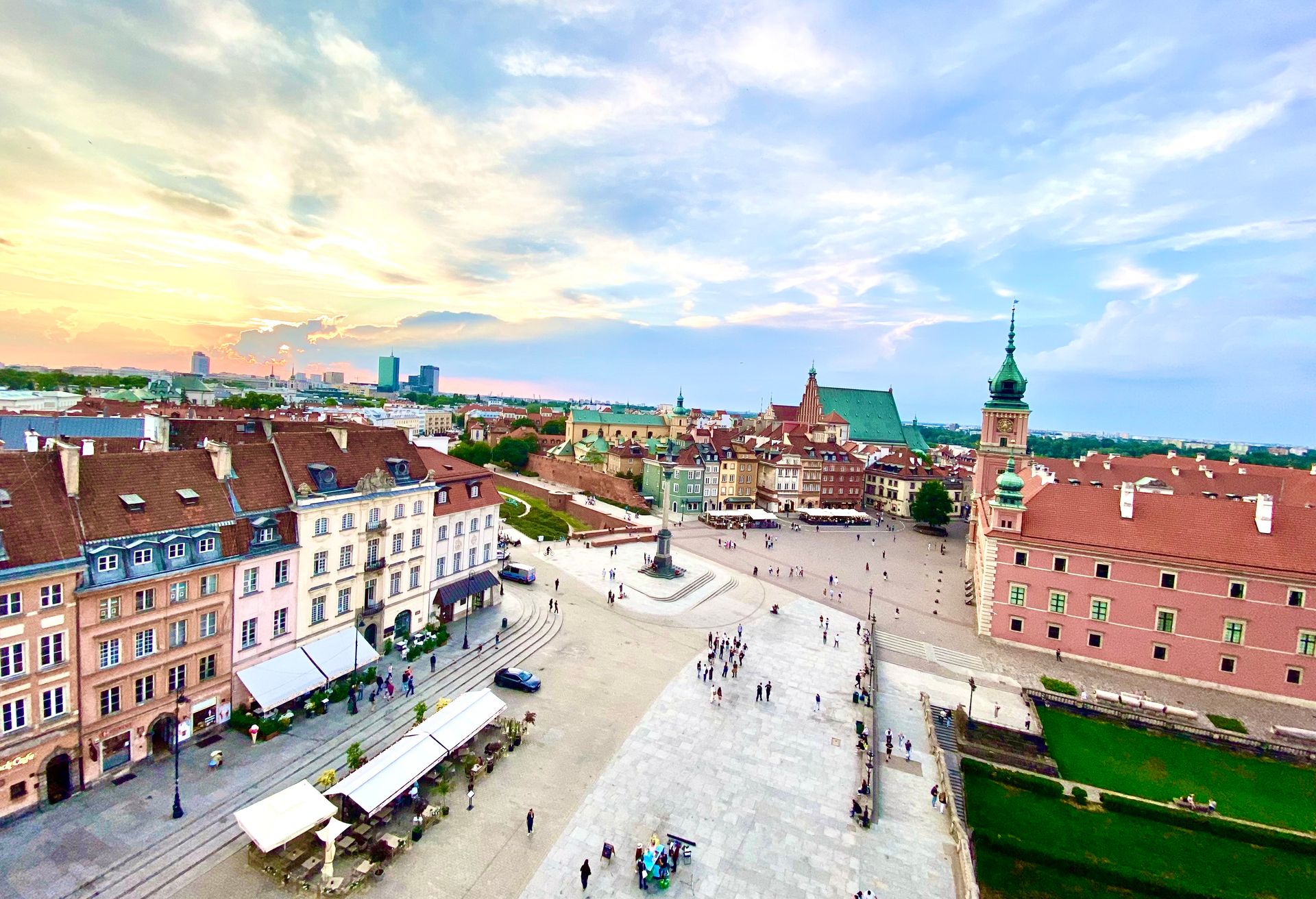
Poland chose instead to put the city back — not approximately, but precisely. Architects and conservators, working with the Warsaw Reconstruction Office, rebuilt the Old Town using prewar architectural surveys, photographs, salvaged fragments, and, famously, the detailed 18th-century cityscapes painted by Bernardo Bellotto, court painter to Poland's last king. Facades, rooflines, and ornamental details were recreated from the canvases and documents. Much of the Old Town was rebuilt by the mid-1950s, funded partly by donations from Poles across the country. The Royal Castle, left for decades as a void, was finally reconstructed and opened in 1984.
The project forced a global rethink of what counts as authentic. Conservation doctrine had long held that a copy, however careful, is not heritage. Warsaw's Old Town broke that rule so persuasively that UNESCO inscribed it on the World Heritage List in 1980 — explicitly as an outstanding example of near-total reconstruction. The listing acknowledged that the value lay not only in the fabric but in the act of restoration itself, as a nation's answer to deliberate cultural erasure.
The rest of Warsaw tells a different story: wide socialist-era avenues, the Soviet-gifted Palace of Culture and Science, and a post-1989 skyline of glass towers. The city is a layered argument about memory, with a meticulously resurrected 18th-century heart inside a 20th- and 21st-century body, and its example is still cited whenever a war-damaged city weighs replica against ruin.
9 / 15
Credit: Niklas Jeromin / Pexels
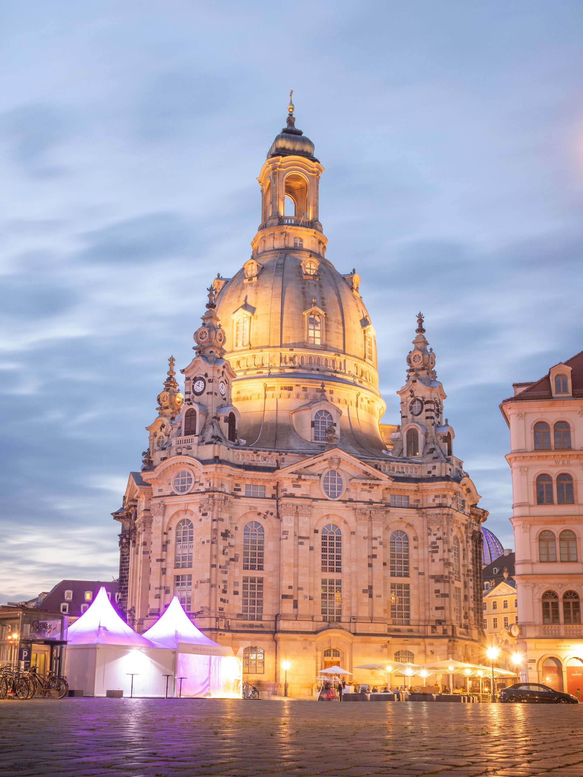
Allied bombers attacked Dresden over three days beginning on February 13, 1945, igniting a firestorm that destroyed the baroque city center. A commission of historians convened by the city later concluded that up to 25,000 people died — far below the inflated figures that circulated for decades, but a staggering toll for a single raid on a city famed as "Florence on the Elbe." Among the losses was the Frauenkirche, the great domed 18th-century church that had dominated the skyline. It burned, then collapsed two days after the raid.
East Germany's communist government rebuilt parts of the city in socialist style and restored some landmarks, including the Zwinger palace and, over decades, the Semperoper opera house. The Frauenkirche it left as a mountain of blackened rubble, designated a war memorial. For 45 years the ruin sat in the heart of Dresden as a deliberate wound.
Reunification changed the calculus. A citizens' initiative launched in 1989 called for rebuilding the church, and donations arrived from around the world, including substantial contributions from Britain and the U.S. Reconstruction began in 1994 and proceeded like archaeology in reverse: thousands of original stones were cataloged, and roughly 3,800 were placed back into the new structure, their fire-darkened surfaces left visible against the pale new sandstone. The new golden tower cross was crafted in Britain, by a silversmith whose father had flown in the 1945 raid. The completed church was consecrated in 2005.
Dresden then rebuilt the Neumarkt square around it in historical style, a choice that reopened Germany's long-running argument between reconstruction and honest modernism. The city also carries a darker legacy: its destruction remains a favorite subject of far-right mythmaking, which is partly why the historians' commission was convened to fix the facts. Dresden's rebuilt center now functions as both a restored skyline and a running debate about how memory should look.
10 / 15
Credit: János Csatlós / Pexels
By May 1945, Berlin had absorbed years of Allied bombing and a final ground battle fought street by street. Vast areas of the city center were rubble; estimates at the time suggested tens of millions of cubic meters of debris. The first phase of recovery belonged substantially to the Trümmerfrauen, the "rubble women" who cleared and sorted bricks by hand. Berlin's man-made hills, including Teufelsberg in the west, are literally piles of the destroyed city, landscaped over.
The Cold War then split the reconstruction into a competition. East Berlin built the monumental Stalinallee — later Karl-Marx-Allee — a grand socialist boulevard lined with ornate workers' apartment blocks. West Berlin answered with the 1957 Interbau exhibition, inviting modernists including Le Corbusier, Walter Gropius, and Alvar Aalto to build the airy Hansaviertel district as a showcase of Western living. Two ideologies rebuilt one city in open argument with each other, and the Wall, from 1961, froze the argument in concrete.
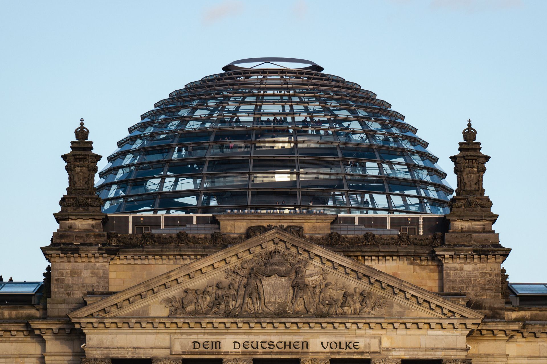
Reunification in 1990 triggered the second rebuilding. Potsdamer Platz, once among Europe's busiest squares and then a dead zone straddling the Wall, became one of the continent's largest construction sites in the 1990s, filled with corporate towers by architects including Renzo Piano and Helmut Jahn. The Reichstag was renovated with Norman Foster's glass dome, opened in 1999, placing the public literally above its parliament. The government quarter, museums, and rail infrastructure followed.
Berlin's approach to its scars is distinctive: it keeps many of them. Bullet-pocked facades survive on museum walls, a preserved stretch of the Wall runs along Bernauer Strasse, and the Kaiser Wilhelm Memorial Church stands as a jagged ruin beside its modern replacement. The rebuilt capital treats incompleteness as part of its character — a city that documents its destructions rather than erasing them, and that has turned its own layered damage into one of Europe's most visited urban landscapes.
11 / 15
Credit: Lachcim Kejarko / Pexels
The atomic bomb dropped on Hiroshima on August 6, 1945, detonated above the city center and destroyed nearly everything within a two-kilometer radius. An estimated 140,000 people had died by the end of that year from the blast, fires, and radiation. Rumors spread that nothing would grow in the city for decades. Survivors, the hibakusha, faced injuries, radiation sickness, and later discrimination, even as they began clearing streets and restarting streetcar service within days.
Recovery was slow and desperate in the first years, hampered by Japan's postwar poverty. The turning point came in 1949, when Japan's parliament passed the Hiroshima Peace Memorial City Construction Law — approved by local referendum — which declared the city's rebuilding a national project and unlocked state funds and land. The law did something unusual: it assigned the city an identity. Hiroshima would be rebuilt not simply as an industrial center but as a symbol of the pursuit of peace.
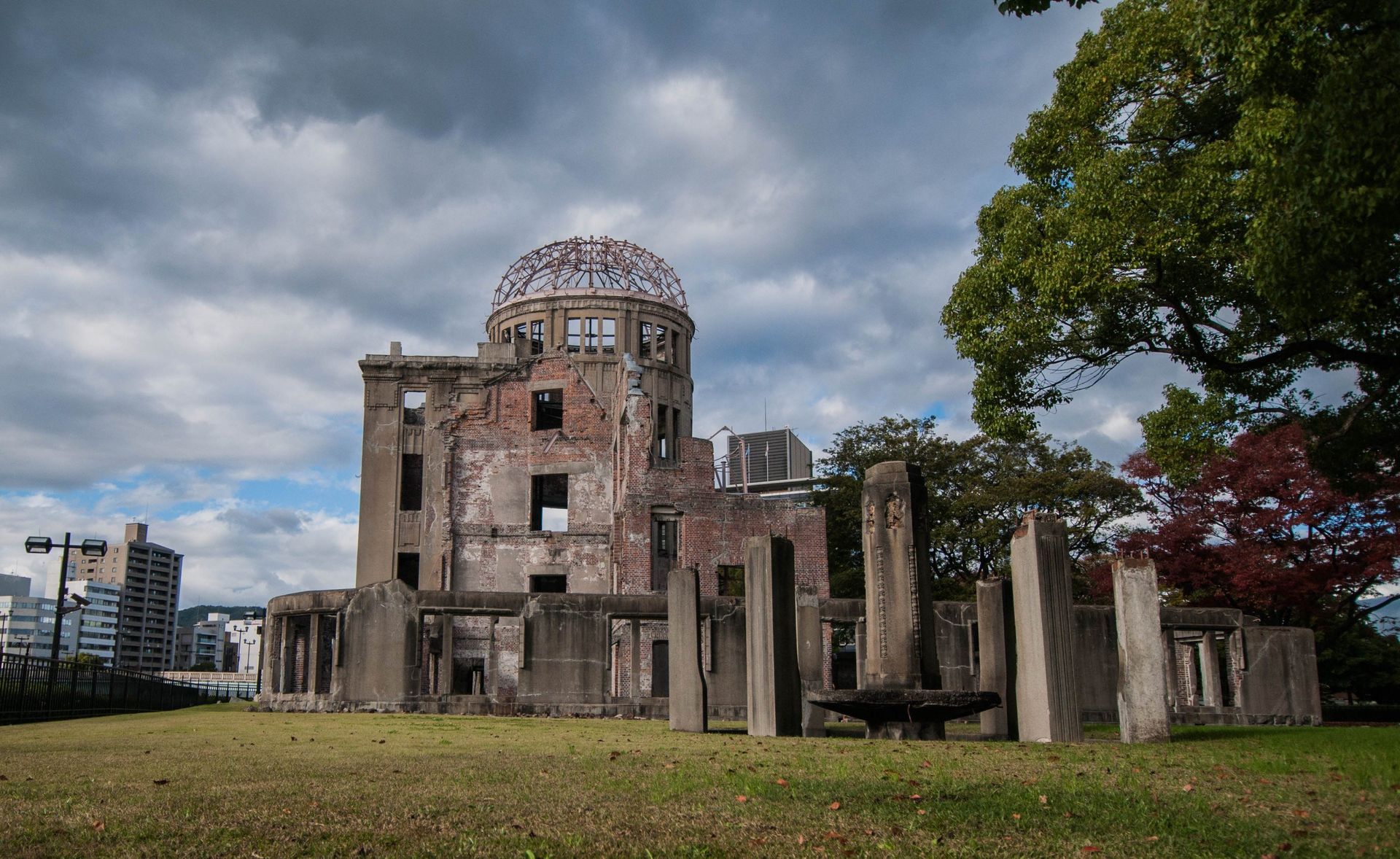
The architect Kenzo Tange won the competition to design the Peace Memorial Park on the delta land near the hypocenter. His axis links the museum, the cenotaph, and the skeletal ruin of the former Industrial Promotion Hall — the Genbaku Dome — which the city preserved as it stood. The dome was inscribed as a UNESCO World Heritage site in 1996. Around the memorial core, a working city returned: wide boulevards such as Peace Boulevard, rebuilt bridges, and eventually a metropolitan economy anchored by manufacturing, including Mazda. Hiroshima's population surpassed its prewar level within about a decade and a half, and the city is home to well over a million people today.
Hiroshima's mayors have addressed annual peace declarations to the world since the late 1940s, and the city co-founded Mayors for Peace, a network of thousands of cities advocating nuclear abolition. The reconstruction produced a rare thing: a major city whose civic purpose is inseparable from the way it was destroyed.
12 / 15
Credit: Anagoria / Wikimedia Commons (CC BY 3.0)
At 3:42 a.m. on July 28, 1976, a magnitude 7.6 earthquake struck directly beneath Tangshan, an industrial and coal-mining city of about a million people in northeastern China. Almost no buildings there had been designed for seismic loads, and the shock arrived while the city slept. The official death toll stands at more than 242,000, making it one of the deadliest earthquakes ever recorded; many analysts believe the true figure was higher. Most of the city's structures were destroyed or rendered unusable within seconds.
The timing compounded the catastrophe. Mao Zedong was weeks from death, the Cultural Revolution was ending, and China's leadership declined offers of foreign assistance, mobilizing the army and domestic resources instead. Soldiers, miners, and medical teams dug survivors from the rubble by hand. Coal miners who had been underground during the quake survived in unusual numbers and joined the rescue.
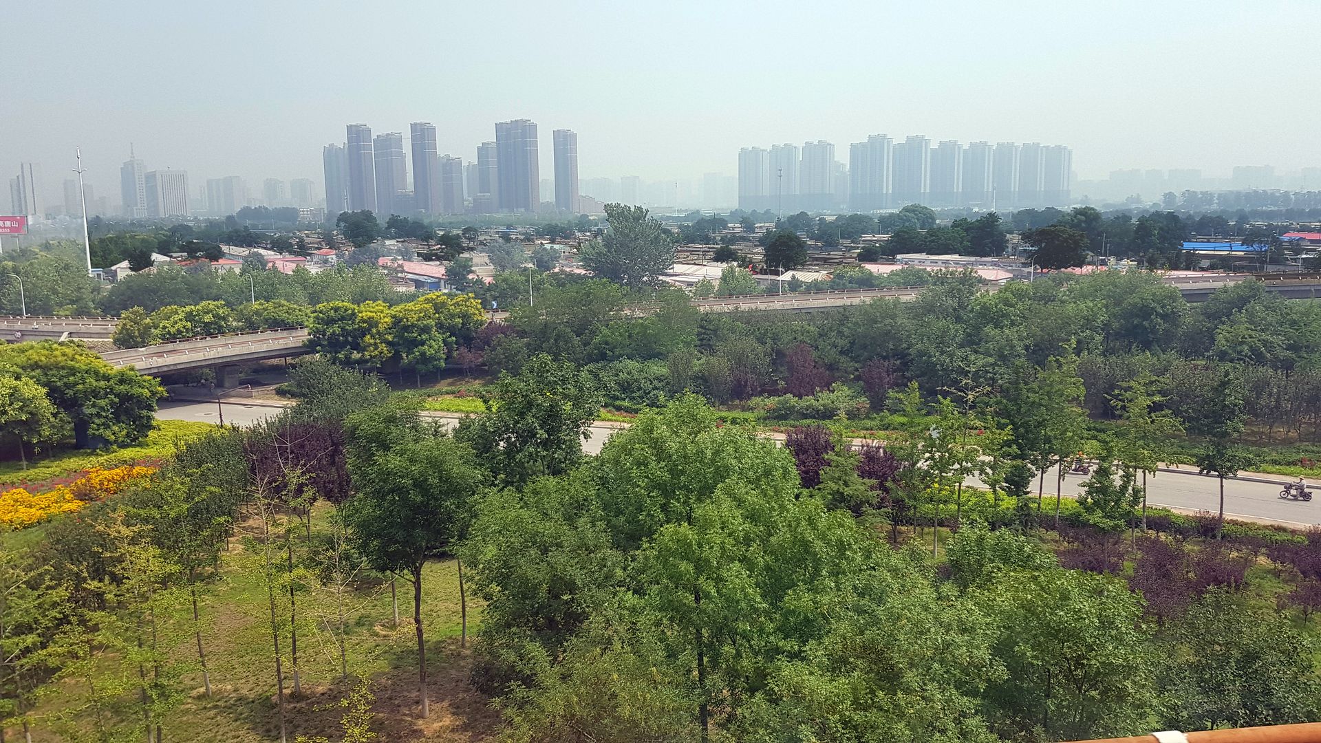
Reconstruction took roughly a decade. Planners rebuilt Tangshan with seismic-resistant standards, wider roads, and lower densities in core areas, and the effort was later held up domestically as proof of collective resilience. The earthquake also forced a broader reckoning in Chinese engineering: seismic design codes were revised and enforcement expanded, and Tangshan's fate became the standard cautionary case in the country's earthquake planning, cited again after the 2008 Sichuan earthquake.
Today Tangshan is a major industrial center in the Beijing-Tianjin-Hebei region, with a metropolitan population several times its 1976 size and one of China's most important steel industries. Its memory infrastructure is unusually direct. A memorial wall in the earthquake park carries the engraved names of the dead, running for hundreds of meters, and the ruins of a college building have been preserved as they fell. Each July 28, residents gather to burn offerings for the victims — a city-scale act of remembrance in a place that had to be almost entirely replaced.
13 / 15
Credit: Life.Time.Values / Unsplash
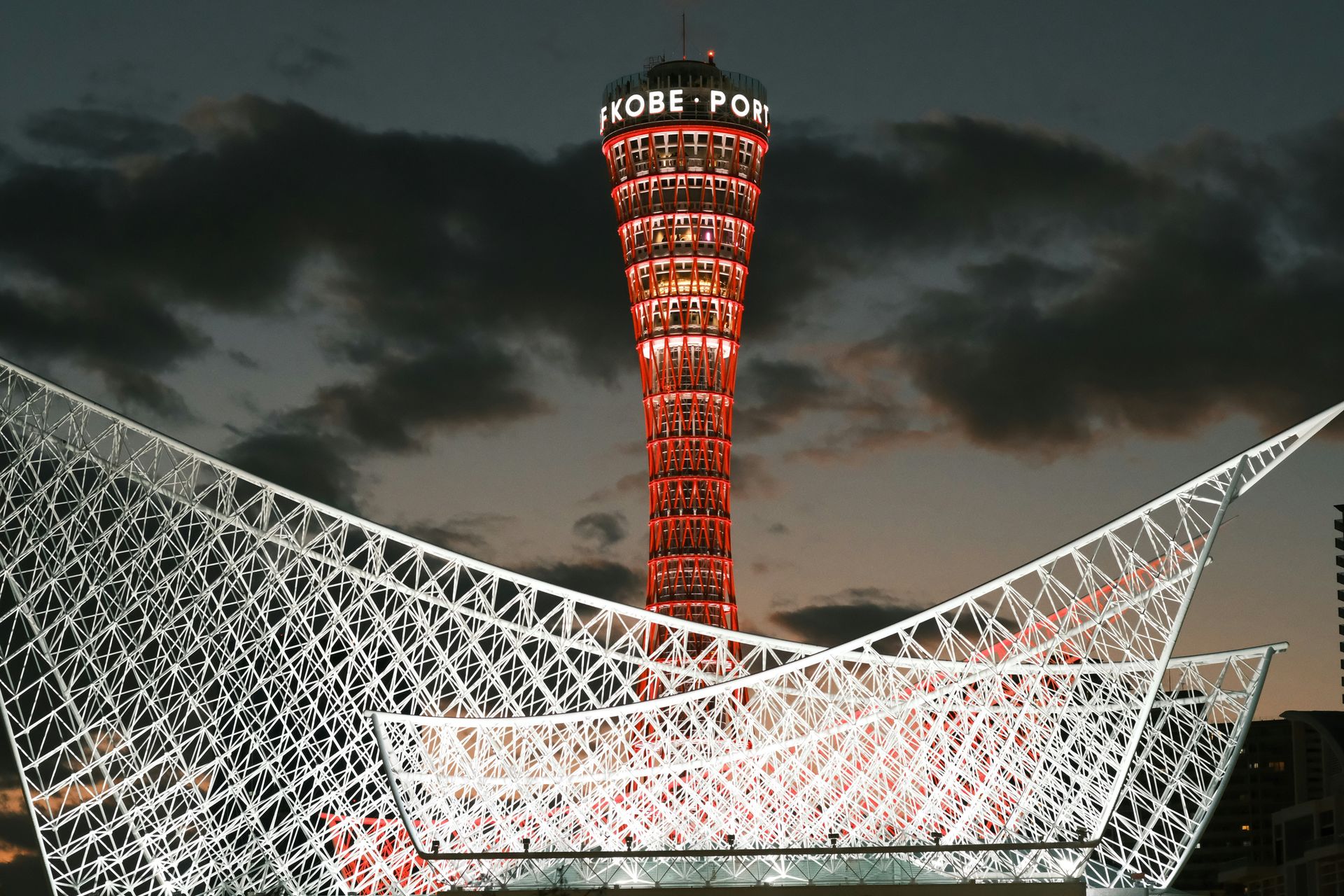
Japan considered the Kobe region relatively safe from major earthquakes. That assumption ended at 5:46 a.m. on January 17, 1995, when a magnitude 6.9 quake struck directly beneath the Osaka-Kobe conurbation. It killed 6,434 people, injured tens of thousands, and destroyed or badly damaged more than 100,000 buildings. The images that defined the disaster showed a toppled elevated section of the Hanshin Expressway lying on its side and older wooden houses pancaked across entire neighborhoods, where most of the deaths occurred.
The earthquake was a national shock on two levels. Structures built to older codes failed catastrophically while buildings meeting the post-1981 standard mostly held, which turned seismic retrofitting of older housing stock into a lasting policy priority across Japan. And the official response stumbled — coordination between agencies was slow in the first hours — while more than a million citizen volunteers poured in to help. The outpouring was so large that 1995 is often called the first year of Japan's volunteer era, and it led to legislation making nonprofit organizations easier to establish.
Kobe's physical recovery moved quickly by most measures. Infrastructure, housing, and rail service were largely restored within a few years, and the city built the Disaster Reduction and Human Renovation Institution, a research center and museum that trains officials and preserves survivor testimony. Every January the Luminarie light festival, first held in December 1995, commemorates the victims.
The economy told a harder story. Kobe's container port, among the busiest on Earth before the quake, was rebuilt within about two years, but the shipping lines that had rerouted to rival Asian ports largely did not return, and Kobe never regained its former global ranking. The lesson has been studied by port cities worldwide: physical reconstruction can be fast, yet a disrupted economic position may be permanent.
14 / 15
Credit: Heather Doty / Unsplash
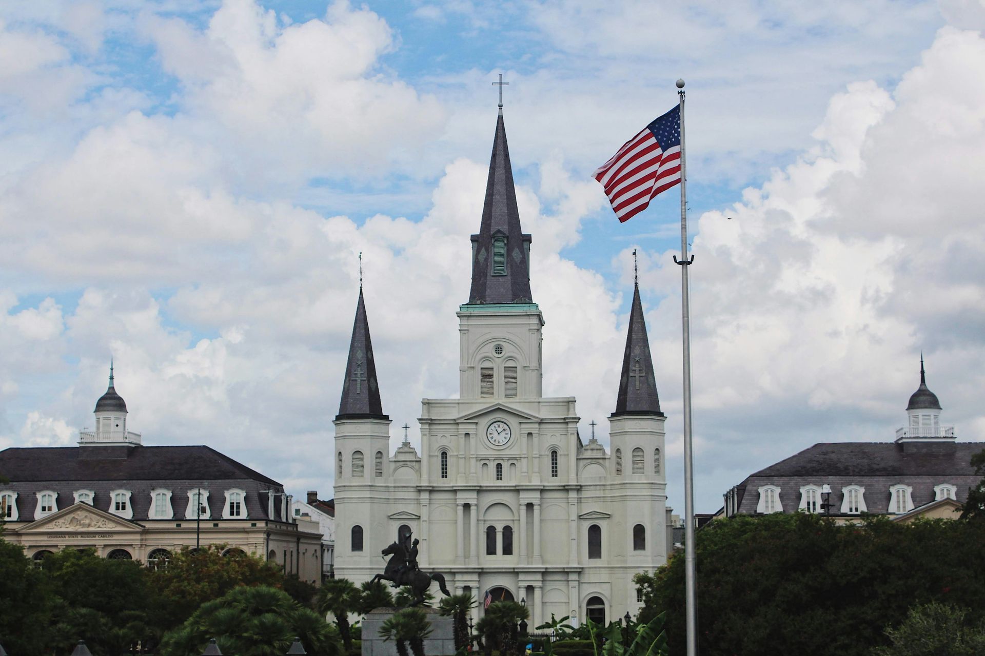
Hurricane Katrina made landfall on August 29, 2005, but the destruction of New Orleans was chiefly an engineering failure. Storm surge breached and overtopped the federal levee and floodwall system in dozens of places, and about 80% of the city flooded, in some districts to the rooflines. More than 1,300 people died across the region, over a million residents of the Gulf Coast were displaced, and images of stranded families at the Superdome became a national scandal. Investigations later attributed the flooding largely to design and construction flaws in the protection system.
The rebuilding unfolded on several tracks at once. The U.S. Army Corps of Engineers built the Hurricane and Storm Damage Risk Reduction System, a roughly $14 billion network of higher levees, floodwalls, gates, and one of the world's largest storm-surge barriers, substantially completed in the early 2010s. Federal programs such as Road Home funded homeowner rebuilding, though unevenly and with long delays that drew years of criticism.
The city that returned was smaller and different. New Orleans' population fell from about 455,000 before the storm to roughly half that within a year, then recovered gradually to just under 400,000 by the 2020 census. Recovery varied sharply by neighborhood: the Lower Ninth Ward, among the hardest hit, regained only a fraction of its former residents, while higher-ground districts rebounded faster. The storm accelerated demographic and economic shifts, including rising housing costs in unflooded areas.
Institutions changed as much as infrastructure. Louisiana converted nearly all of the city's public schools into charter schools, the most sweeping such transformation in the U.S., and rebuilt its hospital and criminal-justice systems in altered forms. Katrina also reshaped national disaster policy, prompting reforms to FEMA and how the federal government plans for catastrophic events. New Orleans became the American case study in the question every rebuilt city faces: recovery for whom?
15 / 15
,_Christchurch_City,_New_Zealand-1920x1547.jpg)
Credit: Michal Klajban / Wikimedia Commons (CC BY-SA 4.0)
Christchurch, New Zealand's second-largest city, was hit by a magnitude 7.1 earthquake in September 2010 that caused heavy damage but no deaths. The catastrophe came five months later, on February 22, 2011, when a shallow magnitude 6.3 aftershock struck almost directly beneath the city at lunchtime. It killed 185 people — 115 of them in the collapse of the Canterbury Television building — and wrecked the central business district. Liquefaction, in which shaking turns water-saturated soil to sludge, buried streets and destroyed foundations across the eastern suburbs.
The response included decisions with few precedents in a developed country. The government cordoned off the entire city center for more than two years while unsafe buildings were demolished; well over 1,000 central-city structures eventually came down. In the worst-hit residential areas, the government declared a red zone and bought out around 8,000 properties, returning whole suburbs along the Avon River to open land. The total rebuild cost has been estimated at about NZ$40 billion, one of the largest economic events in New Zealand's history.
The rebuilding plan treated the cleared downtown as a design opportunity. A government-led blueprint organized the center around a compact core, a green frame of parks, and large anchor projects, including a convention center and a central library, Tūranga, that has won international design attention. Japanese architect Shigeru Ban's Cardboard Cathedral, a transitional church built with giant cardboard tubes, opened in 2013 and became a symbol of inventive recovery, while the ruined Anglican cathedral's fate was debated for years before reinstatement work finally began.
Progress has been slower and more contested than planners promised, with some anchor projects delayed well over a decade. But Christchurch has become a global reference point for managed retreat from hazardous land, for post-disaster insurance stress, and for the question of how much a modern democracy can consciously redesign a city its citizens still remember.
