
15 cities that were once the center of the world
From Baghdad to Tenochtitlan, these cities once sat at the center of global power, trade, and knowledge — and their rises and falls still shape the world today
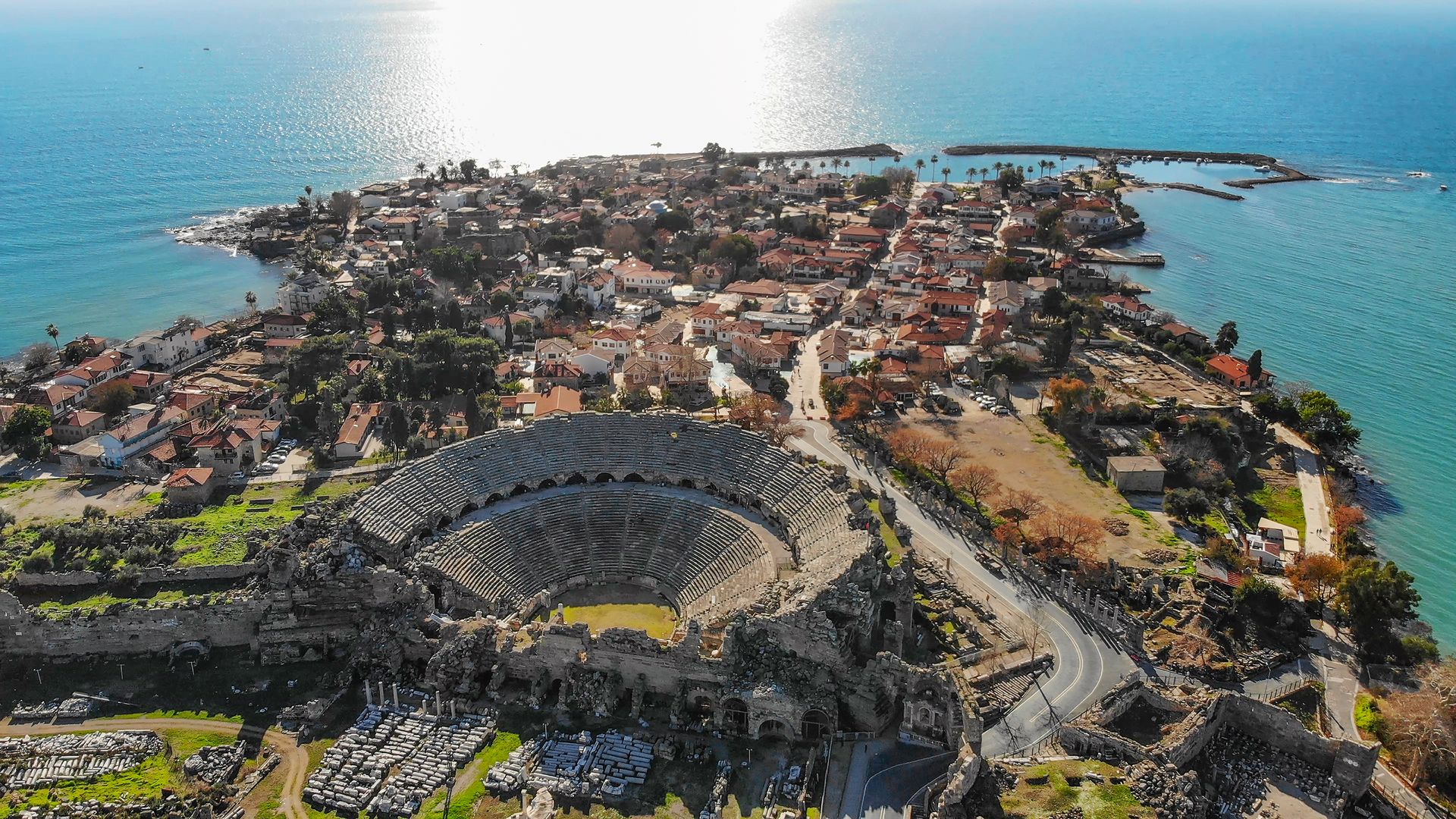
minemero / Getty Images
Power does not stay in one place. Every few centuries, the axis around which human civilization turns shifts — pulled by conquest, commerce, climate, or the slow grinding of institutional decay. The city that once drew merchants, scholars, diplomats, and armies from every corner of the known world finds itself suddenly peripheral, overtaken, or destroyed. A new center emerges somewhere else, often somewhere that, a generation earlier, would have seemed unlikely.
This pattern has repeated itself throughout recorded history, and arguably before it. What makes a city the center of the world is not simply wealth or military force, though both matter. It is the convergence of functions: the place where ideas are produced and disseminated, where goods flow in and out, where political decisions ripple outward across vast territories, where the most ambitious people go when they want to matter. Cities like that have existed on every inhabited continent. They have risen in river valleys and on coastlines, in deserts and on hilltops. Some were planned. Others grew organically into dominance.
What they share is the experience of centrality — a period when to be there was to be at the edge of everything happening in the world. And what most of them also share is the experience of losing that status. Sometimes the decline was violent and sudden. Baghdad was sacked by the Mongols in 1258 in one of the most catastrophic urban destructions in history. Sometimes it was gradual — Venice spent centuries sliding from imperial maritime power to picturesque tourist destination. Sometimes a city simply stopped being useful to the networks that had once fed it, as happened when overland Silk Road trade collapsed and left Samarkand stranded.
The cities in this list span more than three millennia and six continents. They include capitals of empires that no longer exist, commercial hubs whose trade routes dried up, and intellectual centers whose libraries burned. Some are now megacities with tens of millions of residents. Others are ruins visited by archaeologists. A few occupy a strange middle ground — modern cities living inside the shell of something far grander, where the past is visible in the street plan, the architecture, or simply the scale of what was once built there.
Understanding these cities means understanding how power actually works across time: not as a permanent condition, but as a temporary alignment of geography, technology, governance, and luck. Every city that rules the world eventually stops ruling it. The question is always what it leaves behind.
Rome
maydays / Getty Images
For roughly five centuries — from the late Republic through the height of the imperial period — Rome was the undisputed center of the Western world. At its peak in the second century CE, the city held somewhere between one and 1.5 million people, making it the largest urban settlement in Europe and the Mediterranean basin. No European city would reach that population again until London in the 19th century. That gap alone suggests how thoroughly Rome's collapse reorganized the world.
The city's power rested on a set of mutually reinforcing systems. Its road network, eventually stretching more than 80,000 kilometers, allowed armies to move quickly and goods to move reliably across an empire that spanned from Scotland to Mesopotamia, from the Rhine to the Sahara. The roads fed Rome's markets. Rome's markets fed its population. Its population fed its army. The army secured the roads. This circular logic held for centuries — and when any part of it faltered, the whole began to unravel.
Rome was not just a military or administrative capital. It was a cultural machine. The city absorbed influences from Greece, Egypt, Persia, and North Africa and synthesized them into something distinctly Roman — an architectural vocabulary, a legal tradition, a Latin language that would eventually become the root of French, Spanish, Italian, Portuguese, and Romanian. Roman law, in particular, proved extraordinarily durable. Its concepts of property, contract, and legal personhood underpin most European legal systems today.
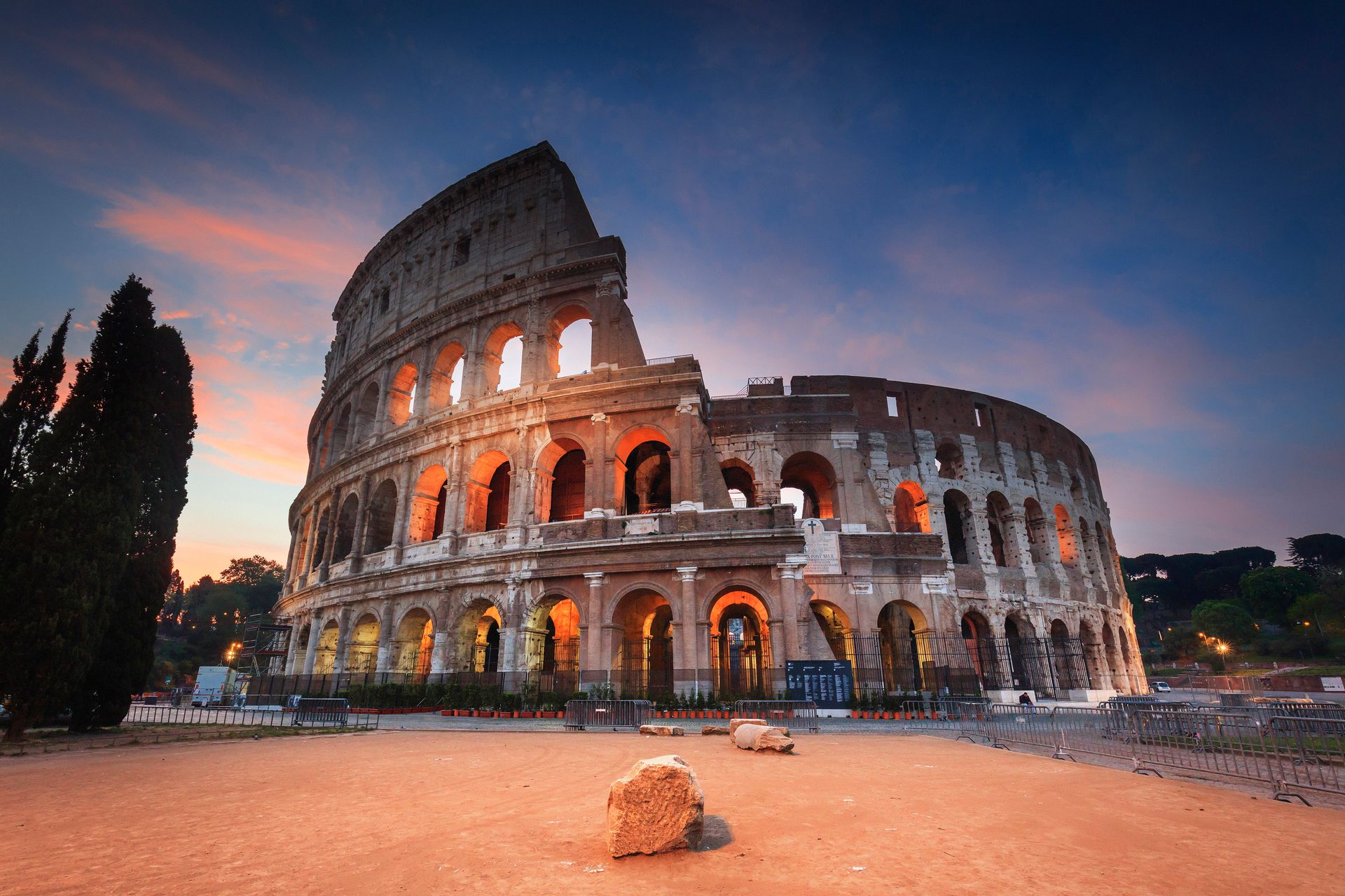
The city's physical scale was meant to communicate dominance. The Colosseum, finished in 80 CE, seated at least 50,000 people. The Pantheon, completed under Hadrian around 125 CE, has a dome that remained the world's largest unreinforced concrete dome for more than 1,300 years. The Forum Romanum was not just a marketplace — it was a stage on which Roman identity was performed and contested.
Rome's decline unfolded across centuries rather than years. The Western Empire formally collapsed in 476 CE, when the Germanic chieftain Odoacer deposed the last emperor, Romulus Augustulus. But by then the city had already been sacked twice — by the Visigoths in 410 CE and the Vandals in 455 CE — and its population had fallen dramatically. By the sixth century, perhaps only 20,000 people lived where a million had been.
What Rome left behind was arguably more consequential than what it destroyed. The Catholic Church, headquartered in the city, preserved Latin literacy and Roman administrative structures through the medieval period. The Renaissance drew on Roman art and philosophy directly. The U.S. Capitol building and dozens of institutions that followed were modeled consciously on Roman precedents. The empire ended. The idea of Rome did not.
Baghdad
Dynamoland / Getty Images
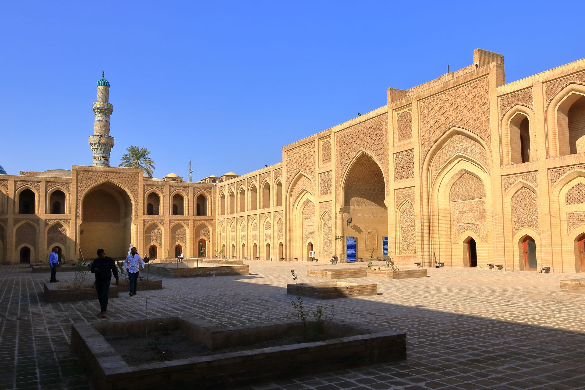
For roughly five centuries following its founding in 762 CE, Baghdad was the intellectual and commercial capital of the world. The city was built from scratch by the Abbasid Caliph Al-Mansur on the western bank of the Tigris River, in a location chosen for its access to trade routes, water, and agricultural land. Within a generation, it had become the largest city on earth outside of China, home to more than a million people at its peak.
The city's design was striking — a nearly perfect circle, roughly three kilometers in diameter, with the caliph's palace and the grand mosque at its center. The circular plan was not merely aesthetic. It was a political statement: Baghdad was the world's axis, and the caliph was its center. The surrounding market towns, canals, and satellite settlements filled in over decades until the city became an interconnected urban mass that sprawled across both banks of the Tigris.
What made Baghdad genuinely central to the medieval world was the House of Wisdom, a scholarly institution that funded the translation of Greek, Persian, Indian, and Syriac texts into Arabic. Mathematicians at Baghdad developed algebra — the word itself comes from the Arabic title of a ninth-century treatise by the mathematician Al-Khwarizmi, whose Latinized name gave us the word "algorithm." Physicians at the city's hospitals wrote medical encyclopedias that remained standard texts in European universities for centuries. Astronomers mapped the stars with precision that would not be surpassed in the West until the Renaissance.
The city was also a commercial hub of enormous scale. Merchants from China, India, East Africa, and Europe converged on Baghdad's markets. Paper, which arrived from China via Central Asia, was produced and traded here on a scale that made it affordable for scholars and administrators across the Islamic world. The postal system, the banking infrastructure, and the legal frameworks that supported long-distance trade were all centered here.
The end came with shocking speed. In February 1258, the Mongol army of Hulagu Khan besieged Baghdad. The city fell within days. What followed was one of the most catastrophic acts of urban destruction in recorded history. The caliph Al-Musta'sim was executed. The canals that had irrigated the surrounding farmland for millennia were deliberately destroyed. The libraries — containing manuscripts that represented centuries of accumulated knowledge — were burned or thrown into the Tigris. Contemporary accounts, some almost certainly exaggerated, describe the river running black with ink.
Baghdad recovered over subsequent centuries but never reclaimed its earlier centrality. The irrigation network, once destroyed, was not rebuilt at full scale for hundreds of years. The agricultural collapse that followed reduced the surrounding region's capacity to support a large urban population. The city remained significant, but the axis of Islamic intellectual and commercial life shifted elsewhere — to Cairo, to Persia, eventually to Istanbul. The Baghdad that exists today is a city with an extraordinary past that its present circumstances make difficult to honor.
Constantinople
prmustafa / Getty Images
For more than a thousand years — from its founding by Constantine in 330 CE to its fall to Ottoman forces in 1453 — Constantinople was the richest, most heavily fortified, and most strategically positioned city in the world. It sat at the precise point where Europe meets Asia, where the Black Sea meets the Mediterranean, where the land route from the East reaches the sea. Geography alone would have made it important. What the Byzantines built on top of that geography made it extraordinary.
The city was designed to be impregnable. Its triple walls, built largely under the emperor Theodosius II in the fifth century, stretched across the peninsula from the Sea of Marmara to the Golden Horn. No army successfully breached them from the landward side for over a thousand years. Constantinople absorbed wave after wave of sieges — by the Avars, the Persians, the Arabs, the Bulgars, the Rus — and survived them all. The walls were not just a military asset. They were a psychological fact that shaped how every neighboring power thought about the city.
The Byzantine Empire at its height controlled territory across Anatolia, Greece, the Balkans, Egypt, and parts of the Levant and North Africa. Constantinople sat at the center of this network as both administrative capital and the dominant commercial city in the eastern Mediterranean. Its harbor, the Golden Horn, was one of the finest natural ports in the world. Merchants from Venice, Genoa, Pisa, Russia, the Arab world, and the Persian plateau all traded there. The city's currency, the gold solidus, remained stable for centuries and was the reserve currency of medieval European and Middle Eastern trade.
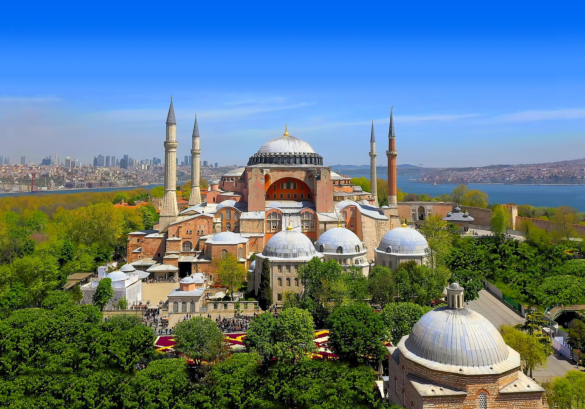
Its cultural production was no less significant. The Hagia Sophia, built under Justinian in the sixth century, remained the largest Christian cathedral in the world for nearly a thousand years. Byzantine art developed a visual vocabulary — gold mosaic, the elongated holy figure, the formalized gaze of the icon — that shaped Eastern Orthodox Christianity permanently and influenced Western art in ways that are still visible. The city's scholars preserved and copied Greek philosophical and scientific texts that would later travel west, via Arab intermediaries and direct manuscript exchange, and fuel the Renaissance.
The fall in 1453 came after a 53-day siege by the Ottoman Sultan Mehmed II, who used gunpowder artillery — a technology that finally made the Theodosian walls vulnerable. The city that fell became Istanbul, the new capital of the Ottoman Empire. Mehmed rebuilt it deliberately as a world city, repopulating it with Greeks, Armenians, Jews, and Slavs. The Hagia Sophia became a mosque. The city remained a global center — just under a different name and a different faith.
Alexandria
-1920x1281.jpg)
KHALED DESOUKI / Getty Images
At its founding in 331 BCE by Alexander the Great, Alexandria was already positioned to become something extraordinary. Sited on the Egyptian coast between the Mediterranean and Lake Mareotis, it had natural harbor access to both the sea and the Nile delta trade network. Alexander's urban planner, Dinocrates of Rhodes, laid it out on a grid with wide boulevards, a design that would influence city planning for centuries. Alexander did not live to see it flourish — he died in Babylon eight years later — but the city that grew in his name became one of the defining intellectual institutions of the ancient world.
Under the Ptolemaic dynasty that followed Alexander's death, Alexandria became the capital of Egypt and the leading city in the eastern Mediterranean. Its famous lighthouse, the Pharos, completed around 280 BCE, stood roughly 100 meters tall and was considered one of the Seven Wonders of the Ancient World. Ships navigating from across the Mediterranean used it as a landmark. It was a statement of ambition as much as a practical structure: this is a city that lights the way.
The Library of Alexandria, founded by Ptolemy I and expanded by his successors, was not simply the largest library of the ancient world — it was a research institution that employed scholars from across the Mediterranean and beyond. Euclid likely worked there and produced his foundational text on geometry, the Elements. Eratosthenes, the Library's director in the third century BCE, calculated the circumference of the earth with remarkable precision using shadow measurements taken on the summer solstice at two locations. The physician Herophilus performed systematic anatomical research there, establishing much of what the ancient world knew about the human body.
Alexandria was also a city of radical cultural mixture. Its population at its peak — perhaps 500,000 people — included Egyptians, Greeks, Jews, Persians, and people from across the African continent. The city's Jewish community was one of the largest in the ancient world, and it was in Alexandria that the Hebrew scriptures were translated into Greek, producing the Septuagint, which shaped how Christianity read the Old Testament for centuries. The city's blend of traditions made it a place where ideas crossed cultural boundaries in ways that were unusual for the ancient world.
The library was damaged, perhaps repeatedly, over several centuries — by Caesar's fire in 48 BCE, by civil war under Aurelian in the third century CE, by the gradual withdrawal of royal funding as the Ptolemaic dynasty weakened. The exact circumstances and timing of its destruction remain debated by historians. What is clear is that the city itself remained important through the Roman period, the Byzantine period, and into the early Islamic era. When Arab forces conquered Egypt in 641 CE, Alexandria was still a major city. It declined over subsequent centuries, partly due to the rise of Fustat and then Cairo as the administrative capital of Islamic Egypt, partly due to the silting of its harbor.
Chang'an
Xinhua News Agency / Getty Images
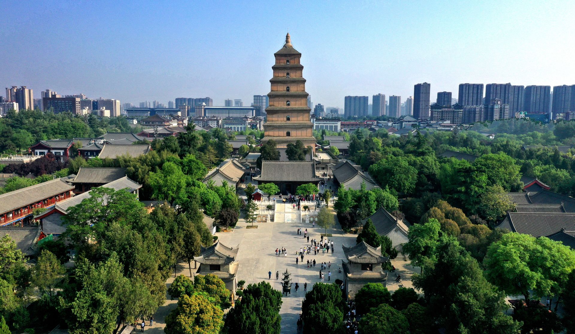
During the Tang dynasty, which ruled China from 618 to 907 CE, Chang'an — the city that now exists as Xi'an in Shaanxi province — was the most populous and arguably the most cosmopolitan city on earth. Its population at its height in the eighth century CE is estimated at around one million people within the city walls, with a larger number in the surrounding metropolitan area. No other city in the world at that time came close.
The city was built on a grid of extraordinary scale and regularity. Its outer walls enclosed an area of roughly 84 square kilometers — larger than most medieval European cities would be for centuries to come. The streets were wide enough to accommodate multiple lanes of traffic. The city was divided into wards, each with its own gates that were locked at night, a system that allowed centralized administration of an enormous urban population.
Chang'an's cosmopolitanism was not incidental — it was a product of the Tang dynasty's position astride the eastern terminus of the Silk Road. Merchants, diplomats, monks, and scholars arrived from Persia, Arabia, India, Korea, Japan, and Central Asia. The city had communities of Nestorian Christians, Zoroastrians, Manichaeans, and Muslims alongside its Buddhist and Daoist population. Foreign fashions, music, and foods became fashionable at the Tang court. A contemporary painting or ceramic figure from the period might show a Central Asian musician, a Persian merchant, or an Arab trader alongside Chinese officials — a visual record of the city's diversity.
Buddhism flourished in Chang'an to an extent that reshaped Chinese religious life permanently. The monk Xuanzang, who had traveled to India to collect Buddhist scriptures in the seventh century, returned to the city and spent years translating texts that transformed Chinese Buddhism. The Giant Wild Goose Pagoda, built to house the scriptures he brought back, still stands in Xi'an today. The Tang court's patronage of Buddhist institutions funded art, architecture, and scholarship on a scale that had no precedent in Chinese history.
Poetry was the prestige art form of the Tang period, and Chang'an was its center. The poets Du Fu and Li Bai both spent time in the capital. Their work — exploring themes of loss, exile, friendship, and the beauty of the natural world — is still considered the apex of Chinese lyric poetry. The examination system that produced the Tang bureaucracy demanded literary skill, which meant that the capital city was full of men who wrote poetry as a professional accomplishment and often as a genuine passion.
The Tang dynasty collapsed in 907 CE following decades of provincial rebellions and the weakening of central authority. Chang'an never recovered its earlier dominance. Subsequent dynasties moved their capitals — to Kaifeng, then Nanjing, then Beijing. Xi'an remained a significant regional city, but the era in which it was the center of a global trading network was over.
Athens
NurPhoto / Getty Images
The fifth century BCE was Athens's century. In the space of roughly 80 years — from the defeat of the Persian invasion at Marathon $MPC in 490 BCE to the end of the Peloponnesian War in 404 BCE — the city produced a body of philosophy, drama, architecture, and political thought that has shaped Western civilization more directly than almost any other single place or period.
The precondition for this was the Persian Wars. When Athenian and Plataean forces defeated the Persian army at Marathon despite being heavily outnumbered, it produced a surge of civic confidence that reshaped how Athenians understood themselves. Ten years later, when a larger Persian force under Xerxes invaded, the Athenians evacuated their city, watched it burn, and then destroyed the Persian fleet at the Battle of Salamis — a victory that effectively ended the Persian threat to Greece. The city that was rebuilt in the aftermath was self-consciously grand.
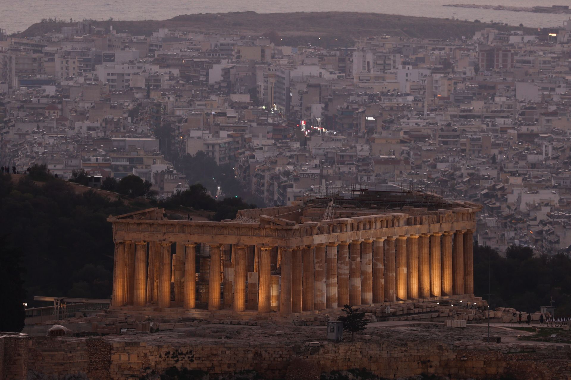
Under the statesman Pericles, who dominated Athenian politics for roughly 30 years in the mid-fifth century BCE, the city undertook a building program of deliberate ambition. The Parthenon, completed in 432 BCE, was not simply a temple to Athena — it was a statement about the kind of city Athens was. Its proportions were calculated to appear perfectly regular while actually incorporating subtle curves and variations that make it visually satisfying from every angle. No building in the Western tradition has been more studied or more imitated.
The democracy that Pericles operated within — though it excluded women, enslaved people, and foreigners — was a radical experiment in collective self-governance. The assembly in which male citizens debated and voted was not a representative body: citizens voted directly on questions of war, peace, legislation, and public spending. The legal system required citizens to serve as jurors and argue their own cases. The city's political culture produced a population with genuine experience of governance, which fed back into its intellectual culture.
Socrates, who never wrote anything, spent his life in Athens's public spaces — the agora, the gymnasia, the drinking parties of the elite — questioning received wisdom and demanding that people examine their assumptions. His methods, recorded by Plato, produced a philosophical tradition that has not stopped producing significant work in 2,500 years. Aristotle, who studied in Plato's Academy in Athens, developed the systematic approach to empirical inquiry that underlies modern science.
The tragedians — Aeschylus, Sophocles, Euripides — staged plays in the Theater of Dionysus that explored questions of fate, justice, and the limits of human knowledge in ways that still resonate. Their works were performed for the entire citizen body, not just an educated elite. Drama in Athens was a civic institution, not merely an entertainment.
Athens's dominance ended with its defeat in the Peloponnesian War, and the city never regained the political independence it had briefly enjoyed. But its intellectual legacy traveled wherever Greek language and culture spread — through Alexander's conquests, through Rome's admiration, through the Renaissance recovery of classical texts. The city itself has been continuously inhabited for at least 3,000 years. It is now the capital of modern Greece, a city of nearly four million people living among ruins that still attract scholars from around the world.
Tenochtitlan
Xinhua News Agency / Getty Images
When Hernán Cortés and his Spanish forces arrived at Tenochtitlan in November 1519, they encountered a city that was, by most measures, larger and better organized than any city in Spain. Built on an island in Lake Texcoco in the Valley of Mexico, Tenochtitlan was the capital of the Aztec Empire — known to its own people as the Mexica — and home to an estimated 200,000 to 300,000 people. It was connected to the lakeshore by three great causeways and supplied with fresh water via an aqueduct from the springs of Chapultepec. Cortés, in a letter to the Spanish king Charles I, compared it favorably to Seville and other great European cities.
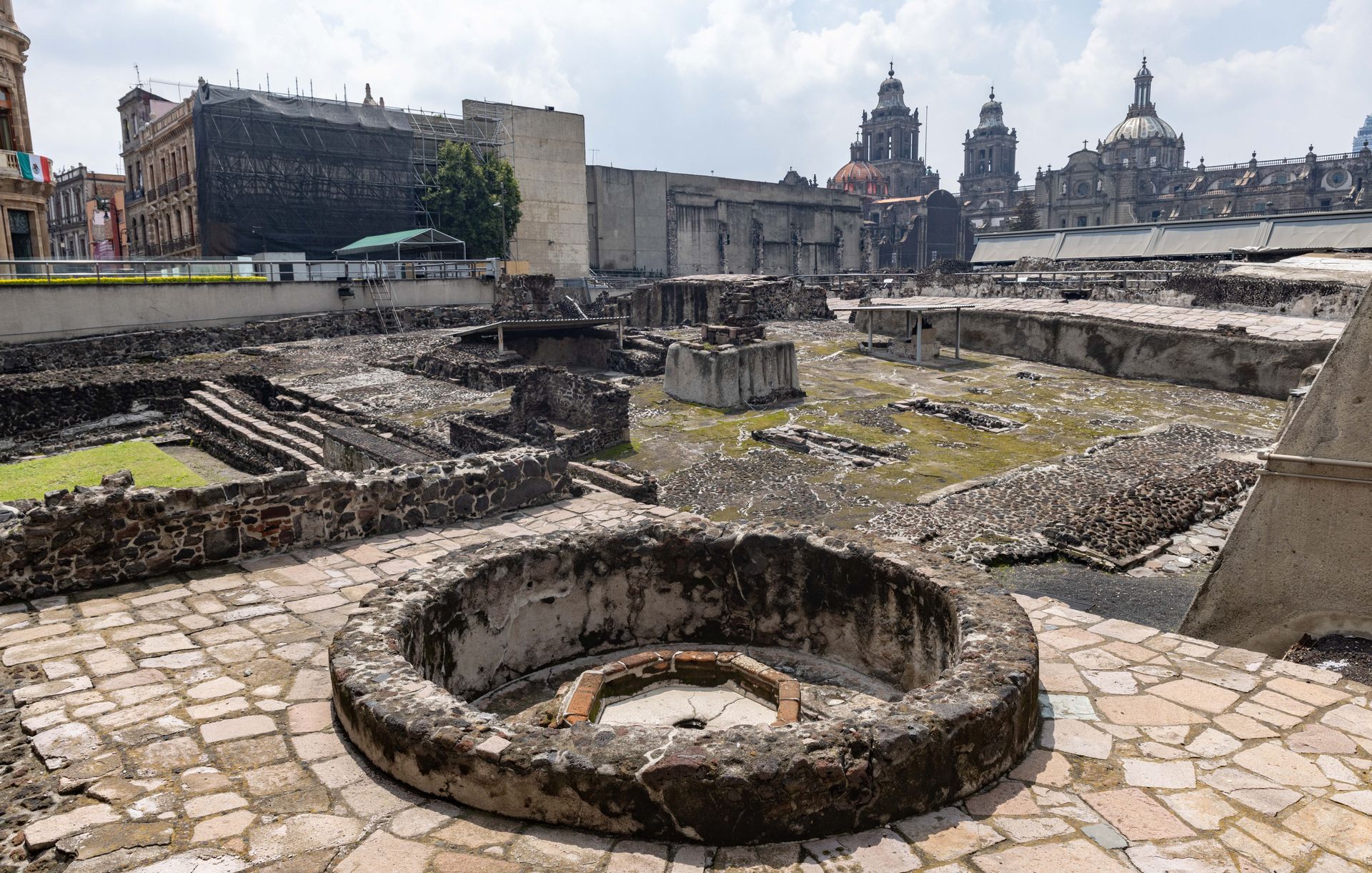
The city's organization was deliberate and elaborate. At its center stood the Templo Mayor, a double pyramid dedicated to the war god Huitzilopochtli and the rain god Tlaloc. The surrounding ceremonial precinct contained dozens of temples, a skull rack displaying the crania of sacrificial victims, a ball court, and schools. Radiating outward from the ceremonial center were four great quarters, each subdivided into neighborhoods organized by trade and lineage. The markets — particularly the great market at Tlatelolco, the neighboring city on the island — were described by Spanish observers as larger and better stocked than anything in Europe.
Tenochtitlan was founded, according to Mexica tradition, in 1325 CE. The Mexica had arrived in the Valley of Mexico as migrants from the north, unwelcome in the already-settled lake basin, and had been permitted to settle only on a swampy, inhospitable island. Within two centuries, they had transformed that island into one of the greatest cities in the world through a combination of military expansion and extraordinary hydraulic engineering. The chinampas — raised agricultural beds built in the shallow lake margins — produced food in quantities sufficient to support the city's population. The system of dikes, canals, and floodgates that controlled lake levels required coordinated maintenance on a metropolitan scale.
At its height, Tenochtitlan sat at the center of an empire that stretched from the Gulf Coast to the Pacific and extracted tribute — in goods, labor, and sacrificial victims — from hundreds of subject peoples. The city's marketplaces received cotton from the Gulf lowlands, turquoise from the northern deserts, cacao from the tropical south, and feathers from birds that lived only in the cloud forests. The empire had no wheeled vehicles and no draft animals, but it had a sophisticated system of human porters and well-maintained roads that moved goods efficiently across difficult terrain.
The Spanish siege of 1521, aided by smallpox and a coalition of peoples who had suffered under Aztec domination, reduced the city to rubble. The lake was drained over subsequent centuries. Mexico City was built directly on top of the ruins. The Templo Mayor was not rediscovered until construction work in 1978 exposed its foundations beneath the historic center of the modern capital. The city beneath the city remains an active archaeological site.
Carthage
VW Pics / Getty Images
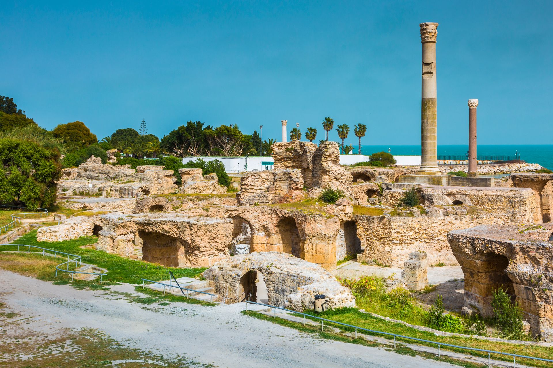
At its height in the fourth and third centuries BCE, Carthage was the dominant commercial power in the western Mediterranean. Founded by Phoenician settlers from Tyre, in what is now Lebanon, around 814 BCE, the city sat on a promontory jutting into the Bay of Tunis in modern-day Tunisia. Its position was nearly ideal for Mediterranean commerce: central to the sea's east-west axis, close to the narrow strait between Sicily and North Africa through which most maritime trade passed, and blessed with a double harbor — one commercial, one military — that was among the most sophisticated port infrastructure of the ancient world.
Carthage built its empire not primarily through land conquest but through commercial dominance. Its trading networks extended from the eastern Mediterranean to the Atlantic coast of Africa and Spain, and possibly as far as West Africa. The navigator Hanno, sailing in roughly the fifth century BCE, led an expedition along the African coast that some scholars believe reached modern-day Sierra Leone or even further south. Carthaginian traders operated under strict commercial secrecy — ancient sources describe their practice of conducting "silent trade" with West African peoples, leaving goods on beaches and returning the next day to collect what had been left in exchange, without direct contact.
The city's population at its height has been estimated at 700,000 or more, though ancient population figures are inherently uncertain. Its agricultural hinterland, the fertile Medjerda Valley, produced grain, wine, and olive oil that fed the city and supplied export markets. Carthaginian agricultural manuals, particularly those written by Mago, were highly regarded in the ancient world — Roman senators ordered them translated into Latin after the city's destruction, evidence of the esteem in which Carthaginian farming knowledge was held.
The three Punic Wars with Rome, fought between 264 and 146 BCE, eventually destroyed the city. The second war, in which the Carthaginian general Hannibal crossed the Alps with a force that included war elephants and defeated Roman armies repeatedly on Italian soil, came close to ending Rome's power. Hannibal spent 15 years in Italy, winning battles, but lacked the siege equipment and reinforcements to take Rome itself. When the war turned against Carthage, Rome brought the fight to North Africa. The third war ended in 146 BCE with a three-year siege, the systematic demolition of the city, and the enslavement of its surviving population.
A new Carthage was later built on the same site by Rome and became an important Roman and then Byzantine city. But the Carthaginian civilization — its language, its archives, its commercial networks — was almost entirely obliterated. What we know about it comes largely from hostile Roman sources and from archaeology.
Babylon
Anadolu / Getty Images
Babylon's centrality to the ancient Near East spanned more than two millennia, an extraordinary run that encompasses at least three distinct periods of peak importance. The city sat on the Euphrates River in what is now central Iraq, roughly 85 kilometers south of Baghdad. Its position in the flat, irrigated lowland between the Tigris and Euphrates — the region the Greeks called Mesopotamia — made it the natural hub of a river-based civilization that depended on coordinated water management for its survival.
The city's first great period came under the Old Babylonian Empire, and particularly under Hammurabi, who ruled from roughly 1792 to 1750 BCE. Hammurabi unified much of Mesopotamia under Babylonian control and is best known for the law code that bears his name — a collection of 282 laws carved into a basalt stele that now sits in the Louvre. The Code of Hammurabi was not the first written law in history, but it was the most comprehensive early legal text to survive, and it reveals a sophisticated urban society with detailed rules governing property, commerce, wages, inheritance, and the treatment of different social classes. The stele was a public document, erected in a temple courtyard where citizens could read it — or have it read to them — and know what the law required.
The city was sacked repeatedly over its long history — by the Hittites around 1595 BCE, by the Kassites, and eventually by the Assyrians. But it recovered each time, in part because its symbolic importance was such that conquerors often chose to restore it rather than obliterate it. The Assyrian king Sennacherib destroyed the city in 689 BCE in a fit of rage after a rebellion, but his son Esarhaddon reversed the decision and rebuilt it.
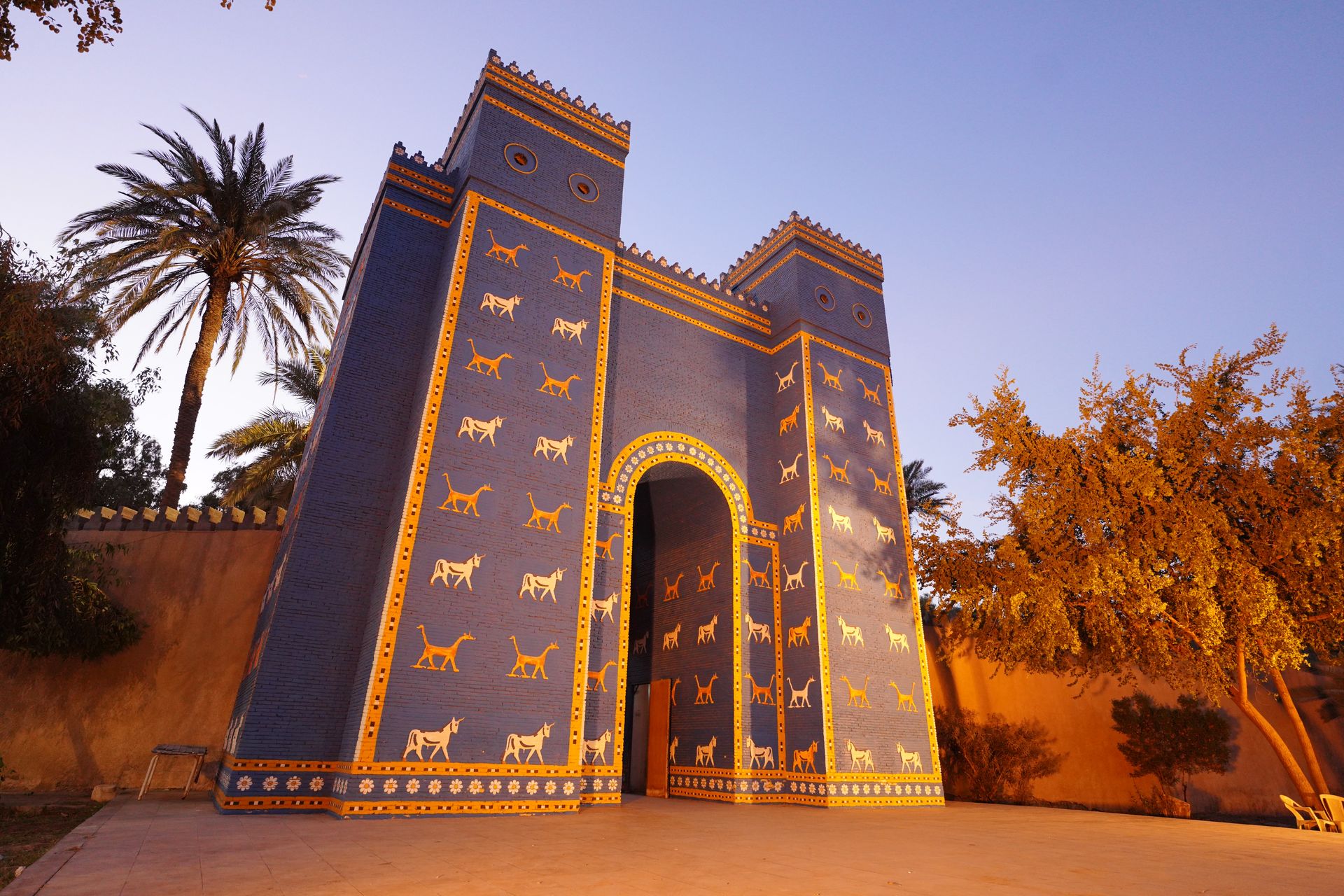
Babylon's final great period came under the Neo-Babylonian Empire, and particularly under Nebuchadnezzar II, who ruled from 605 to 562 BCE. Under Nebuchadnezzar, the city was rebuilt on an enormous scale. Its outer walls were wide enough, according to ancient sources, to allow chariots to turn on top of them. The Ishtar Gate, covered in glazed brick reliefs of lions, bulls, and dragons, was one of the most visually elaborate structures of the ancient world. Its reconstructed form is now in the Pergamon Museum in Berlin.
The city fell to Cyrus the Great of Persia in 539 BCE, reportedly without a major battle — a fact that reflects Babylon's gradual political decline even as its cultural importance remained high. Alexander the Great captured it in 331 BCE and died there eight years later. He had intended to make it the capital of his empire. Instead, his death triggered a succession war that left the city gradually depopulated. By the early centuries CE, Babylon was largely abandoned. The baked bricks of its walls were quarried for later construction across the region for centuries afterward.
Timbuktu
Nik Wheeler / Getty Images
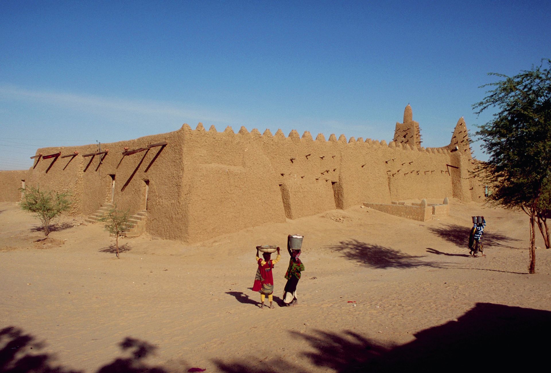
From roughly the 13th through the 16th centuries, Timbuktu was one of the most important cities in the world — a claim that still surprises many people conditioned by later narratives about African "underdevelopment." Situated at the point where the Niger River bends northward toward the Sahara, in what is now Mali, the city sat at the junction of trans-Saharan caravan routes and the river network that served the West African interior. It was, in the most literal geographic sense, the place where the Sahara met the savanna and where overland trade met river trade.
Gold and salt were the engines of Timbuktu's prosperity. Gold came from the forests and rivers of the West African south, carried northward through trading networks that the city helped organize. Salt came from the great deposits at Taghaza in the central Sahara, brought south by camel caravan. The two commodities traded at roughly equivalent value in certain periods — a slab of salt for a measure of gold — a ratio that seems extraordinary by modern standards but made sense given the scarcity of each commodity on the opposite side of the exchange. European demand for gold, flowing through North African intermediaries, drove sustained investment in the city's commercial infrastructure.
Under the Mali Empire and then the Songhai Empire, Timbuktu became not just a commercial center but an intellectual one. The city's three great mosques — Djinguereber, Sankore, and Sidi Yahia — anchored institutions of Islamic learning that attracted scholars from across the Muslim world. The University of Sankore operated as a loose confederation of scholars and students rather than a formally chartered institution on the European model, but at its height it may have enrolled tens of thousands of students. Subjects studied included Islamic jurisprudence, mathematics, astronomy, history, and medicine.
The books produced and collected in Timbuktu were extraordinary in their range and quality. Estimates of the manuscripts that survive in private family libraries and institutions in the city today range from 100,000 to 700,000. These manuscripts cover not only religious topics but mathematics, astronomy, medicine, diplomacy, and history. For centuries, these books were known to Western scholars largely through reputation — Mali was described by the 14th-century traveler Ibn Battuta as a place of remarkable justice and learning — but the manuscripts have been increasingly studied and digitized since the late 20th century.
The Moroccan invasion of 1591, in which a force armed with firearms crossed the Sahara and defeated the Songhai army, ended the city's era of centrality. Timbuktu's scholars were arrested or exiled. The trans-Saharan trade routes gradually declined in importance as European maritime routes around Africa redirected West African commerce toward the Atlantic coast. The city became remote rather than central — the same geographic position that had made it a hub now made it a dead end. Its reputation for inaccessibility, seized on by 19th-century European explorers as a romantic mystery, was a consequence of this structural shift, not an inherent quality of the place.
Venice
Fabrizio Villa / Getty Images
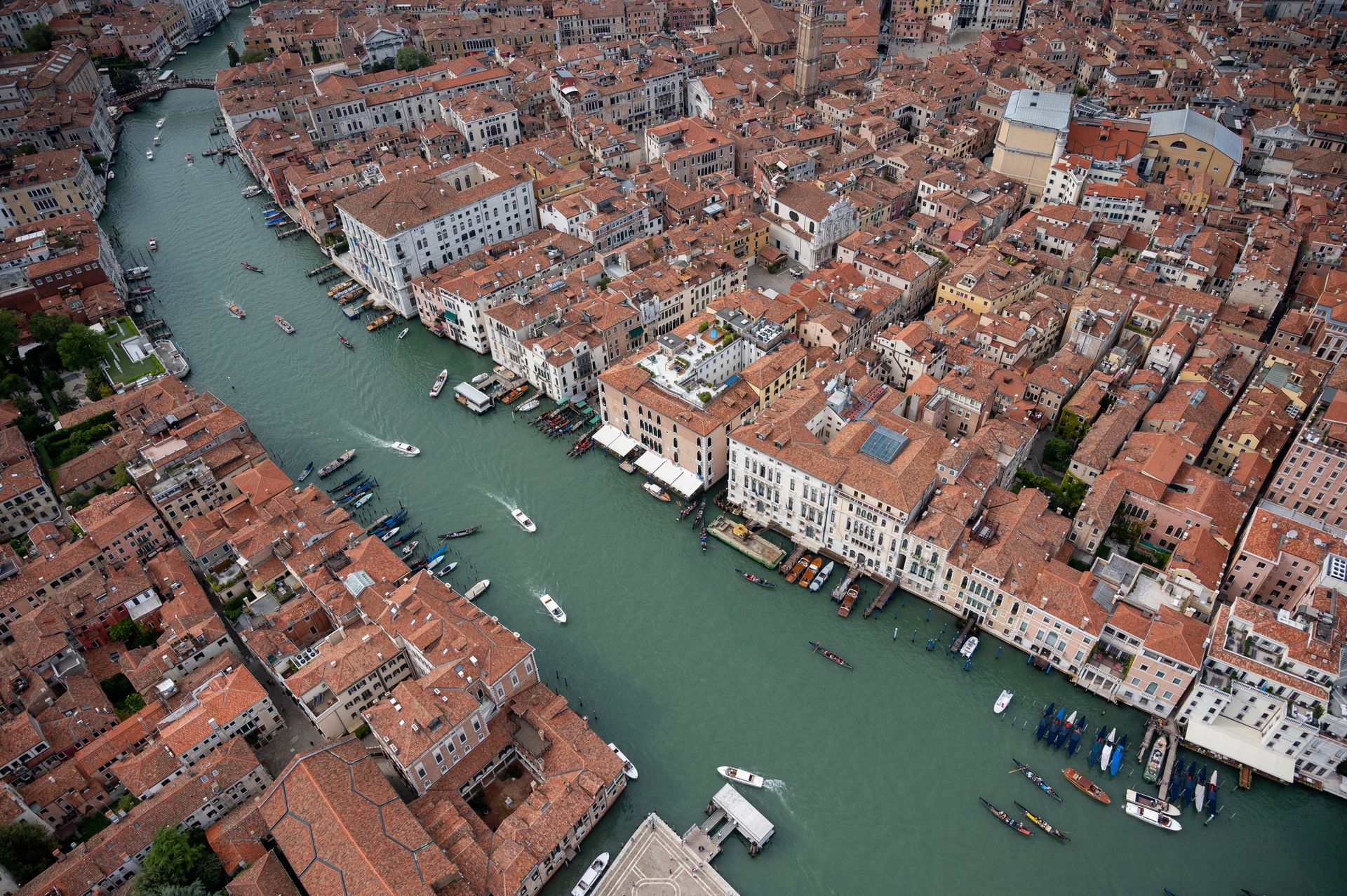
For about four centuries — from the late 12th through the mid-16th century — Venice was the commercial capital of Europe and the essential intermediary between the Mediterranean world and the goods of Asia. At its height the city-state controlled a maritime empire that stretched from the northeastern Italian coast across the Adriatic, through Greece, Cyprus, and Crete, and to trading posts in the Black Sea and the eastern Mediterranean. This was not a territorial empire in the Roman mold. It was a network of ports, warehouses, and fortifications designed to control the movement of goods.
Venice's position depended on a set of interlocking advantages that its rulers worked to maintain with extraordinary consistency. The city sat in a lagoon that made it nearly impossible to attack by land. Its merchants had, since the early medieval period, cultivated relationships with the Byzantine Empire that gave them trading privileges unavailable to other European merchants. When the Crusades opened new routes through the eastern Mediterranean, Venice was positioned to profit from supplying and transporting the Crusader states. The Fourth Crusade of 1204, which Venice effectively redirected to sack Constantinople, gave the city direct control over key Byzantine ports and trade routes.
The commercial machinery Venice built to manage this trade was itself an innovation. The state galley system, through which the government auctioned off trading voyages to private investors, allowed merchants to spread risk across multiple shareholders — an early form of what would eventually become the joint-stock company. The Rialto market in Venice was the financial center of Europe for centuries, the place where exchange rates were set and credit was extended for long-distance trade. Double-entry bookkeeping, which made large-scale commercial accounting practical, was developed in Italy in part through the demands of Venetian commerce.
The city's wealth financed an artistic culture of unusual richness. The Byzantine influence visible in the mosaics of St. Mark's Basilica reflects Venice's orientation toward the east. Later, Venetian painters — Bellini, Giorgione, Titian, Veronese, Tintoretto — developed a distinctive approach to color and light that influenced European painting for centuries. The city's Carnival tradition, the development of the commedia dell'arte theatrical form, and the emergence of opera in the 17th century all reflect a culture that treated spectacle as a civic value.
Vasco da Gama's voyage around the Cape of Good Hope in 1498, opening a direct sea route from Europe to India, began the slow erosion of Venice's commercial position. Goods that had flowed through the eastern Mediterranean and Venice's warehouses could now bypass the city entirely. The process was gradual — Venice remained wealthy and productive for another century and a half — but the structural shift was irreversible. By the 17th century, the center of European commercial gravity had shifted to Amsterdam and London. Venice reinvented itself as a cultural capital and tourist destination — a role it still plays today, somewhat uneasily, for the roughly 20 million visitors it receives annually.
Samarkand
picture alliance / Getty Images
Samarkand sits near the Zerafshan River in what is now Uzbekistan, in a location that has been inhabited for at least 2,750 years and possibly much longer. For much of that span, the city was important primarily because of its position on the Silk Road — the network of overland trade routes connecting China to the Mediterranean. But in the 14th and 15th centuries, under the Timurid dynasty, Samarkand became something more: the capital of a Central Asian empire that controlled territory from Persia to northern India, and a city that its ruler deliberately transformed into the most beautiful in the world.
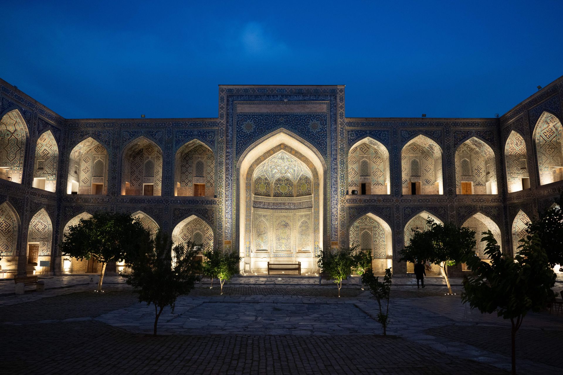
Timur — known in the West as Tamerlane — conquered the city in 1366 and made it the capital of his expanding empire. He was one of the most effective and destructive military commanders in history, a conqueror whose campaigns left trails of devastation across Persia, India, and the Levant. But in Samarkand itself, he built rather than destroyed. Artisans, architects, and craftsmen were brought — by force, in most cases — from the cities Timur conquered: from Persia, from Delhi, from Damascus. The result was a city of mosques, madrasas, and mausoleums covered in the blue and turquoise tilework that became synonymous with Timurid architecture.
The Registan, Samarkand's central square, was developed under Timur and his successors into one of the most architecturally coherent urban spaces in the world. Its three madrasas, built across the 15th and 17th centuries, face each other across a broad plaza, their facades covered in geometric tilework of extraordinary precision. The mathematical complexity of the patterns — some of which anticipate concepts that Western mathematics would not formalize until the 20th century — reflects the sophistication of the craftsmen and scholars who worked in the Timurid capital.
Timur's grandson Ulugh Beg, who ruled Samarkand as governor from 1409 to 1447 and as sultan briefly before his assassination, was one of the greatest astronomers of the medieval world. He built an enormous observatory on a hill outside the city — its underground section, part of a massive sextant, was rediscovered by archaeologists in 1908 — and produced a star catalog of remarkable accuracy. His tables of stellar coordinates remained among the most precise available until the work of Tycho Brahe in the 16th century.
The overland Silk Road's decline, driven by the development of maritime routes around Africa and the political disruption of Central Asia following the Mongol conquests, gradually marginalized Samarkand. The city's position as a trade hub depended on the flow of goods along routes that were becoming obsolete. By the 17th century, the great buildings were still standing, but the city's political and commercial significance had contracted sharply. Russian imperial expansion in the 19th century absorbed the region. Samarkand is now the second-largest city in Uzbekistan, a place that visitors come primarily to see the Timurid architecture — buildings that are genuinely among the most beautiful ever made.
Hangzhou
VCG / Getty Images
When the Venetian merchant Marco Polo visited Hangzhou in the late 13th century, he described it as the finest city in the world — a claim he repeated in multiple formulations throughout his account. He called it Kinsai, from the Chinese X $TWTRíng zaī, meaning "temporary residence," a name that reflected its status as the capital of the Southern Song dynasty, which had retreated south after losing northern China to the Jin dynasty in the 12th century. The name also captured something true about the city's relationship to power: it was a capital by necessity, but it became one of the greatest cities in history by achievement.
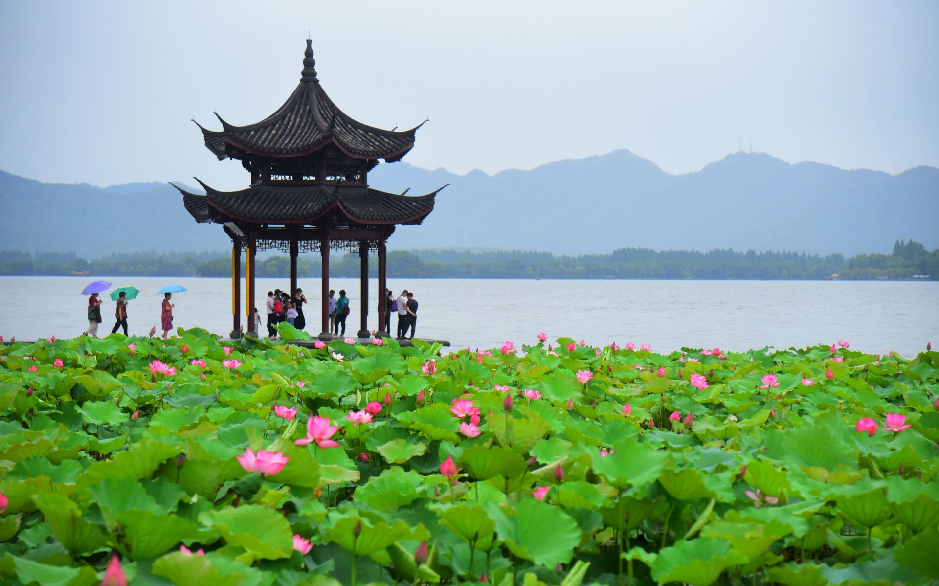
At the Song dynasty's height in the 12th and 13th centuries, Hangzhou's population is estimated at between 1.5 million and 2 million people, making it almost certainly the most populous city on earth at the time. It sat on the shores of West Lake, a body of water that had been shaped and refined by human hands over centuries into a landscape of causeways, islands, and pavilions that served both practical and aesthetic purposes. The lake provided water for the city, supported fishing, and formed the visual backdrop for a culture that prized natural beauty in ways unusual for a major urban capital.
The Southern Song economy was more commercially sophisticated than anything in the contemporary world. The government issued paper money — the world's first currency system of this kind to function at national scale — and used it to fund both its military and its commercial infrastructure. The Song navy was the most powerful of its era, and Hangzhou's port complex connected the city to maritime trade routes that reached Southeast Asia, India, and East Africa. The city's merchants operated insurance schemes, credit instruments, and commercial partnerships that anticipate later European financial innovations.
Silk production was central to Hangzhou's economic life and to its identity. The city's workshops produced fabrics of extraordinary quality — patterned silks, brocades, gauzes — that were exported across Asia and eventually to the Middle East and Europe. The craft knowledge embedded in Hangzhou's textile industry was cumulative and highly specific, passed through families and guilds over generations. The city also produced lacquerware, ceramics, and printed books at scales that supported a literate, commercially active urban population.
The Mongol conquest of the Southern Song was completed in 1279, when Kublai Khan's forces finally took Hangzhou. Marco Polo arrived under Mongol rule and found the city still functioning at enormous scale. Under the Ming dynasty that followed the Mongols, the capital moved north to Nanjing and then Beijing. Hangzhou remained a prosperous city and a center of silk production, but its era as the world's preeminent urban center was over. It is now a city of 12 million people and the capital of Zhejiang province — better known internationally, perhaps, as the headquarters of Alibaba than for its medieval history.
Córdoba
VW Pics / Getty Images
In the 10th century CE, Córdoba was the largest city in Europe — and by some measures, the most sophisticated. Under the Umayyad Caliphate of al-Andalus, which had ruled the Iberian Peninsula since the Arab conquest of 711, the city had grown into a metropolis with a population that historians estimate at between 100,000 and 500,000. The range reflects the difficulty of interpreting medieval sources, but even the lower figure dwarfs contemporary London, Paris, or Rome, which numbered in the tens of thousands.
The city's infrastructure was, by the standards of 10th-century Europe, extraordinary. Córdoba had street lighting — oil lamps positioned along major routes — at a time when no other European city had anything comparable. It had running water, delivered through a system of pipes and aqueducts, and public baths on the Roman and Islamic model. Its markets supplied goods from across the Islamic world: spices and textiles from the east, gold from West Africa, manuscripts from Baghdad and Cairo. The city's souks were organized by trade, a spatial logic that also produced a kind of informal quality control — buyers could compare goods and negotiate prices within a single sector.
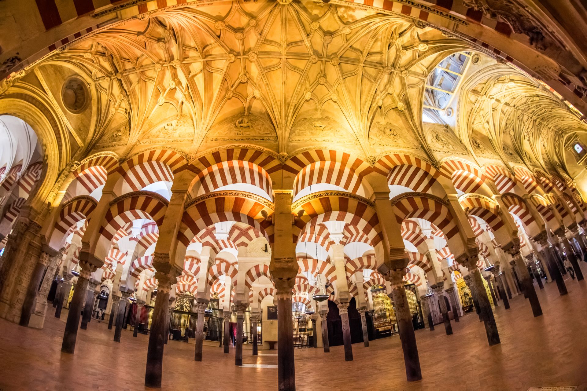
The Great Mosque of Córdoba — the Mezquita — remains one of the most architecturally significant buildings in the world. Built beginning in 785 CE on the site of a Visigothic church, and expanded repeatedly over subsequent centuries, it is a forest of columns in two-tone red-and-white horseshoe arches that seems to extend without obvious limit. The double-arch system, with a smaller arch sitting atop a taller one, was an engineering innovation that allowed the builders to raise the ceiling higher while using columns of modest height — columns recycled, in many cases, from Roman buildings. When the Christian Reconquista took Córdoba in 1236, a cathedral was built inside the mosque, a juxtaposition that still generates architectural conversation.
The intellectual culture of Córdoba under the caliphate was its most consequential contribution. The court of Abd al-Rahman III and his son al-Hakam II, who ruled in the 10th century, was one of the great centers of medieval scholarship. The royal library at Córdoba reputedly held 400,000 volumes — a figure that is contested but reflects the real and massive investment in manuscript collection that characterized the Umayyad court. Scholars working in the city produced advances in medicine, mathematics, astronomy, and philosophy.
The philosopher Ibn Rushd — known in the West as Averroes — was born in Córdoba in 1126. His commentaries on Aristotle, translated into Latin, reintroduced systematic Aristotelian philosophy to European universities and directly shaped the scholastic tradition that runs from Aquinas through much of medieval European thought. The physician and philosopher Ibn Tufayl and the Jewish philosopher Maimonides both worked within the intellectual tradition that Córdoba anchored. The city was genuinely a place where Muslim, Jewish, and Christian scholars read each other's work — not without conflict, but with a density of cross-cultural exchange that was unusual in the medieval world.
The caliphate collapsed in a series of civil wars in the early 11th century, fragmenting al-Andalus into small kingdoms. Córdoba never regained its earlier scale or influence. The city that exists today, with a population of around 325,000, preserves the Mezquita as a UNESCO World Heritage site and a destination for millions of visitors — a physical record of a period of urban brilliance that lasted less than three centuries.
Angkor
SUY SE / Getty Images
Between the ninth and 15th centuries, Angkor was the capital of the Khmer Empire and the largest pre-industrial urban complex in the world. Located in what is now northwestern Cambodia, near the northern shore of the Tonlé Sap lake, the city at its height covered an area of roughly 1,000 square kilometers, a figure established by radar imaging conducted by research teams in the early 21st century. That area figure is somewhat misleading — the city was not densely built across its entire extent, but was organized as an intricate lattice of temples, residential areas, rice paddies, reservoirs, and canals — but it captures something real about the ambition of the Khmer urban project.
The hydraulic infrastructure was the key. The Tonlé Sap is a lake that dramatically changes size between the dry season and the monsoon: it swells from roughly 2,500 square kilometers to more than 16,000 as the Mekong floods back into the river system. The Khmer engineers built a system of reservoirs, called barays, that captured monsoon water and released it during the dry season for rice cultivation. The western baray, the largest, is roughly eight kilometers long and 2.1 kilometers wide. This system allowed Angkor to support a population that archaeologists now estimate at between 750,000 and one million people — extraordinary by medieval standards.
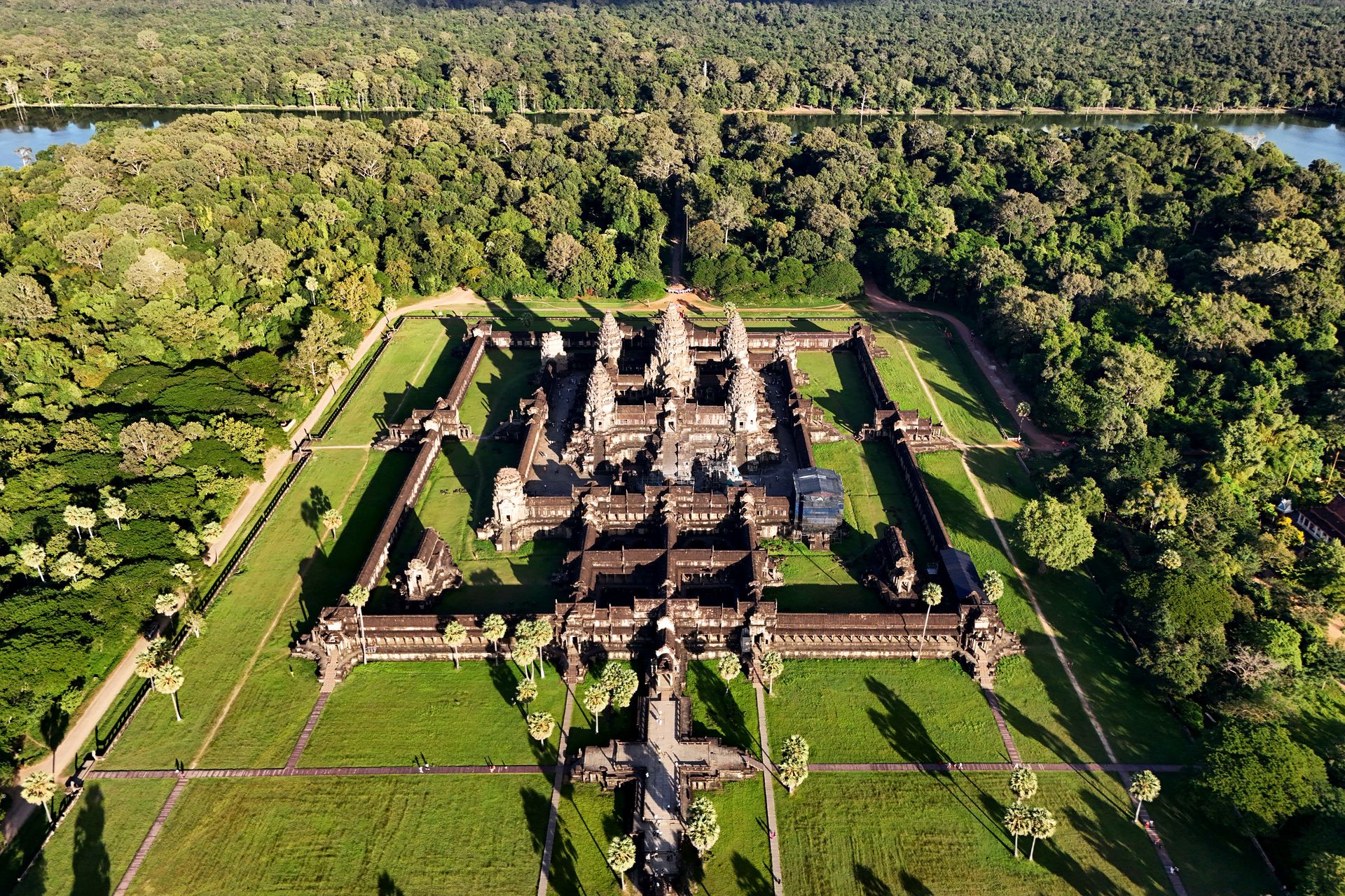
Angkor Wat, built under Suryavarman II in the first half of the 12th century CE, was originally a Hindu temple dedicated to Vishnu. It is the largest religious monument ever constructed, covering an area of roughly 400 acres including its moat. Its five towers, representing the peaks of Mount Meru, the sacred mountain at the center of the Hindu cosmos, are arranged so that an observer standing at the western entrance sees them aligned on the rising sun at the spring equinox. The bas-reliefs along the temple's inner galleries depict cosmic battles, Hindu mythological narratives, and historical scenes from Suryavarman's military campaigns in a continuous narrative stretching for hundreds of meters.
The Khmer Empire's power rested on rice surplus, control of overland trade routes connecting China to the Gulf of Thailand, and the ideological authority of the god-king, the devaraja, whose relationship to the divine was expressed architecturally in the state temples. Each major ruler built a new temple mountain, a practice that required enormous labor mobilization and continuously expanded the city's ceremonial core.
The empire's decline in the 14th and 15th centuries was gradual and is still debated by historians. Climate data from tree rings and sediment cores suggests that the region experienced a series of severe droughts alternating with extreme monsoons in the 14th century, which would have damaged the hydraulic infrastructure that supported the city's food supply. Thai kingdoms to the west, particularly Ayutthaya, grew in power and repeatedly attacked Angkor. The city was abandoned as a capital by the mid-15th century, and the population dispersed toward the coast.
The temples were never entirely abandoned — Buddhist monks maintained Angkor Wat continuously, which partly explains its preservation. But the urban infrastructure decayed. The canals silted. The barays dried. The jungle grew over the residential and administrative structures that surrounded the temples, leaving the stone monuments isolated in a forest that preserved them while hiding everything else. French colonial scholars "rediscovered" the site in the 19th century, though it had never been unknown to Cambodians. Angkor is now a UNESCO World Heritage site and the most visited destination in Cambodia, receiving more than two million visitors annually before the Covid-19 pandemic.