Credit: MINEIA MARTINS / Pexels
Deserts cover roughly one-third of Earth's land surface, yet they remain among the least understood — and most underestimated — environments on the planet. For most people, "desert" conjures a single image: endless sand dunes baking under a merciless sun. The reality is far more varied. There are cold deserts blanketed in snow, coastal deserts swathed in fog, rocky plateaus that see no rain for decades, and painted badlands where erosion has sculpted the earth into formations that seem to belong on another planet.
What defines a desert is not heat or sand, but aridity — a place where evaporation consistently outpaces precipitation. By that definition, Antarctica is the largest desert on Earth. The Sahara, which most people picture when they hear the word, is actually the largest hot desert, but even it is mostly gravel and rock, not the rolling dunes of popular imagination. Fewer than 25% of the Sahara's surface is covered in sand.
Deserts are also, paradoxically, among the most biologically inventive places on Earth. The plants and animals that survive in them have evolved adaptations that represent some of the most elegant engineering in nature — from the fog-harvesting scales of the Namib beetle to the 1,000-year lifespan of the Welwitschia plant. Indigenous communities in desert regions developed sophisticated ways of reading water, weather, and terrain over thousands of years, and their knowledge systems are as much a part of these landscapes as the geology itself.
Travel to deserts has grown significantly over recent decades, but many of the world's most extraordinary arid landscapes remain relatively unvisited. The ones on this list were chosen not for fame alone, but for the depth of experience they offer — whether that's the silence of a salt flat at dawn, the social complexity of a desert trading city, or the otherworldly glow of bioluminescent plankton washing ashore in a coastal fog desert. Some require serious planning and physical preparation. Others are surprisingly accessible. All of them reward the effort.
This list spans six continents and represents the full range of what a desert can be: geological archive, cultural crossroads, wildlife refuge, and one of the few places left on Earth where true silence and genuine darkness are still possible.
1 / 15
Credit: Boris Ulzibat / Pexels
The Sahara is the largest hot desert on Earth, stretching across 11 countries and covering roughly 9.2 million square kilometers — an area almost as large as the U.S. It spans Morocco, Algeria, Tunisia, Libya, Egypt, Mauritania, Mali, Niger, Chad, Sudan, and a sliver of Eritrea, and the experience of traveling through it varies enormously depending on where you go.
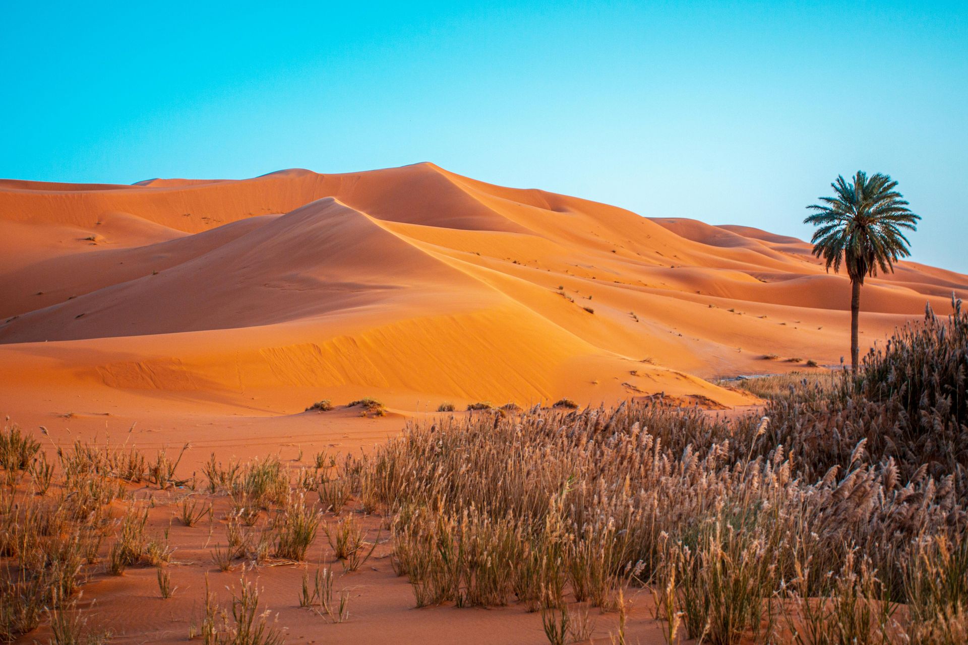
Most visitors approach the Sahara from Morocco, entering the dune seas near Merzouga or the Draa Valley. The Erg Chebbi dunes near Merzouga rise to around 150 meters and are among the most photogenic in the Sahara, turning deep orange at sunrise. But the dunes represent only a fraction of what the desert contains. The Algerian Sahara, which is far less visited due to security concerns and visa restrictions, contains the Hoggar Mountains — a volcanic massif that rises to over 3,000 meters and feels like a different planet. Across the Libyan Sahara, the Akakus mountain range holds prehistoric rock art dating back more than 10,000 years: giraffes, elephants, cattle, and human figures painted and carved onto sandstone walls during an era when the Sahara was a fertile savanna.
The Sahara was not always a desert. Between roughly 11,000 and 5,000 years ago, during a period geologists call the African Humid Period or the Green Sahara, the region received substantial rainfall, supported large lakes and rivers, and was home to a diverse array of wildlife and human populations. The shift to hyperaridity happened gradually, driven by changes in Earth's orbital cycle that altered the amount of solar radiation hitting the Northern Hemisphere.
Traveling through the Sahara today, it's possible to trace the echoes of that wetter past. Dry riverbeds called wadis cut through the landscape, some of them wide enough to suggest the scale of the rivers that once flowed through them. Underground aquifers — relics of ancient rainfall — feed oases like Siwa in Egypt and Taghit in Algeria, where date palms, figs, and pomegranates grow in vivid contrast to the surrounding stone and sand.
The human cultures of the Sahara are as layered as the geology. The Tuareg, a Berber people who have navigated the desert's caravan routes for centuries, have a complex social and spiritual culture tied intimately to the landscape. Saharan cities like Timbuktu in Mali and Ghardaïa in Algeria developed as trading hubs for salt, gold, and enslaved people, and their architectural traditions — mud-brick mosques, labyrinthine medinas, elaborate irrigation systems — reflect centuries of desert adaptation. The best way to experience the Sahara is not to rush it. A week at minimum, ideally more, with time to sleep under the stars, ride camels, and simply sit with the silence.
2 / 15
Credit: MINEIA MARTINS / Pexels
The Namib is the oldest desert on Earth. It has been arid or semi-arid for at least 55 million years — possibly longer — making it a living geological archive that predates the formation of many of the world's mountain ranges. It stretches along the Atlantic coast of Namibia for roughly 2,000 kilometers, and its landscapes shift dramatically from north to south: gravel plains, rocky inselbergs, towering dune fields, and fog-shrouded coastline.
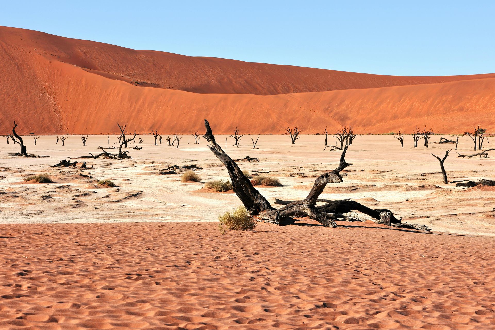
The dunes of Sossusvlei, in the central Namib, are among the tallest in the world. Dune 45 — named for its distance from the park entrance — rises about 170 meters and is one of the most photographed in Africa. The star dune known as Big Daddy is taller still, reaching around 325 meters. The colors of these dunes are extraordinary: deep red-orange at sunrise, pale gold in midday light, almost violet at dusk, the product of iron oxide coating individual grains of sand over millions of years of weathering. At Deadvlei, a white clay pan surrounded by dunes, ancient camelthorn trees that died around 900 years ago still stand upright in the arid air, their blackened trunks preserved by the near-zero humidity.
The Namib is also a fog desert. Cold water from the Benguela Current sweeps up from Antarctica along Namibia's coast, chilling the air above it and producing dense fog that rolls inland for up to 100 kilometers. This fog is the desert's primary water source, and the wildlife that lives here has evolved specifically to harvest it. The Namib fog beetle collects water droplets on its waxy back and tilts forward to drink them. The Welwitschia plant — found nowhere else on Earth — has just two leaves that grow continuously throughout its life, which can span more than 1,500 years. Some individual Welwitschia plants alive today began growing during the Bronze Age.
The Skeleton Coast, in the northern Namib, takes its name from the bleached whale bones and shipwrecks that once littered its shores, and from the danger it posed to sailors. The cold, nutrient-rich waters offshore support one of the most productive marine ecosystems on the planet — Cape fur seals in the hundreds of thousands, brown hyenas, black-backed jackals, and desert-adapted lions that have learned to hunt in the dunes. Inland, the Damaraland region holds desert-adapted elephant and black rhino, both of which have evolved larger feet and more efficient water metabolism than their savanna counterparts.
Namibia is one of Africa's most stable and well-organized tourist destinations, and the Namib is served by a network of lodges and campsites that range from basic to genuinely luxurious. A minimum of five days is needed to do the desert justice.
3 / 15
Credit: Marek Piwnicki / Pexels
The Atacama is the driest non-polar desert on Earth. Some weather stations in its interior have never recorded rain. In the core of the desert, the average annual rainfall is around one millimeter — a figure so low that it challenges the definition of precipitation. The aridity is the product of two converging forces: the Andes mountains to the east block moisture from the Amazon $AMZN basin, and the cold Humboldt Current offshore chills the air and prevents the formation of rain-bearing clouds.
The landscape that results from this extreme dryness is hauntingly beautiful. The Valle de la Luna, near the town of San Pedro de Atacama, is a landscape of salt, sand, and rock formations eroded by ancient floods into rippled, lunar terrain. The altiplano — the high plateau that forms the eastern edge of the Atacama — sits above 4,000 meters and contains some of the most dramatic high-altitude scenery on Earth: turquoise lagoons ringed with pink flamingos, active volcanoes capped with snow, geyser fields that erupt at sunrise when the temperature differential between underground heat and freezing air is at its maximum.
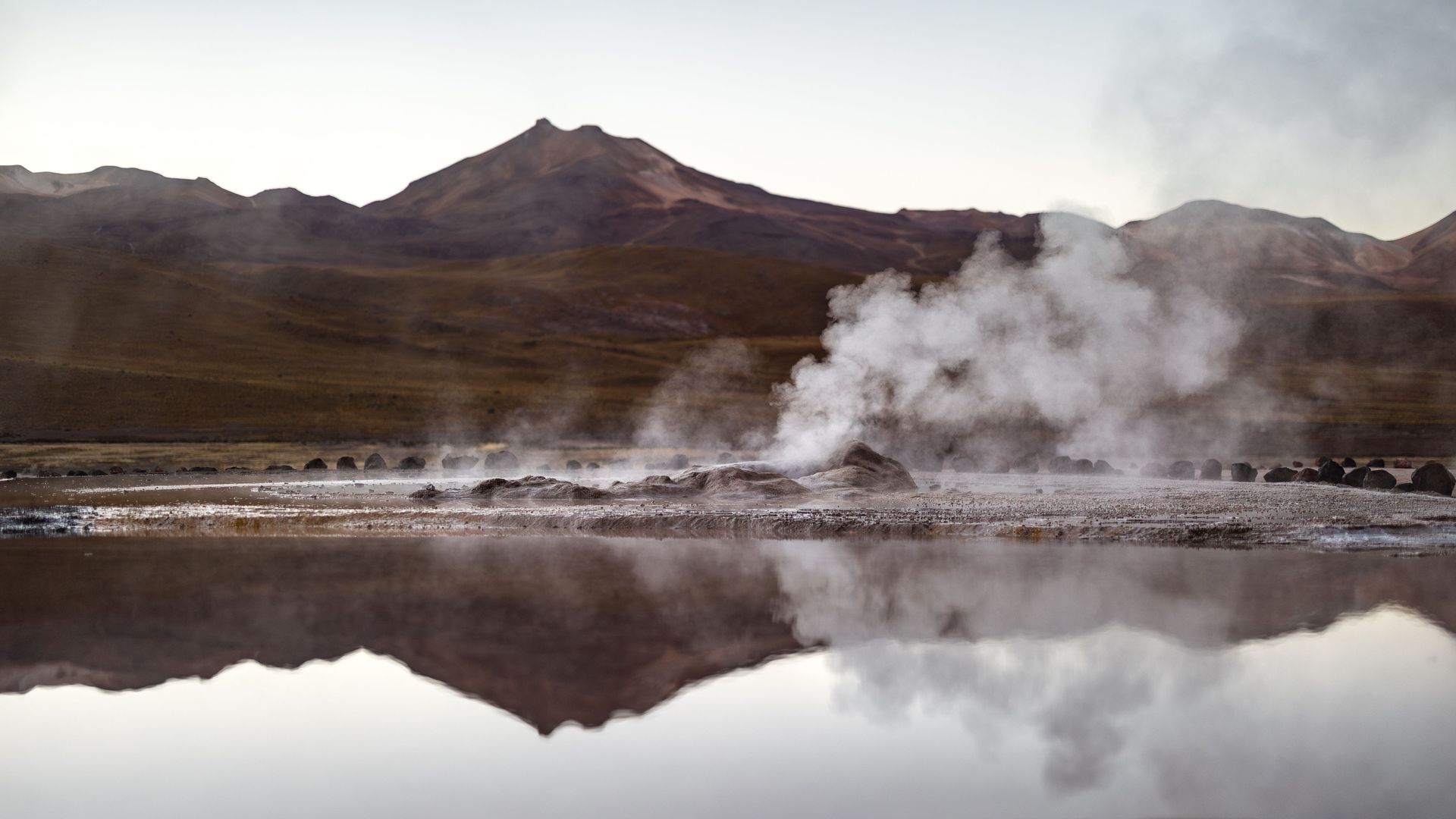
The El Tatio geysers, at 4,320 meters above sea level, are among the highest geyser fields in the world. In the early morning, before the sun warms the air, dozens of vents shoot jets of steam up to six meters high, and the entire plateau is wreathed in mist. The lagoons at Miscanti and Miñiques, a short drive south, hold colonies of Andean flamingos — one of three flamingo species native to South America — against a backdrop of snowcapped peaks and cobalt sky.
The Atacama has another unexpected quality: it is one of the best places on Earth for stargazing. The altitude, the dry air, the absence of light pollution, and the atmospheric clarity combine to produce skies that are used by professional observatories from around the world. The European Southern Observatory operates multiple facilities in the region. On a clear night, the Milky Way is visible as a solid band overhead, and the Magellanic Clouds — satellite galaxies of the Milky Way — appear as luminous patches to the south.
The desert also has a complicated recent history. Under Pinochet's military dictatorship, mass graves were dug in the Atacama's remote interior, and the extreme aridity preserved remains that have allowed forensic anthropologists to identify victims decades later. Several memorial sites and museums in the region acknowledge this history alongside the landscape's natural wonders.
4 / 15
Credit: ArtHouse Studio / Pexels
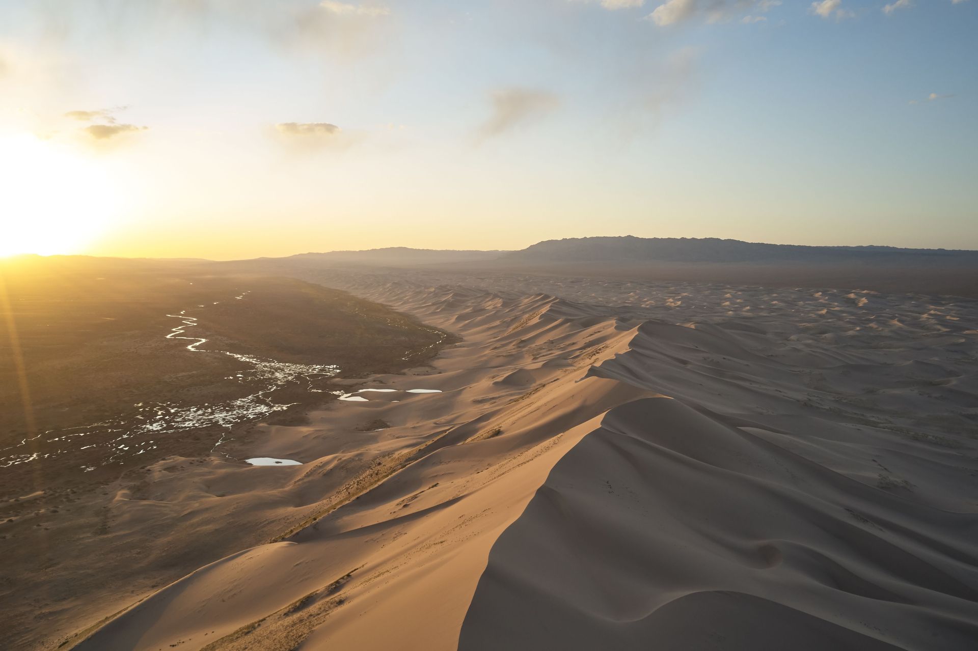
The Gobi is the largest desert in Asia, stretching across southern Mongolia and northern China for roughly 1.3 million square kilometers. It is a cold desert — temperatures in winter can drop below minus 40 degrees Celsius — and its terrain is extraordinarily varied: gravel steppes, bare rock, salt marshes, and dramatic dune fields like the singing dunes of Khongoryn Els, where grains of sand vibrate against each other in the wind to produce a low, resonant hum.
The Gobi is one of the most paleontologically significant regions on Earth. American Museum of Natural History expeditions in the 1920s led by Roy Chapman Andrews discovered the first known dinosaur eggs here, along with dozens of new species, including Protoceratops and Oviraptor. The Flaming Cliffs of Bayanzag — named by Andrews for the way the red sandstone glows at sunset — remain an active fossil site. Walking across the eroded badlands, it is not uncommon to find fragments of dinosaur bone eroding out of the cliff faces.
Mongolian nomadic culture is deeply tied to the Gobi. Herding families move seasonally across the desert steppe with their livestock — horses, camels, goats, and sheep — following traditional grazing routes that have been used for generations. The Bactrian camel, the two-humped species native to Central Asia, survives in the wild in the Gobi in small, critically endangered numbers, while domesticated Bactrians remain essential to nomadic life for transportation and milk. Staying with a herding family in a ger — the circular felt tent that is the traditional Mongolian dwelling — offers an experience of the desert that no lodge or tourist circuit can replicate.
The Gobi is also home to the snow leopard, though sightings are vanishingly rare. The Gobi bear — the world's rarest bear, with a population of fewer than 50 individuals — survives in a remote area of the Mongolian Gobi called the Gobi Gurvan Saikhan National Park, subsisting on saxaul trees and wild onions. The desert also supports Mongolian wild ass, black-tailed gazelle, and a resident population of wolves.
Getting to the Gobi requires either a long drive from Ulaanbaatar across the steppe — a journey that itself reveals the scale of Mongolia's emptiness — or a domestic flight to regional towns like Dalanzadgad. Organized tours with experienced local guides are the most practical way to navigate the terrain.
5 / 15
Credit: Rita / Unsplash
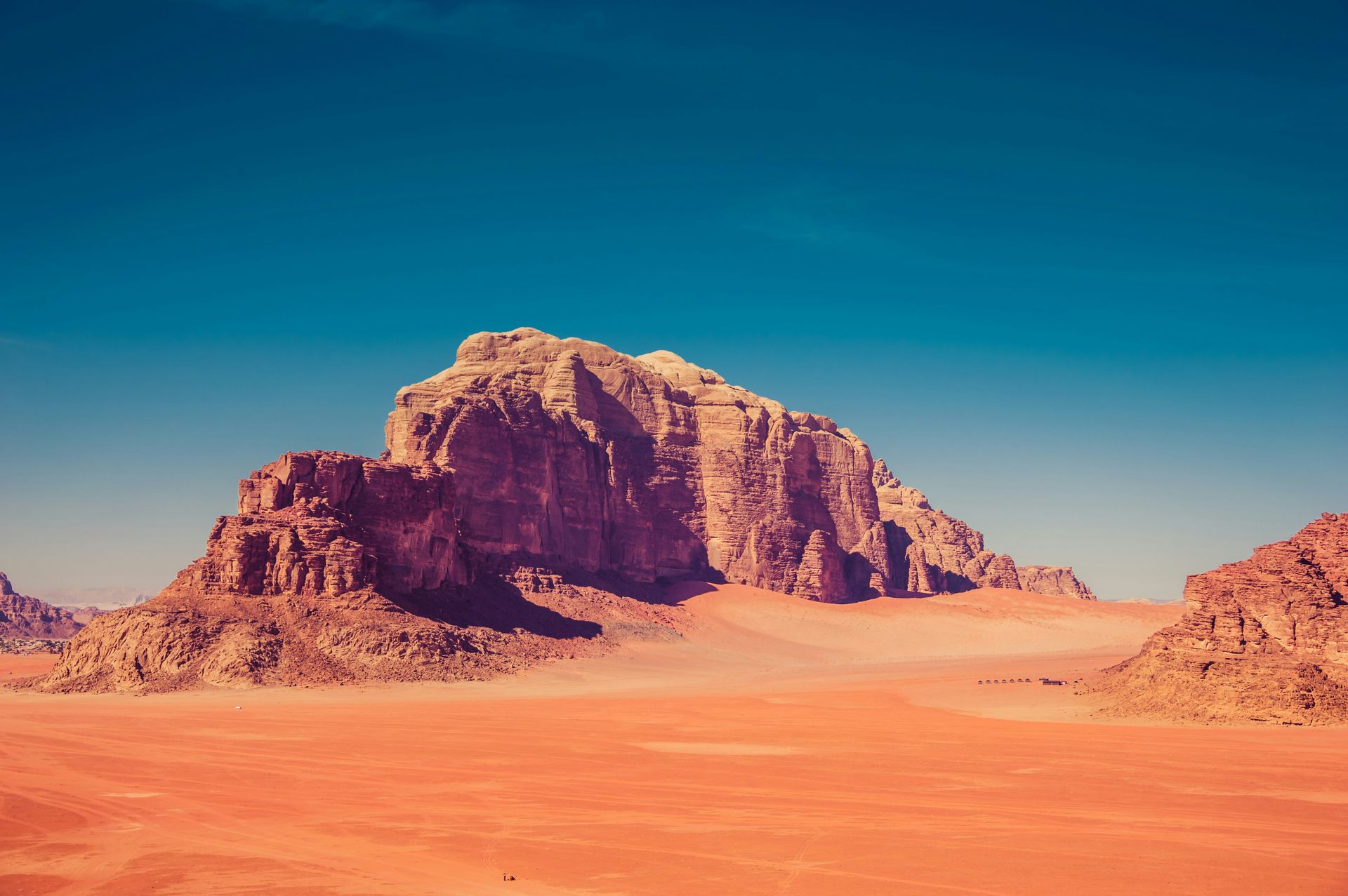
Wadi Rum is a protected desert wilderness in southern Jordan covering about 720 square kilometers. It is not a desert in the geographic sense of a vast, contiguous arid zone — it is more accurately described as a sandstone and granite desert valley — but the scale, the silence, and the sheer visual power of its rock formations place it in a category of its own.
The landscape is dominated by massive jebels — flat-topped sandstone mountains that rise abruptly from a red sand floor, their faces streaked with oxidized iron in shades of red, orange, and ochre. These formations are the remnants of an ancient seabed, lifted and eroded over hundreds of millions of years into arches, canyons, narrow siq passages, and sheer vertical walls. The largest natural arch in the Middle East, the Um Fruth Rock Bridge, is here.
Wadi Rum has been continuously inhabited for thousands of years. The Nabataean kingdom, which controlled trade routes between Arabia and the Mediterranean from roughly the fourth century BCE to the first century CE, left rock inscriptions throughout the valley. Earlier petroglyphs depict camels, hunters, and ibex, and date to prehistoric periods. The Zalabia and Zuwaideh Bedouin tribes have lived in the valley for generations, and their knowledge of the terrain — the water sources, the hidden canyons, the routes between settlements — shapes every serious journey through it.
T.E. Lawrence, the British officer who helped lead the Arab Revolt against Ottoman rule during World War I, described Wadi Rum in his memoir "Seven Pillars of Wisdom" as "vast, echoing and god-like." He passed through the valley repeatedly during the campaign, and a canyon known as Lawrence's Spring is named for him — though the association is loosely documented.
In recent decades, Wadi Rum has been used as a film location repeatedly, most notably for "Lawrence of Arabia," "The Martian," "Rogue One," and "Dune." The landscape's resemblance to Mars is not accidental — NASA has used the valley for rover simulations.
The experience most visitors seek is simple: a night in a Bedouin camp under the clearest, most star-filled sky in the Middle East, followed by a sunrise jeep tour through the canyons. Scrambling up the rock formations is possible without technical climbing gear on many routes, and the quality of the silence — especially at dawn and dusk — is difficult to describe to someone who hasn't experienced it.
6 / 15
Credit: majeed nm / Pexels
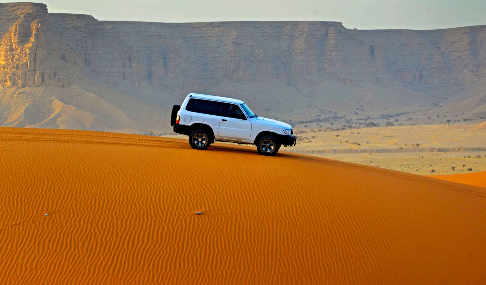
The Rub' al Khali — "the Empty Quarter" in Arabic — is the largest continuous sand desert on Earth, covering approximately 650,000 square kilometers across Saudi Arabia, Oman, the UAE, and Yemen. It contains more sand than the Sahara's entire dune regions combined. In the heart of the desert, the dunes reach heights of 250 meters and the nearest human settlement can be hundreds of kilometers away.
The scale of the Rub' al Khali is genuinely difficult to comprehend from outside it. Summer temperatures regularly exceed 50 degrees Celsius. There is no fresh surface water anywhere in the desert's interior. The dunes shift and reform with the wind, erasing any fixed point of navigation. Wilfred Thesiger, the British explorer who made two crossings of the Rub' al Khali on foot with Bedouin companions in the late 1940s, wrote that the experience changed his understanding of human endurance and simplicity. His accounts remain among the most vivid descriptions of desert travel in the English language.
The most accessible part of the Rub' al Khali is in Oman's Dhofar region and in the UAE's Liwa oasis, which sits on the northern edge of the desert. At Liwa, the dunes are less extreme than the interior but still reach impressive heights — Moreeb Dune, near the town of Hameem, is around 300 meters tall and hosts an annual speed and endurance race. The Saudi Aramco oil company has built roads into parts of the Saudi Rub' al Khali, and organized tours operate from several entry points.
The Empty Quarter is not empty of life, though it can appear so. Arabian sand gazelles survive in the outer margins of the desert. Sand cats — small, large-eared wild cats adapted to extreme heat — have been recorded within the dune fields. Sand vipers and various species of beetle live beneath the sand surface, emerging at night when temperatures drop.
The color of the sand in the Rub' al Khali is distinctive: a deep orange-red from iron oxide compounds that stain the grains. The dunes in the southwest, near the Yemeni border, are among the tallest and most complex in form — star dunes, crescent dunes, and longitudinal dunes arranged in patterns that reveal the prevailing wind directions over millennia.
7 / 15
Credit: Atypeek Dgn / Pexels
The Danakil Depression is one of the most geologically active and physically extreme places on Earth. Located in the Afar region of northeastern Ethiopia, it sits at the junction of three tectonic plates — the African, Somali, and Arabian plates — which are slowly pulling apart from each other. The result is a landscape that looks as though the planet is in the process of tearing itself open.
The depression sits about 100 meters below sea level in its lowest parts and records some of the highest sustained temperatures on Earth — daytime highs regularly exceed 50 degrees Celsius, and the average annual temperature hovers around 34 degrees. There is almost no rainfall. The Awash River, which flows into the depression from the Ethiopian highlands, simply evaporates before it reaches any outlet.
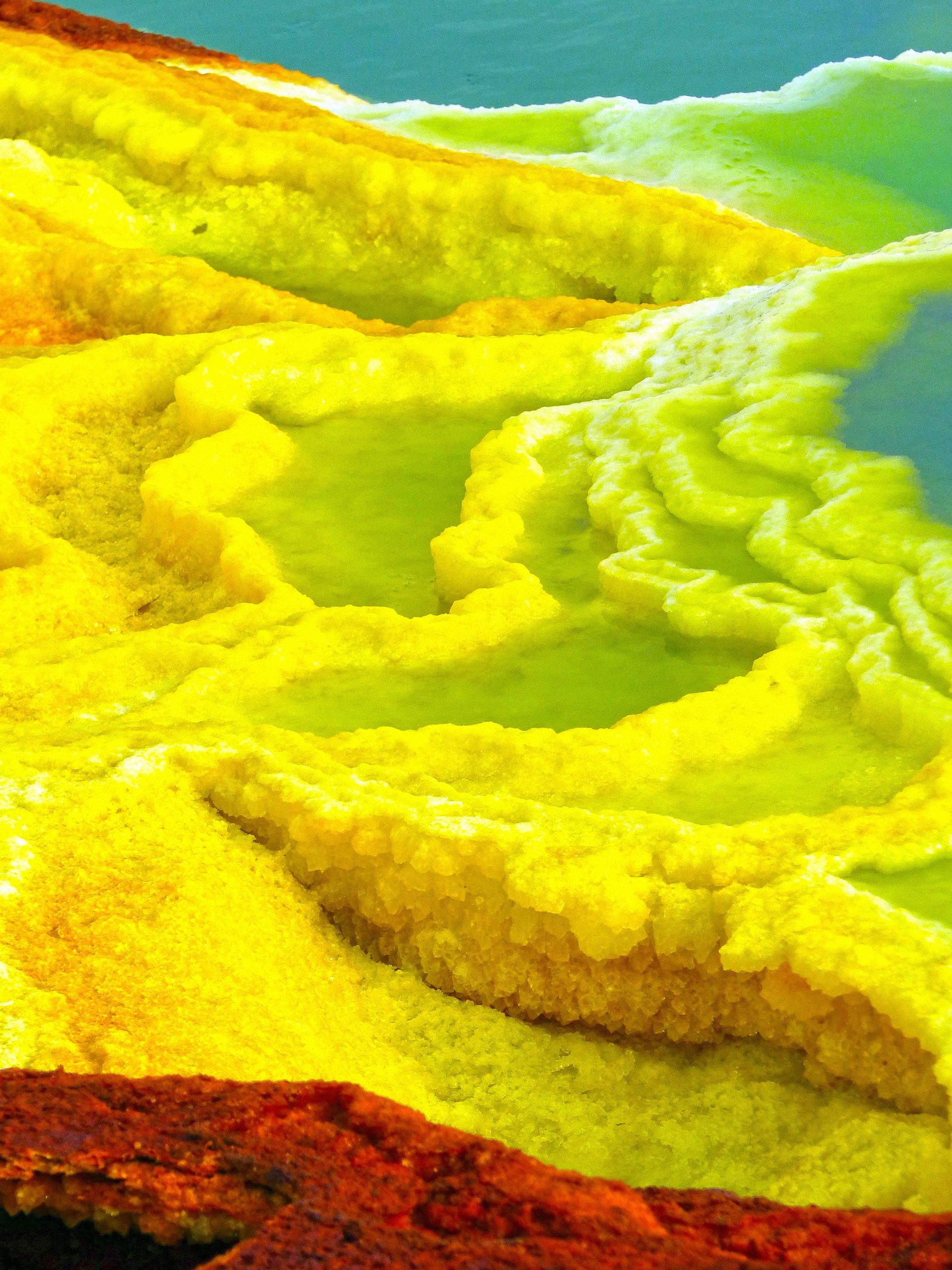
What makes the Danakil worth the considerable effort and expense of reaching it are the hydrothermal fields at Dallol and the Erta Ale volcano. Dallol is one of the most alien-looking places on the planet's surface: a hydrothermal area of sulfur springs, acidic brine pools, salt formations, and gas vents that create a landscape in yellow, green, orange, and white, unlike any other natural environment. The Dallol hydrothermal system reaches temperatures above 100 degrees Celsius in places and produces pools of brine so acidic — pH values below zero — that they cannot support microbial life. They are among the most extreme chemical environments on Earth's surface.
Erta Ale is a shield volcano that contains one of the world's few persistent lava lakes — a pool of molten rock that has been active for at least the past 50 years. The approach involves a nighttime walk of several hours across cooled lava fields, and the experience of looking down into the glowing, churning lake at close range is one of the most visceral things available to travelers outside of formal scientific expeditions.
The Afar people who live in the Danakil have been harvesting salt from the depression's vast salt flats for centuries. Camel caravans loaded with slabs of salt still travel from the salt mines near Hamad Ela to market towns in the highlands — one of the last functioning traditional salt trade routes in the world. Spending time at the salt harvest offers a view of the depression that is both human and geological.
8 / 15
Credit: Shreosi Swarnakar / Pexels
The White Desert is a protected area in Egypt's Western Desert, located about 45 kilometers north of the town of Farafra in the Farafra Oasis. It is a relatively compact area — the protected zone covers around 3,000 square kilometers — but the density and variety of its geological formations make it one of the most visually distinctive landscapes in North Africa.
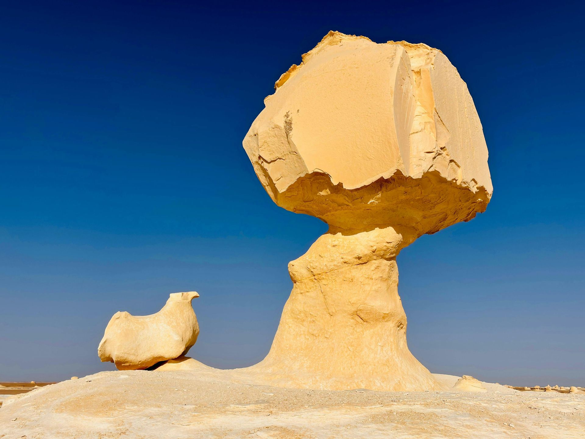
The landscape consists of white chalk rock formations eroded by centuries of wind and sand into shapes that range from the abstract to the figurative: mushroom-shaped outcrops, table rocks, monolithic spires, and formations that visitors have named "the chickens," "the whale," and "the inselberg." The white of the chalk is intensified by the contrast with the golden sand of the desert floor, and at night, under a full moon, the formations glow with an almost phosphorescent quality.
The rock was formed from the sediment of a shallow sea that covered the region during the late Cretaceous period, roughly 80 to 65 million years ago. The chalk is rich in fossils — sea urchins, bivalves, shark teeth, and occasional fragments of marine reptile — that erode continuously out of the formations. The surrounding landscape also contains what is known as the Black Desert, a region of dark volcanic rock and stone, which provides a striking contrast to the white chalk just a short drive north.
The Farafra Oasis, which serves as the main access point for the White Desert, is one of the smaller oases in Egypt's Western Desert but has a long history of habitation. The area around it contains prehistoric rock art, ancient caravan routes, and remnants of early Christian hermit settlements. The oasis town itself is quiet, with a small population and a date palm agriculture that has sustained communities there for millennia.
Camping overnight in the White Desert is the standard and recommended way to experience it. The formations look entirely different at different times of day — pale and stark at noon, warm gold at sunset, ghostly and luminous under starlight. Most visitors approach as part of a multi-day Western Desert circuit that includes the Bahariya Oasis and the Black Desert, making for a journey that covers several distinct landscapes in succession.
9 / 15
Credit: Nate Hovee / Pexels
The Sonoran Desert spans roughly 260,000 square kilometers across southwestern Arizona, southeastern California, and the Mexican states of Sonora and Baja California. It is the hottest desert in North America and the most biologically diverse desert in the world — a distinction it owes partly to its geography and partly to its unusual rainfall pattern, which delivers precipitation in two seasons rather than one.
Most deserts receive their scant rainfall in a single wet season. The Sonoran receives both a winter rainfall from Pacific frontal systems and a summer monsoon from the Gulf of Mexico. This dual moisture regime allows a greater diversity of plants to establish and persist than in deserts with a single rainy season, producing a landscape layered with vegetation in a way that defies the popular idea of what a desert looks like.
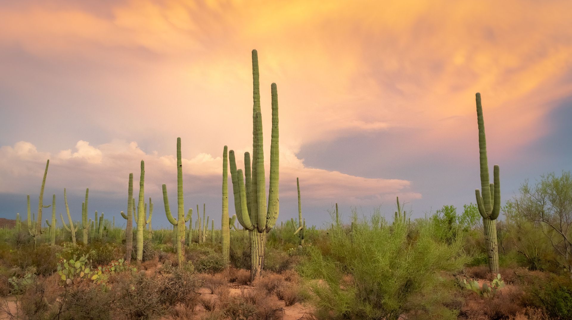
The saguaro cactus — the classic many-armed cactus of American Western iconography — grows only in the Sonoran Desert, and its presence defines the landscape. A mature saguaro can reach 12 meters in height, weigh more than a ton, and live for 150 to 200 years. The first arm of a saguaro doesn't typically appear until the plant is 75 years old. The cactus provides nesting cavities for Gila woodpeckers, which excavate holes in the flesh; when the woodpecker moves on, elf owls — the world's smallest owl — take up residence. Saguaro fruits feed white-winged doves, coyotes, and bats, and the nectar feeds lesser long-nosed bats and various bee species.
Saguaro National Park, which flanks Tucson, Arizona, on both its east and west sides, protects some of the densest saguaro stands in the desert and offers excellent access to the broader ecosystem. But the Sonoran Desert extends far beyond the park boundaries, and some of its most compelling landscapes are in Mexico: the Gran Desierto de Altar in Sonora, which contains the largest active sand dune field in North America, and the Pinacate volcanic field, which has some of the best-preserved impact craters and lava tubes on the continent.
The Tohono O'odham people have lived in the Sonoran Desert for thousands of years and developed a detailed agricultural system — ak-chin farming — that uses seasonal floodwater runoff to grow crops without irrigation. Their knowledge of the desert's seasonal rhythms, edible plants, and water sources represents one of the most sophisticated human-desert relationships in the Americas.
10 / 15
Credit: Eleanore Stohner / Pexels
The Patagonian Desert is the largest desert in South America and the eighth largest in the world, covering roughly 673,000 square kilometers in southern Argentina. It is a cold desert, classified as such because its aridity is primarily the result of the rain shadow cast by the Andes mountains to the west, which block Pacific moisture and leave the plateau in permanent drought.
The landscape is flat to rolling steppe — mostly gravel and sparse scrub — and it lacks the dramatic dune formations of the Sahara or the Atacama. But the Patagonian Desert's appeal lies in something different: the overwhelming scale of the sky, the extreme winds, the wildlife, and the surrounding landscapes that border it on every side. The Andean peaks to the west, including the towers of Torres del Paine just across the Chilean border, provide a backdrop that no other desert in the world can match.
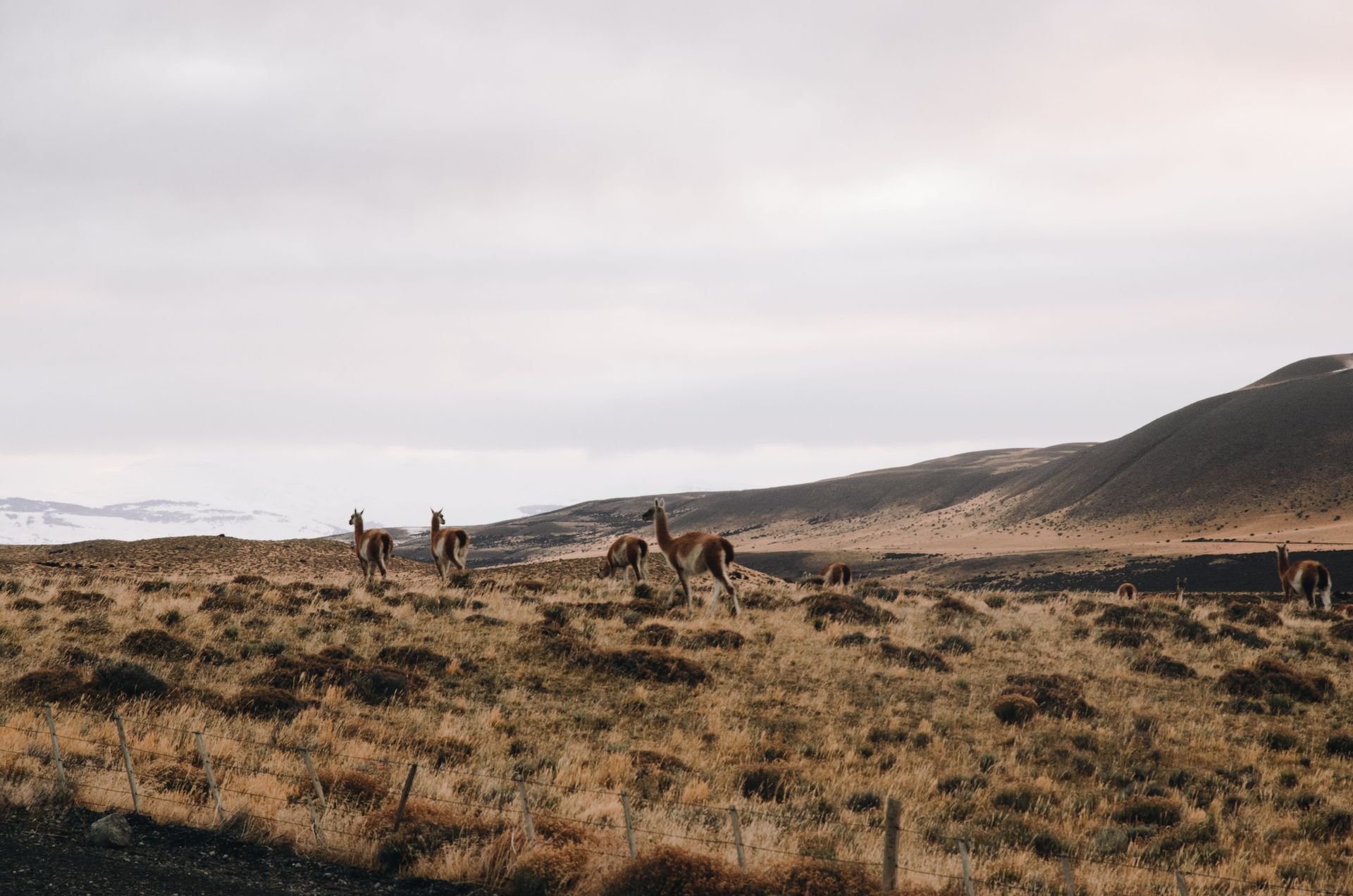
The wildlife of the Patagonian Desert is exceptional. Guanacos — the wild relatives of the llama — range across the steppe in large herds, and their presence draws pumas, which are seen more reliably in Patagonia than almost anywhere else in South America. The desert's eastern edge meets the Atlantic coast, where the Valdés Peninsula hosts one of the most concentrated wildlife spectacles in the Americas: southern right whales calving in the sheltered bays, elephant seals and sea lions hauling out on the beaches, Magellanic penguins in massive colonies, and orcas that hunt sea lions in the surf.
The town of El Calafate on the southern edge of the desert provides access to Los Glaciares National Park, where the Perito Moreno Glacier — one of the few glaciers in the world that is not in net retreat — calves dramatically into a milky-blue lake. The juxtaposition of ice and desert within a few hours' drive of each other captures something of the contradictory character of Patagonia more broadly.
Wind is the defining sensory feature of the Patagonian Desert. The westerlies that sweep across the Southern Ocean unimpeded hit the Patagonian plateau with a force that makes walking upright difficult on exposed ridges. This wind has sculpted the vegetation into low, compact forms and given the landscape a quality of perpetual motion — dust moving, grass bending, clouds racing — that makes a still day feel like an event.
11 / 15
Credit: 光曦 刘 / Pexels
The Taklamakan is the largest desert in China and the second-largest sandy desert in the world, covering about 337,000 square kilometers in the Xinjiang region of western China. The name is commonly translated from Uyghur as "you can go in but you can't come out," though linguists debate this etymology. What is not in debate is that the Taklamakan was one of the most feared deserts in the ancient world.
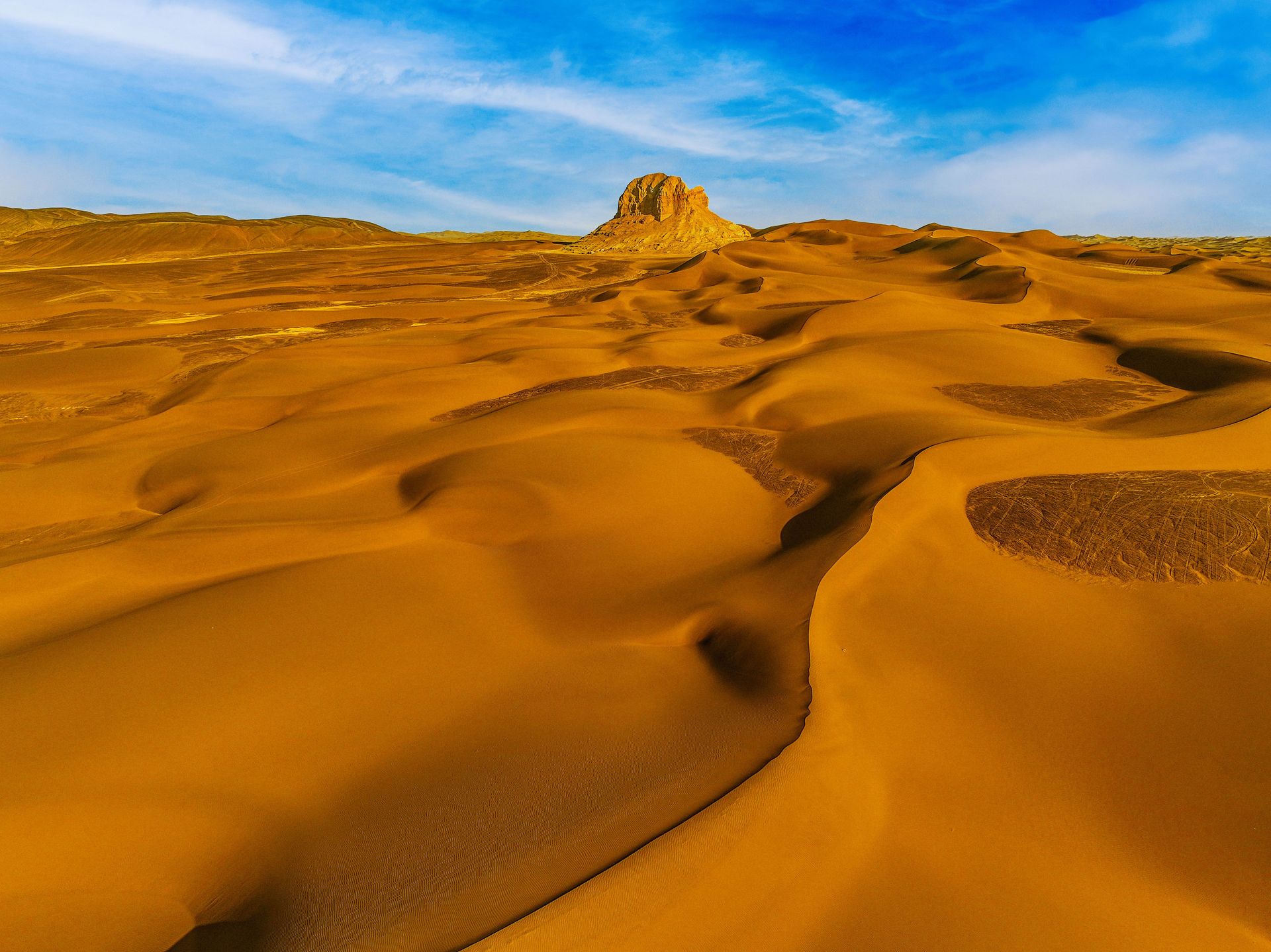
The desert sits in the Tarim Basin, a closed basin surrounded by mountain ranges: the Tian Shan to the north, the Kunlun to the south, and the Pamirs to the west. Rivers flowing from the surrounding mountains disappear into the sand before reaching any outlet. The dune fields are immense, reaching heights of 200 to 300 meters in places. The sand is pale yellow, not red, giving the desert a different visual character from the African or Arabian dune seas.
The Silk Road skirted the Taklamakan on both sides — the northern and southern routes that connected China with Central Asia, the Middle East, and the Mediterranean. The desert was too harsh to cross directly, so caravans followed the oases along its edges: Kashgar, Kucha, Hotan, and Dunhuang, each city a node in one of history's most consequential trade networks. These oases sustained the exchange of silk, spices, glassware, paper, gunpowder, and Buddhism across Eurasia for more than a thousand years.
The buried cities of the Silk Road are one of the Taklamakan's most compelling draws. In the late 19th and early 20th centuries, European explorers discovered dozens of ancient settlements beneath the desert sands, preserved by the extreme aridity. Niya, Dandan Oilik, and Loulan yielded wooden household objects, manuscripts in multiple scripts, textiles, and even food — all perfectly preserved by the desiccating environment. The mummies of Xinjiang, some of which date to around 4,000 years ago and show features associated with Central Asian or even Western Eurasian populations, raised profound questions about the early peopling of inner Asia that remain contested by scholars.
Modern travel through the Xinjiang region involves significant political complexity. Uyghur communities in the region have faced systematic oppression by the Chinese government, a situation that travelers should research carefully and thoroughly before visiting.
12 / 15
Credit: Canva Images
The Karakum — "Black Sand" in Turkic — covers about 350,000 square kilometers across central Turkmenistan, making it one of the largest deserts in Central Asia. It is mostly flat, dominated by clay and sand plains broken by low ridges and dry river channels. But the Karakum has one attraction that overrides its geographic modesty entirely: the Darvaza Gas Crater, known informally as the "Door to Hell."
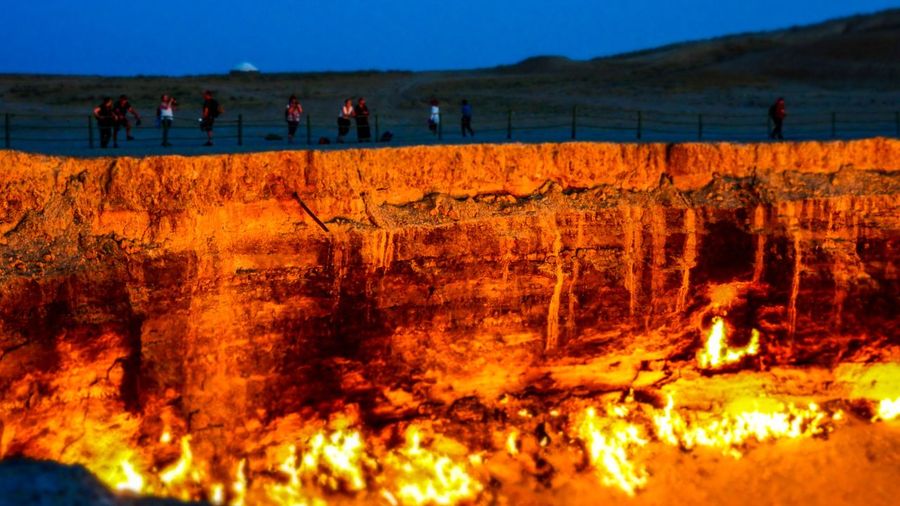
The crater is a collapsed natural gas field that has been burning continuously since 1971. Soviet geologists, drilling for natural gas, struck a cavern and caused the ground to collapse, creating a crater roughly 69 meters wide and 30 meters deep. The decision to ignite the escaping gas — intended to prevent the spread of methane — created a fire that was expected to burn out in a few weeks. It has not stopped burning in more than 50 years.
At night, the crater is visible from many kilometers away, a glowing orange pit in the flat darkness of the Karakum. Standing at its rim in daylight, the heat is intense — thermal plumes carry superheated air upward and the smell of burning gas is heavy. At night, the effect is entirely different: the interior of the crater is a shifting orange and yellow, with occasional blue flames at the base where the gas concentration is highest, and the surrounding desert is lit in a warm glow that reveals the flat, featureless expanse for hundreds of meters in every direction.
The nearest settlement of any size is the village of Darvaza, which is itself a study in post-Soviet Central Asian strangeness — a small community in a vast, flat, gas-rich desert, accessible by a road that stretches ruler-straight across the Karakum to the capital, Ashgabat. Ashgabat, for its part, is one of the more unexpected urban experiences available to travelers: a white marble city built by two consecutive authoritarian leaders whose personality cults have filled the streets with golden statues, enormous fountains, and monumental public buildings that see almost no visitors.
Camping at the crater overnight is possible and relatively straightforward. The combination of the burning crater and the stars of the Karakum sky — with no light pollution for hundreds of kilometers — makes for one of the more unusual nights available anywhere in Central Asia.
13 / 15
Credit:Rachel Claire / Pexels
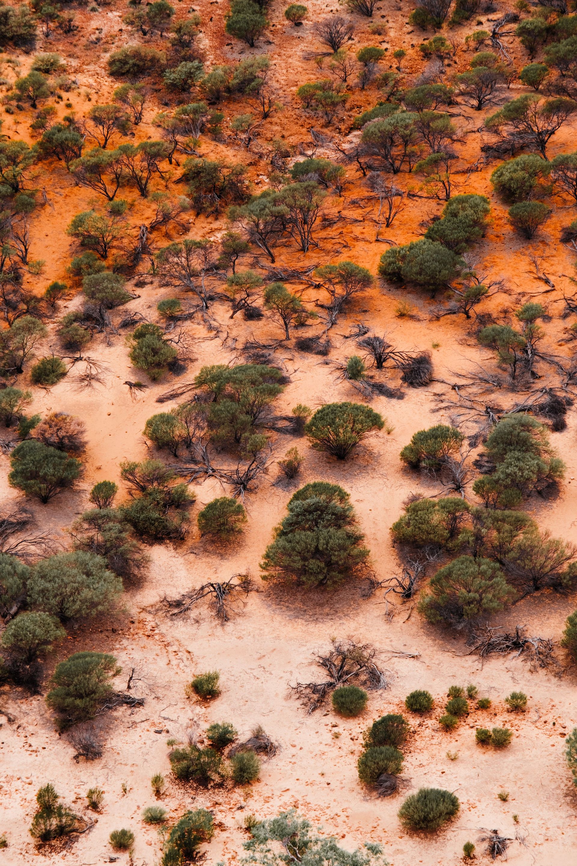
The Great Victoria Desert is Australia's largest desert, stretching across southern Western Australia and into South Australia for roughly 424,000 square kilometers. It is a sandridge desert — characterized by parallel ridges of red sand separated by flat, salt lake basins — and it sits at the western edge of the Australian outback, a vast arid zone that covers about 70% of the continent.
What makes the Great Victoria Desert distinctive within Australia is partly its scale, partly its relative remoteness, and partly the extraordinary cultural significance it holds for the Aboriginal peoples who have lived in and around it for tens of thousands of years. The Spinifex people — whose traditional country covers much of the western Great Victoria Desert — maintain deep connections to the land even in the era of settled communities, and their native title rights were formally recognized by the Australian government in 2000, making it one of the first formal recognitions of land rights in the Australian desert interior.
The flora of the Great Victoria Desert centers on spinifex grass, a coarse, hummocky grass that forms dense mounds across the sandridges and provides habitat for lizards, small marsupials, and invertebrates. Mulga woodland and mallee eucalyptus grow where there is slightly more moisture, and the salt lakes that punctuate the desert floor support specific communities of halophytic plants. After rare rainfall events, the desert can produce spectacular wildflower blooms — everlastings, grevilleas, and native daisies in masses of pink, yellow, and white.
The desert is home to the greater bilby, the thorny devil, the shingleback lizard, and several species of dunnart — small, carnivorous marsupials that fill ecological niches similar to shrews in other continents. The malleefowl, a ground-nesting bird that builds enormous mound nests of decomposing vegetation to incubate its eggs, is also present in the more vegetated margins of the desert.
Access is primarily via the Anne Beadell Highway, an unsealed track that crosses the central Australian desert and requires a high-clearance four-wheel-drive vehicle and significant advance planning. The Nullarbor Plain, which forms the southern edge of the Great Victoria Desert's range, offers a more accessible — and in its own way, equally remarkable — experience of Australian arid emptiness: a flat, treeless limestone plateau above the sea cliffs of the Great Australian Bight.
14 / 15
Credit: Hansueli Krapf / Wikimedia Commons (CC BY-SA 3.0)
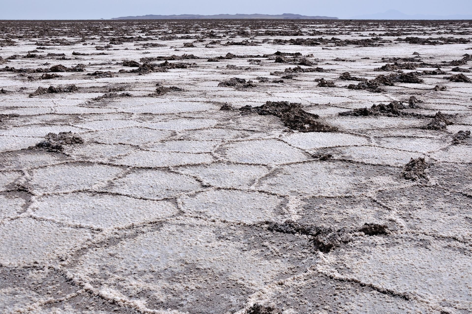
The Dasht-e Kavir, or Great Salt Desert, is the largest desert in Iran, covering roughly 77,600 square kilometers in the country's north-central plateau. It is a high desert, sitting between 600 and 900 meters above sea level, and its dominant feature is not sand dunes but salt flats — vast, cracked expanses of mineral crust formed by the evaporation of ancient lakes.
The surface of the Dasht-e Kavir is treacherous in ways that sand deserts typically are not. The salt crust can appear firm but conceal layers of soft mud beneath — camel caravans and travelers crossing it historically risked breaking through the surface and becoming trapped in the brine mud below. Daytime temperatures in summer exceed 50 degrees Celsius on the salt flat surface, and the glare from the white crust is blinding without eye protection.
The desert's surrounding rim contains a series of caravanserais — roadside inns built along ancient trade routes — that are among the best-preserved examples of Persian architecture in the country. The Maranjab Caravanserai, built during the Safavid period (16th to 18th centuries), sits at the northern edge of the desert near the town of Aran va Bidgol and has been partially restored for visitors. The remains of other caravanserais dot the desert's edges, their mud-brick walls slowly returning to the earth.
Iran's desert cities are among the most architecturally significant in the Islamic world. Kashan, on the western edge of the Dasht-e Kavir, contains some of the finest traditional Persian house architecture anywhere, including the Tabatabaei House and the Boroujerdi House — courtyard residences from the 19th century with elaborate plasterwork, stained glass, and cooling systems that used the desert wind and underground water channels called qanats to maintain temperatures as much as 15 degrees cooler than outside.
The qanat system — a network of gently sloping underground channels that bring groundwater from distant mountains to surface settlements — was developed in Iran several thousand years ago and represents one of the most sophisticated water management technologies in human history. The Dasht-e Kavir region contains hundreds of qanats, some of them still in use, which made agriculture possible in an otherwise uninhabitable landscape.
15 / 15
Credit: Yogendra Singh/ Pexels
The Thar Desert, also called the Great Indian Desert, covers roughly 200,000 square kilometers across northwestern India — primarily in the state of Rajasthan — and extends into Pakistan's Sindh and Punjab provinces. It is the most densely populated desert on Earth, home to more than 83 people per square kilometer in some areas, a figure that reflects both the region's long history of habitation and the agricultural productivity that can be squeezed from even marginal land with careful water management.
The Thar is not an extreme desert in the physical sense. It receives more rainfall than the Sahara or the Atacama — between 100 and 500 millimeters annually, depending on location — and large parts of it are covered in scrub forest, thorny acacia, and seasonal grasses that support livestock. But its sand dunes, its fort cities, and the richness of its cultural life make it one of the most rewarding desert regions to travel in anywhere in the world.
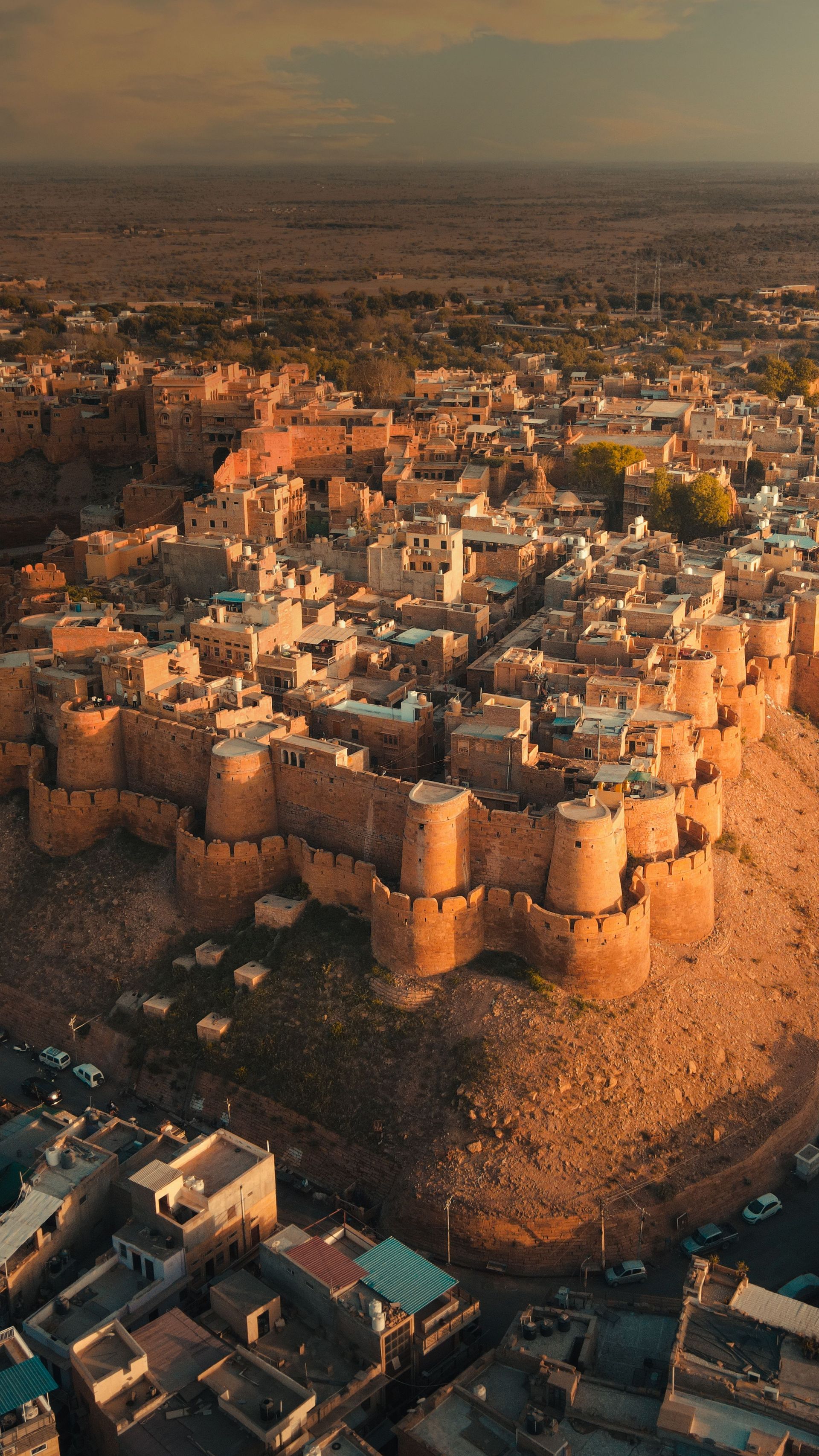
The cities of Rajasthan — Jaisalmer, Bikaner, Jodhpur — were built as desert trading posts on the routes that connected Central Asia and the Arabian Sea with the Gangetic plain. Jaisalmer, the most remote of the three, is a city constructed almost entirely of honey-colored sandstone, including a living medieval fort that still has several thousand permanent residents. The havelis — the ornate merchant townhouses built by wealthy Marwari trading families — are some of the finest examples of domestic stonework architecture in Asia, their facades carved with intricate screens, peacocks, elephants, and flowering vines.
The Sam sand dunes near Jaisalmer are among the most visited in India and offer camel riding and overnight camping at sunset and dawn. More impressive, and far less visited, are the dunes at Khuri and the remote reaches of the Desert National Park, which protects one of the most important habitats for the critically endangered great Indian bustard — a massive bird that once ranged across much of the Indian subcontinent but has declined to fewer than 150 individuals.
The Thar's human density is its defining characteristic and also its appeal. Unlike most deserts, which are experienced as spaces of solitude and absence, the Thar is full: full of villages, livestock, textiles, music, architecture, and the accumulated material culture of thousands of years of desert civilization. The experience of traveling through it is less about encountering emptiness than about encountering density — the extraordinary concentration of human ingenuity that arises when people have been finding creative ways to survive in a difficult landscape for a very long time.
