From the Balkans to Central Asia to sub-Saharan Africa, the world is more accessible than most itineraries reflect
Emilija Manevska / Getty Images
Visa $V anxiety stops more trips than airfare does. The mental model most travelers carry — that certain parts of the world are off-limits, too complicated, or not worth the logistical effort — is outdated in most cases and simply wrong in many. The world has opened up considerably over the past two decades. E-visa systems have replaced embassy queues in dozens of countries. Visa-on-arrival programs have expanded widely. Budget carriers now fly routes that were once reachable only through expensive connections or overland slogs.
The countries on this list share one quality: they are more accessible than most travelers assume. Some carry reputations built on political climates that changed years ago. Others are simply unknown — not dangerous or difficult, just overlooked. A few have modernized their border infrastructure and tourism systems substantially without receiving credit for those changes.
What accessible means here is worth stating plainly. It means straightforward visa access for holders of most major passports. It means a functioning tourism infrastructure — not luxury hotels necessarily, but guesthouses, transport links, and local services that independent travelers can actually use. It means safety profiles that hold up against the destinations most people visit without thinking twice.
This list does not argue that every country on it is right for every traveler. Some require planning. A few involve real infrastructure gaps. But none demand the bureaucratic marathon or genuine risk calculation that their reputations might suggest.
The destinations here span multiple continents and range from the ancient Silk Road cities of Central Asia to the fjord-carved coastlines of the Western Balkans to the high desert of the Arabian Peninsula. They include places that opened formally to tourists within the past decade, places that have been safe and welcoming for years without meaningful media coverage, and places whose reputation has been distorted by proximity to a more troubled neighbor.
If the barrier is uncertainty about how hard it actually is to get in and get around, that uncertainty is worth examining. In most cases, the answer is simpler than expected.
Andrea Pistolesi / Getty Images
Albania occupies the southwestern corner of the Balkans, bordered by Montenegro, Kosovo, North Macedonia, and Greece. Its Ionian and Adriatic coastlines remain among the least crowded in the Mediterranean — not undeveloped in the sense of lacking services, but genuinely less trafficked than comparable stretches of the Adriatic in Croatia or the Greek islands further south.
Citizens of the U.S., Canada, the U.K., and the EU can enter without a visa for stays of up to 90 days, with no prior application required. The border crossings from neighboring countries are functional and frequently used. Land entry from Greece through the Kakavijë crossing in the south is the most common route for travelers coming from Athens or Thessaloniki.
Tirana, the capital, has changed substantially since the political upheaval of the 1990s. The city now has a functional café culture, contemporary art venues, and a renovated city center. The Blloku neighborhood — once a residential enclave reserved for Communist Party officials, sealed off from ordinary Albanians — is now the most sociable part of the city, filled with outdoor terraces and small restaurants.
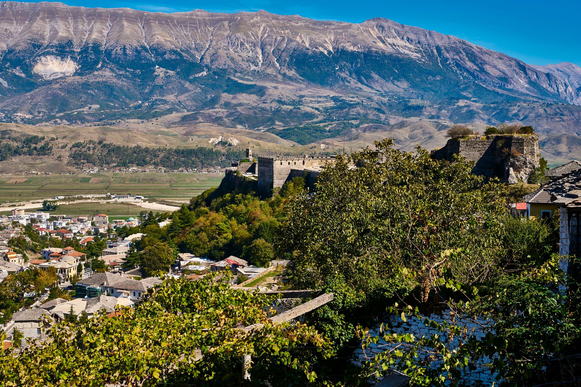
The south offers two UNESCO World Heritage Sites. Gjirokastër is an Ottoman-era city built largely from stone, terraced into a steep hillside above a valley, with a castle that dates to the 12th century and a well-preserved bazaar below it. Berat, the second UNESCO site, sits along a river valley with Ottoman-era neighborhoods stacked on either side — the upper quarters have rows of houses with large windows that prompted its common description as the city of a thousand windows.
The Albanian Alps in the far north offer some of the most dramatic mountain scenery in the Balkans. The Valbona Valley and the ridge trail to Theth have become established stops for trekkers, with guesthouses in both villages providing accommodation and home-cooked meals. The hike between the two valleys takes roughly six to eight hours and crosses alpine terrain at elevations above 1,800 meters.
Food and accommodation are genuinely affordable. A full meal at a local restaurant — grilled meat, salads, bread, local wine — costs a small fraction of what the same meal would cost in western Europe. Guesthouses in rural areas often include meals in the room price. The cultural tradition of hospitality in Albania runs deep; an ancient code called the Kanun places formal obligations on hosts to care for guests, and its influence on daily life remains visible.
The road network has improved significantly and continues to develop. The main highway corridor connecting Tirana to the coast and to Kosovo is modern. Roads in the north and south can be rough on secondary routes, and a four-wheel-drive vehicle makes some routes easier. Public transportation reaches most towns, though schedules in rural areas are infrequent.
Mekdet / Getty Images
Georgia, the country at the crossroads of Eastern Europe and the South Caucasus, has one of the most generous visa policies in its region. Citizens of more than 90 countries — including the U.S., Canada, the U.K., and EU member states — can enter without a visa and stay for up to one year. That is an unusually long allowance for visa-free access, and it applies immediately upon arrival with no prior application. Holders of passports not covered by that policy can apply for an e-visa online before traveling.
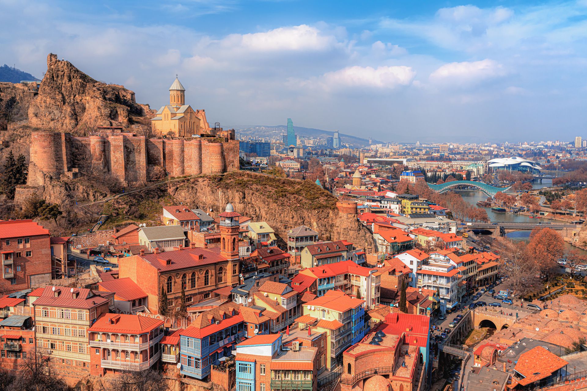
The capital, Tbilisi, sits in a narrow river valley. Its old town is built around sulfurous hot spring baths that have operated for centuries — the name Tbilisi derives from an old Georgian word for warm. The architecture in the old quarter layers Persian, Orthodox Christian, and Soviet elements in a way that feels specific to this city and no other. The surrounding hills are accessible by cable car and offer views over the Mtkvari River below.
Georgia has a winemaking tradition that stretches back roughly 8,000 years, making it one of the oldest wine-producing regions in the world. The traditional method involves fermenting and aging wine in large clay vessels called qvevri, buried underground to regulate temperature. This technique is recognized by UNESCO as intangible cultural heritage. The main wine region, Kakheti, lies east of Tbilisi and has developed a functioning tourism infrastructure with tasting rooms, winery tours, and guesthouses run by producing families.
The Caucasus mountains dominate the northern part of the country. The Svaneti region, accessible by regular flights from Tbilisi or a long mountain road, contains dramatic high-altitude landscapes and a collection of medieval defensive towers built by local clans. Guesthouses in Mestia, the main town in upper Svaneti, provide straightforward accommodation. Hiking in the surrounding range is serious and well-established, with trails running between villages through terrain that has no road access.
Costs are low for travelers from the U.S. or western Europe. Accommodation, food, and transport are priced well below comparable European destinations. English is widely spoken in Tbilisi and in Batumi, the main Black Sea port city, and increasingly in tourist-facing businesses elsewhere in the country.
Georgia's political situation deserves acknowledgment. The country has had a tense relationship with Russia since a 2008 war over the territory of South Ossetia. The breakaway regions of Abkhazia and South Ossetia are not under Georgian government control and are not accessible from Georgia proper. Travel to all other parts of the country is straightforward by conventional safety measures.
Michael Xiao / 500px / Getty Images
Oman sits on the southeastern corner of the Arabian Peninsula, sharing borders with Saudi Arabia and the UAE, with a long coastline along the Arabian Sea and the Gulf of Oman. Its reputation as a destination tends to lag behind its actual accessibility. The country operates a straightforward e-visa system for most nationalities, and citizens of several Gulf Cooperation Council partner states can enter without any prior application. The process for most Western passport holders involves a short online form and a modest fee.
The capital, Muscat, spreads along a coastal corridor backed by the Al Hajar mountains. It is one of the more orderly capital cities in the region — deliberately low-rise, with rules on building heights and exterior signage that give it an aesthetic coherence unusual among fast-developing Gulf cities. The Sultan Qaboos Grand Mosque, completed in 2001, is open to non-Muslim visitors during morning hours and is one of the largest mosques in the world.
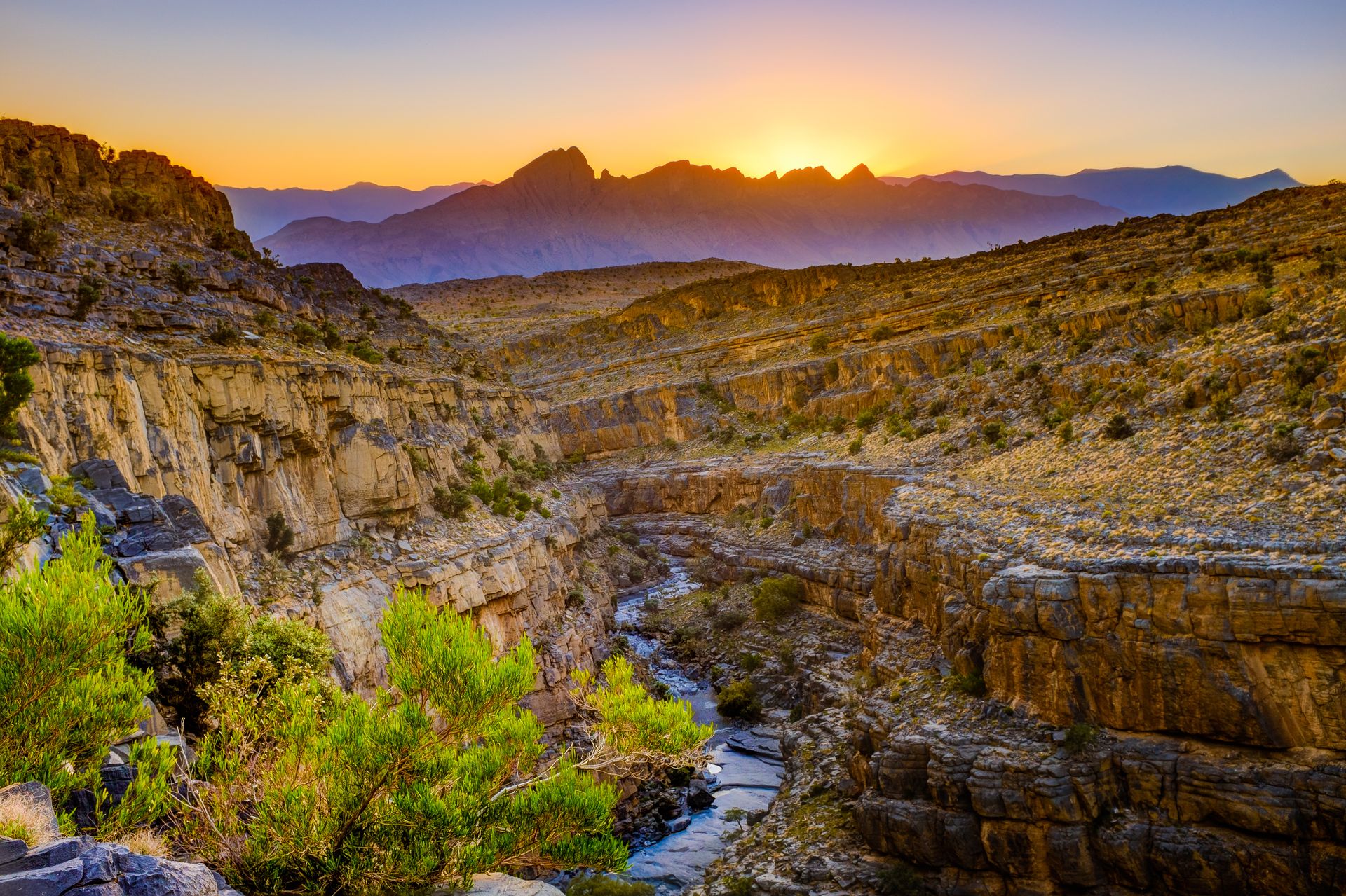
Oman's interior is accessible from Muscat by road. Nizwa, roughly 140 kilometers inland, was once the country's capital and retains its old fort and a lively weekly livestock market. The surrounding area contains several canyon systems — most notably Wadi Nakhr, a gorge of considerable depth that requires a four-wheel-drive vehicle and a local guide to reach properly.
The Wahiba Sands, a large desert area southeast of Nizwa, offers accessible dune landscape at a manageable distance from the capital. The eastern coast contains sea turtle nesting beaches at Ras al-Jinz, where a government-run reserve operates nighttime tours during nesting season from May through October. The far north of the country — the Musandam Peninsula — is separated from the rest of Oman by UAE territory and requires either a flight or a drive through the UAE. The fjord-like inlets of Musandam are among the most distinctive landscapes on the Arabian Peninsula.
Oman is consistently rated among the safest countries in the region. The country operates on conservative social norms — public behavior and dress should be modest, particularly outside Muscat — but foreign visitors are welcomed without the restrictions on movement that characterize some neighboring states. Alcohol is available in licensed hotels and certain restaurants in Muscat and other major cities.
The road network is excellent by regional standards. The main highway system is modern and well-maintained, and self-driving is practical for most of the major tourist routes. English is widely spoken in tourism contexts.
Jhampier Giron / Getty Images
Colombia's reputation for danger was built over several decades of conflict and drug-related violence that peaked in the 1990s. The country today is substantially different. The peace agreement signed in 2016 between the Colombian government and the FARC guerrilla organization ended the most significant armed conflict in the country's history. Major cities have developed robust tourism infrastructure, and international arrivals have grown steadily in the years since.
Citizens of the U.S., Canada, the U.K., and EU member states do not need a visa to enter Colombia for stays of up to 90 days, extendable to 180 days per calendar year. The main international airports are in Bogotá, Medellín, Cartagena, and Cali, with direct routes from North America and Europe.
Bogotá, the capital, sits on a high plateau at around 2,600 meters above sea level. The La Candelaria neighborhood preserves colonial-era architecture and contains several well-regarded museums. The Gold Museum — Museo del Oro — holds the world's largest collection of pre-Hispanic gold artifacts and is free to enter on Sundays.
Medellín is the city whose transformation has drawn the most international attention. Once listed among the most dangerous cities in the world, it has invested heavily in public infrastructure, including a metro system that incorporates gondola lines connecting hillside neighborhoods to the main transit network. The city hosts a major flower festival each August and has developed a competitive food and design scene.
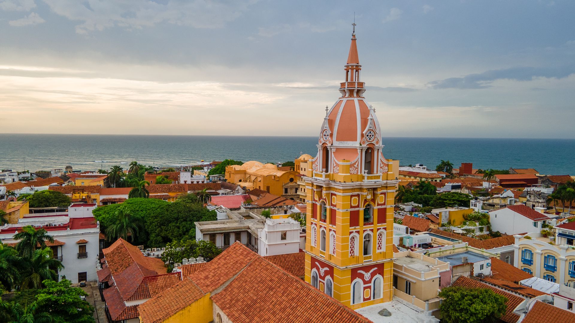
Cartagena, on the Caribbean coast, is a colonial walled city that has been a UNESCO World Heritage Site since 1984. The old city is dense with Spanish colonial architecture, plazas, and churches. The surrounding coast and nearby islands provide access to Caribbean beaches.
The coffee-growing region — known as the Eje Cafetero, or Coffee Axis — is centered around the departments of Caldas, Quindío, and Risaralda. The landscape here is steep green hillsides planted with coffee trees, traditional farmhouses called fincas, and the Cocora Valley, which is home to the wax palm — the tallest palm species in the world and the national tree of Colombia.
Security in Colombia is uneven. Major cities have tourist districts that function with low risk for visitors exercising standard urban caution. Some rural areas, particularly near the Venezuelan border and parts of the Pacific coast, involve real and ongoing security concerns. Travelers $TRV who check current conditions and stay within established urban and tourist routes can move through the country without unusual difficulty.
Terri Lea Mays / Getty Images
Rwanda is a small, landlocked country in central Africa, bordered by Uganda, Tanzania, Burundi, and the Democratic Republic of Congo. The 1994 genocide, which killed an estimated 800,000 people in roughly 100 days, shapes how many outsiders perceive the country. The Rwanda that exists now is distinct from that history in ways that matter for travel: it is among the most stable, orderly, and safe countries on the African continent.
Entry is straightforward. Most nationalities can obtain a visa on arrival at Kigali International Airport, or apply in advance through the government's Irembo online portal. Citizens of African Union member states can enter without a visa. The airport handles direct flights from major hubs including London, Brussels, Nairobi, and Dubai.
Kigali requires an adjustment of expectations. The city is very clean — plastic bags have been banned since 2008, and enforcement is strict enough that visitors are sometimes asked to surrender plastic-wrapped goods at the airport. It is also notably safe; walking in the city after dark is unusually relaxed by the standards of any major African capital. The Kigali Genocide Memorial is a significant and sober site that provides essential context for understanding the country's modern trajectory. A visit there is worthwhile regardless of your primary reason for coming.
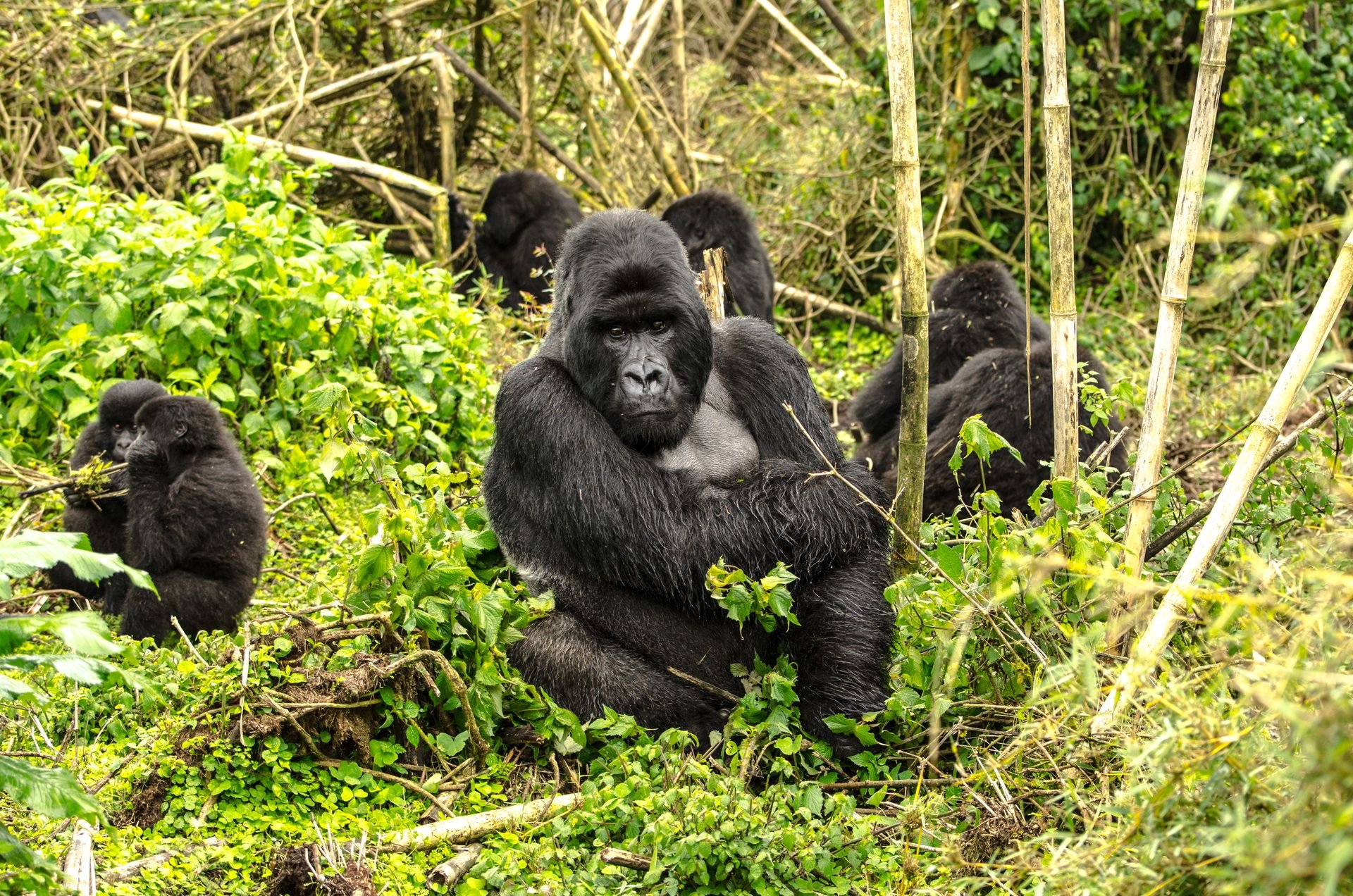
The primary draw for international visitors is gorilla trekking in Volcanoes National Park in the northwest. The park is home to mountain gorillas — a critically endangered species with a total wild population of around 1,000 individuals. The government manages access through a permit system that limits the number of visitors per day. Permits are expensive relative to the broader regional tourism market, but the experience of spending an hour in highland forest with a habituated gorilla family is difficult to compare with anything in conventional wildlife tourism.
Rwanda also shares Nyungwe Forest National Park with Burundi — a large, protected montane rainforest that is home to chimpanzees and a significant diversity of primate species. The Lake Kivu shoreline in the west has guesthouses and a growing number of upmarket lodges. The terrain across the country — often described as the land of a thousand hills — is consistently dramatic and makes for rewarding travel even without a specific destination in mind.
Infrastructure within Rwanda is good by regional standards. Roads are paved and maintained, public transport runs between major towns, and the government has made tourism facilitation a stated policy priority.
GoodLifeStudio / Getty Images
Serbia sits at the center of the Balkans, landlocked between Hungary to the north, Romania and Bulgaria to the east, and Croatia, Bosnia and Herzegovina, Montenegro, North Macedonia, and Kosovo to its south and west. It requires no visa for citizens of the U.S., Canada, Australia, the U.K., or the EU for stays of up to 90 days. Entry by air through Belgrade's Nikola Tesla $TSLA Airport, or by rail and bus from neighboring countries, is routine.
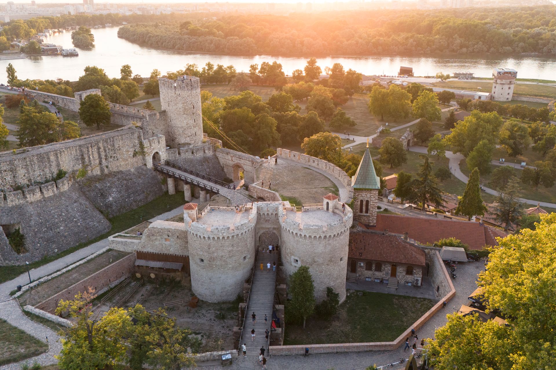
Belgrade, the capital, occupies the confluence of the Sava and Danube rivers. The Kalemegdan fortress, built on the headland where the two rivers meet, has been fought over and rebuilt by Romans, Byzantines, Ottomans, Austro-Hungarians, and Serbs across roughly two millennia. The adjacent Skadarlija cobblestone quarter is the city's traditional bohemian neighborhood — a short street lined with restaurants serving grilled meats and rakija, a fruit brandy that functions as the national drink and is produced in home quantities across the country.
Belgrade has a reputation for nightlife that is not exaggerated. The city has a cluster of floating clubs called splavovi moored along the rivers, as well as underground venues that run on a schedule distinct from most of western Europe — events that start late and continue well into the following day.
Beyond Belgrade, Serbia has genuine historical depth. Novi Sad, the second city, sits on the Danube and has a well-preserved Austro-Hungarian old town. The EXIT music festival, held each summer in Novi Sad's Petrovaradin Fortress, draws international visitors. The medieval Orthodox monasteries of the Raška region in the south represent an architectural tradition that is less known outside Eastern Europe than it deserves to be.
Food and accommodation are cheap by western standards. A full meal with drinks at a mid-range restaurant in Belgrade costs a fraction of what a comparable meal would cost in Vienna or Prague.
One complication is worth knowing before you book. Serbia does not recognize Kosovo's independence. Entry to Serbia with a Kosovo entry stamp in your passport can create problems at Serbian border crossings, and entering Kosovo with prior Serbian entry stamps may complicate crossing from the Kosovo side. Travelers $TRV planning to visit both countries should research current conditions and plan the sequence carefully.
Godong / Getty Images
Uzbekistan sits in the heart of Central Asia, landlocked between Kazakhstan, Kyrgyzstan, Tajikistan, Afghanistan, and Turkmenistan. For most of the post-Soviet period, it was difficult to visit — visa requirements were strict, registration regulations for tourists were complex, and the government did not prioritize international arrivals. That has changed. Since 2017, Uzbekistan has introduced an e-visa available to citizens of more than 90 countries, and citizens of many additional countries can now enter without a visa entirely.
The country's tourism appeal is centered on the Silk Road cities of Samarkand, Bukhara, and Khiva — three of the great historic cities of the Islamic world, all designated UNESCO World Heritage Sites.
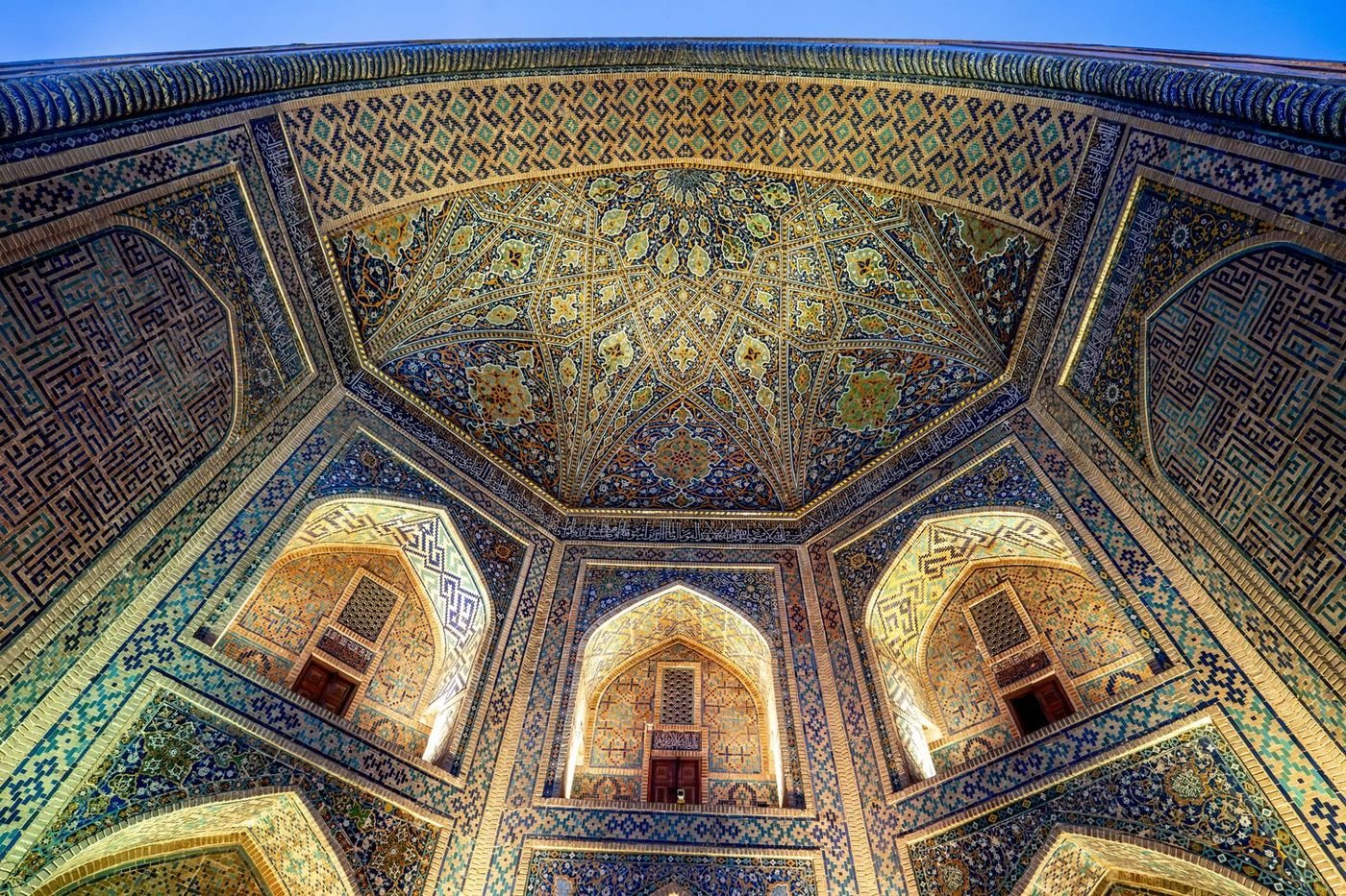
Samarkand is the most visited. The Registan, a public square framed by three madrassas decorated with elaborate geometric tilework, is among the most photographed architectural ensembles in Asia. The city was the capital of the Timurid Empire in the 14th and 15th centuries, and the scale and ambition of the buildings from that period still register clearly in person. The Shah-i-Zinda necropolis — a corridor of mausoleums built across several centuries on the edge of the city — is perhaps the more moving site. It is quieter, less comprehensively restored, and carries more visible historical complexity.
Bukhara is the better-preserved of the main cities. The old quarter is dense with functioning mosques, caravanserais, and covered bazaar domes — a trading city infrastructure operating in some form for more than two millennia. The Kalon Minaret, built in the 12th century, is said to have survived the Mongol invasion because Genghis Khan himself ordered it spared.
Khiva, in the far west, is the most intact. The inner city — the Ichan Kala — is a walled enclosure of palaces, mosques, and minarets, most of which date to the 18th and 19th centuries. It is small enough to walk completely in a day and is less touristed than Samarkand.
The Uzbek government has invested in tourism infrastructure — hotels, airport upgrades, and a high-speed train connecting Tashkent, Samarkand, and Bukhara. Travel between the main cities is practical and reasonably comfortable. Costs for accommodation and food are low. The national cuisine — plov, samsa, lagman — is Central Asian in character and often very good.
vovashevchuk / Getty Images
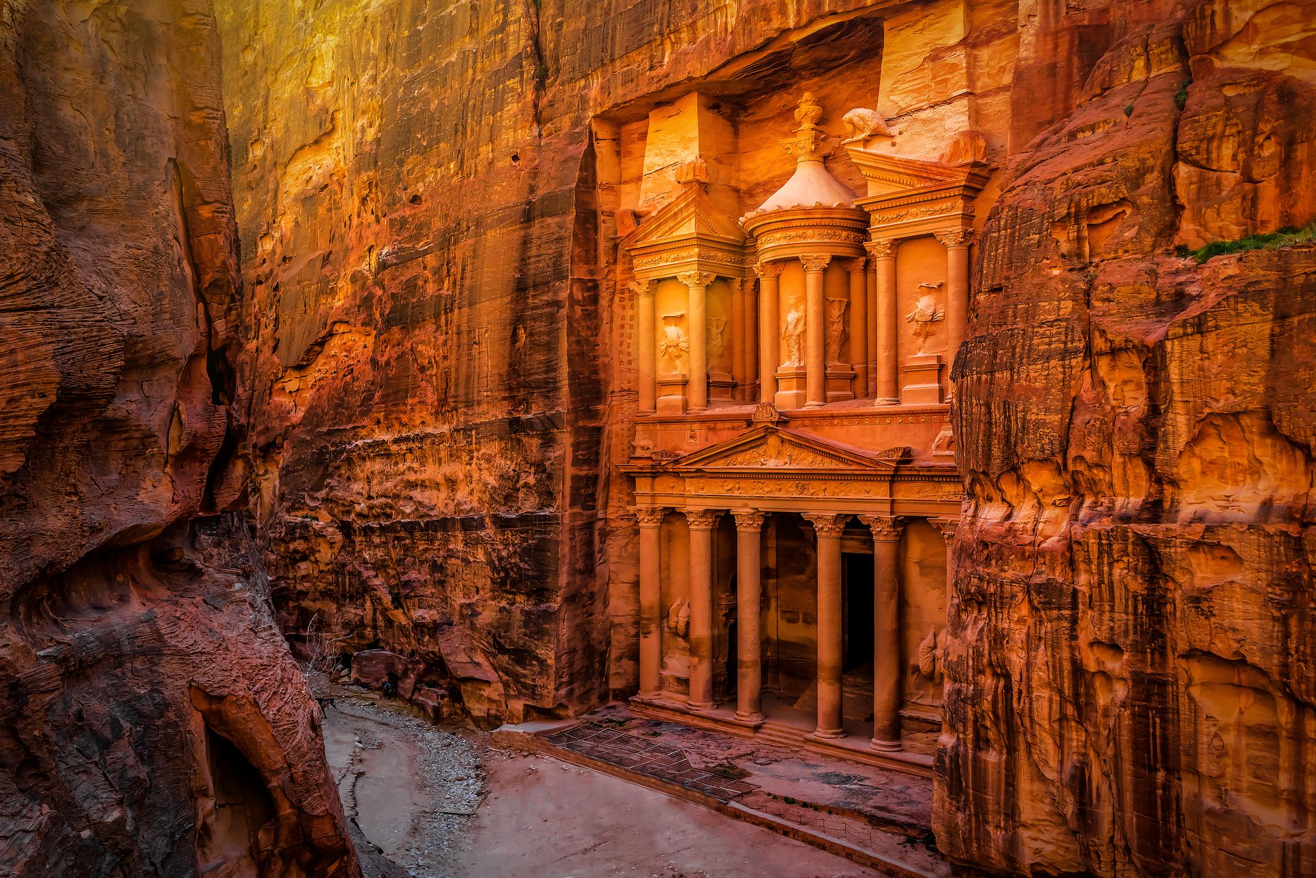
Jordan is one of the most tourist-ready countries in the Middle East, and one of the most consistently overlooked by travelers who default to Israel, Egypt, or the Gulf. Citizens of the U.S., the U.K., the EU, Canada, and Australia can obtain a visa on arrival at Queen Alia International Airport in Amman, or purchase one in advance online. The Jordan Pass — available online before travel — bundles a tourist visa with entrance tickets to more than 40 attractions, including Petra, and is widely used by independent travelers as a cost-effective way to manage both requirements at once.
Petra, the Nabataean city carved into rose-red sandstone cliffs in the south of the country, is the primary draw. The site covers roughly 264 square kilometers, most of it accessible on foot along ancient caravan paths. The Treasury — the façade most reproduced in photographs — is only the beginning of the site. The full city extends through a canyon-spanning complex of temples, tombs, colonnaded streets, and a monastery at the far end of a long uphill climb. A full day covers the main corridor comfortably but leaves significant portions unvisited.
The Wadi Rum desert, two hours south of Petra by road, is a sandstone and granite landscape of considerable scale — broad red valleys between sheer cliff faces, with a color range that shifts from ochre to deep burgundy depending on the light. The area is accessible through guided jeep tours or camel treks operated by Bedouin outfitters, and desert camping is available at several price points.
The Dead Sea, at roughly 430 meters below sea level, is the lowest point on earth's surface that is accessible by land. The water is so dense with dissolved minerals that flotation requires no effort. The Jordanian shore has a cluster of resorts.
Aqaba, on the Red Sea at the country's narrow southern coast, provides access to reef diving and snorkeling with consistently good visibility and dense marine life. The town is small and manageable.
Jordan is politically stable and has not experienced the conflicts that have affected several of its neighbors. The tourism infrastructure — hotels, guides, English-language road signs, well-maintained visitor centers at major sites — is among the most developed in the region.
YuliaGr / Getty Images
Armenia occupies a mountainous plateau in the South Caucasus, bordered by Georgia to the north, Azerbaijan to the east, Iran to the south, and Turkey to the west. Two of those four borders are closed: Turkey has kept its border with Armenia shut since 1993, and the border with Azerbaijan is not open due to the ongoing conflict over Nagorno-Karabakh. Despite those geographic constraints, Armenia is fully accessible by air through Zvartnots International Airport in Yerevan, or by land crossing from Georgia.
Citizens of the U.S., Canada, the U.K., and EU member states can enter without a visa for stays of up to 180 days — a notably generous allowance. The visa-free policy covers a long list of nationalities. Holders of other passports can apply for an e-visa online before traveling.
Yerevan, the capital, is a city built largely from pink volcanic tuff — a stone quarried from the nearby mountains that gives the skyline a warm, unified color tone unlike most other former Soviet capitals. The city has a compact, walkable center, several well-run museums, and a growing café and restaurant scene centered on Northern Avenue and the area around Republic Square $SQ.
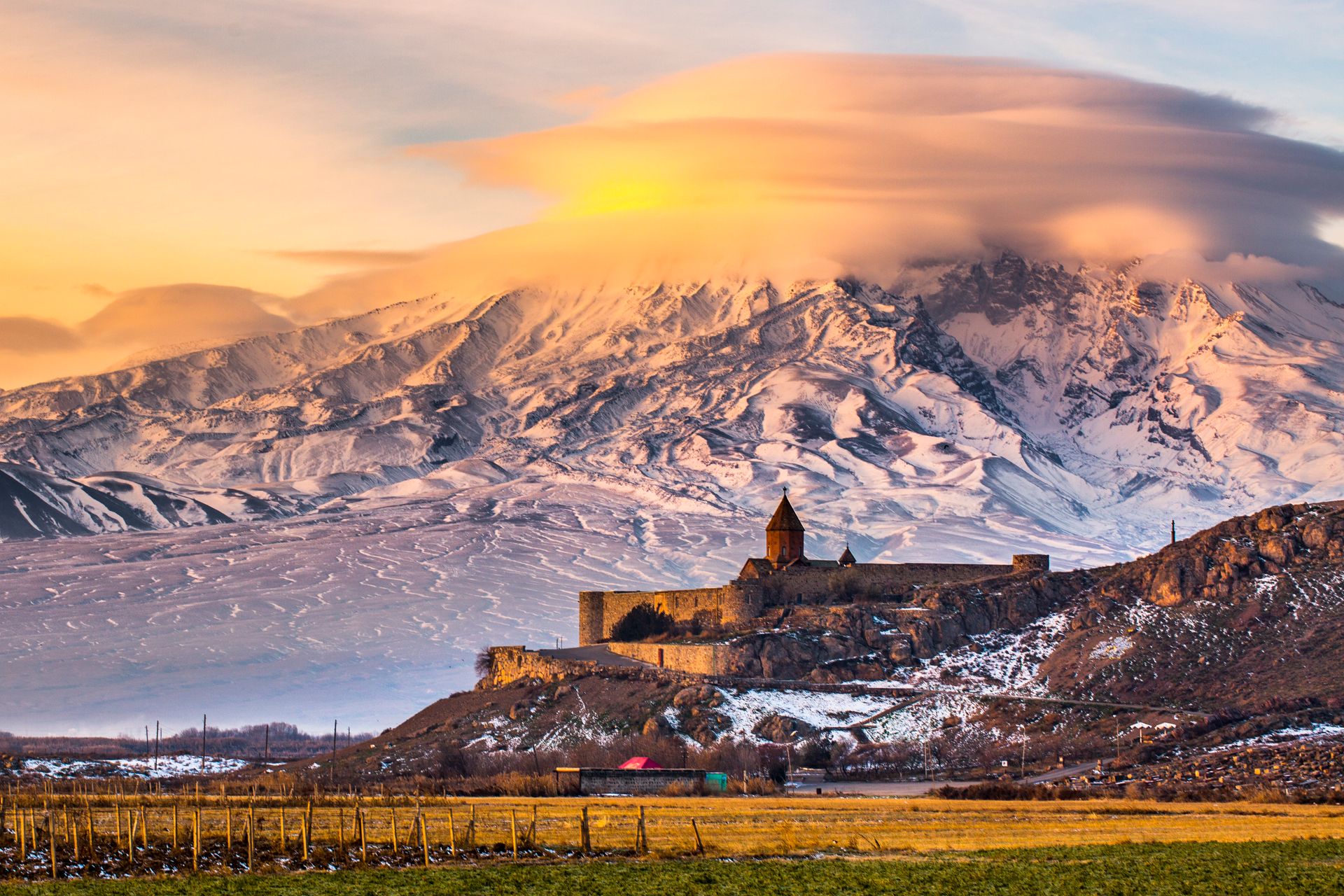
Armenia adopted Christianity as a state religion in 301 CE — the first nation to do so officially. The monasteries that survive from subsequent centuries are among the oldest continuously functioning Christian religious sites in the world. Khor Virap, a monastery near the Turkish border, is the most visited: it sits close enough to Mount Ararat that photographs of the monastery against the mountain have become emblematic of the country, even though Ararat itself has been on Turkish territory since 1921. Geghard Monastery, carved partly into a cliff face in a river gorge east of Yerevan, dates to the fourth century and is a UNESCO World Heritage Site.
Armenian brandy has a history that stretches back to the 19th century. The Ararat distillery in Yerevan offers tours of its production facility. Armenia also has a developing wine culture, with vineyards in the Ararat Valley and the Vayots Dzor region growing Areni grapes — a variety specific to the local high-altitude climate.
Food and accommodation costs in Yerevan are low by European standards. The city is safe, the infrastructure is functional, and English is spoken widely enough in tourist-facing contexts to make navigation straightforward.
joe daniel price / Getty Images
Montenegro is a small country on the Adriatic coast, roughly the area of Connecticut. It declared independence from Serbia in 2006 and has been pursuing EU membership since. Citizens of the U.S., the U.K., Canada, and EU member states can enter without a visa for stays of up to 90 days. The main entry points are Podgorica's airport, Tivat airport near the Bay of Kotor, and several land border crossings.
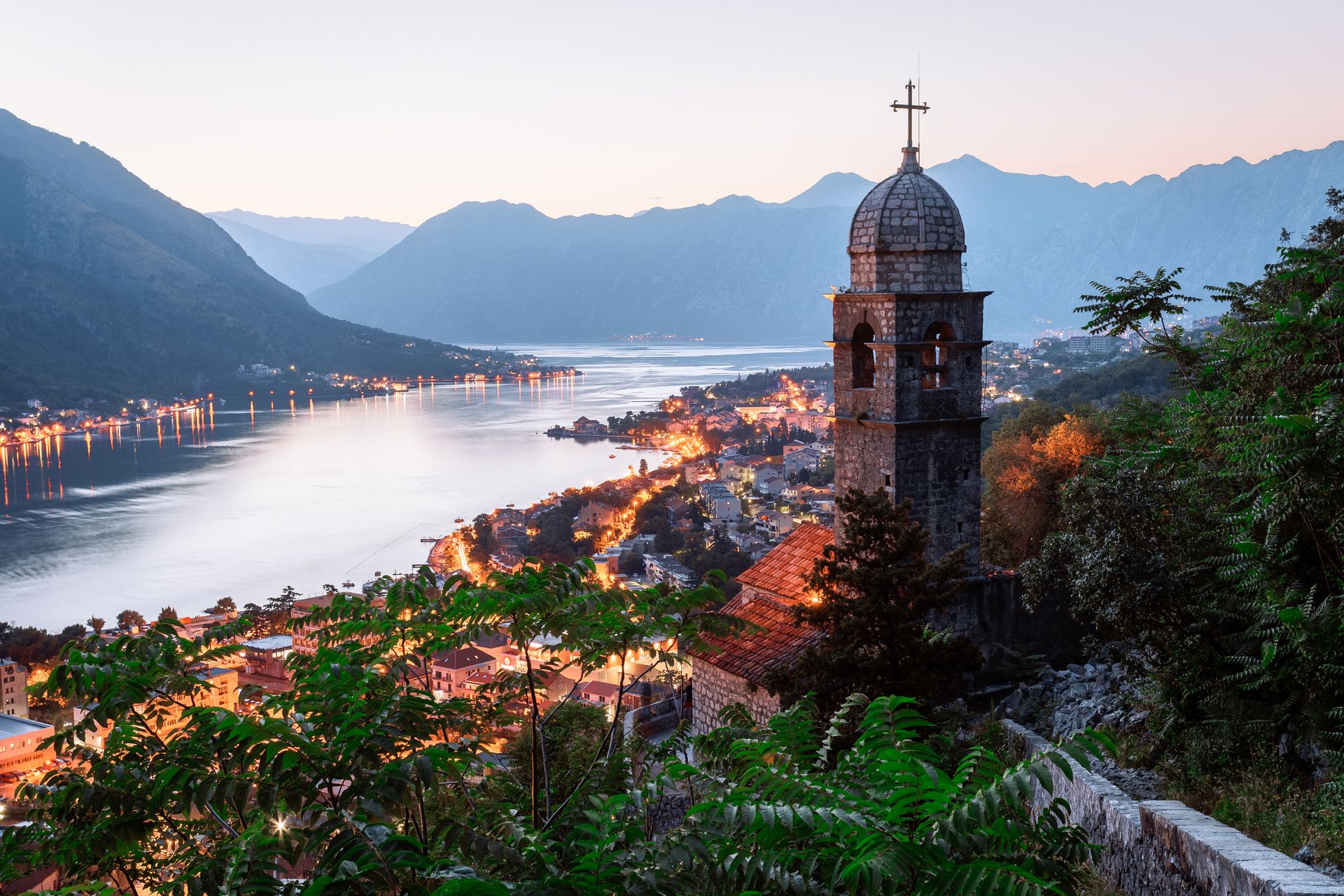
The Bay of Kotor is the defining landscape. It is a deep, winding bay — technically a submerged river canyon rather than a fjord, though it resembles one — that cuts inland from the Adriatic through a series of narrow passages and opens into a broader interior basin. The medieval walled town of Kotor sits at the far end of the inner bay, flanked by steep limestone cliffs. The town walls climb up the cliff face above the rooftops to a fortress at the top, and the hike to the summit takes about 45 minutes and provides views along the full length of the bay.
The coast from Kotor south to Herceg Novi is lined with small towns, old harbors, and beaches that draw regional visitors throughout the summer. The Budva Riviera south of Kotor is the most developed stretch — beach clubs, apartment rentals, and a busy summer season — and it can feel very crowded in July and August.
The interior of the country is almost entirely different in character. Durmitor National Park in the northwest is a high mountain area with glacial lakes, dense forest, and ski slopes used in winter. The Tara River Canyon, which runs along the park's northern edge, is one of the deepest river canyons in Europe and is a standard site for rafting.
Montenegro is small enough to drive across in a few hours, which makes it practical as a short trip or as part of a wider Balkans itinerary. The road from Kotor to Podgorica crosses the Lovćen massif via a switchback route that is steep but passable in ordinary weather.
Prices are lower than comparable Adriatic destinations in Croatia or Italy. The country uses the euro despite not being an EU member, which simplifies budgeting. Kotor and Budva have accommodation at a range of price points.
nantonov / Getty Images
Kyrgyzstan is a landlocked country in Central Asia, bordered by Kazakhstan to the north, China to the east, Tajikistan to the south, and Uzbekistan to the west. It is predominantly mountainous — more than 90 percent of the territory lies above 1,500 meters. Citizens of many countries, including the U.S., the U.K., and most EU member states, can enter without a visa for stays of up to 30 or 60 days depending on nationality. Most other nationalities can obtain an e-visa online within a few days.
The capital, Bishkek, is a former Soviet administrative center with wide boulevards, a grid layout, and more parks than most post-Soviet cities. It functions primarily as a logistics base for travelers — most people use it to arrange permits, gear, and onward transport before heading into the mountains. The Osh Bazaar is one of the largest and most active markets in the region and worth at least a morning.
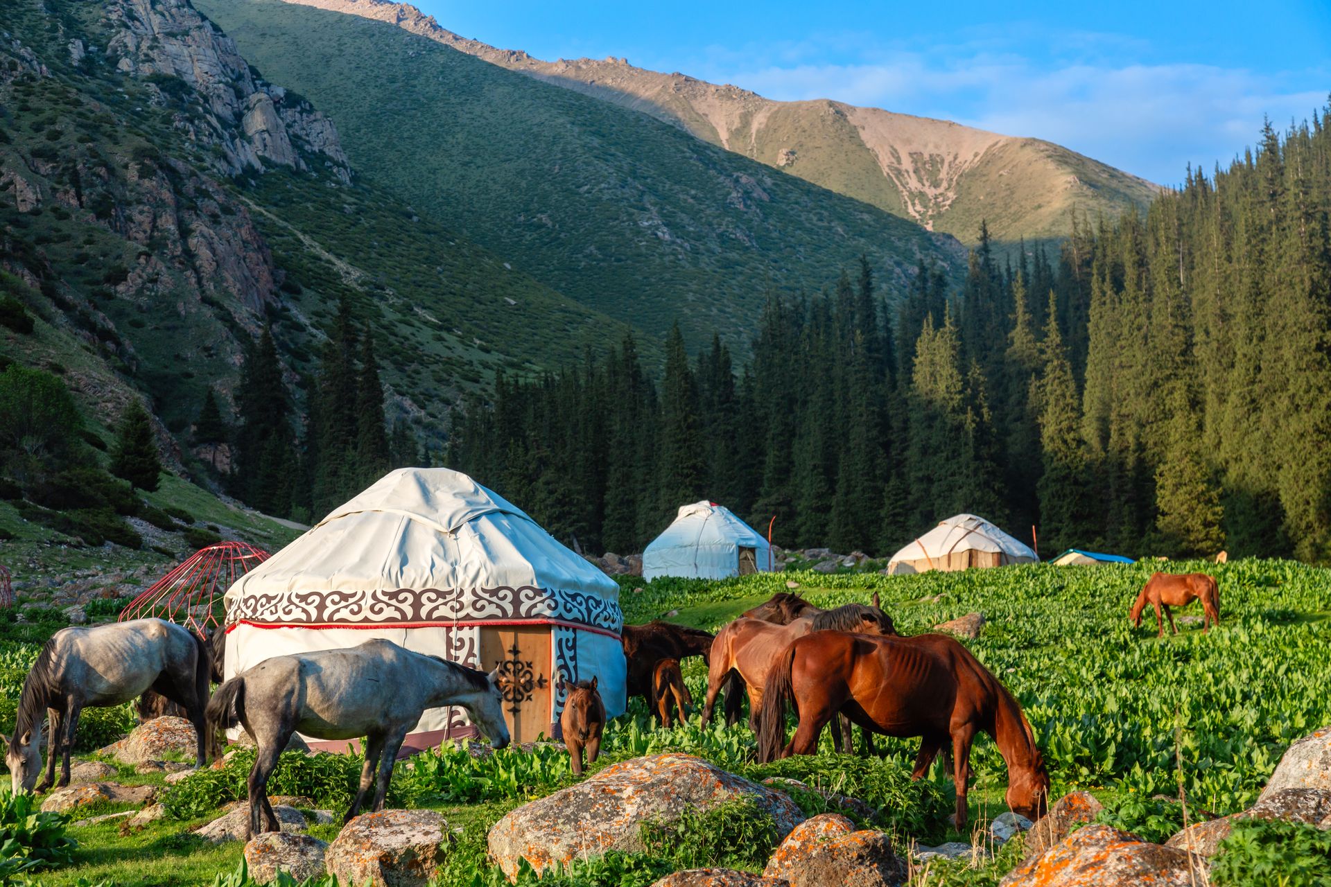
The landscape is why people come. The Tian Shan mountain range covers most of the country, and the alpine meadows — called jailoos — that spread across the high valleys are the traditional summer pastureland for nomadic herders. The nomadic culture is not a historical artifact: many Kyrgyz families still move livestock to high pasture in summer, living in traditional felt yurts. Tourism infrastructure has developed around this reality, and it is genuinely possible to stay with herding families in their yurts, eat traditional food including fermented mare's milk called kumiss, and travel by horse through terrain with no roads.
Issyk-Kul, a large alpine lake in the northeast, is the main organized tourist destination. At more than 1,600 meters above sea level, it remains unfrozen through the winter due to its salinity and thermal properties. The lake is surrounded by resorts and beaches that cater primarily to Kyrgyz and Kazakh domestic visitors, as well as guesthouses that serve international trekkers.
The Song-Kul lake, at roughly 3,000 meters, is more remote and has a more authentic jailoo character in summer months. Reaching it requires a vehicle suited to rough mountain roads.
Travel in Kyrgyzstan rewards flexibility. Distances between attractions can be long, mountain roads are rough, and infrastructure in remote areas is basic. Community-based tourism organizations operating in several valleys can connect travelers with local guides and accommodation.
Godong / robertharding / Getty Images
Kosovo declared independence from Serbia in 2008 and is now recognized by more than 100 UN member states — though not by Serbia, Russia, China, or several others. That geopolitical complexity has made some travelers reluctant to visit. The practicalities of entry are straightforward for citizens of most Western nations. U.S., U.K., Canadian, and EU passport holders can enter without a visa for stays of up to 90 days. There are no fees and no prior application for these nationalities.
One complication is worth knowing before booking. Serbia does not recognize Kosovo's immigration documents. Entry to Serbia directly from Kosovo, or presenting a Kosovo entry stamp to Serbian border officials, can cause difficulty. Travelers $TRV who plan to visit both countries should research current conditions and plan the sequence carefully. Citizens of countries that do not recognize Kosovo — including Russia and China — face their own complications that vary by circumstance.
Pristina, the capital, is a small city that wears its recent history openly. The National Library, a brutalist 1982 building with a dome covered in chain-link mesh, is one of the more architecturally discussed buildings in southeastern Europe. A large statue of Bill Clinton stands on the main boulevard — a reflection of the significant role U.S. intervention played during the 1999 conflict. The city is lively rather than polished; it has a café culture, an active bar scene, and a young population.
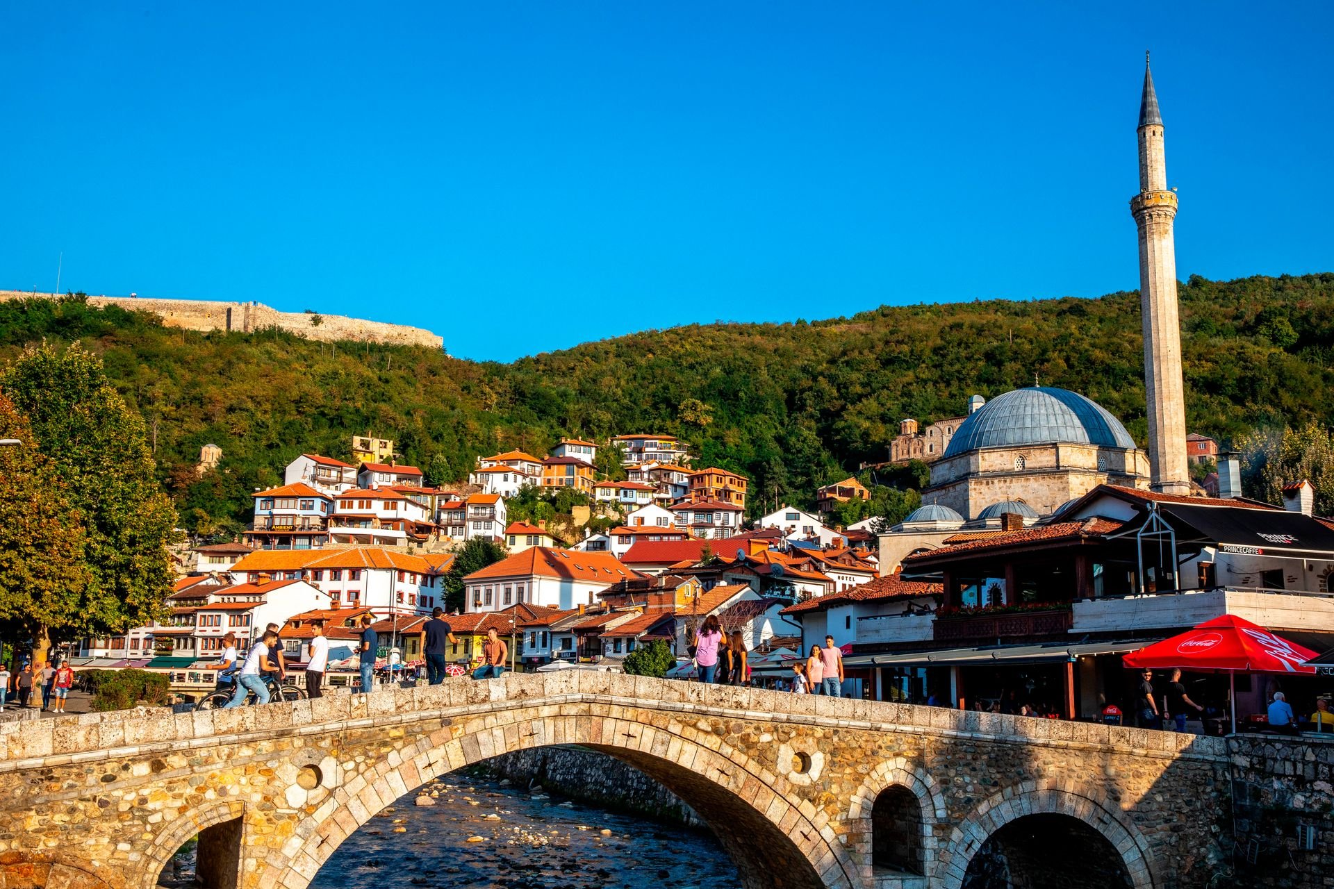
Prizren, in the south, is the more historically layered city. Its old town contains an Ottoman-era bazaar, a 14th-century Byzantine church converted to a mosque during Ottoman rule, and a fortress overlooking the town and the surrounding hills. The League of Prizren — an Albanian nationalist organization formed in 1878 — met here, and its original meeting house is preserved as a museum. Prizren also hosts a major documentary film festival each June.
The Rugova Canyon west of Peja is a dramatic river gorge with hiking trails and monasteries accessible from the canyon road. The Visoki Dečani Monastery near Peja, built in the 14th century, is a UNESCO World Heritage Site and one of the best-preserved medieval monasteries in southeastern Europe.
Kosovo is very affordable. Food and accommodation are among the cheapest in Europe. The country uses the euro, which simplifies cash management for European visitors.
MisoKnitl / Getty Images
Paraguay is the most overlooked country in South America, and possibly the most overlooked country on this list. Landlocked between Brazil, Argentina, and Bolivia, it receives a fraction of the tourist traffic of its neighbors — not because it lacks accessible entry or worthwhile destinations, but because it has never developed the international tourism profile that would bring it to travelers' attention. Citizens of the U.S., Canada, the U.K., and most EU countries can enter without a visa for stays of up to 90 days.
Asunción, the capital, is one of the oldest continuously inhabited cities in South America, founded by Spanish colonizers in 1537. It spreads along the eastern bank of the Paraguay River in a relatively flat landscape. The city does not have a concentrated historic center in the way of many South American capitals — it was partially rebuilt following various conflicts — but the Palacio de los López government building and several 19th-century structures along the Costanera riverfront are worth seeing. The city is navigable and hospitable without being organized around international tourism.
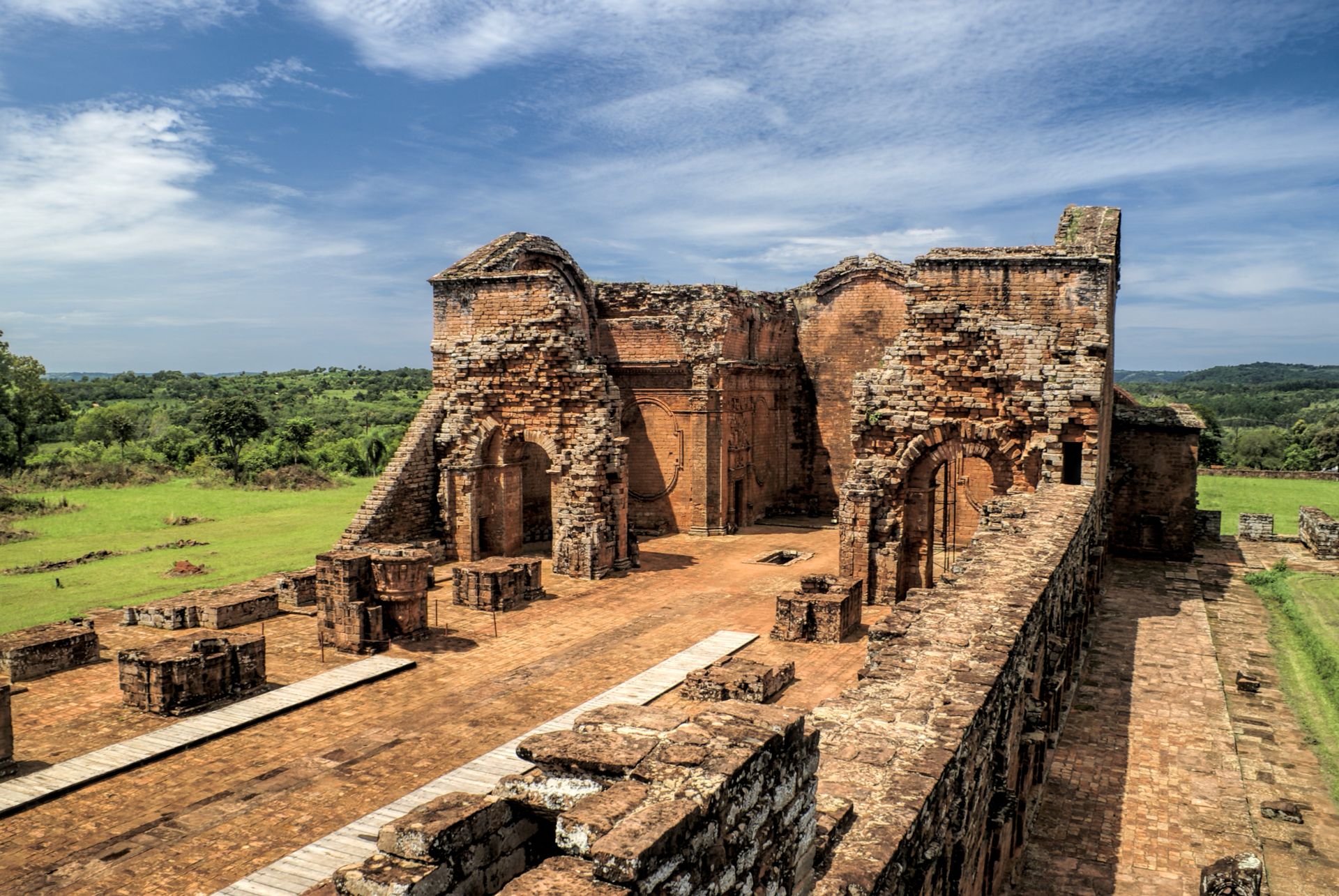
The Jesuit missions of La Santísima Trinidad de Paraná and Jesús de Tavarangue, in the southeastern department of Itapúa, are the country's only UNESCO World Heritage Sites. The Jesuit order established a series of settlements among the Guaraní people in the 17th and 18th centuries. The ruins at these two sites represent some of the best-preserved mission architecture in South America. Trinidad, the larger of the two, has a recognizable residential core, a central church, and a system of plazas that communicate the ambition of the mission project. The sites can be visited as a day trip from the nearby city of Encarnación.
The Gran Chaco in the west — a vast, flat, and largely unpopulated lowland — covers more than 60 percent of Paraguay's territory and extends into Bolivia and Argentina. Travel there is genuinely challenging and requires preparation, but for specialists in birding and wildlife, the Chaco contains a density and diversity of species rarely encountered elsewhere.
Paraguay is not a country with a clear narrative to sell to international tourism markets. That is part of what makes it interesting. The Guaraní language remains a co-official language alongside Spanish, and a significant portion of the population speaks it as a first language — a cultural continuity unusual in South America.
Preto_perola / Getty Images
Laos is a landlocked country in Southeast Asia, bordered by China, Vietnam, Cambodia, Thailand, and Myanmar. It is the least visited country on the mainland by international tourist numbers — partly because it lacks the beach culture of Thailand, and partly because it has historically been overlooked in favor of its neighbors. In practical terms, visiting is not difficult. Most nationalities can obtain a 30-day tourist visa on arrival at major entry points, and an e-visa is available online before travel for citizens of many countries.
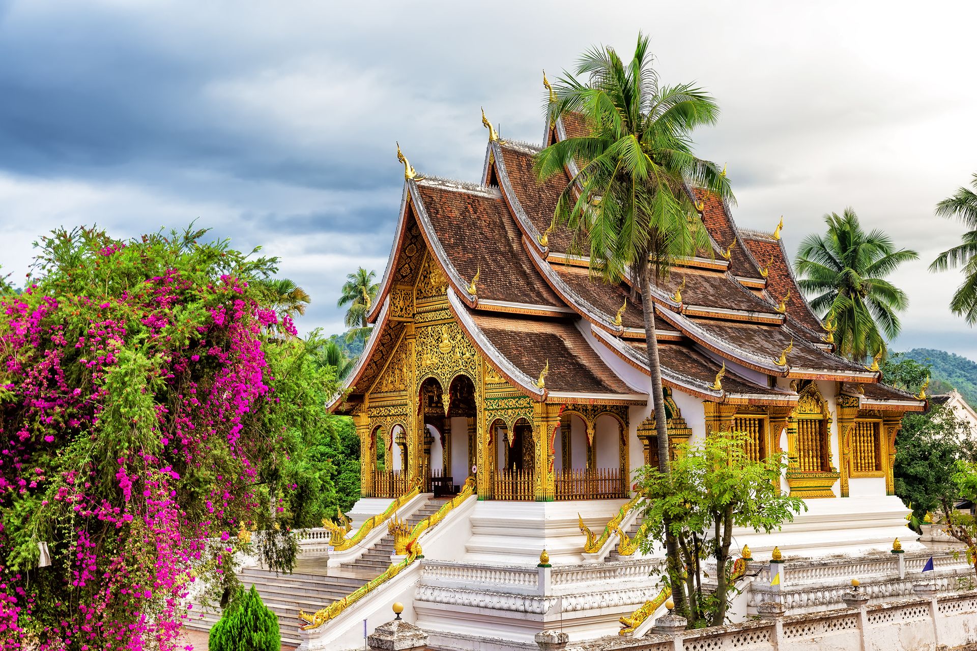
Luang Prabang, the former royal capital in the north, is the primary draw for most visitors. The town sits at the confluence of the Mekong and Nam Khan rivers on a narrow peninsula. It is compact enough to cover on foot or by bicycle. The streets of the old town — a UNESCO World Heritage Site since 1995 — are lined with French colonial buildings and Buddhist temple compounds called wats. The daily alms-giving ceremony at dawn, during which monks walk through the streets collecting rice from residents, is one of the most visited scenes in the city. It has become complicated by the presence of tourists who photograph it from close range, and it is worth observing from a respectful distance rather than joining the organized spectator crowds.
The Mekong River is navigable north of Luang Prabang, and the slow boat journey from the Thai border town of Huay Xai takes two days. Passengers ride on wooden benches through river valley scenery for roughly 10 hours each day. The route has been part of the overland Southeast Asia circuit for decades and remains one of the more atmospheric river journeys in the region.
Vang Vieng, a small town on the Nam Song River south of Luang Prabang, is surrounded by karst limestone formations and accessible caves. It went through a period of intense and unsafe party tourism in the 2000s and early 2010s and has since rebalanced. The landscape is genuinely dramatic and the outdoor activities — kayaking, caving, hot air balloon flights — have become a mainstream offering at a range of prices.
Vientiane, the capital, is an unusually quiet capital city for Southeast Asia — low-rise, not dense, with a pace that differs noticeably from Bangkok or Hanoi. The COPE Visitor Centre, which documents the legacy of unexploded ordnance from the American bombing campaign during the Vietnam War era, is one of the more important sites in the city. Laos was the most heavily bombed country per capita in history during that period, and a significant amount of ordnance remains active in rural areas.
Oleg_0 /Getty Images
Moldova is among the smallest and least-visited countries in Europe. It is landlocked between Romania to the west and Ukraine to its north, east, and south, and it does not appear on most travelers' itineraries even after repeated trips to neighboring countries. Citizens of the EU, the U.S., and the U.K. can enter without a visa for stays of up to 90 days. Holders of many other major passports can also enter without a visa or obtain one on arrival.
The capital, Chișinău, was largely rebuilt after a 1940 earthquake and extensive World War II damage, giving it a predominantly Soviet-era street plan. It is not a conventionally picturesque city, but it has a functioning café culture, a lively central market, and several well-organized museums. The National Museum of History of Moldova covers the country's development from prehistoric times through the present.
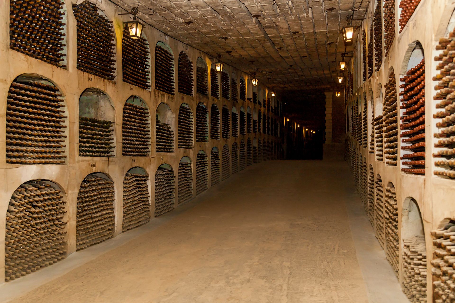
Moldova has a serious claim to recognition as a wine destination. Viticulture in the region dates back thousands of years, and Moldova has one of the highest vineyard densities relative to total land area of any country in the world. The Cricova winery, roughly 15 kilometers north of Chișinău, has an underground cellar system with approximately 120 kilometers of tunnels cut from the limestone bedrock. Visitors tour the cellars by electric vehicle. The collection held there includes bottles recovered from Nazi storage facilities after World War II — a detail that says something specific about the depth of the country's wine history.
The Milestii Mici winery, also near Chișinău, holds a Guinness World Record for the largest wine collection, with millions of bottles stored in underground galleries that run for more than 200 kilometers.
Transnistria, a narrow strip of territory along the Dniester River in the east, is a self-declared state not recognized by any UN member. It separated from Moldova in a short armed conflict in 1992 and operates under its own government, currency, and military with Russian backing. Visitors can cross from Moldova into Transnistria with a standard passport and receive a registration document at the checkpoint. The main town, Tiraspol, retains Soviet-era aesthetics — statues, mosaics, and official buildings that look largely unchanged from the 1980s. Most visitors spend a day and return to Moldova without difficulty.
emicristea / Getty Images
North Macedonia, officially the Republic of North Macedonia since 2019, is a small landlocked country in the central Balkans. It is bordered by Serbia to the north, Kosovo to the northwest, Albania to the west, Greece to the south, and Bulgaria to the east. Citizens of the U.S., Canada, the U.K., and EU member states can enter without a visa for stays of up to 90 days. The country is in active EU accession negotiations.
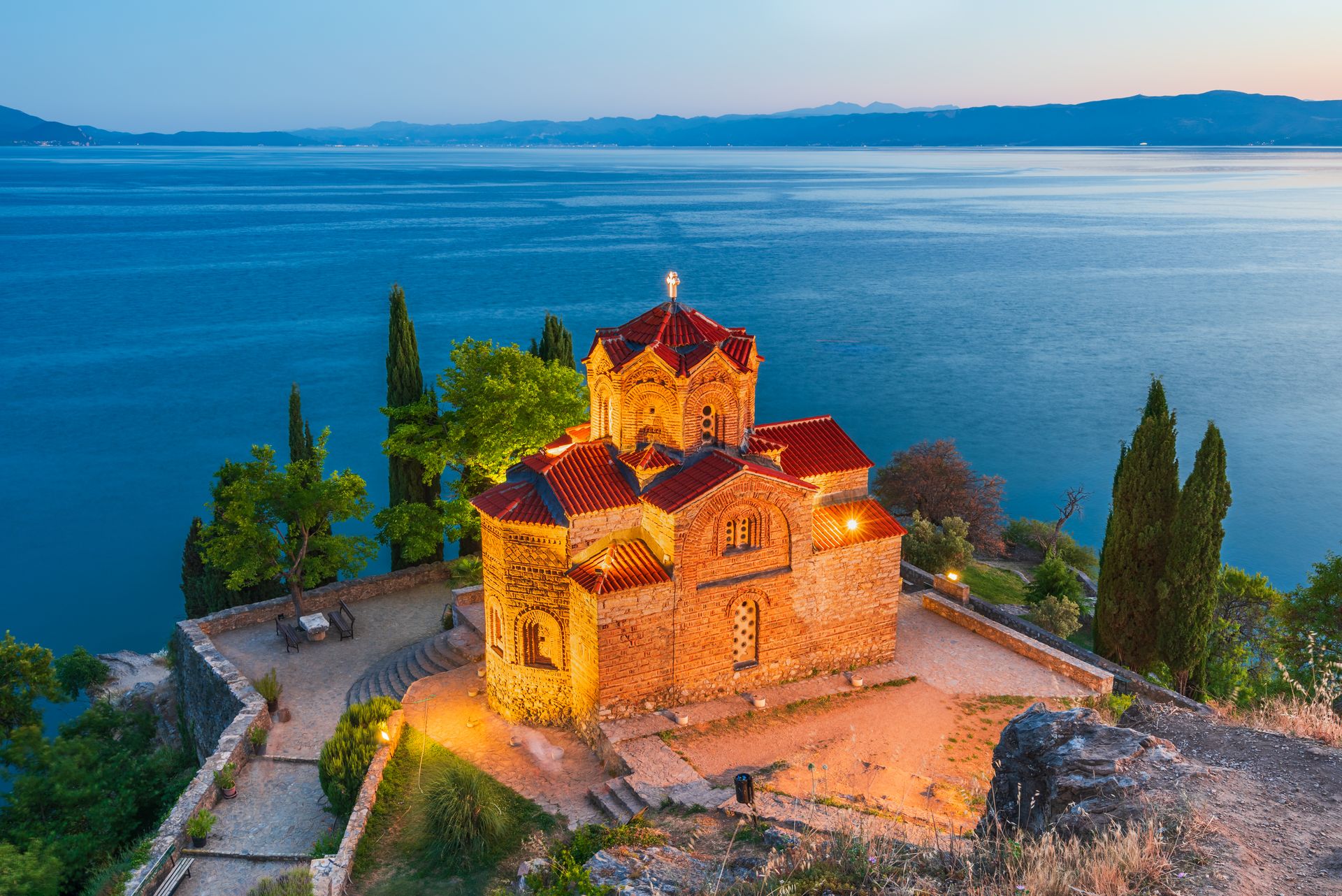
Ohrid, on the shores of Lake Ohrid in the southwest, is the most visited destination in the country. The old town sits on a hillside above the lake and contains more than 300 Byzantine-era churches — an unusually high density for a town of its size, reflecting Ohrid's role as a major religious center from the ninth century onward. Several of those churches, including the Church of Saint John at Kaneo, are still active and occupy positions on cliffs directly above the water. The lake itself is one of the oldest in the world — estimated between two and three million years — and contains numerous species found nowhere else. Ohrid received UNESCO designation in 1979 for both its cultural monuments and its natural properties.
Skopje, the capital, went through a major and controversial urban renovation project starting around 2010 under a government program called Skopje 2014. The initiative added dozens of neoclassical-style buildings, monuments, and fountains to the city center — a design vision intended to project historical depth that struck many architects and residents as theatrical and mismatched with the city's actual history. The result is a city center unlike any other in Europe: dense with monuments, simultaneously busy and odd in its artificiality. The Ottoman-era Old Bazaar, which survived relatively intact, is the more authentic historical area — a network of craft workshops, mosques, and markets that has been functioning since the 15th century.
North Macedonia has a culinary tradition built around grilled meats, fresh salads, and a sheep's milk cheese called sirenje. The country produces wine primarily in the Tikveš region in the south. Prices for food and accommodation are among the lowest in Europe.
The landscape outside the main cities includes Mavrovo National Park — a protected mountain area with forest, ski slopes, and a reservoir — and the Matka Canyon near Skopje, which is accessible as a half-day excursion from the capital by road or boat.
nmessana / Getty Images
Saudi Arabia opened to international tourism in September 2019, making it one of the most recently opened major destinations in the world. For most of its modern history, the country issued visitor visas only to religious pilgrims traveling to Mecca and Medina, to business travelers, and to guests of Saudi residents. That changed with the introduction of a tourist e-visa available to citizens of 49 countries, including the U.S., the U.K., Canada, Australia, and most EU member states. The application is completed online and typically approved within minutes.
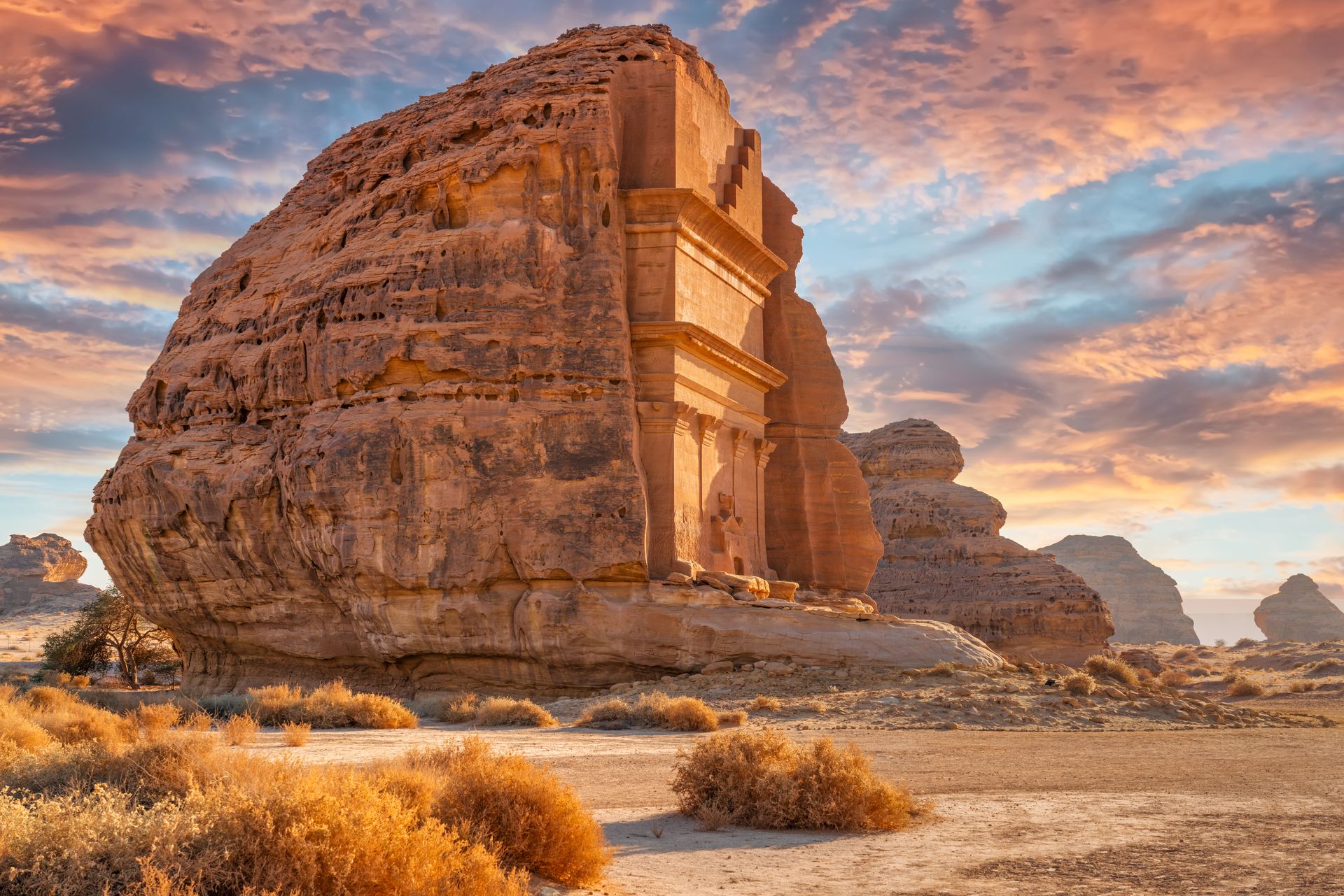
The primary non-religious heritage site is Hegra — also known as Mada'in Saleh — a Nabataean city in the Hejaz region of the northwest. The Nabataeans were the same civilization that built Petra in Jordan, and Hegra is their second-largest known city, with more than 100 monumental tombs carved into sandstone rock formations across a desert landscape. Until the tourism opening in 2019, the site was essentially inaccessible to international visitors. It is now served by direct flights into the nearby Al-Ula airport and has a modern visitor center. The oasis town of Al-Ula, which manages the surrounding heritage area, has developed into a significant hospitality destination with designed camps and lodges.
Jeddah, on the Red Sea coast, is the commercial city with the most developed international infrastructure. Al-Balad, the historic center of Jeddah, is a UNESCO World Heritage Site — a quarter of coral-stone buildings with elaborately carved wooden screens called rawasheen on the upper-floor facades. The district dates to the seventh century and served for centuries as the main gateway city for pilgrims traveling to Mecca and Medina before the modern airport era.
Riyadh, the capital, is primarily a business and administrative city. The Diriyah district on the outskirts — the founding site of the Saudi state in the 18th century — has been developed as a heritage destination. The At-Turaif area within Diriyah is a UNESCO World Heritage Site.
Several practical realities apply. Non-Muslim visitors cannot enter Mecca or Medina. Modest dress — covering shoulders and knees — is expected in public and required at religious sites. Alcohol is not available to tourists anywhere in the country. Ramadan affects business hours and public eating. These constraints are real and clearly defined, not ambiguous, which makes planning around them straightforward.
Didier Marti / Getty Images
Egypt has been a tourist destination for longer than almost anywhere else in the world — ancient Greek travelers made pilgrimages there to see the pyramids, which were already 2,000 years old. Despite its familiarity as a concept, many travelers stay away because of security concerns, travel advisories, or a sense that navigating the country is too complicated. The main tourist sites have robust infrastructure, the e-visa system works for most nationalities, and tens of millions of visitors pass through the country each year.
The visa situation is simple: an e-visa is available online for citizens of the U.S., U.K., Canada, Australia, EU member states, and many others. Applications go through the official Egyptian government portal and are typically approved within a few days. Citizens of some countries can also obtain a visa on arrival at Cairo International Airport.
Cairo is a city of roughly 20 million people — a megacity that is noisy, dense, and demanding to navigate but also layered with history at a depth few cities can match. The Egyptian Museum in central Cairo holds the world's largest collection of pharaonic artifacts, including the full contents of Tutankhamun's tomb. The Grand Egyptian Museum, a new facility near the Giza plateau that has been opening in phases, is designed to present the collections with space and context that the old building could not accommodate.
The Giza pyramids complex, on the edge of the metropolitan area, contains the three great pyramids of the Fourth Dynasty along with the Sphinx. The site is accessible by taxi or guided tour from any hotel in Cairo. It is heavily visited and has a substantial vendor presence, but the scale of the monuments communicates through the noise.
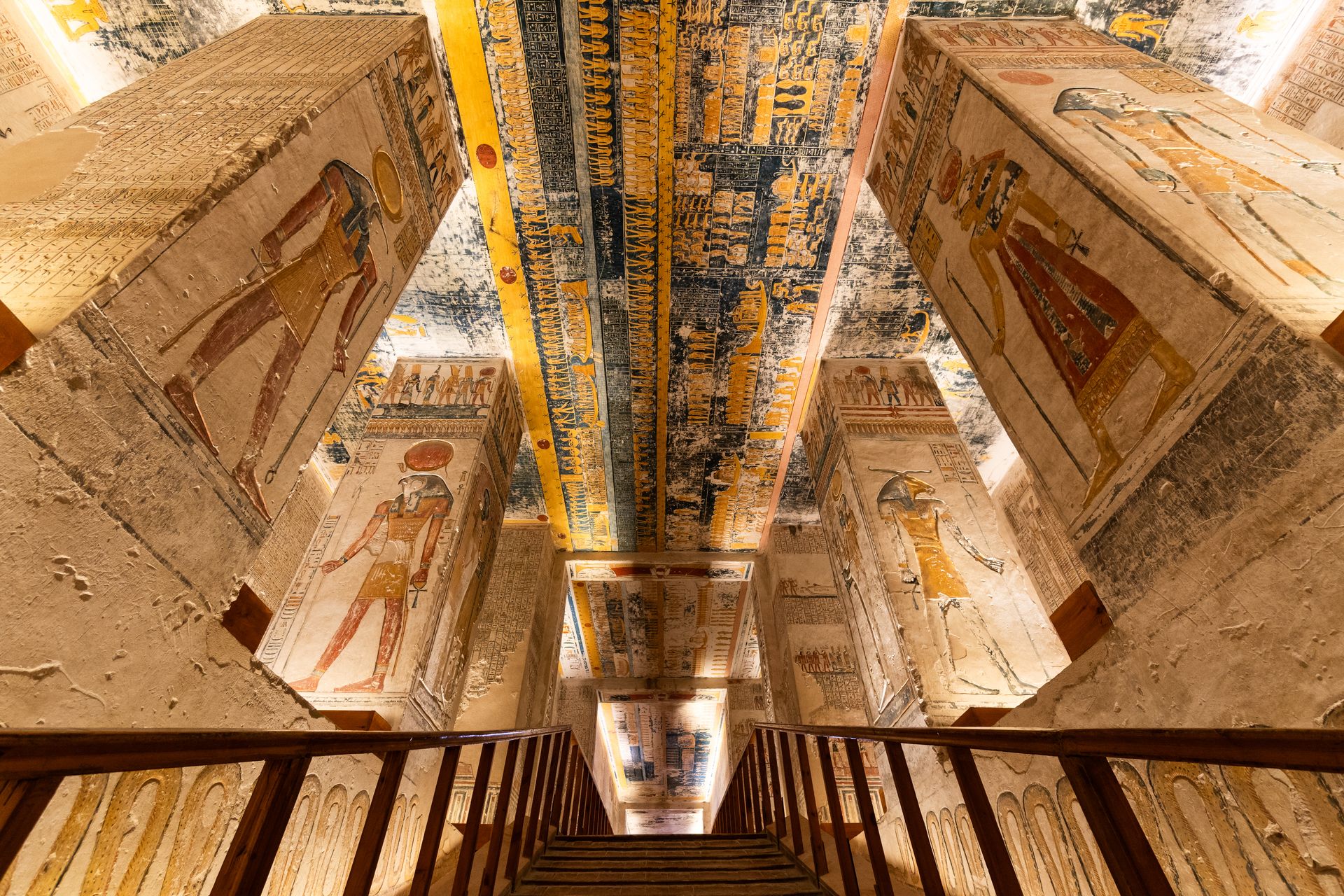
Luxor, roughly 700 kilometers south of Cairo, is the site of ancient Thebes. The east bank contains the Karnak and Luxor temple complexes; the west bank contains the Valley of the Kings, where royal tombs from the New Kingdom period are cut into limestone cliffs. Many tombs are open to visitors, and the painted chambers of several — including the tomb of Ramesses VI — are among the most elaborately decorated spaces surviving from antiquity.
The security situation in Egypt varies by region. The northern Sinai Peninsula has experienced ongoing instability. The main coastal resorts of Sharm el-Sheikh and Dahab on the southern tip of the peninsula are geographically and operationally separate from the problem areas. Travelers $TRV who follow current foreign ministry guidance and stay within established tourist corridors navigate Egypt without unusual difficulty.
Dukas / Getty Images
Bolivia is a landlocked country in central South America, bordered by Peru, Chile, Argentina, Paraguay, and Brazil. It contains some of the most distinctive landscapes on the continent — high-altitude salt flats, the world's highest navigable lake, and a seat of government at an elevation that triggers altitude sickness in many new arrivals before they have done anything strenuous.
Citizens of the U.S., Canada, Australia, and most EU countries do not need a visa to enter Bolivia for stays of up to 90 days. Entry by air through El Alto International Airport, which serves La Paz, is the standard route for most international visitors.
Altitude is the most significant practical consideration. La Paz sits at roughly 3,600 meters above sea level. El Alto, the city on the plateau above La Paz where the airport is located, sits above 4,000 meters. Altitude sickness — characterized by headache, nausea, fatigue, and in serious cases fluid accumulation in the lungs — is a genuine risk for travelers arriving from lower elevations. Most people experience at least mild symptoms. The standard approach is to take the first one or two days slowly, drink water consistently, and avoid alcohol until acclimatized.
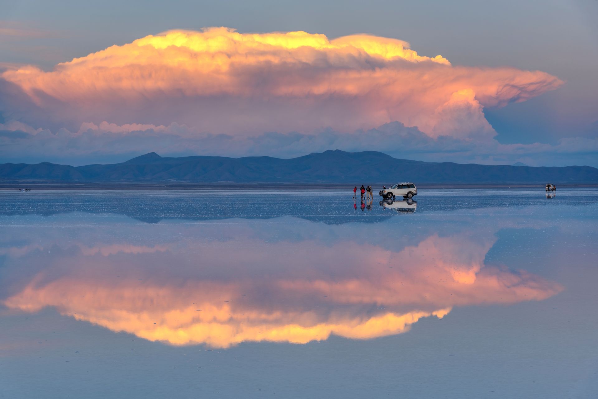
The Salar de Uyuni, at roughly 10,000 square kilometers, is the largest salt flat in the world. It sits at approximately 3,650 meters on the altiplano in southwestern Bolivia. During the dry season, the surface is a flat expanse of white crystallized salt extending to the horizon. During the rainy season, a thin layer of water covers the surface and creates a mirror effect that reflects the sky. Tours from the town of Uyuni run across the flat to the active volcano of Tunupa, to the island of Incahuasi — which rises from the salt and is covered in giant cacti — and to the Eduardo Avaroa Andean Fauna National Reserve near the Chilean border.
Lake Titicaca, on the border with Peru, sits at about 3,800 meters and covers roughly 8,400 square kilometers, making it the largest lake in South America by volume and the highest commercially navigable lake in the world. The Bolivian side is anchored by the town of Copacabana, from which boats run to the Isla del Sol. The island contains Inca ruins and traditional villages accessible on foot.
Sucre, the constitutional capital, sits at the lower elevation of about 2,750 meters and is a more comfortable acclimatization point. Its colonial architecture is well-preserved, and it is one of the oldest Spanish colonial cities in the Americas.
Nikada / Getty Images
Namibia is a large, sparsely populated country on the southwest coast of Africa, bordered by Angola, Zambia, Botswana, South Africa, and the Atlantic Ocean. It is frequently cited as one of the safest countries in sub-Saharan Africa, and it has a tourism infrastructure — particularly in its national parks — that is genuinely developed for independent travel. English is the sole official language, which significantly lowers the navigation barrier for most international visitors.
Citizens of the U.S., the U.K., the EU, Canada, and Australia can enter without a visa for stays of up to 90 days. Arrivals at Hosea Kutako International Airport outside Windhoek are straightforward.
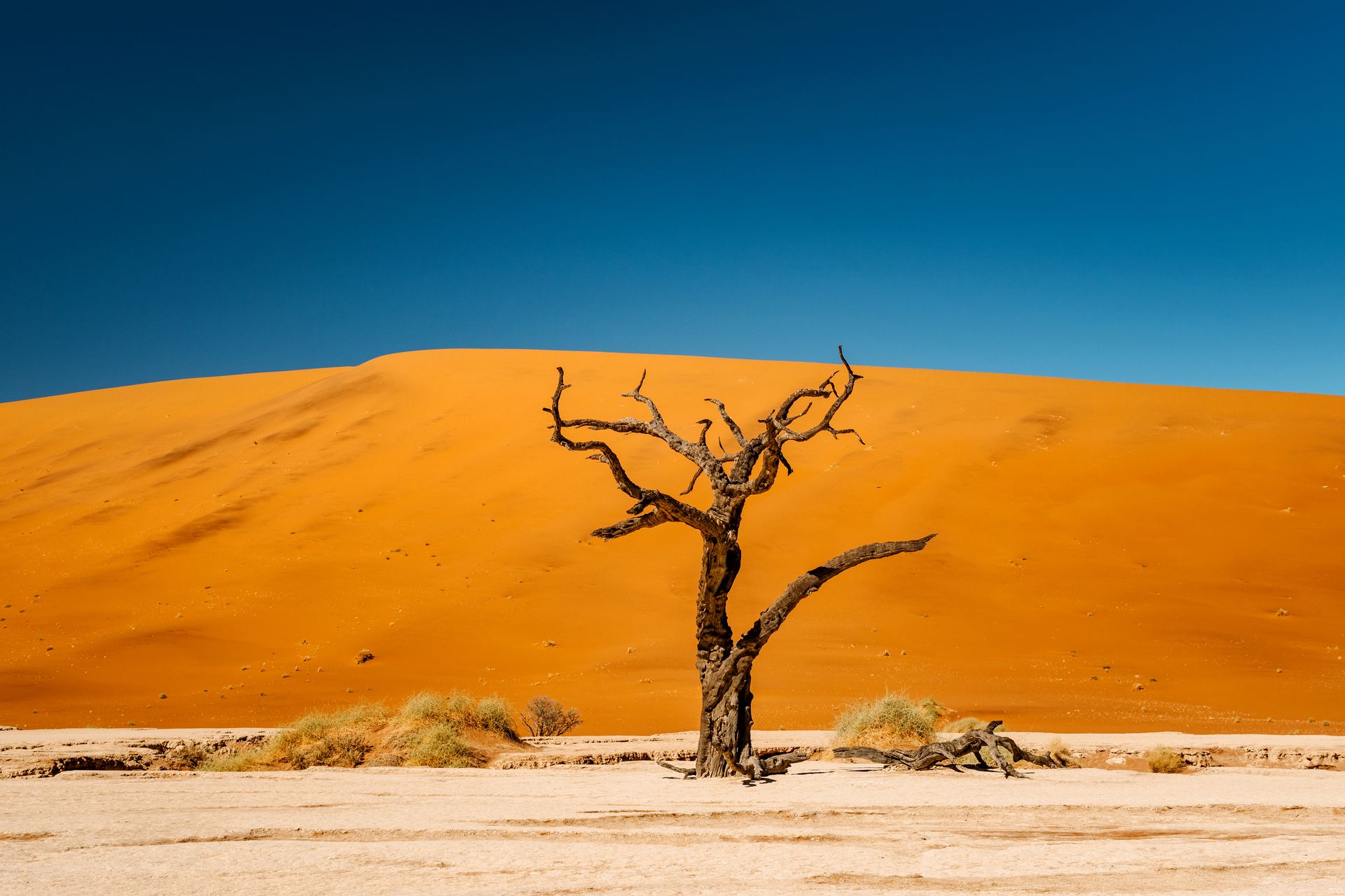
The Namib Desert runs along the entire Atlantic coast and is one of the oldest deserts in the world. The dune fields near Sossusvlei in the Namib-Naukluft National Park include some of the tallest dunes on earth — some exceed 300 meters. The dune landscape is accessible via a sealed road from the lodge cluster near Sesriem, and sunrise hikes to the top of the main dunes are a standard itinerary item. Deadvlei, a white clay pan surrounded by dunes with dead acacia trees — the trees are estimated to have died more than 700 years ago, preserved by the extreme aridity — is one of the most photographed landscapes on the continent.
Etosha National Park in the north is the main wildlife destination. The park is centered on the Etosha Pan, a vast salt flat that shrinks and expands seasonally. During the dry season, animals concentrate around active waterholes, and game viewing from the roadside or from illuminated camp waterholes at night can be exceptional. The park contains significant populations of elephant, lion, both black and white rhinoceros, giraffe, and zebra.
The Fish River Canyon in the south is the largest canyon in Africa. The hiking route along the canyon floor — the Fish River Hiking Trail — is a five-day route available between May and September, when the river is low enough to walk safely.
Namibia's road network is one of the best in sub-Saharan Africa. Most major routes are sealed and clearly signed, and a standard two-wheel-drive vehicle is adequate for most tourist circuits. The country is large, and distances between attractions are significant — planning for driving time is as important as planning for destinations.
