From Lake Como's still Alpine reflections to a loggerhead turtle beach closer to Tunisia than to Rome
Mi Yo / Unsplash
Europe’s beauty ranges from Arctic fjords to Mediterranean beaches, from medieval walled towns to 20th-century garden estates, from Alpine valleys to limestone gorges cut by rivers over geological time. The breadth of the category is part of what makes it compelling and part of what makes a list like this necessarily incomplete. No 10 destinations can represent the full visual range of a continent that spans from Norway’s Lofoten archipelago to the volcanic crater lakes of the Azores, from Scotland’s single-track coastal roads to the still waters of Italian lakes framed by mountain ranges. A list can point toward destinations that deliver a concentrated, distinctive version of what European landscape beauty actually means.
The 10 places here reflect a range of landscape types: a lake, a garden, a mountain valley, a hilltop town, a river gorge, a riverfront village, an ancient lake on two national borders, a single-lane road, and a beach. Several are based on recommendations from travel experts consulted by Travel + Leisure: Jim Strong, president of Strong Travel Services, and Emma Major Schroeder, a luxury travel advisor at Major Traveler. Their firsthand assessments give specific texture to destinations that generalized descriptions of scenery cannot always convey.
These destinations come from Travel + Leisure’s selection of the most beautiful places in Europe, representing the first 10 from the full list. Expert assessments from two travel advisors, Jim Strong and Emma Major Schroeder, inform several of the entries. The full Travel + Leisure list extends to 20 destinations and covers the continent from Norway to Malta, with the remaining entries spanning destinations including the Lofoten Islands, Barcelona, the Azores, and Keukenhof, the Dutch tulip garden that draws over a million visitors each spring.
Lewis J Goetz / Unsplash
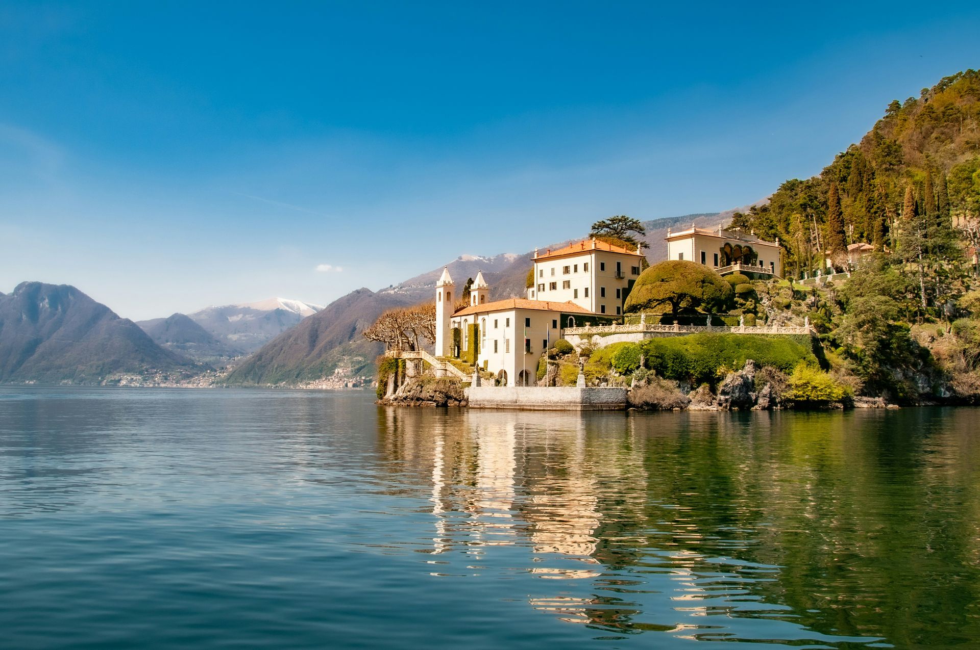
Lake Como in northern Italy has accumulated one of the most enduring reputations in European travel, and the reputation reflects something real. Travel advisor Emma Major Schroeder calls it one of the most beautiful places on earth, pointing specifically to the lake's stillness against the backdrop of the surrounding dramatic mountains as a setting unlike any other. The private boat cruise she recommends is the format that makes those elements most accessible: moving through the water at low speed, with the mountain reflections shifting as the boat changes position across the lake, produces an immersive experience that viewpoints from the shore cannot replicate.
The villages that line the lake’s shores — Bellagio, Varenna, Menaggio, and others — extend the visit beyond the water itself into the lanes, villas, and garden terraces that the lake’s long history as a destination for European aristocracy produced. Natural scale and human refinement across centuries of cultivation give Lake Como its particular character: it is not simply a beautiful lake but a landscape that human attention across many generations has made even more expressive.
For visitors who want to see the lake over a multi-day visit, the ferry system connecting the lakeside towns allows them to cover much of the eastern and western shores without a car. The lake is most serene in spring, before the peak summer crowds arrive, and in autumn, when the mountain light changes and the lakeside gardens show their late-season color. The lake’s shores are also home to some of Italy’s most celebrated villa gardens, including Villa del Balbianello and Villa Carlotta, which open to visitors during the warmer months and extend the garden-to-lake visual experience across the northeastern and western shores. The lake also offers access to some of the finest silk and textile products in Italy, with the town of Como itself maintaining a centuries-old tradition of silk production that continues to supply fashion houses across Europe.
CALIN STAN / Unsplash
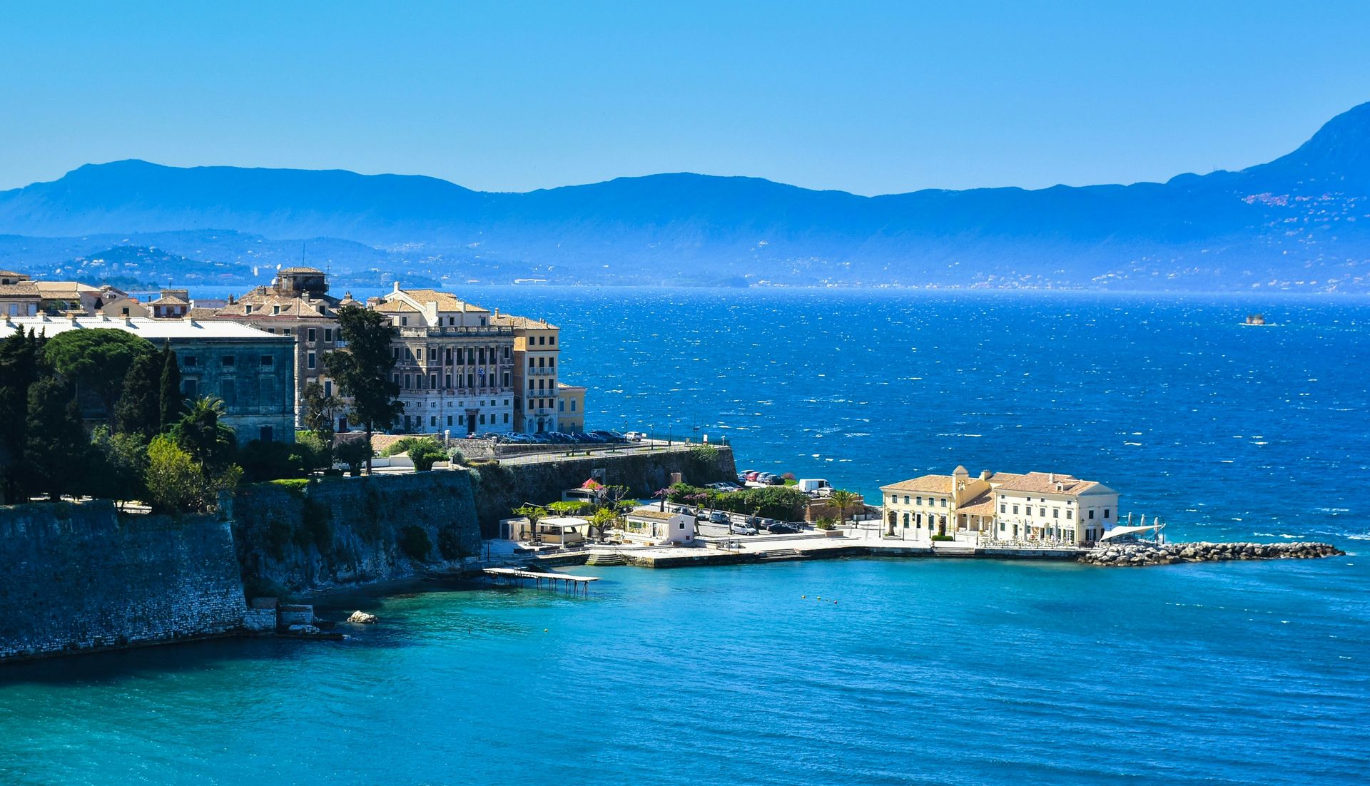
Corfu, the Greek island in the Ionian Sea, offers natural beauty across several registers: turquoise coastal waters, rugged mountainous interior, and forested hills that give the island a greener character than most Greek islands. The Corfu Trail, a long-distance walking route that traverses the island from south to north, provides structured access to both the coastal and interior landscapes across a multi-day hike that serious walkers use to experience the full range of the island’s terrain.
The Old Town of Corfu holds UNESCO World Heritage Site designation for its unusual architectural character, shaped by centuries of Venetian, French, and British occupation. The fortresses that dominate the town’s perimeter, the elegant palaces and administrative buildings from the French and British periods, and the narrow cobblestone alleys known as kantounia together produce a historic center that is visually richer and more varied than most Greek island towns. The layering of different colonial influences across the same urban fabric gives Corfu’s Old Town a complexity that single-period medieval towns cannot match.
The island’s position in the Ionian Sea, with Albania visible across the water to the east, also gives it a geographic setting with more visual drama than islands set in the open Aegean. Accessible mountains, coastal walking trails, a UNESCO-designated Old Town, and turquoise swimming waters together make Corfu one of the most comprehensively rewarding single destinations on this list. The island’s Venetian architectural legacy is also unusually well preserved: the Venetians held Corfu for four centuries, and the administrative and military buildings they left behind give the Old Town a coherent visual character that distinguishes it from Greek island towns built under less sustained foreign influence. The island’s position as the only Greek territory to remain under continuous Venetian rule for four centuries — ending only in 1797 — makes Corfu a genuinely unusual entry point into both Greek and Venetian history.
Credit: National Trust
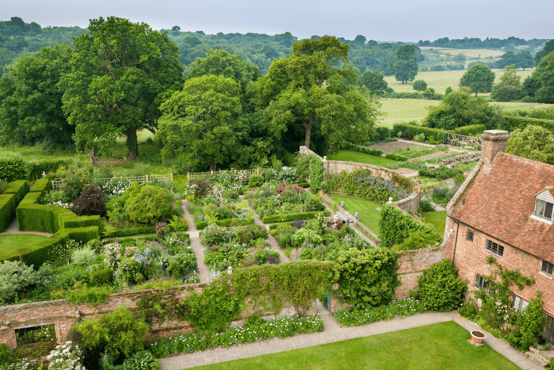
Sissinghurst Castle Garden sits in Kent, the English county known as the Garden of England. The writer Vita Sackville-West and her husband Harold Nicolson created it in the 1930s. The garden’s organizing principle is a series of enclosed outdoor rooms, each with a distinct design and planting strategy, connected by paths and archways that move visitors from one environment to the next. The effect is of a sequence of separate garden experiences within a single estate.
Travel expert Jim Strong calls the garden tranquil in any weather and identifies spring and summer as the seasonal highlights, when the planting reaches full expression: daffodils, peonies, magnolia blossoms, and blooming fruit trees mark different moments in the seasonal calendar. Each of the garden’s rooms makes different demands on the calendar, which means repeat visitors encounter a different garden at different times of year from the same paths and enclosures.
Kent’s agricultural landscape surrounds the garden, providing a setting that reinforces the design's rural English character. A specific creative vision, a historic castle structure, an English county landscape, and planting that spans centuries of horticultural knowledge together make Sissinghurst one of the most genuinely distinctive gardens in Europe, not simply one of the most famous. Strong’s observation that a stroll around the grounds rewards in any weather reflects a garden designed for sustained engagement, not a single photographic moment. The White Garden, one of the most celebrated of Sissinghurst’s rooms, was Vita Sackville-West’s own most famous design achievement: a space where every plant and structure uses only white, silver, and green, creating an experience of restraint and deliberate composition that the more colorful rooms elsewhere in the garden set in strong contrast. The kitchen garden and the cottage garden are two additional rooms that appeal to visitors with a practical interest in growing as well as those who come purely for the aesthetic experience.
Robin Ulrich / Unsplash
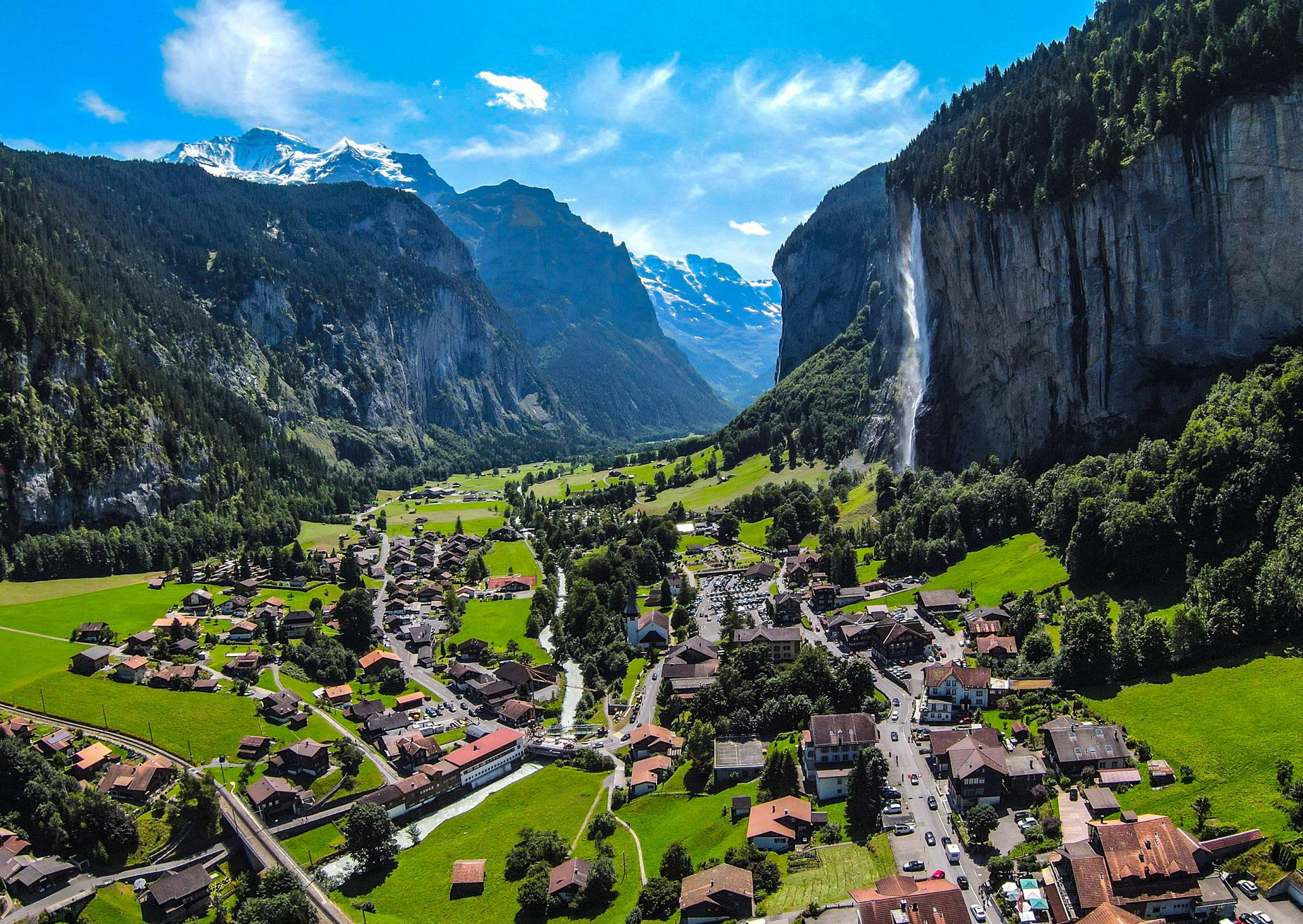
The Lauterbrunnen Valley lies in the Bern region of Switzerland and contains six villages: Wengen, Gimmelwald, Lauterbrunnen, Isenfluh, Mürren, and Stechelberg. Travel expert Jim Strong recommends it specifically for its stunning mountain and waterfall views, which emerge from the steep valley walls, snowmelt streams, and high Alpine peaks that define the valley’s upper horizon. The valley floor sits at roughly 800 meters, while the surrounding summits exceed 4,000 meters, producing a vertical scale that makes the waterfalls appear to drop from the sky.
Two mechanical transport options extend access into the upper elevations. The Schilthornbahn cable car climbs to Mürren, a car-free village perched on a cliff above the valley. The Jungfrau Railway, a historic mountain railway, ascends to Jungfraujoch, the highest railway station in Europe. Both offer elevated perspectives that transform the valley from a destination viewed from the floor into a landscape understood from above.
The valley’s accessible villages, active hiking trails, and dramatic vertical topography together make it a destination suited to visitors with a range of physical ambitions: those who want a gentle walk along the valley floor to view the waterfalls, those who want to hike between the mountain villages, and those who want to reach the highest elevations by rail or cable car and look down across the entire Alpine landscape. The car-free status of Mürren and Wengen, both reachable only by cable car or rail, also means the villages have preserved a pedestrian character that most Alpine resorts have long since abandoned, and the absence of traffic noise amplifies the experience of the mountain environment around them. The valley’s waterfalls, which number more than 70 within the valley walls, also give the landscape a constant acoustic presence: the sound of falling water from multiple directions simultaneously is one of Lauterbrunnen’s most distinctive sensory qualities, setting it apart from Alpine valleys that offer visual drama without the same acoustic dimension.
Federico Di Do photography / Unsplash
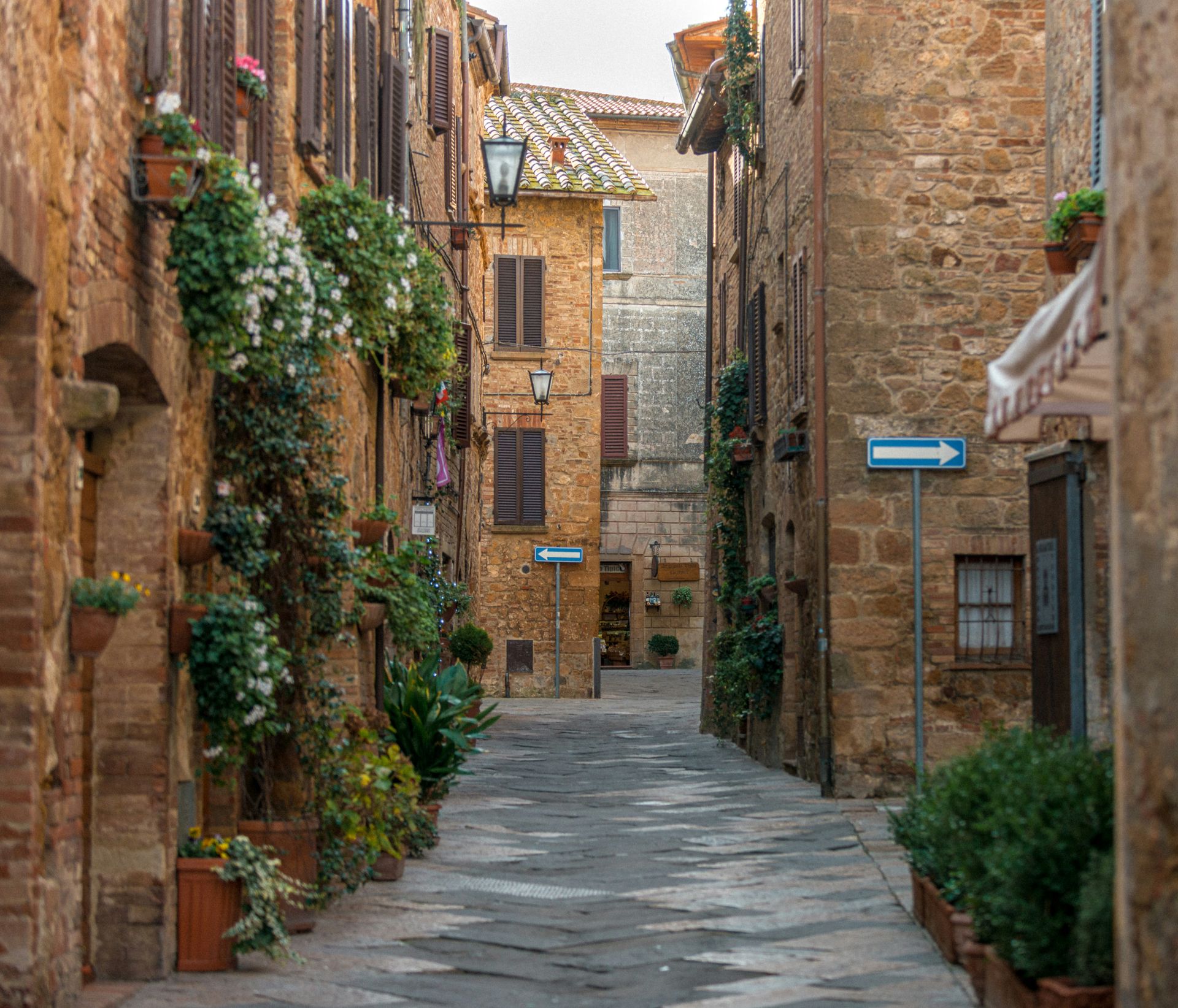
Pienza sits on a hilltop in Tuscany, and Emma Major Schroeder’s description of it captures what makes the town distinctive: the smell of Pecorino di Pienza cheese in the streets, available to taste in the shops that line the lanes, alongside views of rolling Tuscan hills visible at every turn. The historic center is designated a UNESCO World Heritage Site. Bars and restaurants along the town's outer edges offer outdoor seating with direct views over the Tuscan landscape, giving the Italian aperitivo tradition a setting that few other hilltop towns can match.
The Pecorino di Pienza cheese is not incidental to the visit but central to it: this is the specific cheese of this specific town, produced from sheep that graze the surrounding Val d’Orcia landscape, and tasting it in its place of origin gives the experience a directness that cheese tourism to less specific destinations cannot provide. Schroeder specifically mentions smelling the cheese as you walk through the town, reflecting a production activity that remains embedded in the urban fabric of a functioning small town, not relocated to a facility outside the historic center.
Pienza also benefits from its position within the Val d’Orcia, a broader Tuscan landscape of rolling clay hills, cypress-lined roads, and fortified farmhouses that is itself a UNESCO-designated cultural landscape. The town sits at the center of a visual environment that extends well beyond its walls, making the approach and departure from Pienza as scenic as the town itself. The Val d’Orcia landscape surrounding Pienza is also a wine-producing region, with Brunello di Montalcino produced nearby and available in the bars and restaurants Schroeder recommends for aperitivo. The surrounding Val d’Orcia also holds UNESCO World Heritage Site designation, which means Pienza sits within a doubly protected environment: the town’s historic center and the agricultural landscape visible from it both carry international recognition.
Alex Vasey / Unsplash
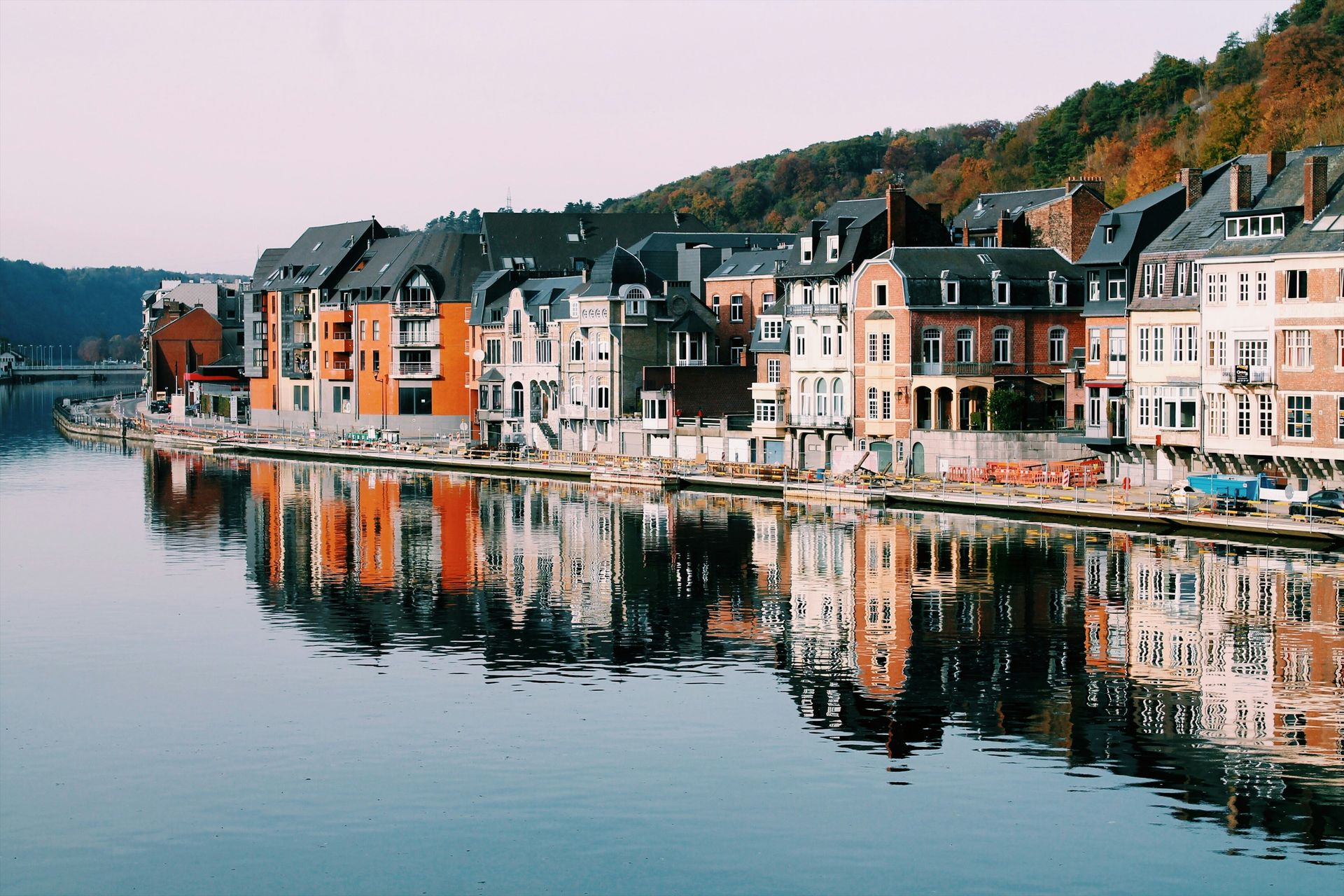
Dinant sits in the French-speaking Walloon region of Belgium on the banks of the River Meuse, at the point where the river cuts through the Condroz limestone plateau. The town occupies a narrow strip of land between the cliff face and the water, giving its waterfront architecture a compressed visual quality that the river setting amplifies. On one end of the visual field stands the 13th-century Gothic Collegiate Church of Our Lady of Dinant. On the other stands the Bayard Rock, a tall, isolated rock formation that once served as natural protection against the town’s enemies. Gothic architecture and ancient geology in a single view is not something most Belgian towns can offer.
The citadel above the town, accessible by cable car, offers an elevated perspective that places both the river and Dinant's rooflines within a wider geographic frame. From that height, the way the river has cut through the limestone becomes legible as a geological process, not just a scenic backdrop, and the town’s position as a point of passage between the plateau and the lower valley is apparent.
Dinant also holds a specific musical claim: Adolphe Sax, inventor of the saxophone, was born there in 1814, and the town celebrates that connection with saxophone-shaped public art along the riverfront. For visitors who approach Dinant as a day trip from Brussels or Namur, the town rewards several hours of exploration across the Gothic interior of the collegiate church, the citadel, the riverside promenade, and the geological landscape that frames them all. The city of Namur, about 30 kilometers upriver, makes a practical base for exploring Dinant as a day trip while also giving visitors access to the broader Meuse valley landscape and the medieval citadel complex at Namur itself. Dinant is also the birthplace of the saxophone: Adolphe Sax was born there in 1814, and the town marks that connection with saxophone sculptures along the riverside promenade.
Hoai Nam Mai / Unsplash
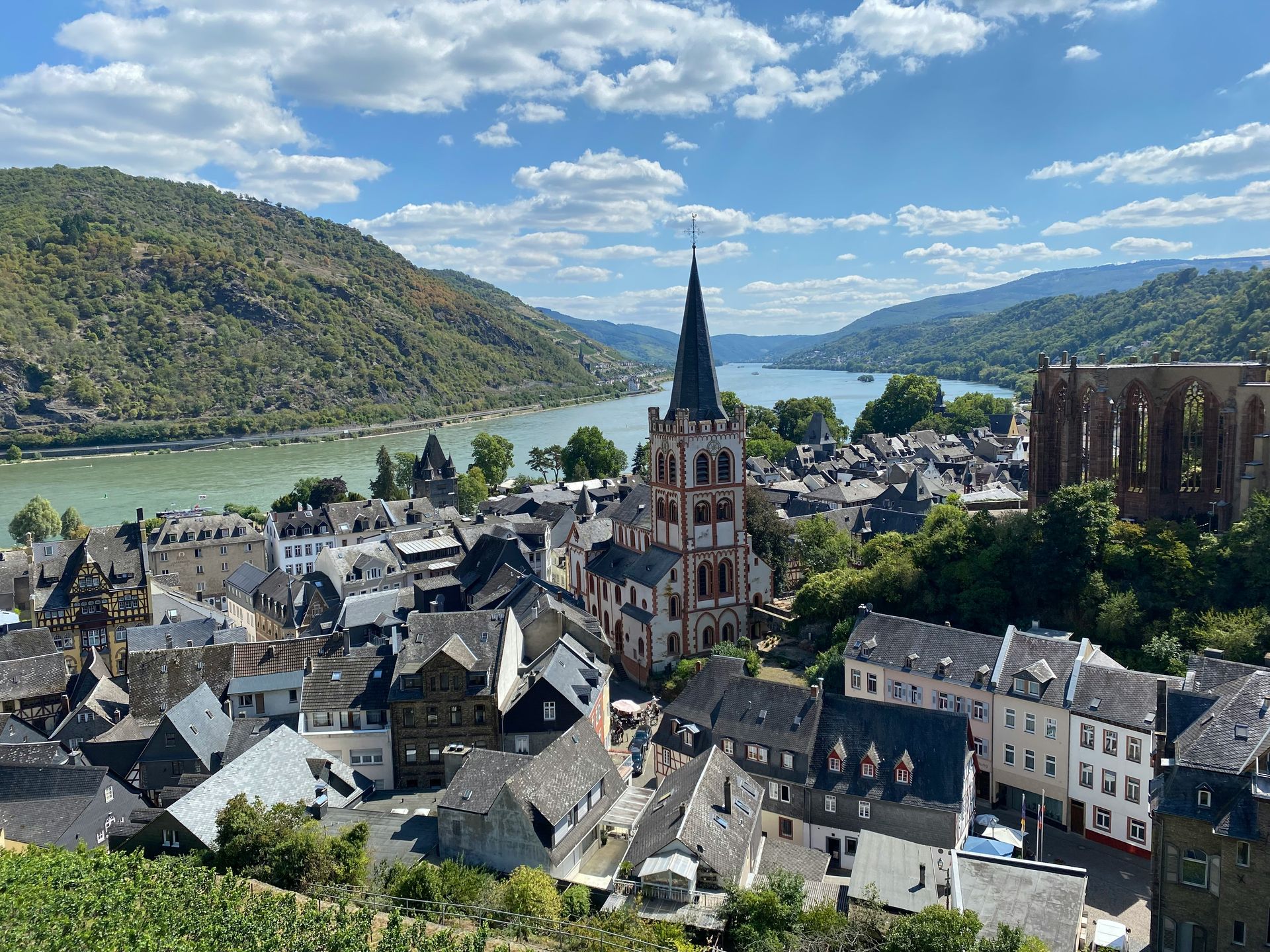
Bacharach sits in the Upper Middle Rhine Valley, a UNESCO World Heritage Site and one of Europe's most historically significant transport corridors, where the Rhine cuts through a narrow gorge, and the valley walls rise steeply on both sides. Travel expert Jim Strong calls it a village that ticks all the boxes of a European dream, citing its medieval architecture and the fairy-tale quality of the half-timbered buildings lining the central streets. The views of the Rhine from within the town, and from the castle ruins above, add a natural-scale backdrop to the built environment.
The vineyards that cover the valley slopes outside Bacharach produce Riesling from terraced sites where the steep gradient and slate soils make the wines particularly expressive. Strong identifies the vineyards as an added plus to the town’s appeal, and the proximity of wine production to the medieval streetscape gives Bacharach a layered character that river towns without viticulture cannot match. The local wine taverns within the half-timbered buildings offer the specific experience of drinking Rhine Valley Riesling in the landscape that produces it.
The Upper Middle Rhine Valley designation also means that Bacharach exists within a UNESCO-recognized landscape, not as an isolated historic town: the valley as a whole, with its sequence of castle-topped hills, riverside villages, and vineyard terraces, constitutes the heritage context that gives individual stops like Bacharach their full meaning. A boat trip along the Rhine through the gorge section puts the town into that larger visual frame. The valley also includes Boppard and Oberwesel, two additional medieval towns within a short drive of Bacharach, making the Upper Middle Rhine a route worth spending 2 or more days to cover the full extent of its UNESCO-designated heritage landscape. The Marksburg Castle near Braubach, the only Rhine hillside castle that survived the 17th-century wars intact, is also within a short boat ride of Bacharach and extends the medieval heritage of the valley beyond the individual town.
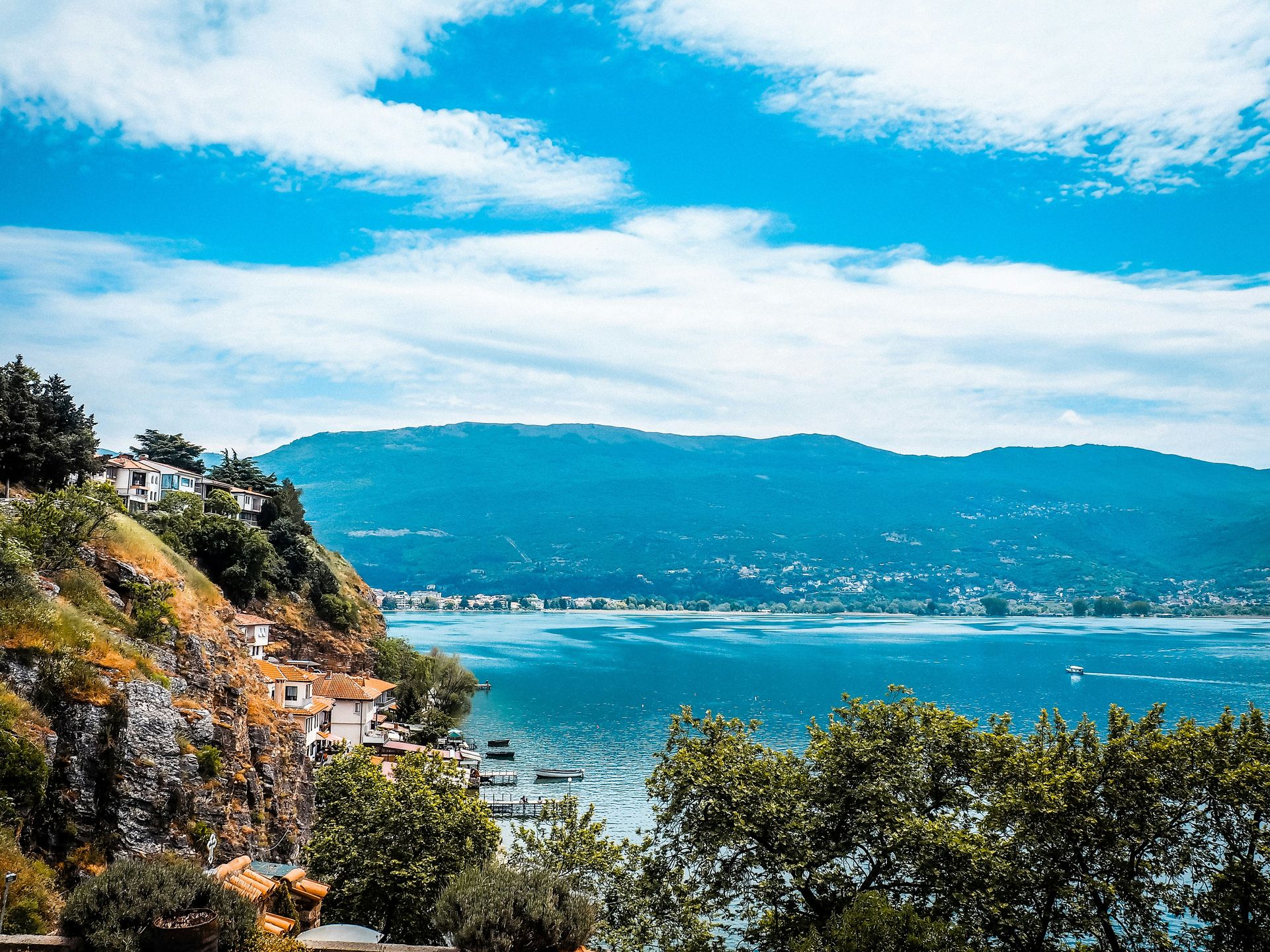
Adventure Albania / Unsplash
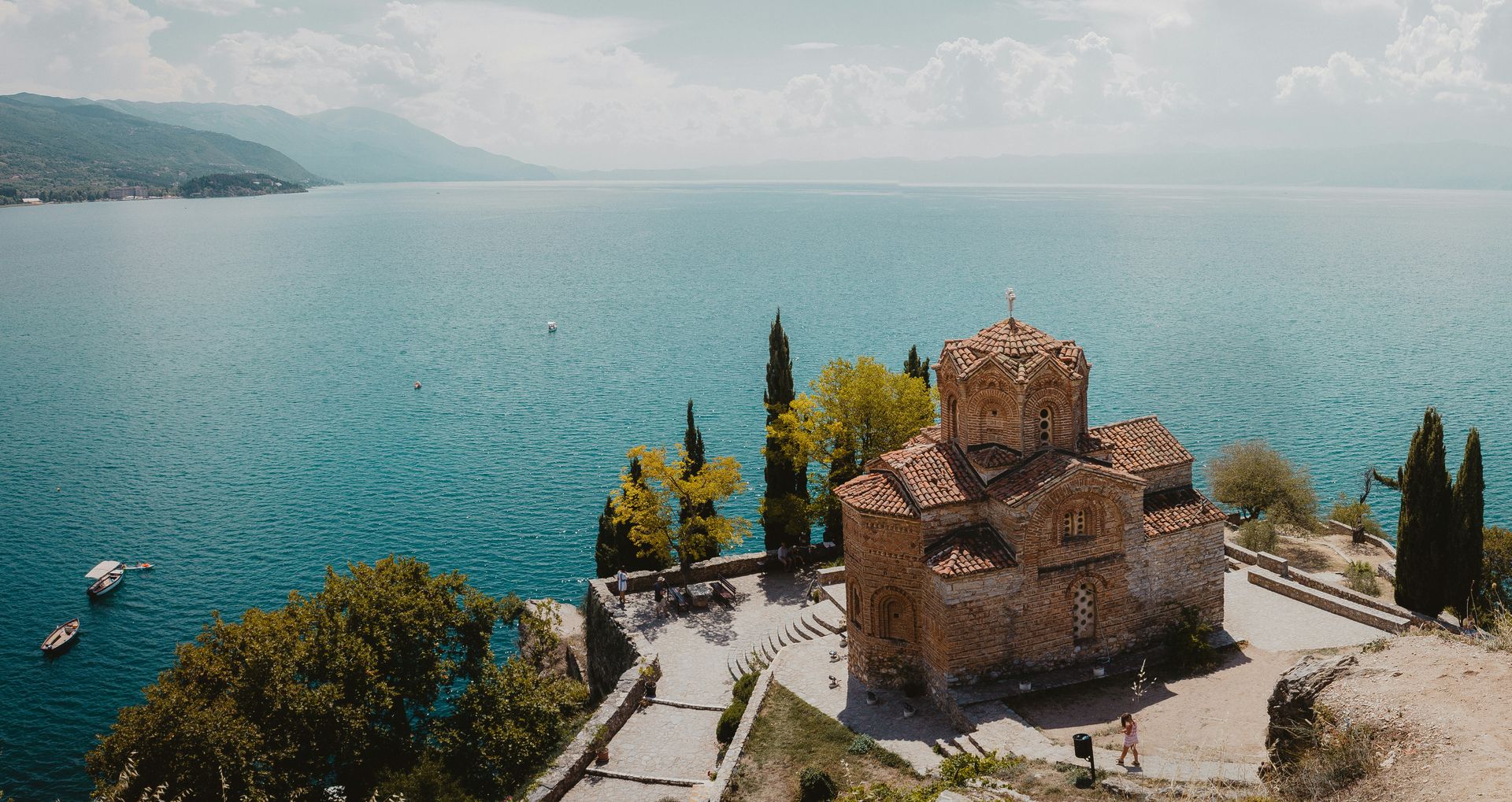
Lake Ohrid sits on the border between North Macedonia and Albania, and its credentials are specific: the lake is nearly two million years old, making it one of the oldest lakes in the world and a site of exceptional biodiversity. Ancient villages, rolling hills, and beaches surround the shoreline on both the Macedonian and Albanian sides. The lake’s age and relative geographic isolation have produced an ecosystem with a high proportion of endemic species, which gives it scientific significance alongside its considerable scenic appeal.
Archaeologists have been working in recent years to uncover an 8,000-year-old stilt village submerged in the lake, identified as the oldest of its kind in Europe. The excavation work is ongoing, and its findings have added a specific dimension to prehistoric human history, further distinguishing the destination as one of the world's oldest and most biodiverse. Visitors to the shores of Lake Ohrid are, in that sense, looking at a body of water that has accumulated two million years of geological change, eight thousand years of human inhabitation, and ongoing scientific investigation simultaneously.
For travelers interested in destinations that fall outside the primary European tourism circuits, Lake Ohrid offers natural and historical depth that many more-visited European lakes lack. The towns of Ohrid in North Macedonia and Pogradec in Albania both offer access to the water and the surrounding landscape, and the relative scarcity of mass tourism infrastructure means the lake retains a character that more famous European lakes have largely lost. The town of Ohrid on the North Macedonian shore is worth specific attention: its medieval churches, Roman-era amphitheater, and Ottoman-period architecture give the lakeside setting a density of historical layers that matches the lake’s own geological depth. The Albanian shore of the lake, centered on Pogradec, offers a less-visited perspective on the same body of water and has begun attracting travelers seeking the Lake Ohrid experience with even fewer fellow tourists.
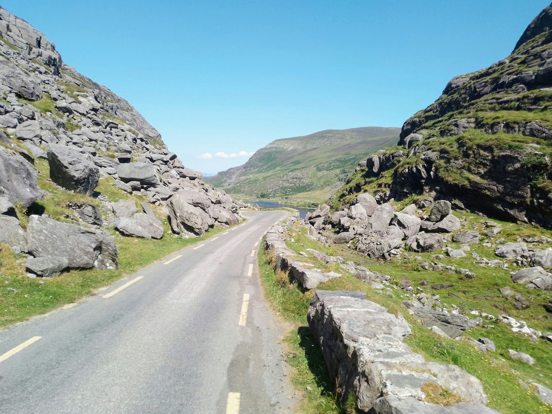
Michael Ryan / Unsplash
The Wee Mad Road is a section of the North Coast 500, Scotland’s most celebrated driving route, running along the western edge of the Scottish Highlands on roads that Jim Strong describes as not for the faint of heart. The one-lane roads with passing places, the absence of barriers between the tarmac and the sea in places, and the sheer scale of the open Highland landscape create a driving experience that Strong identifies as offering some of the most dramatic and strange sights available from a vehicle in the British Isles.
The Highland landscape that the road traverses reflects the geological history of northwest Scotland: ancient Torridonian sandstone and Lewisian gneiss, among the oldest surface rocks in Britain, form the distinctive mountains and coastal formations that give this part of Scotland its particular visual character. The lack of settlement across large stretches of the route amplifies the sense of scale. In a continent as densely populated as Europe, the experience of driving for tens of miles through virtually uninhabited mountainous terrain is unusual and increasingly rare.
The route is best experienced at a pace that allows stopping: the passing places double as viewpoints, the single-track nature of the road requires attention that rewards looking up when the road widens, and the light in this part of Scotland changes rapidly enough that a stretch driven in morning mist can look entirely different on the return in afternoon sun. Strong’s “faint of heart” characterization is practical advice as much as dramatic framing: drivers who prefer wide roads and clear verges will find the experience genuinely stressful, while those comfortable with close quarters and uncertain surfaces will find it among the most memorable road trips in Europe. The North Coast 500 as a whole is best driven over five to seven days to avoid rushing the stops, and Durness, the small village at the far northwestern corner of the British mainland, makes a logical overnight stop at the end of the Wee Mad Road stretch.
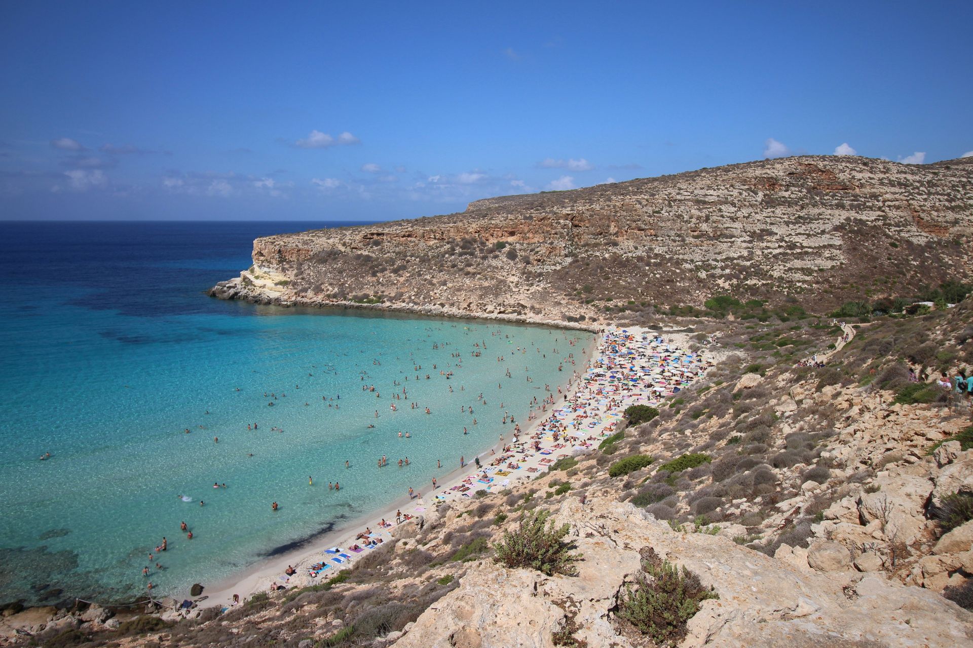
Enrica Tancioni / Unsplash
Spiaggia dei Conigli, or Rabbit Beach, sits on the island of Lampedusa, the southernmost point of Italian territory, closer to the coast of Tunisia than to the Italian mainland. The crescent-shaped beach has white sand and intensely blue water, and its position, sheltered by the tiny Isola dei Conigli — Rabbit Island — keeps the water calm and shallow, making it suitable for swimming and snorkeling for people of all ages and abilities. The sheltered geometry of the beach, enclosed by the islet on one side and low cliffs on the other, creates a visual completeness that open beaches on exposed coastlines cannot match.
The water clarity at Spiaggia dei Conigli reflects Lampedusa’s geographic position in the central Mediterranean, where depth and temperature combine to produce the vivid blue-to-turquoise gradient that characterizes the beaches of this part of the sea. The beach’s crescent shape means the water color shifts across the arc depending on depth and angle of light, giving the swim a visual experience that changes as you move through it.
The island of Lampedusa is a significant nesting ground for the loggerhead sea turtle, and Spiaggia dei Conigli is among the most important nesting beaches in the Mediterranean. Authorities restrict access to parts of the beach during nesting season to protect the turtles, which means the beach’s full visual appeal and its conservation significance are directly connected: the restrictions that keep it uncrowded during peak season also protect the ecological reason for its existence as an intact natural environment. Lampedusa’s geographic isolation also means visitor numbers stay lower than comparable Italian beaches on the mainland or major islands, which protects the beach’s natural character while giving travelers willing to make the journey the experience of a Sicilian-channel beach at something closer to its natural state. The island is also accessible by direct flights from several Italian cities, making the journey less logistically complex than its isolated position in the central Mediterranean might suggest.
