
From hexagonal basalt columns to giant underground crystals, these 15 formations show how heat, water, pressure and time shape the planet's most unusual landscapes
Credit: Gildo Cancelli / Pexels
The planet's most distinctive landscapes were not designed. They emerged from ordinary physical processes — cooling, erosion, evaporation, uplift — operating over spans of time that dwarf human history. A basalt column with edges so straight it looks quarried, a salt flat so level it calibrates satellites, a cave filled with crystals the size of telephone poles: each is the product of chemistry and physics working without interruption for thousands, millions or even billions of years.
Geologists read these formations the way historians read archives. A tilted layer of sandstone records an ancient collision between continents. A field of conical limestone hills preserves the memory of a seafloor that once teemed with coral. A terrace of white travertine marks the exact spot where hot groundwater met open air and gave up its dissolved minerals. The formations in this list are scattered across six continents, but they tell overlapping stories about the same restless planet.
They also correct a common misconception: that dramatic landscapes require dramatic events. A few of the sites here do trace back to volcanic violence. Most do not. The Grand Canyon is the work of a single river and a slowly rising plateau. The hoodoos of Bryce Canyon owe their existence to water freezing and thawing in rock cracks, a process that repeats more than a hundred times each year. The Moeraki Boulders of New Zealand grew grain by grain inside seafloor mud, the way a pearl grows inside an oyster. Patience, not catastrophe, is the dominant force in geology.
This list covers 15 formations and the specific processes that created them — columnar jointing, karst dissolution, differential erosion, chemical precipitation, tectonic uplift and more. Each entry explains what the formation is, where it sits and, most importantly, how it came to exist. Some of these places draw millions of visitors a year. Others sit in deserts and remote coastlines where few people ever go. All of them reward a closer look at the mechanics underneath the scenery.
Credit: Mario Spencer / Pexels
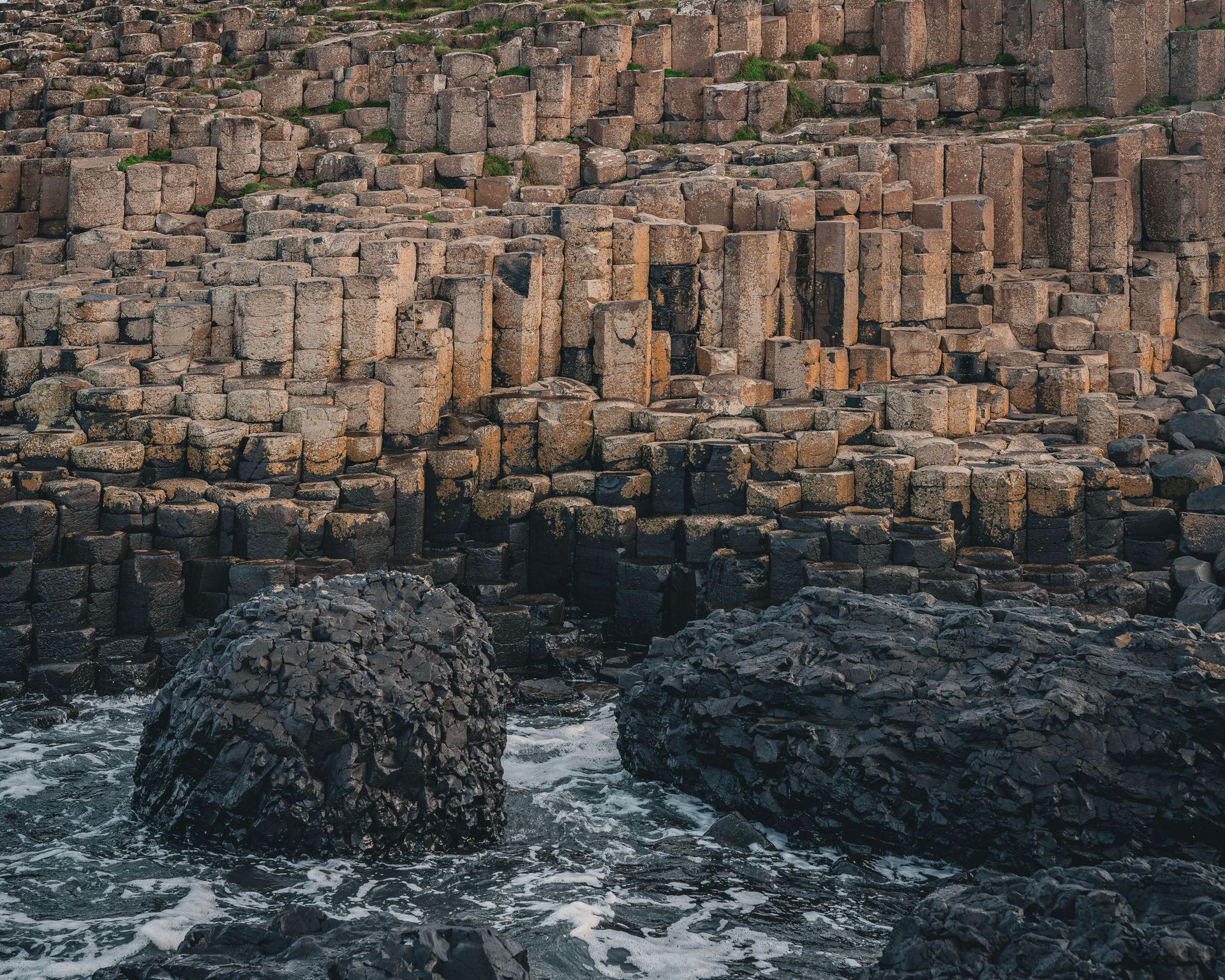
The Giant's Causeway on the coast of County Antrim consists of roughly 40,000 interlocking basalt columns, most of them hexagonal, stepping down from cliffs into the North Atlantic. The columns fit together so precisely that early observers assumed they were built by hand — or, in local legend, by the giant Finn McCool. The real builder was cooling lava.
Around 50 to 60 million years ago, during the Paleogene period, intense volcanic activity accompanied the early opening of the North Atlantic. Molten basalt poured across the chalk landscape of what is now Northern Ireland, pooling in places to form thick lava lakes. As the lava cooled and solidified, it contracted. That contraction created stress across the surface of the rock, and the stress relieved itself by cracking.
Here is the key to the geometry: cracks that form in a cooling, contracting material tend to intersect at angles that minimize energy, and a network of such cracks naturally converges on a roughly hexagonal pattern. The same physics produces the polygonal cracks in drying mud, just at a much smaller scale. As the basalt cooled downward from its surface, the cracks propagated deeper into the flow, extending the polygons into long vertical columns.
The result is a landscape of pillars, some more than 12 meters tall, with faces so flat they resemble cut stone. Not every column has six sides. Careful counts show columns with four, five, seven and eight sides mixed in, which is exactly what the physics of fracture predicts.
The Causeway became a UNESCO World Heritage Site in 1986 and remains one of the most studied examples of columnar jointing in the world. Similar columns appear at Fingal's Cave in Scotland — formed from the same ancient volcanic province — and at Devils Postpile in California, showing that the process repeats wherever thick lava cools slowly and evenly.
Credit: Igor Passchier / Pexels
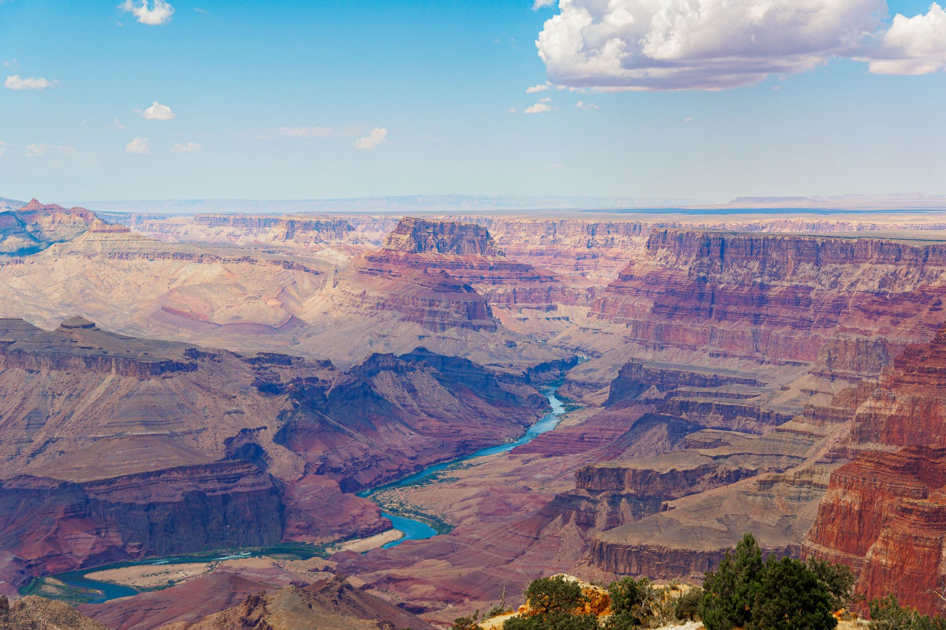
The Grand Canyon in Arizona stretches about 446 kilometers along the Colorado River and reaches depths of around 1.8 kilometers. Its scale invites explanations involving cataclysm. The actual mechanism is a river doing what rivers do, combined with land that would not stop rising.
The canyon exposes one of the most complete rock records on Earth. At the bottom, the dark Vishnu Schist and related basement rocks are nearly two billion years old, formed when island arcs collided with the ancient core of North America and were cooked and squeezed deep in the crust. Above them sit layer upon layer of sandstone, limestone and shale, deposited over hundreds of millions of years by shallow seas, coastal dunes and river plains that repeatedly advanced and retreated across the region.
The carving came much later. Most geologists place the integration of the modern Colorado River system at roughly five to six million years ago, when the river established its current course to the Gulf of California. As the Colorado Plateau rose — lifted by tectonic forces still debated among researchers — the river held its position and cut downward through the stack of rock like a saw held against rising timber.
Water alone did not do the work. The river carried sand, gravel and boulders that acted as abrasive tools, grinding the channel deeper, especially during floods. Meanwhile the canyon widened through a separate set of processes: rain, frost and gravity attacked the exposed walls, and rockfalls and landslides carried debris down to the river, which flushed it away.
The differing hardness of the layers produced the canyon's staircase profile. Resistant limestones and sandstones form cliffs. Softer shales erode into slopes. The carving continues, though dams built upstream in the 20th century now trap much of the sediment the river once used as its primary cutting tools.
Credit: Igor Passchier / Pexels
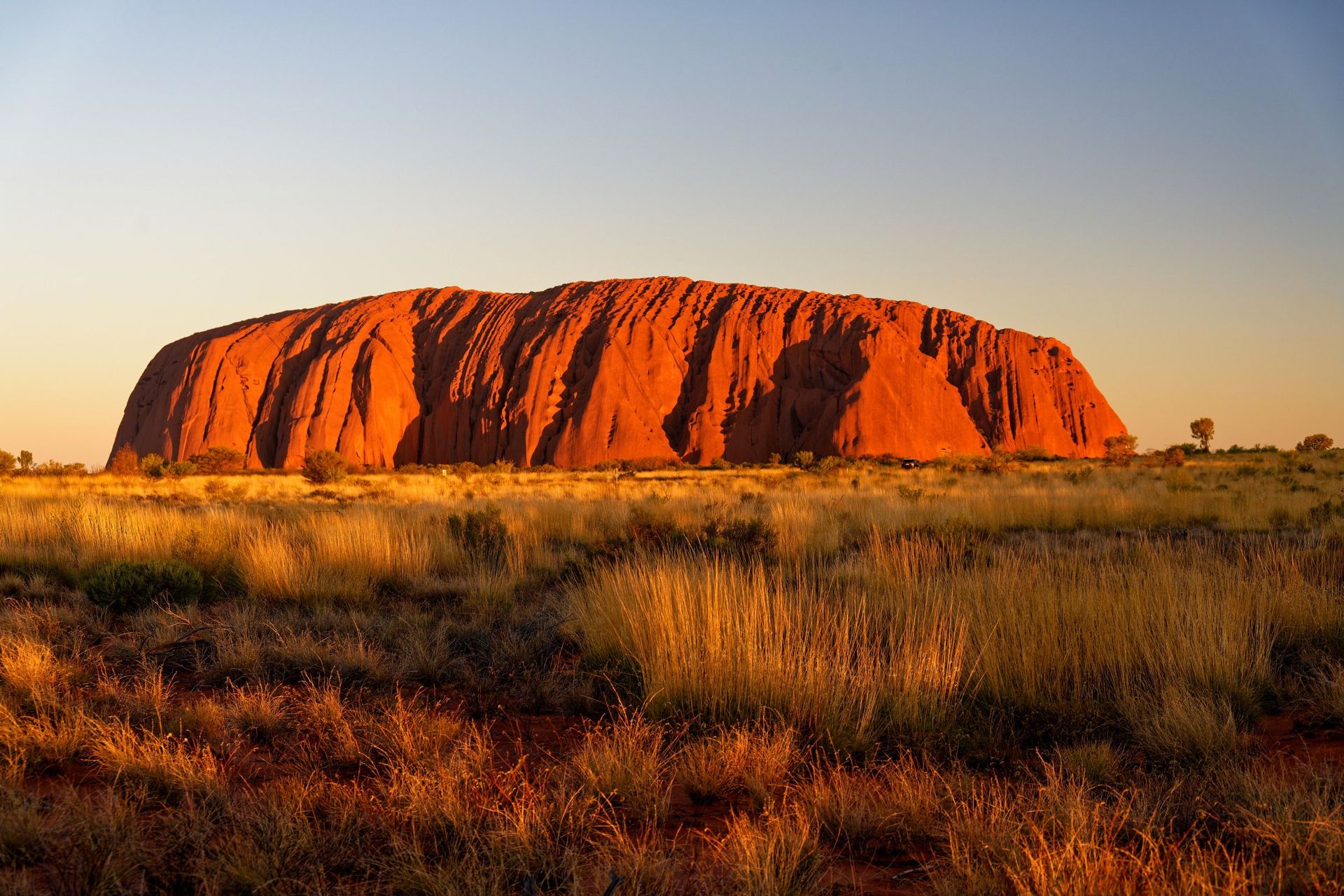
Uluru rises about 348 meters above the flat desert of Australia's Northern Territory, a single mass of red sandstone visible from tens of kilometers away. It is an inselberg — literally an "island mountain" — a remnant of resistant rock left standing after everything around it wore away. What shows above the surface is only a fraction of the whole; the rock continues far below the surrounding plain.
The story begins around 550 million years ago. Erosion of a newly uplifted mountain range shed enormous volumes of coarse sand into low-lying basins, where it accumulated in thick fans. That sand became arkose, a sandstone rich in feldspar grains, which is the rock that makes up Uluru today. Nearby Kata Tjuta, a cluster of domed rock formations, formed from coarser gravels shed by the same ancient mountains.
Later, a mountain-building episode known as the Alice Springs Orogeny compressed central Australia. The compression folded the sedimentary layers and rotated the beds at Uluru until they stood nearly vertical. Look closely at the rock's flank and the original horizontal layers now run almost straight up and down, expressed as parallel ridges and grooves across the surface.
Hundreds of millions of years of erosion then stripped away the softer surrounding rock. The arkose at Uluru resisted, partly because it lacks the joints and fractures that let water penetrate and break rock apart. What survived is a monolith smoothed and fluted by wind and occasional desert rain.
The famous red color is a surface phenomenon. Iron-bearing minerals in the arkose oxidize — rust, in plain terms — coating the exterior. Rain, though rare, transforms the monolith when it arrives, sending temporary waterfalls streaming down the grooves that follow the vertical bedding. For the Anangu, the traditional owners, Uluru is a sacred site, and climbing it was permanently banned in 2019.
Credit: Robert Schrader / Pexels
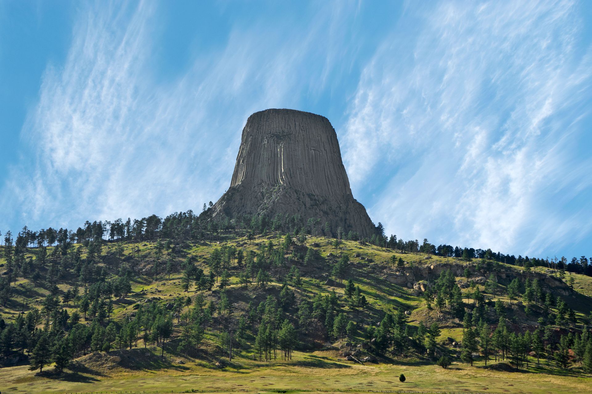
Devils Tower rises about 265 meters above the Belle Fourche River in northeastern Wyoming, a fluted column of gray rock standing alone above pine forest and grassland. President Theodore Roosevelt made it the first U.S. national monument in 1906, and it later reached global audiences as the alien rendezvous point in "Close Encounters of the Third Kind."
The tower is made of phonolite porphyry, an uncommon igneous rock, and it formed underground. Around 50 million years ago, magma pushed up into the sedimentary rocks of the region but never reached the surface as a classic erupting volcano. Instead it stalled and cooled within the crust. Geologists still debate the exact form of the intrusion — whether it was the neck of an eroded volcano, a laccolith that domed the overlying rock, or another type of igneous body — but they agree on the essential sequence: magma intruded, cooled and solidified at depth.
As the magma cooled, it contracted and fractured into columns, the same columnar jointing process seen at the Giant's Causeway. The columns at Devils Tower are unusually large, commonly measured in meters across, and mostly five- or six-sided. They run nearly the full height of the tower, giving it the appearance of a bundle of enormous stone posts.
Erosion did the rest. The sedimentary rocks that once buried the intrusion — shales and sandstones far softer than phonolite — gradually washed away over millions of years, exhuming the hard igneous core and leaving it standing in relief. Piles of broken columns around the base show the process continuing today, as freeze-thaw cycles pry columns loose.
More than 20 Native American tribes hold the site sacred, calling it names that translate to Bear Lodge. The tower also draws thousands of climbers each year, who ascend the cracks between columns.
Credit: Gildo Cancelli / Pexels
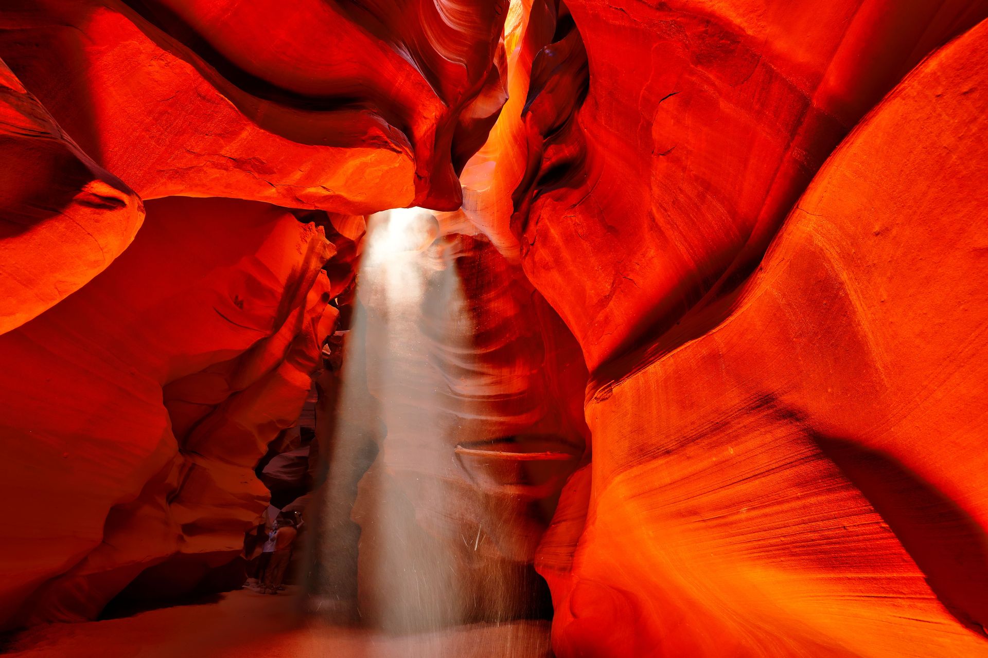
Antelope Canyon, on Navajo Nation land near Page, Arizona, is a slot canyon: a passage carved through sandstone that is far deeper than it is wide. In places the walls rise dozens of meters while the floor narrows to the width of a hallway. Sunlight filtering down from the slit above illuminates walls sculpted into flowing curves, which is why the canyon has become one of the most photographed geological sites in the U.S.
The rock is Navajo Sandstone, formed from vast dune fields that covered the region during the Jurassic period. Wind-blown sand accumulated in sweeping layers, and the angled bedding of those ancient dunes — called cross-bedding — is still visible in the canyon walls as gentle, intersecting lines.
The carving agent is water, delivered in violent bursts. The area receives little rain, but summer monsoon storms can drop large amounts of it in a short time, often on terrain many kilometers upstream. The runoff funnels into narrow drainages and arrives as a flash flood: a fast-moving slurry of water, sand and rock debris. Each flood scours the canyon like liquid sandpaper, deepening the channel and polishing the walls into smooth, undulating shapes that record the turbulence of the flow.
The process is episodic rather than steady. The canyon may see no significant flow for months, then be transformed by a single storm. That same dynamic makes slot canyons dangerous. A flood in 1997 killed 11 tourists in Lower Antelope Canyon, driven by a storm that fell far from the canyon itself. Access today is controlled through guided tours, and operators monitor regional weather closely.
Antelope Canyon is young by geological standards and still actively forming. Every monsoon season continues the work, cutting the slot incrementally deeper into the Jurassic dunes, while sand deposited by one flood is swept out by the next.
Credit: 逸蜂 吴 / Pexels
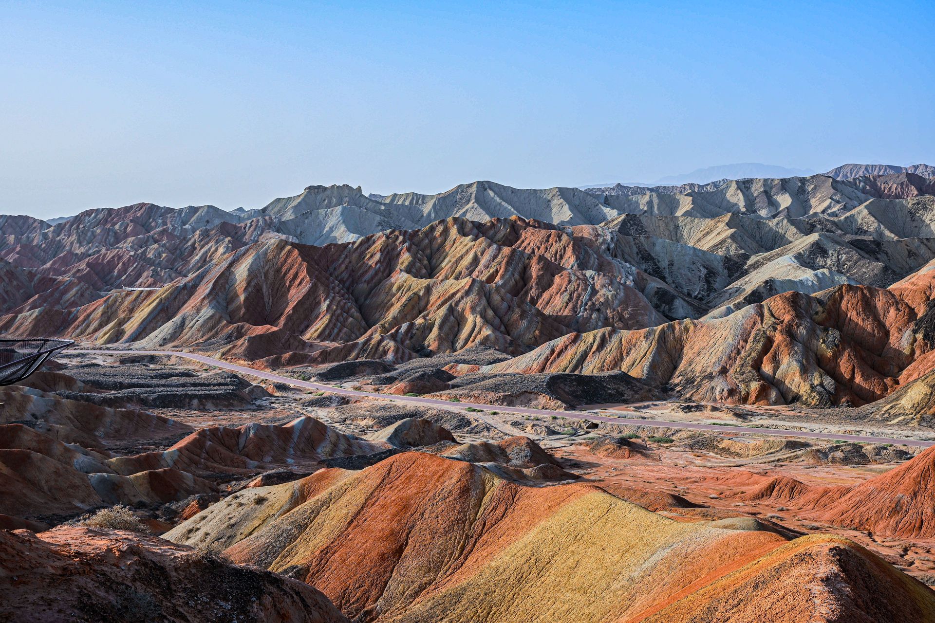
The Zhangye National Geopark in China's Gansu province contains ridges striped in red, orange, yellow and cream, running across the landscape in tilted, parallel bands. Photographs of the site often look digitally exaggerated. The colors are real, though popular images frequently boost their saturation.
The formation begins with sediment. Over tens of millions of years, rivers and lakes deposited layers of sandstone, siltstone and mudstone in a basin here. Each layer picked up its color from its chemistry and the conditions under which it formed. Iron oxides stain rock red and orange. Other iron minerals, formed under different moisture and oxygen conditions, yield yellows and browns. Layers deposited in oxygen-poor settings tend toward gray and green. The stripes are, in effect, a stack of ancient climates and environments rendered in pigment.
Tectonics turned the stack into scenery. The collision of the Indian and Eurasian plates — the same collision that raises the Himalayas — transmitted compression far into the Asian interior. The originally horizontal layers at Zhangye were folded, faulted and tilted, in places steeply, so that the colored bands now intersect the land surface at an angle. Erosion by wind, rain and freeze-thaw then cut into the tilted stack, exposing the stripes across hillsides and carving the ridges and gullies that give the terrain its corrugated texture.
The word "danxia" refers to a class of landscapes in China developed on red sedimentary rocks, and a group of danxia sites in southern China was inscribed on the UNESCO World Heritage list in 2010. The Zhangye site, though not part of that inscription, has become the most photographed example of the type. Boardwalks and viewing platforms now channel visitors across the fragile slopes, because the soft, poorly cemented rock erodes easily under foot traffic and a single set of footprints can persist for years. The best viewing light comes shortly after rain, when moisture darkens the bands and deepens the contrast between colors.
Credit: Kubilay Bal / Unsplash
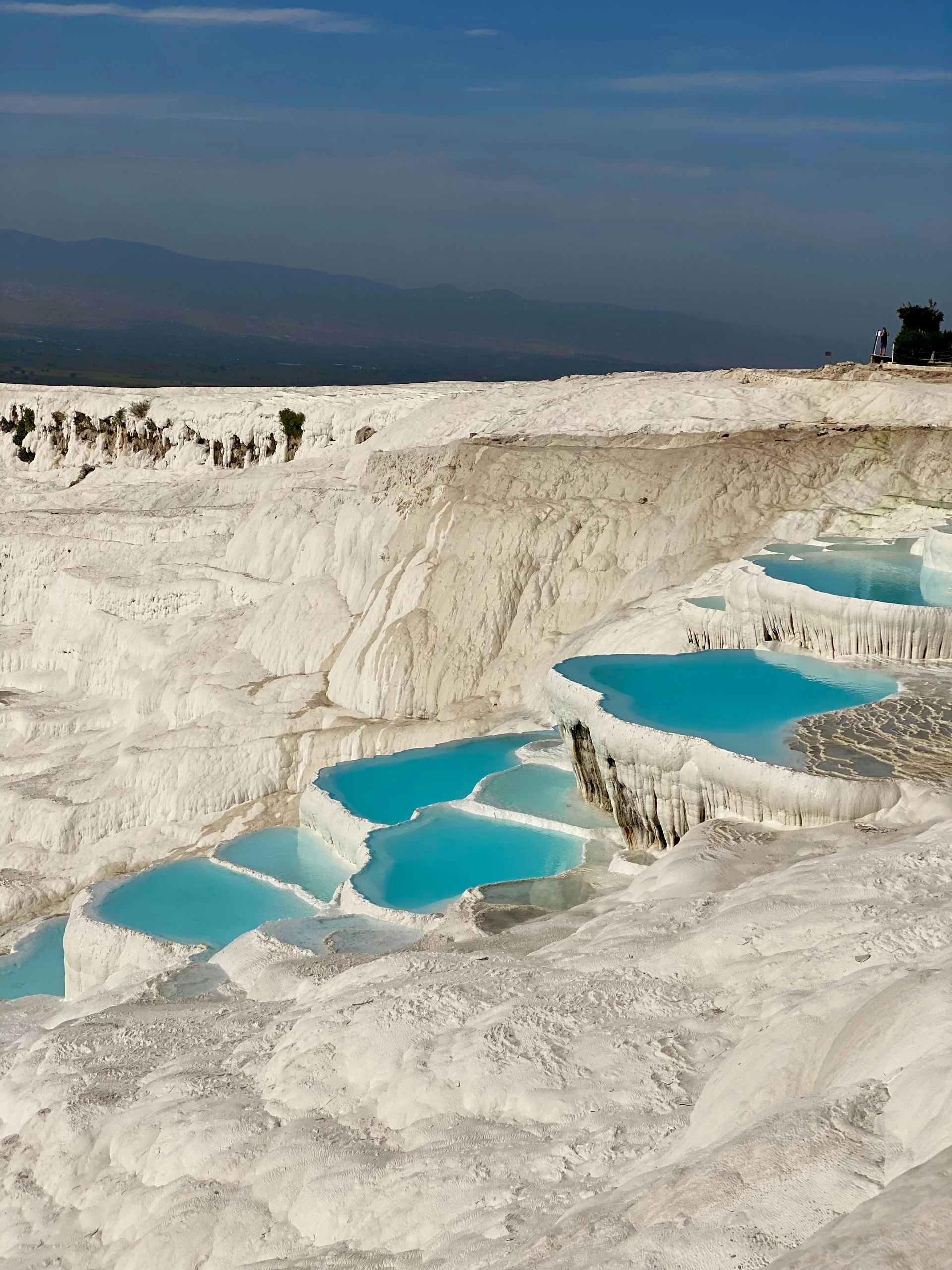
Pamukkale, in southwestern Turkey, means "cotton castle" in Turkish, and the name fits. A hillside above the town of Denizli is covered in brilliant white terraces, each rimmed with scalloped edges and filled with pale blue water. The terraces are made of travertine, a form of calcium carbonate, and they are being built by the water itself.
The process starts underground. Rain and groundwater percolate through limestone deep beneath the region, where geothermal heat warms the water and helps it dissolve calcium carbonate from the surrounding rock. The water also takes on dissolved carbon dioxide under pressure, which increases its capacity to hold the mineral in solution.
When the hot, mineral-saturated water emerges at springs on the hillside, the conditions reverse. Pressure drops, carbon dioxide escapes into the air — the same physics as a soda bottle going flat — and the water can no longer hold all its calcium carbonate. The mineral precipitates out, coating whatever surface the water flows across. Layer by thin layer, the deposits build rims, pools and cascades. Where water spills over an edge, deposition concentrates there and the rim grows, deepening the pool behind it.
The terraces have been forming for thousands of years, and people have used the warm pools for nearly as long. The Greco-Roman city of Hierapolis was founded on the plateau above the springs, and its ruins — including a large theater and extensive necropolis — sit beside the terraces. Both are jointly listed as a UNESCO World Heritage Site.
Tourism nearly destroyed the formation in the 20th century. Hotels built on the plateau diverted spring water, and visitors walked on the terraces in shoes, graying the travertine. Authorities demolished the hotels, restricted access and now route water carefully across different sections in rotation, keeping the travertine white and the terraces actively growing.
Credit: Matheus Oliveira / Unsplash
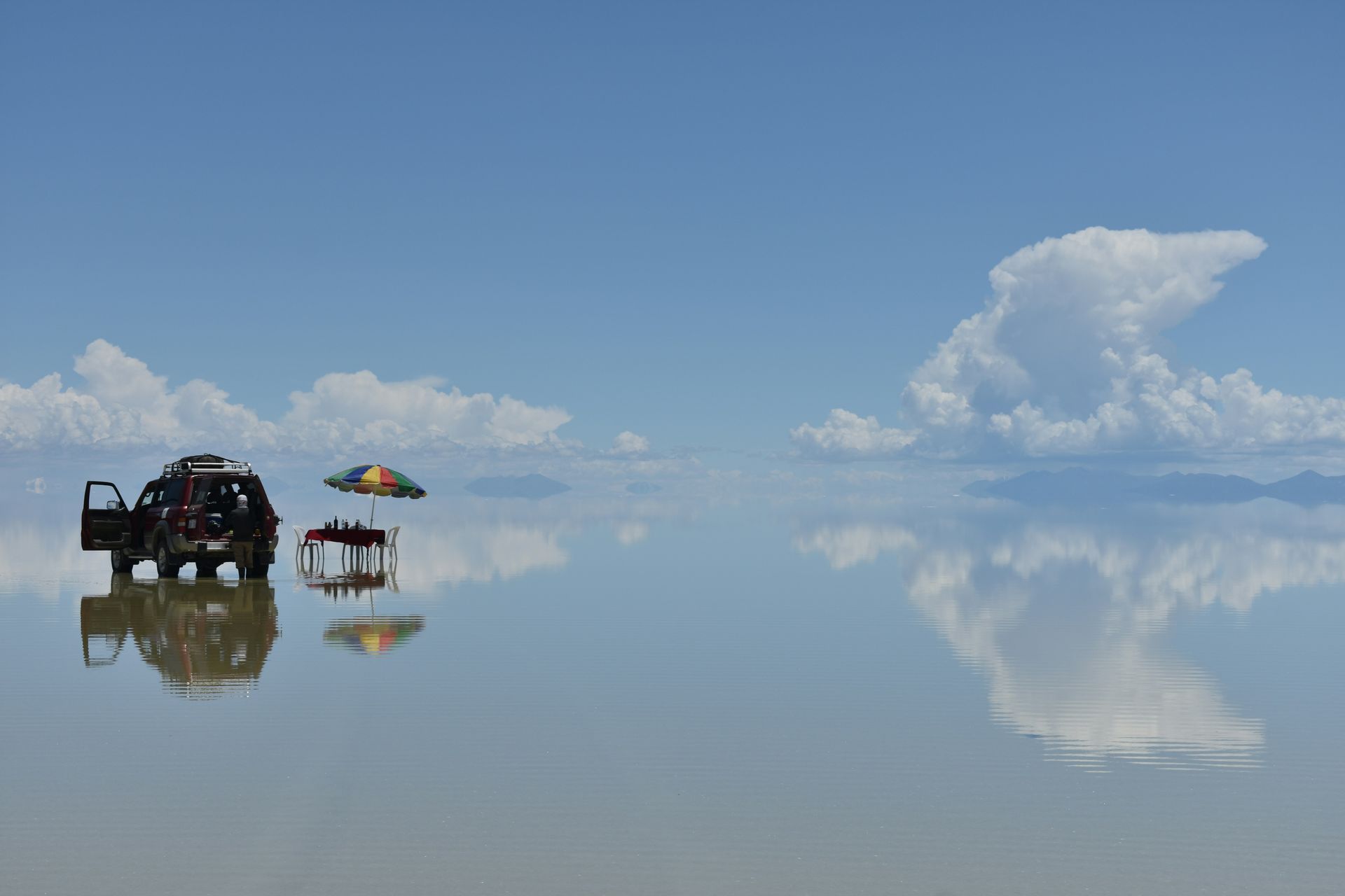
The Salar de Uyuni in southwestern Bolivia is the largest salt flat on Earth, covering roughly 10,000 square kilometers of the Altiplano at an elevation above 3,600 meters. It is also one of the flattest natural surfaces known, varying by only about a meter across its entire extent. That flatness is so reliable that scientists have used the salar to help calibrate the altimeters of Earth-observing satellites.
The salt is the residue of vanished lakes. During wetter periods of the Pleistocene, large lakes repeatedly filled this closed basin — a basin with no outlet to the sea. Water flowed in from the surrounding Andes, carrying dissolved minerals leached from volcanic rock, but the only exit was evaporation. Each time the climate dried, the lakes shrank and the dissolved salts concentrated, eventually precipitating onto the lakebed. The most recent major lake dried out thousands of years ago, leaving a crust of halite — common salt — meters thick, layered above briny mud.
The surface behaves in two distinct modes. In the dry season, the crust dries and contracts, cracking into a vast network of polygons, another instance of the same fracture geometry that shapes columnar basalt and drying mud. In the wet season, a thin sheet of water spreads across the flat and turns it into an enormous mirror, reflecting the sky so cleanly that the horizon disappears.
Beneath the crust lies one of the world's largest known reserves of lithium, dissolved in the brine that saturates the sediments. As demand for batteries grows, Bolivia has pursued plans to industrialize extraction, setting up a tension between mining revenue, local communities and the tourism economy built on the salar's mirror-like surface. The flat also supports islands of ancient coral rock topped with giant cacti, remnants of the drowned lakebed's higher ground, and serves as a breeding ground for flamingos in the wet season.
Credit: Geio Tischler / Unsplash
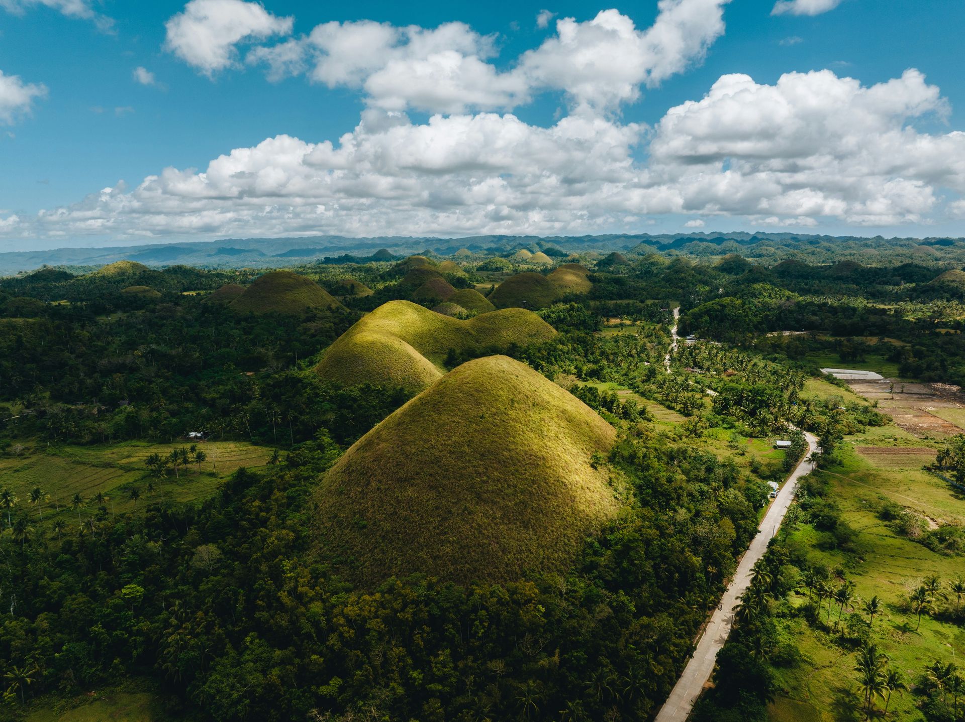
The Chocolate Hills of Bohol, in the central Philippines, are a field of well over a thousand nearly symmetrical mounds spread across some 50 square kilometers of the island's interior. Counts commonly cited range from about 1,200 to nearly 1,800 hills, most standing between 30 and 50 meters tall. Grass covers them, and in the dry season it browns — the source of the name.
The hills are made of marine limestone, which records the formation's first chapter. During the late Miocene and Pliocene, the rock that now forms the hills accumulated on a shallow seafloor as the skeletons and shells of corals, foraminifera, mollusks and other organisms piled up and cemented into stone. Fossils of marine life remain embedded in the hills today, on land now well above sea level.
Tectonic uplift raised that seafloor. The Philippines sits in one of the most geologically active regions on the planet, squeezed between converging plates, and Bohol has been lifted in stages over millions of years. Once the limestone stood above the waves, water took over.
Limestone dissolves in slightly acidic water. Rain absorbs carbon dioxide from the air and soil, forming weak carbonic acid, and over long spans that acid eats limestone away. This process, called karstification, produced the hills through dissection: water exploited joints and fractures in the uplifted limestone, widening them into valleys and sinkholes, and left the intervening rock standing as residual mounds. Geologists classify the result as cockpit or conical karst, a style also seen in parts of Jamaica and southern China.
The hills are a protected national geological monument and Bohol's signature attraction. A magnitude 7.2 earthquake in 2013 damaged several viewing sites and sheared the faces off some hills, exposing fresh limestone and fossils — a reminder that the uplift that created the landscape has not stopped.
Credit: Dirk Schuneman / Pexels
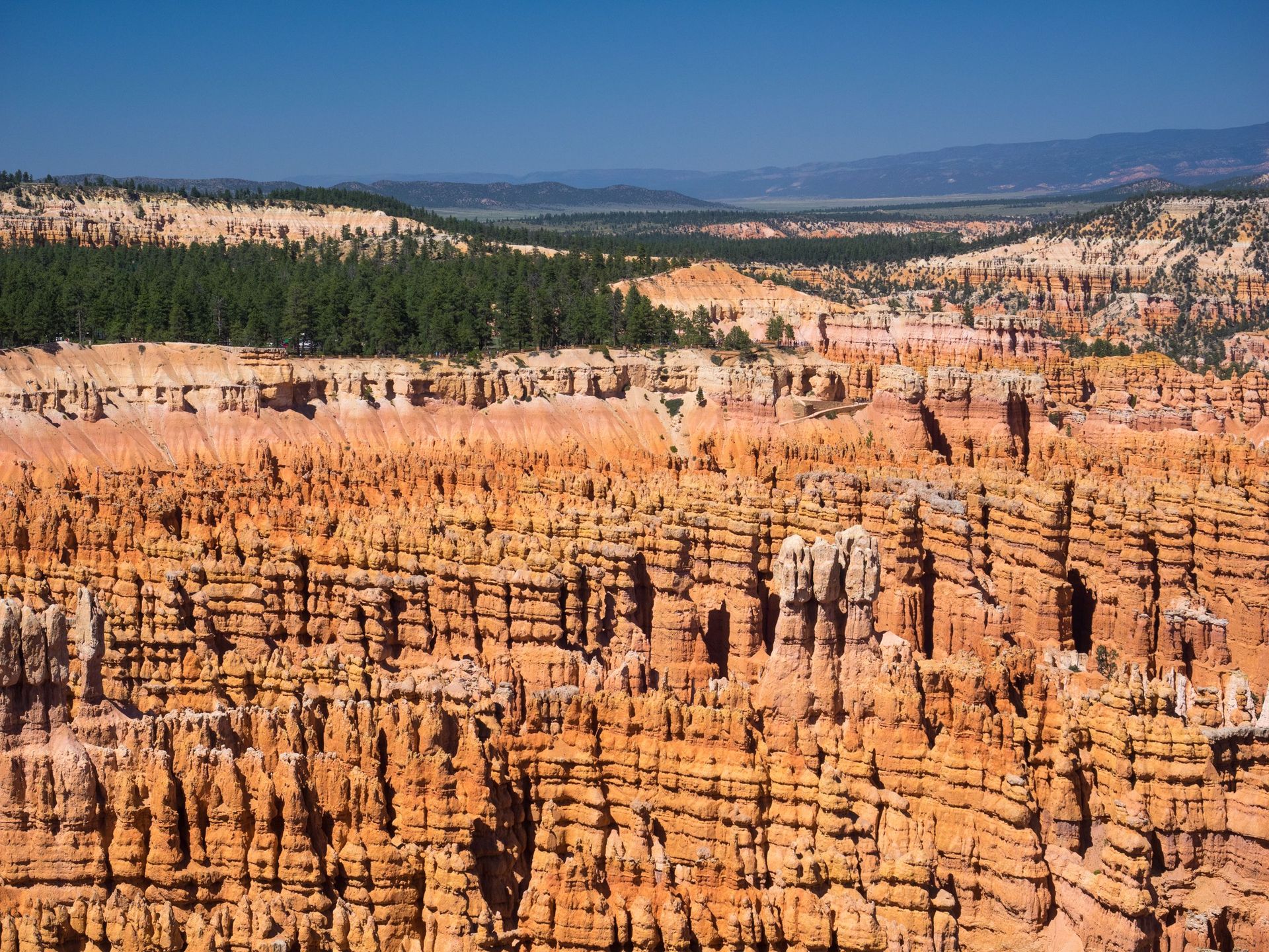
Bryce Canyon in southern Utah is not a canyon in the strict sense — no single river carved it. It is a series of amphitheaters eroded into the edge of a high plateau, and those amphitheaters are filled with hoodoos: slender towers of banded rock, some tens of meters tall, packed together in the thousands. Bryce holds one of the largest concentrations of hoodoos on Earth.
The rock is the Claron Formation, deposited around 40 to 50 million years ago in lakes and floodplains. It consists of limestones, siltstones and mudstones in varying mixtures, tinted pink, orange and white by iron oxides. Crucially, the layers differ in hardness. That variation drives everything that follows.
The dominant sculpting force is frost wedging. The plateau rim sits at high elevation, and for a large portion of the year — the National Park Service cites roughly 170 to 200 days annually — temperatures cross the freezing point daily. Snowmelt seeps into cracks in the rock by day and freezes at night. Water expands about nine percent when it freezes, and that expansion works like a wedge, prying cracks wider with each cycle. Repeated over millennia, freeze-thaw shatters the plateau edge into fins — thin walls of rock — and then breaks the fins into rows of separate towers.
Chemical weathering refines the shapes. Rain, naturally slightly acidic, dissolves the limestone-rich layers faster than the more resistant beds. Harder layers form protective caps and bulges; softer layers recede into waists and notches. The result is the hoodoos' irregular, totem-like profiles.
The same processes that build hoodoos destroy them. Towers collapse regularly, and the amphitheater rim retreats. The landscape visitors see is a snapshot of a formation in constant, slow-motion turnover. Park geologists estimate the rim retreats measurably over human lifetimes, and trails are periodically rerouted as sections of the edge crumble away.
Credit: Ravish Maqsood / Pexels
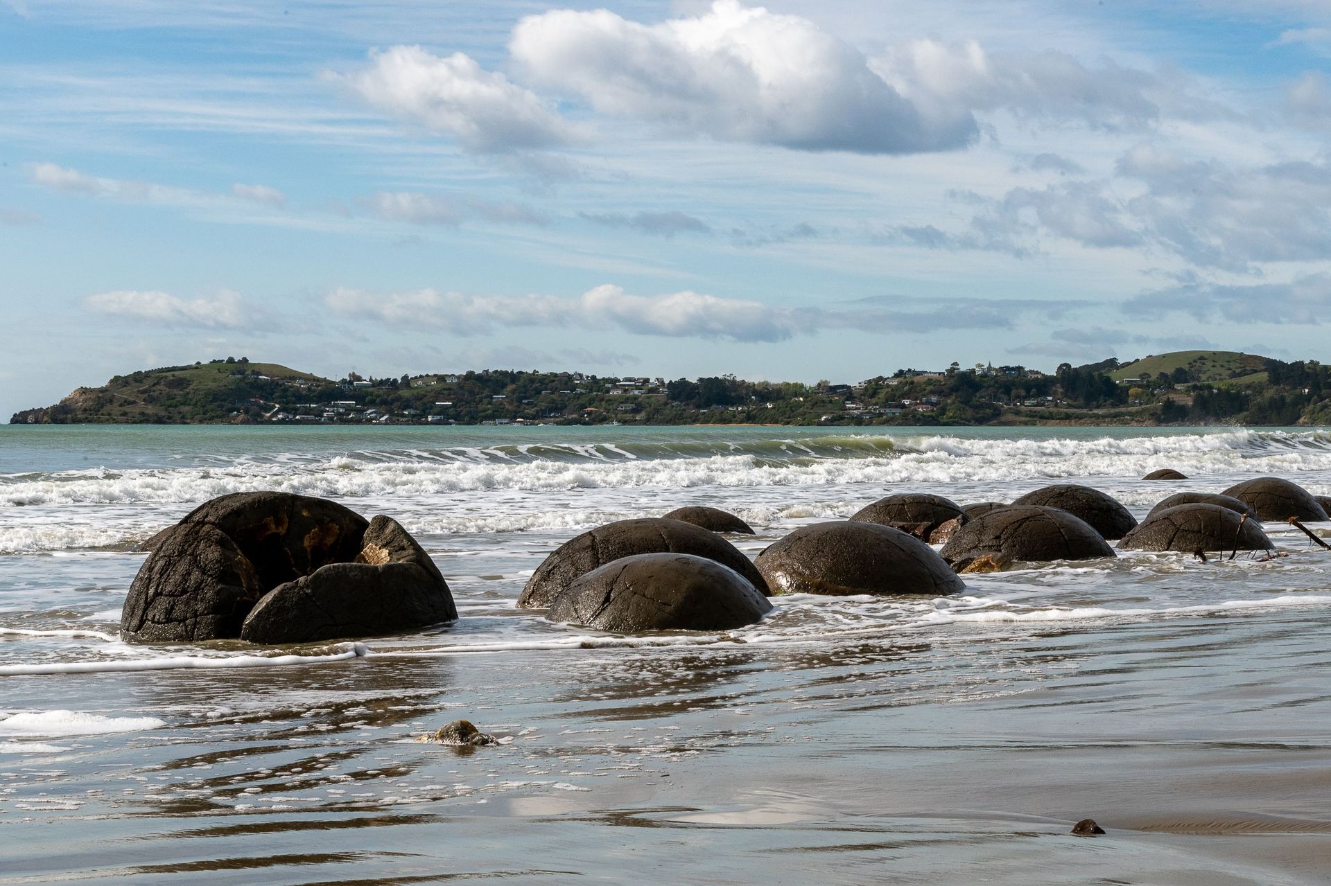
The Moeraki Boulders lie scattered along Koekohe Beach on the Otago coast of New Zealand's South Island: dozens of gray, almost perfectly spherical stones, the largest more than two meters in diameter. They look placed, like abandoned bowling balls. They grew where they now sit — or rather, in the mudstone cliffs behind the beach, which is slowly releasing them.
The boulders are concretions, masses of mineral cement that formed inside sediment. Around 60 million years ago, during the Paleocene, fine mud accumulated on the seafloor here. Within that mud, calcite began to precipitate around nuclei — often a shell fragment, a piece of organic matter or some other chemical trigger. The cement grew outward in all directions at roughly equal rates, which is why the concretions are so close to spherical. Grain by grain, over what researchers estimate took millions of years, the calcite bound the surrounding mud into rock far harder than the untreated sediment around it.
Many boulders display networks of ridges across their surfaces, giving them a turtle-shell pattern. These are septaria: cracks that opened inside the concretions and later filled with yellow and brown calcite. The origin of septarian cracking is still debated, with explanations involving dehydration and shrinkage of the interior or pressure changes during burial.
Erosion delivered the boulders to the beach. The soft Paleocene mudstone that encloses them wears back under wave attack, while the hard concretions resist. As the cliff retreats, boulders emerge, tip out and come to rest on the shore. Partially exposed examples can still be seen embedded in the cliff face.
In Māori tradition, the boulders are the eel baskets and gourds washed ashore from the wreck of the canoe Ārai-te-uru. Similar concretions occur elsewhere in New Zealand and around the world, but few are as large, round and accessible.
Credit: Valeria Drozdova / Pexels
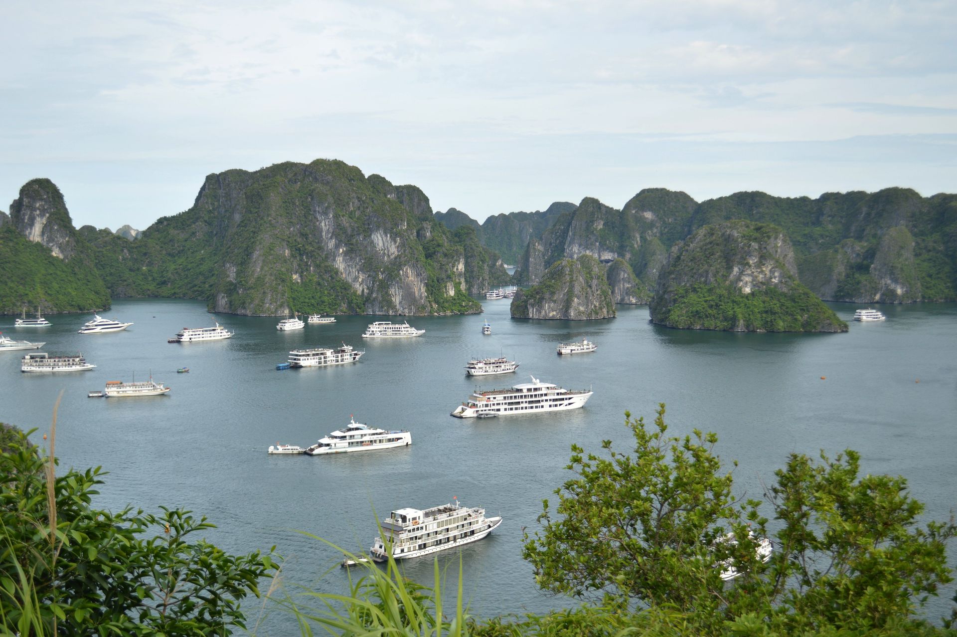
Ha Long Bay, in northeastern Vietnam's Gulf of Tonkin, contains well over a thousand limestone islands and islets rising abruptly from green water. Many are towers with near-vertical walls, capped in vegetation and undercut at the waterline into notches and arches. The bay is a UNESCO World Heritage Site and one of the most recognizable seascapes in Asia.
The limestone itself is ancient, laid down over hundreds of millions of years in warm, shallow seas, largely during the Carboniferous and Permian periods, when the remains of marine organisms accumulated into carbonate platforms hundreds of meters thick. Tectonic movements later raised and fractured these platforms.
The towers are the product of karst evolution taken to an advanced stage. Slightly acidic rainwater dissolves limestone, attacking the rock along joints and faults. Over millions of years, dissolution widened those weaknesses into valleys and sinkholes, progressively consuming the limestone mass and leaving residual hills. In mature tropical karst, the hills take two characteristic forms: fengcong, clusters of conical peaks sharing a common base, and fenglin, isolated towers standing apart on a plain. Ha Long Bay displays both, and geologists have cited it as a reference example of tower karst development.
The sea supplied the final act. Rising water after the last ice age flooded the karst plain, turning hills into islands and valleys into channels. Marine erosion now works on the towers directly: waves and dissolution cut notches at sea level, undermining cliffs, while tidal action helps enlarge caves. Some islands contain large caverns, remnants of underground drainage from the landscape's earlier, dry phase.
The bay's roughly 1,600 islands, most uninhabited, support distinct plant communities on their summits and a tourism industry that Vietnamese authorities now regulate to limit damage from boat traffic and waste. Floating fishing villages, some occupied for generations, persist among the towers.
Credit: Axelspace Corporation / Wikimedia Commons ( CC BY-SA 4.0)
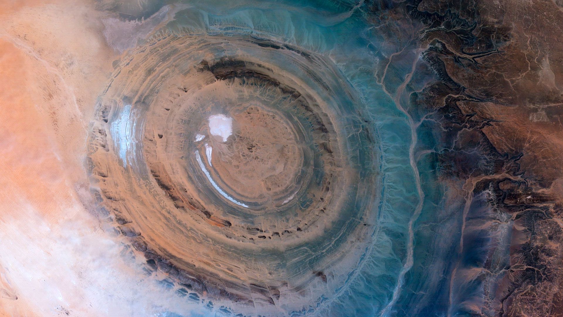
The Richat Structure, also called the Eye of the Sahara, is a set of concentric rock rings about 40 kilometers across in the desert of central Mauritania. From the ground it barely registers — a series of low ridges. From orbit it is unmistakable, a giant bullseye stamped into the Sahara, and astronauts have used it as a landmark since the early days of spaceflight.
Its appearance long invited the wrong explanation. The circularity suggested a meteorite impact crater, and for years that was a leading hypothesis. Field studies undermined it: the structure lacks shocked minerals, such as shocked quartz, and other telltale signatures that confirmed impact sites reliably contain. The scientific consensus now describes the Richat Structure as a deeply eroded geological dome.
The sequence ran roughly as follows. Magmatic activity associated with the breakup of the supercontinent Pangaea intruded beneath layered sedimentary rocks, doming them upward — picture pushing a fist up under a stack of carpets. The uplifted rocks included alternating layers of resistant quartzite and weaker material. Erosion then planed the dome down over tens of millions of years. Cutting horizontally through a stack of upward-arched layers exposes them as concentric circles, the way slicing an onion reveals rings. The tough quartzite layers survived as circular ridges; the softer layers between them wore into circular valleys.
Volcanic rocks, a central limestone-dominated zone and features attributed to hydrothermal activity complicate the details, and researchers continue to refine the story. Breccias — jumbled, cemented rock fragments — near the center point to dissolution and collapse driven by hot fluids.
The structure sits near the town of Ouadane in a hyperarid region, and the same aridity that makes the desert inhospitable keeps the rings crisply exposed, free of the soil and vegetation that hide similar eroded domes in wetter climates.
Credit: Wikipedia Loves Art participant / Wikimedia Commons (CC BY-SA 2.5)
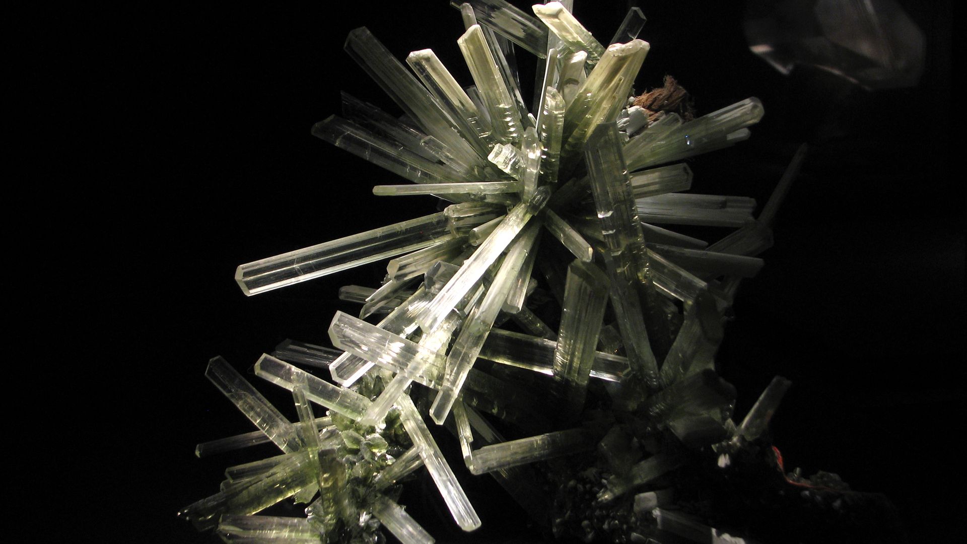
In 2000, miners at the Naica mine in Chihuahua, Mexico, broke into a chamber about 300 meters below the surface and found crystals unlike any documented before: beams of translucent selenite, a form of gypsum, up to around 11 meters long and weighing tens of tons. The Cave of the Crystals held some of the largest natural crystals ever discovered.
The formation required an unusual and stable set of conditions. The Naica mountain sits above a magma chamber, and groundwater filling the mountain's caves was heated geothermally and saturated with dissolved minerals, including calcium sulfate. At higher temperatures, that calcium sulfate tends to form the mineral anhydrite. As the magma below gradually cooled over hundreds of thousands of years, the water temperature settled near a critical threshold — around the mid-50s Celsius — at which anhydrite becomes unstable and gypsum becomes the favored form.
Anhydrite in the surrounding rock slowly dissolved, feeding calcium and sulfate into the water, and gypsum slowly crystallized out. The exchange happened at an extremely gentle pace, with the water hovering near equilibrium, which is precisely what giant crystals require. Fast crystallization produces many small crystals; near-equilibrium conditions produce few crystals that grow very large. Researchers who studied fluid inclusions trapped inside the selenite concluded the beams grew over spans of hundreds of thousands of years.
Humans could barely enter the chamber. Air temperatures around 58 degrees Celsius combined with humidity near 100 percent, conditions that can kill an unprotected person within minutes. Scientists explored in ice-packed suits with breathing apparatus, in visits limited to short intervals.
The cave existed in air only because the mine pumped water out. Mining operations at Naica were later suspended and the chamber reflooded, returning the crystals to the water in which they grew — likely the best outcome for their preservation, since exposure to air had begun to degrade them.
Credit: Niketh Vellanki / Unsplash
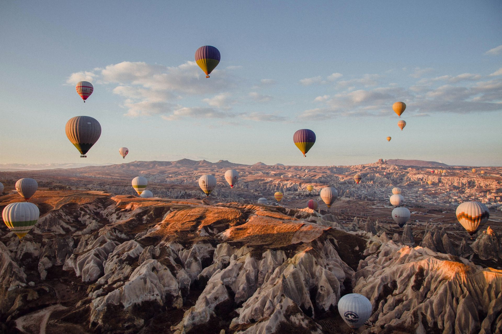
Cappadocia, in central Turkey, is covered with rock spires known as fairy chimneys: tapering towers of pale stone, many capped with a darker boulder balanced on top like a hat. The formations cluster around Göreme and neighboring valleys, where they number in the thousands and rise as high as several dozen meters.
The raw material came from volcanoes. Millions of years ago, eruptions from Mount Erciyes, Mount Hasan and other volcanic centers buried the region in ash. The ash consolidated into tuff, a soft, light rock that carves almost like hard chalk. Later eruptions deposited harder layers, including basalt lava flows and dense ignimbrites, on top of the tuff. That two-layer arrangement — soft rock below, hard rock above — set up the landscape's defining process.
Erosion attacks the layers unequally. Rain, snowmelt and streams cut through the hard capping layer along cracks, then rapidly excavate the soft tuff beneath. Wherever a fragment of the hard layer survives, it shields the tuff directly under it from rain, while the unprotected tuff nearby washes away. The shielded column persists as a chimney, wearing gradually into a tapered cone with its protective boulder still perched on the summit. This mechanism, called differential erosion, continues today; chimneys collapse when their caps finally fall, while new ones emerge along the retreating valley edges.
Humans added a second layer of sculpting. The tuff is soft enough to excavate with hand tools, and people have been digging into it for millennia. Cappadocia contains cave dwellings, rock-cut Byzantine churches with painted interiors and multilevel underground cities such as Derinkuyu, which sheltered thousands of people. Göreme National Park and the rock sites of Cappadocia were inscribed as a UNESCO World Heritage Site in 1985, recognized jointly for the volcanic geology and the centuries of human history carved directly into it.