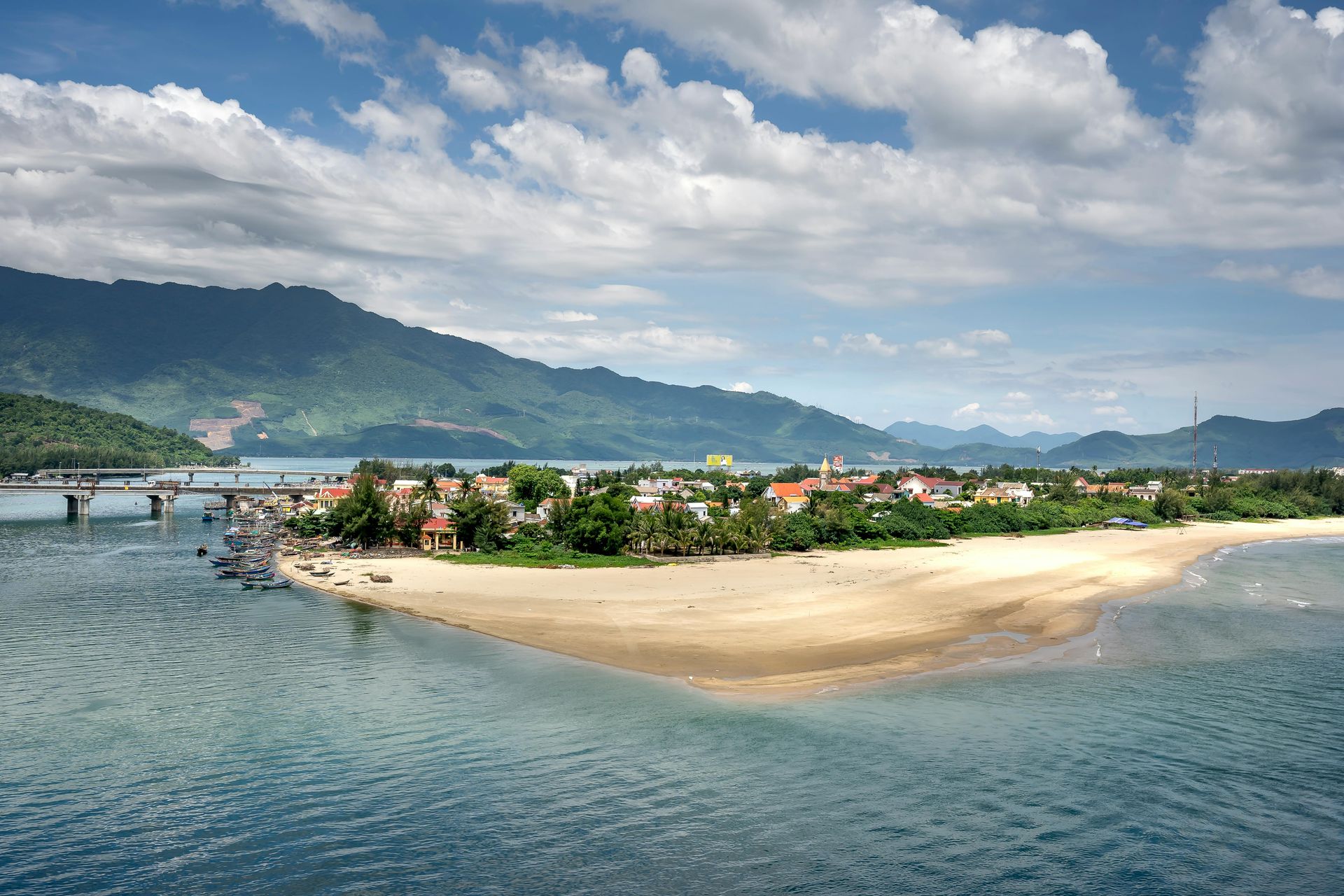
Credit: Evgeny Matveev, Unsplash
The most photographed stretch of the Amalfi Coast now sees more than 14,000 visitors per day during peak summer months. Santorini imposes cruise ship caps. Dubrovnik has asked day-trippers to stay away. The places that once defined the dream of a coastal escape — whitewashed walls, empty harbors, fish pulled fresh from the water — have in many cases become theme-park versions of themselves, managed for throughput rather than experience.
This is not a new problem, but it is an accelerating one. Social media has compressed the timeline between "hidden gem" and "overrun." A single viral post can send visitor numbers climbing within weeks. Infrastructure built for 10,000 annual visitors buckles under 200,000. Housing prices follow, and the fishing families who gave a place its character are gradually priced out, replaced by souvenir shops and short-term rentals.
But coastlines are long, and the world is full of towns that have not yet crossed that threshold. They exist on every inhabited continent — in the fjords of Norway, the rice-paddy coastlines of Vietnam, the volcanic shores of the Azores, the long forgotten fishing ports of southern Chile. What they share is not obscurity for its own sake, but the quality of life that comes before mass tourism arrives: restaurants that serve what the boats brought in that morning, guesthouses run by families rather than hotel chains, streets where the sound of the sea competes only with ordinary human activity.
The towns in this list were chosen for a combination of factors: genuine coastal character, evidence of a functioning local economy that predates tourism, relative difficulty of access compared to nearby famous alternatives, and the absence of the infrastructure — cruise terminals, cable cars, shuttle buses from major airports — that signals a place has already been fully absorbed into the tourist circuit. None of them are inaccessible. All of them are worth the effort it takes to reach them. And all of them, for now at least, still belong primarily to the people who live there.
1 / 25
Credit: Evgeny Matveev, Unsplash
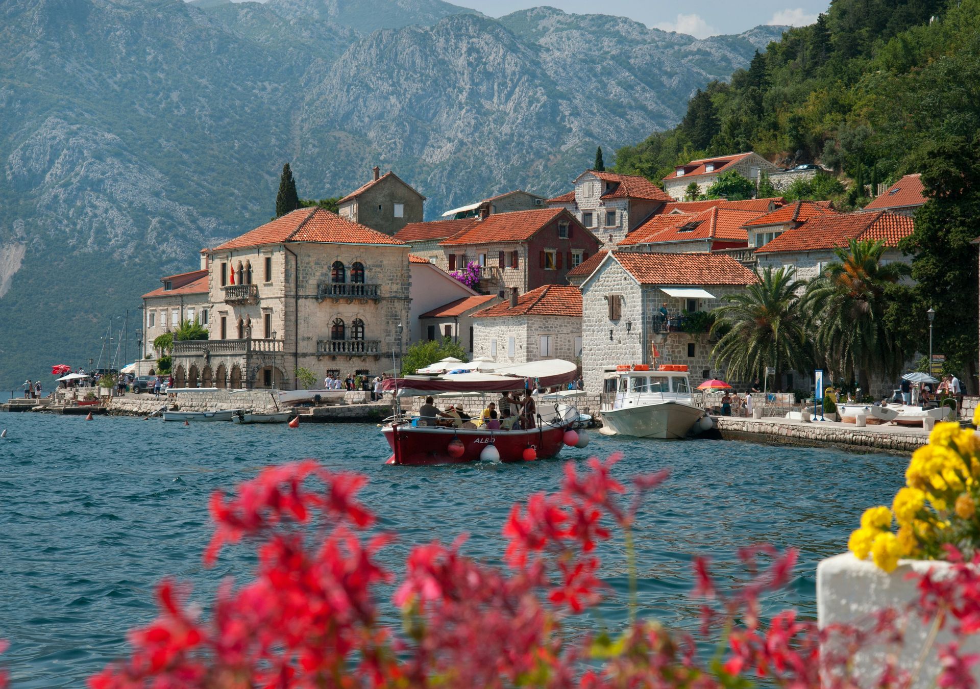
Perast sits on the Bay of Kotor, a landlocked fjord so sheltered it barely feels like the sea. While Kotor's old town has been listed on UNESCO's World Heritage list and fills with cruise passengers on summer mornings, Perast — a ten-minute drive along the bay road — receives only a fraction of that traffic.
The town is tiny, a single long street of Baroque palaces built by wealthy sea captains during the era when Venetian merchant shipping made this part of the Adriatic enormously prosperous. The architecture is genuinely remarkable: stone buildings four and five stories high, with carved window frames and heraldic details, now quietly crumbling in the most photogenic way possible. There is no shopping district, no tour operator hub, no café selling English breakfasts.
The dominant sight is two small islands sitting just offshore. One holds a monastery that has been continuously occupied since the 12th century. The other, Our Lady of the Rocks, was built by local sailors over centuries, a man-made island assembled stone by stone from the seabed. Local boats ferry visitors across for a few euros. The church interior is covered floor to ceiling in ex-votos — silver plaques left by sailors who survived storms — and the overall effect is less tourist attraction than living artifact.
Perast has a handful of guesthouses and restaurants, all of them small-scale. The food leans heavily on Adriatic seafood — black risotto made with cuttlefish ink, grilled branzino, octopus salad dressed with olive oil and parsley. The pace is genuinely slow. On weekday mornings in spring or autumn, you can sit on the waterfront and watch fishing boats without being surrounded by other people watching you watch the fishing boats. That experience, common enough in this region a generation ago, is increasingly rare.
Getting there from Kotor takes under 20 minutes by car. The bay road is scenic enough to justify a slow drive. Most visitors to Montenegro focus on the walled city and the beach towns south toward Budva; Perast captures a different and arguably more authentic version of what this coast has to offer.
2 / 25
Credit: Boris Hamer, Pexels
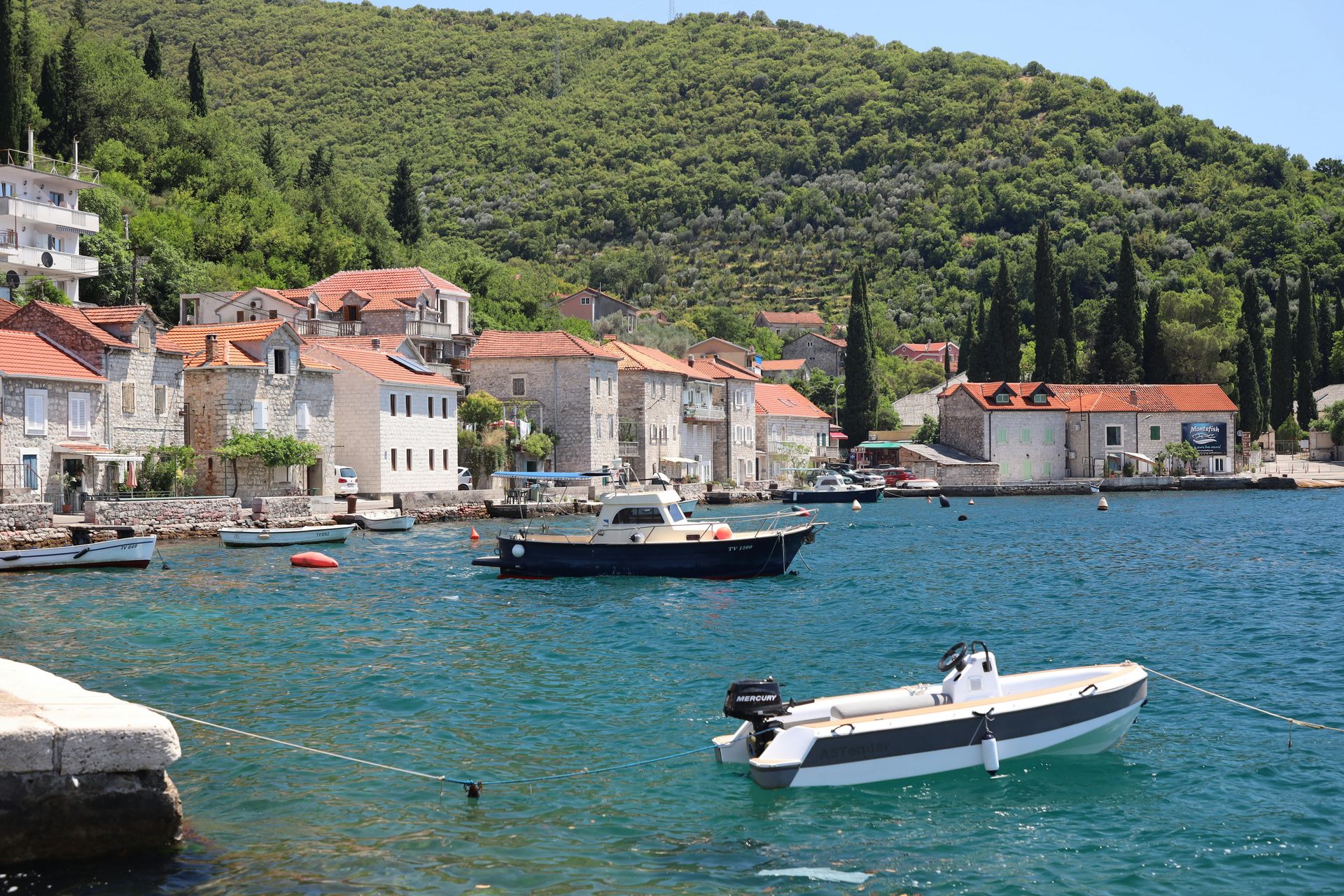
Croatia's Dalmatian Coast has been one of Europe's most popular summer destinations for two decades. Split and Dubrovnik anchor most itineraries; the islands of Hvar and Brač have become firmly established on the international party-and-beach circuit. Vis, the most remote of the inhabited central Dalmatian islands, sits outside most of those itineraries.
The island's distance from the mainland — roughly two hours by regular ferry from Split — functions as a natural filter. It does not have the nightclub infrastructure of Hvar or the day-trip accessibility of Brač. What it has instead is an economy still organized partly around fishing and agriculture, wine production from indigenous grape varieties, and a landscape that feels genuinely rural rather than managed for tourism.
The main town of Vis Town is built around a large harbor and contains a layered history that includes Greek, Roman, and Venetian occupation, followed by a long period as a Yugoslav naval base that kept the island off-limits to foreign visitors entirely until 1989. That late opening to tourism partly explains the relative lack of tourist infrastructure. The harbor cafés are local places that happen to welcome visitors, not tourist operations that happen to have good locations.
The island's secondary town of Komiža, on the western shore, is even quieter — a compact fishing village with a working harbor, a 16th-century Venetian tower, and a reputation for producing some of the best food on the Dalmatian Coast. The local fish stew, brodetto, is made with whatever came off the boats that morning and cooked in tomato, white wine, and herbs. The wine — made from Vugava grapes grown only on Vis — is worth seeking out.
The beaches are mostly pebbly and some require a short boat ride or walk to reach, which keeps the crowds manageable. The island's interior is crossable by bicycle in a morning and contains olive groves, vineyards, and hillside villages that see almost no tourist traffic. For travelers who have been to Croatia before and found the coast more crowded than expected, Vis offers the version of things those famous places used to be.
3 / 25
Credit: Artem Zhukov, Pexels
The Alentejo Coast in southwestern Portugal runs south from the Sado estuary toward the Algarve, and for most international visitors it simply does not exist. The Algarve, with its airport, golf courses, and decades of British package tourism, absorbs the overwhelming majority of visitors. The Alentejo coast, by contrast, is less connected, less developed, and considerably less busy.
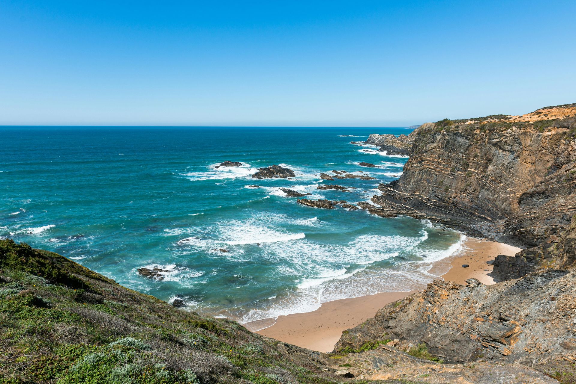
Vila Nova de Milfontes sits at the mouth of the Mira River, on a stretch of coast protected as part of the Vicentine Coast Natural Park. The town is small enough to walk across in 20 minutes but substantial enough to have a real local life — bakeries, a market, hardware stores, bars where older men drink coffee in the morning and wine in the afternoon. The castle on the headland was built in the 16th century to repel pirates and now houses a small guesthouse, one of the most unusual places to sleep on the Portuguese coast.
The beaches here are Atlantic-facing and genuinely wild. The water is colder than in the Mediterranean and the waves are strong enough to attract surfers. The cliffs are reddish sandstone and the dunes behind the beaches are anchored by marram grass and sea lavender. In spring, the hillsides above the coast bloom with cistus and wild lavender in a way that feels like a different country from the manicured resort strips of the Algarve.
The Mira River is navigable upstream and the estuary is a productive area for birdwatching — the wider Vicentine Coast Natural Park is one of the best locations in western Europe for observing migratory birds in spring and autumn. The food is distinctly Alentejan: pork-heavy, bread-based, with the local cataplana stew and fresh-caught fish prepared simply.
Infrastructure is basic by Algarve standards, which is the point. Getting there requires a car or a bus connection from Lisbon that involves patience. In summer the town fills with Portuguese families; in spring and autumn it is close to empty and the coast belongs almost entirely to the people walking it.
4 / 25
Credit: NaturEye Conservation, Pexels
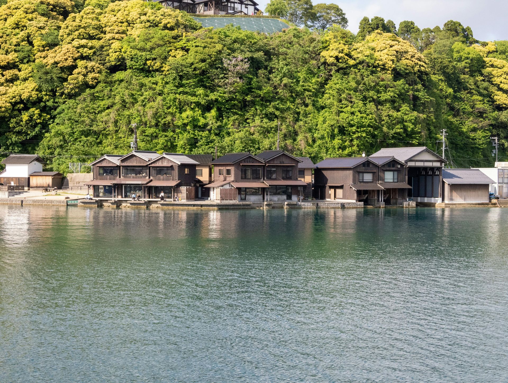
Ine sits on the northern coast of the Kyoto Prefecture, facing the Sea of Japan rather than the Pacific. It is about 90 minutes by bus from the city of Miyazu, and most visitors to Japan's Kansai region never make it this far. The town is known for a single thing: its funaya, a row of traditional boat houses built directly over the water so that fishermen can moor their boats inside the ground floor of their homes.
Roughly 230 funaya survive along the inlet, making Ine one of the best-preserved examples of this architectural form in Japan. They date from the Edo period and have been continuously maintained and used. This is not a preserved street for tourism; the people who live there are active fishing families. The boats go out at night; the lights of the funaya reflect off the water in the morning when the fleet returns.
The settlement is tiny — around 2,000 people — and the infrastructure for tourism is modest. There is a small visitor center, a few minshuku (family-run guesthouses), and a handful of cafés. You can rent a boat for a short tour of the inlet to see the funaya from the water, and local women run a sake brewery that has been operating for generations. The sake, made with local rice and Sea of Japan water, is distinctive and not widely exported.
The broader Tango Peninsula, of which Ine is a part, has a long and relatively undiscovered coastline with hot spring resorts, isolated beaches, and small fishing ports. The coast road between Kyotango city and Miyazu passes through some of the most scenic landscape on Honshu that most tourists never see. Ine works as the anchor for a longer exploration of this region, which rewards slowness and the willingness to follow a road simply because it follows the shore.
5 / 25
Credit: claudia ceruti, Pexels
Chiloé is an archipelago off the coast of southern Chile, separated from the mainland by a narrow channel. The largest island, Isla Grande, is accessible by ferry from Puerto Montt and contains a landscape unlike anywhere else in South America: dense temperate rainforest, peat bogs, dairy farms, and a coastline of tidal flats and wooden churches. Ancud, the island's northern city, is the main entry point.
The town sits on a natural harbor that was one of the last strongholds of the Spanish crown during Chile's war of independence. The 19th-century fort at the harbor mouth is worth an hour. The central market is the place to eat: Chiloé cooking is built around the curanto, a traditional feast in which shellfish, smoked meats, potatoes, and dumplings are cooked together in a pit lined with hot stones and covered with nalca leaves. In the market you can get a simplified version — the milcao potato pancake, the chapalele dumpling, the smoked sausage — for very little money.
Chiloé is also famous for its churches. There are 16 UNESCO-listed wooden churches on the island built by Jesuit missionaries in the 17th and 18th centuries, each one painted in a distinctive color and built in a style that blends European ecclesiastical architecture with indigenous Mapuche building techniques. The nearest ones to Ancud can be reached in a short drive.
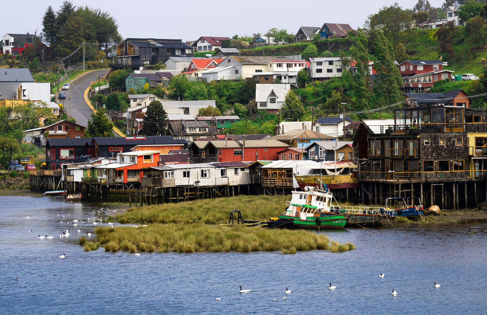
The weather is famously wet — Ancud averages more than 2,000 mm of rain annually — and the light on overcast days has a particular quality that photographers describe as extraordinary. The landscape is most itself in grey weather: the mossy forests, the mist over the water, the painted wooden houses on stilts at the harbor edge. This is not a beach destination, and that is precisely why it has not been overrun. The visitors who come here tend to be those who want to understand a place rather than simply see it.
6 / 25
Credit: 0xd1ma, Pexels
Sicily's southern and southeastern coast holds several well-preserved Baroque towns rebuilt after a major earthquake in 1693. Ragusa and Noto have become reasonably well-known on the cultural travel circuit. Scicli, despite winning international recognition as a filming location and despite being part of the same UNESCO-listed Val di Noto zone, remains considerably less visited.
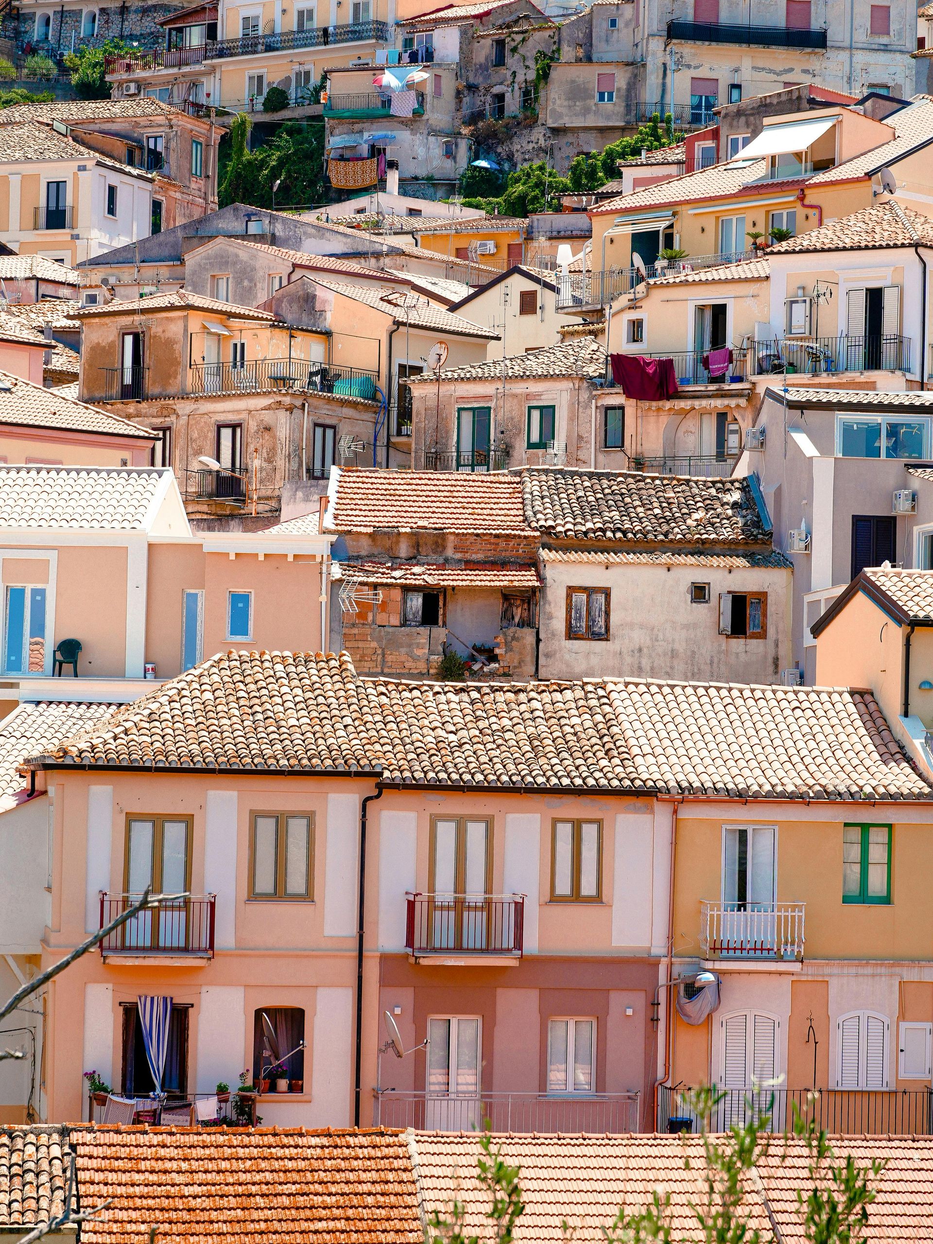
The town sits in a valley carved by three river gorges, and the historic center is built across multiple ridges and cliff faces, giving it a vertical drama that the more photogenic Ragusa Ibla lacks. Churches appear at the tops of staircases cut directly into limestone. Abandoned cave dwellings — sesi — are visible in the cliff faces above the more recent buildings. The whole ensemble has a raw, slightly unfinished quality that feels authentic rather than preserved.
The local economy is based on agriculture — greenhouses visible along the coast produce tomatoes and peppers exported across Europe — and the town has a working-class, unsentimental character that distinguishes it from the more self-consciously beautiful Noto. There are good restaurants, but they are not performing for tourists. The fish comes from Donnalucata, the coastal village 15 minutes away, and the pasta is made with the local tuna and swordfish that Sicilian fishermen have been catching in these waters for centuries.
The nearby coast around Sampieri and Playa Grande has long beaches with fine sand and shallow water, almost entirely occupied in summer by Sicilian families rather than international visitors. The bars serve arancini and granite in the morning, not eggs and toast. Getting there from Catania airport requires a car and about 90 minutes of driving, which filters out the day-trip crowd.
Scicli is worth three or four days — time to walk the gorges, drive the coastal road to Pozzallo, eat well, and sit in the main piazza in the evening when the town comes back to life after the afternoon heat has passed.
7 / 25
Credit: Aqwis, Wikimedia Commons / (CC BY-SA 3.0)
The Sognefjord is Norway's longest and deepest fjord and one of the country's most recognized landscapes. Most visitors see it from cruise ships or from the ferry between Flåm and Bergen, two towns that have adapted fully to mass tourism. Mundal, at the head of the Fjærlandsfjord — a branch of the Sognefjord — receives a fraction of that traffic and has developed a personality entirely its own.
The village has around 300 permanent residents and has positioned itself as Norway's "book town," one of a network of used and antiquarian book towns that exists across Europe. Roughly 10 book shops operate in old wooden farm buildings along the main road, selling second-hand books in Norwegian, English, and other languages. The format requires no explanation in Norway; book towns began in Wales and spread across the continent as a way to bring visitors to otherwise economically marginal villages.
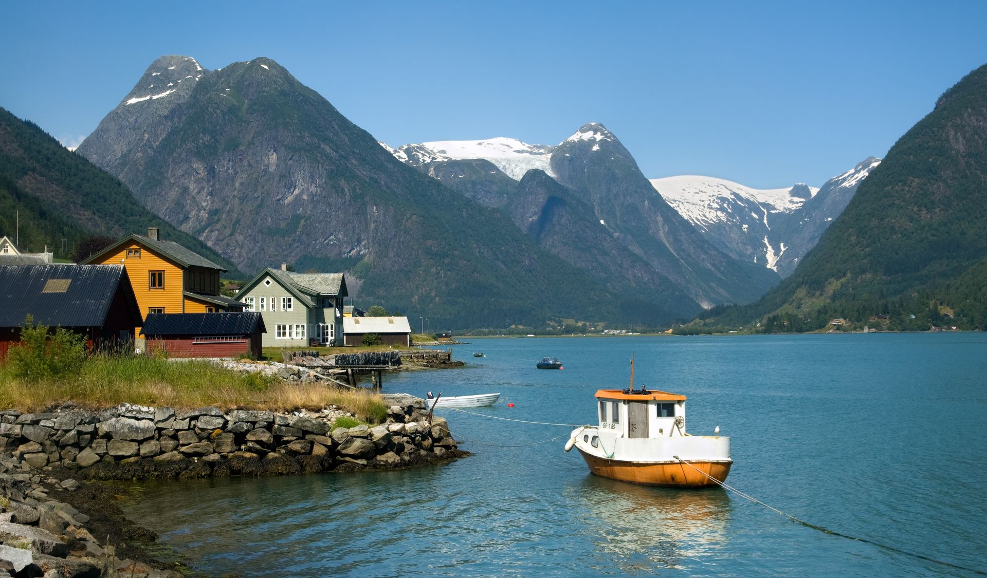
The landscape is the more significant draw for most travelers. Two glaciers — Bøyabreen and Supphellebreen — descend toward the village from the Jostedalsbreen ice cap, Europe's largest mainland glacier. The glacier arms are close enough to walk to. The fjord below the village is calm and deep green. In June, the combination of glacier light and midnight sun creates conditions that are genuinely difficult to describe without lapsing into the kind of language this article is trying to avoid.
Getting to Mundal requires commitment. The ferry from Balestrand is one option; the road through the mountains is another, although the road is closed in winter and in heavy snowfall. That difficulty is precisely what keeps the village quiet. The handful of guesthouses are clean and comfortable without being designed. The food is Norwegian farmhouse cooking — cured meats, brown cheese, fish from the fjord. It is a place that rewards exactly the kind of unhurried attention that more accessible destinations cannot accommodate.
8 / 25
Credit: Jean van der Meulen, Pexels
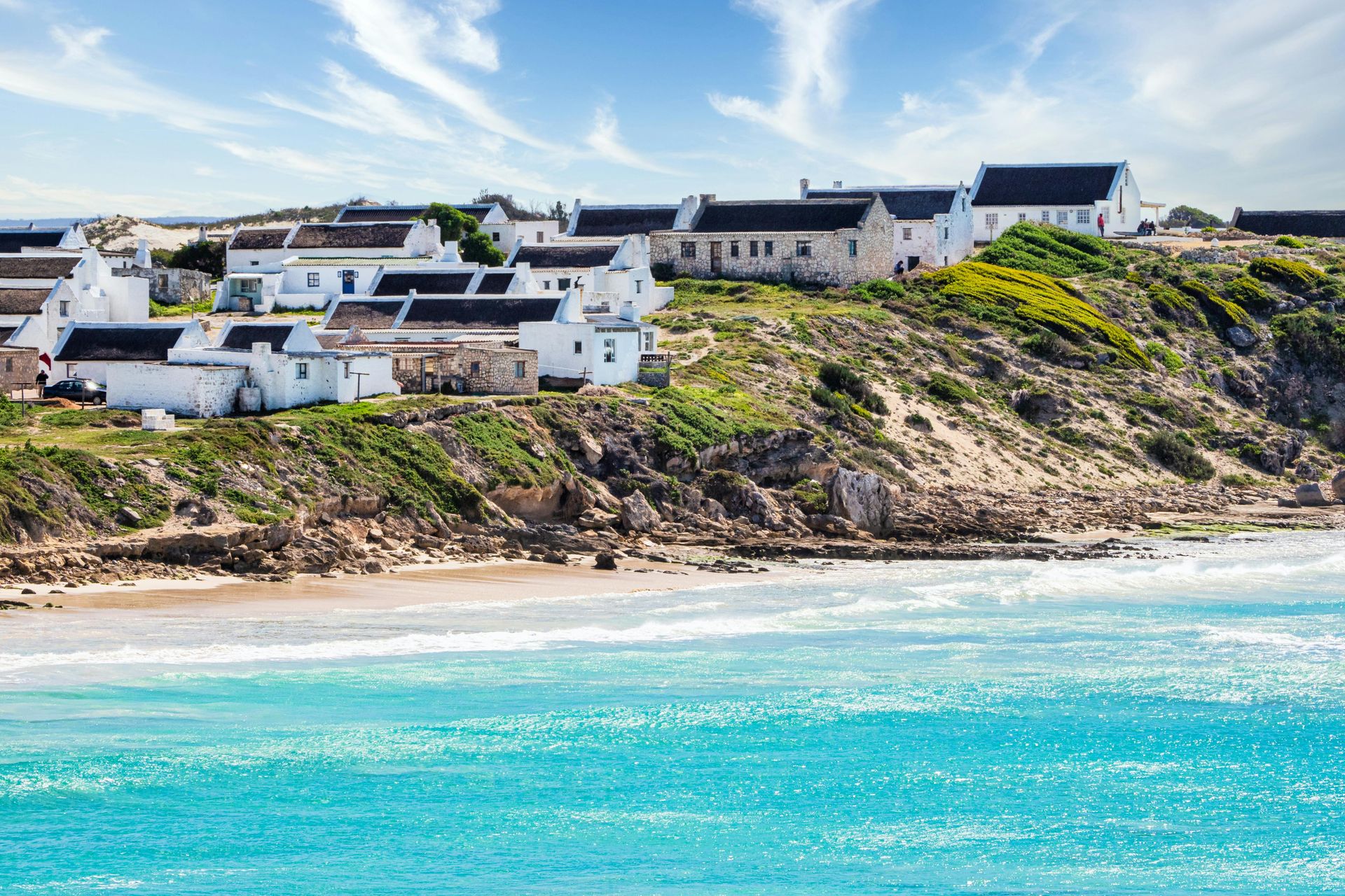
The Western Cape coastline south of Cape Town is divided between the well-known Garden Route on the east and the Overberg on the west and south, a region of wheat fields, whale nurseries, and small fishing towns that most international visitors skip entirely. Arniston — also called Waenhuiskrans, its Afrikaans name — is a small fishing village on the southern tip of the Overberg, about two and a half hours from Cape Town by road.
The white-washed cottages in the historic core, Kassiesbaai, are among the oldest continually inhabited vernacular buildings in South Africa. They were built by the Cape Malay fishing community whose descendants still live in them. The settlement has a protected status that prevents new development within the historic core, and the result is a physical environment that has changed relatively little in a century.
The coastline here faces the cold Benguela Current and is windswept and dramatic. The cave that gives the town its Afrikaans name — Waenhuiskrans translates roughly as "wagon house cliff" — is a large sea cave accessible at low tide, large enough that local legend says wagons were once sheltered inside it. The beach in front of the village is sheltered and the water is shallow, making it usable despite the cold. In the surrounding waters, southern right whales calve between July and November, and it is possible to watch them from the shore without a boat.
The town has a few restaurants and guesthouses. The food is Cape Malay in character — fish curries, pickled fish, snoek prepared in the traditional way. There is nothing to do in the conventional tourist sense, which is exactly what attracts the people who go there. On weekdays outside South African school holidays, the village is as quiet as it must have been a hundred years ago.
10 / 25
Credit: Lee Chalmers, Unsplash
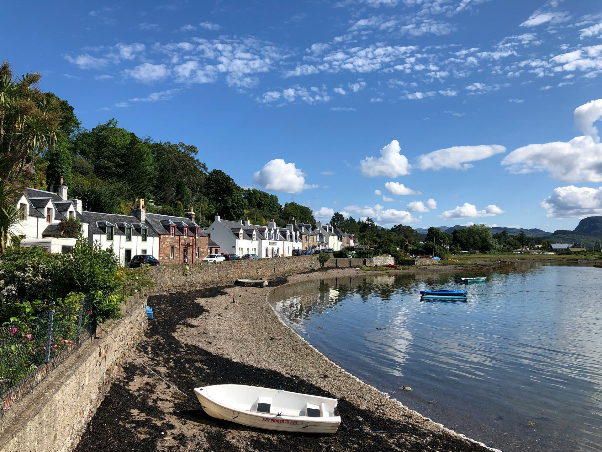
The northwest coast of Scotland is one of the least populated stretches of coastline in western Europe. The villages along it are small, the roads single-track, and the weather variable in ways that discourage those who prioritize comfort over experience. Plockton, on a small sea loch off the larger Loch Carron in the Western Highlands, has the unusual distinction of being both genuinely beautiful and genuinely unknown to most people outside Scotland.
The village faces west across the loch, with views to the mountains of Applecross beyond. It was developed as a planned village in the early 19th century to rehouse fishing families displaced by the Highland Clearances, and the stone cottages along the waterfront were built to a uniform plan that gives the settlement an unusual visual coherence. Palm trees — actually Trachycarpus fortunei, a Chinese windmill palm — grow on the waterfront, warmed by the Gulf Stream to an extent that surprises most visitors.
Plockton has a small but active music scene connected to the broader Gaelic folk tradition of the Western Highlands. The local pub hosts sessions that are informal and participatory rather than staged for visitors. The village is also a departure point for boat trips to see seals on the nearby islands; grey seals are resident year-round and common enough that sightings are essentially guaranteed.
The nearest town of any size is Kyle of Lochalsh, about 15 minutes by road, where the bridge to Skye begins. Skye has been one of Britain's most visited landscapes for a decade and now shows all the infrastructure pressure that comes with that. Plockton is far enough from the Skye circuit to have been left aside. Getting there requires driving or taking the train on the Kyle of Lochalsh line, which runs through some of the most dramatic landscape in Scotland and is one of the best train journeys in Britain. The effort involved is, again, the filtering mechanism.
11 / 25
Credit: Muhammed Fatih Beki, Pexels
Turkey's Aegean coast is one of the more tourist-saturated stretches of coastline in the eastern Mediterranean. Bodrum, Kuşadası, Marmaris — these towns have been shaped by decades of package tourism and exist in a state of managed hospitality that has little to do with the coast's underlying character. Assos, the ancient Greek city now known by its Turkish village name Behramkale, operates in a completely different register.
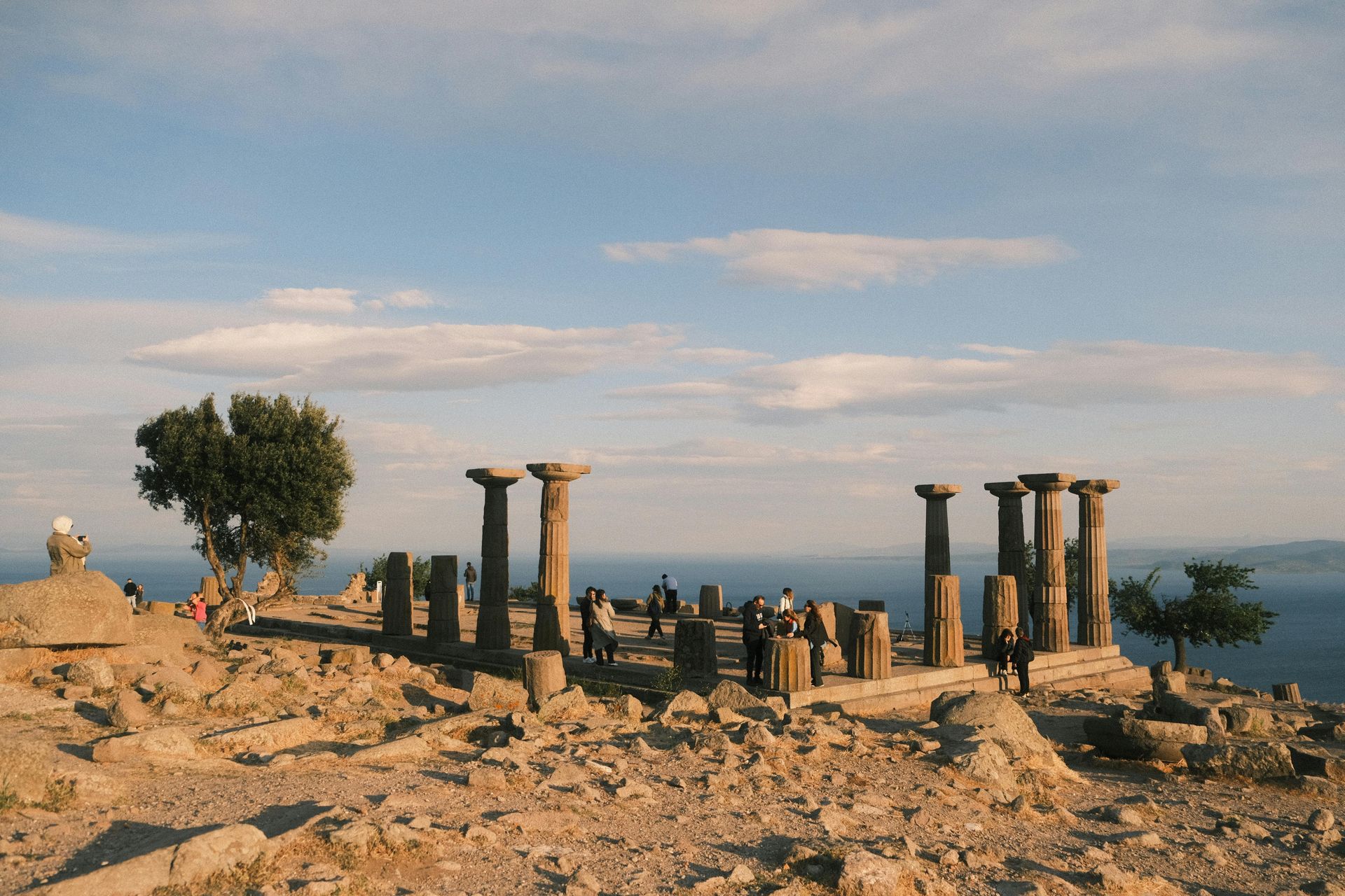
The site sits on a volcanic promontory overlooking the Aegean at a point where the sea between Turkey and the Greek island of Lesbos is only about 10 kilometers wide. The ruins of the ancient city, including a temple to Athena with some of its columns still standing, occupy the hilltop above a modern village of stone houses. The harbor below — the old port area — has a small cluster of stone hotels and restaurants built along the water's edge.
Aristotle taught in Assos for three years after leaving Plato's academy, and the site has a philosophical tradition that a handful of visitors arrive specifically to honor. More commonly, people come because the combination of ancient ruins, dramatic sea views, and functioning traditional village is relatively rare on a coast that has largely traded that combination for amenities. The harbor restaurants serve fish from the strait below and meze prepared in the Aegean style — stuffed vine leaves, marinated vegetables, seafood salads dressed with lemon and olive oil.
The village itself has perhaps 500 permanent residents and the pace is genuinely rural. Donkeys are still used as working animals on the steep paths between the harbor and the hilltop. The stone guesthouses are family-run and the rooms are simple but well-maintained. It is not undiscovered — Turkish travelers and a small number of European visitors have found it — but it has not been built up in the way that almost every comparable site on this coast has been.
12 / 25

Credit: Demetrio Jereissati, Wikimedia Commons / (CC BY-SA 4.0)
Brazil's northeastern state of Maranhão is not on most international travel itineraries, which is one reason its colonial capital Alcântara remains almost entirely outside the tourist circuit. The town sits across the Baía de São Marcos from São Luís, about 90 minutes by boat from the state capital.
Alcântara was the wealthiest town in colonial Brazil during the 17th and 18th centuries, when the sugar and cotton economy made the Maranhão coast one of the most productive parts of the Portuguese empire. The wealth funded an extraordinary concentration of Baroque architecture — churches, manor houses, public buildings — all of which began to decay when the economy collapsed in the 19th century. That decay is now the town's defining quality: the ruins and half-standing buildings are not picturesque in a managed way but genuinely abandoned, colonized by vegetation, slowly returning to the landscape.
The central Praça da Matriz holds the ruins of a church façade that has become the town's defining image — two stone towers standing without a building between them, with the blue sky visible through the arch. The surrounding streets contain further ruins interleaved with inhabited wooden houses painted in the primary colors that characterize vernacular architecture across the Brazilian northeast.
The population of Alcântara includes communities descended from enslaved Africans who escaped Portuguese plantations and established independent quilombo settlements in the forests inland. Their descendants remain and the cultural traditions they maintained — including forms of music and religious practice with West African roots — are still active. The town's isolation has protected these traditions in ways that more connected places have not managed.
Getting there requires the ferry from São Luís, and São Luís itself requires a flight from São Paulo or Fortaleza. The chain of connections filters out casual visitors. Those who make the effort find a place where the 21st century has arrived only partially.
13 / 25
Credit: Evangelos Mpikakis, Unsplash
The Peloponnese peninsula extends south from mainland Greece and contains some of the country's most historically layered landscape. The Mani Peninsula at its southern tip has attracted a small but dedicated following; the Byzantine ruins of Mystras see some visitors. Monemvasia, on the eastern coast near the tip of the middle prong of the Peloponnese, is known in Greece but sees only a fraction of the tourist traffic that its quality would suggest it deserves.
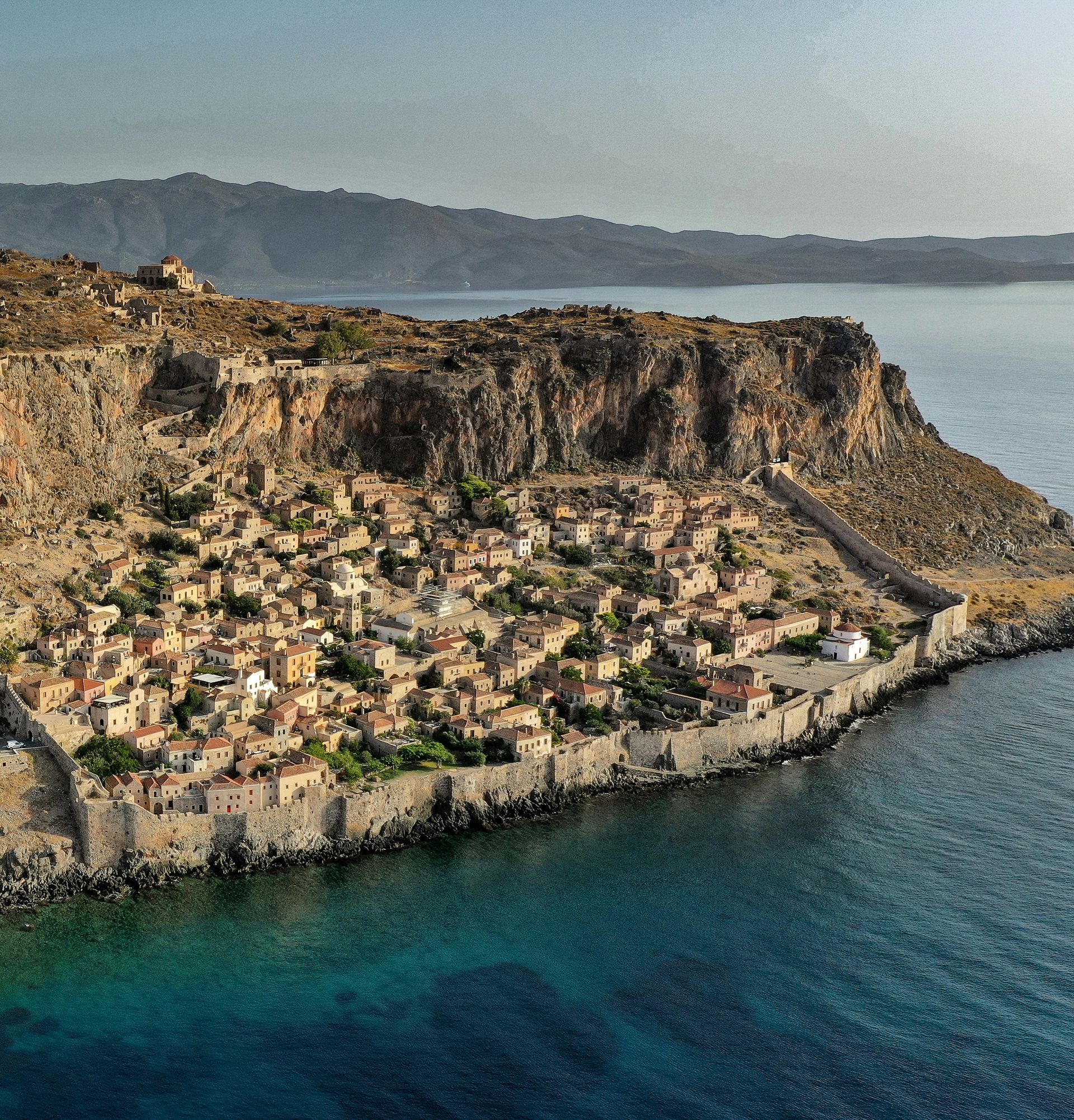
The medieval town is built on a massive offshore rock connected to the mainland by a causeway. From the mainland side, the rock appears completely uninhabited — all the buildings are on the seaward face and invisible until you pass through the tunnel cut in the rock wall. The lower town, still inhabited, consists of Byzantine churches, Venetian mansions, and Ottoman additions layered across each other in the way that only happens in places that have been continuously occupied for over a thousand years. The upper town, the acropolis, is largely ruined and offers views across the Aegean that have not changed since Byzantium.
There are about a dozen small hotels and guesthouses within the walled town, all of them in converted medieval buildings. The rooms are typically stone-walled, small-windowed, and dark in the way that Mediterranean architecture was designed to be — built for heat, not light. The restaurants cook the local fish and produce and the wine is from the Laconia region, which has its own distinct character.
The town works best in spring and autumn. In summer the walled town gets warm enough to be uncomfortable and the causeway road sees enough traffic to diminish the sense of isolation that makes the place work. The rock and the lower town are accessible to day-trippers from Sparta or the coastal road, but the walk up to the upper town filters out most of them. Monemvasia requires a night or two to reveal itself fully.
14 / 25
Credit: Francesco Ungaro, Pexels
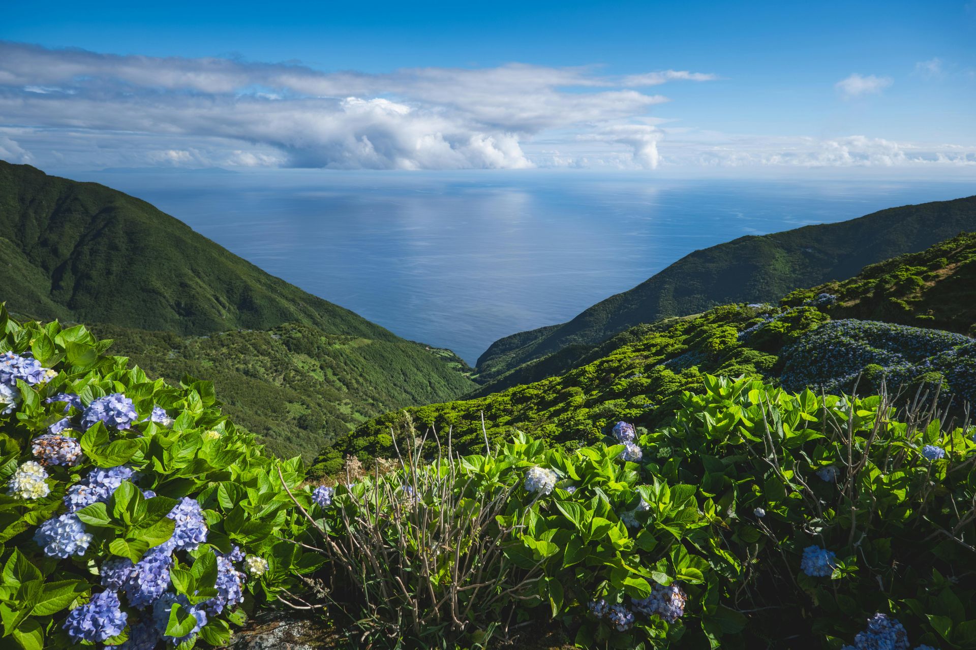
The Azores archipelago sits in the mid-Atlantic, roughly equidistant between Portugal and North America, and has been attracting nature-focused travelers for a decade. The central island of Faial and the western island of Flores are the least visited parts of the archipelago. Flores — the name means "flowers," and it earns it — is the westernmost point of Europe and sees fewer than 30,000 visitors annually.
The island is small enough to drive around in an afternoon and contains a landscape defined by volcanic calderas, crater lakes, and basalt cliffs dropping to the Atlantic. The cliff faces are stained blue and purple with hydrangeas that grow wild across the island, planted originally as field dividers and now effectively feral. The resulting landscape in July and August is something that photographs struggle to capture accurately: stone walls, green fields, blue-purple flower masses, and the grey Atlantic beyond.
The village of Santa Cruz das Flores, the island's capital, is a small port town of whitewashed houses and black basalt detailing. There are a few cafés and restaurants, two or three guesthouses, and a small museum. The food is standard Azorean — beef from the island's dairy farms, fresh tuna from the Atlantic, the local caldo verde with a thicker consistency than the mainland version.
Access requires a short flight from Faial or a ferry passage that depends heavily on weather. The Atlantic swells around Flores are significant enough that the ferry port closes regularly, and travelers who need to be somewhere on a specific date should fly. That unpredictability is part of the island's character. It is a place that operates on its own schedule, not a visitor's. The whale-watching here is among the best in the Atlantic — the deep water close to shore and the migration routes that pass the island make encounters frequent in spring and summer.
15 / 25
Credit: Ani Kameraj, Pexels
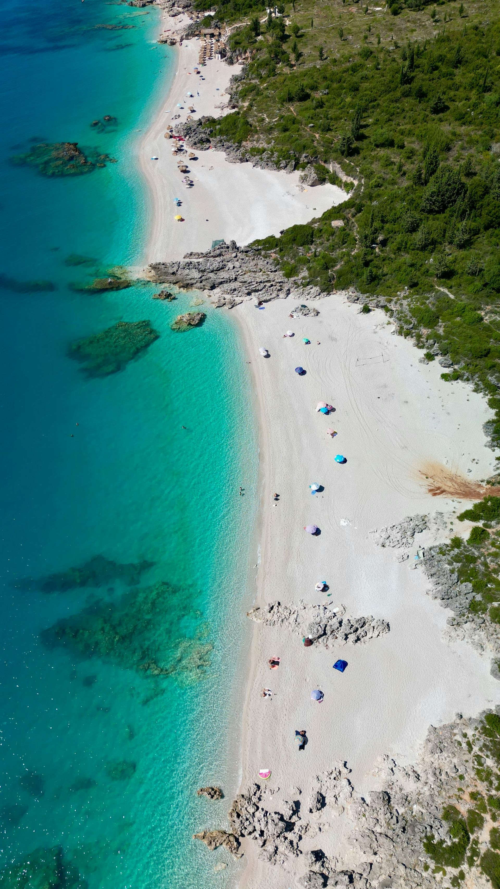
Albania's coast on the Ionian Sea, south of the city of Vlorë, has been developing rapidly since the country opened its borders to tourism following the end of communism. Sarandë, the southernmost town near the Greek border, now sees significant summer crowds and has the resort infrastructure to match. Dhermi, about 80 kilometers to the north on a stretch of coast that requires negotiating a serious mountain road, remains behind the development curve.
The village sits in the mountains above a bay and requires a steep descent to reach the beach. That descent — either on foot down a path or by car down a winding road — keeps the beach from being flooded with people who are not committed to being there. The water in the bay is extraordinarily clear and the colour shifts from turquoise in the shallows to deep blue offshore.
The village itself is old — the stone buildings in the upper part predate tourism by centuries — and the newer constructions along the beach road are mostly basic apartment blocks and restaurants that serve Albanian fish dishes with a directness that the more developed coastal towns have lost. The local grilled fish is excellent; the gjellë e detit, a fish stew with vegetables, is worth seeking out.
The mountain road down to Dhermi from the main Vlorë-Sarandë highway is one of the more dramatic coastal drives in southeastern Europe. The road descends from a pass through hairpin turns with views over the bay that are genuinely vertiginous. Getting there without a car is possible but complicated — shared taxis run from Vlorë and Sarandë but on informal schedules. The reward for the logistics is a beach town that still functions primarily as a place where Albanians and a moderate number of European backpackers and independent travelers spend time together without the mediation of a tourist industry.
16 / 25
Credit: Taxiarchos228, Wikimedia Commons / (CC BY-SA 3.0)
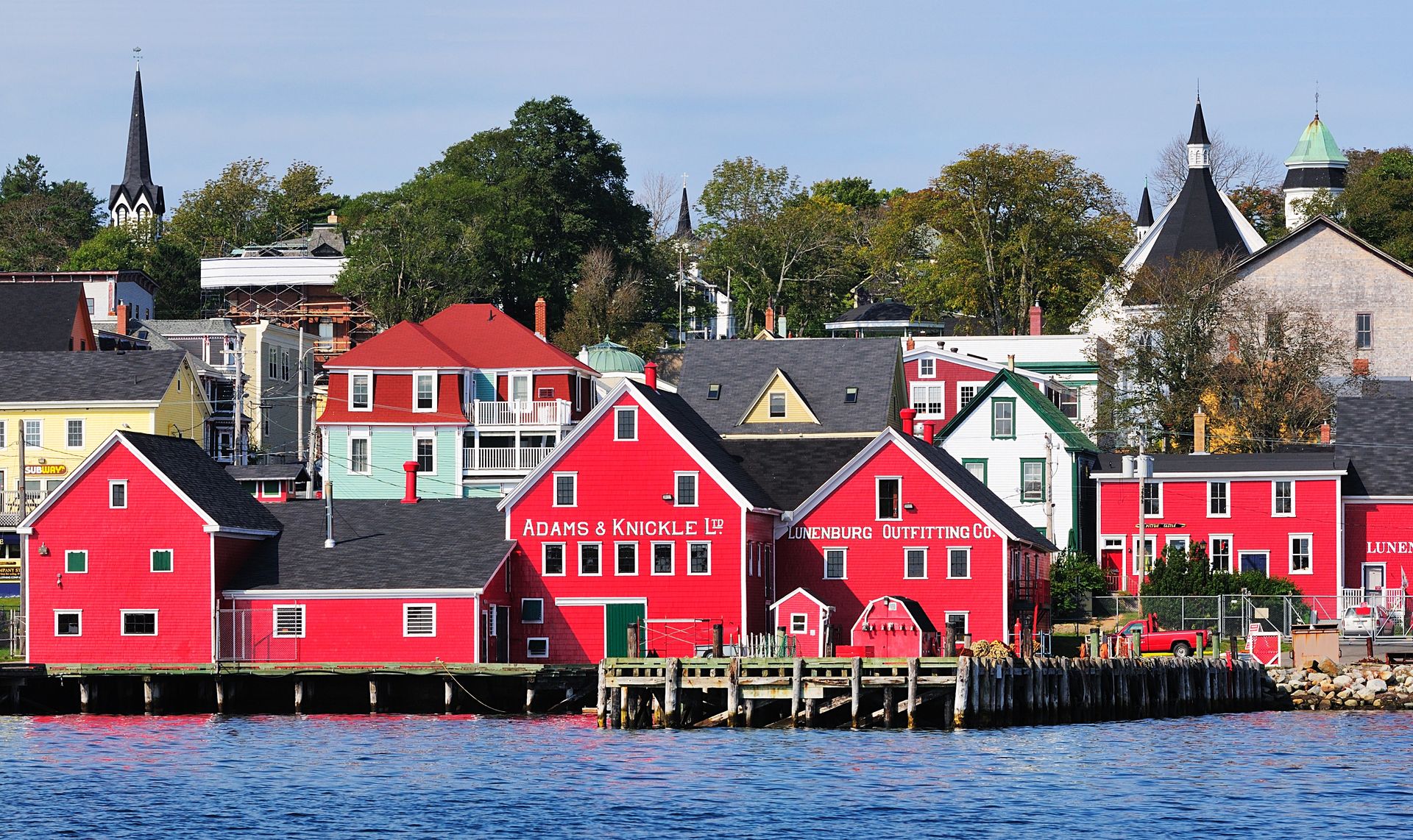
Nova Scotia's South Shore runs west from Halifax along a coastline of granite headlands, spruce forests, and small harbors that once supported one of the most productive fishing fleets in the Atlantic world. Most international visitors to Nova Scotia stop at Halifax and perhaps Cape Breton Island to the north. Lunenburg, on the South Shore, is UNESCO-listed and genuinely worth a day or two, but sees far fewer visitors than its quality would attract in a more centrally located country.
The town was founded in 1753 by German and Swiss Protestants brought by the British Crown to balance the region's Acadian French population. The colonial grid layout and the double-sloped "Lunenburg bump" roofline on many buildings reflect that Central European origin. The buildings are painted in strong, saturated colors — red, yellow, blue, green — that make the waterfront one of the more photographed streetscapes in Atlantic Canada.
The fishing industry centered here produced the Bluenose, a racing and fishing schooner that won international competitions in the 1920s and whose image appears on the Canadian dime. A full-scale replica, the Bluenose II, still sails from Lunenburg and offers passenger voyages during summer. The Fisheries Museum of the Atlantic, on the waterfront, is one of the better maritime museums in the region.
The food in Lunenburg is centered on Nova Scotia seafood — lobster, scallops, and smoked fish are the local staples. The town has a number of restaurants that handle them well. The South Shore Chowder — a milk-based chowder with fish, potatoes, and sometimes salt pork — differs from the cream-based New England version and is the local standard. Getting there from Halifax takes about an hour and a half by road, and the drive through the South Shore landscape is itself worthwhile.
17 / 25
Credit: Ethan Hung, Pexels
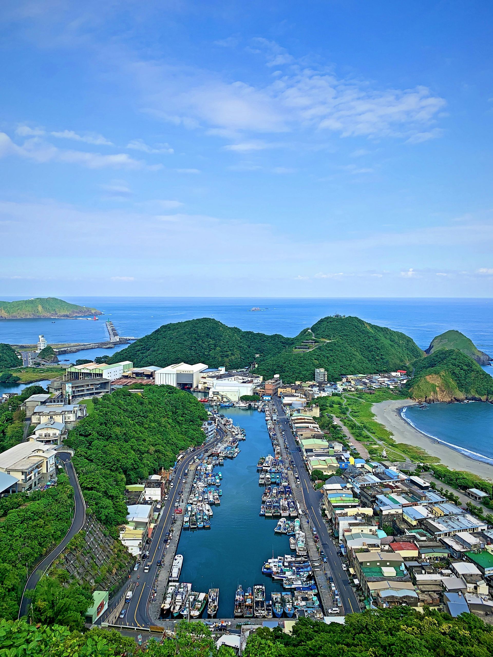
Taiwan's east coast faces the Pacific Ocean and is separated from the more developed west coast by the Central Mountain Range. The train line that runs down the east coast connects a series of small towns — Hualien to the north, Taitung to the south — that see a modest but growing stream of domestic and international visitors. Chenggong, roughly in the middle, is known to Taiwanese people primarily as one of the country's leading fishing ports for marlin and tuna. International visitors rarely go there.
The harbor at Chenggong holds a fishing fleet that brings in blue marlin, bigeye tuna, and swordfish caught in the deep water off the Pacific shelf. The fish market operates in the early morning and the surrounding restaurants serve sashimi and grilled fish of a freshness and quality that the restaurant industry in Taipei cannot replicate regardless of budget. The local version of tuna rice — maguro don in Japanese style, reflecting Taiwan's Japanese colonial past — is the thing to order at breakfast.
The surrounding coastline is rugged and largely undeveloped. The Sanxiantai islet, connected to shore by a footbridge with a distinctive dragon-arch design, is the nearest attraction of note — about 15 kilometers north — and is well-visited by Taiwanese tourists. Beyond it, the coast road runs through rocky shoreline and small Aboriginal Amis communities that maintain fishing and agricultural traditions.
The east coast is subject to typhoons between July and September, which keeps summer visitor numbers lower than the west coast. Spring and autumn are the preferred times to visit. The train is the best way to move along the coast — the East Trunk Line is engineered through dramatic mountain and coastal terrain and the journey itself is worth making without a specific destination in mind.
18 / 25
Credit: Jonathan Borba, Pexels
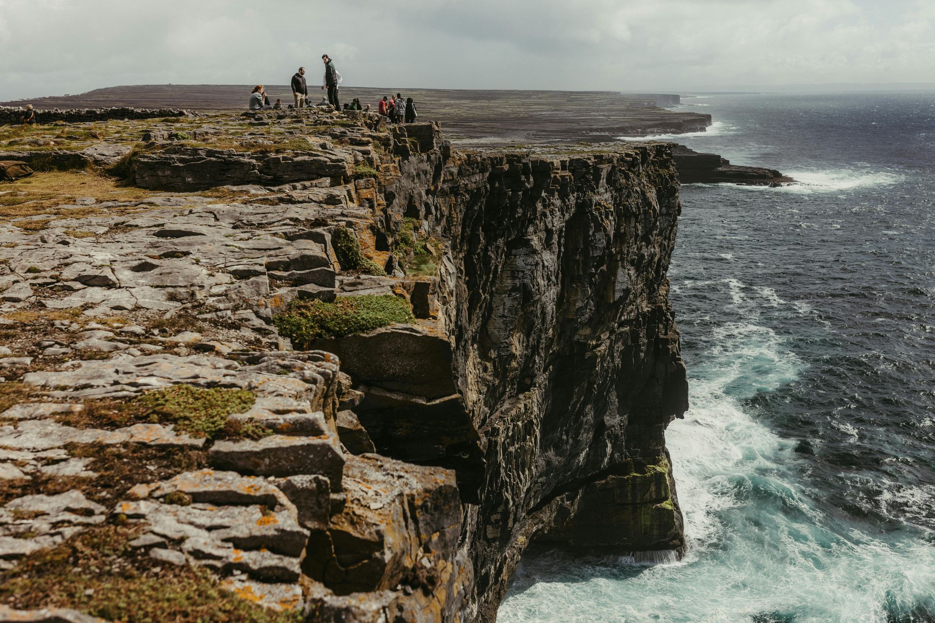
The Aran Islands sit at the mouth of Galway Bay in the west of Ireland, three limestone islands of extraordinary cultural and geological character. The largest, Inis Mór, has been on the tourist itinerary since the early 20th century, when the playwright John Millington Synge spent time there and the filmmaker Robert Flaherty made "Man of Aran" on the island. Despite this history of attention, the islands remain genuinely themselves in ways that most famous Irish places do not.
Kilronan is the main port village on Inis Mór, where the ferry from Rossaveel arrives and where most visitors spend their first hour renting bicycles. The island is flat enough to cycle and the main sites — Dún Aonghasa, a Bronze Age cliff fort on the island's western edge, and the early Christian churches and holy wells scattered across the limestone plateau — are reachable in a day by bike. The cycling infrastructure is basic and the roads are narrow; the experience of riding across the karst limestone with the Atlantic visible on both sides is distinctive enough that no amount of other visitors diminishes it.
Irish is the first language of daily life on the Aran Islands, one of the last functioning Irish-speaking communities in the country. The pubs in Kilronan play trad music that is locally generated rather than performed for tourists. The guesthouses are family-run. The food on the island is limited — the ferry brings most supplies — but what is local is excellent: crab, lobster, and mackerel from the bay, soda bread baked in the old way.
The weather is the deciding factor in planning a visit. The Aran Islands are exposed to Atlantic weather systems and fog, rain, and wind are regular features even in summer. That exposure is inseparable from the character of the place. Clear days on Dún Aonghasa, looking straight down the cliff face to the Atlantic, are among the most memorable experiences available on the Irish coast. They require patience.
19 / 25
Credit: Perry A. Dominguez, Wikimedia Commons / (CC BY-SA 3.0)
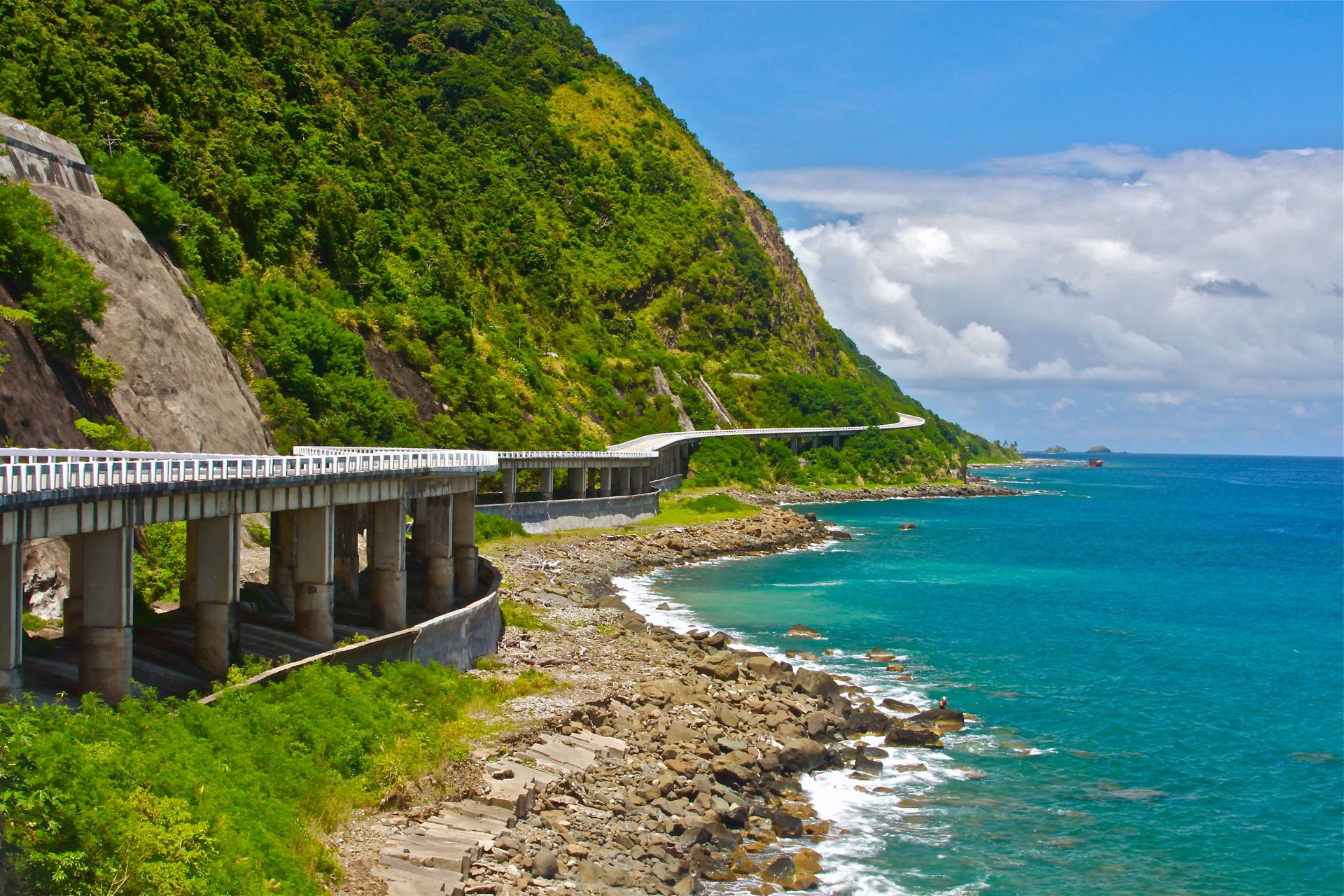
The Philippines is a country of over 7,000 islands, of which a relatively small number — Palawan, Siargao, Boracay, El Nido — absorb the overwhelming majority of domestic and international tourism. Pagudpud, on the northern tip of Luzon in Ilocos Norte Province, sits outside that circuit and has remained relatively undeveloped.
The town's main beach, Saud Beach, is a long curve of white sand backed by palm trees, with the South China Sea on one side and the mountains of the Cordillera in the distance on the other. The water is shallow and warm and the beach is wide enough that even on a busy weekend it does not feel crowded. There is a modest resort cluster at the beach, but most of it is Filipino-owned, small-scale, and priced for domestic tourism.
The surrounding area has its own character beyond the beach. The Bangui Wind Farm, the first commercial wind energy installation in the Philippines, runs along a stretch of coastline north of the town and the turbines visible against the ocean and mountain backdrop have become a point of local pride. The Kapurpurawan Rock Formation — white coral rock eroded by the sea into irregular formations — is a short drive from the beach.
The food in Pagudpud reflects the Ilocano culinary tradition, one of the most distinctive regional cuisines in the Philippines. Bagnet — deep-fried pork belly cooked until the skin shatters — is the defining dish. Pinakbet, a vegetable stew cooked with bagoong shrimp paste, and the various preparations of freshwater fish from the nearby Abra River round out the local table.
Getting to Pagudpud from Manila requires a bus journey of roughly 10 to 12 hours or a flight to Laoag City followed by a two-hour drive. That distance from the capital is the primary reason the town remains uncrowded.
20 / 25
Credit: Никита Шелайкин, Pexels
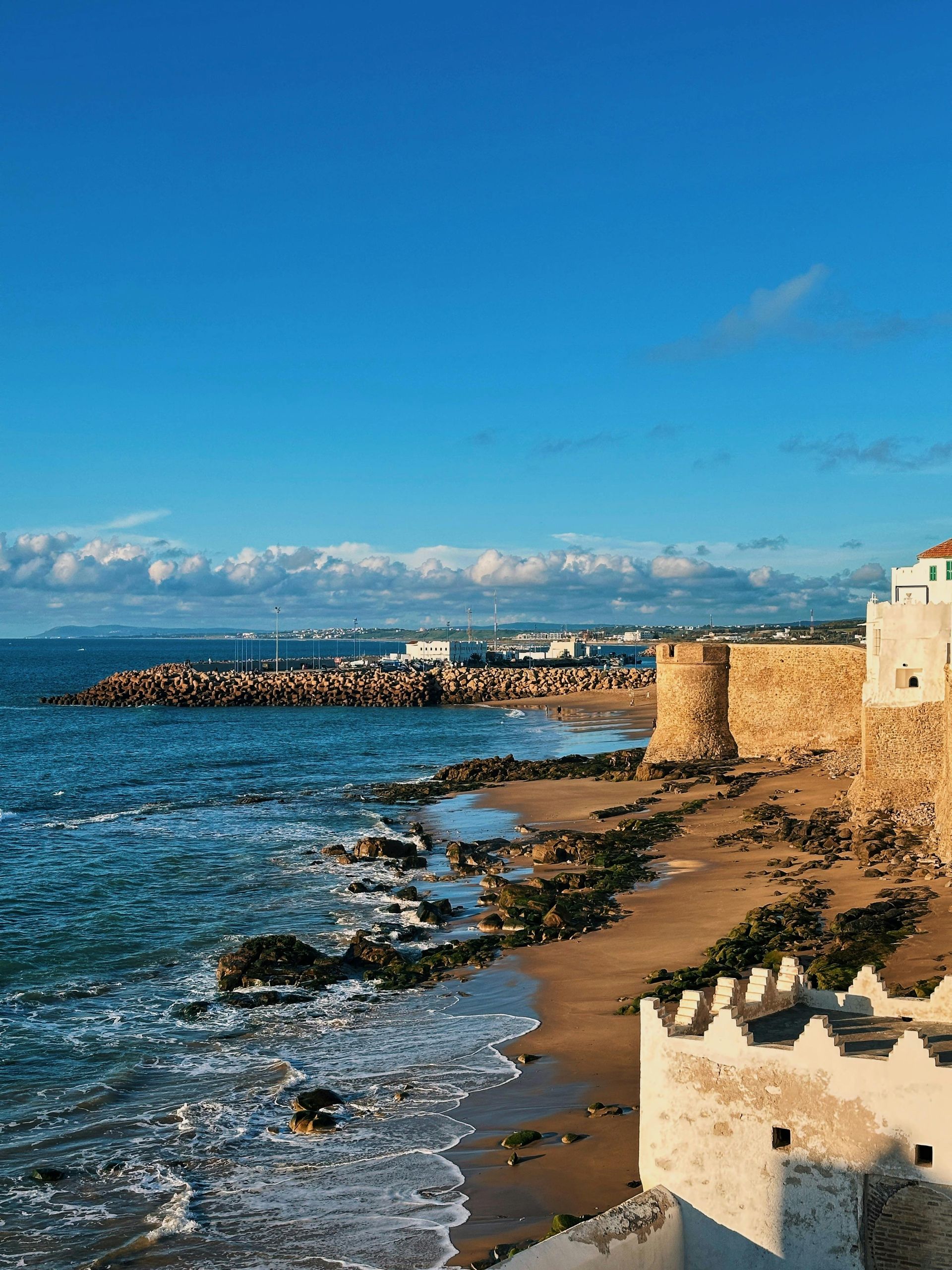
Morocco's Mediterranean coast, including Chefchaouen and the cities of Tétouan and Martil, has been discovered in waves over the past decade. The Atlantic coast, running south from Tangier, is less commonly on international itineraries. Asilah, about 45 kilometers south of Tangier by train or road, is a small walled town on the Atlantic with a history layered across Portuguese, Spanish, and Moroccan occupation.
The medina is compact and genuinely livable — the walls are lower and the streets wider than in more famous Moroccan medinas, and the sensation of being enclosed without being overwhelmed is distinctive. Every August the town holds an international arts festival, and during and after the festival the walls of the medina are covered in large-format murals painted by artists from around the world. Those murals — which change every few years as new ones are commissioned — make the medina walls a kind of open-air gallery that no other Moroccan town replicates.
The beach runs for kilometers in both directions from the town, and the Atlantic breaks here with a force that makes it suitable for surfing but less ideal for swimming in the way that calmer Mediterranean beaches are. The fishing harbor is active in the morning, and the catch comes directly to the town's restaurants in a way that is visible and unmediated — you can watch the boats come in and order the same species for lunch.
The food in Asilah is Moroccan coastal: fresh fish grilled or cooked in chermoula (the herb and spice marinade that is the standard preparation on this coast), seafood pastilla, and the usual tagine and couscous of Moroccan cooking. The medina has a handful of good restaurants and several cafés. It does not have the elaborate riad hotel industry that Marrakech and Fez have built. The accommodation is plainer and the prices lower.
21 / 25
Credit: Shvets Anna, Pexels
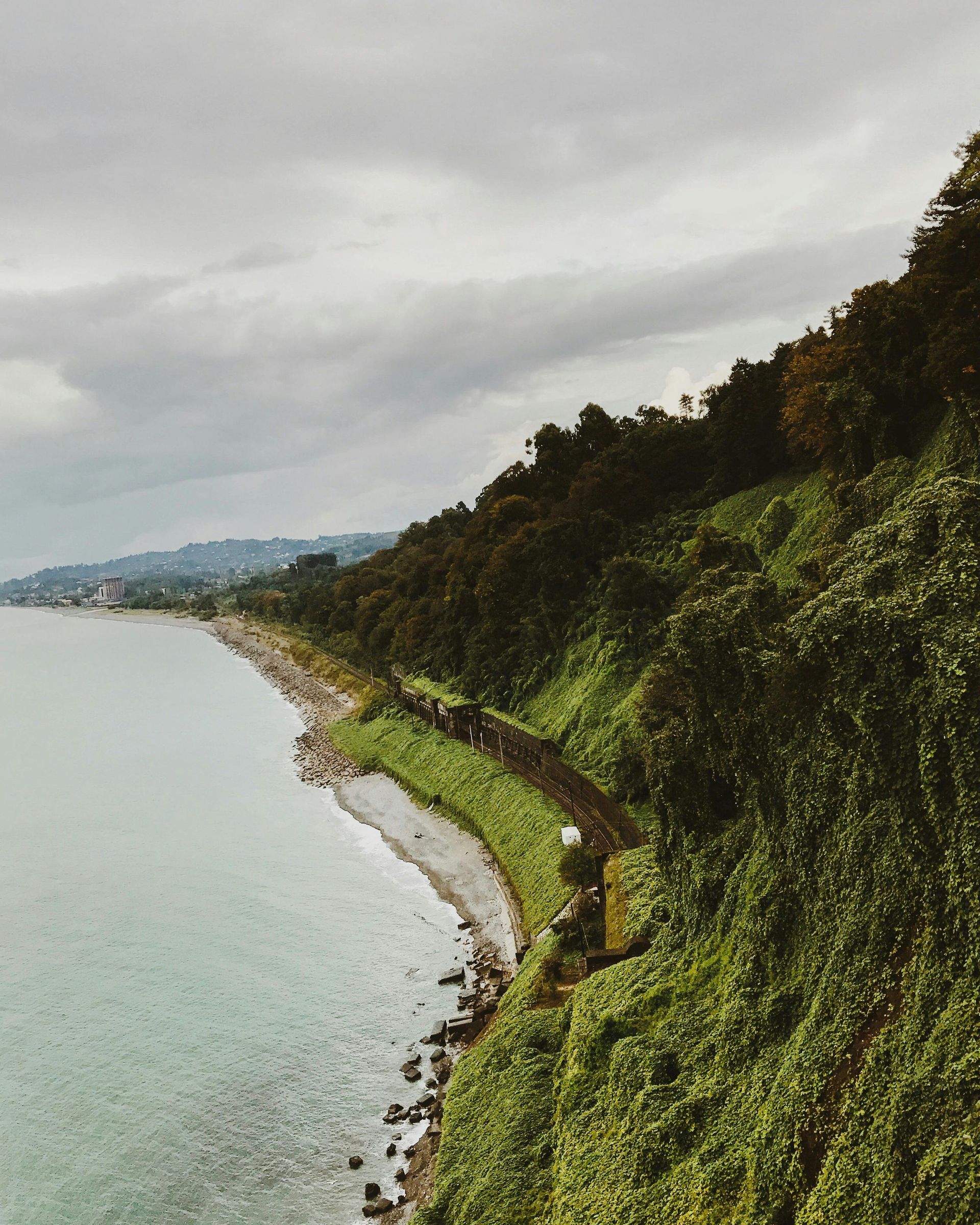
Georgia's Black Sea coast runs south from Russia's Abkhazia border to Turkey, and the main resort infrastructure is concentrated in Batumi, the country's second city, which has been developed with significant investment into a skyline of towers and international hotels. Anaklia, about 60 kilometers north of Batumi near the de facto border with Abkhazia, is at the opposite end of the development spectrum.
The town sits on a wide beach backed by eucalyptus groves and contains an unusually photogenic abandoned fort — Shekvetili Fort — that dates from the medieval period. There is a small resort strip but it is Georgian domestic tourism infrastructure: basic wooden bungalows, barbecue facilities, simple restaurants serving Georgian coastal food. The Black Sea here is warm from July through September, and the beach is wide and sandy.
The access road from Batumi passes through Poti, Georgia's main Black Sea port, and through wetland delta landscapes that form an important bird migration corridor. The Kolkheti National Park, which protects these wetlands, begins near Anaklia and extends inland. The combination of beach, wetland, and mountain views makes the area more interesting ecologically than most of the developed Black Sea coast.
Georgian coastal food is different from the more famous inland cuisine. Smoked fish from the Black Sea, fresh cornbread, and dishes from the Mingrelian culinary tradition — heavier with walnuts, spicier than Tbilisi cooking — characterize what is served. The wine is inland Georgian, trucked to the coast; the Rkatsiteli and Saperavi varieties are the standard.
Getting to Anaklia is easiest by marshrutka (shared minibus) from Batumi or by hiring a car. The journey takes about an hour. The border situation with Abkhazia means the northern approach is closed, which limits the town to a single road in and out and suppresses development pressure.
22 / 25
Credit: wirestock, Magnific
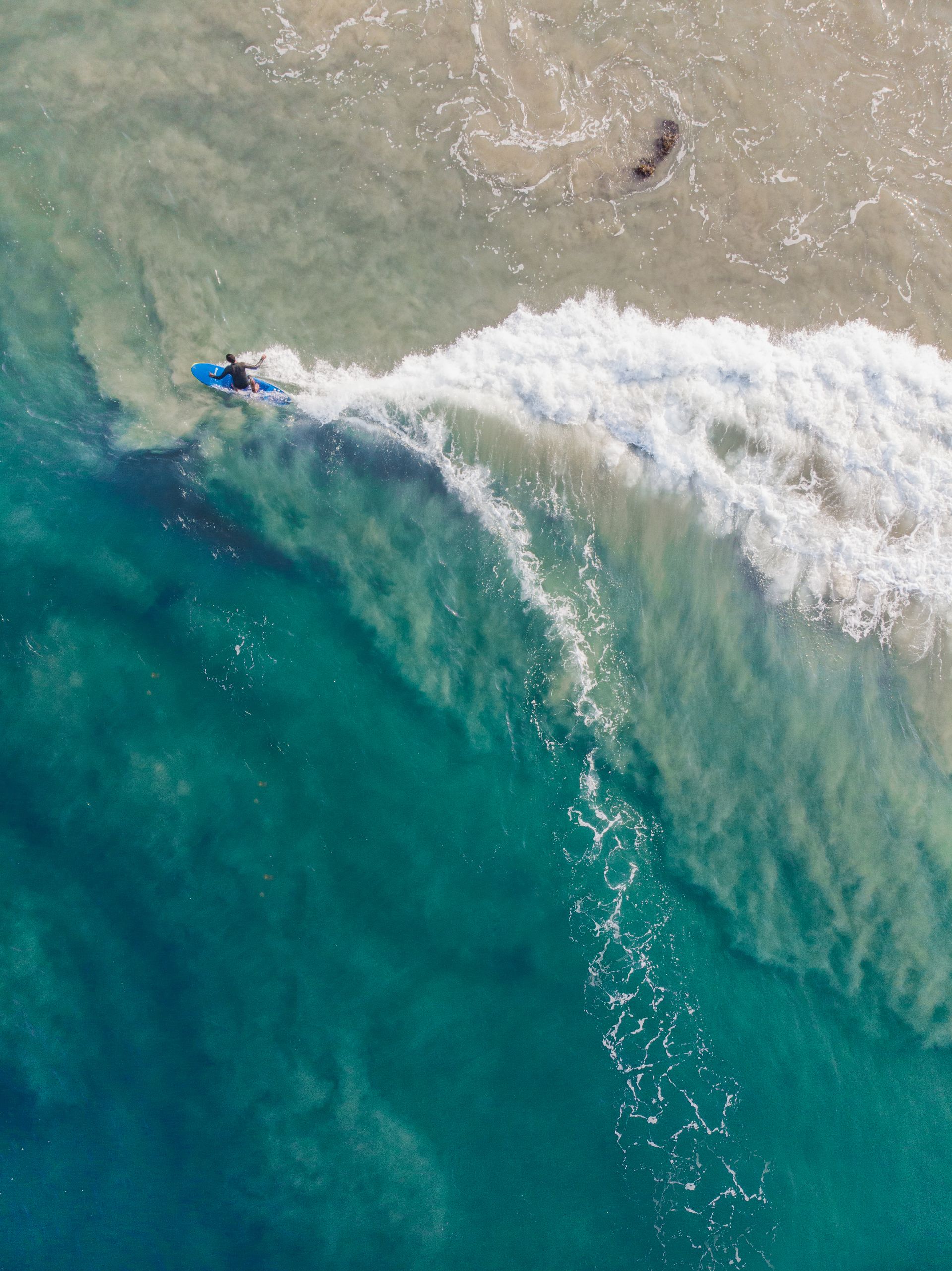
South America's Pacific coast is one of the world's longest continuous shorelines, running from Colombia to Tierra del Fuego. Most of it is cold — the Humboldt Current keeps the water below 20°C even in summer as far north as Lima. Máncora, in the far north of Peru near the Ecuadorian border, is the exception: the Humboldt weakens here and the water is warm enough for swimming year-round.
The town has been a gathering point for backpackers and independent travelers since the 1990s and has a cluster of guesthouses and restaurants along the main beach road. What it lacks is the resort infrastructure of the Brazilian coast or the Caribbean — no all-inclusive hotels, no package tour circuit, no marina full of chartered boats. The visitors who come are mostly South American — Limeños on weekend breaks, Ecuadorians driving south — with a smaller contingent of international travelers.
The beach is long and the waves are reliable enough for surfing; the water temperature makes surfing comfortable year-round. Freshly prepared ceviche — the Peruvian preparation with ají amarillo chili, red onion, and lime — is the dominant food and the local version, made with whatever the boats caught that morning, is among the best in a country where ceviche is already taken seriously. The lobster from the area around Cabo Blanco, about 20 kilometers south, was once famous enough to attract Ernest Hemingway.
The road north from Máncora continues to the Ecuadorian border at Aguas Verdes. The entire northern Peruvian coast is warmer and greener than the rest of the country's coastline and the small towns between Máncora and Tumbes are largely unknown outside Peru. Staying a few extra days to explore that stretch, rather than immediately connecting to Ecuador, reveals a version of the Peruvian coast that the usual Lima-Cusco-Machu Picchu itinerary never shows.
23 / 25
Credit: Monika Michelson-Mõik, Wikimedia Commons / (CC BY-SA 4.0)
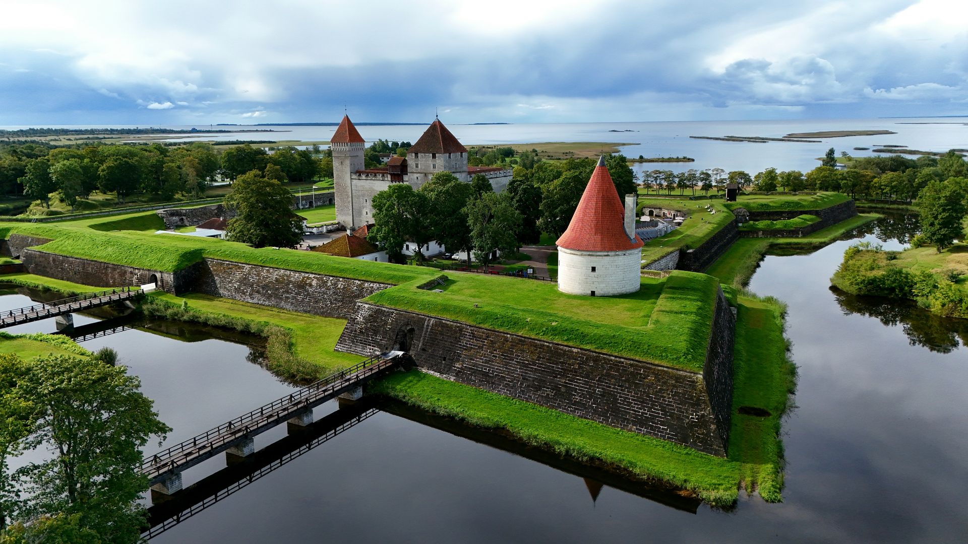
The Baltic Sea coastline of Estonia is flat, pine-forested, and punctuated by islands that were closed to foreign visitors during the Soviet period. Saaremaa, Estonia's largest island, was a restricted military zone until 1990 and has been open to tourism for only a generation. The island's capital Kuressaare is one of the better-preserved small medieval towns in the Baltic region and sees only modest international visitor numbers.
The Kuressaare Episcopal Castle, a 14th-century fortress on the edge of the town, is one of the most intact medieval castles in the Baltic states. Its setting on a small promontory over the sea, surrounded by a moat, is photogenic in a way that does not require photographic manipulation. The castle contains a well-organized regional history museum. The old town beyond the castle has a market square and several streets of 18th and 19th-century wooden buildings in the style that characterizes Estonian vernacular architecture.
Saaremaa is known in Estonia for its spa culture — several resort spa hotels operate outside Kuressaare, drawing on the mineral mud and spring water that the island has been known for since the 19th century. This domestic spa tourism keeps the island's hospitality infrastructure viable outside the short summer season. For international visitors, the spas are an affordable luxury compared to equivalent facilities in Scandinavia.
The island's coast is heavily indented and contains some of the most pristine natural landscapes in the Baltic Sea region. The Vilsandi National Park on the western coast protects wetlands and seabird colonies. The juniper forests — a distinctive ecosystem of the Baltic limestone islands — are preserved in several areas of the island's interior. The food is Estonian coastal: smoked fish, black rye bread, dairy products, and the local beer brewed by the Saaremaa brewery.
Getting there requires either a ferry from Virtsu on the mainland (about 30 minutes) or a flight from Tallinn. Tallinn itself is a well-known destination, and the two-hour drive from there to the ferry terminal makes Saaremaa a reasonable extension of a Baltic trip.
24 / 25
Credit: Claudio Giovenzana, Wikimedia Commons / (CC BY-SA 3.0)
Oaxaca's Pacific coast has been developing faster than most of Mexico's other beach destinations over the past decade. Puerto Escondido is now well-known for surf and has the infrastructure to match; Zipolite has a long-standing reputation as a clothing-optional beach. Mazunte, a small village a short distance from both, has its own character that distinguishes it from its neighbors.
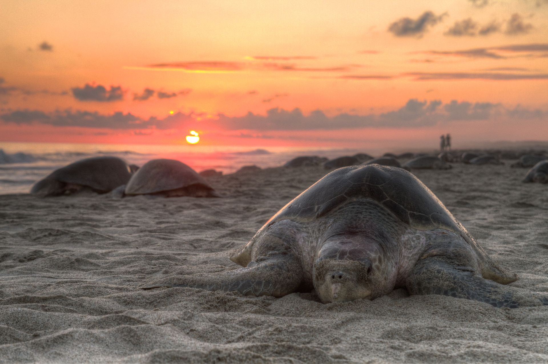
The village was originally dependent on the sea turtle processing industry, which was banned in Mexico in 1990. The transition that followed was difficult but has produced a community with an unusual degree of environmental awareness and cooperative economic organization. The National Mexican Turtle Center operates nearby and the beaches are protected nesting sites for Olive Ridley and leatherback sea turtles. In nesting season — roughly July through February — mass nesting events called arribadas bring thousands of turtles ashore simultaneously, and rangers allow small numbers of visitors to observe them.
The beach at Mazunte is crescent-shaped and rocky at the headlands, with a broad sandy center. The surf is strong and the currents can be dangerous; the beach is for swimming only in the calmer central section, and local knowledge matters. The cliff walk from the headland to the point at Punta Cometa, the southernmost point of Oaxaca, is 30 minutes and offers views down both coasts.
The local economy includes a cosmetics cooperative — the Cosméticos Naturales factory produces body care products from local plants and is one of the few community-owned enterprises of its kind in Mexico — and a scattering of small restaurants, palapa bars, and guesthouses. The food is Oaxacan coastal, which means tlayudas, tamales, and fresh fish prepared with chili and lime. The mezcal available locally is from Oaxaca's interior and is generally of very good quality.
25 / 25
Credit: Noor din, Pexels
The Faroe Islands, an autonomous Danish territory in the North Atlantic between Iceland and Norway, have emerged on the travel radar over the past several years as a hiking and landscape destination. Tórshavn, the capital, sees most of the visitor traffic. The smaller villages — and the Faroes has many of them — remain largely outside the tourist flow.
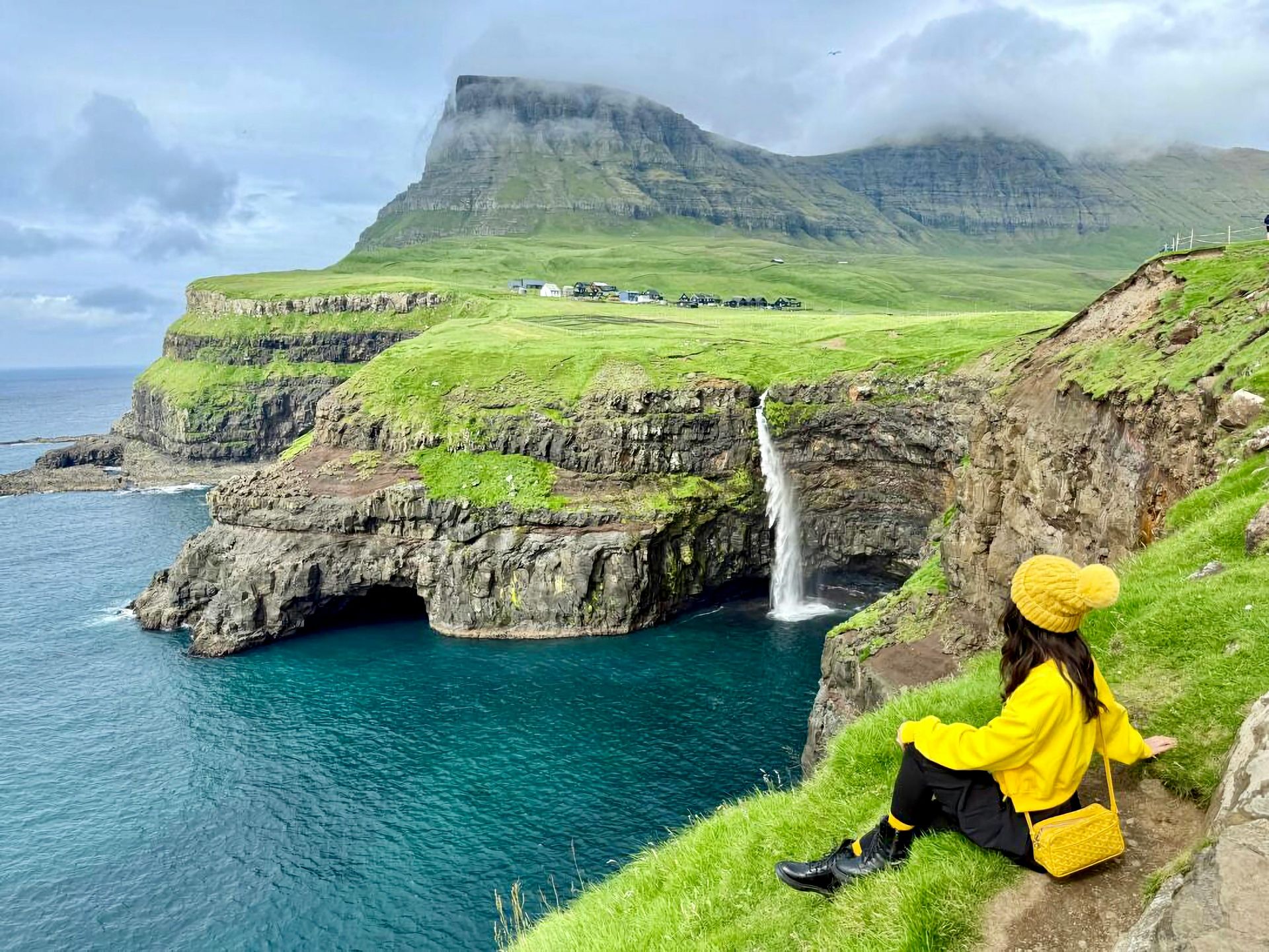
Gjógv, on the northeastern tip of the main island of Estreymoy, is accessible by road but lies at the end of a valley behind a mountain ridge that requires a commitment to reach. The village — a cluster of grass-roofed houses around a natural harbor formed by a sea gorge — has around 50 permanent residents and represents the archetypal Faroese settlement in the way that postcards of the islands usually show but that tourists rarely find themselves standing in.
The harbor is the feature. A narrow gorge in the basalt cliff allows boats to be brought in from the sea and moored in still water, protected from the Atlantic swells. The effect, from the cliff above, is of an impossibly photogenic scene that looks manufactured but is entirely natural and functional. The boats still go out for cod and pollock; the fishermen still use the gorge as working mariners have for centuries.
The walk from Gjógv to the summit of Slættaratindur, the highest mountain in the Faroes, takes about three hours and passes through landscapes of moorland, scree, and cliff that are characteristic of the archipelago. The weather is variable in the extreme — sunny mornings can become foggy afternoons within 20 minutes — and the preparation required for any walk in the Faroes is serious: waterproof clothing, navigation equipment, and local knowledge about the route.
The Faroes ask more of visitors than most destinations. The reward is landscapes and a quality of emptiness that are genuinely rare in the densely connected Atlantic world. Gjógv is the purest expression of what the islands are.