From the limestone karsts of Kbal Spean to the ancient temples of Mrauk U, Southeast Asia's less-visited places tend to offer more than the famous ones — and fewer of the crowds
Vietnam Hidden Light / Pexels
Southeast Asia has a tourist trail problem — not that the trail is bad, but that it is so well-worn that the places on it increasingly resemble each other. Angkor Wat, Ha Long Bay, Bali, the Thai islands, Luang Prabang — these are extraordinary places whose tourism infrastructure has expanded to accommodate millions of visitors per year, and that expansion has changed them in ways that are not always improvements. The organized queues at Angkor at sunrise, the party boats on Ha Long Bay, the traffic on Bali's Seminyak strip — these are the specific costs of the trail's success, and they are significant enough to send a growing proportion of travelers looking for something else.
The something else exists in abundance. Southeast Asia is one of the most geographically and culturally varied regions on Earth — eleven countries spanning rainforest, karst landscape, volcanic archipelago, Mekong delta, Himalayan foothills, and thousands of islands — and the tourist trail covers only a small fraction of what is there. The places that are not on the trail are not there because they are inferior. They are there because they require more planning, more local knowledge, more willingness to deal with less polished infrastructure, and occasionally more physical effort to reach. The rewards are proportional to the effort, and the effort is rarely as large as it appears from the outside.
This list covers 20 places — spread across eight countries — that consistently deliver the quality of experience that travelers go to Southeast Asia for, without the crowds that have diluted that experience at the region's most famous destinations. Several are genuinely difficult to reach and require advance preparation. Several are easy to reach and simply require knowing they exist. Several are beginning to attract more visitors and will not remain uncrowded indefinitely — which is as honest a travel recommendation as any list can make.
Each slide covers what the place is, what makes it worth visiting, and the practical information required to get there. Not every place on this list will suit every traveler, and the honest caveat for all of them is that infrastructure varies, conditions change, and a destination described as uncrowded in 2024 may not be uncrowded in 2026. The region moves fast.
Tony Wu / Pexels
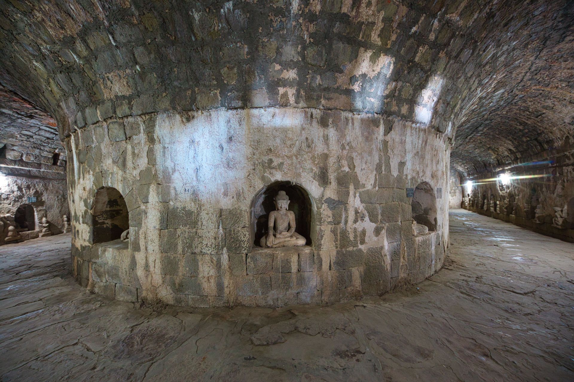
Mrauk U — the ruined capital of the Arakan Kingdom, located in the Rakhine State of western Myanmar — contains one of the most extraordinary concentrations of ancient Buddhist temples in Asia, built between the 15th and 17th centuries when Arakan was one of the most powerful kingdoms in the Bay of Bengal region. At its height, Mrauk U may have held more temples than Bagan; the roughly 700 that survive are largely unrestored, emerging from forest and farmland across a landscape of extraordinary atmospheric density.
The Shitthaung Temple — built by King Minbin in 1536 to celebrate his victory over the Portuguese and the Mughals, and containing more than 80,000 images of the Buddha — is the most significant structure, its corridors carved with an extraordinary density of relief sculpture depicting military campaigns, court life, and mythological scenes. The Koe Thaung Temple, slightly later and similarly massive, contains a similar density of images. Unlike Bagan, where the temples are spread across a flat plain, Mrauk U's temples occupy forested hills and valley floors, requiring exploration on foot through a landscape that feels genuinely archaeological rather than touristically managed.
Access to Mrauk U has been severely restricted since the military coup of February 2021, the subsequent civil conflict in Myanmar, and the specific violence in Rakhine State that has made independent travel to the region genuinely dangerous at the time of writing. This entry is included because Mrauk U is one of the most remarkable ancient sites in Asia and because conditions in Myanmar change — travelers should monitor the security situation carefully and consult current travel advisories from their governments before any attempt to visit.
Karolina / Pexels
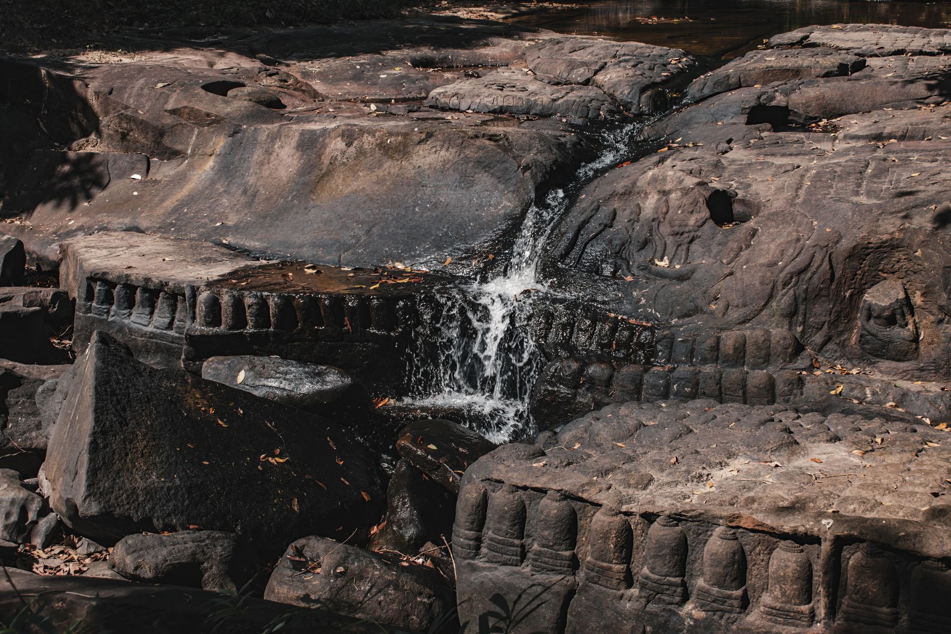
Kbal Spean — the River of a Thousand Lingas, located approximately 50 kilometers north of Siem Reap in the Phnom Kulen range — is one of the most unusual and most beautiful archaeological sites in the Khmer world: a riverbed carved, between the 11th and 12th centuries CE, with hundreds of lingams (phallic symbols representing Shiva) and images of Vishnu, Brahma, and mythological scenes, all submerged beneath a shallow, clear mountain stream whose water is considered sacred by the Khmer people because it flows over the carvings on its way to the fields of Angkor.
The walk to Kbal Spean — approximately one and a half hours each way through dense forest — begins at a trailhead 25 kilometers from the Angkor Archaeological Park and passes through a forest landscape of significant wildlife value. The site at the top of the walk consists of two waterfalls and an extended section of carved riverbed that can be walked along the water's edge, the carved stones visible beneath the current. The density and quality of the carving, combined with the setting — clear water flowing over ancient religious art in a forest clearing — produces an experience qualitatively different from anything available in the main Angkor complex.
Kbal Spean is accessible as a day trip from Siem Reap and is entirely feasible without a guide, though a guide adds significant context. It receives a fraction of the visitors that the main Angkor temples attract — partly because of the walk required and partly because it is less well-known outside specialist travel circles. The best visiting time is the dry season (November to April), when the water is clearest and the carvings most visible.
allPhoto Bangkok / Pexels
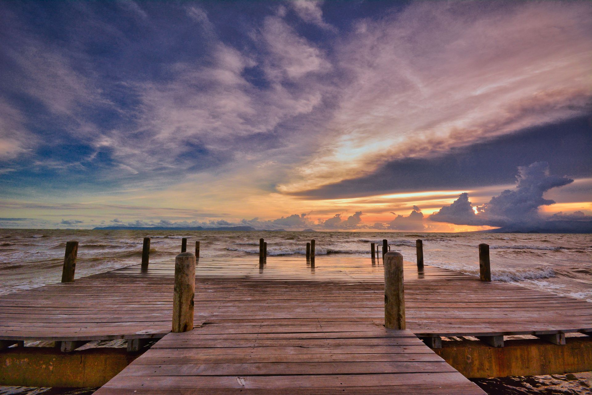
Kampot — a small riverside town in southern Cambodia, approximately 150 kilometers southwest of Phnom Penh — has developed over the past decade from a backpacker stopover into a genuinely charming destination with a distinct character: French colonial architecture in varying states of elegant decay, a slow-moving river lined with riverside restaurants and guesthouses, a surrounding landscape of limestone karst hills and pepper plantations, and proximity to both the coast (Kep, 25 kilometers east) and the Bokor National Park highland plateau (35 kilometers up a winding mountain road).
Kampot's specific appeal is its pace and its scale. It is small enough to explore entirely on foot or bicycle, unhurried enough to accommodate the kind of slow travel that is difficult to sustain in more visited destinations, and varied enough to occupy three to five days without any sense of having exhausted the options. The Kampot pepper — one of the most highly regarded pepper varieties in the world, grown on the limestone hills surrounding the town — can be visited at working plantations within cycling distance.
The Bokor Hill Station above Kampot — a French colonial resort built in the 1920s at 1,000 meters elevation, subsequently abandoned and reoccupied multiple times through Cambodian history and now partly redeveloped as a casino resort — is a specific destination of considerable atmospheric power. The abandoned hotel, the old Catholic church, and the casino-on-a-mountain-top sit in a landscape of cloud forest and sweeping coastal views that rewards a full day's exploration.
Afif Ramdhasuma / Pexels
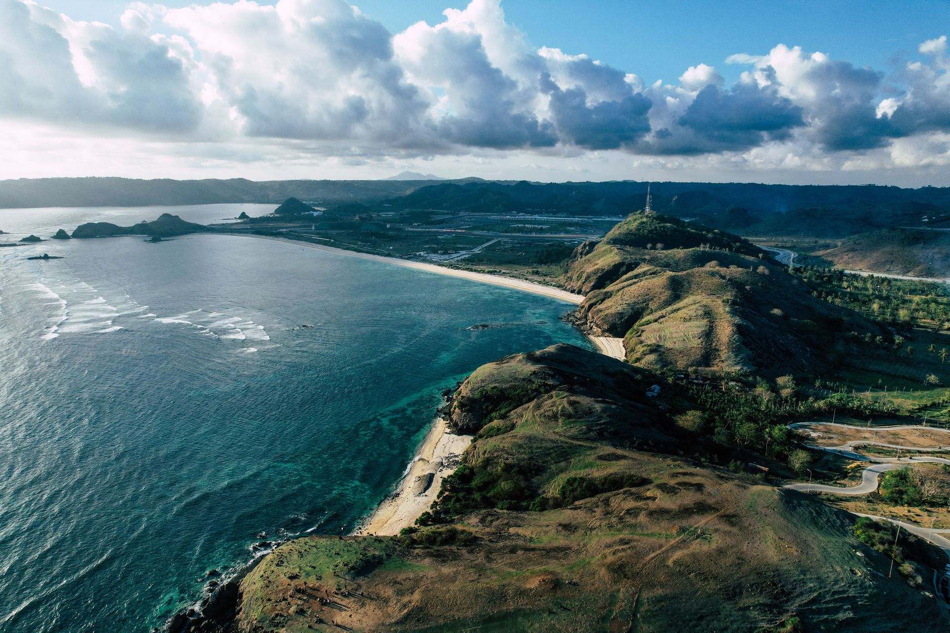
Lombok — the island immediately east of Bali, separated from it by the Wallace Line (the biogeographical boundary between Asian and Australasian fauna) — is frequently described as "Bali without the crowds," a comparison that does it a partial injustice. Lombok is not merely a quieter Bali. It has a distinct landscape, a distinct culture (the Sasak people, predominantly Muslim, with a textile and architectural tradition quite different from Bali's Hindu culture), and a dominant geographical feature — Gunung Rinjani, the second-highest volcano in Indonesia at 3,726 meters — that gives it a vertical drama Bali cannot match.
Rinjani is the island's defining experience for physically capable travelers. The most popular trekking route — a two-night, three-day circuit that ascends to the crater rim, descends to the turquoise crater lake (Segara Anak), climbs to the summit, and descends via a different route — is one of the great volcano treks in Southeast Asia, combining high-altitude crater views with the specific visual drama of a lake inside a caldera, a new volcanic cone (Gunung Baru) rising from the lake's surface, and hot springs at the lake's edge where trekkers soak after the descent. The trek requires reasonable fitness and a licensed guide; independent summiting is not permitted.
The southern coast of Lombok — particularly the beaches at Mawun, Mawi, and the Kuta area (entirely distinct from Bali's Kuta) — has the white sand and clear water of Bali with a fraction of the infrastructure and visitors. The surf at Mawi is world-class and largely uncrowded. The Gili Islands — Gili Trawangan, Gili Meno, and Gili Air — are accessible by fast boat from Bangsal on Lombok's northwest coast; Gili Meno and Gili Air offer the Gili experience (no motorized vehicles, turquoise water, excellent snorkeling) without the Gili Trawangan party infrastructure.
Lombok is accessible by direct flight from Bali (25 minutes), Jakarta, and several other Indonesian cities, or by fast boat from Bali's Padang Bai port (approximately two hours).
Apijate Rungwijitsin / Pexels
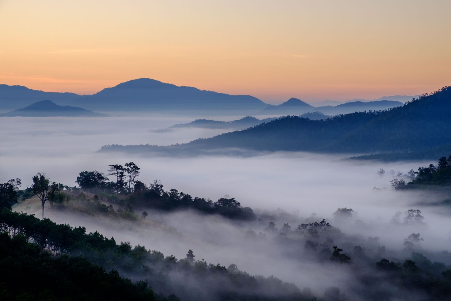
Pai — a small mountain town in Mae Hong Son Province, approximately 130 kilometers northwest of Chiang Mai in the mountains near the Myanmar border — has the reputation of a backpacker destination that has been discovered and has lost its character. This reputation is partially accurate and partially outdated. Pai does have a tourist infrastructure, a walking street, and a seasonal influx of visitors in the cool season. It also has a surrounding landscape of rice paddies, hot springs, waterfalls, mountain viewpoints, and hill tribe villages that most visitors never reach.
The drive to Pai on Route 1095 from Chiang Mai — 762 curves over 130 kilometers of mountain road — is itself a significant experience, passing through landscape that changes from northern Thai lowland agricultural plain to cloud forest and mountain valley over three hours. The road is negotiable by small motorcycle (the primary local transport) or by songthaew, and the journey's drama is worth allowing time for rather than rushing.
The area around Pai contains several temples of architectural interest, including Wat Phra That Mae Yen — a hilltop wat with views over the entire valley — and several hot spring complexes. The Tha Pai Hot Springs, 8 kilometers from town, are a natural system rather than a tourist facility, with mineral-rich water flowing into rock pools in a forest setting.
The cool season (November to February) is Pai's peak season, bringing the mist and cool temperatures that have made it popular with Thai domestic tourists as well as international visitors. The wet season reduces accessibility to some surrounding areas but brings the rice paddies to their most visually dramatic state.
Trinh Tuoi / Pexels
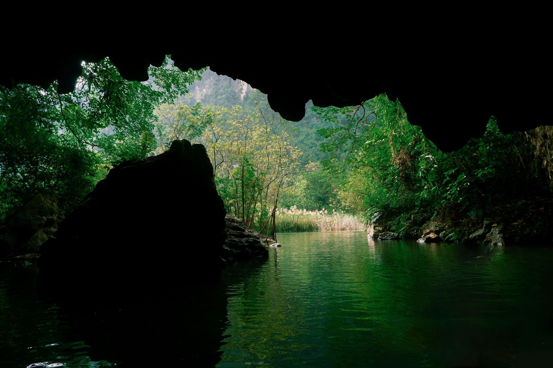
Phong Nha — the cave system and surrounding karst landscape in Quang Binh Province, central Vietnam — contains some of the most extraordinary cave environments on Earth, including Son Doong, the largest known cave in the world, whose interior is large enough to contain an entire river, its own jungle, and clouds. Son Doong tours (limited to a few hundred people per year, at a price of approximately $3,000) are the most extreme version of what the area offers; the broader Phong Nha-Ke Bang National Park contains dozens of caves at various levels of accessibility and price.
Phong Nha Cave and Paradise Cave are the most accessible entries into the national park's cave system, requiring no special equipment or preparation and accessible to any visitor with the ability to walk on uneven surfaces in low light. Paradise Cave is approximately 31 kilometers long, with the section open to visitors — approximately 1 kilometer of wooden boardwalk illuminated by atmospheric lighting — showing a density of stalactite and stalagmite formations that most cave visitors will not have encountered before.
The town of Phong Nha itself — a riverside settlement on the Son River, with guesthouses and restaurants along the waterfront — is a relaxed base for cave exploration and for the broader national park, which includes highland jungle with significant wildlife. Dark Cave, which requires swimming through cave chambers wearing a harness, provides the adventure experience at a fraction of the Son Doong price. The motorcycle ride through the national park to the cave entrances passes through karst landscape of unusual beauty.
Afif Ramdhasuma / Pexels
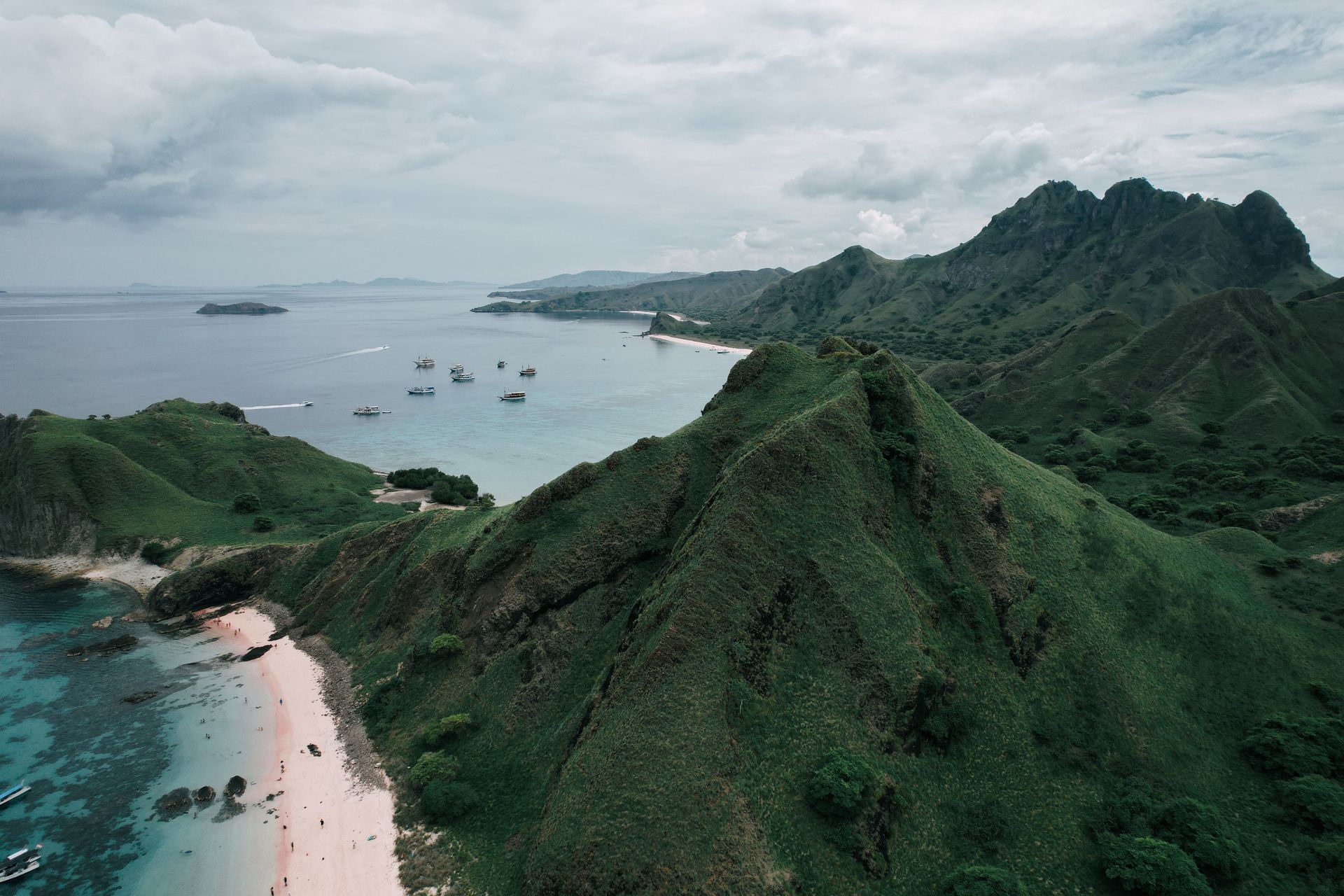
Flores — the long, mountainous island east of Bali, Lombok, and Sumbawa in the Indonesian archipelago — is best known internationally as the departure point for live-aboard boat tours to Komodo National Park (where Komodo dragons can be seen in their natural habitat), but the island itself is one of the most scenically and culturally varied in Indonesia, with a landscape of volcanic lakes, traditional villages, colonial-era towns, and a coastline of significant marine biodiversity.
Kelimutu — the volcanic complex in the center of Flores that contains three crater lakes whose colors change independently, due to different mineral compositions and oxidation states, between shades of turquoise, green, brown, black, and red — is one of the most visually unusual natural phenomena in the region and one of the most undervisited given its quality. The two-kilometer walk from the car park to the crater rim takes approximately 30 minutes, and the views at sunrise, when the lakes are most vivid and the crowds thinnest, reward the 4am alarm call.
The Ngada highlands around Bajawa contain traditional villages — Bena and Wogo are the most accessible — where the animist megalithic tradition of the Ngada people is preserved in the form of thatched ancestral houses, stone altars, carved wooden posts, and thatch-roofed tombs organized around the village meeting ground. The villages are inhabited rather than preserved as museums, and the presence of daily life alongside the traditional structures makes them more engaging than a purely archaeological visit.
Flores is accessible by direct flight from Bali to Labuan Bajo in the west or Maumere in the east. The island is small enough to drive across in a day, though a week or more rewards the landscape's complexity.
Archie Binamira / Pexels
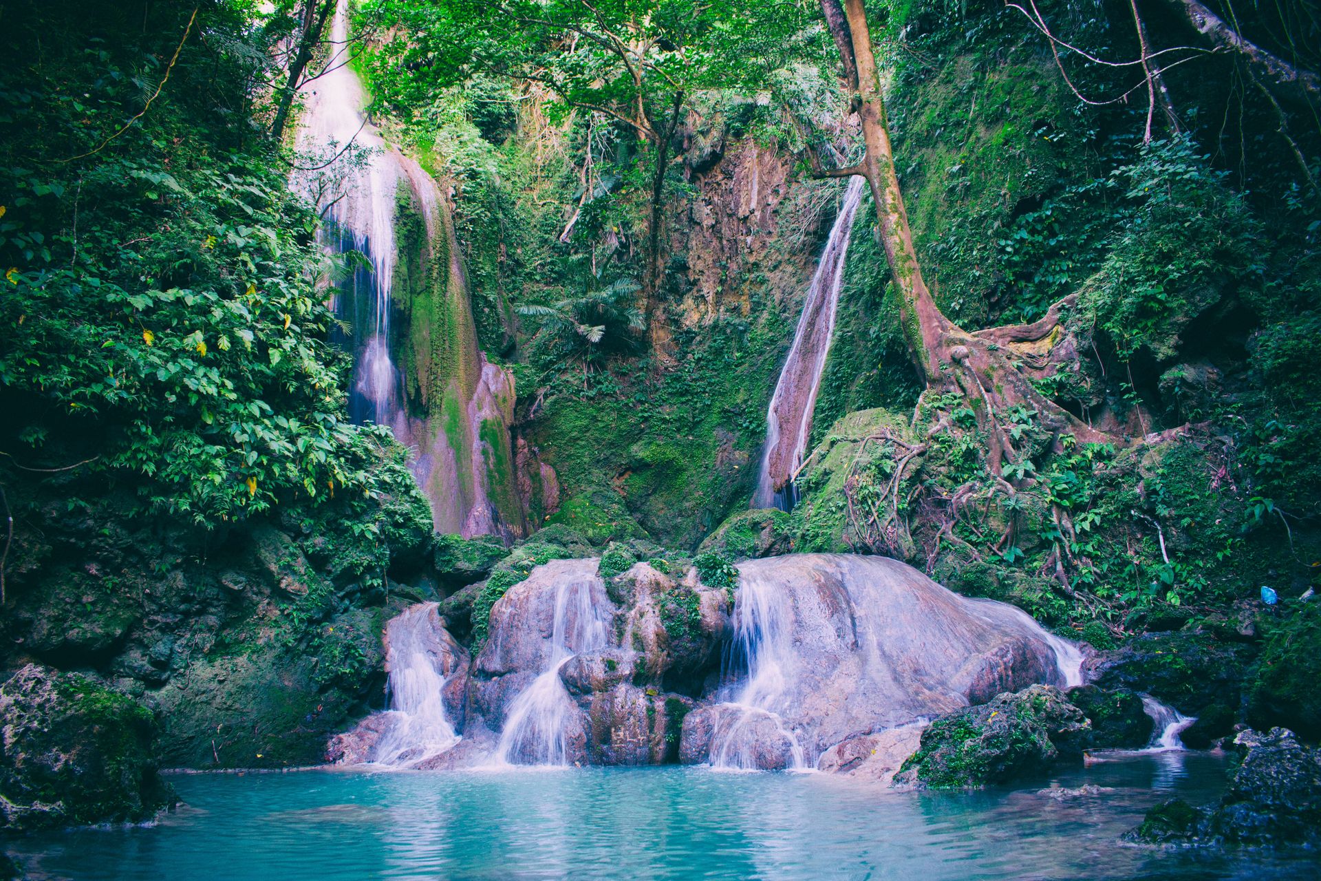
Siquijor — a small island province in the central Visayas, accessible by ferry from Dumaguete, Cebu, or Tagbilaran — has a reputation in the Philippines that precedes it wherever it is mentioned: it is the island of witches, healers, and folk magic, a place where the mananambal (traditional healers) still practice using potions, incantations, and herbal preparations, and where the annual Lenten healing festival draws healers from across the island to gather ingredients and perform rituals that are specific to Siquijor and found nowhere else in the Philippines.
The folk healing culture is not a performance for tourists but a living tradition woven into the island's social fabric, and the healers who accept visitors do so on their own terms. A visit to a mananambal — arranged through a local guide or guesthouse — typically involves the healer's home, a consultation, and the preparation of a specific remedy or ritual object. Whether one approaches this as anthropological observation, cultural tourism, or genuine participation shapes the experience considerably.
The island itself — small enough to circumnavigate by motorcycle in half a day — has the white sand beaches, clear water, and coral reef diving of the wider Visayas with a fraction of the visitors. Salagdoong Beach on the northeastern coast, with its forested headland and cliff jumping platform, is among the most attractive beaches in the region. The century-old balete tree near the town of San Antonio — enormous, gnarled, and the subject of numerous local supernatural stories — stands at the edge of a spring where small fish nibble at the feet of visitors who wade in.
Siquijor is most easily reached by ferry from Dumaguete (approximately one hour), which is itself accessible by air from Cebu or Manila. The island's accommodation ranges from simple beachside guesthouses to mid-range resorts; none are large enough to significantly affect the island's uncrowded character.
Siamways Individualreisen / Pexels
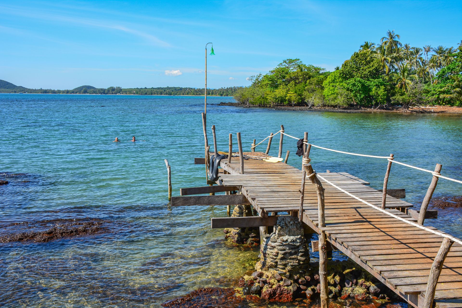
Koh Kood — the fourth-largest island in Thailand, located approximately 80 kilometers off the Trat Province coast near the Cambodian border — is one of the most attractive Thai islands and one of the least developed, its combination of white sand beaches, clear water, mangrove-lined rivers, and waterfalls accessible in half-day trips providing the full Thai island experience without the infrastructure density of Koh Samui, Koh Phangan, or Koh Tao.
The island's low development reflects its relative inaccessibility — reaching it requires a combination of bus or private transfer to the Laem Sok pier and a one-and-a-half to two-hour ferry, adding a total travel time from Bangkok of approximately five to six hours. This is sufficient to keep the backpacker and budget mass market away while remaining accessible to travelers willing to plan the journey.
Klong Chao waterfall — accessible by boat up the mangrove-lined Klong Chao River and then a short walk — is the island's most popular inland attraction and genuinely beautiful, a wide curtain of water falling into a clear pool surrounded by forest. The river journey itself, past the wooden stilted houses of the fishing village and through progressively narrowing mangrove channels, is worth the trip independently of the waterfall.
The island's accommodation ranges from simple bungalow resorts to higher-end beachfront properties, and the relatively small number of visitors means that beach access, including at the most attractive beaches, is never crowded. The best beaches are on the western and southern coasts; the eastern coast is less developed and requires motorcycle exploration.
José Carlos Alexandre / Pexels
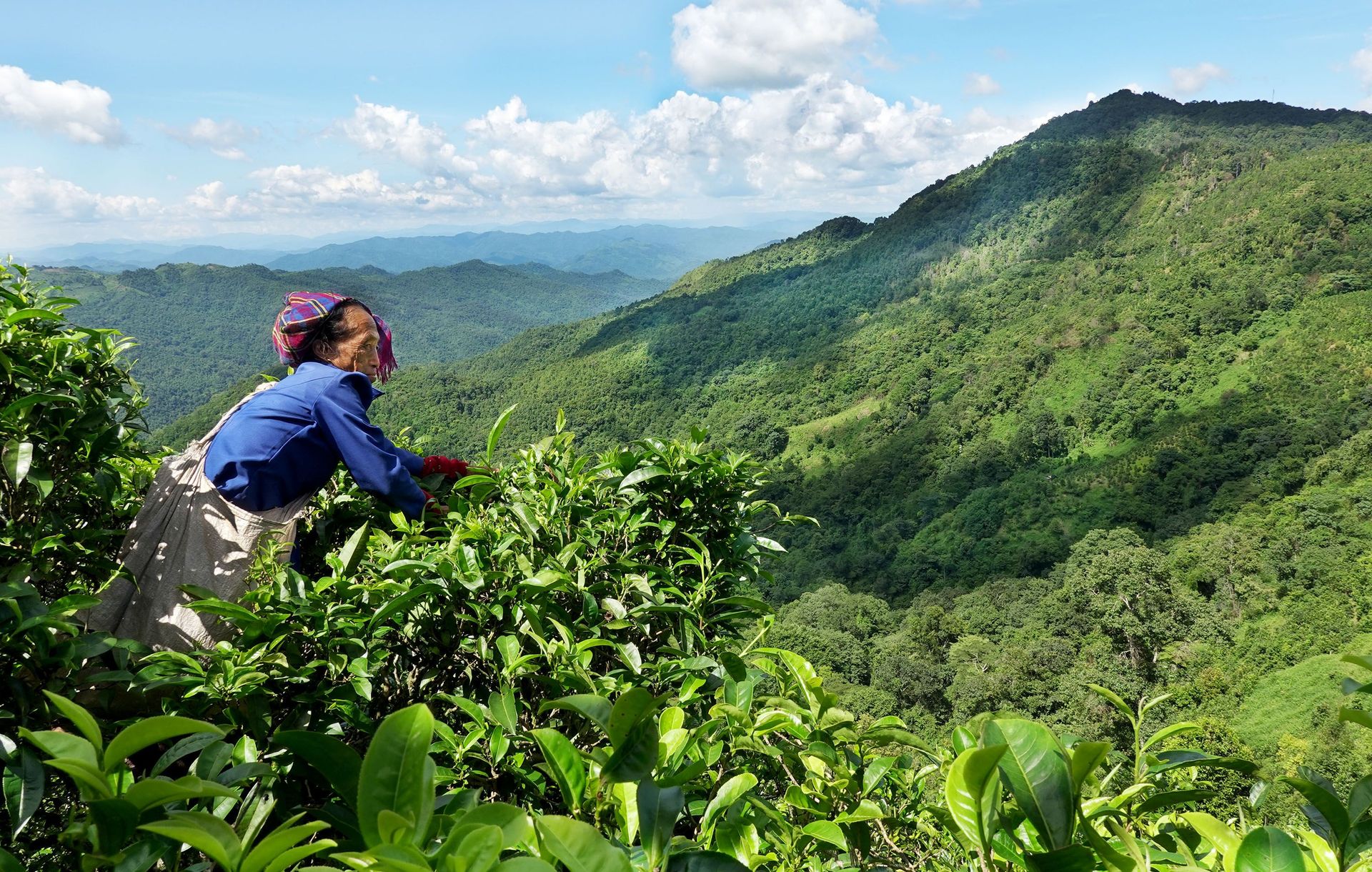
Luang Namtha — a small town in the far northwest of Laos, near the borders with Myanmar and China — is the base for trekking into one of the most pristine forest landscapes in mainland Southeast Asia: the Nam Ha National Protected Area, a 222,400-hectare forest that forms part of a larger transboundary protected area with adjacent parks in Myanmar and China.
The trekking circuits available from Luang Namtha — one, two, and three-night circuits that pass through Akha, Khamu, Lanten, and Lahu minority villages — are organized as community-based tourism with a specific model: tourists pay a fee that is divided between the tourism company, the national park authority, and the village, and the number of visits to each village is limited to prevent dependency and overexposure. The villages visited are working communities rather than performance villages, and the homestay accommodation is in family homes rather than purpose-built facilities.
The forest environment of Nam Ha is among the most biologically significant in the region, containing populations of gibbon, sun bear, clouded leopard, and numerous bird species that require undisturbed primary forest. Night kayaking on the Nam Ha River, with fireflies in the riverside vegetation and the occasional sound of gibbons in the surrounding forest, is one of the specific experiential highlights available from Luang Namtha that no more visited destination in Laos offers.
Access is by flight from Vientiane or Luang Prabang (approximately one hour) or by bus from Luang Prabang (approximately seven hours on a road that passes through spectacular mountain scenery).
Tony Wu / Pexels
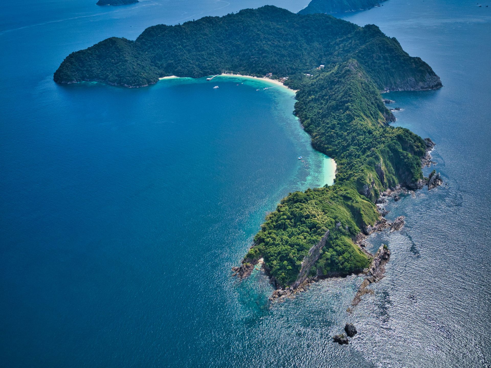
The Mergui Archipelago — approximately 800 islands scattered across 36,000 square kilometers of the Andaman Sea off the coast of Tanintharyi Region in southern Myanmar — is one of the most pristine marine environments remaining in Southeast Asia, with coral reefs, mangrove forests, and open water ecosystems largely undisturbed by the tourism and development pressures that have degraded comparable environments elsewhere in the region.
The archipelago is the traditional home of the Moken — the sea nomads of Southeast Asia, a semi-nomadic maritime people who have lived on boats and in stilt villages on the islands for centuries, fishing and foraging across a marine territory whose extent and productivity supported a way of life with minimal contact with the mainland. Moken populations have declined significantly in recent decades due to government settlement policies, and their traditional culture is increasingly adapted to engagement with the mainland economy and with tourism.
Live-aboard dive boats operating from Kawthaung, the southernmost town of Myanmar near the Thai border, are the primary means of accessing the archipelago's dive sites. The diving is characterized by exceptional visibility, undisturbed reef systems, and encounters with species including whale sharks, manta rays, and large schools of pelagic fish that are increasingly rare in more heavily visited dive destinations.
Access restrictions since the 2021 coup apply to Mergui as to the rest of Myanmar. Thai operators from Ranong province offer day trips to the closest islands from the Thai side of the border under a specific permit arrangement, but full archipelago access requires entry to Myanmar and is subject to current travel advisories.
Vietnam Hidden Light / Pexels
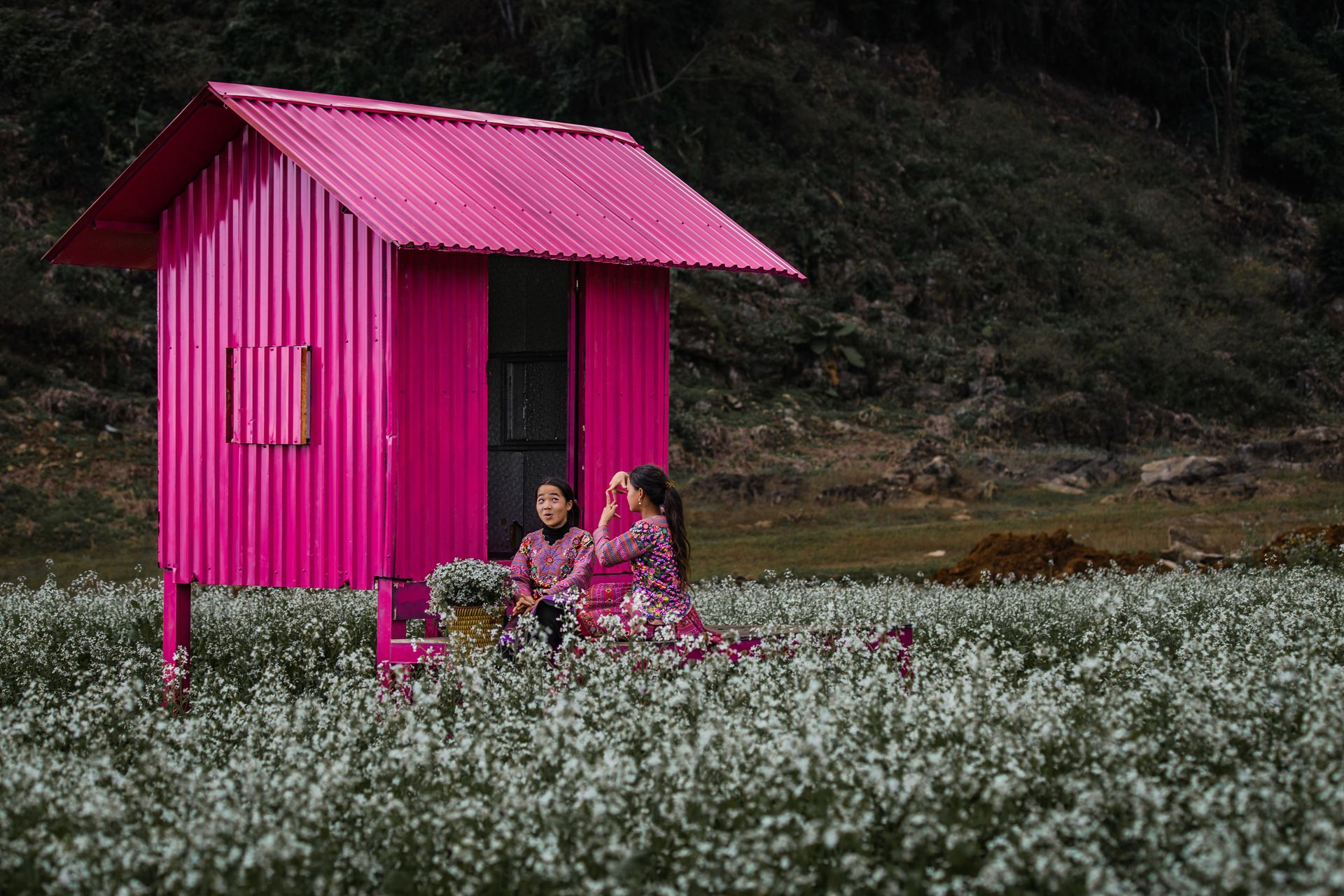
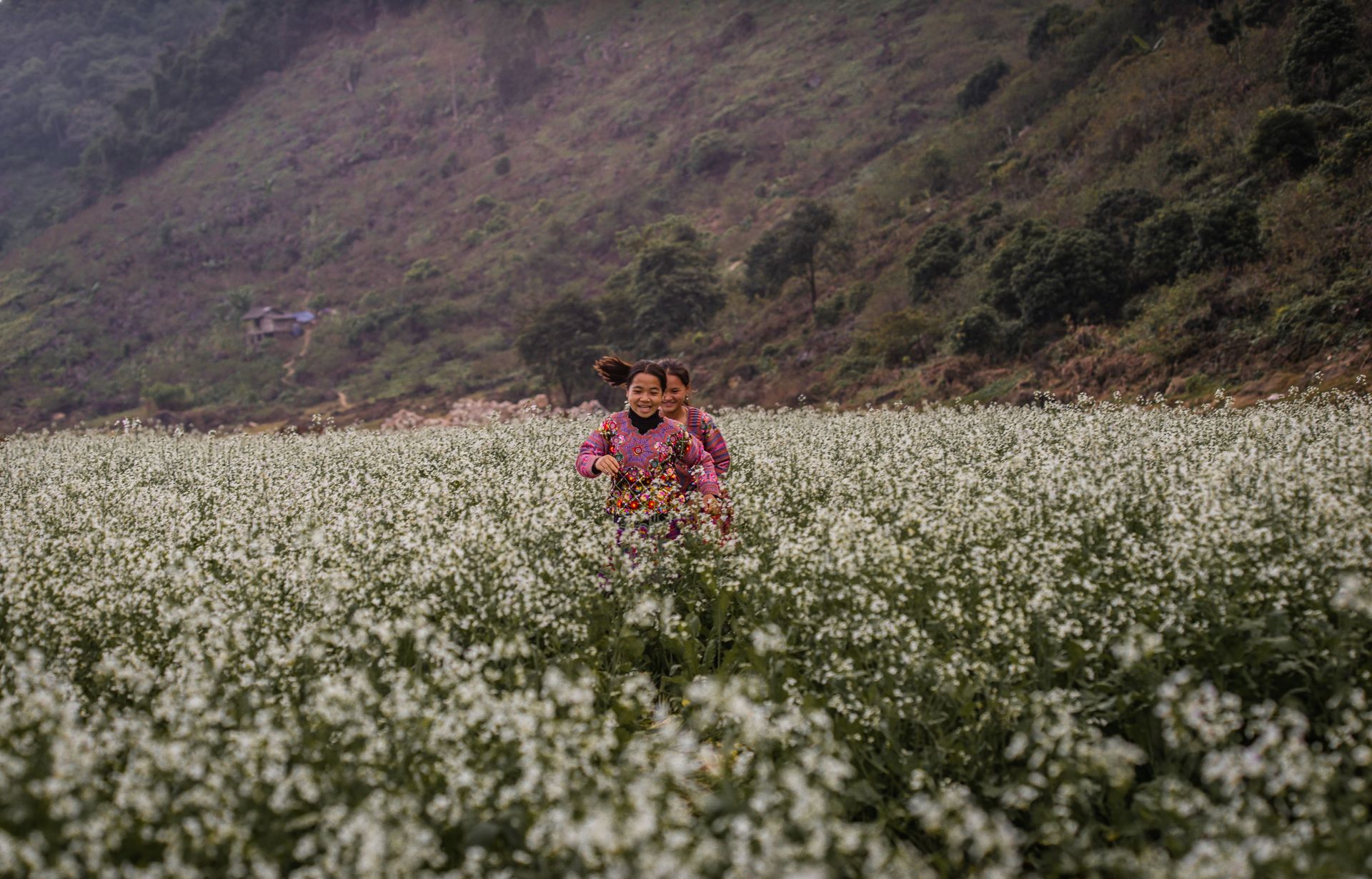
Moc Chau — a highland plateau in Son La Province, approximately 180 kilometers southwest of Hanoi — is best known to Vietnamese domestic tourists as a tea-growing region and a destination for seasonal flower viewing: white plum blossoms in late January and February, mustard flowers in November and December, and tea harvest at various points through the growing season. International visitors are rare enough that arriving as one produces genuine curiosity rather than the performative welcome of heavily touristed areas.
The plateau's landscape — a mosaic of tea plantations, subsistence agriculture, forest, and scattered hill tribe villages at approximately 1,000 meters elevation — is visually striking in any season, with the mist that frequently covers the plateau in the early morning adding a specific atmospheric quality to the views across the valley. The Thai and H'mong minority communities of the surrounding villages maintain distinct textile traditions, architectural styles, and agricultural practices.
The practical visit from Hanoi involves a four-hour bus journey on the expressway and local roads, with the journey itself passing through increasingly dramatic hill country as the altitude increases. The plateau town has a range of accommodation from simple guesthouses to mid-range resorts, and the most rewarding visits involve a motorcycle rental and independent exploration of the smaller villages and viewpoints accessible on the plateau's network of back roads.
Moc Chau pairs naturally with Mai Chau, two hours to the east — a valley of rice paddies and traditional White Thai stilt houses that provides a complementary landscape to Moc Chau's plateau.
Danny Hollander / Pexels
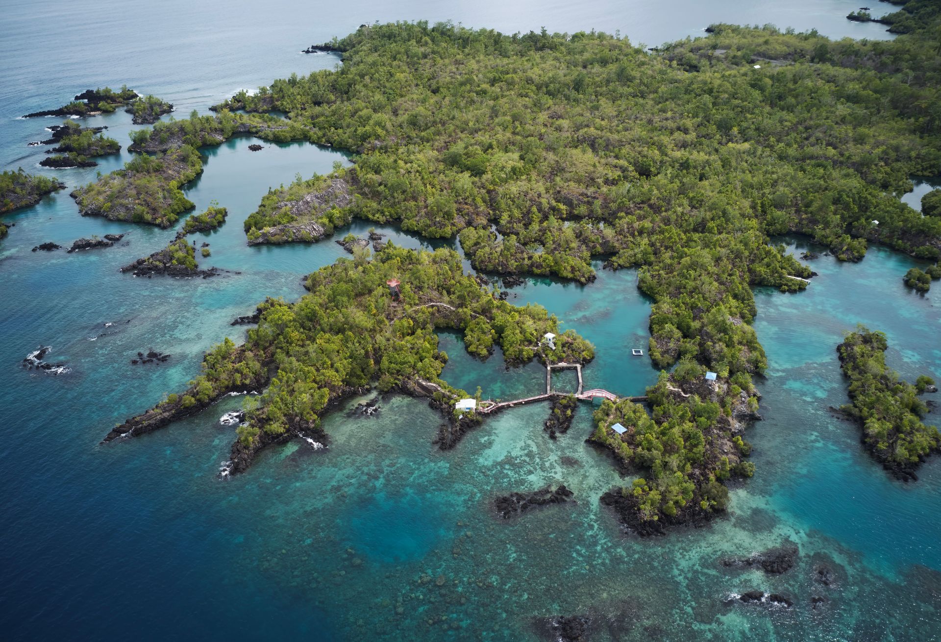
The Banda Islands — a small volcanic archipelago in the Banda Sea, part of the Maluku (Moluccas) province of eastern Indonesia — were, for most of human history, the only place in the world where nutmeg grew. This geographical fact made them the most economically valuable islands on Earth for several centuries, the center of the global spice trade, and the cause of the first corporate war in history — the Dutch East India Company's conquest and near-depopulation of the islands in 1621.
The history is still legible in the landscape. Banda Neira, the largest island and the administrative center of the archipelago, contains Dutch colonial fortifications, a colonial governor's mansion, nutmeg plantations worked by the descendants of the enslaved people brought by the Dutch after the massacre of the original Bandanese population, and a pace of life unchanged from what it was before mass tourism reached most of Indonesia.
The marine environment of the Banda Sea is one of the most spectacular in the world for diving — the nutrient-rich, clear water supports enormous concentrations of pelagic fish, marine mammals including sperm whales, and reef systems whose remoteness has protected them from the anchor damage, runoff, and fishing pressure that affect more accessible reefs. Dive operators on Banda Neira offer liveaboard and day dive trips to sites that see very few visitors per year.
Access is by flight from Ambon, the capital of Maluku Province, which is in turn reached by flight from Makassar, Jakarta, or Denpasar. The journey requires at least one night in Ambon and a commitment to the eastern Indonesian travel logic of occasional flight cancellations and flexible timing.
Project Lakbay / Pexels
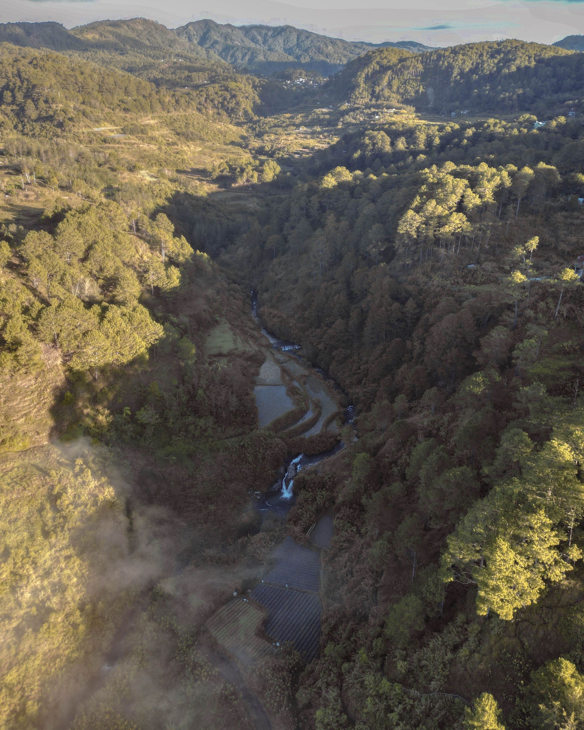
Sagada — a small municipality in the Cordillera mountains of Luzon, approximately 400 kilometers north of Manila in the Ilocos and Mountain Province region — is known primarily for two unusual cultural practices: the hanging coffins of Echo Valley, where members of the Kankana-ey people have suspended wooden coffins from cliff faces for centuries, believing that the elevated position brings the deceased closer to the spirit world; and the cave connection through Sumaguing and Lumiang Caves, where a rope-and-waterfall passage through an enormous limestone chamber requires courage, a guide, and a willingness to get entirely wet.
The town itself — at approximately 1,500 meters elevation, consistently cool, with vegetable gardens extending across terraced slopes and pine forest rising above — has a specific character quite different from the lowland Philippines. It is small, quiet, genuinely cold in the early morning, and organized around the Igorot culture of the Cordillera rather than around the beach-resort model that dominates Philippine tourism.
The Sagada weaving tradition — producing textiles in distinctive geometric patterns on backstrap looms in patterns that vary by village and by family — is visible in workshops throughout the town, and the weavers are accustomed to, and welcoming of, visitors who are interested in the process rather than purely in purchasing the product. The surrounding mountains contain significant hiking, including the path to the summit of Mt. Ampacao and the trek to the Bomod-ok (Big) Falls, a wide curtain of water in a remote valley requiring a two-hour round-trip walk.
Simon Berger / Pexels
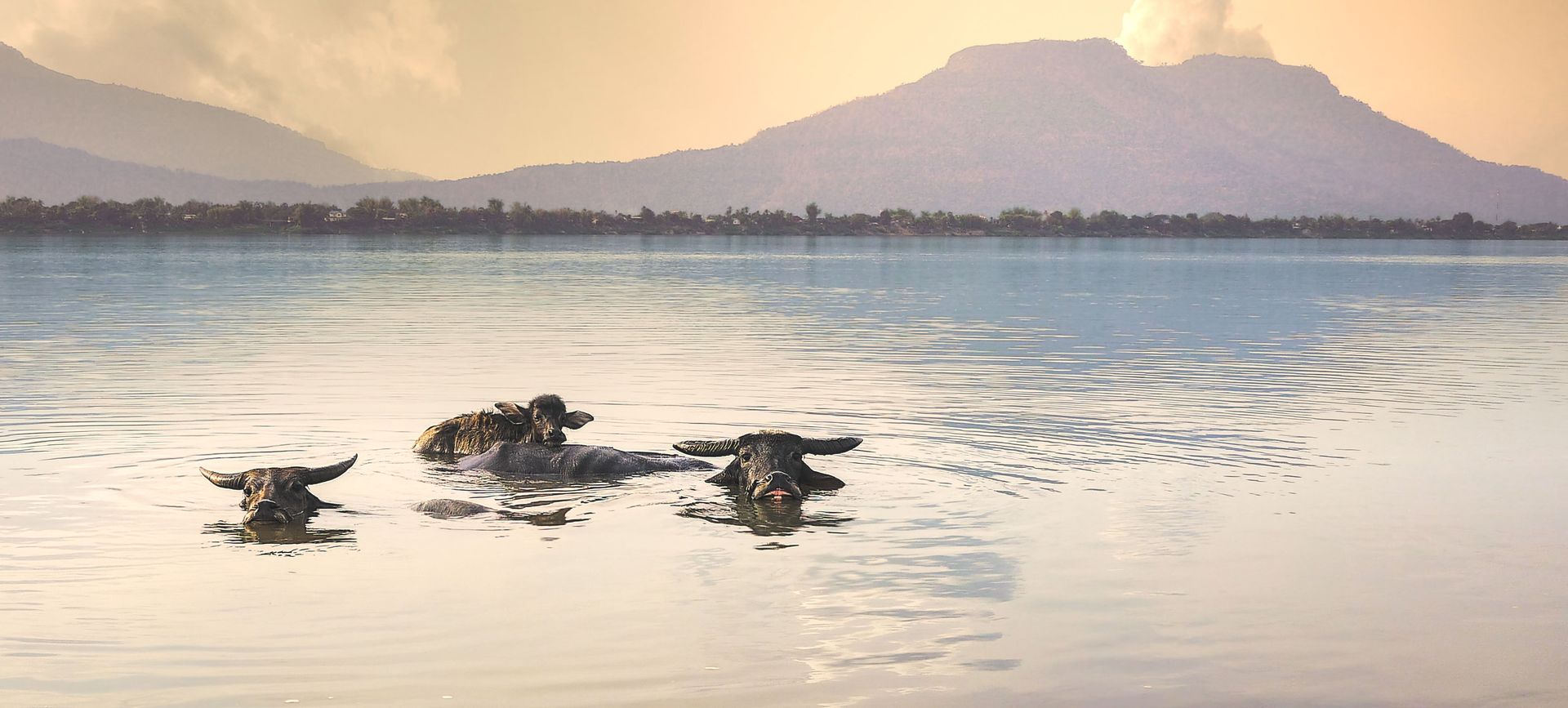
Si Phan Don — the Four Thousand Islands — is the name given to the vast shallow archipelago of islands, sandbars, and channels in the Mekong River as it spreads to approximately 14 kilometers in width before crossing the Cambodian border in Champasak Province, southern Laos. At high water in the wet season, the number of distinct islands may actually approach four thousand; in the dry season, many sandbars emerge and consolidate, changing the landscape's character.
Don Det and the adjacent Don Khon are the two islands most accessible to travelers, connected to each other by a French colonial-era railway bridge — the only railway ever built in Laos, constructed to bypass the Khone Phapheng Falls that prevent navigation on this section of the Mekong — and reachable by boat from the Nakasong pier. The islands are sufficiently flat and small to explore entirely by bicycle, and the combination of riverside bungalows, wide views across the Mekong, and minimal road traffic makes them one of the most genuinely relaxing destinations in a region that has made relaxation a selling point.
The Khone Phapheng Falls — the widest waterfall in Southeast Asia and the largest waterfall in the world by volume during the rainy season — are accessible by tuk-tuk from Don Khon and represent a natural spectacle on a scale that most visitors do not anticipate. The Irrawaddy dolphins of the Mekong — a critically endangered freshwater dolphin population of approximately 90 individuals — can sometimes be seen in the deep pools near the Cambodian border from Don Khon, their appearances becoming less frequent as the population declines.
Richard L / Pexels
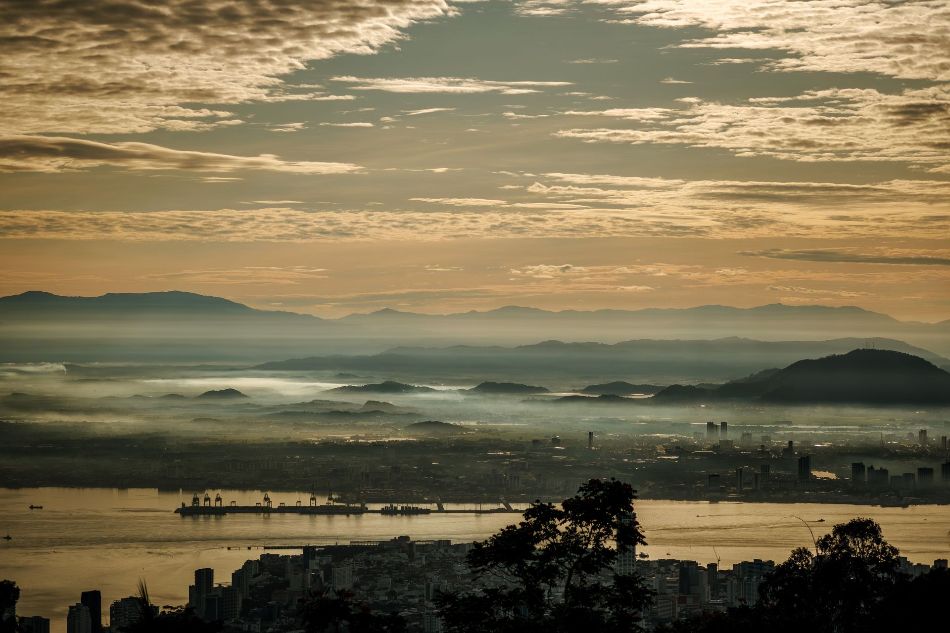
Penang Hill — the forested hill massif rising to 830 meters above George Town, the UNESCO World Heritage-listed capital of Penang state — is accessible by funicular railway in under half an hour from the city center and offers a complete change of environment: cool temperatures, intact rainforest, panoramic views across the island and the Penang Strait to the Malaysian mainland, and a specific historical landscape of colonial bungalows and early 20th-century colonial retreat infrastructure that is preserved in a state of atmospheric decay.
George Town itself is one of the most rewarding cities in Southeast Asia for architecture, food, and street art, with a shophouse streetscape of exceptional integrity and a street food culture — Penang is frequently cited as one of the best food destinations in Asia — that rewards multiple days of exploration. Penang Hill is the component of a Penang visit that most travelers skip in favor of additional time in the city, and the skip is a mistake.
The David Brown's Restaurant on the hill — a colonial-era hilltop restaurant and garden that has been restored and reopened — offers the specific combination of excellent food and extraordinary views across the strait that justifies the trip independently of the forest walk and the botanical garden that occupy the hill's summit plateau. The night views from the hill, with George Town spread below and the Penang Bridge visible to the south, are among the most dramatic in peninsular Malaysia.
The hill also provides access to the Habitat — a privately operated forest walkway above the canopy, offering views across the rainforest and opportunities for guided wildlife observation that the urban setting of George Town does not provide.
Lam Phn / Pexels
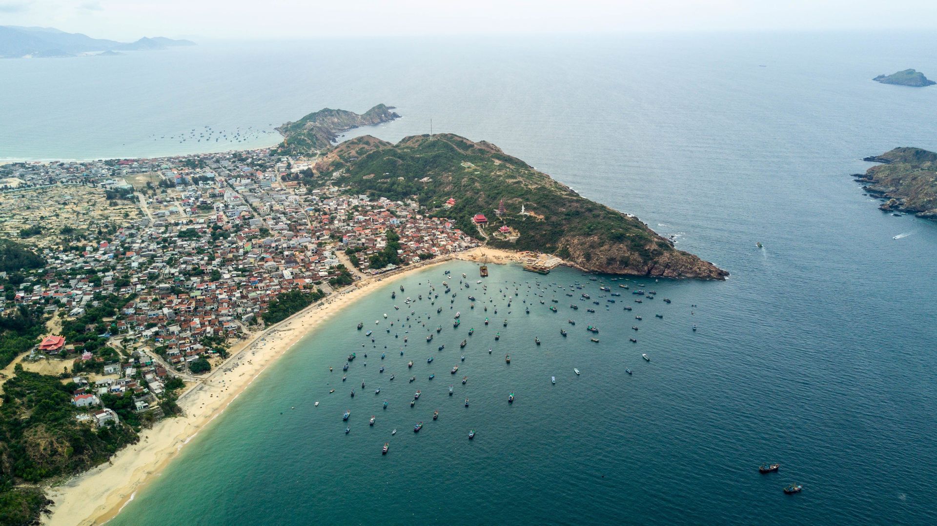
Quy Nhon — the capital of Binh Dinh Province on Vietnam's south-central coast, approximately halfway between Da Nang and Ho Chi Minh City — is one of the least internationally visited mid-sized cities in Vietnam and one of the most rewarding for travelers willing to step off the standard north-south tourist corridor. It is primarily a domestic tourism destination: Vietnamese families from Ho Chi Minh City who know the seafood, the beaches, and the Cham tower ruins that most international itineraries skip entirely.
The Cham towers of Binh Dinh — the Thap Doi twin towers on the edge of Quy Nhon itself, and the Banh It, Canh Tien, and Duong Long towers in the surrounding countryside — are among the finest surviving examples of Cham brick architecture in Vietnam, built between the 10th and 13th centuries CE by the Cham Kingdom whose territory once covered central and southern Vietnam. The Duong Long towers, approximately 50 kilometers north of Quy Nhon, are the tallest Cham towers in Vietnam and among the most elaborately decorated, their brick surfaces covered in sandstone reliefs of makara, kala, and apsara figures that are largely unrestored and therefore more atmospheric than the heavily renovated towers at My Son.
The seafood is a specific reason to visit. Quy Nhon's position on a productive stretch of coast, its large domestic fishing fleet, and the local cooking culture produce a seafood quality and variety — particularly the squid, crab, and shellfish — that travelers who have eaten their way through Vietnam consistently cite as among the best in the country. The market seafood restaurants around the fishing harbor serve it at prices that reflect the domestic rather than the tourist economy.
Quy Nhon is accessible by direct flight from Hanoi or Ho Chi Minh City, or by train on the Reunification Express line that passes through the dramatic Hai Van Pass landscape to the north.
Serg Alesenko / Pexels
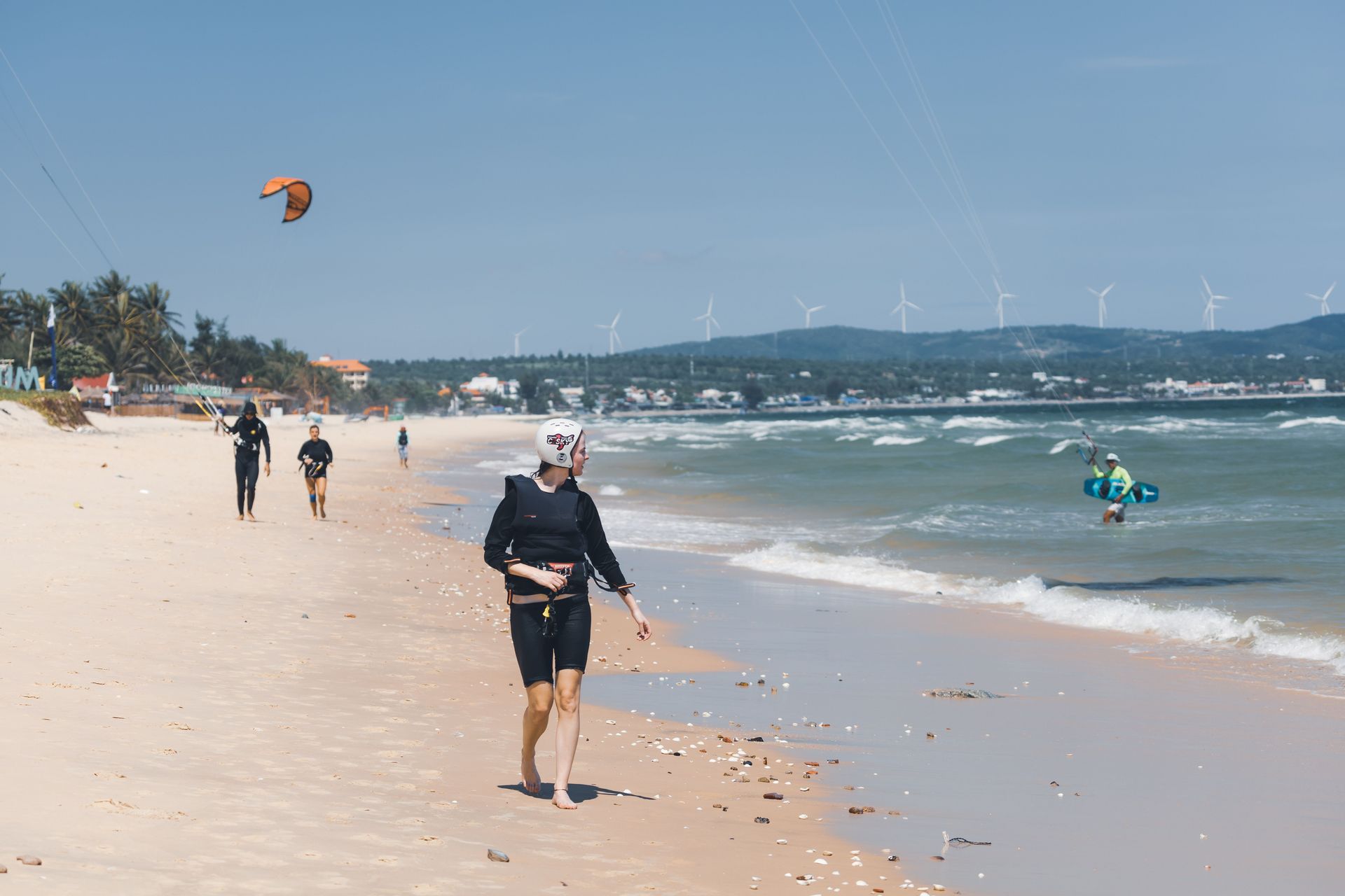
Mui Ne — a fishing village and beach resort town on the southeastern coast of Vietnam, approximately 200 kilometers northeast of Ho Chi Minh City — is best known for its red and white sand dunes, which rise from the coastal plain a few kilometers from the beach and provide the specific landscape anomaly of desert dune systems adjacent to a tropical coastline and fishing community. The dunes are accessible by jeep, quad bike, or on foot, and the sunrise over the red dunes — when the light catches the iron-oxide-rich sand at its most vivid — is one of the more photogenic moments in a country that does not lack for photogenic moments.
The Fairy Stream — a shallow waterway cutting through sandstone formations and red clay cliffs a short walk from the town center — provides a 40-minute barefoot wade through ankle-deep water between walls of ochre and red rock, emerging at a small waterfall and pool. The geological formations along the stream are striking, and the combination of the red-clay walls, the clear water, and the coconut palms overhead produces a landscape that photographs comprehensively and looks even better in person.
Mui Ne's fishing fleet — the round coracle boats that are specific to the Central Vietnamese coast, used by the fishing community to navigate the surf zone — operates from the beach at dawn and returns through the morning, and the fish market that forms on the beach as the boats land provides a specific quality of observation of working coastal life that the beach-resort zone does not otherwise offer. The village behind the resort strip has maintained a character largely distinct from the tourist economy.
Mui Ne is easily combined with Dalat — the highland city in the Central Highlands, approximately three hours inland — for a journey that moves between coastal and highland Vietnam across a dramatic landscape transition.
alleksana / Pexels
Nusa Penida — the largest of the three Nusa islands southeast of Bali, accessible by fast boat in approximately 45 minutes from Sanur — has transitioned over the past decade from an almost entirely unvisited island with challenging roads and limited accommodation to a destination attracting significant day-trip traffic from Bali, while remaining at a development level sufficiently below Bali's to feel genuinely different.
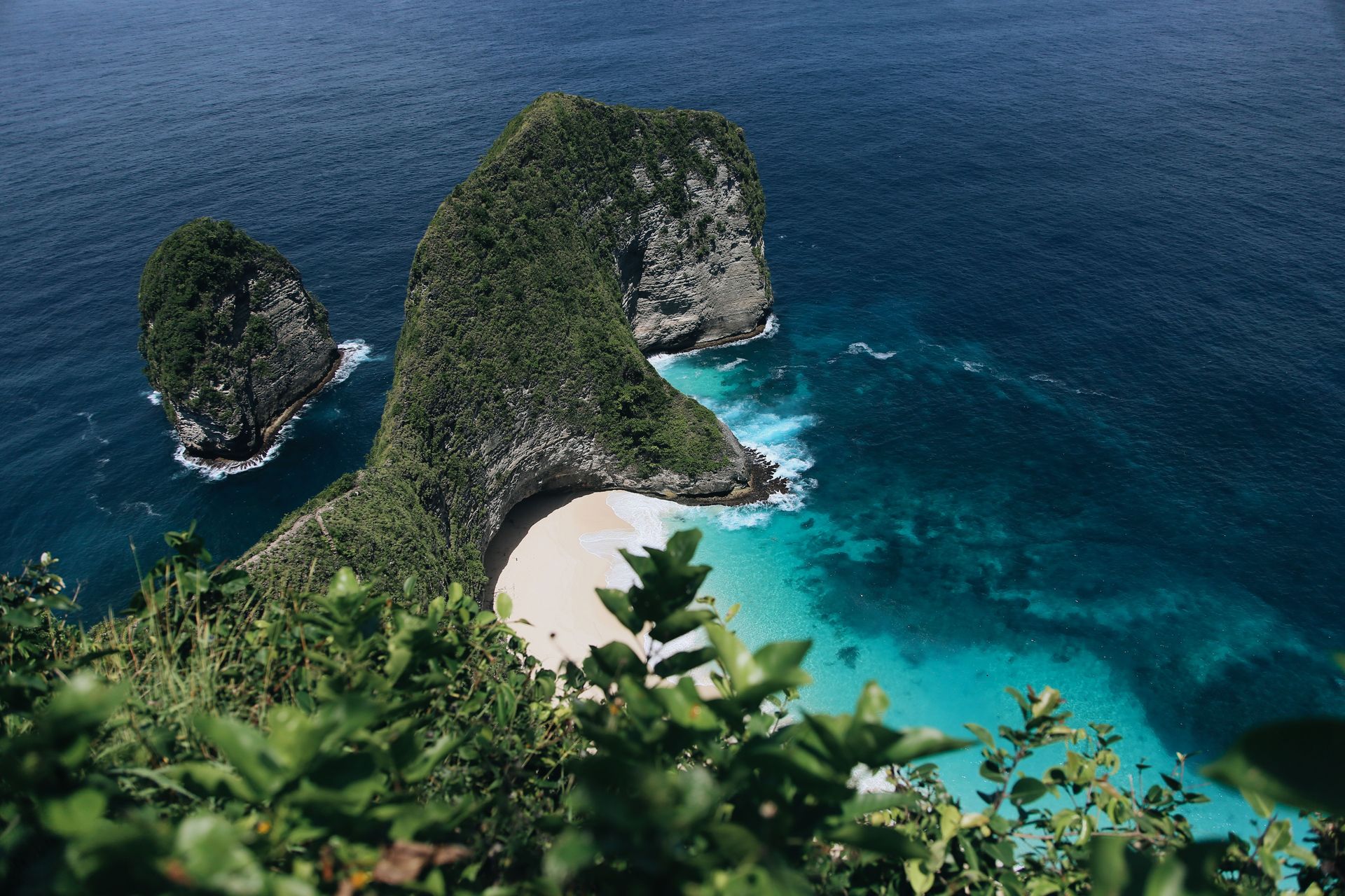
The island's southern cliff coast — particularly the viewpoints at Kelingking Beach, Angel's Billabong, and Broken Beach — is dramatically beautiful, with white limestone cliffs falling to turquoise water and natural rock arch formations that have made it one of the most photographed landscapes in Indonesia. The cliffs and viewpoints are accessible by motorcycle (the primary island transport, hired with or without a driver) on a road network that has been progressively upgraded.
Nusa Penida is one of only two places in the world where the Bali starling can still be seen in something approaching wild conditions — the island maintains a breeding program and a protected natural habitat for the bird, which was essentially extinct in the wild on Bali. The manta rays of Crystal Bay — present year-round with peak abundance from July to October — attract divers specifically for the manta cleaning stations in the bay.
The island's interior, less visited than the cliff coast, contains temple complexes of genuine antiquity and traditional villages where the Hindu-Balinese culture that arrived from Bali centuries ago has developed in an isolated, unchanged form. A full-island loop by motorcycle takes a full day and reveals a landscape of rice terraces, Hindu temples, and forest that Bali itself no longer provides.
Paul Fellini / Pexels
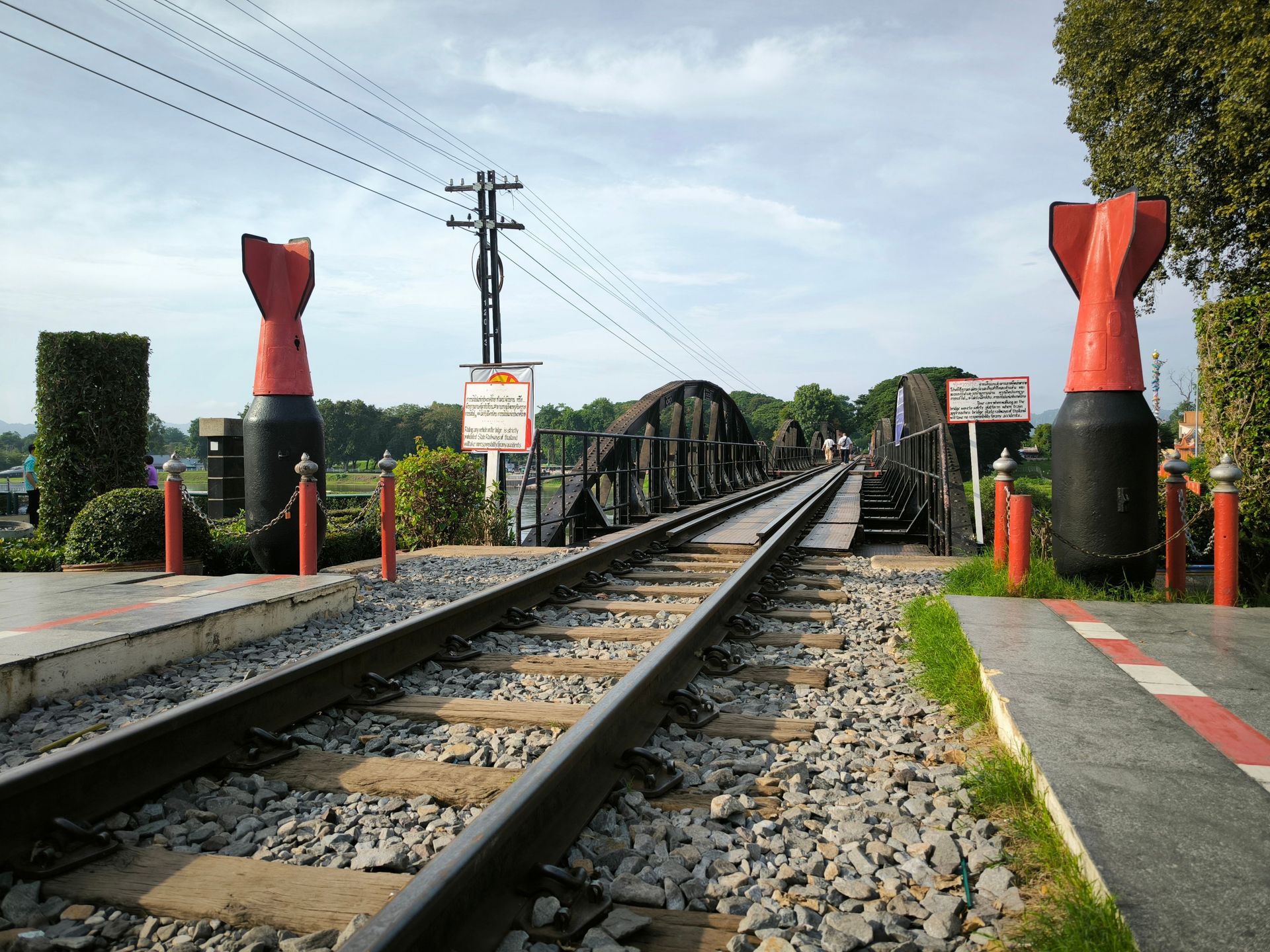
Kanchanaburi — a provincial capital approximately 130 kilometers west of Bangkok, on the River Kwai in the hills near the Myanmar border — is known primarily as the site of the Death Railway and the Bridge on the River Kwai, and the weight of that history — the approximately 12,000 Allied prisoners of war and 90,000 Asian laborers who died building the Japanese military railway to Burma during World War II — gives it a specific gravity that most Southeast Asian destinations lack.
The Death Railway Museum and the Hellfire Pass Memorial Museum — the latter operated by the Australian government at the site of a particularly brutal section of the railway cut through rock at night under torchlight by forced labor — are among the most thoughtfully designed historical sites in the region, presenting the history with the specificity and documentary care that it deserves. The Commonwealth War Graves Cemetery in the town center contains the graves of 6,982 Allied servicemen in a garden of immaculate upkeep.
The town and the surrounding river valley are not purely defined by the war history. The River Kwai is a genuinely beautiful river, with limestone hills rising from its banks, floating restaurants and guesthouses moored on the current, and a surrounding landscape of forest and agricultural land accessible by longtail boat, bicycle, or motorcycle. Erawan National Park — 65 kilometers north of town — contains a seven-tier waterfall of exceptional clarity, whose pools are inhabited by fish large enough to nibble the dead skin from the feet of visitors who wade in.
Kanchanaburi is accessible from Bangkok in approximately two hours by road or three hours by train on a line that itself passes through the Death Railway landscape, and it is one of the more easily incorporated additions to a Bangkok itinerary for travelers with a specific interest in the region's 20th-century history.
