
21 islands worth the journey
From remote Pacific atolls to storied Mediterranean shores, these 21 islands reward the effort it takes to reach them
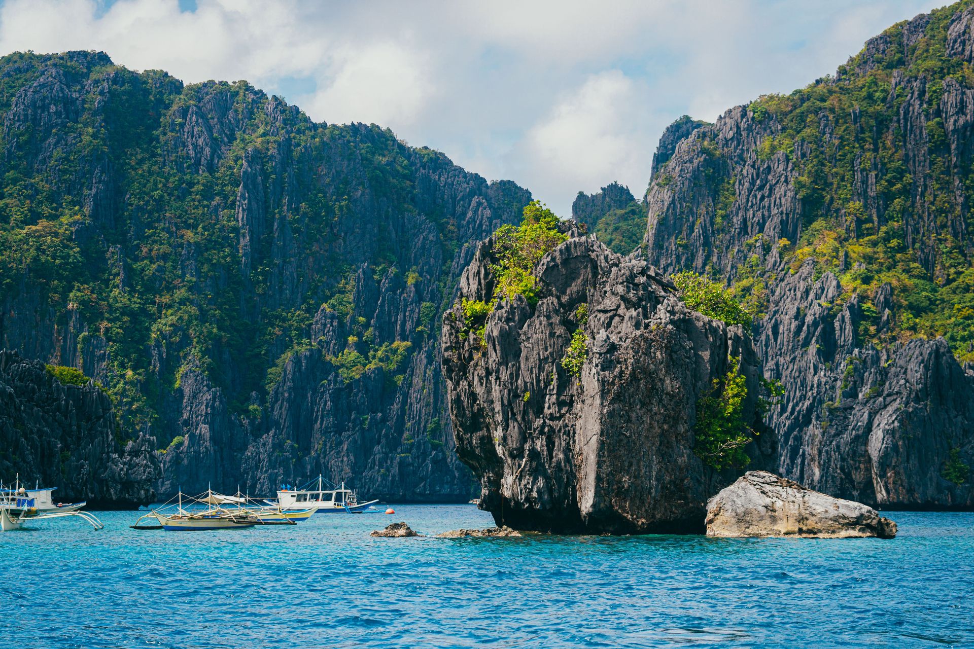
Credit: Nothing Ahead / Pexels
The world has roughly 900,000 islands. Most are uninhabited slivers of rock, but a meaningful number have developed cultures, landscapes, and ecosystems so distinctive that visiting them changes how you think about geography, history, and what a place can be. The challenge is distinguishing the islands that genuinely reward the journey from those that have become more brand than destination — where the beach looks exactly like the brochure but the experience feels hollowed out by the volume of people trying to have it at the same time.
This list is not a ranking of the most popular islands, nor is it a collection of hidden gems in the clickbait sense. Several of these places receive millions of visitors a year. Others require connecting flights, ferry rides, and a tolerance for uncertainty. What unites them is that they offer something irreplaceable — a geological feature, a cultural tradition, a culinary identity, an ecological system — that does not exist in quite the same form anywhere else on Earth.
Island travel has a logic of its own. The physical separation from a mainland shapes language, food, architecture, and temperament in ways that continental places rarely match. Isolation produces adaptation, and adaptation produces specificity. The Greek island that developed its own dialect, the Japanese island with a cuisine unlike anything on Honshu, the Indian Ocean atoll where the forest has evolved in total isolation — these are the products of geography working on human and natural communities over centuries.
The islands here span every major ocean and several seas. Some are politically autonomous; others are territories or provinces of larger nations. They vary enormously in size, population, climate, and cost. What they share is consequence — the sense, once you arrive, that this particular place could not have developed anywhere else, and that coming to it has given you access to something that photographs and articles can gesture toward but not actually deliver.
Travel to islands is never purely passive. Ferries run on their own schedules. Weather closes airports. The restaurant everyone recommends is closed on Tuesdays. That friction is part of the value. The islands on this list are not easy to forget precisely because reaching them required something from you.
Faroe Islands, Denmark
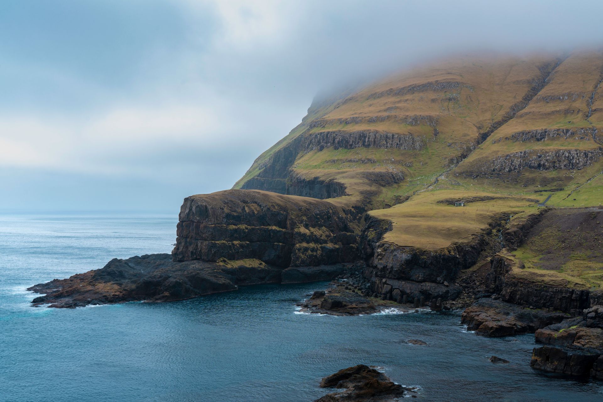
Credit: Raul Ling / Pexels
The Faroe Islands sit in the North Atlantic between Norway and Iceland, an archipelago of 18 islands where the population of roughly 54,000 has maintained a Norse-descended language and a culture shaped by centuries of near-total self-sufficiency. The landscape is defined by steep basalt cliffs, narrow fjords, and grass-covered slopes that descend sharply into the sea. There are virtually no trees. The light, when it appears between cloud banks, falls on the islands with an unusual intensity, as if the sky has been compressing it.
The capital, Tórshavn, is one of the smallest capitals in the world by population — around 21,000 people — and its old quarter, Tinganes, sits on a peninsula of brightly painted wooden buildings that dates to the Viking age. The modern restaurant scene there has attracted significant international attention, largely through the influence of chefs who began applying fermentation and preservation techniques rooted in Faroese tradition to contemporary cooking. The islands historically had no choice but to preserve food for winter, and that necessity produced distinctive methods for drying, fermenting, and aging meat and fish that are now recognized as culinary techniques in their own right.
Hiking in the Faroe Islands requires preparation and a tolerance for rapidly changing weather. Paths cross terrain where fog can descend in minutes, and trails along cliff edges demand attention. But the rewards are considerable: views of sea stacks rising from churning Atlantic water, puffin colonies nesting in turf slopes, and valleys where the only sounds are wind and running water. The island of Vágar is home to Lake Sørvágsvatn, which appears, from certain vantage points on the cliff, to sit far above the ocean — an optical illusion caused by the geometry of the coastline that has made it one of the most photographed landscapes in northern Europe.
The Faroes are a self-governing territory within the Kingdom of Denmark, with their own language, flag, and parliament. They are not part of the European Union, which affects everything from import costs to visa arrangements for some nationalities. Getting there means a flight to Vágar Airport, which operates connections from Copenhagen, Reykjavik, and a handful of other European cities. The airport sits dramatically close to the lake and cliff edge, and the approach on clear days offers an introduction to the landscape before you have even landed.
Sicily, Italy
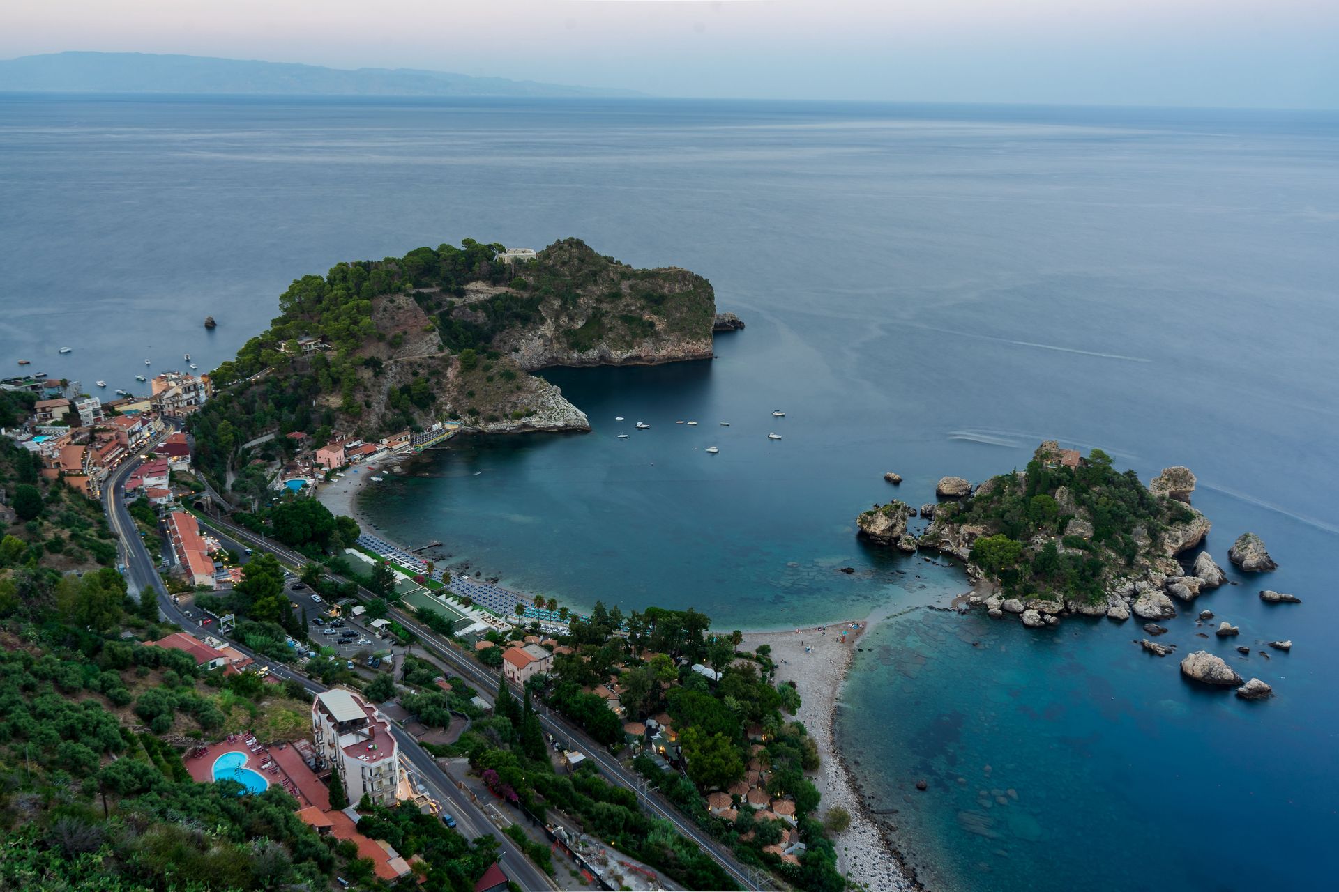
Credit: Alejandro De Roa / Pexels
Sicily is the largest island in the Mediterranean Sea and one of the most layered places in Europe — a place where Greek temples, Arab-Norman churches, Baroque city centers, and active volcanoes occupy the same geography. It was colonized, conquered, and administered by Greeks, Carthaginians, Romans, Byzantines, Arabs, Normans, Swabians, Angevins, Aragonese, and eventually unified Italy, and each of those periods left traces that are still visible in the architecture, the language, the food, and the surnames.
The food is the most immediate way in. Sicilian cuisine is distinct from Italian mainland cooking in ways that reflect the island's layered history. The Arab influence survives in the use of saffron, raisins, pine nuts, and caponata — the sweet-and-sour vegetable dish that has no real equivalent elsewhere in Italy. Street food culture in Palermo centers on arancini, panelle (chickpea fritters), and stigghiola (grilled intestines) sold from carts and storefronts. The granita of eastern Sicily, particularly in Catania and Messina, is made with a coarser texture than the versions found elsewhere, served in a brioche bun for breakfast in a combination that initially sounds strange and quickly becomes the only reasonable way to begin a warm morning.
Mount Etna, on the island's eastern coast, is one of the most active volcanoes in the world and the highest peak in Italy south of the Alps. It is not merely a geological spectacle — it is a wine region. The volcanic soil on Etna's slopes produces wines of significant complexity, particularly from the Nerello Mascalese grape, and the area around the towns of Randazzo and Linguaglossa has attracted winemakers from across Europe who recognized the quality of the terroir before most international buyers did. Visiting the summit craters requires a guide and conditions permitting, but the lower slopes are walkable and offer views across the island to the sea.
The Valley of the Temples outside Agrigento contains one of the best-preserved collections of ancient Greek architecture outside Greece itself. The Temple of Concordia, built in the fifth century B.C., stands nearly intact along a ridge above almond and olive groves. Syracuse, on the eastern coast, was one of the most powerful cities of the ancient Greek world — larger than Athens at its height — and its archaeological park contains a Greek theater still used for performances, a Roman amphitheater, and the Ear of Dionysius, a cave with unusual acoustic properties that has been the subject of speculation since the architect Caravaggio named it in the 17th century.
Lord Howe Island, Australia
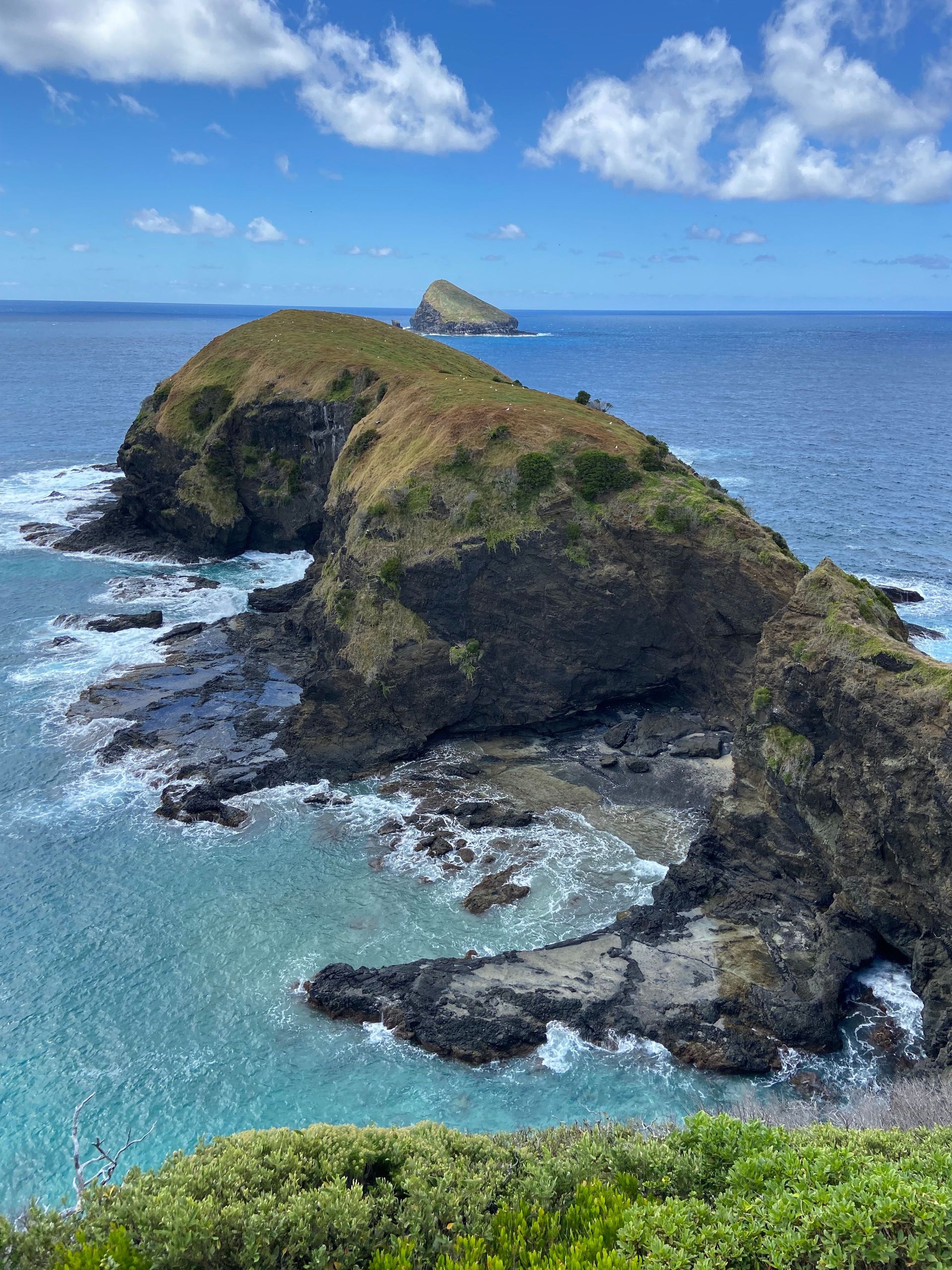
Credit: Jocelyn / Pexels
Lord Howe Island lies about 600 kilometers off the coast of New South Wales, a crescent-shaped remnant of a volcanic seamount that emerged from the Pacific Ocean around seven million years ago. It has a permanent population of around 400 people and a strict cap of 400 tourists at any given time — a limit enforced through a quota on accommodation. The island is a UNESCO World Heritage Site, listed for its exceptional natural beauty and the biodiversity of its marine environment, including the southernmost coral reef in the world.
The physical setting is extraordinary. Two volcanic peaks — Mount Gower and Mount Lidgbird — rise sharply from the southern end of the island, their summits frequently obscured by cloud. The lagoon on the western side is enclosed by a coral reef that creates calm turquoise water suitable for snorkeling and kayaking. The surrounding ocean supports populations of kingfish, trevally, and other game fish. The diving is considered among the best in the Indo-Pacific, with visibility that regularly exceeds 30 meters and marine life that includes schools of double-headed wrasse and regular passes by grey nurse sharks.
The bird life is what sets Lord Howe apart ecologically from almost anywhere else accessible to general visitors. The Providence petrel, which breeds on the island, was once hunted to near-extinction but has recovered significantly. The Lord Howe woodhen — a flightless rail that evolved in the absence of terrestrial predators — was reduced to around 30 individuals in the 1970s and has been brought back to a population of several hundred through a breeding program. The island also hosts the Lord Howe Island stick insect, believed extinct for most of the 20th century following the arrival of black rats, and rediscovered in 2001 on the sea stack of Ball's Pyramid, 23 kilometers to the south.
Access is by a small propeller aircraft from Sydney, with two or three flights per week depending on the season. There are no traffic lights, and cars are limited. Most transport on the island is by bicycle. The accommodation ranges from self-catering units to lodge-style properties, and the cost of visiting is relatively high given transport and the limited supply of beds. The restriction on visitor numbers means the island feels genuinely uncrowded — a condition that has become increasingly rare in places with this combination of natural quality.
Okinawa, Japan
Credit: William Chen / Pexels
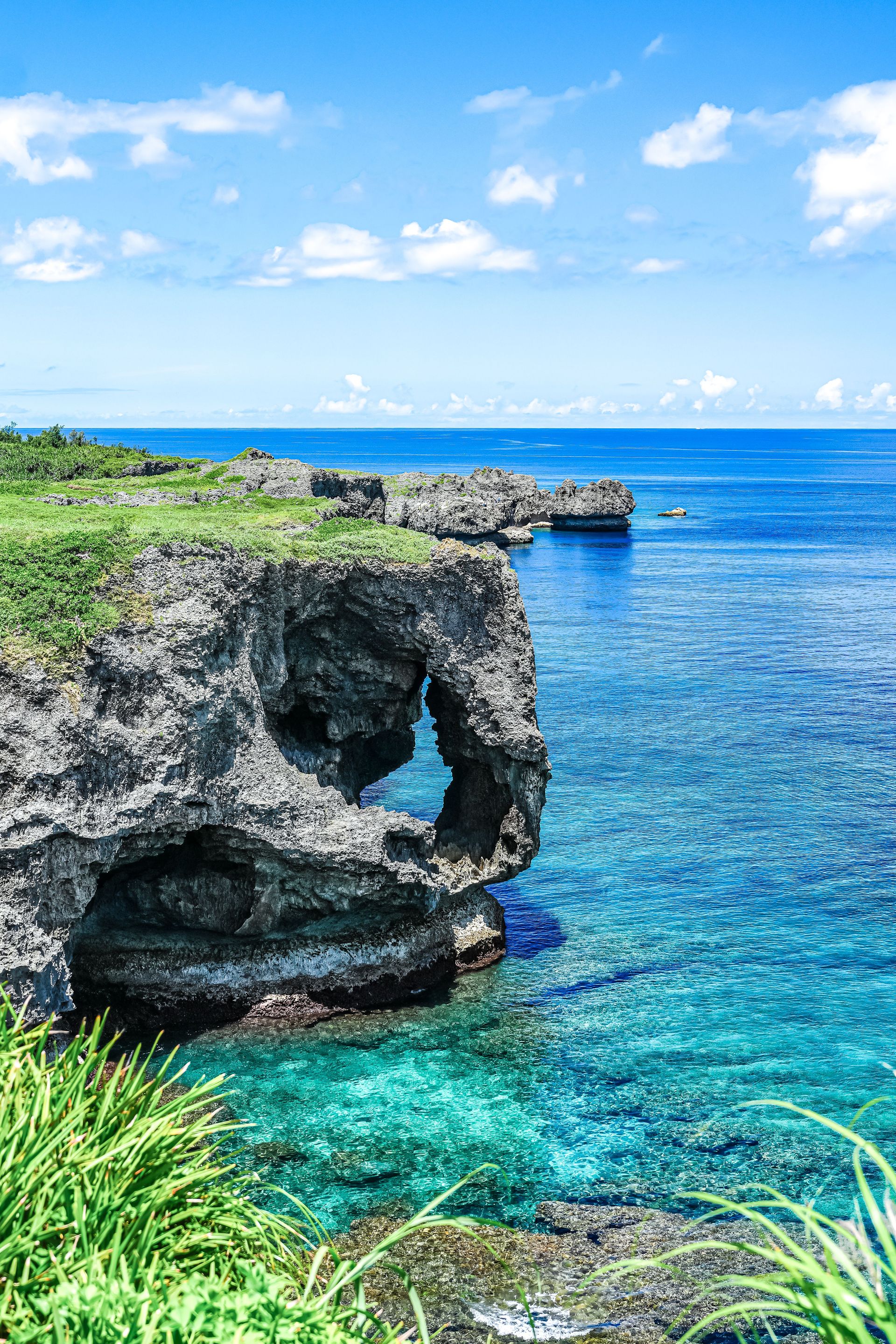
Okinawa is the main island of the Ryukyu archipelago, a chain of islands stretching between Kyushu and Taiwan that was an independent kingdom — the Ryukyu Kingdom — until 1879, when Japan formally annexed it. That history of independence, and the subsequent experience of devastating battle during the Second World War followed by U.S. administration until 1972, has produced a culture that is Japanese in many respects but distinctly Okinawan in language, food, music, and attitude.
The cuisine is one of the most immediate expressions of that distinctiveness. Okinawan food differs from mainland Japanese cooking in its heavy use of pork, its reliance on bitter melon (goya), and its tradition of champuru — a class of stir-fried dishes that combines tofu, vegetables, egg, and meat in combinations that reflect Chinese, Southeast Asian, and Japanese influences. Awamori, the local distilled spirit made from Thai indica rice, has been produced in Okinawa for centuries and differs significantly from Japanese sake or shochu. The prefecture has long been associated with exceptional longevity rates among its elderly population, and the traditional diet — low in calories, high in vegetables and legumes — is typically cited as a contributing factor, alongside strong social networks and regular physical activity.
The music and performing arts of the Ryukyus have their own tradition. The sanshin, a three-stringed instrument with a body covered in snake skin, is the central instrument of Okinawan music and sounds nothing like the shamisen of mainland Japan. Traditional dance forms, recognized by UNESCO as intangible cultural heritage, were historically performed for Ryukyuan royalty and for visiting Chinese envoys, and survive in both formal performance and popular culture. The castle sites of the Ryukyu Kingdom — including Shuri Castle in Naha, which was being restored after a 2019 fire — reflect an architectural tradition that synthesized Chinese, Japanese, and indigenous Ryukyuan influences.
The beaches of the Kerama Islands, a short ferry ride from Naha, are considered among the clearest-water destinations in East Asia. The coral coverage has declined due to bleaching events linked to warming sea temperatures, but the water clarity and the diversity of reef fish remain exceptional relative to most alternatives in the region.
São Miguel, Azores, Portugal
Credit: Alexandre Moreira / Pexels
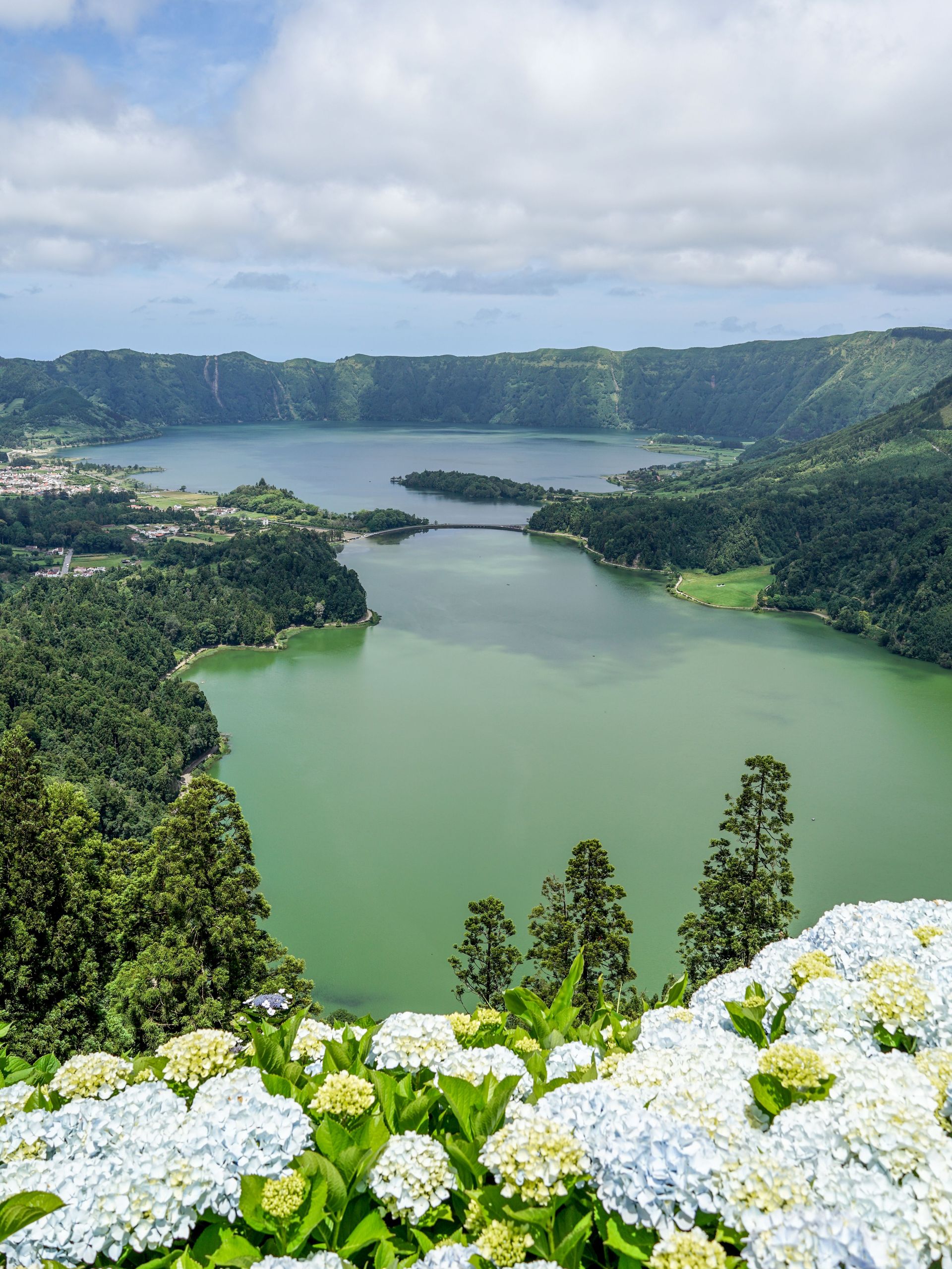
São Miguel is the largest island in the Azores, a Portuguese archipelago in the mid-Atlantic that sits closer to North America than to continental Europe. The island formed through volcanic activity and remains geologically active — its interior is marked by calderas filled with crater lakes, hot springs that heat naturally through geothermal venting, and fumaroles that release steam through cracks in the earth. The landscape is green year-round due to consistent rainfall and the moderating effect of the Gulf Stream on temperature.
The Sete Cidades caldera in the island's west contains two lakes — one appears green, the other blue, a difference caused by variations in light reflection and algae content. The Furnas valley in the east is the center of geothermal activity, where locals cook cozido das Furnas — a slow-braised stew of meat, blood sausage, and root vegetables — in pots buried in the ground and heated by volcanic steam for six or more hours. Several restaurants in Furnas serve the dish daily, lifting the pots from the ground around lunchtime.
São Miguel is one of the few places in Europe where tea is grown commercially. The Gorreana plantation in the north of the island has been operating since the 19th century, producing green and black teas on hillside terraces above the Atlantic. Pineapples are grown in glass greenhouses around Ponta Delgada, the island's capital, in conditions artificially managed to produce the fruit on an island where the climate does not naturally support tropical agriculture. The result is a small, dense, intensely sweet pineapple that tastes substantially different from the commercially grown varieties that dominate the global market.
The ocean around the Azores is a feeding ground for dozens of cetacean species. Whale watching from São Miguel is productive across most of the year, with sperm whales present reliably because the deep water channels of the mid-Atlantic that run between the islands are their preferred habitat. The historical connection between the Azores and whaling — the archipelago was a major hunting ground in the 19th century and sent many men to work on American and Portuguese whaling ships — adds a layer of complexity to watching the same animals now from tourist boats.
Palawan, Philippines
Credit: Nothing Ahead / Pexels
Palawan is a long, narrow province in the western Philippines that extends from Mindoro in the northeast to Borneo in the southwest. It is separated from the rest of the Philippine archipelago by deep water and has a different geological origin — its bedrock connects it to Borneo rather than to the rest of the Philippines, which is reflected in its wildlife. The island is home to species found nowhere else in the Philippine archipelago, including the Palawan bearcat (binturong), the Palawan peacock-pheasant, and the Philippine crocodile in its northern rivers.
The seascape around Palawan is what draws most visitors. El Nido, in the north, sits among a group of limestone karst formations that rise directly from turquoise water. The limestone towers were formed by coral reefs that were pushed above sea level by tectonic movement and subsequently shaped by rain and wave action over millions of years. The lagoons enclosed by these formations — reached by small outrigger boats that thread through narrow passages in the rock — have a quality of enclosure and calm that is difficult to find in more accessible environments. Bacuit Bay, which encompasses El Nido and the surrounding islands, is part of a protected area where fishing restrictions have allowed reef populations to partially recover.
Coron, at the northern tip of Busuanga Island, is a different kind of destination within the same province. The area contains a series of Japanese warships sunk by U.S. aircraft in September 1944 during a coordinated attack on a Japanese fleet that had taken shelter in the bay. The wrecks are now dive sites, the largest being the Irako — a refrigeration supply ship that sits upright on the seabed at a maximum depth of around 42 meters. The wrecks have been colonized by coral and are home to significant populations of fish. Coron is also known for several freshwater lakes in the interior of Busuanga, most notably Kayangan Lake, which combines dramatic limestone scenery with water of exceptional clarity.
The Underground River in Puerto Princesa, the provincial capital, is a UNESCO World Heritage Site — a navigable river that flows through an extensive cave system before emerging directly into the sea. It is one of the longest navigable underground rivers in the world, and the cave system it runs through contains multiple chambers with large stalactite and stalagmite formations.
Lofoten Islands, Norway
Credit: Jakub Samberger / Pexels
The Lofoten Islands are a chain of islands in northern Norway, above the Arctic Circle, where mountains rise almost directly from the sea to heights of 1,000 meters and more. The islands sit at a latitude that should, by thermal logic, produce conditions similar to Siberia, but the Gulf Stream keeps the climate dramatically milder than the latitude suggests — temperatures rarely drop below minus 10 degrees Celsius even in the depths of winter, and the sea rarely freezes. This combination of Arctic latitude and temperate ocean makes Lofoten one of the few places in the world where winter visitors can experience polar darkness, aurora borealis, and relatively survivable cold simultaneously.
The light is the defining experience of Lofoten regardless of season. In summer, the midnight sun means the sky never fully darkens, and the low angle of the light at midnight produces colors — rose and amber reflected on still fjord water below mountains silhouetted against a pale sky — that have made the archipelago a significant destination for photographers. In winter, the polar night reduces direct sunlight to a few hours around midday, when the sun skims the horizon and casts a long, blue-tinged twilight across the snow-covered peaks. The aurora borealis appears when solar activity is sufficient and the sky is clear, typically on the clearer winter nights between September and March.
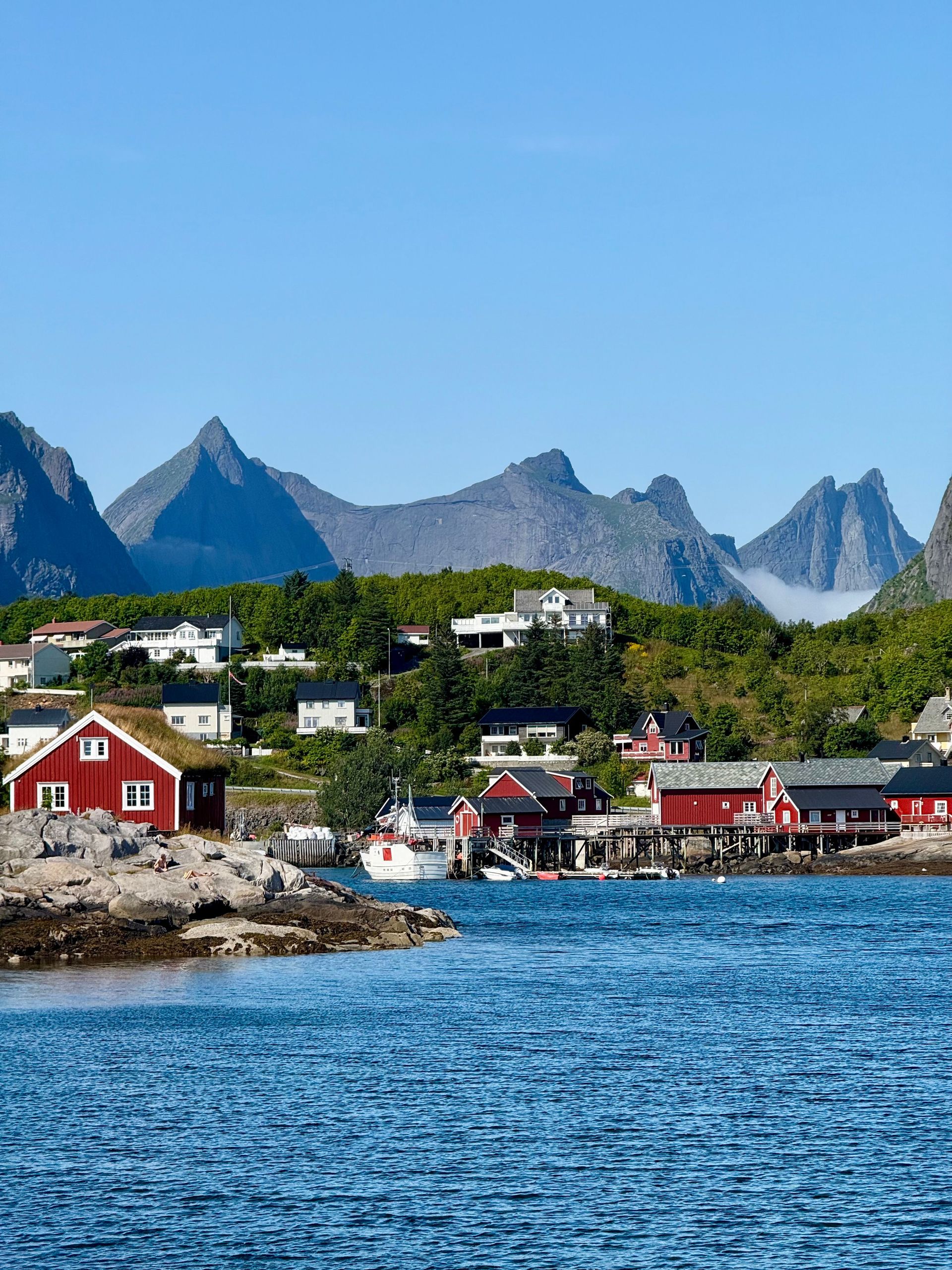
The fishing villages of Lofoten have a specific architectural character defined by the rorbuer — traditional red fishermen's cabins built on stilts over the water. Many of these have been converted to tourist accommodation. The village of Reine is frequently cited as one of the most scenically positioned villages in Norway, its cluster of red buildings reflected in the fjord below mountains that cut sharply against the sky. Nusfjord, one of the oldest preserved fishing villages in Norway, operates as an open-air museum where the 19th-century industrial infrastructure of the cod fishing industry — drying racks, salt houses, boathouses — remains largely intact.
Cod has defined the economy of Lofoten for centuries. The waters around the islands are the winter breeding ground of the Arctic skrei cod, which migrates from the Barents Sea every year between January and April. The dried cod produced in Lofoten — hung on wooden racks called hjell that stand along every harbor — has been exported to southern Europe for over a thousand years and is the base ingredient for bacalhau in Portugal and baccalà in Italy.
Bali, Indonesia
Credit: Patrick Gamelkoorn / Pexels
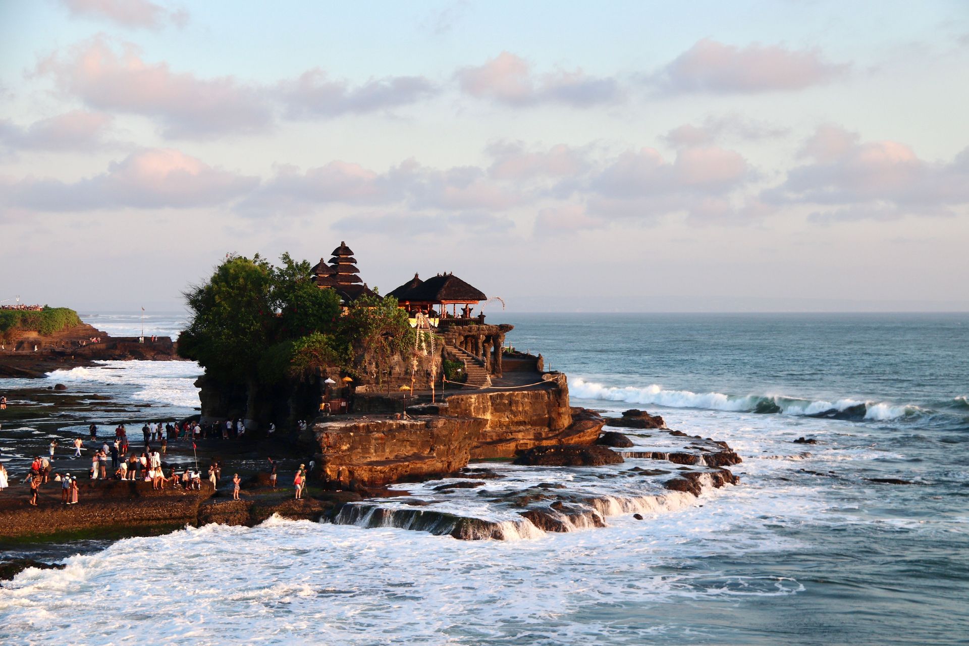
Bali is one of more than 17,000 islands in the Indonesian archipelago, and it is exceptional not for its beaches or climate — both of which are matched or exceeded by several other Indonesian islands — but for the persistence of a Hindu-Balinese culture that survived the Islamization of most of the rest of the archipelago during the 15th and 16th centuries. Around 83% of Bali's roughly 4 million people practice a form of Hinduism that has evolved distinctly from its Indian origins over the course of more than a thousand years of local development.
The religious dimension of Balinese life is expressed daily and visibly in a way that is unusual in the contemporary world. Small offerings called canang sari — woven palm-leaf trays holding flowers, incense, rice, and sometimes small portions of food — are placed each morning at household shrines, at the entrances to shops and offices, at road intersections, and at the base of large trees. The temples that occupy the high ground of every village, the cremation ceremonies that are among the most elaborate public rituals in Southeast Asia, and the calendar of festival days that marks regular interruptions to ordinary commerce — all of these operate as a functioning religious system embedded in the daily rhythm of life rather than as performances for visitors.
The terraced rice fields of central Bali — particularly in the Tegallalang and Jatiluwih areas — are the product of a communal irrigation system called subak that dates back to the 9th century. The subak system coordinates water distribution across the terraces through a network of water temples, where priests manage the allocation of water between communities using ritual cycles tied to the agricultural calendar. UNESCO recognized subak as a Cultural Landscape in 2012. The terraces themselves, cut into the hillsides in long, curved steps, are planted and harvested in offset cycles that create a mosaic of different shades of green and gold across the landscape.
The southeast coast of Bali has been heavily developed, and areas like Kuta and Seminyak operate as resort districts with limited connection to the cultural life of the island's interior. Ubud, in the highlands, functions as the center of Balinese performing arts, with daily performances of the Kecak fire dance, wayang kulit shadow puppetry, and various forms of gamelan-accompanied dance that can be seen in temple courtyards and dedicated venues throughout the year.
Crete, Greece
Credit: manos koutras / Unsplash
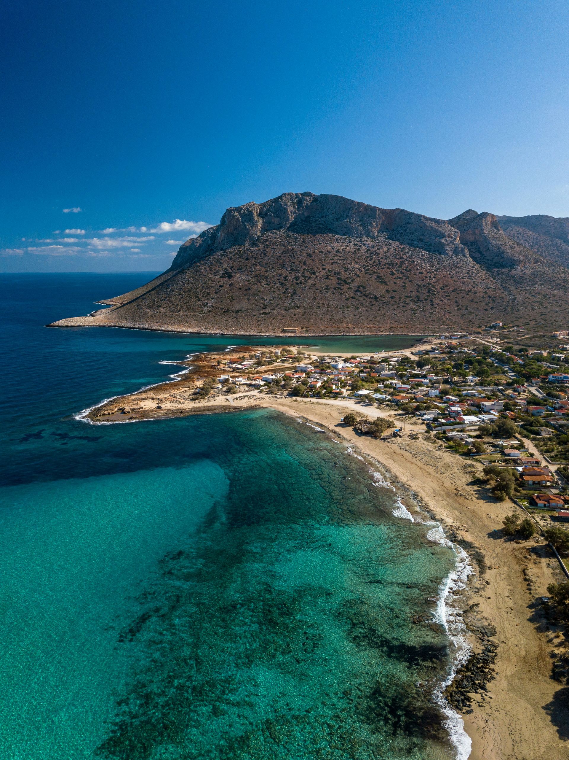
Crete is the largest of the Greek islands and the fifth-largest island in the Mediterranean, large enough that its different regions have distinct identities and climates. The island's history runs from the Minoan civilization — which produced the palace complex at Knossos around 2000 B.C. and is considered Europe's earliest advanced civilization — through Venetian colonial rule, Ottoman administration, and eventual union with Greece in 1913. Each of these periods left infrastructure, vocabulary, and culinary traditions that persist visibly into the present.
The food of Crete is perhaps the most studied example of what nutritional scientists began calling the Mediterranean diet in the mid-20th century. The traditional Cretan diet — built around olive oil, legumes, wild greens, bread, and small amounts of meat and dairy — was documented in the Seven Countries Study, a long-running international research project that began in the 1950s. The olive trees of Crete include some of the oldest productive trees in Europe; groves in the region around Vouves contain trees estimated to be over 2,000 years old that continue to produce fruit. Cretan olive oil, produced in large volume, has a flavor profile shaped by the island's variety of olive — the Koroneiki — which is small, high in polyphenols, and produces oil with a characteristic peppery finish.
The Samaria Gorge in the White Mountains of western Crete is one of the longest gorges in Europe — approximately 16 kilometers from the plateau at the top to the Libyan Sea at the bottom. The descent takes most walkers five to seven hours and involves considerable elevation change over rough terrain. The gorge is part of a national park and opens seasonally, typically from May through October when water levels in the riverbed allow safe passage. The walls of the gorge narrow in places to less than four meters — a section called the Iron Gates — where the limestone has been cut by centuries of water flow.
The north coast of Crete is heavily developed along the strip running east from Heraklion toward Agios Nikolaos, and this part of the island operates primarily as a beach resort destination in summer. The south coast and the western peninsula around Chania are substantially different in character — the Venetian harbor of Chania, the mountain villages of the Sfakia region, and the beach at Elafonisi in the far southwest, where shallow water over pink-tinted sand creates conditions unlike anything on the island's more developed coastlines.
Galápagos Islands, Ecuador
Credit: Sofia / Unsplash
The Galápagos Islands are an archipelago of volcanic islands in the Pacific Ocean, roughly 1,000 kilometers off the coast of Ecuador, that achieved their status in the history of science through the observations Charles Darwin made during the Beagle's visit in 1835. Darwin's notes on the variation between finch populations on different islands contributed to his later formulation of natural selection. The islands now function as a UNESCO World Heritage Site and a national park, with visitor access tightly regulated to manage ecological impact.
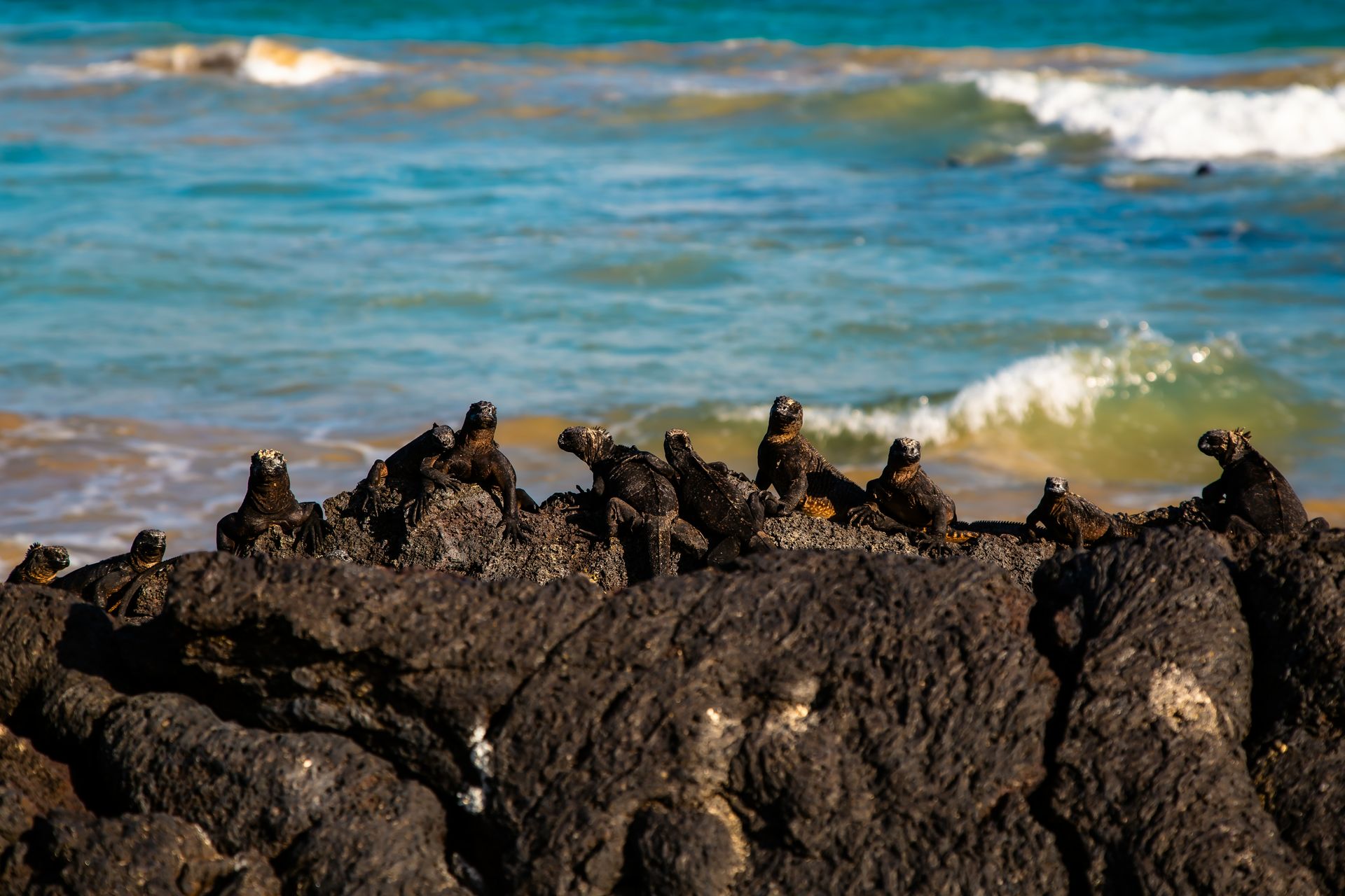
The wildlife is what makes the Galápagos experience unlike any other in the world accessible to general visitors. The animals evolved in the absence of terrestrial predators and have not developed a fear response to humans. Marine iguanas — the only ocean-going lizards in the world — warm themselves on black lava rocks and ignore people passing within arm's reach. Blue-footed boobies perform their mating dance on open paths. Sea lions occupy the benches in Puerto Baquerizo Moreno and the docks of Puerto Ayora with the confidence of animals that have never learned to be worried. Waved albatrosses perform their elaborate courtship rituals on Española Island in full view of visitors who can observe from a few meters away.
The geology of the islands is as significant as the biology. The Galápagos sit above a volcanic hotspot — a plume of heat from deep within the mantle that has produced a chain of islands as the Nazca Plate moves eastward across it. The youngest islands, in the west, are still volcanically active; Fernandina Island last erupted in 2024 and its surface is composed largely of bare lava fields. The older islands, in the east, have had more time for soil development and vegetation, which is why the eastern islands support the large Galápagos tortoise populations while the western islands are more barren.
Tourism to the Galápagos is managed through a combination of national park fees, restrictions on where visitors can go without guides, and limits on the size and number of visitor groups at sensitive sites. Liveaboard boats are the most common way to cover multiple islands, though land-based visits to Santa Cruz and San Cristóbal are also possible. The regulations are enforced seriously, and the commitment to conservation has kept the islands in considerably better ecological condition than they would otherwise be given the volume of international interest.
Madeira, Portugal
Credit: João Jesus / Pexels
Madeira is a Portuguese island in the Atlantic, about 1,000 kilometers southwest of Lisbon and 500 kilometers from the northwest coast of Africa. It is a volcanic island with dramatic topography — steep cliffs that drop directly to the sea, a central plateau at around 1,800 meters, and deep valleys carved by water over millions of years. The island's position in the Atlantic, intercepting trade winds and moisture from the north, has produced a varied microclimate system where the north coast receives significantly more rain than the south, and the high interior sustains a cloud forest ecosystem — Laurisilva — that is a remnant of the subtropical forest that covered much of Europe and North Africa before the Quaternary ice ages.
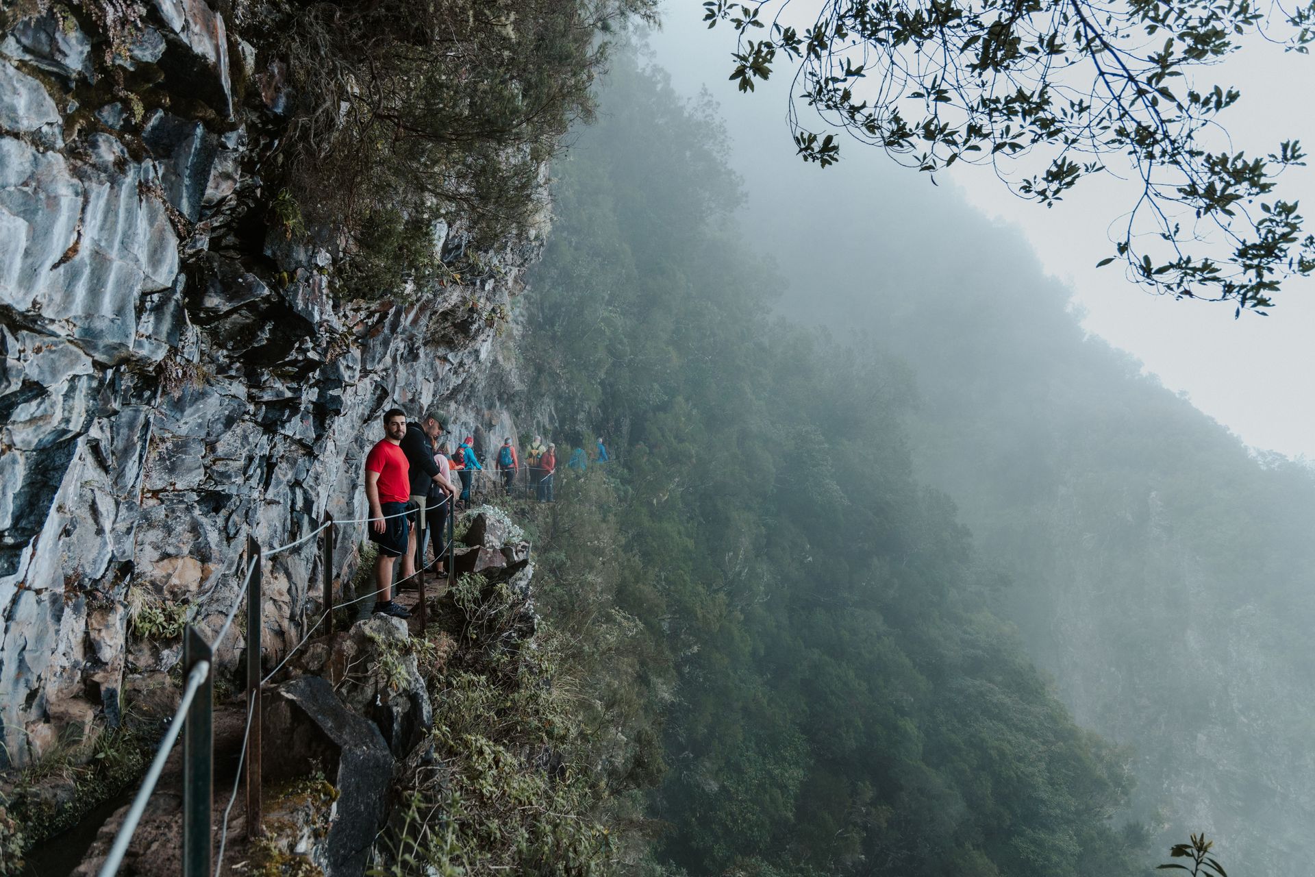
The Laurisilva of Madeira, which covers around a third of the island and is a UNESCO World Heritage Site, is the largest surviving area of this ancient forest type in the world. It contains trees that can live for centuries — species of laurel, til, and Madeira mahogany — growing in conditions of near-constant moisture from low-lying cloud. The forest floor is dense with mosses, ferns, and lichens. Walking through it, particularly along the levada trails that follow the irrigation channels cut into the hillsides by early settlers, produces a sense of extreme botanical density that is unlike any other forest experience in Europe.
The levadas are one of Madeira's most distinctive features. They are narrow channels carved from the 15th century onward to bring water from the wet north of the island to the drier agricultural terraces of the south. Hundreds of kilometers of levadas cross the island, and walking their maintenance paths — typically about half a meter wide, running along hillsides at consistent elevation — has become the primary activity of active visitors to Madeira. Some levadas pass through tunnels cut in the rock; others run along exposed cliff faces with steep drops. The most dramatic routes require headlamps and some comfort with heights.
Madeira wine — produced from grapes grown on the island's terraced hillsides — is one of the world's most stable wines, historically significant because the wine developed its characteristic oxidized flavor profile during long sea voyages, when barrels in the holds of ships were subjected to heat and movement that would ruin other wines. The Madeira wine trade was central to the island's economy for centuries, and the island's wines were reportedly consumed at the signing of the U.S. Declaration of Independence.
Zanzibar, Tanzania
Credit: Moses Londo / Unsplash
Zanzibar is an archipelago of islands off the coast of Tanzania, the main island of which — Unguja — is commonly referred to simply as Zanzibar. The island was for centuries the center of the Indian Ocean spice trade and a major hub of the Arab slave trade, and its capital Stone Town is a UNESCO World Heritage Site where the architecture of Omani Arab merchants, Indian traders, British colonial administrators, and East African Swahili culture coexists in a dense, intricately layered urban environment.
Stone Town's streets are narrow enough that the light rarely reaches the ground at midday. The buildings are constructed of coral stone, with elaborately carved wooden doors that were historically a statement of the owner's wealth and status — the more ornate the door, the more prosperous the household. The doors combine Omani, Indian, and East African motifs in a hybrid style that is specific to the Swahili coast and has no direct parallel elsewhere. The old fort, the Palace Museum, and the former slave market — now the site of an Anglican cathedral — map the island's history in physical form across a small walkable area.
The spice history of the island is commercially alive. Cloves, nutmeg, cardamom, vanilla, black pepper, and cinnamon are grown on the island and sold in the markets of Stone Town. Guided spice tours of working farms in the island's interior remain popular because the agricultural context — seeing vanilla orchids climbing support posts, tasting raw cinnamon bark, learning to distinguish clove varieties — gives concrete form to the history of trade routes that made this island economically significant across the known world for centuries.
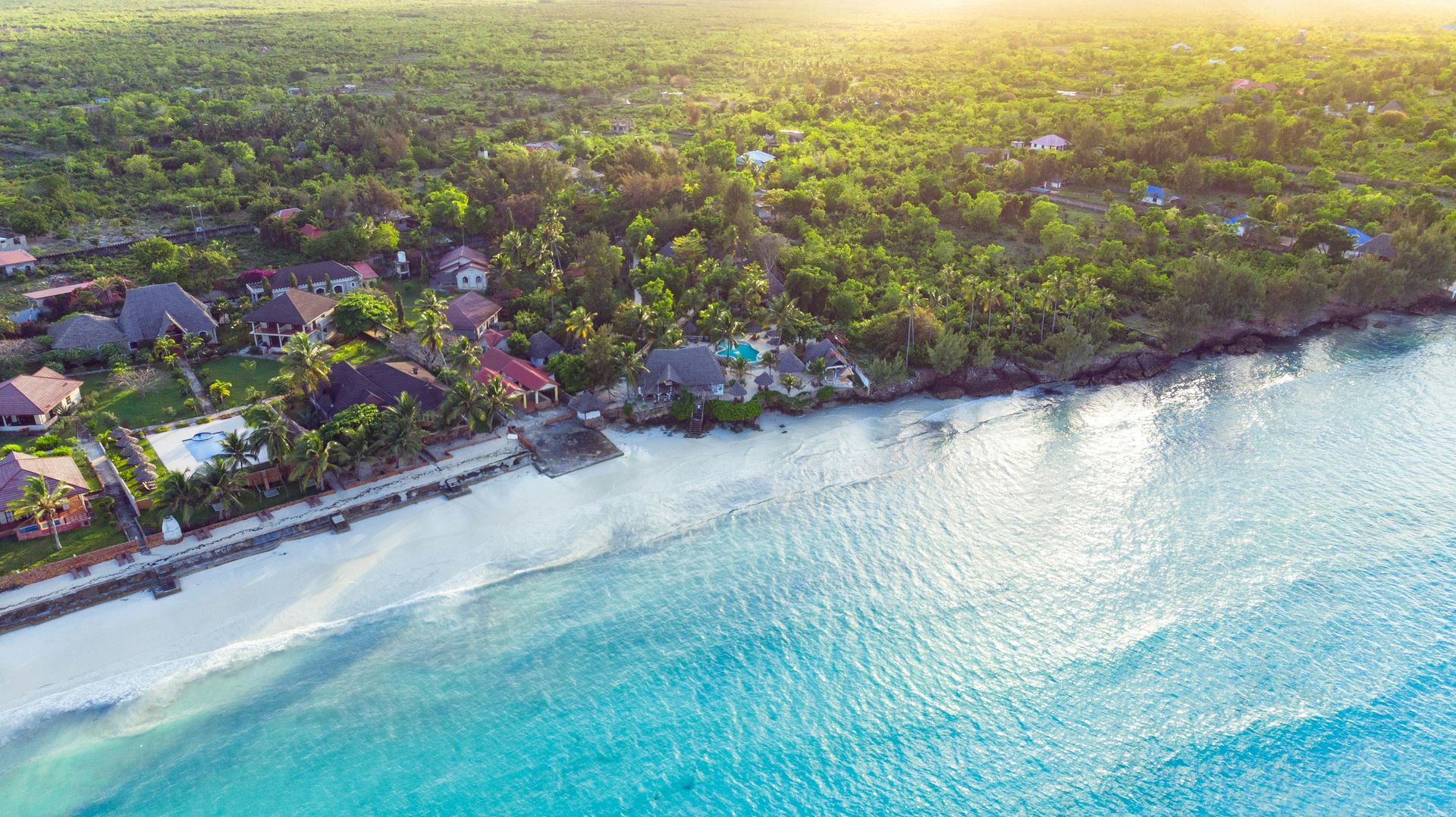
The east coast of Unguja has beaches — particularly around Nungwi and Kendwa in the north — that are popular for their white sand and calm water. The reef systems around the island have suffered from warming events and dynamite fishing, but some areas, particularly around Mnemba Atoll in the northeast, retain significant coral coverage and support populations of green sea turtles, spinner dolphins, and reef fish.
Corsica, France
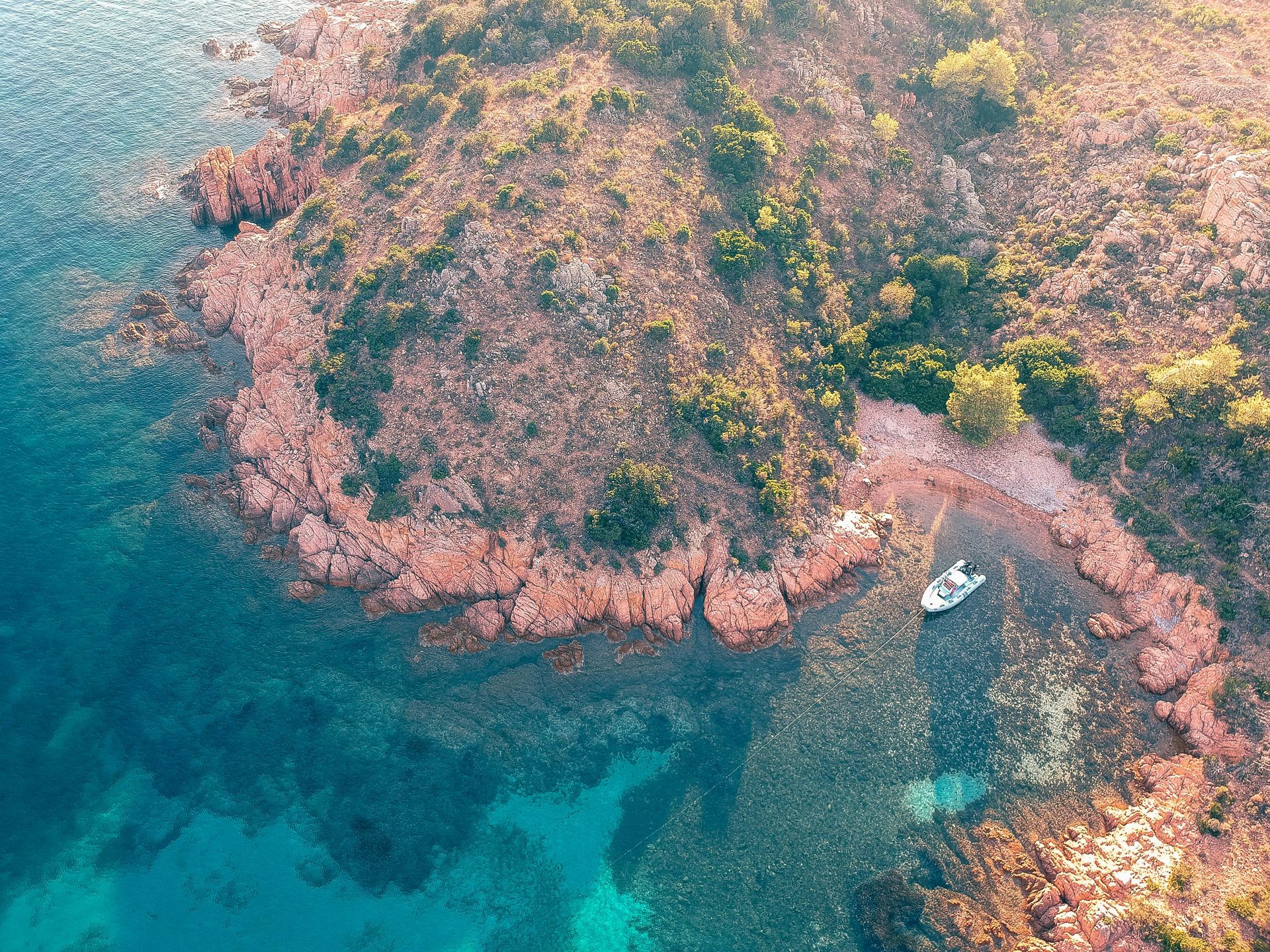
Credit: Mathilde Cureau / Unsplash
Corsica is a French island in the Mediterranean, 80 kilometers south of the French Riviera and about 12 kilometers north of Sardinia. It is the fourth-largest island in the Mediterranean by area, and its interior is more mountainous than most visitors who arrive for the beaches realize — the central ridge of the island includes peaks above 2,700 meters, and the GR20 long-distance hiking trail that traverses the island from north to south is considered one of the most demanding mountain trails in Europe.
The GR20 covers approximately 180 kilometers across terrain that alternates between exposed granite ridges, mountain lakes, pine forests, and maquis — the dense scrubland of rosemary, cistus, myrtle, and lavender that covers the lower slopes of the island and gives the air a herbal quality that is one of the most immediately distinctive sensory experiences of arriving in Corsica. Napoleon Bonaparte, who was born in Ajaccio in 1769, supposedly claimed he could identify his home island by smell alone while still out at sea — a claim that, whether accurate or not, reflects something real about the vegetation.
Corsica produces wines that have become better known internationally over the past two decades, particularly the whites and rosés from the Patrimonio appellation in the north, made primarily from the Vermentino grape, and the reds from the Ajaccio appellation, made primarily from Nielluccio and Sciaccarellu — grape varieties that are either unique to the island or closely related to Sardinian and Tuscan varieties. The wine culture is inseparable from the broader Corsican identity, which has a complicated relationship with French governance and has produced a political separatist movement that was active with violence from the 1970s through the 2000s.
The coastal scenery of Corsica is varied enough that the island rewards extended rather than brief visits. The Calanques de Piana in the west — red granite formations carved into towers and arches by erosion — are among the most dramatic coastal rock formations in the Mediterranean. The beaches of the south, around Bonifacio, are accessible largely by boat. The Lavezzi Islands, just south of Bonifacio, are a nature reserve with some of the clearest water in the Mediterranean.
Jeju Island, South Korea
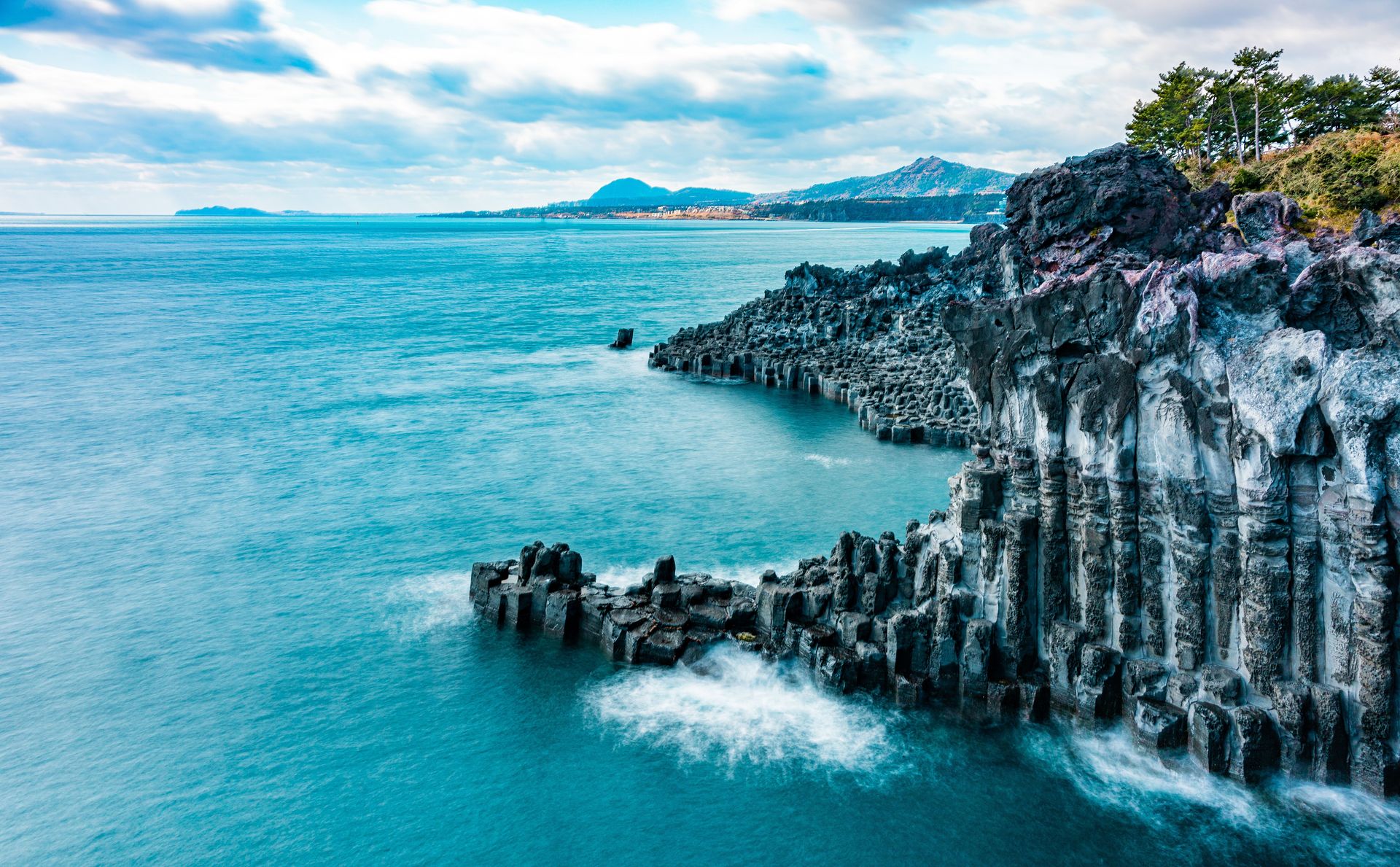
Credit: Ethan Brooke / Pexels
Jeju Island sits in the Korea Strait, roughly 80 kilometers south of the Korean peninsula. It is the largest island in South Korea and the only province that consists entirely of an island. The island formed through volcanic activity centered on Hallasan, a shield volcano that at 1,950 meters is the highest peak in South Korea. UNESCO has recognized Jeju in three separate categories — as a Biosphere Reserve, a World Heritage Site for its volcanic features, and as a Global Geopark.
The Geomunoreum lava tube system contains some of the most complex and well-preserved lava tube caves in the world. The Manjanggul Cave, part of the system, is one of the longest lava tubes on Earth open to the public — visitors can walk approximately one kilometer of the cave's 7.4-kilometer total length. The cave ceiling at the entrance reaches 30 meters in height, and the interior contains lava stalactites, lava columns, and a prominent lava pillar near the end of the accessible section that is one of the largest of its kind anywhere.
Jeju has a cultural tradition distinct from the mainland. The haenyeo — women divers who free-dive for abalone, sea urchin, and other marine produce without breathing equipment — have practiced their trade for centuries and represent a matrilineal economic tradition that persisted in part because so many Jeju men died at sea or were conscripted for labor. The haenyeo are now largely elderly, with younger generations not taking up the practice at the same rate, and UNESCO inscribed the haenyeo culture as intangible cultural heritage in 2016. Experienced haenyeo can hold their breath for two to three minutes and dive to depths of 20 meters or more.
The black lava coastline of Jeju, the tangerine orchards that cover the island's lower slopes, and the stone grandfather statues — dol hareubang — that stand at village entrances and have become the island's emblem, all contribute to an environment that feels substantially different from the mainland. The island is a popular domestic tourist destination and a common honeymoon choice for South Korean couples, which means infrastructure is well developed but the most visited sites, particularly Seongsan Ilchulbong at sunrise, become very crowded.
Ischia, Italy
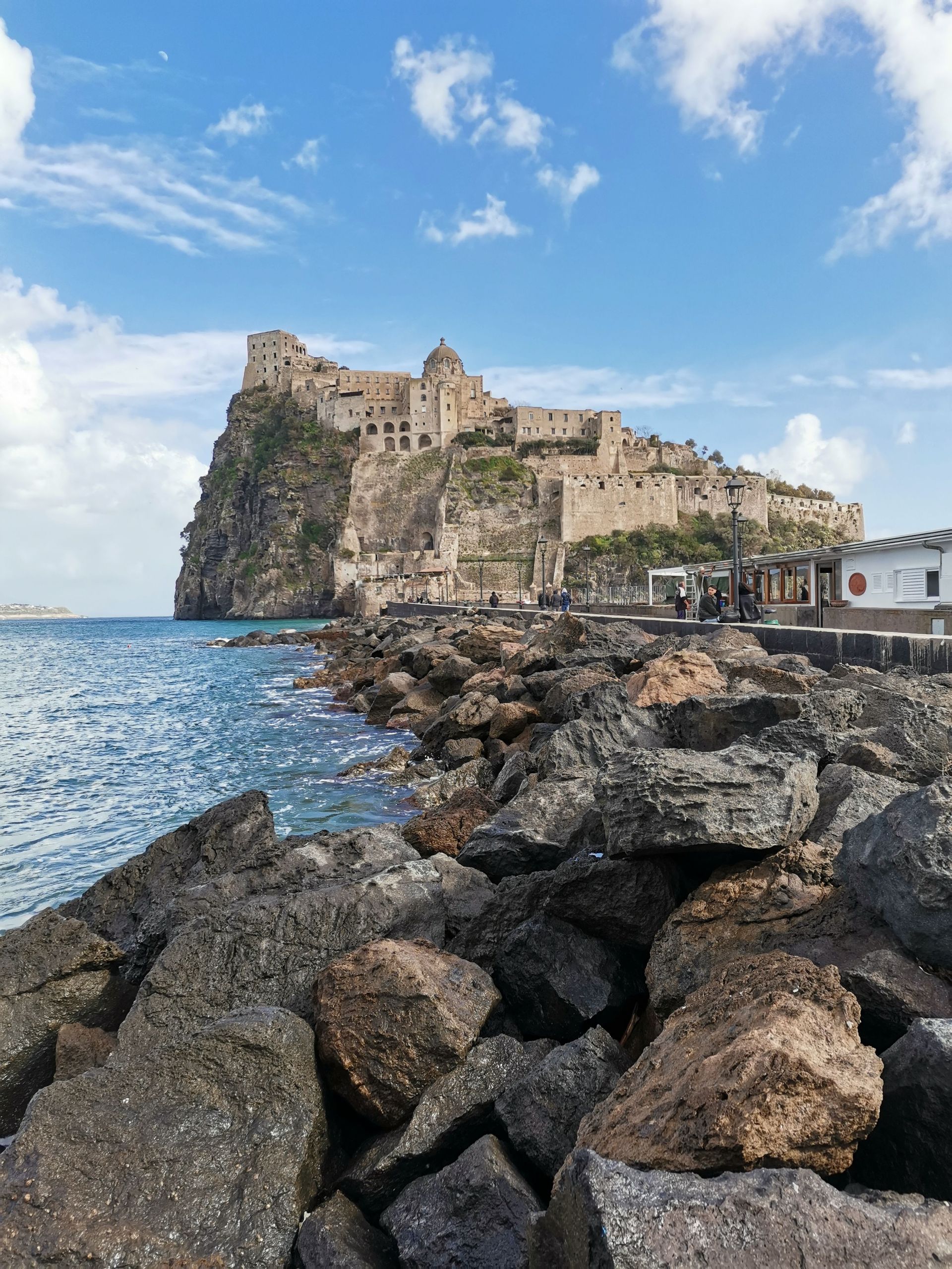
Credit: Alberto Brunello / Pexels
Ischia is a volcanic island at the northern end of the Gulf of Naples, about 30 kilometers from Naples by ferry. It is less visited than the island of Capri, which sits across the bay, and substantially larger — Ischia is roughly 46 square kilometers, compared to Capri's 10. The island has been a destination for thermal bathing since ancient times; the Greeks and Romans knew it as a place where naturally heated mineral water emerged from the ground, and thermal parks and spa hotels are now the primary draw for the significant German, Austrian, and Swiss tourist traffic that arrives each year.
The thermal water of Ischia is heated geothermally and varies in temperature and mineral content by location. The public beach at Spiaggia dei Maronti in the south has sections where hot water emerges naturally from the sand, and bathers can dig into the beach to release steam and create personal hot pools at low tide. The thermal parks — private establishments with pools of varying temperatures, hot springs, gardens, and spa facilities — are typically open from April through October and charge daily entry fees.
The wine culture of Ischia is older than the thermal bathing tradition. The island was one of the earliest sites of Greek colonization in the western Mediterranean — the settlement of Pithecusae was established on Ischia around 770 B.C., making it one of the oldest Greek colonies in Italy. The agricultural character of the island, including viticulture, predates Roman rule. The wines of Ischia — particularly the whites made from Biancolella and Forastera grapes — have experienced renewed interest as part of the broader appreciation for indigenous Italian grape varieties that has developed in the wine trade over the past 20 years. The steep terraced vineyards on the island's volcanic slopes, worked in some cases entirely by hand or with monorail-assisted equipment, produce wines of modest volume and increasing reputation.
The castle complex of Castello Aragonese, connected to the main island by a footbridge, was inhabited continuously from the 13th century through the early 19th century and contains within its walls a cathedral, convent, cemetery, and various other structures in various states of preservation. The view from the castle across the gulf toward Naples and Vesuvius has a compositional quality that makes it one of the more considered viewpoints in the Campanian archipelago.
Socotra, Yemen
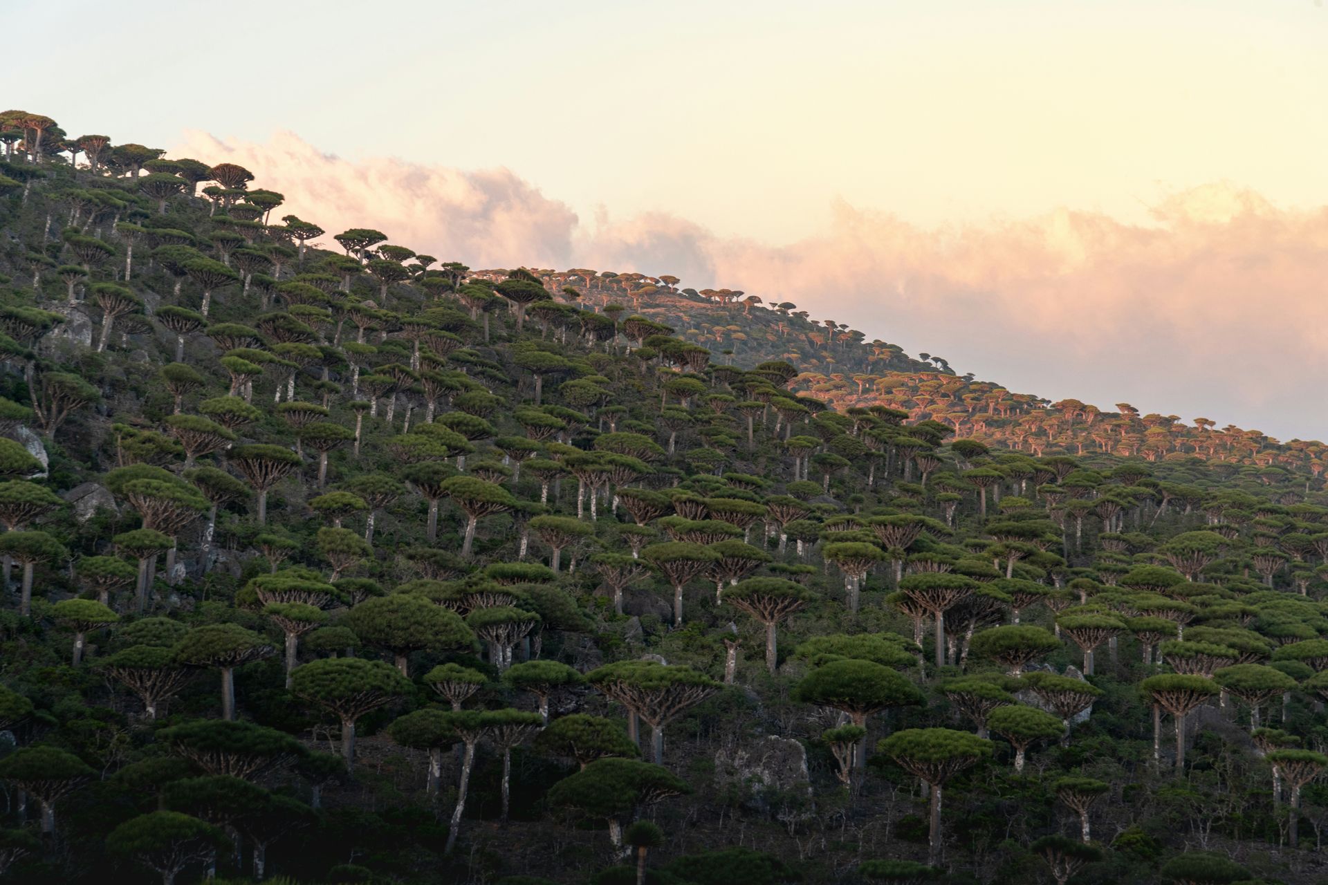
Credit: Andrew Svk / Unsplash
Socotra is an island in the Arabian Sea, part of Yemen but separated from the mainland by approximately 240 kilometers of open ocean. Around 37% of its plant species, 90% of its reptile species, and significant proportions of its bird and invertebrate species exist nowhere else on Earth.
The dragon blood tree — Dracaena cinnabari — is Socotra's most iconic species and one of the most visually distinctive trees in the world. It has a thick, smooth trunk that branches repeatedly into a canopy shaped like an upturned umbrella. The sap, when the bark is cut, exudes a dark red resin that has been traded as a pigment, medicine, and varnish for at least two thousand years. The trees grow in high-altitude areas of the island, particularly on the Haggeher Mountains, where the mist from monsoon clouds provides moisture in an otherwise arid environment. The plateau landscapes around Dixam, where dragon blood trees grow in open groves against a background of stark rock, are unlike any scenery elsewhere on the planet.
Socotra has been physically isolated for so long that it developed its own language — Socotri — an unwritten South Semitic language spoken by the indigenous population that bears little resemblance to Arabic despite the island's administrative and cultural connections to Yemen and the broader Arabian Peninsula. The traditional material culture of the Socotri people — round stone houses, specific textile patterns, pastoral practices adapted to the island's semi-arid environment — has been maintained in relative isolation, though the installation of a causeway and airport has increased outside contact significantly since the 1990s.
The current situation in Socotra is complicated by the broader Yemeni conflict. Visiting requires working through specialized operators with updated security assessments, and the situation is subject to change. The ecological and cultural distinctiveness of the island is beyond question; whether to visit given the political context requires current, specific research that goes beyond what any static list can provide.
Réunion, France
Credit: Alonzo Photo / Pexels
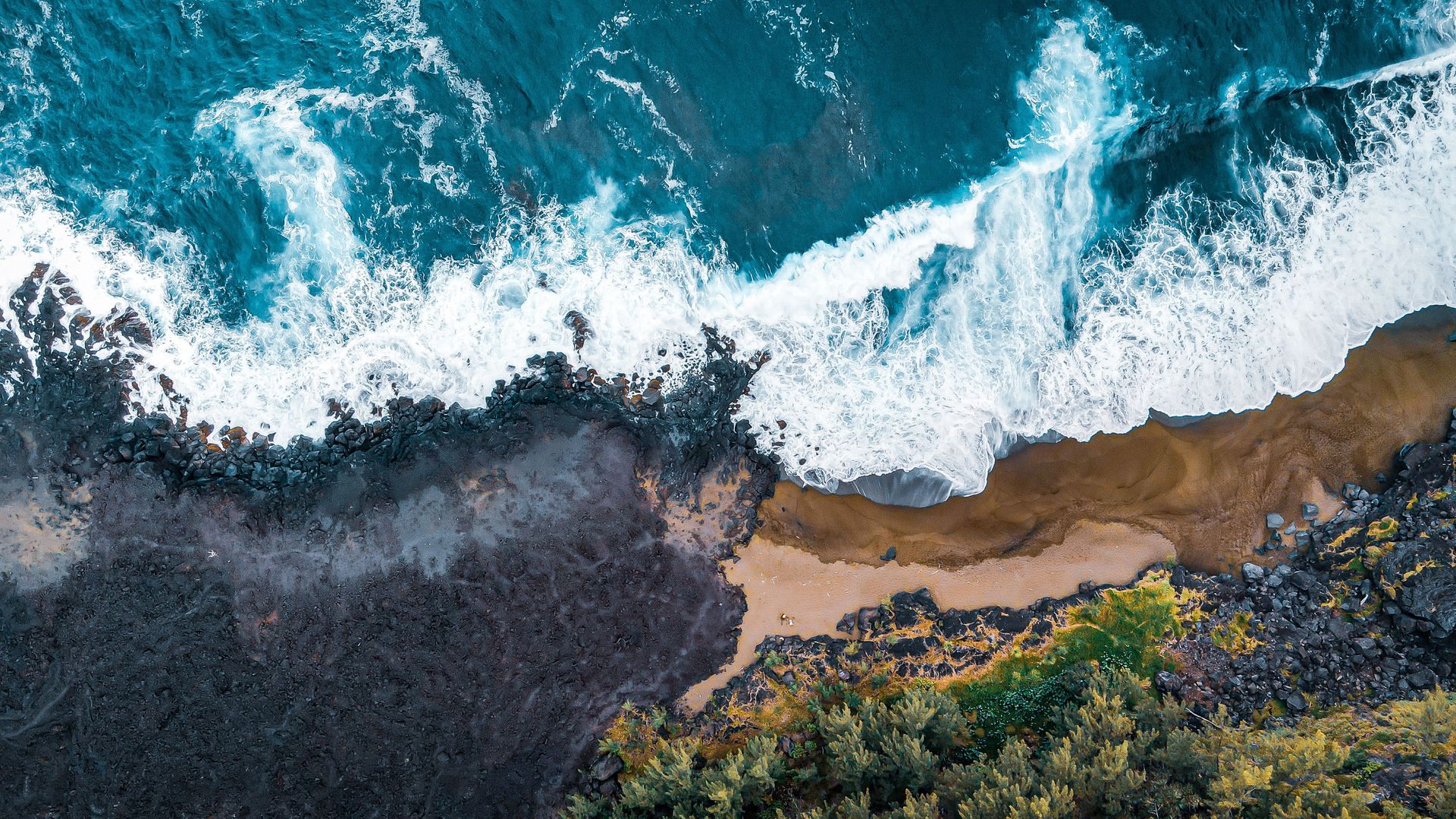
Réunion is a French overseas department in the Indian Ocean, roughly 170 kilometers southwest of Mauritius. Its defining feature is the Piton de la Fournaise, one of the most active volcanoes in the world, which has erupted on average around once per year for as long as records have been kept. The volcano sits in the southeastern part of the island and its eruptions — typically effusive flows of low-viscosity basalt rather than explosive events — can be observed from a safe distance, and the island's tourism infrastructure includes protocols for getting visitors to observation points during active eruptions.
The island's interior is organized around three cirques — Cirque de Cilaos, Cirque de Mafate, and Cirque de Salazie — which are large, steep-sided basins created by the collapse of an older volcanic shield over millions of years. The cirques are accessible by road (Cilaos and Salazie) or primarily by foot and helicopter (Mafate, which has no road access). The villages within the cirques have been occupied for centuries by descendants of escaped slaves, called maroons, who found refuge in the inaccessible interior of the island and built communities that remained largely isolated until the 20th century.
The food of Réunion reflects the island's history as a meeting point of African, Indian, European, Chinese, and Malagasy communities. Rougail — a tomato-based sauce incorporating chilies, ginger, and various proteins including smoked sausage, salt cod, or shrimp — is served across the island in versions that vary by family and region. Cari, the local adaptation of curry, is the central dish of Réunion cuisine, reflecting the significant population of Indian descent — primarily Tamil and Gujarati — that arrived as laborers after the abolition of slavery in 1848.
The lagoon on the west coast of Réunion, protected by a coral reef, provides swimming and snorkeling conditions in contrast to the rougher open coastline of the east. Shark activity in the waters around Réunion has been higher than average, and several surfing beaches have been closed or operate under restrictions.
Maddalena Archipelago, Italy
Credit: Andrea barsali / Pexels
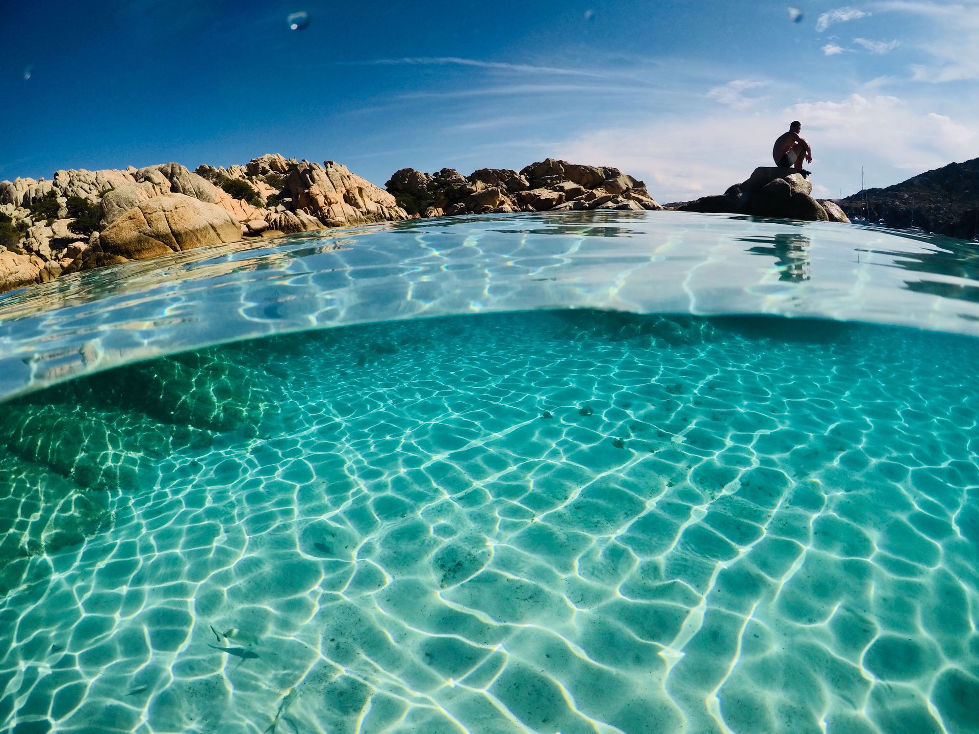
The Maddalena Archipelago is a group of seven main islands and numerous smaller islets off the northeastern tip of Sardinia, in the Strait of Bonifacio between Italy and Corsica. The archipelago is a national park — Parco Nazionale dell'Arcipelago di La Maddalena — and the combination of granite rock formations, clear water, and relative inaccessibility by road has kept the sea conditions considerably cleaner than most of the western Mediterranean.
The water clarity around the Maddalena islands, particularly at the beaches of Spiaggia Rosa on the island of Budelli, is driven by the flushing action of the strong tidal currents through the strait and the absence of significant industrial activity in the surrounding area. Spiaggia Rosa — named for the pink-tinged sand, a color produced by fragments of coral and shell accumulated over centuries — is now only accessible as a viewpoint from the water; walking on the beach has been prohibited since the 1990s after erosion from tourist foot traffic and the removal of sand as souvenirs damaged the ecosystem.
The national park encompasses marine as well as terrestrial areas, and the underwater terrain in the strait includes strong currents, significant biodiversity, and conditions that support diving from beginner to advanced levels. Posidonia oceanica — the seagrass meadow that forms the foundation of Mediterranean marine ecosystems — is well preserved around the Maddalena islands compared to most of the Italian coast, where boat anchor damage and water quality have reduced coverage substantially.
The town of La Maddalena on the main island has the feel of a working port community that also receives tourism, rather than a resort that happens to have boats. The houses are compact, the streets narrow, and the restaurants serve the fish landed by the local fleet. The island of Caprera, connected to La Maddalena by a causeway, was the home and burial site of Giuseppe Garibaldi, one of the central figures of Italian unification, whose house and grounds are preserved as a museum.
Nusa Tenggara, Indonesia
Credit: SANJIV JOSHI / Pexels
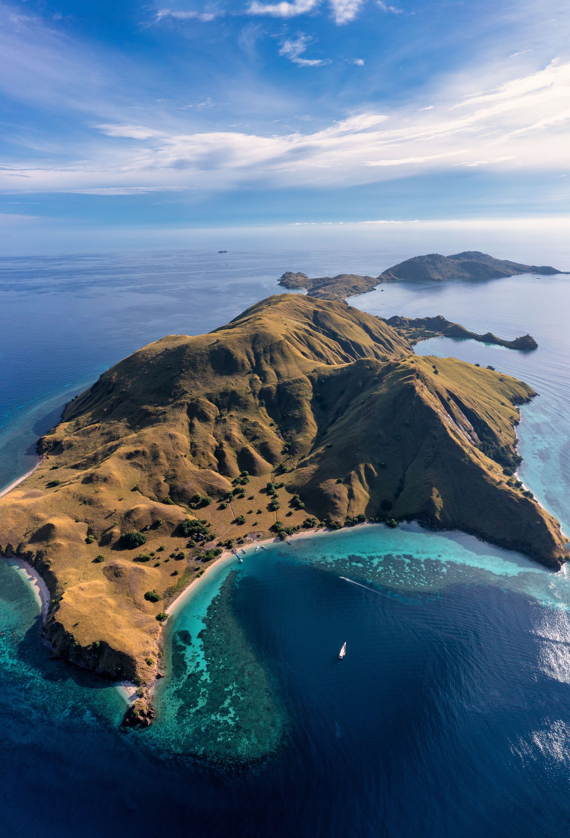
Nusa Tenggara is the chain of islands in Indonesia that extends east from Bali — including Lombok, Sumbawa, Komodo, Flores, Sumba, Timor, and others — collectively covering enormous cultural, linguistic, and ecological diversity within a relatively compact geographic area. The chain sits along the Wallace Line, the biogeographical boundary identified by Alfred Russel Wallace in the 19th century that separates the Asian-origin fauna of western Indonesia from the Australasian-origin fauna of the east.
Komodo Island and the surrounding protected area is the only place in the world where Komodo dragons — the largest living lizards — exist in the wild. The dragons can reach three meters in length and 70 kilograms in weight. They are ambush predators that feed primarily on deer, pigs, and water buffalo, using a combination of serrated teeth and venom glands to incapacitate prey. The park — which includes Komodo Island, Rinca Island, and several smaller islands — is a UNESCO World Heritage Site, and the dragons can be observed on guided walks that maintain safe distances. The park's waters contain some of the most biodiverse marine environments in the Indo-Pacific due to the upwelling of cold, nutrient-rich water from deep channels between the islands.
Flores contains Kelimutu — a volcano with three crater lakes whose colors change independently due to differences in volcanic chemistry and oxidation state. The lakes have shifted between shades of blue, green, red, and black over recorded history. The viewing platform at the crater rim at sunrise, when the colors are most vivid before atmospheric haze develops, attracts visitors from across the island.
Sumba, further east in the chain, has a traditional culture — animist, horse-centered, with a material culture of ikat textiles produced using natural dyes in patterns that encode clan and cosmological meaning — that remains more intact than on most of the more accessible islands of the chain. The island is also known among surfers for the quality of the waves on its southern coast.
Milos, Greece
Credit: Michal Vaško / Pexels
Milos is a volcanic island in the southwestern Cyclades, one of the less visited of the main Aegean island groups. It is best known internationally as the place where the Venus de Milo — now in the Louvre — was discovered in 1820. The island is geologically active, and its volcanic origin produces a coastal landscape of unusual chromatic variety: the rocks along the shoreline shift between white, orange, red, yellow, and green depending on the mineral composition, and the sea ranges from deep blue to pale turquoise.
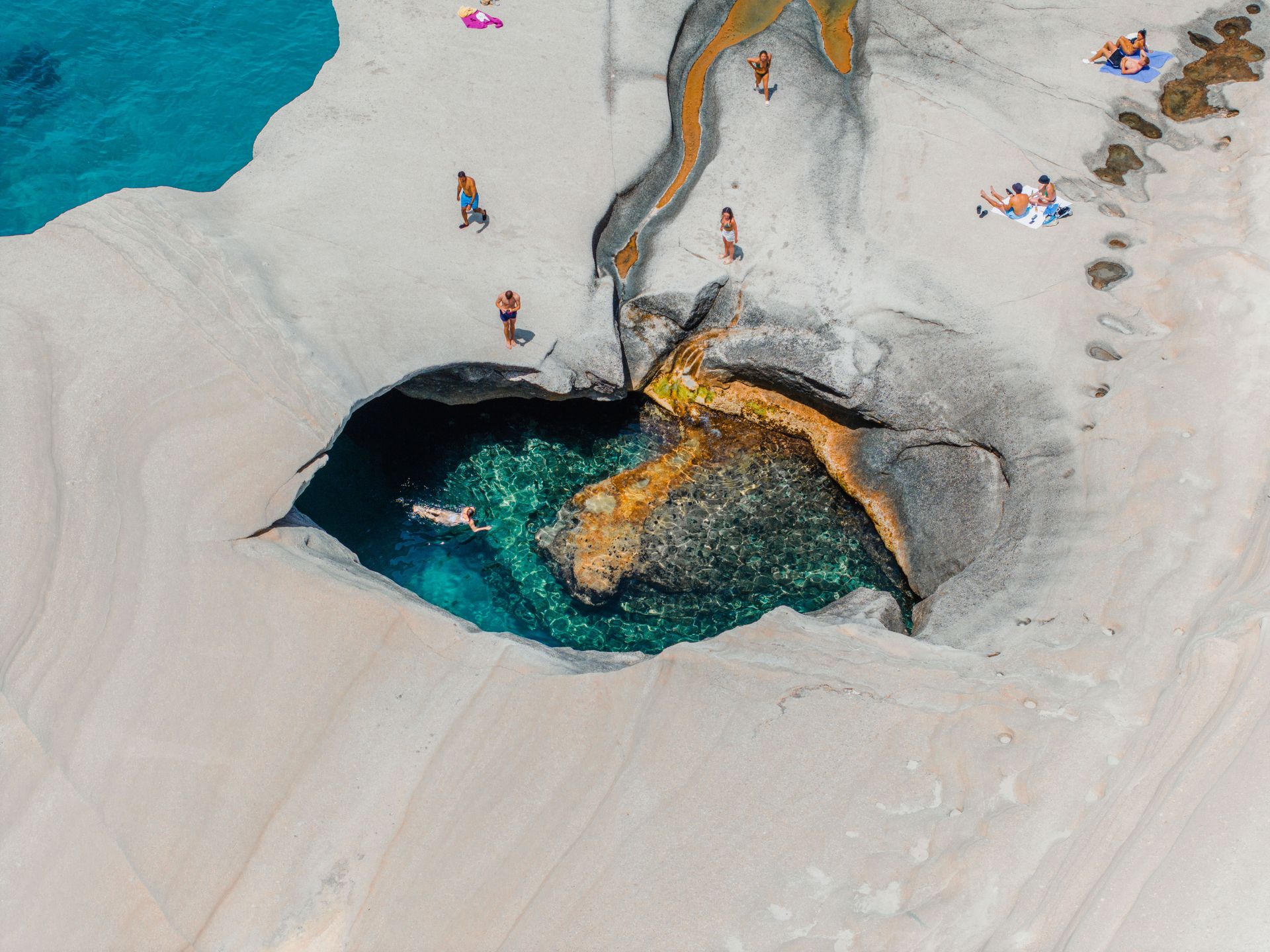
The beaches of Milos include Sarakiniko, where white volcanic ash formations have been eroded by wind and wave into smooth curves and natural pools directly at the waterline. The formations are bright white against the blue Aegean and have a quality of abstraction — the softened angles and seamless curves suggest something made rather than natural — that makes the landscape photographically and experientially distinct from the granite or sand beaches of most Aegean islands. Kleftiko, accessible by boat, is a cluster of sea caves and rock arches on the southwestern coast where the water in the enclosed spaces is exceptionally clear.
The island's mining history runs from ancient times to the present. Obsidian from Milos was traded across the Aegean in the Mesolithic and Neolithic periods and was one of the earliest traded commodities in European prehistory. The mineral diversity that makes Milos attractive to mining also produced the coastal color variety that makes it visually distinctive.
The catacombs of Milos, cut into the hillside near the village of Tripiti, are among the earliest known Christian burial sites in the world — the earliest inscriptions date to the first century A.D. They were used for Christian burials before Christianity became the official religion of the Roman Empire, and their existence on an island this small reflects the extent to which early Christian communities used sea routes to spread across the Mediterranean. The village of Plaka, the island's capital, sits on the hill above the catacombs with views across the caldera bay that formed in the island's center after the main volcanic collapse.
Tioman Island, Malaysia
Credit: Lloyd Alozie / Pexels
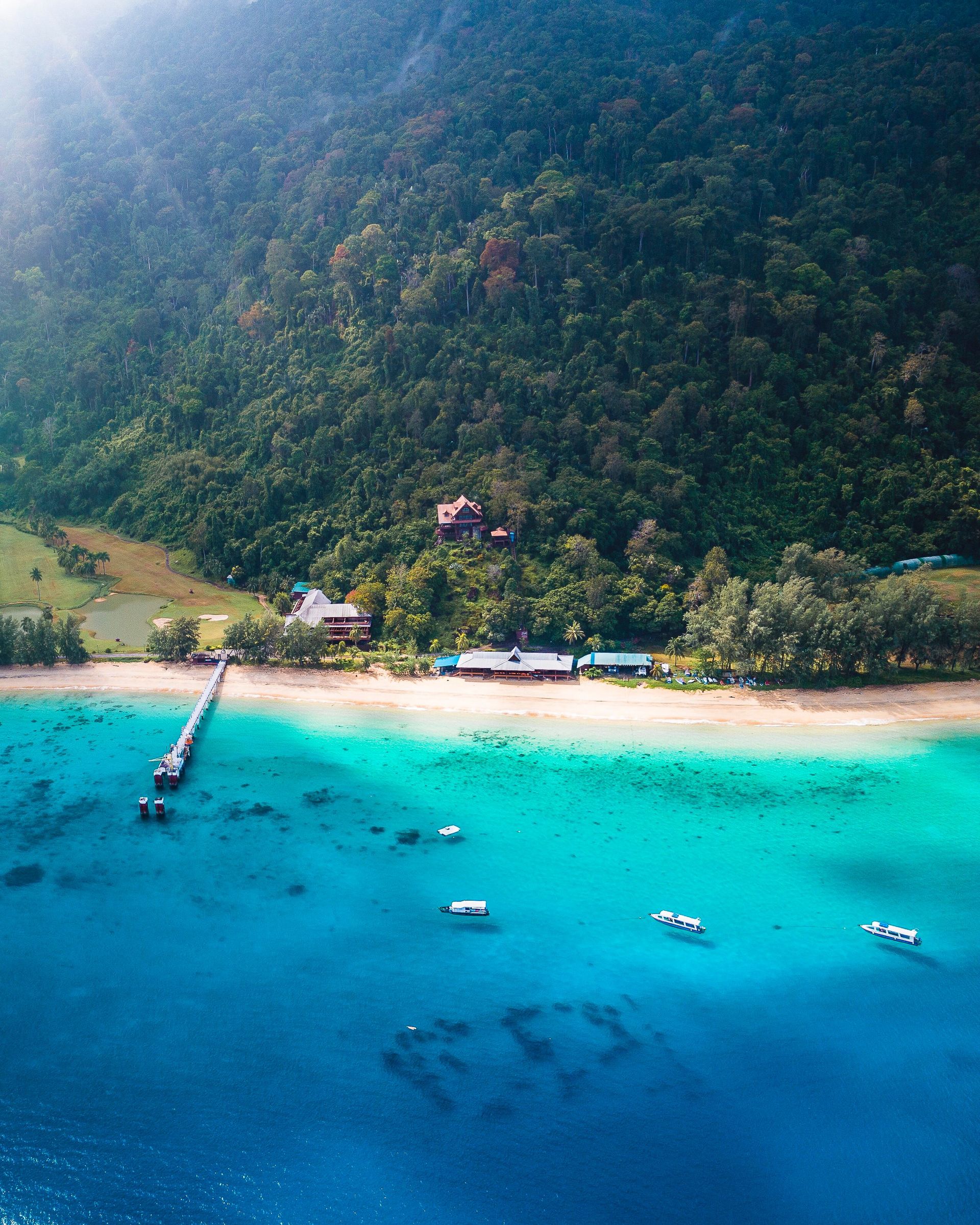
Tioman Island is in the South China Sea, off the east coast of the Malay Peninsula, reachable by ferry from Mersing or by a small aircraft from Kuala Lumpur. The island is a permanent resident wildlife reserve and the surrounding waters are part of a marine park, which limits the types of activity permitted and has helped maintain the reef in better condition than most comparable sites in the South China Sea.
The reef around Tioman has suffered some coral bleaching due to warming sea temperatures, but the diversity of fish and invertebrate life remains high relative to regional alternatives, and the water clarity is sufficient for productive snorkeling from beaches without a boat. Dive sites around the island vary from sheltered bays suitable for beginners to deeper sites with stronger current where more experienced divers can encounter schools of barracuda, occasional leopard sharks, and the macro invertebrate life associated with sponge and soft coral growth.
The interior of the island is primary rainforest, accessible via hiking trails that connect the main settlements on the west coast with each other and with the undeveloped east coast. The trail crossing to the east coast passes through forest where the light barely penetrates at ground level and the air is thick with the humidity of primary tropical vegetation. The crossing takes roughly two hours each way depending on fitness and conditions.
The accommodation on Tioman is primarily chalet-style — simple wooden bungalows, some directly over the water, at modest prices. There is no international hotel chain presence on the island, and the absence of luxury resort infrastructure is part of what has kept the character of the place intact. The main town of Tekek has the island's only paved road, the airport, and the services of a small working community: a clinic, a school, a mosque, and a handful of restaurants and provision shops.