
These 20 state parks rival the national parks in scenery and wildlife but draw a fraction of the visitors and never require a timed entry permit
Credit: Beth Fitzpatrick / Pexels
The most famous national parks in the U.S. now come with their own logistics. Arches and Zion require timed-entry reservations during peak months. Yosemite has capped vehicle entries in summer. Getting a permit to hike Half Dome is a lottery, and cars back up for miles at the gates of Grand Teton in July. None of that scarcity reflects a shortage of dramatic American landscape. It reflects a shortage of dramatic American landscape that most people know about.
State parks as beautiful as the national parks exist in nearly every region of the country, and most ask for nothing more than a modest day-use fee and a full tank of gas. Nevada has a valley of red sandstone that looks lifted from Utah's canyon country. South Dakota has a bison range and a mountain road that out-scenic anything near Mount Rushmore. New York has a gorge nicknamed the Grand Canyon of the East, and Minnesota has a stretch of Lake Superior shoreline with waterfalls and sea caves that most travelers associate with Acadia or the Pacific coast, not the Midwest.
This list covers 20 of them, chosen for scenery that holds up against the national park system's biggest names and for visitor numbers that, in most cases, stay in the thousands or low millions rather than the four, five, or six million that pass through parks like Zion or Great Smoky Mountains each year. Some are enormous wilderness tracts bigger than several national parks combined. Others are compact day-trip destinations built around a single waterfall or rock formation. All of them are open to the public, all of them are real alternatives for a weekend or a full vacation, and none of them require a permit lottery to get in the gate.
Credit: Jean Jacques / Pexels
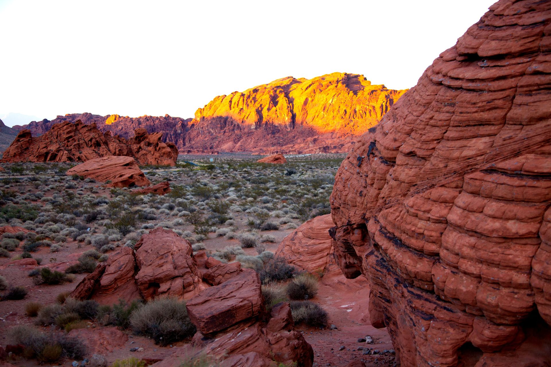
Valley of Fire State Park sits about an hour northeast of Las Vegas and holds some of the most vividly colored sandstone in the Southwest, without the entrance quotas that come with Zion or Arches two states over.
Established in 1935, it is Nevada's oldest and largest state park, built around Aztec sandstone formations that date back roughly 150 million years and glow deep red and orange, especially at sunrise and sunset. The signature formation, known as the Fire Wave, is a swirl of pink and white sandstone banding that has become one of the most photographed rock formations in the state, but it sees a fraction of the foot traffic of comparable spots inside national park boundaries.
Beyond the Fire Wave, the park holds Atlatl Rock, a sandstone outcrop covered in petroglyphs left by the ancestors of the Southern Paiute people going back more than 3,000 years. Elephant Rock, a natural arch shaped like its namesake, sits near the east entrance and takes only a short walk from the parking area. The White Domes Trail loops through a slot canyon that was used as a filming location for scenes in several Hollywood productions, and it remains one of the park's most requested short hikes.
Summer temperatures in Valley of Fire regularly top 100 degrees Fahrenheit, so spring and fall are the better windows for a visit, with daytime highs in the 70s and 80s and clear desert light that makes the red rock especially vivid in early morning. The park connects to Lake Mead National Recreation Area, so a single trip can combine the sandstone formations with a stop at the lake. Camping is available at two campgrounds inside the park, and the entrance fee remains far lower than the cost of a multi-day national park pass, with none of the reservation system required at some nearby federal sites.
Credit: Gintare K. / Pexels
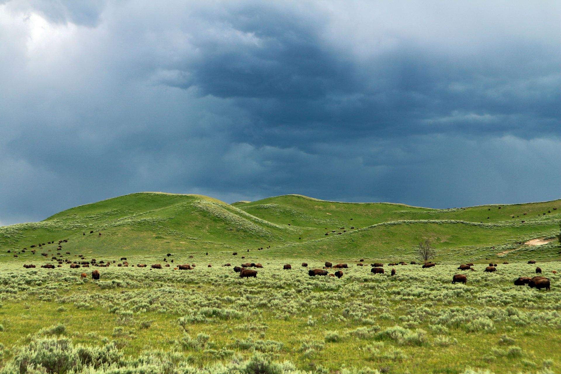
Custer State Park in the Black Hills holds one of the largest publicly owned bison herds in the world, roughly 1,300 animals that roam freely across nearly 71,000 acres of prairie and pine forest, with none of the crowd management systems used at nearby Mount Rushmore.
The park's Wildlife Loop Road is the main draw for many visitors, an 18-mile route where bison, pronghorn, elk, and burros regularly wander into the roadway, creating the kind of close wildlife encounters that usually require a long lens and a lot of patience in places like Yellowstone. The park's annual Buffalo Roundup each fall, when staff on horseback drive the herd for health checks and population management, draws visitors from across the country, but even then the crowds stay well below what similar wildlife events pull at national parks.
The Needles Highway is the park's other signature drive, a 14-mile stretch of granite spires, tight tunnels blasted through solid rock, and switchbacks that were designed in the 1920s specifically to showcase the rock formations rather than move traffic efficiently. Some of the tunnels are barely wide enough for a single vehicle, so the drive works better in a smaller car than in an RV or a full-size truck.
Sylvan Lake, at the park's western edge, is a granite-rimmed lake with a walking trail around its shore and a swimming beach that stays cool through the summer thanks to its elevation above 6,000 feet. The lake also serves as the trailhead for the hike up Black Elk Peak, the highest point in South Dakota at 7,242 feet and the highest point east of the Rockies until reaching peaks in Europe. Custer State Park sits close enough to Mount Rushmore and the Crazy Horse Memorial to combine with both in a single Black Hills itinerary, but it draws a smaller share of the region's overall visitor traffic than either monument.
Credit: Miranda Lattimore / Pexels
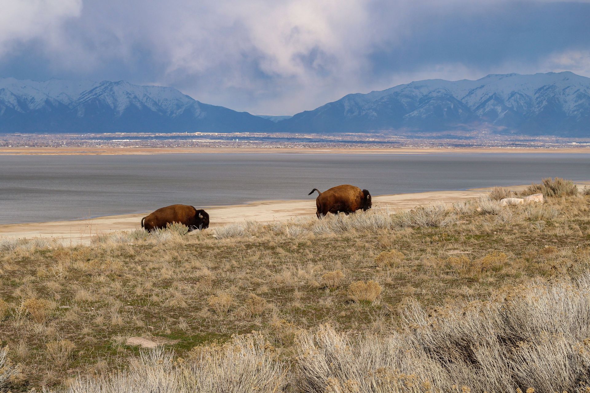
Antelope Island State Park protects the largest island in the Great Salt Lake, home to a free-roaming bison herd that has lived there since 1893, reachable by a seven-mile causeway that most Salt Lake City visitors never think to drive.
The bison were introduced to the island more than a century ago and have been managed as a conservation herd ever since, with an annual roundup each fall that helps control population size and supports genetic research used by other bison conservation programs around the country. Visitors regularly spot the herd from the island's main roads, along with pronghorn antelope, mule deer, and one of the largest populations of California gulls in North America, most of which nest on the lake's rocky shorelines each spring.
The island's geology is part of what makes it distinct. Its bedrock is Precambrian rock more than 700 million years old, among the oldest exposed rock in Utah, and the island's highest point, Frary Peak, tops out at just over 6,500 feet with views across the entire lake basin and the Wasatch Range to the east. The hike to Frary Peak is a moderate round trip of around seven miles and offers one of the better vantage points in the state for taking in the scale of the Great Salt Lake, which covers more surface area than Rhode Island in wetter years.
The lake's high salinity, several times saltier than the ocean, means swimmers float without effort at the island's beaches, and the water supports brine shrimp in numbers dense enough to sustain the gull colonies. Because the causeway sits close to Salt Lake City and its airport, the island works as an easy half-day or full-day trip for visitors already in the area for other Utah destinations like the Wasatch ski resorts or the drive south toward the state's five national parks, without adding the entrance lines that come with those parks in summer.
Credit: Petra Nesti / Pexels
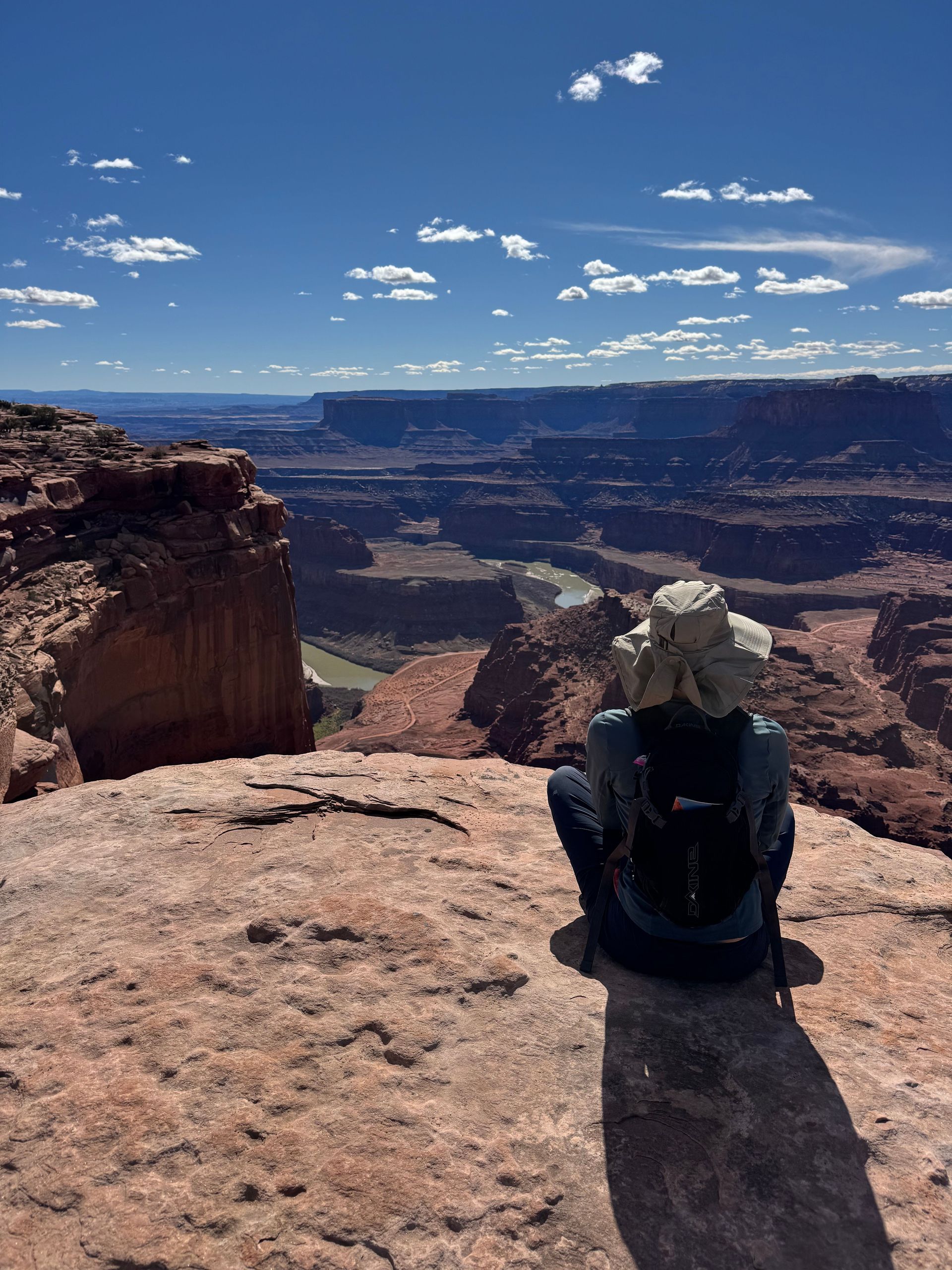
Dead Horse Point State Park overlooks a gooseneck bend in the Colorado River nearly 2,000 feet below its rim, a view frequently compared to the Grand Canyon but reachable with a short paved walk rather than a multi-mile hike.
The main overlook sits at the tip of a narrow sandstone mesa, with the river curling almost back on itself in a horseshoe shape carved over millions of years. The park takes its name from a 19th-century legend involving wild mustangs that were reportedly corralled on the point and left to die of thirst within sight of the river below, a story that has never been fully documented but remains part of the park's local lore. The overlook gained wider recognition as the filming location for the closing scene of Thelma & Louise, and the ledge shown in that scene remains a popular photo stop today.
Dead Horse Point sits just a few miles from the entrance to Canyonlands National Park's Island in the Sky district, which means visitors can pair both destinations in a single day near Moab. The state park charges a considerably lower entrance fee and, unlike some of the more congested pullouts inside Canyonlands during peak season, rarely requires visitors to wait for parking at its main overlook.
The park also runs a network of mountain biking and hiking trails along the mesa rim, including the Intrepid Trail System, built with berms and technical features aimed at intermediate riders. Sunrise and sunset are the strongest times to visit, when the canyon walls shift through shades of orange and rust, and the park operates a small visitor center with exhibits on the region's geology and the La Sal Mountains visible on the horizon to the southeast. Camping is available at a campground perched near the rim, with sites that book up months ahead during spring and fall.
Credit: dennis George / Pexels
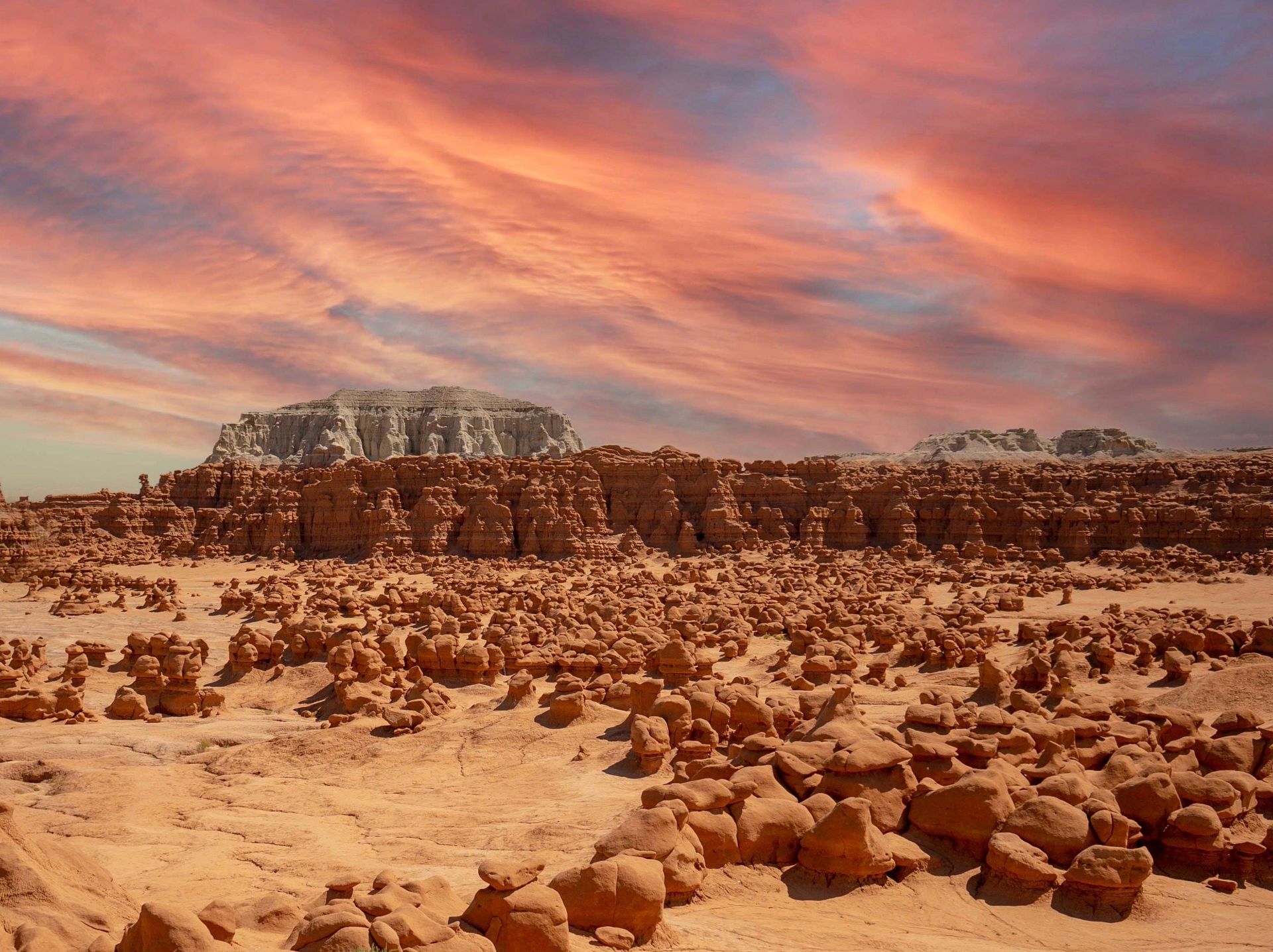
Goblin Valley State Park is filled with thousands of mushroom-shaped rock formations called hoodoos, carved from Entrada sandstone into shapes odd enough that visitors are allowed to walk freely among them rather than staying on a marked trail.
The formations, nicknamed goblins by early visitors, range from a few feet tall to formations several stories high, clustered together across three main valleys within the park. Unlike many national park sites where off-trail hiking is restricted to protect fragile terrain, Goblin Valley's main viewing area is designated for open exploration, so visitors can walk, climb over low formations, and photograph the hoodoos from angles a boardwalk trail would never allow. The rock itself formed from sediment deposited around 170 million years ago, later shaped by wind and water erosion into the bulbous shapes seen today.
The park sits in a remote stretch of central Utah, roughly halfway between Green River and Hanksville, near the San Rafael Swell, a large geologic uplift with its own network of slot canyons and dirt roads popular with experienced backcountry travelers. That remoteness keeps visitor numbers well below those at Utah's five national parks, even though the drive from Salt Lake City takes only about four hours.
Because Goblin Valley sits far from major cities and has minimal light pollution, it earned International Dark Sky Park certification, and the park hosts occasional astronomy events where visitors can view the Milky Way with the naked eye from among the hoodoos. A small campground inside the park offers primitive sites without hookups, and yurts are available for visitors who want a roof without a full cabin rental. Temperatures swing widely between day and night in the surrounding desert, so layers are worth packing even in summer, and spring and fall remain the most comfortable seasons for exploring the valley floor on foot.
Credit: Soly Moses / Pexels
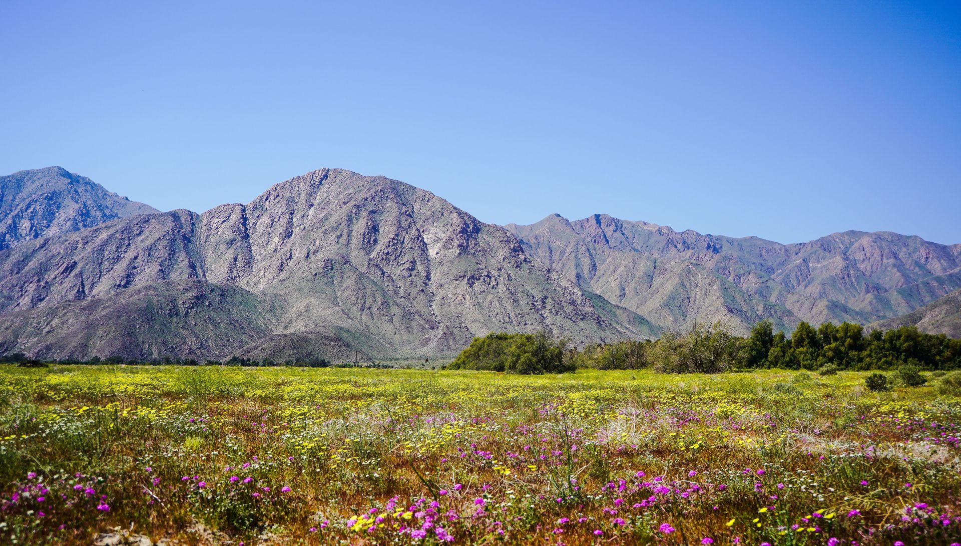
Anza-Borrego Desert State Park covers roughly 640,000 acres in San Diego County, making it the largest state park in California, with badlands, slot canyons, and a spring wildflower bloom that draws visitors without the shuttle systems used at Joshua Tree.
The park sits within the Colorado Desert, a lower and hotter extension of the Sonoran Desert, and its terrain ranges from palm oases fed by natural springs to eroded badlands that look closer to the surface of Mars than to coastal Southern California just an hour and a half away. Borrego Palm Canyon, near the park's main visitor center, holds one of the largest natural stands of California fan palms in the state, reachable by a three-mile round-trip hike that often passes bighorn sheep grazing on the canyon walls.
In wet years, the park becomes known for a spring super bloom, when desert wildflowers including desert sand verbena, dune primrose, and desert lily carpet the sandy flats for a few weeks between February and April. Bloom intensity depends heavily on winter rainfall, so conditions vary year to year, and the park publishes wildflower updates each spring for visitors trying to time a trip.
The town of Borrego Springs, inside the park boundaries, is one of the few communities in the U.S. built entirely within a state park and holds International Dark Sky Community certification, making the area a strong option for stargazing after dark. The park is also known for its metal sculptures scattered across the desert floor near Galleta Meadows, oversized depictions of prehistoric creatures and desert wildlife created by sculptor Ricardo Breceda, which have become an unofficial photo attraction distinct from the park's natural features. Unlike Joshua Tree two hours north, Anza-Borrego charges no entrance fee for day use, though camping and some facilities carry separate costs.
Credit: Vasilis Karkalas / Pexels
Palo Duro Canyon State Park protects the second-largest canyon system in the U.S., stretching around 120 miles long and reaching depths of about 800 feet, carved by the Prairie Dog Town Fork of the Red River across the Texas Panhandle.
Only the Grand Canyon surpasses Palo Duro in scale among U.S. canyons, yet the state park section covers a manageable slice of the full canyon system, with roughly 30 miles of trails suited to day hikers rather than the multi-day backcountry permits required for a Grand Canyon rim-to-rim trip. The canyon's exposed rock layers span roughly 250 million years of geologic history, with bands of red, orange, and white sediment visible in the walls, a formation locals sometimes call the Spanish Skirts for its layered, fabric-like appearance.
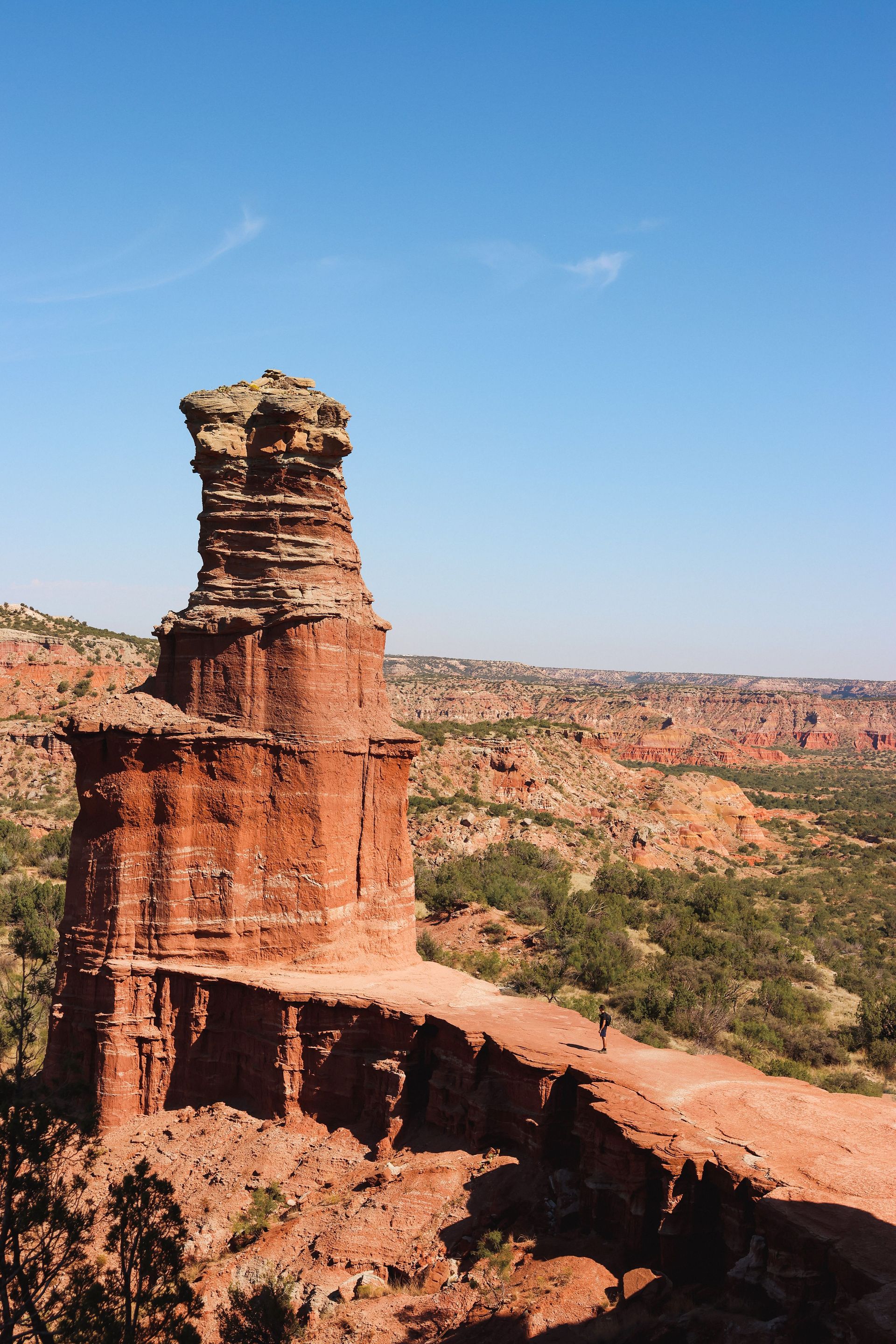
The park's best-known feature is the Lighthouse, a 300-foot rock spire that has become the unofficial symbol of the Texas Panhandle. Reaching it requires a round-trip hike of about six miles along a mostly flat trail through the canyon floor, one of the more accessible long hikes among the destinations on this list. Summer temperatures in the canyon regularly exceed 100 degrees Fahrenheit, so most hikers start early morning, and the park recommends carrying more water than a similar hike would require at higher elevation.
Palo Duro Canyon also hosts Texas, an outdoor musical drama performed each summer in an amphitheater built into the canyon wall, running continuously since 1966 and billed as the official play of the state of Texas. Mountain biking has grown into one of the park's larger draws in recent years, with singletrack trails built specifically for two-wheeled use across the canyon's mesas. Camping options range from developed sites with electrical hookups to more primitive backcountry sites reached by a short hike, and the park sits just 25 miles south of Amarillo, making it an easy addition to a Panhandle road trip.
Credit: Michael Vest / Pexels
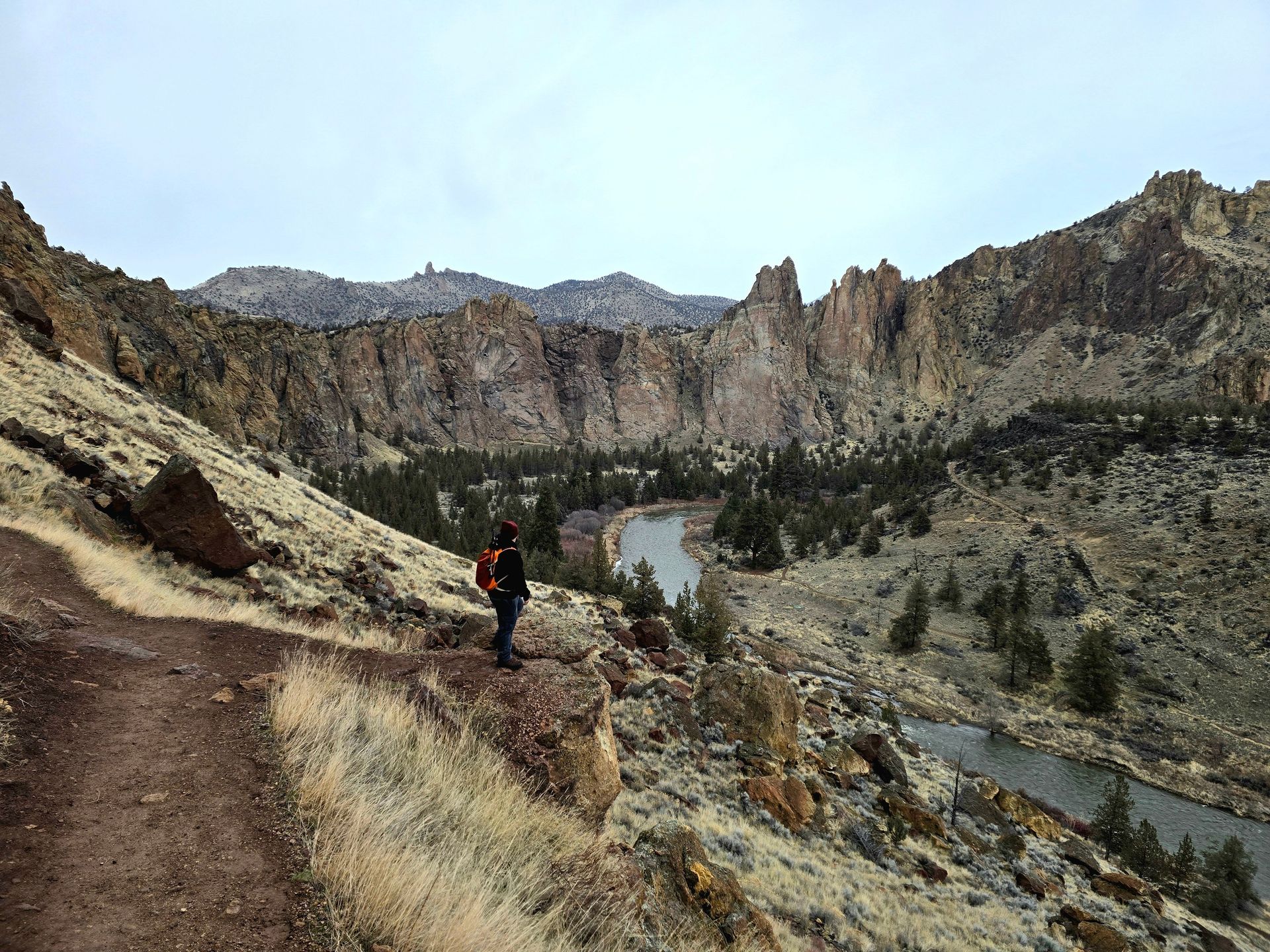
Smith Rock State Park is widely credited as the birthplace of American sport climbing, a compact stretch of volcanic tuff and basalt cliffs above the Crooked River that draws serious climbers alongside hikers who never touch a rope.
The park's rock, formed from ancient volcanic ash and lava flows, rises in jagged spires above a horseshoe bend in the Crooked River, with colors that shift from gray to rust depending on the mineral content of each layer. Climbers began establishing routes here in the 1980s, and the park is still credited with several of the first sport climbing routes in the country, bolted rather than protected with traditional gear, a technique that changed how American climbers approached rock faces afterward. More than 1,800 climbing routes now exist within the park's boundaries, spanning difficulty levels from beginner-friendly to some of the hardest sport routes in North America.
Non-climbers have their own reason to visit in the Misery Ridge Trail, a loop of just under four miles that climbs steeply out of the canyon, crosses above Monkey Face, one of the park's tallest rock towers, and drops back down along the river. The elevation gain is significant for the mileage, but the payoff includes views across the canyon and, on clear days, sightlines toward the Cascade Range to the west, including Mount Jefferson and the Three Sisters.
The park sits near Redmond and Bend in central Oregon, a region known for its high desert climate, meaning drier and more predictable weather than the wetter forests on the state's coastal side. Wildlife along the river includes golden eagles, which nest on the cliffs each spring, and prairie falcons, and the park closes certain climbing routes seasonally to protect active nests. Because Smith Rock is a day-use state park with a modest parking fee, it avoids the entrance reservation systems used at national parks elsewhere in the Pacific Northwest during peak season.
Credit: Liz Lauren / Pexels
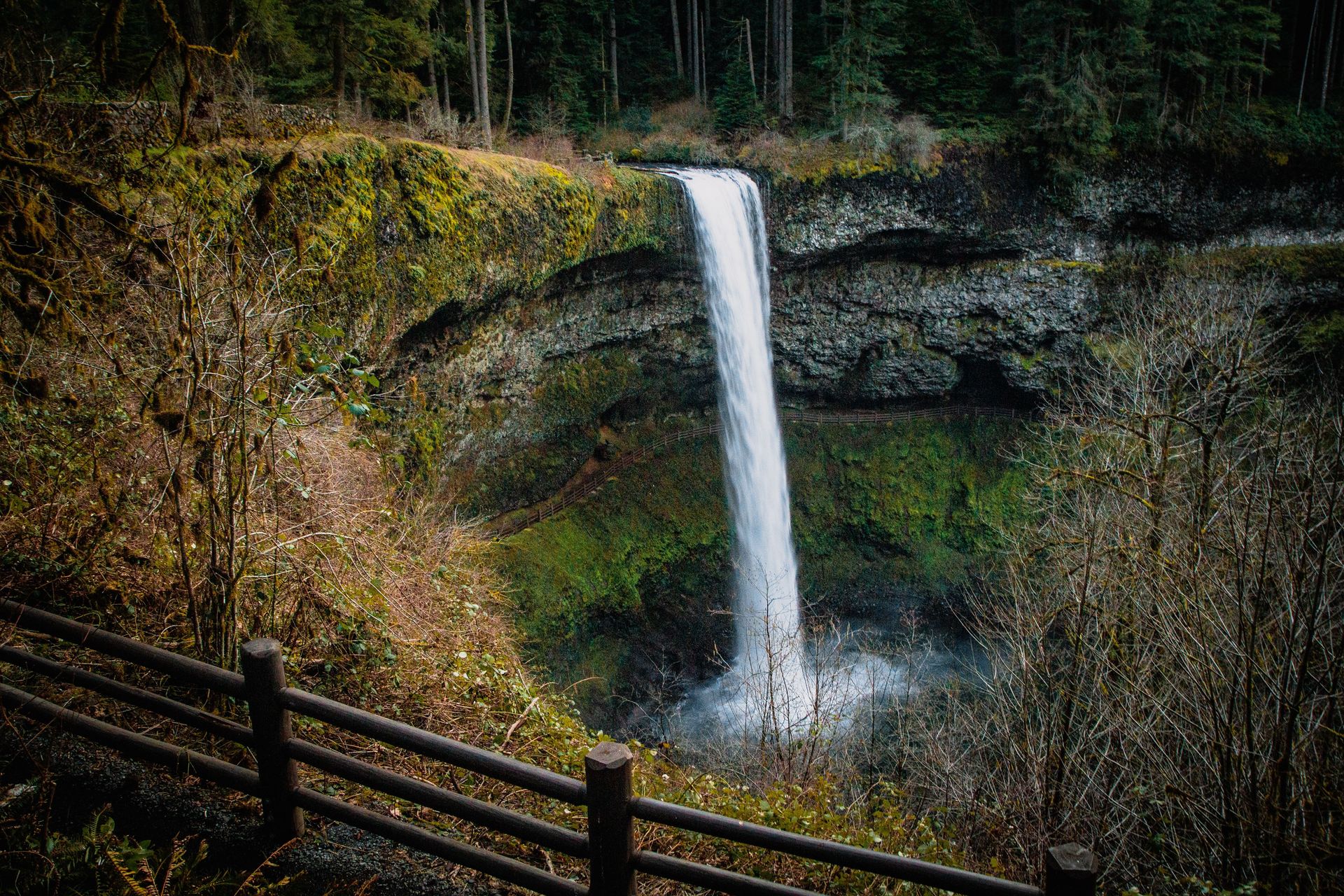
Silver Falls State Park is Oregon's largest state park and centers on the Trail of Ten Falls, an eight-mile loop that passes 10 waterfalls, four of which visitors can walk directly behind through carved-out basalt alcoves.
The waterfalls along the loop range from around 30 feet to more than 170 feet at South Falls, the park's tallest and most photographed drop. The trail follows Silver Creek through a canyon lined with old-growth Douglas fir and western red cedar, and the basalt cliffs behind several of the falls were carved out over thousands of years as softer rock layers eroded faster than the harder basalt above, leaving walkable passages behind the falling water. South Falls and North Falls both offer this behind-the-curtain walk, a feature that distinguishes Silver Falls from most other waterfall destinations in the Pacific Northwest.
Visitors do not need to complete the full eight-mile loop to see the highlights. Several trailheads allow shorter out-and-back routes to individual falls, and the area around South Falls, near the main day-use lot, gets the most foot traffic while the northern half of the loop tends to be quieter. The park sits about an hour southeast of Salem, making it a realistic day trip from Oregon's state capital and from Portland with a slightly longer drive.
Beyond the waterfall loop, Silver Falls includes horse trails, a bike path, a swimming area at Silver Falls Lake, and a historic conference center built by the Civilian Conservation Corps in the 1930s, when the park was developed as part of a broader New Deal effort to expand public recreation land in Oregon. Fall brings vine maple and bigleaf maple color changes along the canyon walls, while winter can bring icy trail conditions near the waterfalls that require additional caution. Unlike Multnomah Falls along the Columbia River Gorge, which can see parking lots fill before mid-morning on summer weekends, Silver Falls spreads visitors across a much larger trail network.
Credit: wired_optics / Pexels
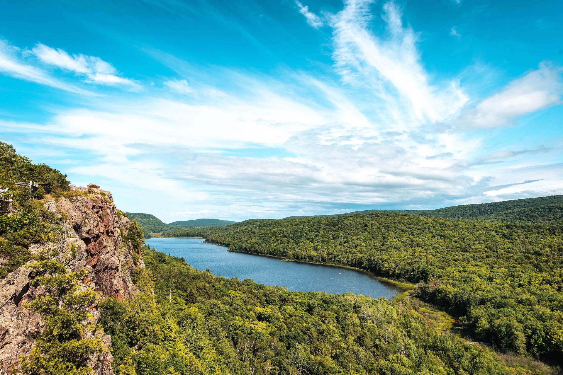
Porcupine Mountains Wilderness State Park protects the largest tract of old-growth hardwood forest in the Midwest, more than 60,000 acres along Michigan's Upper Peninsula, centered on an overlook that ranks among the most photographed views in the state.
The Lake of the Clouds overlook, reachable by a short walk from a parking area just off the park's main road, looks down over a small lake ringed by forested ridges, with Lake Superior visible in the distance on clear days. The view requires almost no hiking to reach, unlike comparable overlooks at national parks that often demand a multi-mile climb, making it one of the more accessible dramatic vistas on this list.
The park earned its wilderness designation because the forest was never logged the way most of Michigan's timberland was in the late 19th and early 20th centuries, leaving stands of hemlock, yellow birch, and sugar maple that in places exceed 300 years old. That old growth supports one of the state's more stable populations of pine marten, a weasel-family predator eliminated from much of its former Michigan range by historic logging and trapping, along with a healthy population of black bears.
The park's more than 90 miles of trails include a stretch of the North Country Trail, which runs from New York to North Dakota, and the Presque Isle River area at the park's western edge, where the river cuts through a narrow gorge before reaching Lake Superior over a series of waterfalls. Fall color season, typically running from late September into early October depending on the year, draws the largest crowds, when sugar maples across the ridges turn shades of red and orange visible from the Lake of the Clouds overlook. Camping ranges from drive-in campgrounds to rustic cabins and yurts, some accessible only by trail, giving visitors a range of options between a car-camping trip and a genuine backcountry stay.
Credit: Jonathan J. Castellon / Unsplash
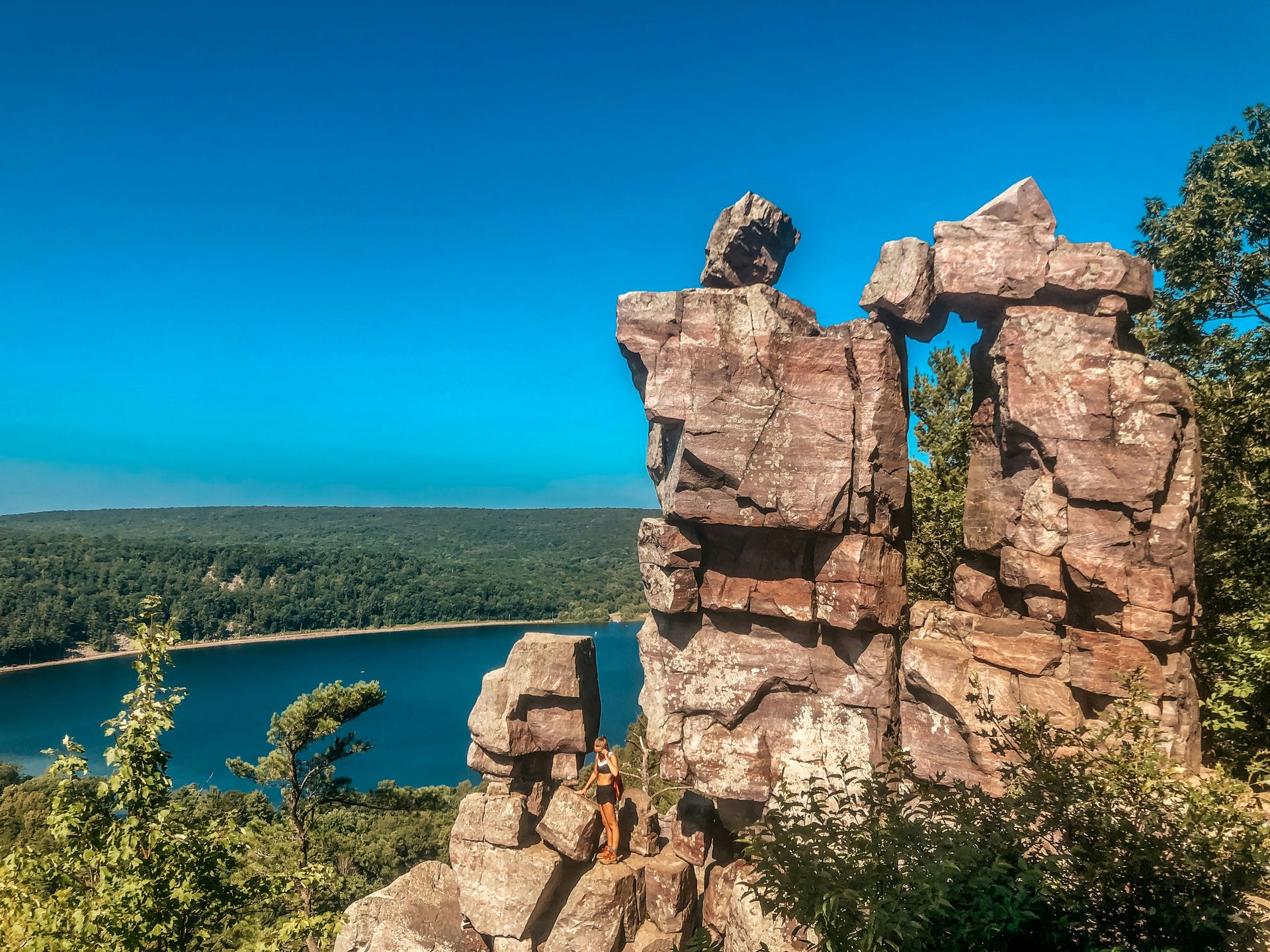
Devil's Lake State Park is Wisconsin's most visited state park, built around a 360-acre glacial lake framed by quartzite bluffs rising roughly 500 feet on either side, within the Baraboo Range in the south-central part of the state.
The quartzite that forms the bluffs is among the oldest exposed rock in North America, dating back roughly 1.6 billion years, far older than the sedimentary rock found in most of the Midwest's other scenic landscapes. The lake itself formed when glacial ice-age debris dammed both ends of a preglacial river valley, leaving a body of water with no natural inlet or outlet, fed instead by springs and rainfall. The East Bluff and West Bluff trails climb steeply from the lakeshore to the ridgeline, with the East Bluff Trail passing several rock formations, including Balanced Rock, a boulder perched on a narrower quartzite base.
Rock climbing is a significant draw at Devil's Lake, with several hundred established routes across the quartzite bluffs, making it one of the more popular climbing destinations in the Midwest despite its distance from any major mountain range. The park also has two swimming beaches on the lake, both supervised during summer months, along with canoe and kayak rentals for exploring the water below the bluffs.
Because the park sits within a two-hour drive of Milwaukee, Madison, and Chicago, it draws heavy weekend traffic from three major metro areas, though its trail network, which spans more than 29 miles, spreads that traffic out more than a single-trail destination would. The park connects to the Ice Age National Scenic Trail, a long-distance path that traces the edge of the last glaciation across Wisconsin, giving through-hikers a reason to pass through even if the lake itself is not their destination. Fall foliage season and the quieter shoulder months of May and September tend to offer the best combination of good weather and manageable crowds.
Credit: Todd Trapani / Pexels
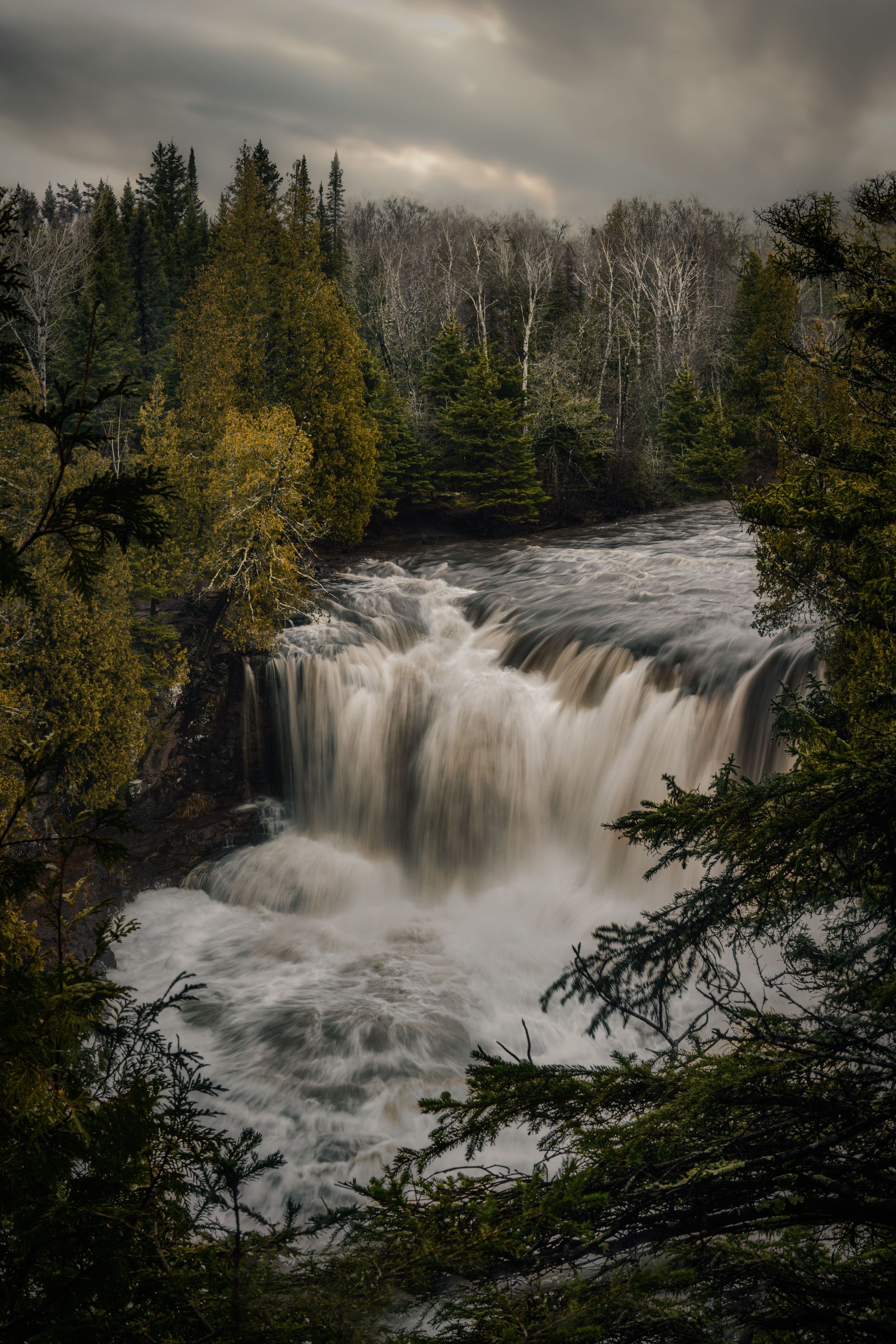
Tettegouche State Park sits along the North Shore of Lake Superior and holds High Falls on the Baptism River, one of the tallest waterfalls located entirely within Minnesota's borders, alongside sea caves and cliffs that most visitors do not associate with the Midwest.
The waterfall drops roughly 70 feet over a rock ledge and is reachable by a short hike from the park's main trailhead, with a suspension bridge crossing the river just below the falls that offers a direct view of the water crashing into the pool beneath. The Baptism River continues from the falls toward Lake Superior, cutting through a narrow gorge lined with black spruce and paper birch that turn bright yellow each fall.
Lake Superior itself defines much of the park's character. Its shoreline here is rocky rather than sandy, with cliffs, coves, and sea caves carved by centuries of wave action against volcanic rock formed more than a billion years ago during the Midcontinent Rift, a period when the region nearly split apart along a deep geologic fault. Palisade Head, a 200-foot cliff just outside the park's main boundary but managed alongside it, offers one of the most expansive views of Lake Superior available from land, with the lake stretching to the horizon in a way that surprises visitors who think of it as just another lake rather than the largest by surface area in the world.
Inland from the shoreline, the park includes several small lakes, including Mic Mac Lake and Nipisiquit Lake, along with rustic camper cabins built directly on the shore of Lax Lake, some of the more sought-after overnight stays in the Minnesota state park system. The Superior Hiking Trail, a 310-mile long-distance path running along the North Shore from Duluth to the Canadian border, passes directly through Tettegouche, giving day hikers a chance to sample a stretch of a trail usually associated with multi-day backpacking trips. Winter transforms the park into a destination for cross-country skiing and ice climbing on the frozen faces of the gorge.
Credit: Mason Miller / Unsplash
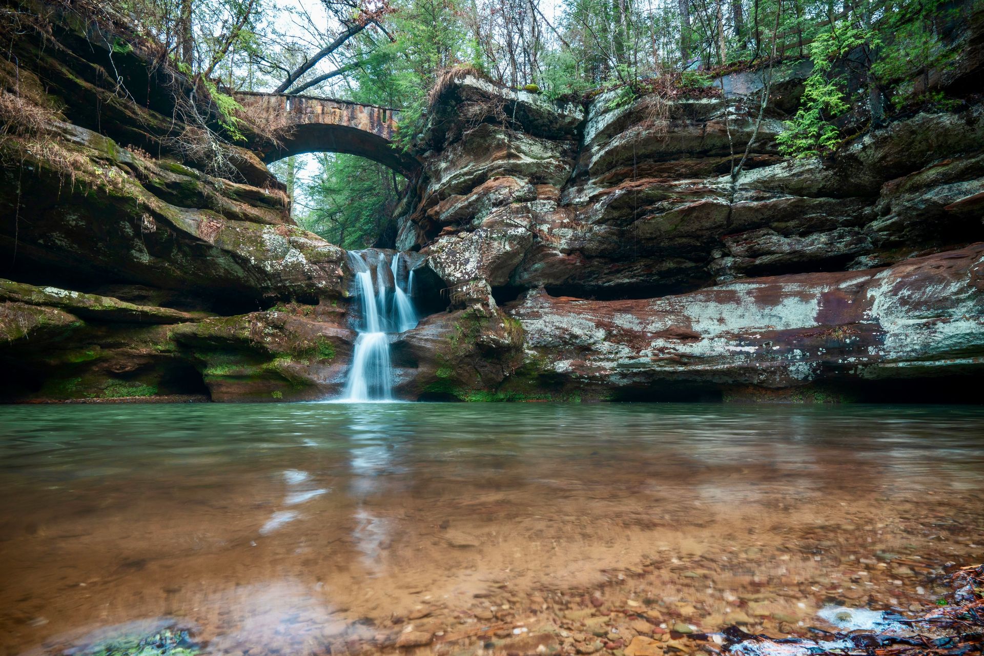
Hocking Hills State Park in southeastern Ohio is built around a cluster of sandstone gorges, waterfalls, and rock shelters carved into Blackhand sandstone, concentrated closely enough together that several major features can be visited in a single day without a long drive between them.
Old Man's Cave, the park's most visited section, is not a true cave but a series of gorges, waterfalls, and a natural rock shelter large enough to walk through, named for a hermit who reportedly lived there in the early 1800s. A paved and stepped trail leads visitors down into the gorge, past Upper Falls and Lower Falls, and through a narrow passage known as the Devil's Bathtub, a small whirlpool-carved basin in the creek bed.
Ash Cave, a few miles south, holds one of the largest recessed sandstone caves in the eastern U.S., with a rock overhang roughly 700 feet across and 100 feet deep, large enough that its interior stays several degrees cooler than the surrounding forest even in summer. Cedar Falls, despite its name, drops over hemlock trees rather than cedars, a naming error dating back to early settlers who misidentified the hemlock groves along the creek.
The park's trails connect through the Buckeye Trail, a 1,444-mile loop circling the entire state of Ohio, so hikers can walk between the major Hocking Hills sites on marked trail rather than driving between separate trailheads. Because the park sits within roughly an hour of Columbus, it draws heavy weekend traffic from central Ohio, and parking lots at Old Man's Cave and Ash Cave can fill by mid-morning on fall weekends when foliage color peaks. Visiting on a weekday, or choosing one of the park's less-trafficked sections like Conkle's Hollow, a narrow gorge with cliffs rising 200 feet on either side, tends to offer a quieter version of the same sandstone scenery.
Credit: Samuel Jackson / Pexels
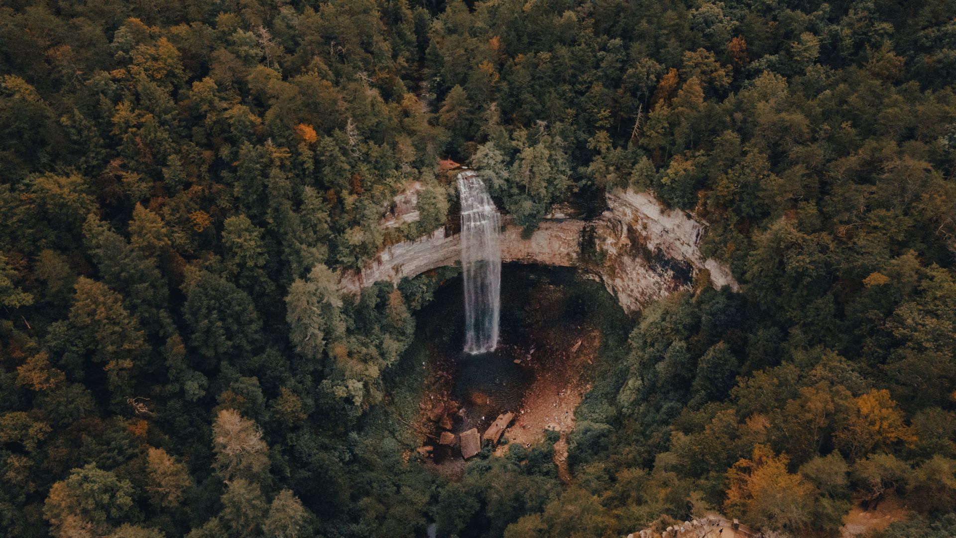
Fall Creek Falls State Park is named for its centerpiece, a 256-foot waterfall widely cited as one of the tallest east of the Rocky Mountains, set within more than 26,000 acres on Tennessee's Cumberland Plateau.
The falls drop from a sandstone overhang into a deep gorge below, and the main overlook sits just a short walk from the parking area, though reaching the base of the falls requires a steeper, more strenuous trail down into the gorge itself. The Cumberland Plateau's geology, layers of sandstone over limestone, has produced a cluster of additional waterfalls within the park, including Cane Creek Falls and Piney Falls, both visible from overlooks reachable without a long hike.
Beyond the waterfalls, the park includes Fall Creek Falls Lake, a reservoir used for boating, fishing, and a swimming beach, along with a golf course and inn built to draw overnight visitors rather than just day-trippers. The gorge and surrounding forest support a mix of hardwoods, including oak and hickory, that turn strong shades of orange and red each October, drawing a smaller but noticeable seasonal bump in visitors compared with the park's typically quieter fall traffic.
The park sits roughly equidistant between Nashville and Chattanooga, both about a 90-minute drive, making it a realistic day trip or weekend destination from either city without the congestion found at Great Smoky Mountains National Park two hours to the east, which remains the single most visited national park in the country. Trail options range from short paved paths near the main falls to the more demanding Cane Creek Gorge Loop, which drops steeply into the gorge and requires scrambling over rock in places. Because the park's terrain includes steep drop-offs near several overlooks, rangers recommend staying on marked paths, particularly after rain, when sandstone surfaces near the falls become slick.
Credit: lauren barton / Unsplash
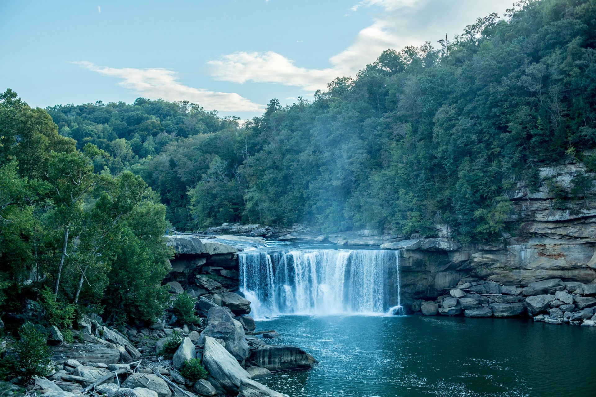
Cumberland Falls State Resort Park is home to one of the few places in the Western Hemisphere where a consistently visible moonbow forms, a nighttime rainbow created by moonlight passing through the mist of a 125-foot-wide waterfall on the Cumberland River.
The falls themselves drop about 65 feet and are sometimes called the Niagara of the South, a nickname that reflects their width and volume rather than an exact comparison in scale. The moonbow appears most reliably on clear nights within a few days of a full moon, when moonlight is bright enough to refract through the falls' mist into a faint band of color, visible to the naked eye though it photographs more vividly with a long camera exposure. The park publishes a moonbow calendar each year listing the best viewing nights, and rangers sometimes lead guided moonbow walks during peak viewing windows.
The falls sit within a forested gorge along the Cumberland River, part of the Daniel Boone National Forest region in southeastern Kentucky, and the park includes several miles of hiking trails along the river gorge, including a trail to Eagle Falls, a smaller waterfall reachable by a moderate hike across the river from the main overlook. Whitewater rafting operates on a stretch of the Cumberland River below the falls during scheduled dam releases, giving visitors a way to experience the river from water level rather than the overlooks above.
The park includes a lodge and cabins built in the 1930s under the Civilian Conservation Corps, similar to lodges built at several national parks during the same era, giving overnight visitors a rustic option without needing to book a reservation months in advance the way many national park lodges require. Because Cumberland Falls sits roughly two hours from both Louisville and Knoxville, it draws a regional visitor base rather than the heavier out-of-state tourist traffic seen at nearby Mammoth Cave National Park, keeping the main overlook manageable even on weekends.
Credit: Zach Camp / Unsplash
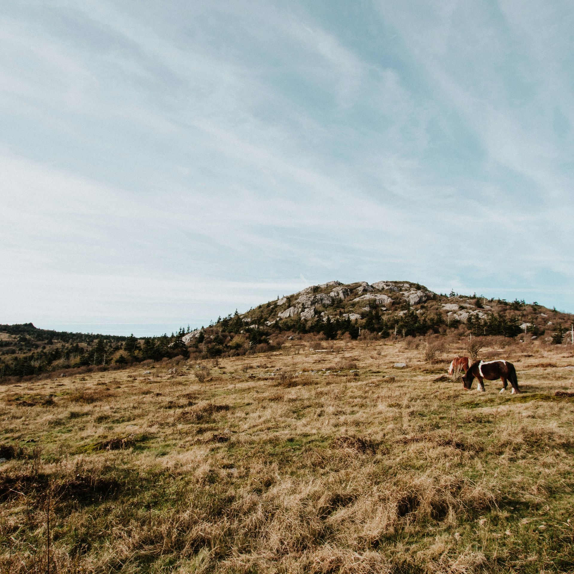
Grayson Highlands State Park sits at elevations above 5,000 feet in southwestern Virginia and is best known for herds of wild ponies that roam its high-elevation balds, grassy summits that resemble alpine terrain more than typical Appalachian forest.
The ponies were introduced in the 1970s to help manage the balds, open grassy areas above the tree line that would otherwise become overgrown with shrubs and young trees, and their grazing has kept the summits open ever since. Visitors regularly encounter the ponies directly along the trail near Massie Gap $GPS, the park's main trailhead, close enough that rangers post reminders not to feed or approach them despite their apparent tameness.
The park borders Mount Rogers National Recreation Area, home to Mount Rogers, Virginia's highest peak at 5,729 feet, and many visitors combine a hike from Grayson Highlands with a summit push to Mount Rogers itself, a round trip of around eight to nine miles depending on the route chosen. The balds throughout both areas offer some of the widest long-distance views in Virginia, with layered mountain ridges visible in multiple directions on clear days, a perspective usually associated with the higher peaks of the Rockies or the Sierra Nevada rather than the older, more worn-down Appalachians.
The Appalachian Trail itself runs directly through the park, so through-hikers headed toward Maine or Georgia pass along the same balds that day visitors use, occasionally sharing the trail with the resident ponies. Rock formations along the ridgelines, exposed granite outcrops shaped by extreme wind and ice over thousands of years, add another distinct feature not typical of the surrounding Blue Ridge forest. Because the park sits at higher elevation than most of Virginia, weather can shift quickly, with wind, fog, and temperatures well below the valley floor even in summer, so layers are worth carrying regardless of the season chosen for a visit.
Credit: Tyler Rutherford / Unsplash
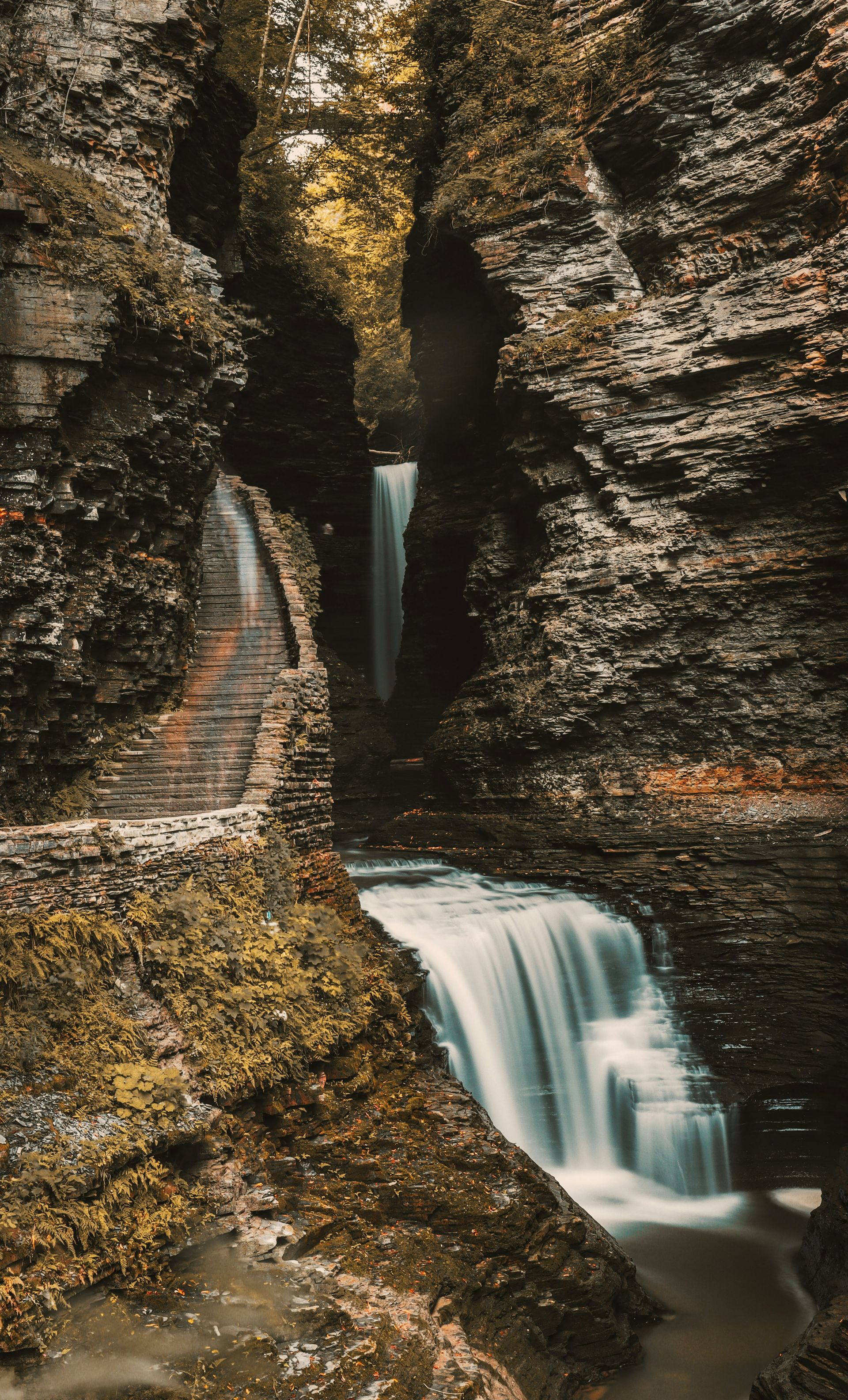
Watkins Glen State Park packs 19 waterfalls into a gorge less than two miles long, a stone stairway and tunnel trail carved directly into the rock face at the southern end of New York's Finger Lakes region.
The Gorge Trail, the park's main route, was built largely by hand in the late 19th and early 20th centuries, with stone staircases, bridges, and a tunnel blasted through solid rock to allow the path to pass behind and beside the falling water at several points. Sherman Falls, Rainbow Falls, and Cavern Cascade rank among the more distinct drops along the route, with Rainbow Falls producing a visible rainbow in its mist on sunny afternoons, giving the falls its name.
The gorge was carved by Glen Creek cutting through layers of shale and sandstone left behind roughly 400 million years ago, when the region sat under a shallow inland sea, and the exposed rock layers along the trail walls show that history in visible horizontal bands. Because the trail climbs and descends through a narrow space with limited passing room, the park has at times managed one-way foot traffic during peak summer weekends, though it has never required the kind of advance reservation system used at more heavily trafficked national park trails.
Watkins Glen sits at the southern tip of Seneca Lake, the largest of the Finger Lakes, putting it within easy reach of the region's wine country, with dozens of vineyards along the lake's eastern and western shores. The village of Watkins Glen also hosts a NASCAR road course and a historic auto racing circuit, giving the area a second identity distinct from the gorge itself. The gorge trail is best hiked in dry conditions, since the stone steps become slick after rain, and the park closes sections of the upper trail in winter when ice makes the stairways unsafe.
Credit: Beth Fitzpatrick / Pexels
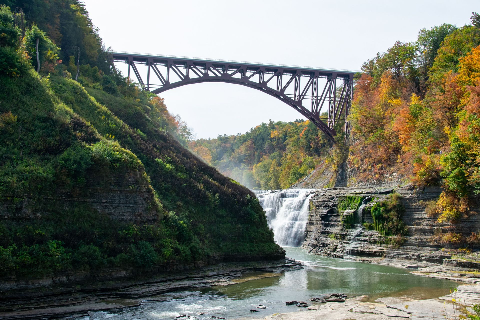
Letchworth State Park is often called the Grand Canyon of the East, a 17-mile gorge cut by the Genesee River through walls that rise as high as 600 feet in places, with three major waterfalls along its length.
The largest of the three, Middle Falls, drops 107 feet and sits directly below the Glen Iris Inn, a former estate house built by William Pryor Letchworth, the park's original benefactor, who donated the land to New York State in 1907 specifically to preserve the gorge from development. Upper Falls and Lower Falls, both roughly 70 feet, sit at either end of the same river corridor, and a series of overlooks along the gorge rim allow visitors to see all three without a difficult hike.
The park's Wolf Creek area includes a suspension bridge crossing high above a tributary gorge, while the main gorge itself is spanned by a rail bridge still used by active freight trains, a structure that replaced an even taller original built in the 1870s. Hot air balloon rides operate seasonally over the gorge, giving visitors an aerial view of the river cutting through the rock layers below, a perspective usually reserved for helicopter tours over national park canyons out west.
The gorge exposes roughly 550 million years of rock layers in places, with shale, sandstone, and limestone visible in bands along the walls, shaped most recently by glacial meltwater at the end of the last ice age roughly 12,000 years ago rather than by the river alone. The park spans more than 14,000 acres and includes camping, cabins, and more than 66 miles of trails, along with a section of the North Country Trail. Fall foliage season, typically peaking in early to mid-October in this part of western New York, draws the heaviest crowds of the year, while spring brings higher water volume and a more forceful version of all three waterfalls.
Credit: James Mirakian / Pexels
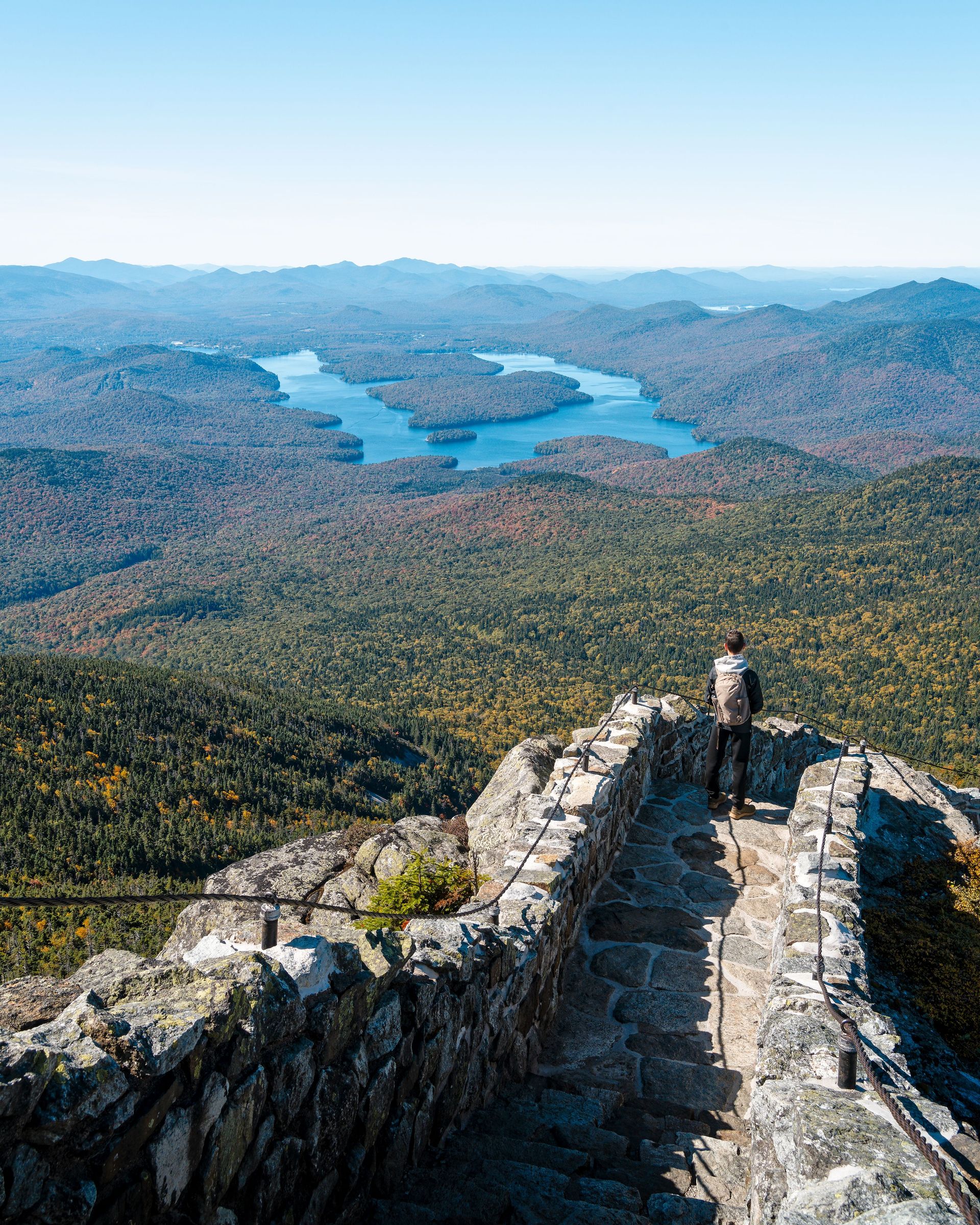
Baxter State Park protects Mount Katahdin, Maine's tallest peak at 5,268 feet and the northern terminus of the Appalachian Trail, across more than 200,000 acres of wilderness donated to the state in pieces by former Governor Percival Baxter starting in the 1930s.
Baxter gave the land with strict conditions attached, requiring it be kept forever wild, with no paved roads, no cell towers, and only limited development inside its borders, conditions the state has maintained for nearly a century. That means visitors reach the park by unpaved road, camp without electrical hookups in most areas, and hike without cell service across most of the park's interior, a level of remoteness that stands apart from most national parks, which typically maintain paved entrance roads and at least partial cell coverage near visitor centers.
Katahdin itself is the main draw for many visitors, with several routes to the summit, including the Knife Edge, a narrow ridge trail with steep drop-offs on both sides that ranks among the more exposed hikes in the eastern U.S. The mountain also marks the end, or the beginning depending on direction of travel, of the roughly 2,190-mile Appalachian Trail, and northbound through-hikers finishing their journey at Katahdin's summit sign have become one of the more recognized images associated with the trail.
Beyond Katahdin, the park includes more than 200 miles of hiking trails, dozens of ponds and streams, and a healthy population of moose, often visible from park roads at dawn or dusk, particularly around Sandy Stream Pond near the Roaring Brook Campground. Because Baxter limits daily vehicle entries to manage congestion on its unpaved roads, arriving early is important during peak summer and fall foliage weekends, though the park has never required the kind of paid reservation system used at some national parks. Winter access is limited to those with backcountry skiing or snowshoeing experience, since the park does not plow its interior roads.
Credit: Chris Newsom / Pexels
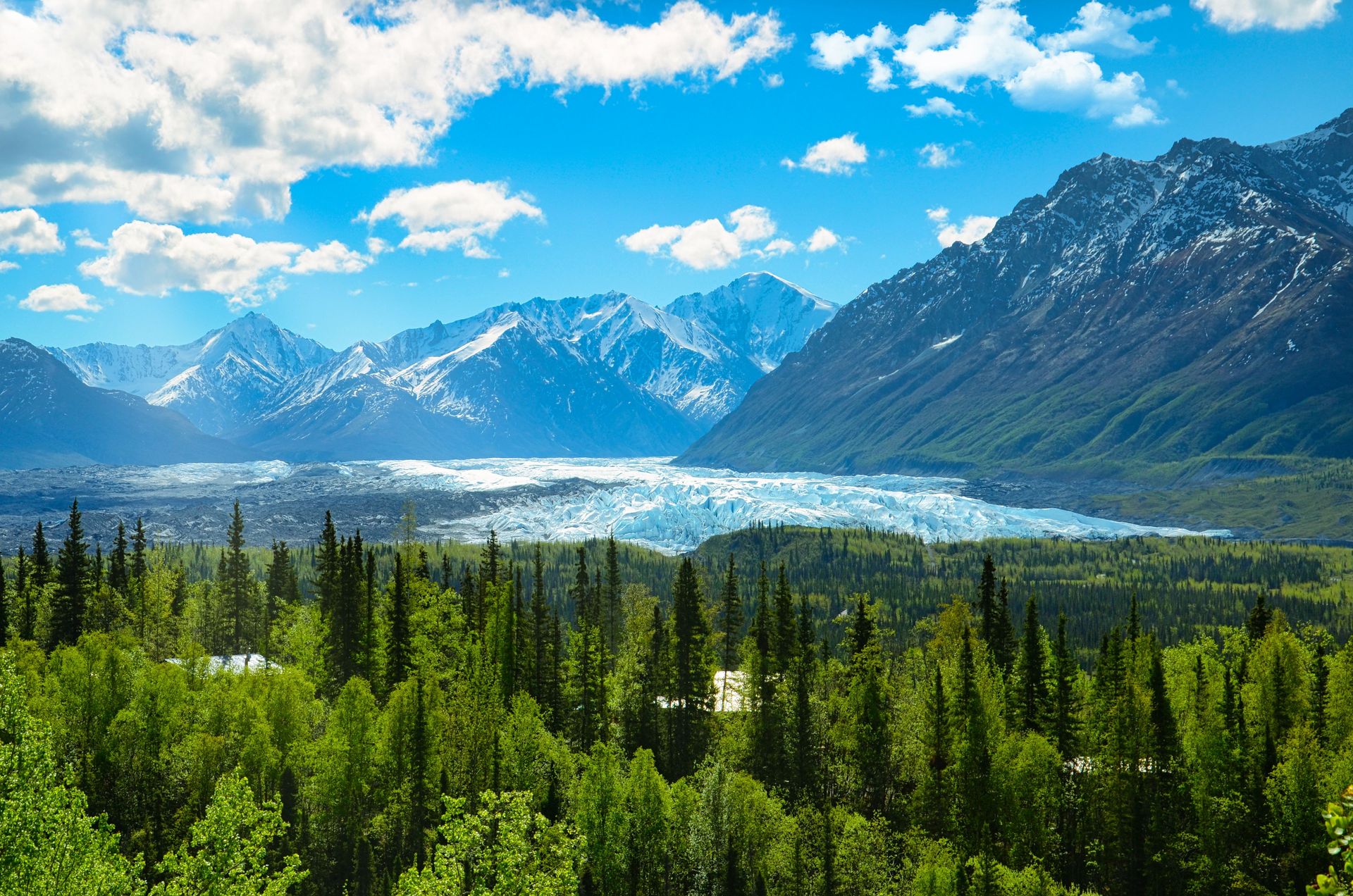
Chugach State Park covers nearly 495,000 acres on the edge of Anchorage, making it one of the largest state parks in the country and putting glaciers, alpine lakes, and a chance at sighting Dall sheep within a short drive of Alaska's largest city.
Unlike most of the destinations on this list, Chugach borders a major metropolitan area directly, with several trailheads reachable within 20 to 30 minutes of downtown Anchorage, giving residents backcountry access that would otherwise require a flight or a long drive in most other U.S. cities. The Flattop Mountain Trail, the most heavily used route in the park, climbs to a summit at just over 3,500 feet and offers views across Cook Inlet toward Mount Susitna, a popular short hike for visitors with limited time before or after an Alaska cruise or flight.
The park's interior holds far more remote terrain, including the Eklutna Glacier and Eklutna Lake, a turquoise glacial lake reachable by a flat trail along its shoreline or a more demanding route into the surrounding peaks. Dall sheep, recognizable by their curled horns and white coats, live on the steep slopes visible from the Seward Highway as it runs along the park's western edge, giving drivers a chance at wildlife sightings without leaving the road.
Because Chugach sits adjacent to Anchorage rather than requiring a separate long drive, it functions differently from most state parks on this list, serving as both a wilderness destination for visitors and a daily recreation area for local residents, with trail traffic concentrated near the handful of trailheads closest to the city and dropping off sharply deeper into the park's interior. Brown and black bears both live within the park, and rangers post regular updates on bear activity near popular trails, particularly during salmon runs in late summer when bears concentrate near streams. Winter transforms much of the park into a backcountry skiing and snowshoeing destination, with far fewer visitors than the hiking season draws.