
From Praiano's uncrowded Amalfi cliffs to a St. John harbor where the live-aboard sailing community outnumbers the tourists
Martina Jorden / Unsplash
The beach town’s appeal is structural: the natural environment and the built one are in close, productive dialogue in a way that purely urban and purely wild places are not. The boats in the harbor catch the light the same way the fishing boats that inspired the harbor’s construction caught it a century ago. The whitewashed cottages on the cliff have absorbed enough salt air to carry the coast in their paint. The boardwalk between the sea and the restaurants exists because the people who built the restaurants wanted to be near the water, and the people who come to eat there want the same thing. This proximity creates the specific atmospheric quality that the best beach towns share across geography and culture: a place where slowing down is not a choice but an environmental inevitability.
What distinguishes the most beautiful beach towns from the merely pleasant ones is usually specific natural drama, specific architectural character, and the absence of the commercial over-development that removes both. Praiano on the Amalfi Coast has all three: the cliff-edge position, the medieval village fabric, and the relative absence of the crowds that have overwhelmed its neighbor, Positano. St. Ives in Cornwall has all three: the turquoise bay, the fishermen’s cottages converted into galleries, and the winding lanes too narrow for tourist buses. The best beach towns are always the ones that have managed to stay themselves.
The 10 towns below appear in Travel + Leisure, drawn from a larger list nominated by travel experts and editors, spanning six countries across four continents. They range from small Italian cliff villages accessible only by a winding coastal road to a Japanese port town reachable on a luxury express train from Tokyo, with stops in Cornwall, Maine, Costa Rica, and the Pacific coast of Mexico.
3DVISU / Unsplash
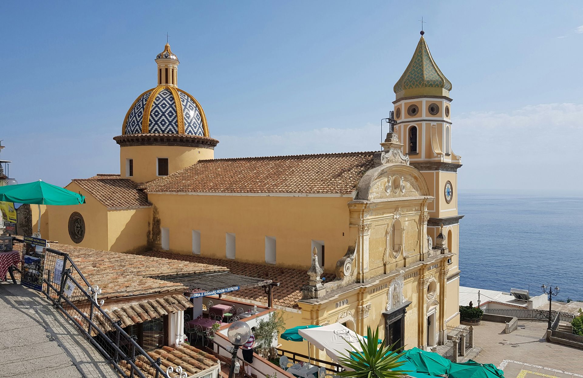
Praiano is the Amalfi Coast town that gives travelers who have found Positano overwhelming the same essential experience at a more human scale. The small town hugs the cliffs, with views in every direction: terraced gardens descending to the water, the sea extending toward Capri on a clear day, and the lights of other coastal towns visible at night across the water. The nearby beach beneath the Fiordo di Furore bridge provides the swimming program with a dramatic setting, unique to the geological formations of this stretch of coast. The Fiordo di Furore beach, accessible by steps cut into the cliff face, sits in a narrow fjord where the sheer rock walls meet the water, a configuration that has made it one of the most photographed small beaches in Italy.
Casa Angelina, perched high above the water on Praiano’s cliff, gives the lodging program its most committed expression of the location’s visual drama: the hotel’s white-on-white interior and the terrace views over the piercingly blue Tyrrhenian Sea give the accommodation a visual identity specific to the cliffside Amalfi architecture tradition. Il Pirata, a restaurant carved into the rocks above the water, provides the dinner program with a setting appropriate to a celebration on this coastline.
The road between Praiano and Positano gives the comparison its most practical context: the two towns are close enough to visit each other in an afternoon, and the difference in crowd density is apparent from the moment the driver parks. Positano’s main beach is often shoulder-to-shoulder from June through September, while Praiano’s equivalent attracts a fraction of the volume. For the traveler who wants the Amalfi experience without the Positano price and population, Praiano is the answer the coast offers. The walk between the two towns, along the clifftop footpath that connects the villages of the Amalfi, takes a few hours and gives views of the coastline from a height and distance that neither town’s beach provides.
Tom Patmore / Unsplash
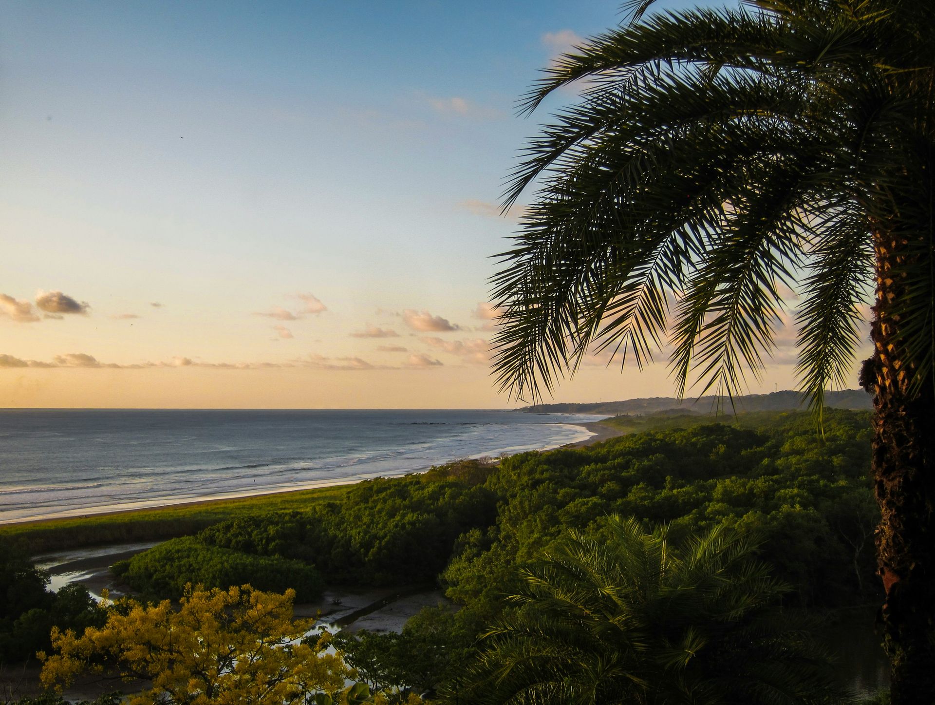
Nosara is a surf town on Costa Rica’s Nicoya Peninsula that has maintained its barefoot, jungle-meets-sand character through a development policy that limits infrastructure expansion and maintains the tree canopy that gives the town its distinctly non-resort atmosphere. The unpaved roads that connect the town’s scattered restaurants and accommodations, the howler monkeys audible from the beach at dawn, and the Pacific surf that breaks consistently enough to support a surf school industry alongside a serious local surfing culture give Nosara a specific character that the more developed Costa Rican beach towns have traded away.
The surf break at Playa Guiones, the town’s main beach, is one of the most consistent in Central America: the long, sandy bottom and the offshore wind pattern give the wave a shape and duration that beginners and intermediate surfers find productive, and the absence of the reef and rock that make other Costa Rican breaks dangerous for learners gives Guiones a safety profile appropriate to the surf school concentration the beach has attracted. The beach itself, backed by the protected Nosara Wildlife Refuge forest, gives the setting a natural buffer from the town’s development that maintains the tree line the toucans and scarlet macaws require.
The food and social culture give Nosara its evening program: open-air restaurants with partial walls, ceviche and fresh fish from the Pacific, and cocktails with local tropical fruit give the night a specifically Costa Rican beach town character whose casual intimacy reflects the town’s scale and philosophy. The four-wheel-drive rental culture, necessary to navigate the town’s roads during and after the rainy season, gives the visit a logistical engagement with the environment that the paved-road beach towns do not require. The Nosara Biological Reserve, a protected mangrove and forest area adjacent to the beach, gives the natural history program a wildlife dimension specific to this Nicoya Peninsula ecosystem: nesting olive ridley sea turtles use Playa Ostional, just north of town, in numbers that make it one of the most significant sea turtle nesting sites in the Pacific.
Jacques Beaulieu / Flickr (CC BY-NC 2.0)
Shimoda is a coastal town on the Izu Peninsula south of Tokyo that gives the visitor a genuinely unexpected version of Japan: crystal-clear water, soft sand beaches, a relaxed surfing culture, and a historic town center whose 19th-century architecture reflects the town’s significance as one of the first Japanese ports opened to Western trade. The Shimoda treaty of 1854, signed in the town’s Ryosenji Temple, made Shimoda the place where Japan’s feudal isolation formally ended, and the American-period history visible in the town’s museums and monuments gives the visit a cultural dimension alongside the beach program that most Japanese coastal towns do not provide in the same concentrated form.
Shirahama Beach, about 2.5 miles outside the central town, gives the surfing and swimming program its most productive setting: the consistent Pacific swell, the rental shops that line the beach road, and the food stalls that give the beach day its lunch program make Shirahama a complete day visit from the town center or from Tokyo via the limited express train that reaches Shimoda in under three hours. The train journey itself, descending the Izu Peninsula through forested mountains and brief coastal glimpses, offers an arrival with a scenic approach that the road journey does not.
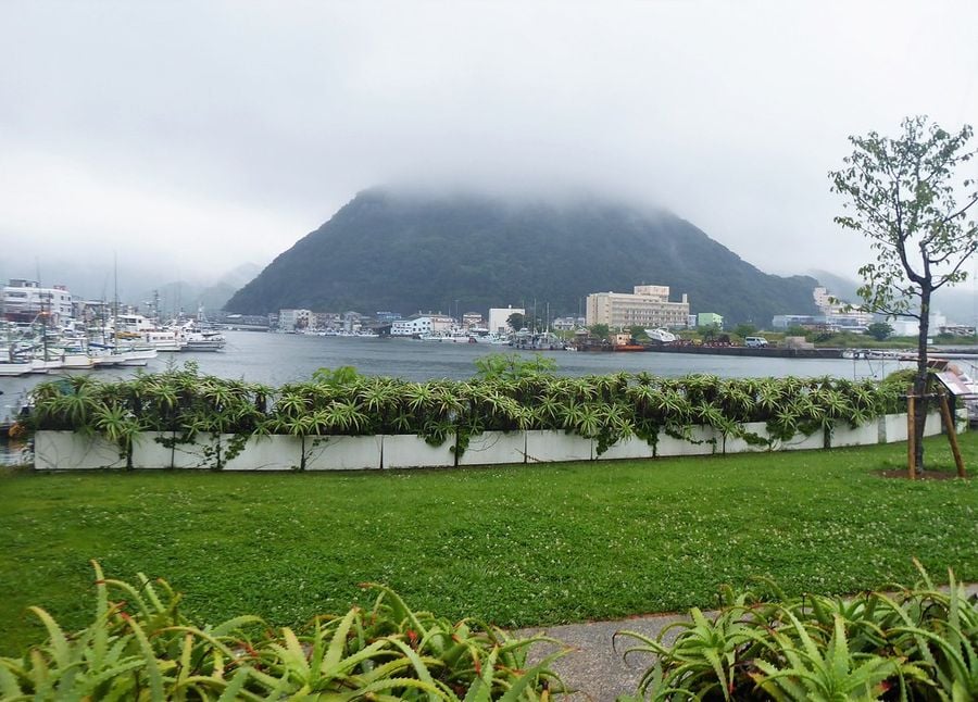
The town’s harbor, ringed by fishing boats and framed by the surrounding hills, gives Shimoda its most specifically Japanese coastal atmosphere: the morning fish market, the boat tours of the harbor, and the local izakayas that serve the day’s catch give the non-surfing visitor a complete program specific to this working port town. The ryokan culture of the surrounding Izu Peninsula, with its hot spring baths and kaiseki dinners, gives the overnight stay a specifically Japanese dimension that the beach towns of every other country on this list cannot replicate. The Shimoda Aquarium, whose collection focuses on the marine life of the Izu Peninsula’s waters, provides an educational complement to the snorkeling and surfing offered by the beaches.
-1920x1439.jpg)
Ben Elliot / Unsplash
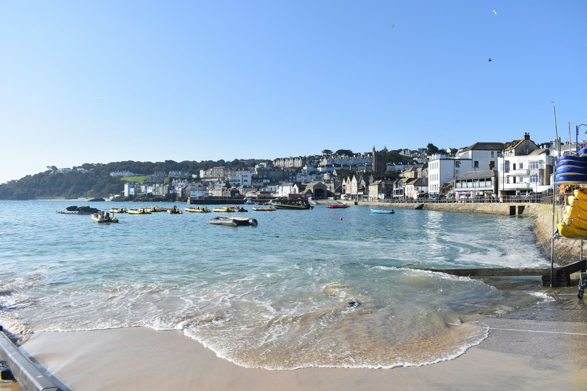
St. Ives began as a fishing village on the Penwith Peninsula at Cornwall’s western tip, and the physical evidence of that origin gives the town its specific visual character: the fishing boats still occupy the harbor alongside the pleasure craft, the smoke-house and net loft buildings that once served the pilchard industry have been converted into galleries and studios, and the narrow lanes that connect the harbor to the surrounding hillside neighborhoods were designed for the fishermen’s feet, not for the tourist coaches that now have to stop at the town’s edge. The historical accident of this street geometry is St. Ives’s most durable asset: the absence of road access through the old town preserves the pedestrian scale that makes the place worth visiting.
The turquoise water of St. Ives Bay, produced by white quartz sand on the seafloor and the direction of the light through clear Atlantic water, gives the Cornish coast a visual quality more commonly associated with the Mediterranean or the Caribbean, and the beach town’s latitude creates the specific pleasure of swimming in water that looks tropical in a climate that is distinctly not. Porthminster Beach, sheltered and south-facing, gives the warmest and calmest swimming conditions of the town’s several beaches, and the café that sits above it on the beach path gives the post-swim lunch its most consistently recommended address in St. Ives.
The Tate St. Ives, the outpost of the London gallery built into the cliff above Porthmeor Beach in 1993, gives St. Ives its institutional artistic credential alongside the village-scale studios and commercial galleries that the town’s association with the St. Ives School of artists has accumulated since Barbara Hepworth and Ben Nicholson made the town their home in the 1940s. The Hepworth Sculpture Garden, preserved at the artist’s original studio, gives the contemporary art program its most historically specific address. The garden’s arrangement of Hepworth’s large bronze and marble works among the subtropical plantings supported by the Cornish climate gives the sculpture an outdoor setting whose interaction with the garden’s seasonal light and the distant glimpses of the bay makes the visit a specific St. Ives experience.
michael schaffler / Unsplash
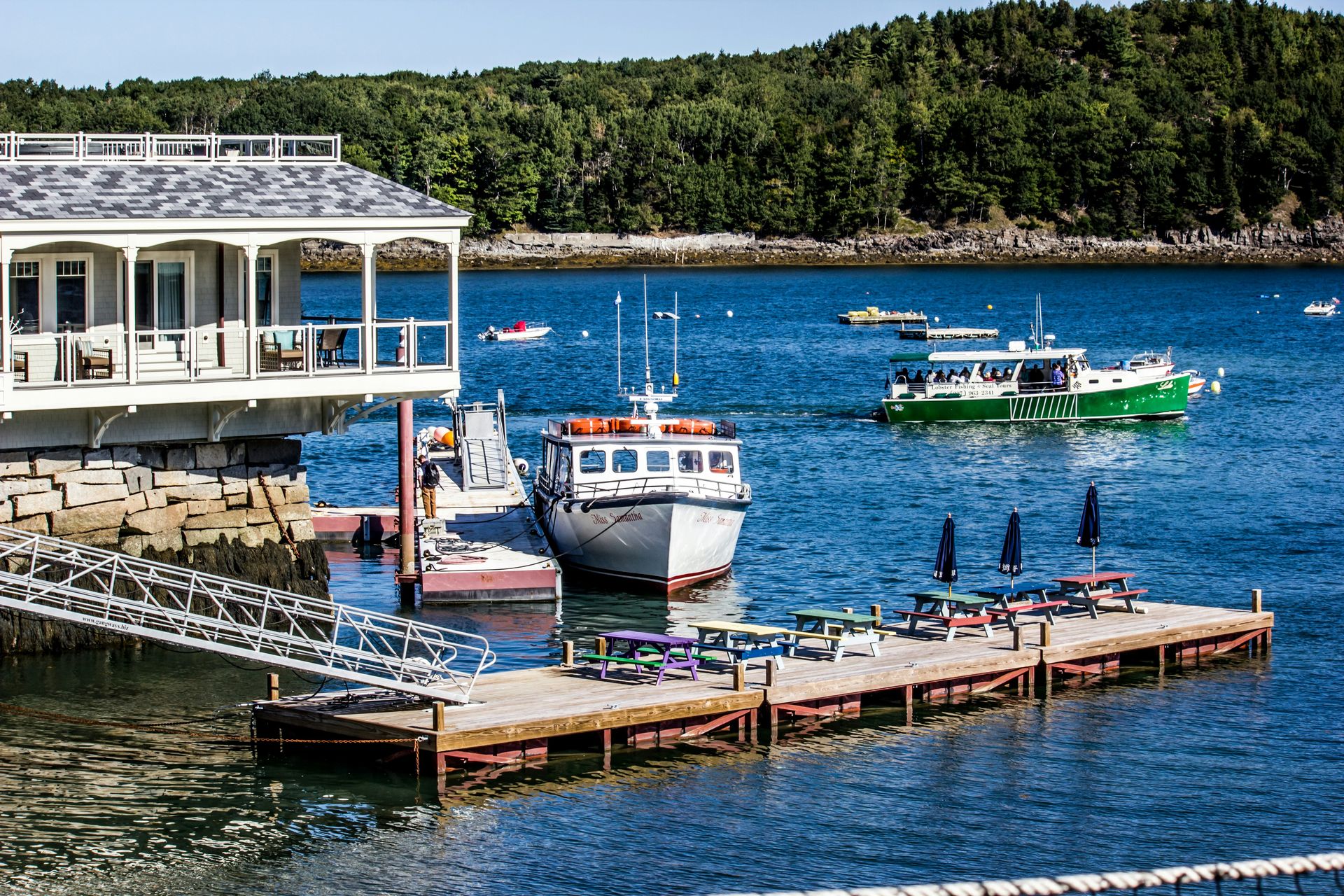
Bar Harbor sits on Mount Desert Island at the entrance to Acadia National Park, which gives it a set of functions that most beach towns do not have to manage simultaneously: a tourist destination for the national park’s 4 million annual visitors, a working harbor for the lobster fishing fleet whose traps are stacked along the pier, and a small town whose year-round residential community carries the cultural weight of a place that has been both working waterfront and vacation destination since the late 19th century. The robber barons who built the summer cottages whose ruins dot the island’s carriage roads gave Bar Harbor its Gilded Age identity, and the national park designation that Franklin Roosevelt supported in 1919 gave it its permanent protection.
The Shore Path that runs from the Town Pier along Agamont Park gives the sunrise visit to Bar Harbor its most concentrated scenic experience: the path sits above the tide line on the rocky shore, and the view from it at dawn, with the Porcupine Islands in the harbor and Egg Rock Light visible to the east, gives the visual program a quality that justifies the early alarm clock the sunrise timing requires. The 27-mile Park Loop Road that circumnavigates the island’s eastern portion gives the driving visitor a scenic tour that includes Sand Beach, Thunder Hole, and the summit of Cadillac Mountain, the first place in the continental United States to receive direct sunlight on many mornings of the year.
The lobster culture gives Bar Harbor its most directly edible program: the lobster rolls, the lobster boils, and the lobster pounds, where guests eat at picnic tables with bibs and mallets, giving the town’s food scene a specific regional identity that the waterfront restaurants in more fashionable coastal towns have refined away from the same direct encounter with the source material. The Bar Island land bridge, which appears at low tide and gives walkers access to a forested island directly from the town, offers an afternoon tidal adventure unavailable at any other time of day.
Rijan Gurung / Unsplash
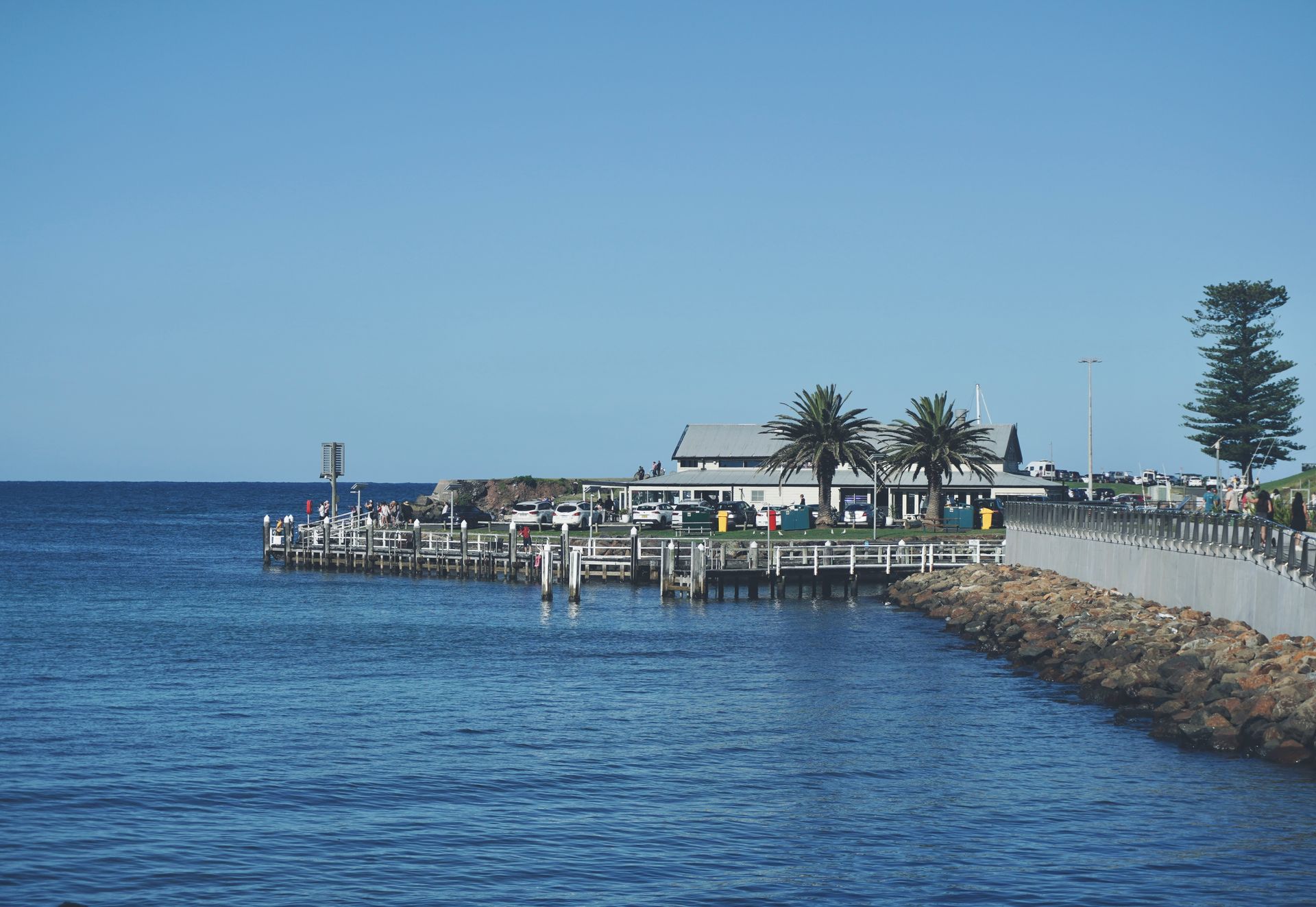
Kiama is a coastal town 90 minutes south of Sydney whose natural spectacle, Victorian architecture, and accessible beach and surf culture give it a completeness that most New South Wales coastal towns provide in only one or two of those dimensions. The Kiama Blowhole, listed as the world’s largest blowhole, shoots water up to 100 feet into the air when the Southern Ocean swell enters the sea cave below and compresses through the narrow opening at the top. The unpredictability of the eruption, which depends on the specific timing and angle of each incoming wave, gives the blowhole watching a performance quality whose randomness is itself part of the appeal: the visitors who gather on the platform do not know when the next eruption will come, and the anticipation between eruptions is as much part of the experience as the eruption itself.
The terrace houses from the 1880s that line Kiama’s historic center give the town a Victorian architectural character specific to the colonial period of the New South Wales coast, and the preservation of these buildings against the generic commercial development that has replaced equivalent buildings in other Australian coastal towns gives Kiama a historical townscape that complements the natural spectacle. The ocean pools and volcanic rock formations along the coast give the swimming program its most dramatic geological setting: the rock pool at Kiama, carved by centuries of wave action into the basalt formations, offers the swimmer an enclosed, calm alternative to the surf beach.
The region’s position on the Illawarra Escarpment, where the coastal plain meets the dramatic sandstone edge of the plateau, gives Kiama’s surrounding landscape its most visually distinctive quality: the escarpment is visible from the beach, and the coastal and highland terrain accessible within a short drive gives the town a day-trip geography disproportionate to its modest size. The Kiama Heritage Trail, which connects the town’s 19th-century public buildings and the Pilot’s Cottage Museum, offers an architectural walking program that the beach and blowhole visits can extend into a full-day engagement with the town.
Dorin Seremet / Unsplash
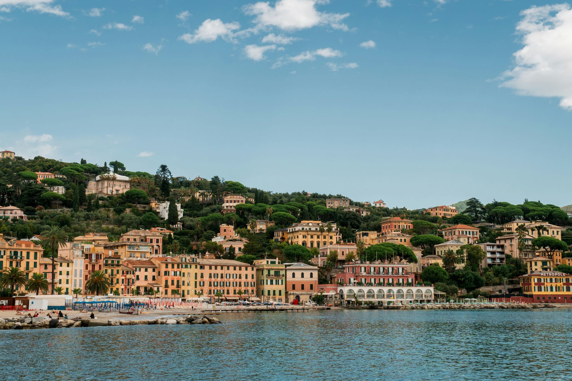
Santa Margherita Ligure occupies a bay on the Ligurian coast south of Genoa, tucked between the more famous Portofino to the south and the Cinque Terre to the north, and the town’s position between these two more celebrated neighbors has given it a specific quality: less discovered, less expensive, and less crowded than both, while sharing the essential landscape qualities of the Italian Riviera coast whose colorful harbors, terraced hillside villages, and flat-calm blue water give the region its identity. The waterfront promenade, lined with the pastel facades that characterize Ligurian fishing-village architecture, offers the town's most photogenic single view, and the harbor’s fishing and pleasure boats give the foreground the maritime character that completes the scene.
The beaches, a mix of sandy and rocky stretches with the colorful umbrellas aligned in the Italian bagno tradition, give the swimming program its organized, social form, and the view back toward the town from the water gives the visitor the specific experience that travel advisors consistently describe: the hills behind, the terraced gardens, the harbor, and the town’s church and piazza compressed into a single coastal panorama that the Italian Riviera produces in concentrated form at Santa Margherita’s specific bay. The hilltop wineries and olive groves above the town give the inland day trip its program, and the boat from Santa Margherita to Portofino takes 15 minutes, providing the town with a direct connection to its more famous neighbor without the crowds and price premium of staying there.
Fritto misto, the fried seafood mix specific to the Ligurian coast tradition, and the local vermentino white wine give the food and drink program their most regionally specific expression in the restaurants and trattorias along the waterfront, and the sunset cocktail culture that the western-facing harbor’s evening light supports gives the end of the beach day a specific social ritual appropriate to the Italian coast’s approach to the transition between day and evening.
-900x524.jpg)
Vicenç Salvador Torres Guerola / Wikimedia Commons (CC BY-SA 3.0)
Deià is a small village on the northwestern coast of Mallorca that has attracted writers and artists since the 1930s, most famously Robert Graves, who lived and wrote there for most of his adult life and whose house is now a museum with a garden that gives visitors a direct encounter with the landscape that shaped his work. The village itself, a cluster of stone houses stepping down toward the rocky coastline on the slopes of the Tramuntana mountain range, gives Deià the visual character specific to this UNESCO World Heritage landscape: the terraced olive groves, the ancient stone walls, and the mountain backdrop above the sea give the town a setting that the more beach-resort-focused Mallorcan towns cannot replicate.
Cala Deià, the rocky cove at the base of the village, is accessible via a winding road and a walk down a steep path, and the effort of reaching it gives the cove its defining quality: a small pebble beach with crystal-clear turquoise water, surrounded by the limestone cliffs that the cove’s sheltered position requires, with a cluster of simple outdoor restaurants above the waterline that serve grilled fish and cold wine to the visitors who have made the descent. The swimming in the cala’s clear water gives the beach program its most specifically Mallorcan form, different in character from the sandy beaches of the island’s southern coast and specific to the rocky, intimate coastal geography of the Tramuntana shore.
The boat day that gives Mallorca’s most experienced visitors their preferred approach to the island’s coastline gives Deià its most complete context: seeing the village from the water, with the Tramuntana’s limestone peaks rising directly behind it and the terraced gardens descending to the sea in front, gives the visual comprehension of why Graves chose this specific spot that the land-based perspective, looking out, cannot provide in the same terms. The Robert Graves Museum in his former home, Ca n’Alluny, gives visitors direct access to the poet’s library, writing desk, and personal effects in the setting where he composed much of his work.

Toby Argüelles / Wikimedia Commons (CC BY-SA 2.0)
Todos Santos sits on the Pacific coast of Baja California Sur, tucked between the Sierra La Laguna mountains and the ocean, about an hour north of Los Cabos, and gives the Baja Peninsula a beach-town identity categorically different from the resort development that concentrates in the tourist zone to the south. The town’s historic center, whose 19th-century adobe buildings, the old sugar mill ruins, and the palm-lined main street give it a Mexican colonial townscape, sits a short distance from the Pacific beaches whose strong surf, dangerous undertow, and dramatic dune formations make them more spectacular to look at than safe to swim in.
The boutique hotel culture gives Todos Santos its most distinctive contemporary dimension: the small, design-forward properties that have opened in and around the historic center give travelers an alternative to the large resort model that Cabo has developed, and the properties that have committed to the town’s specific character, including one that turns off Wi-Fi on Sundays to encourage guests to engage with the surrounding landscape, reflect a philosophy consistent with the town’s identity as a place that resists the acceleration of the resort economy.
The art galleries, farm-to-table restaurants, and farmers market that make up the town’s commercial culture give the non-beach program its specific character: Todos Santos has developed a creative community drawn by the light, the landscape, and the distance from the pace of the cities, and the galleries that display local painters’ and sculptors’ work alongside the taco stands and mezcal bars give the town a cultural depth that the resort zones of Cabo do not attempt in the same terms. The horses available for beach rides at the properties with stables give the sunset activity its most specifically Baja form. Todos Santos Surf Co. operates out of town and provides the surf program with a local connection to the Pacific breaks accessible from the town’s coast, where the swell and the dramatic beach scenery give the surfing a visual context that the calmer resort beaches to the south cannot provide in the same way.
Bonus Onus / Wikimedia Commons (CC BY-SA 3.0)
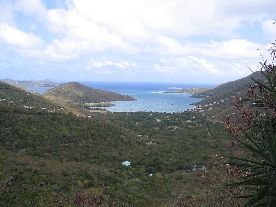
Coral Bay is the smaller and quieter of St. John’s two main settlements, sitting on the eastern end of the island away from the ferry dock and resort concentration of Cruz Bay, and giving the visitor who makes the drive across the island’s steep, scenic interior the specific reward of a beach town that has not been optimized for the tourist economy in the same terms as the island’s western end. The harbor, with its collection of sailboats anchored in the calm water behind the reef, gives Coral Bay its defining visual character: this is a working anchorage as much as a tourist destination, and the live-aboard sailing community that has made Coral Bay its home base for generations gives the town a social texture specific to the Caribbean sailing world.
The beaches accessible from the Coral Bay side of St. John, including portions of the island that fall within the Virgin Islands National Park, give the swimming and snorkeling program access to the protected marine environment that covers much of the island’s coastline. The coral reef systems accessible from shore in this part of St. John have benefited from the park’s protection in a way that the more heavily visited beaches near Cruz Bay have not maintained the same health, and the sea turtle sightings that the protected reef supports give the snorkeling program a wildlife dimension that justifies the drive from the ferry dock.
The beach bar culture at Coral Bay, anchored by Skinny Legs and its outdoor tables and cold beer, gives the social program the specific laid-back quality that the Virgin Islands beach town experience at its best produces: no dress code, no reservation, no ambient lighting calibrated for Instagram: just the harbor view, the warm evening air, and the particular contentment that the end of a long, warm day on an island in the Caribbean consistently delivers to people who have nowhere else to be.