From Seychelles' polished granite boulders at Anse Source D'Argent to Gabon's Loango Park where elephants surf the Atlantic waves
Diana Krotova / Unsplash
Africa has 39 countries with coastlines, which means the continent’s beach geography is more diverse than the sum of the destinations its most famous travel circuits cover. The Indian Ocean coast of Mozambique and Tanzania gives the beach traveler warm, clear water, coral reefs, and the marine megafauna that the protected waters of the East African coast sustain. The Atlantic coast of West Africa gives an entirely different experience: the raw, fog-covered wilderness of the Skeleton Coast in Namibia, the surf beaches of Angola’s Cabo Ledo, and the festival culture and voodoo heritage of Benin’s Grand-Popo occupy the same ocean as the luxury beach resorts of Morocco, but they share almost nothing else with them in character, culture, or physical environment.
The island beaches add further range. Anse Source D’Argent on La Digue in the Seychelles, with its polished granite boulders and shallow turquoise lagoon, is one of the most recognized beach images in the world. The Bazaruto Archipelago off Mozambique’s coast gives the Indian Ocean luxury beach its most concentrated expression. Margarida Beach on the island of Príncipe, reachable only by boat or on foot, represents the opposite end of the accessibility spectrum.
The beaches below appear in Travel + Leisure, drawn from a longer list covering the Atlantic and Indian Ocean coasts and the major island groups. They span the full range from party beach to protected wilderness, from dive destination to heritage site. Africa’s 39 coastal nations give the continent a beach geography whose east-to-west and north-to-south range encompasses more distinct, varied, and climatically differentiated marine environments than any other single continental landmass, and the 10 destinations below represent only a small fraction of what the full range of the continent’s coastlines and remarkable island groups contain and offer.
Joshua Kettle / Unsplash
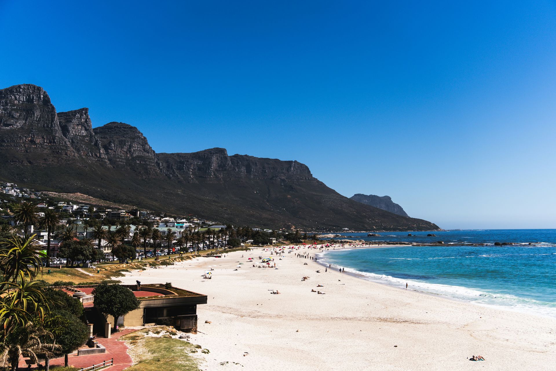
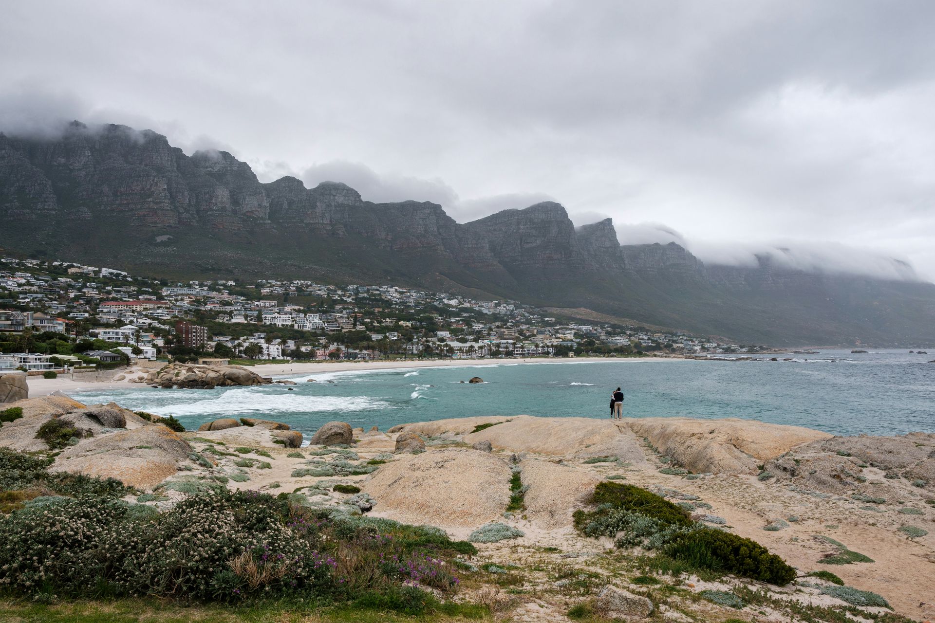
Camps Bay Beach is Cape Town’s most socially charged beach strip, positioned between the Atlantic Ocean and the dramatic backdrop of the Twelve Apostles mountain range, the coastal extension of Table Mountain, whose vertical faces give the beach its defining visual setting. The beach’s social culture is specific: the European visitors and celebrity sightings that define the summer high season give Camps Bay a character closer to Saint-Tropez than to the wilderness beaches that define the broader South African coastline, and the trendy bars, clubs, and hotels that line the beachfront road give the evening a program that extends the beach day well past sunset.
The water is cold by tropical beach standards, fed by the Benguela Current that runs up the South African Atlantic coast, which gives the swimming a bracing quality that the sunbathing culture compensates for by treating the beach as a social platform. The Table Mountain Aerial Cableway, accessible by car or taxi from Camps Bay, offers vertical access to the mountain landscape that the beach-level perspective does not, and the vineyards of the Cape Winelands, a short drive inland, give the Cape Town visit its most productive edible day-trip option.
The broader Cape Town setting gives Camps Bay its most important context: the city is one of the most visually spectacular urban environments on earth, and the beach functions as its most accessible single public gathering point. The Boulders Beach penguin colony near Simon’s Town, the Cape Point reserve at the peninsula’s southern tip, and the Kirstenbosch Botanical Gardens give the Cape Town visit a natural program whose variety gives the Camps Bay beach day its best companions. The Chapman’s Peak Drive, the cliff-face road between Hout Bay and Noordhoek, gives the coastal scenery its most dramatic road experience and a perspective on the Camps Bay area from above the mountain that the beach-level view does not provide in the same dramatic vertical terms.
Wynand Uys / Unsplash
Ponta do Ouro, whose name translates as the Tip of Gold, is a small coastal village at the southern end of Mozambique near the border with South Africa. The beach itself, a clean curve of pale sand above the blue Indian Ocean, gives the village its most immediately attractive feature, but the real draw is underwater: the warm waters off Ponta do Ouro support one of the most productive marine environments on the East African coast, with whale sharks, reef sharks, dolphins, sea turtles, rays, and extensive coral reefs accessible from dive sites within a short boat ride of the beach.
The shark-diving season runs from October to May, coinciding with the Mozambican summer, when water temperatures are at their most comfortable for extended diving sessions. The visibility in these waters is among the best on the African coast, giving the underwater photography program a specific technical advantage that murkier dive sites elsewhere in the region cannot match. The reef sharks that inhabit the shallower reef structures and the pelagic species accessible in deeper water provide divers with a range of species encounters across multiple dives.
The village’s proximity to South Africa, accessible by car from Durban via the border crossing at Kosi Bay, gives Ponta do Ouro logistical access that the more remote Mozambican dive destinations do not. The small-scale resort and guesthouse accommodation that serves the village provides the overnight visitor with a relaxed, low-key base, specific to a destination whose marine environment is the primary reason to visit and whose social atmosphere is pleasantly unhurried by the standards of the major Mozambican beach resorts further north. The dolphin pods that visit the bay in the early morning provide the dawn snorkel with a regular, reliable wildlife encounter that the scuba certification required for the deeper reef shark dives does not restrict to those not yet certified in the sport.
SnapSaga / Unsplash
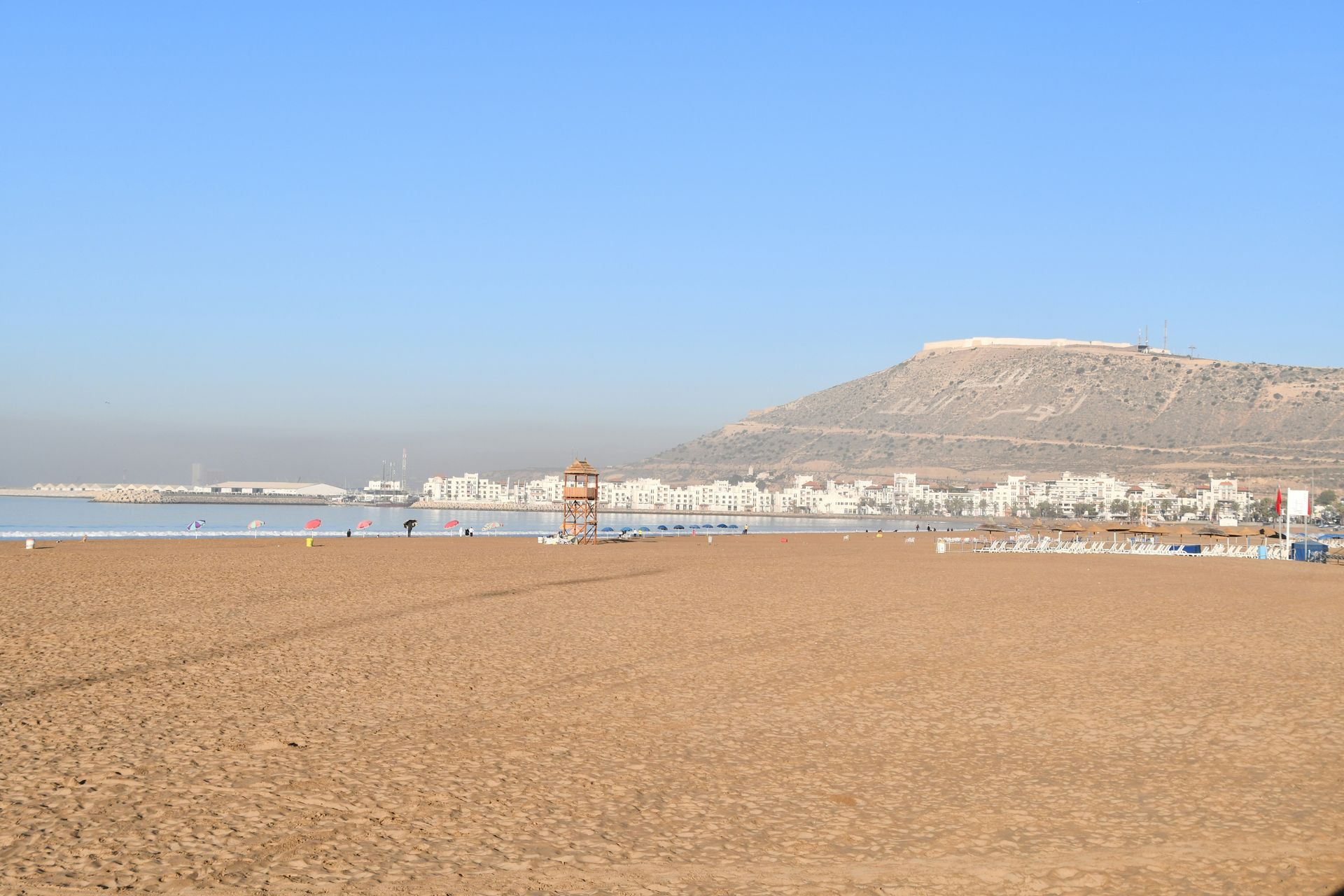
Plage d’Agadir is the main beach of Agadir, a modern Moroccan city on the Atlantic coast that was rebuilt from scratch after a devastating earthquake in 1960 destroyed the previous town. The rebuilt city’s beach-focused planning gave Plage d’Agadir a wide promenade with outdoor cafes and restaurants running parallel to the sand, giving the beach a social infrastructure that makes the full day from morning coffee to evening meal a self-contained experience along the seafront. The beach’s pale bronze sand and the aquamarine Atlantic waves give the visual setting its distinctive Moroccan coastal character, and the average of 300 days of sunshine a year makes the weather program unusually reliable even by North African standards.
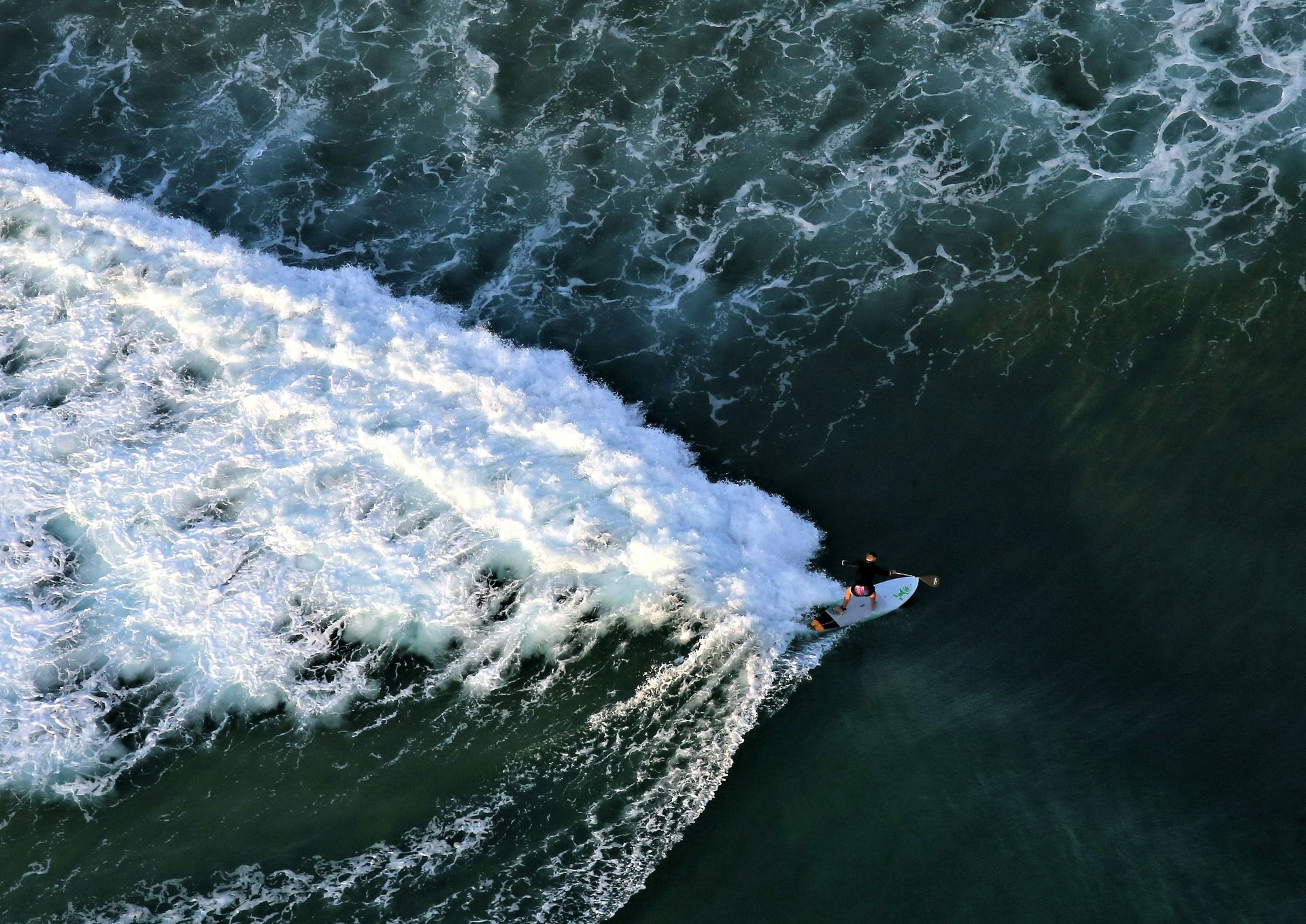
The water sports program covers the full range that the consistent Atlantic conditions support: surfing, windsurfing, kitesurfing, and jet skiing give the active beach visitor options whose quality reflects both the reliable wind patterns and the wave conditions produced by the Atlantic exposure. The beach’s sheltered position within the broad Agadir bay gives the conditions a consistency and a relative calmness compared to the more exposed Atlantic beaches to the north.
The Kasbah of Agadir Oufella, the 16th-century fortress ruins that survived the 1960 earthquake and now serve as the hillside above the new city's most historically significant landmark, is accessible by taxi or guided tour and adds a historical dimension to the Agadir visit that the beach-and-promenade experience alone does not provide. The Souk El Had, Agadir’s large covered market, gives the visit its most specifically Moroccan commercial experience: fresh produce, spices, artisan crafts, and the specific texture of a functioning North African market whose clientele is primarily local, give the souk visit a character different from the tourist-oriented medinas of Marrakech and Fez. The Amazigh Heritage Museum near the old kasbah site offers the Berber cultural history of the Sous region its most organized public presentation, and the argan oil cooperatives in the surrounding Souss-Massa valley provide a locally produced edible and cosmetic product specific to this part of Morocco.
Credit: National Parks Africa
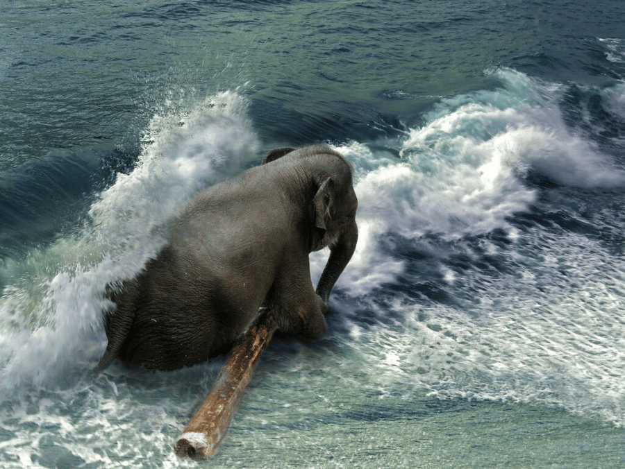
Loango National Park in Gabon occupies a stretch of the Atlantic coast whose forested hinterland, sweeping grasslands, tidal estuaries, and open beaches give it a coastal wildlife environment that no other destination on this list approaches. The park is known for a specific behavioral phenomenon that has made it one of the most extraordinary wildlife spectacles in Africa: forest elephants enter the surf zone and ride the waves in what observers consistently describe as play behavior, giving the beach safari its most iconic single encounter and the park its international reputation among wildlife photographers.
Forest buffalo join the elephants on the beach, and the leatherback turtle nesting season adds its own wildlife program to the nighttime beach walks. The bird life includes species whose names reflect the specific character of the Gabonese forest zone: the white-crested tiger heron, the vermiculated fishing owl, and the chocolate-backed kingfisher add visual and acoustic richness that the more open savannah environments do not provide. The hippos that also enter the surf, which gives Loango its “surfing hippo” nickname, add a large mammal dimension to the beach that no other African coastal park can match.
Access to Loango requires a flight to Libreville and a further connection to the park’s airstrip or a road journey, giving the destination a logistical commitment appropriate to its remoteness and its specific quality. The safari operators who run guided experiences in the park give wildlife encounters a structured, responsible format, with a minimum-impact policy that reflects the park’s conservation priorities, and professional guides who provide context for what visitors are watching that the self-guided equivalent cannot at the same depth. The Kongou Falls within the park, the widest waterfall in Africa at certain water levels, give the inland journey an additional natural spectacle specific to the Gabonese interior, whose scale the coastal beach safari does not prepare the visitor to encounter.
-1920x1216.jpg)
Sam Power / Unsplash
The Skeleton Coast in Namibia stretches approximately 310 miles along the country’s Atlantic shore and takes its name from the whale bones, ship timbers, and scattered human remains that the fog-covered beach accumulated across centuries of maritime disasters. The cold Benguela Current, the unpredictable fog that rolls in from the Atlantic, the powerful surf, and the complete absence of fresh water together made this coast one of the most dangerous maritime passages in the world during the age of sail, and the hundreds of shipwrecks now partially buried in the sand give the landscape its most historically specific character.
The wildlife that occupies this wilderness is not the wildlife of the conventional safari: the beach-dwelling desert lions, whose adaptation to the coastal environment gives them behaviors not observed in lions anywhere else in Africa, the spotted hyenas, and the large Cape fur seal colonies whose barking gives the fog-covered beach its most distinctive sound give the Skeleton Coast a specific ecological character whose strangeness amplifies the physical environment’s post-apocalyptic visual quality. The vast dune fields that extend inland from the coast, where the Namib Desert meets the ocean without transition, give the landscape a scale and an austerity that make it one of Africa’s most geographically extreme destinations.
Exploration requires a 4x4 vehicle and proper preparation, or a booking with one of the specialist safari operators who work the coast with the local knowledge and safety infrastructure that the remoteness demands. The Skeleton Coast National Park covers the northern section and requires permits, while the southern section is more accessible from the resort town of Swakopmund, which gives the Skeleton Coast visit its most practical logistical base. Swakopmund’s German colonial architecture, its bakeries, and its position at the edge of the Namib Desert give the visitor an urban base whose specific cultural character, a German seaside town on the edge of a desert on the Atlantic coast of Africa, is one of the more dissonant and memorable settings available at any beach destination.
seytakes / Unsplash
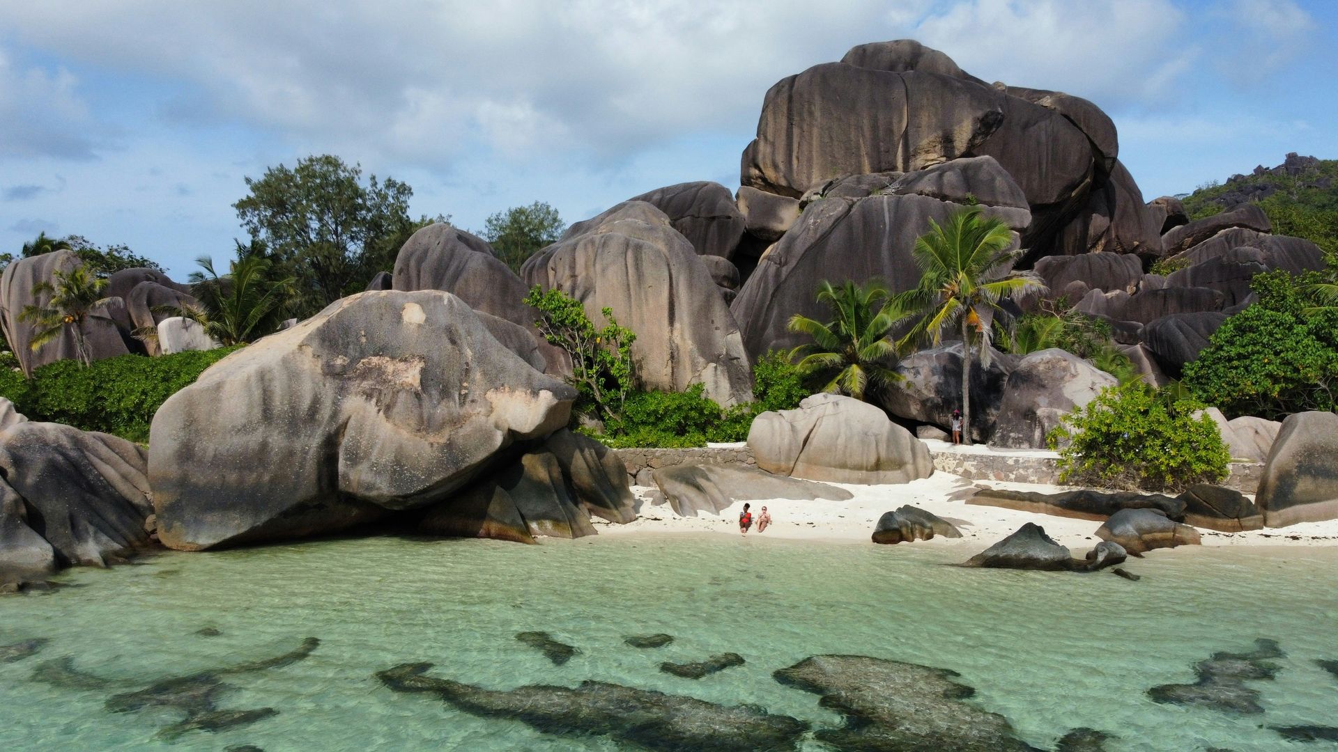
Anse Source D’Argent on La Digue Island in the Seychelles is one of the most reproduced beach images in the world: the pale sand, shallow turquoise water, lush palm trees, and massive polished granite boulders that rise from the sand and water in rounded, weathered formations give the beach a visual character that is simultaneously tropical and geological in a way that no other beach on earth replicates in the same form. The granite boulders, whose distinctive rounded shapes are formed over millions of years of weathering unique to the Seychelles archipelago, give the beach its character and photographic identity.
The shallow, clear water created by the reef and boulder formations gives Anse Source D’Argent its most practical appeal beyond the visual: the protected swimming environment, with water rarely deeper than waist height across a wide area of the beach, makes the visit a swimming experience appropriate to all ages and confidence levels. The snorkeling among the rock formations gives the underwater program access to the small reef fish and the occasional ray that inhabit the shallow structures.
La Digue, the island on which Anse Source D’Argent sits, is reached by ferry from Mahé or Praslin and gives the island visit its most distinctly low-key Seychelles atmosphere: the island’s ban on private cars, which means visitors travel by bicycle or ox-cart taxi, gives La Digue a specific character of unhurried pace specific to an island whose infrastructure has not been modernized in the direction of the main tourist islands. The island’s secondary beaches, Petit Anse and Grand Anse, offer the visitor who explores beyond Anse Source D’Argent an equally beautiful, far less crowded alternative within a short cycling distance. The La Digue island trail network, passable by bicycle on the island’s flat terrain and by foot on the hillier sections, gives the visit a natural history program that includes the endemic Black Paradise Flycatcher bird, found only on La Digue, and the giant tortoise enclosure at L’Union Estate that gives the Seychelles’ most famous endemic reptile its most accessible public presentation.
Martie Bloem / Unsplash
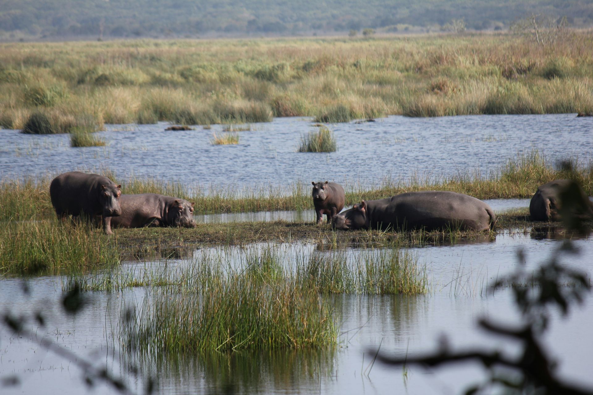
iSimangaliso Wetland Park in KwaZulu-Natal, whose name means miracle and wonder in Zulu, stretches 136 miles along the northern KwaZulu-Natal coast and encompasses a range of beach environments whose ecological diversity gives the park its UNESCO World Heritage designation. The park contains several distinct beach areas whose specific character reflects the ecosystems they border: Cape Vidal and Sodwana Bay, known for their accessible coral reef diving, give the underwater program its most developed infrastructure, while the more remote northern beaches of Black Rock, Mabibi, and Kosi Bay give the visitor willing to drive further the solitude that the more accessible southern sections cannot provide at the same completeness.
The turtle program gives iSimangaliso its most specifically seasonal wildlife draw: leatherback and loggerhead turtles return to the same beaches where they hatched to lay their own eggs, and the guided turtle-tracking walks available from November to March give the visitor a direct encounter with a natural cycle whose continuity across millions of years gives the beach visit a biological depth that no other beach experience on this list provides in the same terms. The turtles’ navigation from the ocean to the nesting site above the high tide line and back, observed from a close but non-disruptive distance with a guide, gives the night walk its most extraordinary moments.
The Lake St. Lucia safari, operated within the park boundaries, gives the iSimangaliso visit its most varied single day: a morning game drive along the lake shore, where hippos, crocodiles, and the park’s diverse bird life give the safari its content, followed by an afternoon at one of the beachfront access points, gives the day a combined wildlife and beach program specific to this extraordinary park. The village of St. Lucia at the park’s entrance offers a small town with restaurants, accommodation, and an evening social program, providing the park visit with a comfortable base for the multi-day stay that the park’s 136-mile extent rewards.
Credit: Visit Bazaruto
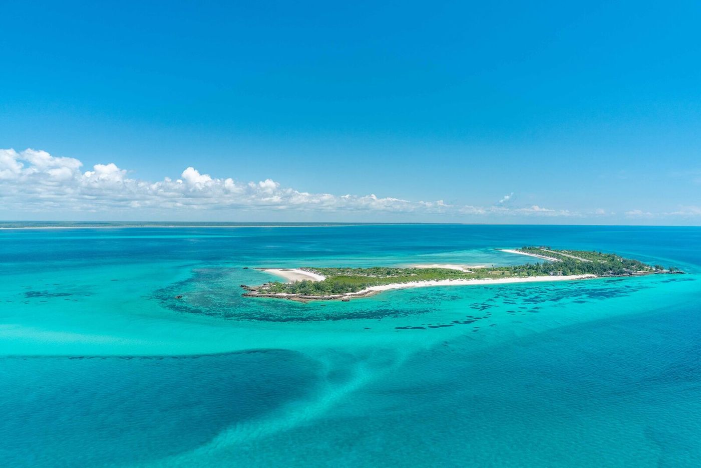
The Bazaruto Archipelago is a group of five islands off the coast of Vilanculos, Mozambique, whose white sand, turquoise shallows, and the marine sanctuary that surrounds them give the Indian Ocean beach its most complete expression of luxury in Africa. The shallow sandbars that extend between the islands give the aerial view its most visually distinctive quality and the paddleboarding and sandbank picnic program their most natural format. The marine protected area status gives the surrounding waters a fish and cetacean biodiversity whose health reflects decades of conservation management: whale sharks, humpback whales, manta rays, sea turtles, dolphins, and the rare dugong, one of the few stable dugong populations left in the Western Indian Ocean, give the snorkeling and diving programs their wildlife dimension.
The island resorts that operate within the archipelago give the luxury beach program its most sustainable credentials in Mozambique: Kisawa Sanctuary’s use of 3D printing technology to create building materials from sand and seawater, reducing the import footprint that conventional construction imposes on remote island environments, gives the sustainability program a specific technological innovation that the broader luxury resort industry has not yet replicated at the same scale.
Access to Bazaruto, via a flight to Vilanculos from Johannesburg or Maputo, followed by a boat transfer to the islands, provides the destination with the logistical infrastructure appropriate to a remote Indian Ocean island archipelago whose natural qualities and conservation status make the journey worthwhile. The visibility in the Bazaruto waters, which consistently reaches 30 meters or more during the calm season, provides the underwater program with its most technically demanding and rewarding conditions. The sandbanks that shift position with the tides and the wind give the aerial approach to Bazaruto its most visually distinctive single feature: the shallow water over the sand produces a turquoise-to-white gradient specific to the sand and depth relationship of the Bazaruto shallows that satellite photographs have made into one of the most reproduced Indian Ocean images. The traditional dhow sailing offered by the island boat operators gives the water-based activity its most distinctive East African coastal culture expression, and the sunset dhow cruise is among the most consistently celebrated single-activity recommendations at any beach destination in Mozambique.
Credit: Malawi Tourism
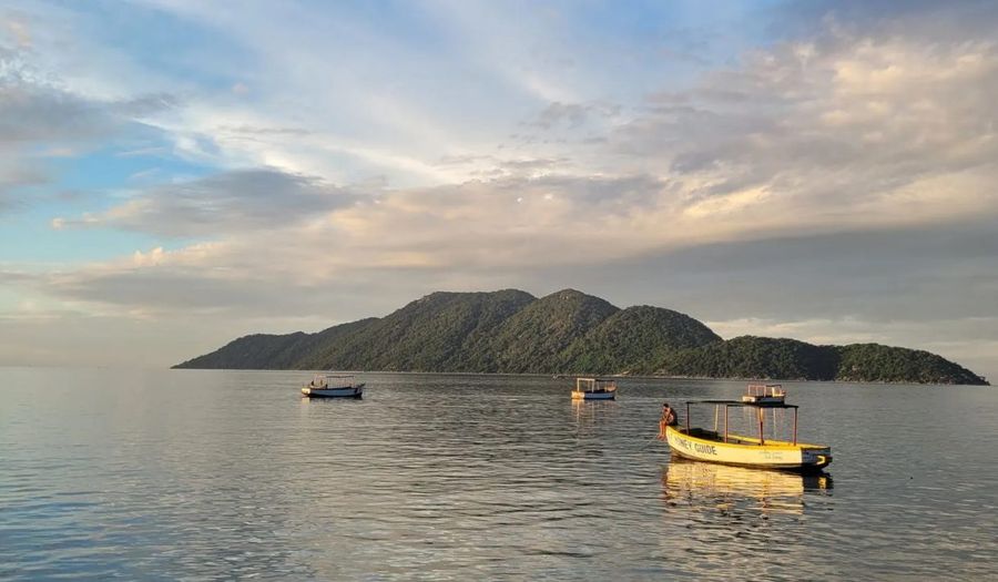
Cape Maclear is a lakeside village on the shores of Lake Malawi whose beach experience is specifically different from every other destination on this list in one fundamental way: the water is fresh. Lake Malawi, one of Africa’s Great Lakes and the ninth-largest freshwater lake in the world by area, gives Cape Maclear its beach setting, and the lake’s clarity, warm temperature, and specific fish population give the swimming and snorkeling program a character specific to the freshwater tropical lake environment. The cichlid fish species that inhabit Lake Malawi’s shallows, numbering over 1,000 species and found nowhere else on earth, give the snorkeling at Cape Maclear a fish encounter whose biological uniqueness is specific to this lake.
The affordability that Cape Maclear offers relative to the Indian Ocean island and coastal beach destinations gives it a specific demographic appeal: the guesthouse accommodation, the beach bars, the kayak and snorkel rentals, and the boat trips to the lake’s more remote shores can be assembled at a daily cost that the Seychelles or Mozambique island resorts cannot approach. The village’s specific social atmosphere, relaxed and genuinely welcoming, gives the visit the low-key pleasure that the high-end beach resorts sometimes sacrifice to their service standard.
The Lake Malawi National Park, whose boundaries include the Cape Maclear area, holds UNESCO World Heritage status as the first freshwater protected area in the world, and the park’s management provides the lake’s wildlife with protection, resulting in the cichlid fish diversity that makes snorkeling unique and valuable. Access to Cape Maclear via Lilongwe or Blantyre airport, and a four-hour drive, gives the destination its most honest logistical parameters: it is remote, the drive is long, and the reward is proportional. The boat trips to Mumbo Island and the lake’s more remote shores give the Cape Maclear visit a water-based exploration program that extends beyond the beach into the lake’s island geography, and the overnight camping on Mumbo’s boulder-strewn shore gives the adventurous traveler one of the most specifically remote beach camping experiences available in East Africa.
Omoniyi David / Unsplash
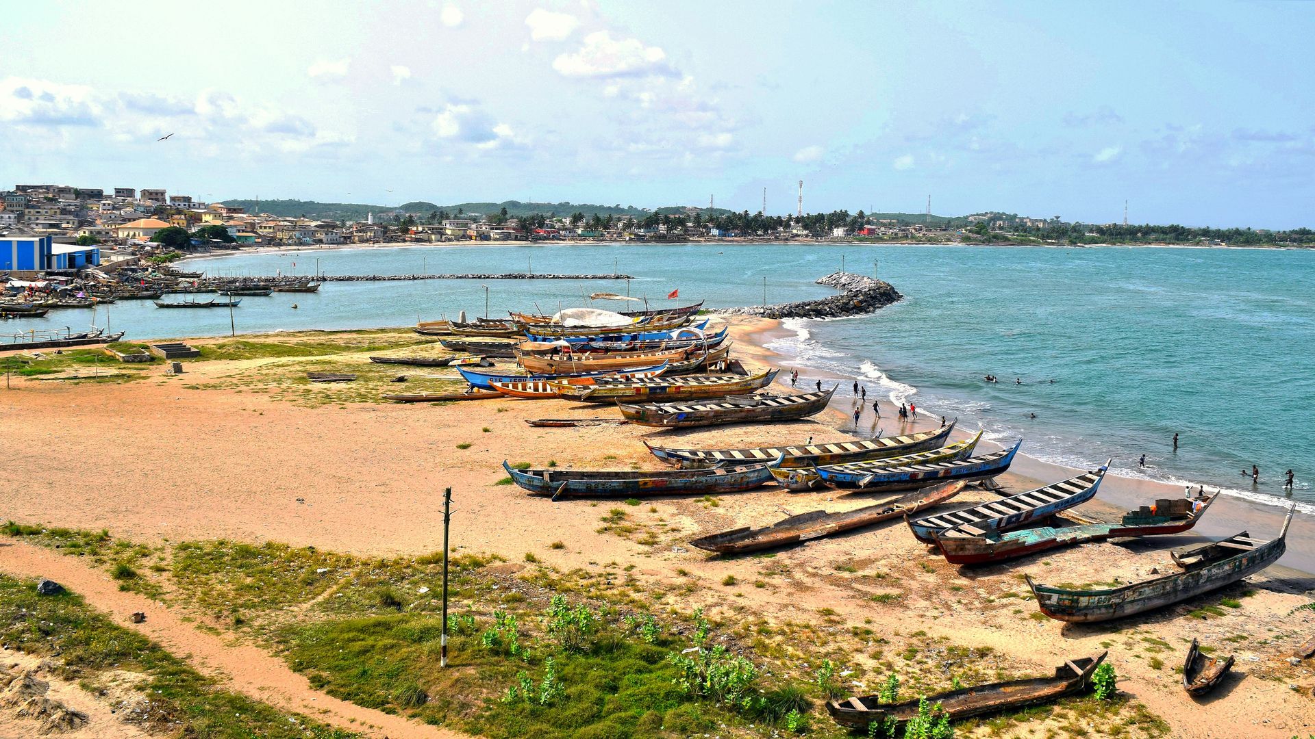
Elmina in Ghana’s Central Region gives the beach visit its most historically weighted dimension on this list: the town is home to Elmina Castle, built by Portuguese colonizers in 1482 and recognized as the oldest European building in sub-Saharan Africa, and the facility served for centuries as one of the primary holding points for enslaved Africans before the transatlantic voyage. The castle’s dungeons, the courtyard where enslaved men and women were separated and assessed, and the Door of No Return through which the enslaved were led to the waiting ships give the visit a confrontation with the Atlantic coast’s history that transforms the subsequent view of the ocean.
The Cape Coast Castle Museum, 20 minutes by road from Elmina, gives the historical program its most comprehensive interpretation: the castle’s exhibitions on the transatlantic slave trade, the specific routes from the interior of the continent to the coast, and the global consequences of the trade give the visitor a contextual framework for understanding what the castle buildings contain and what the ocean beyond them witnessed. The museum does not soften the historical record, which gives the visit its specific value and its moral seriousness.
Ghana’s Beyond the Return initiative, launched in 2020 around the 400th anniversary of the first enslaved Africans’ arrival in Virginia, gives the Elmina visit a contemporary dimension alongside the historical: the initiative’s invitation to people of African descent to return, visit, and reconnect with the continent of their ancestors’ origins gives the heritage tourism program at Elmina a living purpose specific to the location’s history. The beach at Elmina, beautiful and quiet beneath the castle walls, gives the visit its most quietly powerful final image. The fishing community that continues to work from the same harbor where the slave ships once anchored gives the present-day Elmina a living continuity that the castle’s tourism function exists alongside, not instead of, and the interaction between the two gives the visitor a more complete picture of what this place has been and continues to be.
