From a beach bought by 40,000 Kiwis to a stretch of volcanic black sand where The Piano was filmed, New Zealand's best beaches
Credit: Nelson Tasman Official Site
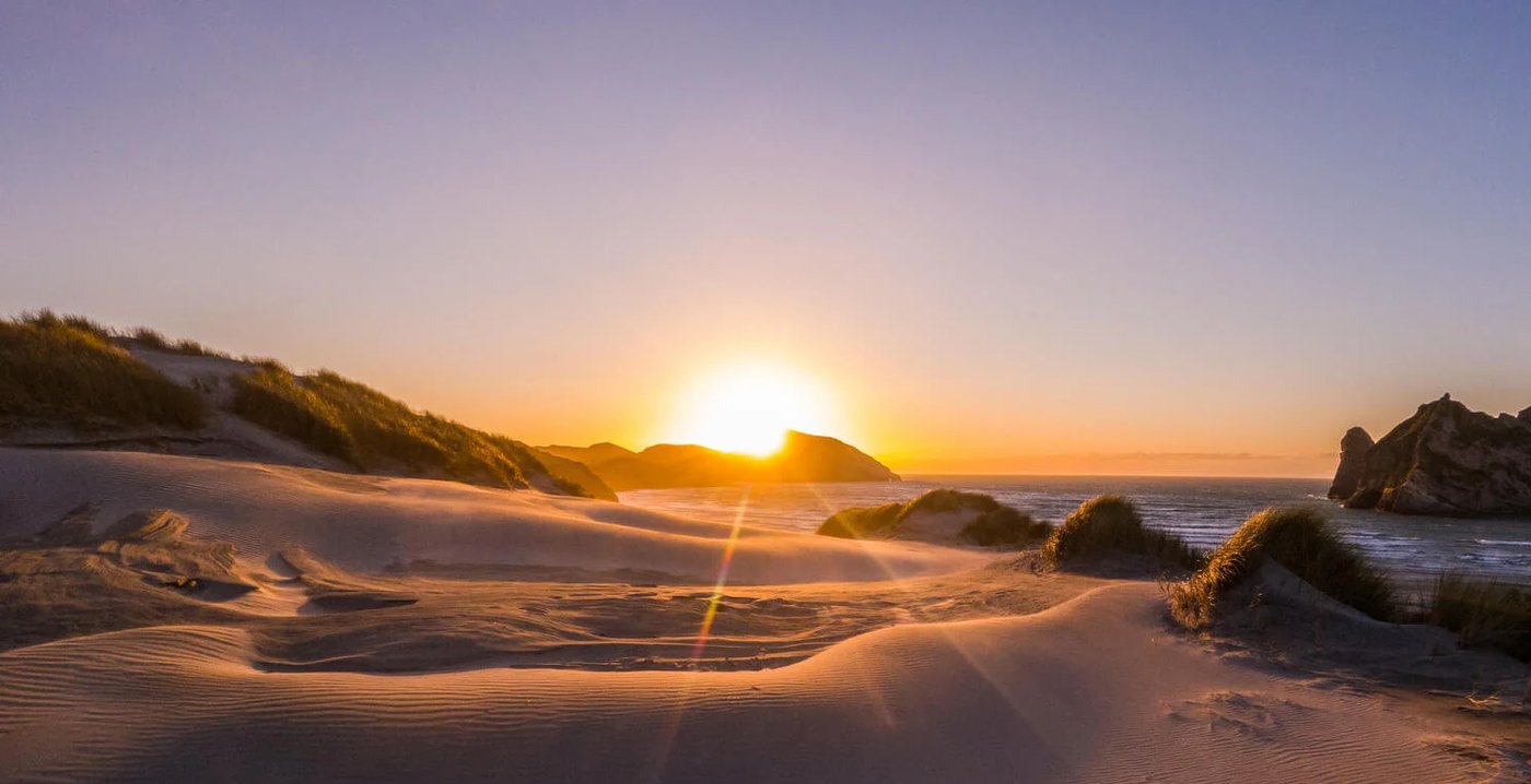
New Zealand’s coastline extends across two main islands separated by the Cook Strait, and the beaches that line those islands reflect the full range of what ocean environments can produce. The North Island’s beaches tend toward warmer water and more accessible conditions, with surf beaches on the west coast and sheltered harbors and coves on the east. The South Island’s west coast is wilder and wetter, shaped by the Southern Alps and the Tasman Sea, while the east coast runs from the alpine landscapes of Otago north to the top of the island and the national parks that line it. The seasonal calendar works differently here than in the Northern Hemisphere: summer runs December through February, but the shoulder seasons — autumn from March through May and spring from September through November — often deliver beach-quality weather across much of the country.
The beaches here span both islands and showcase the variety New Zealand’s geography offers. Several are remote enough to require planning: Awaroa Beach in Abel Tasman National Park is accessible only by boat or multi-day hike, and Rarawa Beach is a five-hour drive from Auckland. Others are within an hour of major cities and can be done as day trips. Together, they cover the range from surf beaches to geothermal sand, from white quartz shores to black volcanic sand, and from geological curiosities to UNESCO-recognized natural environments.
These 10 beaches come from Travel + Leisure’s selection of the best beaches in New Zealand, representing both the North and South Islands across a range of beach types from geothermal sand to volcanic black sand, and ancient spherical boulders to quartz-white Far North shores where quartz purity makes sunglasses essential equipment for comfortable viewing of the quartz-white shore in direct New Zealand coastal sunlight.
Credit: Nelson Tasman Official Site
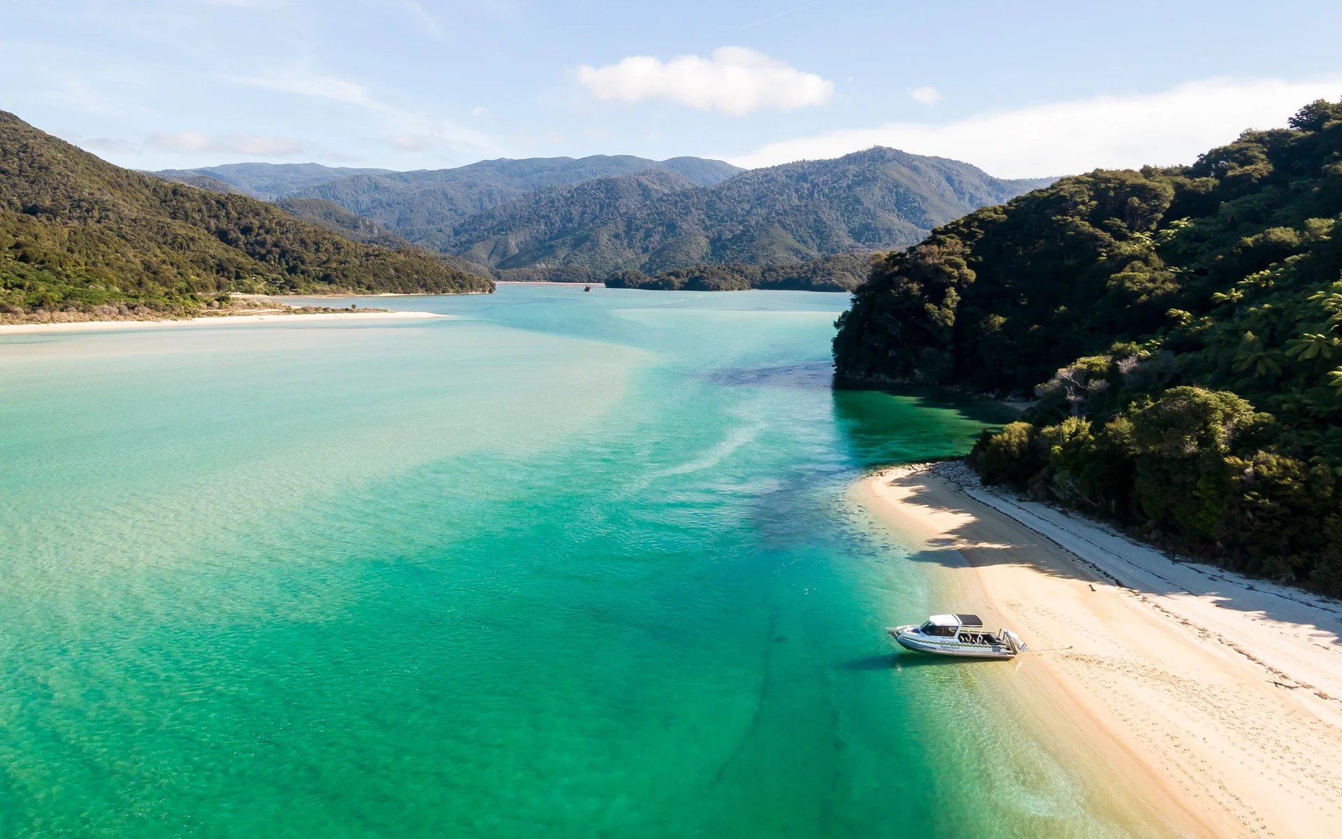
Awaroa Beach in Abel Tasman National Park is located at the top of the South Island, along Tasman Bay, known in te reo Māori as Te Tai-o-Aorere. The beach itself is a long strip of golden sand fringed by turquoise water and backed by the native bush that covers much of the national park. Its conservation story is as notable as its landscape: in 2016, nearly 40,000 New Zealanders contributed to a crowdfunding campaign to purchase the beach from a private owner for more than two million dollars, and donated it to New Zealand’s Department of Conservation. The collective purchase made national news and highlighted the cultural significance of coastal access in New Zealand.
Access requires some planning. A boat ride from Kaiteriteri takes roughly 90 minutes and deposits visitors directly onto the sand. Alternatively, the Abel Tasman Coast Track connects Awaroa to other sections of the national park on foot: the segment from Totaranui Beach covers 4.5 miles, while the approach from Bark Bay adds up to six miles. Bark Bay itself is not road-accessible, so hikers starting from that end need to book a shuttle boat to Medlands Beach, where the Bark Bay segment begins.
On the beach, kayaking and paddleboarding in the crystal-clear water make use of the sheltered bay conditions. The Abel Tasman Coast Track is one of New Zealand’s nine Great Walks, which means the infrastructure along the route — huts, campsites, and boat connections — is well maintained and booked well in advance during the peak summer season. Visitors who plan shoulder-season travel find the same landscape, with significantly fewer people and similar swimming conditions. The full Abel Tasman Coast Track spans the length of the park and connects Awaroa to a series of other beaches and coves, making it possible to spend multiple days walking between swimming stops in one of the most comprehensively rewarding national park coastal environments in New Zealand.
Credit: Nelson Tasman Official Site
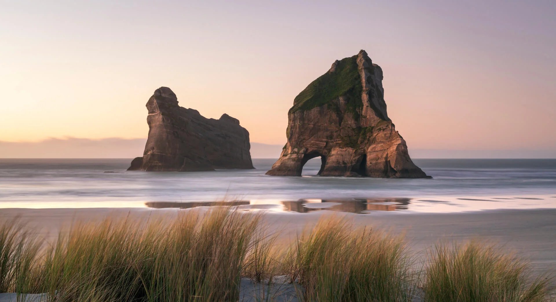
Wharariki Beach sits at the northwesternmost point of the South Island, accessed by a 20-minute walking track from the end of Wharariki Road. The walk crosses farmland and low dunes before opening onto a beach defined by its Archway Islands: three large rocks shaped like natural arches that emerge from the surf and provide the photographic landmark most visitors come to see. The arches vary in scale and alignment with tidal position and light, giving the beach a different visual character at different times of day.
New Zealand fur seals use the shore and rocks as resting areas, and encounters with the animals are reliably available without the artificial staging of a managed wildlife experience. The dunes behind the beach provide additional exploration terrain, and sea caves accessible at low tide add another dimension to the visit. Horseback riding along the beach is available through local operators, offering an unusual way to experience the coastal landscape.
Low tide is the recommended time to visit for the best exposure of the rock formations and sea caves. The beach is genuinely remote, which means it retains a quality of isolation that more accessible South Island beaches have lost to visitor volume. The Archway Islands, photographed from every angle and in every light condition, consistently reward the walk in from the road. The 20-minute walk from Wharariki Road ends at a wire gate before the final dune crossing, beyond which the beach opens up fully. Visitors who time the walk for late-afternoon light find the arches and seals illuminated in a way midday visits cannot replicate, and the north-facing orientation means the beach holds the sun well into the evening in summer. The seals on the rocks at Wharariki are not habituated to human contact in the way that managed wildlife experiences produce, which gives the encounters a naturalness that guided marine wildlife tours cannot replicate.
Cole Robinson / Unsplash
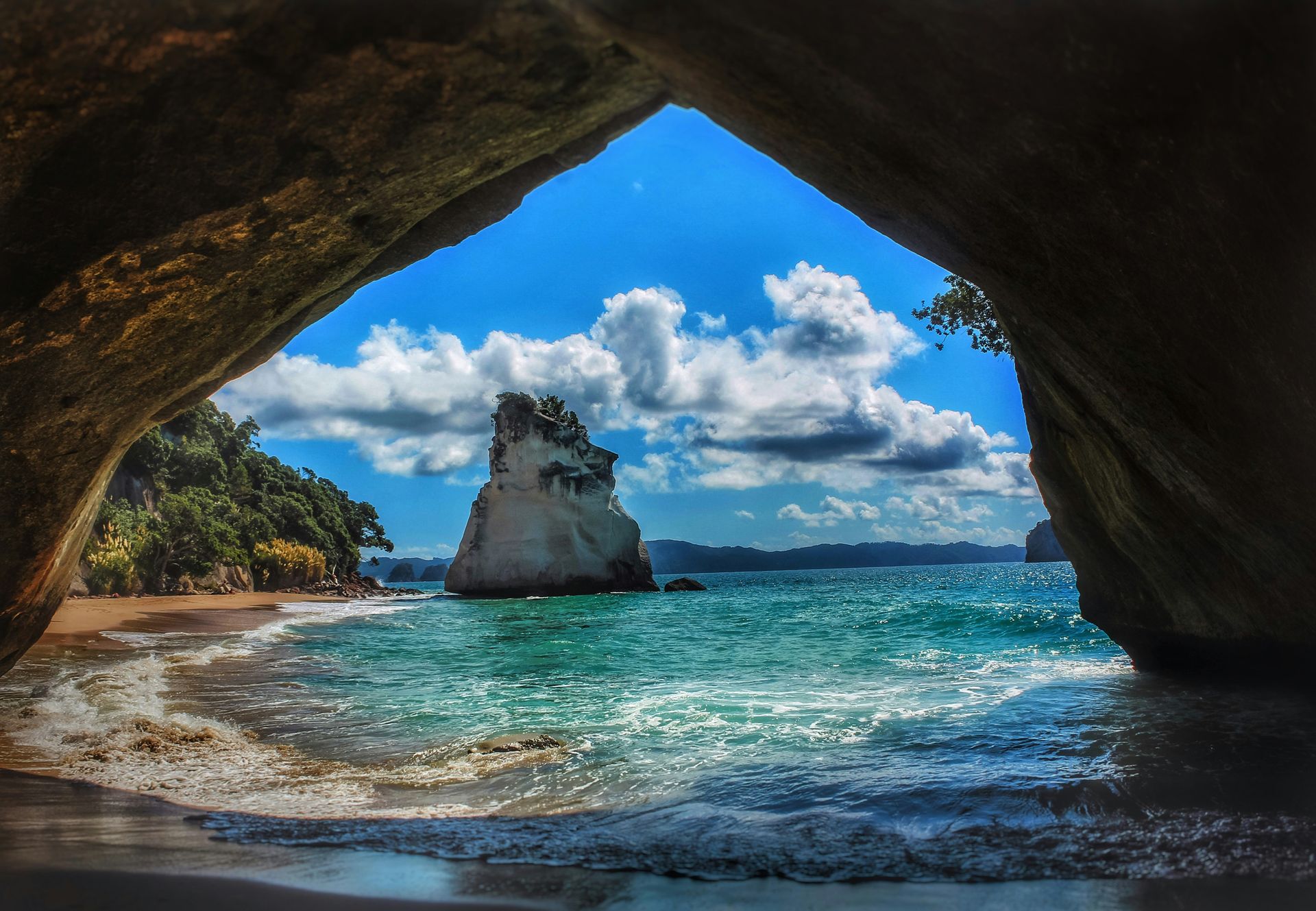
Cathedral Cove on the Coromandel Peninsula lies on what the Māori language calls Te Tara-o-Te-Ika-a-Māui, or the Spine of the Fish of the North Island, a description that captures both the peninsula's geographic character and its cultural significance. Reaching the cove requires a clifftop trail from the northern end of Hahei Beach, a one-hour walk along a path that delivers increasingly dramatic coastal views before descending to the beach. The destination is an arched cavern large enough to walk through, and the name Cathedral Cove derives from the cathedral-like proportions of this natural arch.
The arch connects the main beach to two secluded coves on the other side, accessible only by passing through the cavern or arriving by water. Snorkeling in the blue-green water is productive, with the rocky reef environment supporting marine life visible from the surface in calm conditions. Two tree-covered rock formations rise from the water near the shore, and fragrant pohutukawa trees — the New Zealand Christmas tree, with its distinctive red blossoms — line the beach and provide shade. Boat trips from Hahei offer offshore views of the white cliffs and the arch, giving the site’s scale a perspective that the beach-level view cannot.
Cathedral Cove sees high visitor volume during the peak summer months of December through February, leading to access management measures, including restrictions on private vehicle access to the trailhead during busy periods. Water taxi services from Hahei operate as an alternative arrival route. Visiting in October or March gives access to the same landscape with considerably less competition for space on the sand. The pohutukawa trees along the Cathedral Cove beach provide shade at the margins of the sand when the midday sun is most intense, giving the beach a practical quality that exposed coves lack during peak summer hours, making Cathedral Cove a practical all-day destination.
Harley Lin / Unsplash
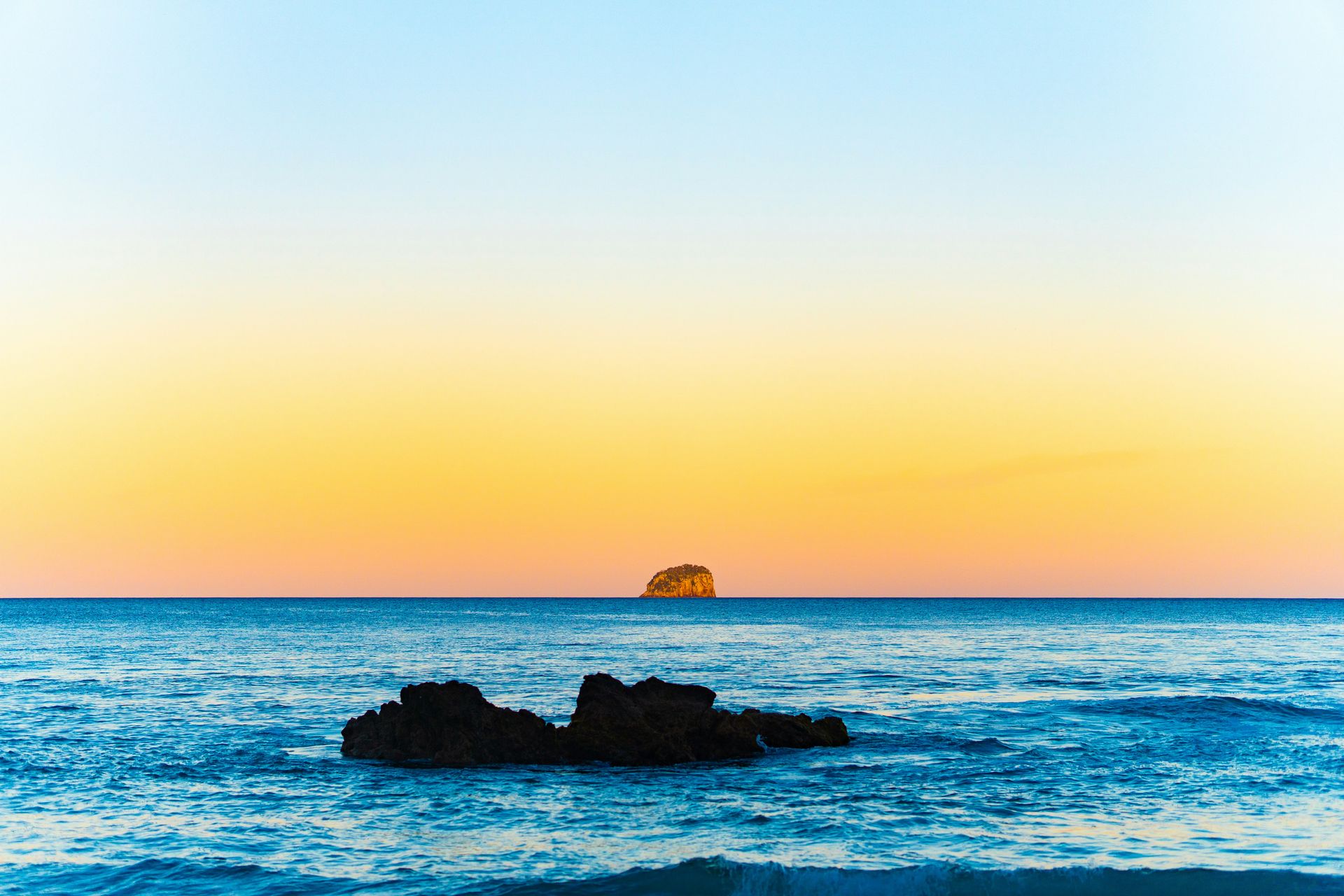
Hot Water Beach on the Coromandel Peninsula, about a 10-minute drive from Cathedral Cove, sits above a geothermal system that allows visitors to dig their own hot springs in the sand. The hot water access window is specific: within two hours either side of low tide, the geothermal upwelling is accessible at the southern end of the beach, near the rocks. Visitors bring shovels — several of the nearby cafes rent them — and dig down until hot water fills the hole.
The springs can reach up to 147 degrees Fahrenheit, requiring careful management to avoid scalding. The standard approach is to dig a hole that mixes the rising hot water with cooler seawater flowing in from the sides, producing a comfortable soaking temperature. When the hole gets too hot, stepping briefly into the ocean resets the experience. The beach also carries standard surf conditions on either side of the hot spring zone, and watching surfers work the waves from a personal hot spring is a specific pleasure that few beaches anywhere in the world can replicate.
The geothermal system beneath Hot Water Beach results from volcanic activity in the broader Coromandel region, and the same geology that heats the beach sand is responsible for the thermal springs and volcanic landscape that characterize the wider Waikato and Bay of Plenty regions to the south. Ocean swimming, surfing spectacle, and fully accessible geothermal soaking together make Hot Water Beach one of the most genuinely unusual coastal experiences in New Zealand. Hot Water Beach also draws day visitors from Whitianga, the main service town for the northern Coromandel, making it possible to combine the beach with Cathedral Cove and other peninsula highlights in a single day from a Whitianga base. The wider Coromandel Peninsula rewards a multi-day visit, with the mountain interior and the east coast beaches providing context beyond the geothermal and cove beaches.
Ravish Maqsood / Unsplash
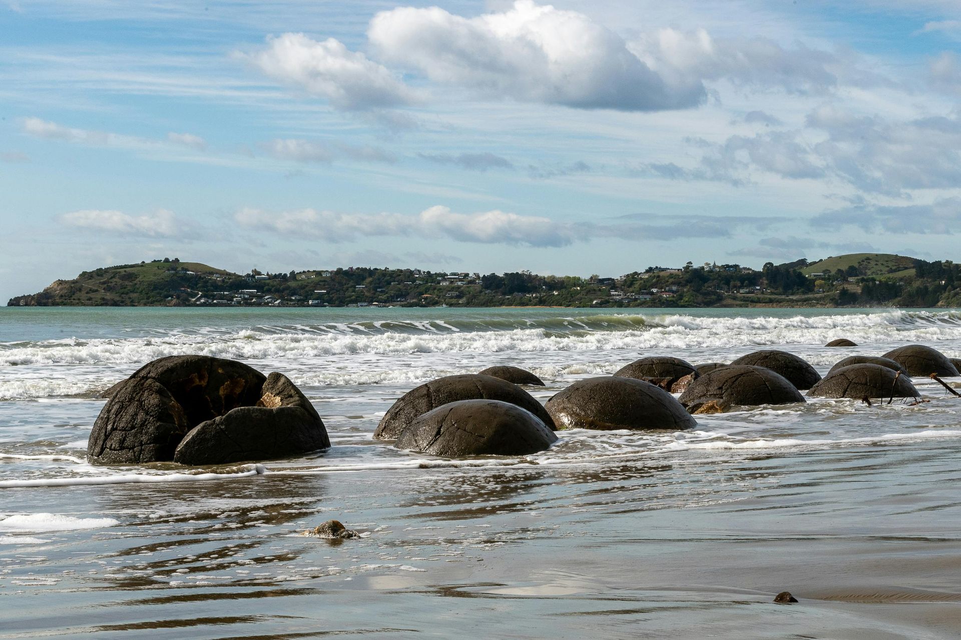
Koekohe Beach sits about an hour’s drive north of Dunedin on the Otago coast of the South Island, and its defining feature is a collection of large spherical boulders that formed approximately 65 million years ago through a geological process that unfolded over four million years. Calcite built up gradually around organic cores on the seafloor, and the compaction and cementation process produced the near-perfect spheres now exposed on the beach. The striking cracks visible on many boulders formed as calcite hardened and contracted over geological time.
The Māori people of the region held a different understanding of the boulders’ origin: they believed the spheres were gourds and food baskets that washed ashore from an ancient canoe wreck, a narrative that gave the landscape a human and cultural dimension alongside its geological significance. The two explanations coexist at Koekohe, with the boulders serving as subjects for both scientific interpretation and traditional storytelling.
The Otago coast beyond Koekohe rewards extended exploration. The nearby fishing village of Moeraki provides a base for visitors who want more than a single afternoon at the boulders. The coast as a whole supports penguin and fur seal colonies at several points, making it productive for wildlife viewing on a scale that Koekohe Beach alone cannot provide. The boulders are best photographed at low tide, when they are fully exposed on the sand, not surrounded by surf, and at golden hour, when the angled light emphasizes their surface texture and the cracks that run across their faces. The Otago coast south of Koekohe also rewards driving: the Moeraki to Oamaru stretch passes through farmland and limestone country, with sea views that give the road its own character, from the boulder destination at Koekohe back toward Dunedin. The city of Dunedin, with its Victorian architecture and strong café culture, provides a full day’s urban complement to the Otago coast's coastal geology.
Credit: New Zealand Department of Conservation
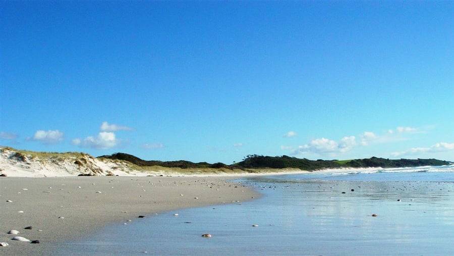
Rarawa Beach in Northland is about five hours north of Auckland by car, located within the Wharekāpu or Paxton Point Conservation Area. The beach is exceptional for a specific reason: its sand consists of quartz so pure that it produces a whiteness most beach visitors have not encountered before. Sunglasses are genuinely necessary on a clear day, as the quartz reflects light at an intensity that makes extended viewing uncomfortable without eye protection. The shore stays uncrowded even in summer, a rarity for a beach with this level of visual quality.
A lagoon forms at high tide, providing calm swimming conditions in addition to the ocean beach access. New Zealand dotterels and variable oystercatchers nest in the dunes, adding a birdwatching dimension to the beach experience. A campsite on a nearby riverbank allows overnight stays for visitors who want more than a day trip. The sandboarding at Te Paki Sand Dunes, accessible around the peninsula from Rarawa, provides an adjacent activity for visitors with energy left after the beach. Cape Reinga lighthouse, at the northernmost tip of the North Island, is an hour’s drive away and worth including in a Northland itinerary that brings a visitor this far north.
The remoteness of Rarawa Beach is part of its value. The five-hour drive from Auckland filters out casual day-trippers, and the conservation area designation protects the sand quality and nesting habitat in ways that more heavily visited beaches cannot. The drive north from Rarawa toward Cape Reinga passes through some of the most sparsely populated terrain on the North Island, and the lighthouse at the cape provides a destination that anchors the long drive in both directions from Auckland. The Far North region around Te Kao and Houhora also offers beaches and harbors worth stopping at between Rarawa and Cape Reinga, adding depth and reasons to stop to the northward journey from Auckland.
Bill Fairs / Unsplash
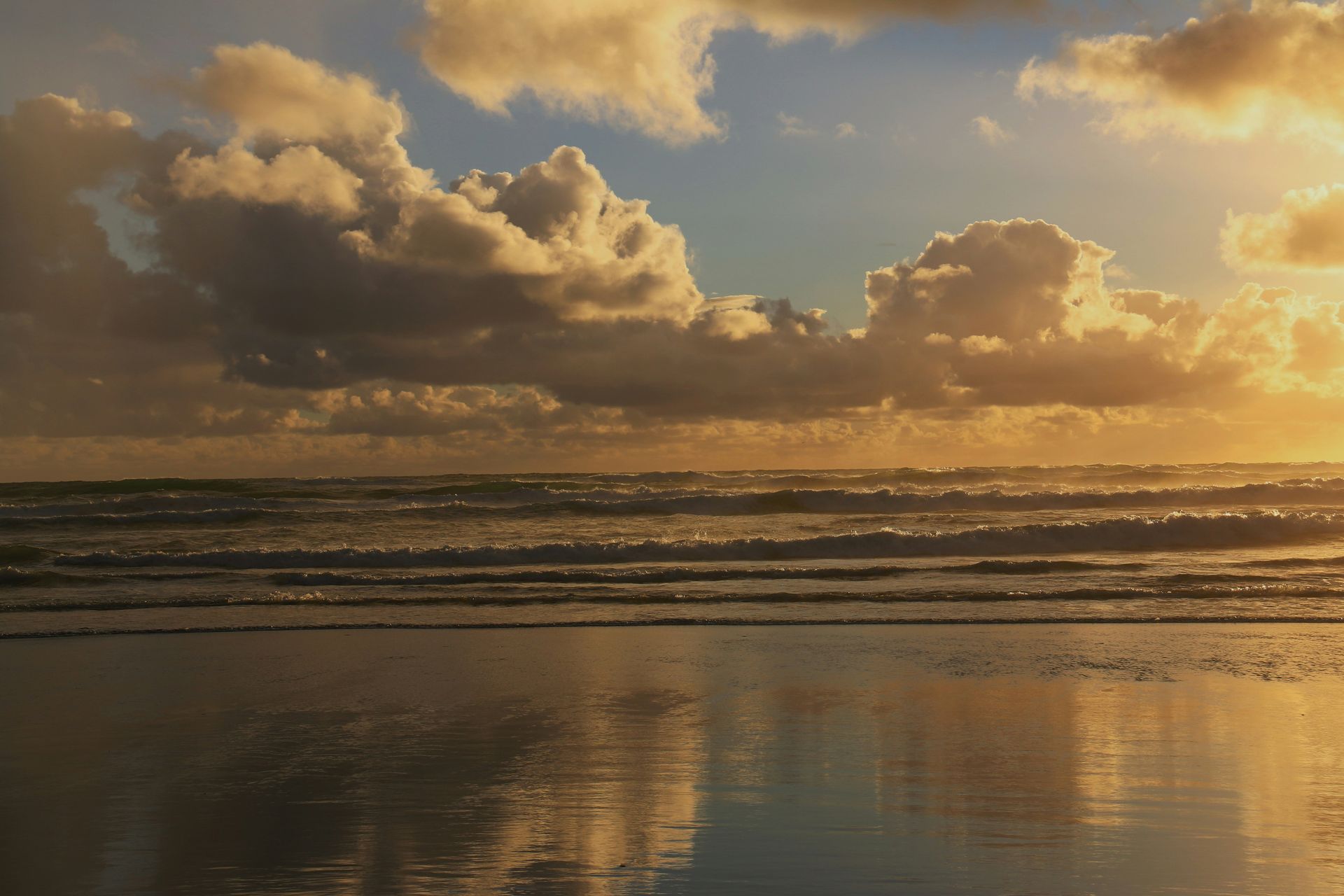
Karekare Beach is about an hour’s drive west of Auckland, part of the Waitākere Ranges Regional Park on the wild western coast of the North Island. The beach’s sand is black, produced by the volcanic geology of the Waitākere Ranges, and its soft texture is notably different from the harder, coarser black sand of other west coast beaches. The waves are sizable, making Karekare a favored surf spot and drawing board riders from Auckland year-round. Sunbathers share the beach with athletes, and the black sand absorbs heat well, making it an unusually warm surface on sunny days.
The beach’s cinematic history gives it an additional cultural layer. Jane Campion filmed much of The Piano on the Karekare sand in 1992, and the beach has since appeared in other film and television productions, including Xena: Warrior Princess. Dramatic landscape and accessible-from-Auckland location together make Karekare a natural choice for productions that need a visually striking wild beach within reach of the city’s infrastructure.
After a day on the sand, Kitekite Falls rewards the walk inland. A two-mile trail through native coastal forest leads to a waterfall and swimming hole that offer a cooler, shaded alternative to the beach. The Waitākere Ranges as a whole contain an extensive network of walking tracks through old-growth kauri and tawa forest, and Karekare connects to that network, making it a starting point for multi-hour explorations of the regional park beyond the beach itself. The Waitākere Ranges Regional Park also includes Piha Beach, another renowned black-sand surf beach a short drive north, which gives visitors to Karekare a second option within the same park for exploring the wild west Auckland coast. Mercer Bay Loop Walk, starting from the Karekare valley, offers a clifftop perspective on the coast that the beach itself cannot, and takes about two hours at a relaxed pace.
Grace Caadiang / Unsplash
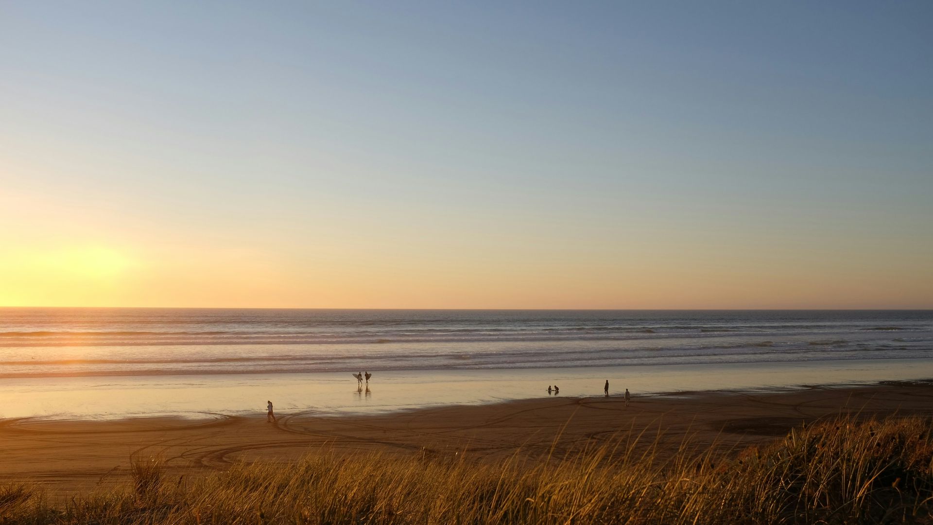
Ninety Mile Beach runs along the western side of Northland’s Aupouri Peninsula from Ahipara in the south to Scott Point in the north. Despite the name, the beach is only 55 miles long. The discrepancy traces to early horseback riders who estimated the journey at 30 miles per day based on a normal riding pace, without accounting for the slower pace horses make on soft sand. The name has persisted regardless of the cartographic correction.
The beach’s scale is still genuinely impressive: 55 miles of continuous sand, wide enough to drive on in places (and formally designated as a highway at various points in New Zealand’s transport history), with the Tasman Sea on the western horizon. Visitors cite sunsets from this west-facing shore as among the best in New Zealand, combining the low-angle Pacific light with the atmospheric effects produced by the open-ocean horizon lines. Left-hand surf breaks attract experienced surfers who come specifically for the wave type, which requires a long sandy bottom to develop its characteristic shape.
The beach’s length creates a specific mode of experience: driving along it, or walking sections of it, produces a sense of temporal suspension that shorter beaches do not. The sameness of the horizon and the regularity of the surf create a meditative quality. For visitors making the journey to the Far North of New Zealand, Ninety Mile Beach connects the practical itinerary between Kaitaia and Cape Reinga with a landscape experience that gives the drive its own reason for being. The Ahipara end of the beach, where the sand begins, also has a small settlement with cafes and accommodation, providing a practical base for exploring the length of the beach over multiple tidal cycles and tracking the sunset from different positions along the long Ninety Mile sand strip as the evening light drops toward the Tasman Sea horizon from the west and the surf still breaking on the beach below.
Credit: New Zealand Department of Conservation
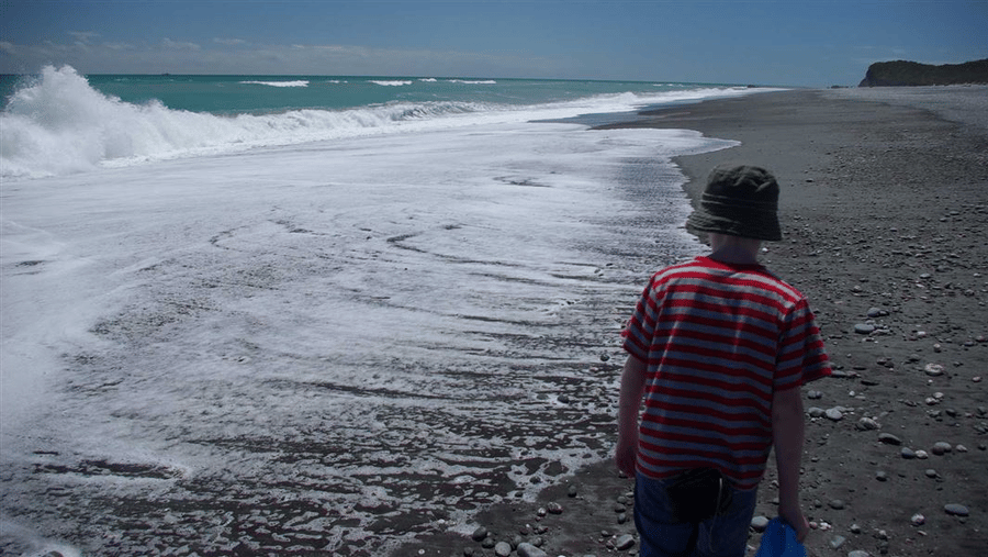
Gillespies Beach is on the West Coast of the South Island, reached by a 30-minute drive along Cook Flat Road from Fox Glacier, the township at the base of the Southern Alps. The beach is known among visitors for three convergent qualities: sunsets over the Tasman Sea, fur seals on the nearby rocks, and the view eastward to Aoraki/Mount Cook, the tallest mountain in New Zealand, visible in clear conditions beyond the beach and the intervening Southern Alps.
A warm, tannin-stained lagoon at the beach end of Cook Flat Road provides sheltered, comfortable swimming regardless of conditions on the open beach. The tannin staining comes from the leaching of organic material through the wetland and coastal forest that line the road, giving the water a tea-colored clarity distinct from the blue-green of the more photographed New Zealand beaches. A former gold-mining settlement occupied this coast, and a miner’s cemetery within the beach area provides a historical layer to a landscape now better known for its natural qualities.
A hike to nearby Galway Beach reaches a fur seal colony where the animals occupy the rocks beside the Tasman Sea in numbers large enough to constitute a genuine wildlife spectacle. The West Coast of the South Island receives relatively few visitors compared to the east coast and the North Island, and Gillespies Beach benefits from that lower visitor pressure in preserving the quality of the sunset, seal, and mountain experience that the three-qualities reputation is built on. The drive between Fox Glacier township and Gillespies Beach also passes through regenerating West Coast bush and crosses the coastal wetlands that give the Tasman Sea shoreline in this section its distinctive character of wetland, driftwood, and coastal forest meeting the remote Tasman Sea in one of the least-visited and most atmospherically rewarding coastal settings on the South Island’s remote west coast beyond the glaciers.
Credit: New Zealand Department of Conservation
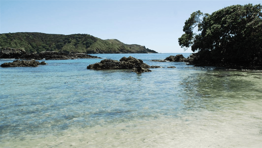
Maitai Bay on the Karikari Peninsula in Northland has clear, calm water, soft white sand, and a sheltered geometry that makes it suitable for swimming across a wider range of conditions than the exposed beaches elsewhere on the Northland coast. The pohutukawa trees that line the shore — the New Zealand Christmas tree, known for its vivid red flowers that bloom in December — provide shade and fragrance to the campsite directly adjacent to the water, with a short path connecting the tents to the swimming beach.
A short drive from Maitai Bay reaches Carrington Estate, which holds the designation of New Zealand’s northernmost winery. The estate pours Syrah alongside coastal views, offering a specific afternoon activity that extends the beach visit into a wine-tasting context in a setting most wineries do not offer. The northernmost winery designation gives Carrington a specificity that the broader Northland wine region, still developing its identity relative to Marlborough and Hawke’s Bay, benefits from.
The Karikari Peninsula as a whole is a destination for visitors willing to drive the distance from Auckland that its northern position requires. In addition to Maitai Bay and Carrington Estate, the peninsula has several other beaches with varying orientations and conditions, allowing you to spend multiple days exploring different aspects of the same coastal landmass. Sunrise swims from the campsite, in water clear enough to see the sandy bottom, providing a specific daily reward for overnight visitors that day-trippers cannot access from Auckland in a single round trip. The Karikari Peninsula also holds Matai Bay on the eastern side, a second beach with different conditions from Maitai Bay, giving the peninsula enough variety to justify spending several nights in the area to cover the full range of what the Karikari Peninsula offers at its various beaches, headlands, and wineries across its compact but varied geography and shoreline.
