
10 iconic national parks every traveler should visit
These protected natural landscapes showcase dramatic geological formations, ancient ecosystems, and pristine wilderness that highlight global biodiversity conservation efforts
Rakshith Hatwar / Unsplash
Selecting the most visually compelling national parks requires looking beyond simple aesthetic appreciation to evaluate unique topography, ecological rarity, and scale. The world's most dramatic parks are defined by powerful natural forces—tectonic uplift, glacial carving, volcanic activity, and river erosion—that have shaped the Earth over millions of years. From the jagged granite spires of Patagonia to the turquoise travertine terraces of central China, these landscapes offer stark visual contrasts that illustrate the sheer diversity of terrestrial ecosystems.
Moreover, these protected wilderness areas play a critical role in local economies and global environmental policy. Managing high-volume tourism alongside delicate habitat conservation presents an ongoing challenge for park authorities worldwide. Infrastructure developments, trail maintenance, and visitor caps are frequently adjusted to mitigate human impact on fragile alpine tundra, ancient rainforests, and vulnerable wildlife populations. Examining these ten exceptional national parks reveals the biological wealth of our planet and highlights the ongoing global effort required to preserve intact ecosystems for future generations.
Here are ten of the most remarkable protected landscapes across six continents.
Banff National Park, Canada
Jacky Huang / Unsplash
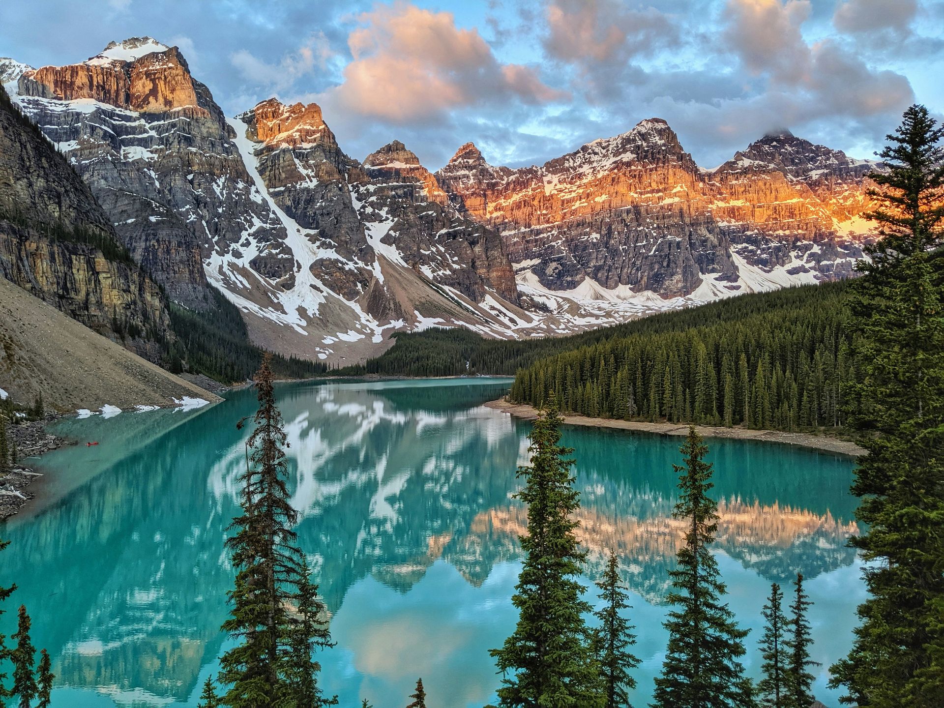
Established in 1885 in the Canadian Rockies of Alberta, Banff stands as Canada's oldest national park and a core component of the Canadian Rocky Mountain Parks UNESCO World Heritage site. Spanning 2,564 square miles of mountainous terrain, the park is characterized by massive valley glaciers, dense coniferous forests, and alpine lakes celebrated for their deep turquoise hues. These distinctive water colors result from glacial flour, fine silt particles suspended in glacial meltwater that refract light in the green and blue wavelengths. Lake Louise and Moraine Lake represent two of the park's primary hydrologic features, fed directly by the melting ice of the Victoria Glacier and surrounding icefields.
The park's topography was carved primarily during the last glacial period, when moving ice sheets eroded limestone and shale layers into dramatic horst and graben formations. Peaks like Mount Rundle and Castle Mountain exhibit classic sedimentary layering, showing millions of years of marine deposition uplifted by tectonic forces during the Laramide orogeny. Elevations within Banff range from 4,500 feet on the valley floors to over 11,800 feet at Mount Forbes, creating distinct ecological zones that support diverse flora and fauna.
At lower elevations, montane forests of Douglas fir and lodgepole pine give way to subalpine spruce and larch, eventually transitioning to fragile alpine tundra above the treeline. This varied terrain provides habitat for major mammalian species, including grizzly bears, timber wolves, elk, and bighorn sheep. Park management relies heavily on wildlife corridors and overpasses constructed across the Trans-Canada Highway to maintain habitat connectivity and prevent vehicle collisions. Banff serves as a global model for balancing high-volume eco-tourism with strict wilderness protection protocols.
Torres del Paine National Park, Chile
Alex Wolowiecki / Unsplash
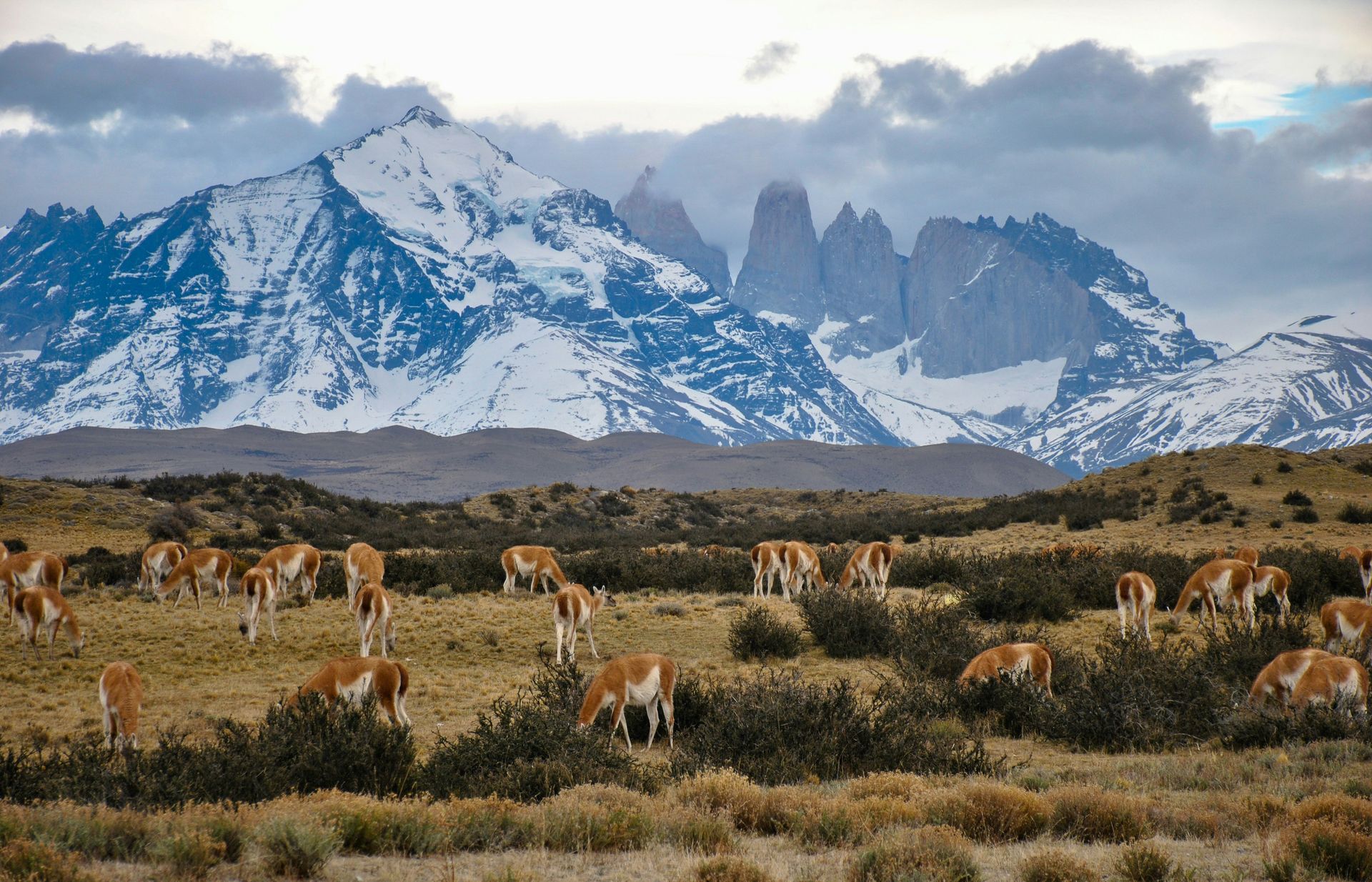
Located in southern Chilean Patagonia, Torres del Paine National Park encompasses over 700 square miles of mountain peaks, ice fields, glacial lakes, and windswept steppe. The centerpiece of the park is the Cordillera del Paine, an isolated mountain group rising abruptly from the Patagonian plain. The three distinctive granite towers, or Torres, reach heights over 8,000 feet above sea level and were formed through a combination of laccolithic magma intrusions and intense glacial erosion. The dark sedimentary rock capping the lighter granite spires offers a clear visual record of tectonic uplift and subsequent erosion over millions of years.
The park contains significant portions of the Southern Patagonian Ice Field, one of the largest non-polar ice masses on Earth. Glaciers such as Grey Glacier drop icebergs directly into cold, mineral-rich lakes like Lake Grey and Lake Pehoe. These bodies of water display varying shades of blue, gray, and milk-white due to different concentrations of suspended rock flour carried by glacial streams. Strong sub-Antarctic winds blow across the steppe almost constantly, shaping the growth of native lenga and nire forests that blanket the lower mountain slopes.
Torres del Paine is a critical sanctuary for Patagonian wildlife, functioning as a fully protected ecosystem for native species. Guanacos, wild relatives of the llama, graze in large herds across the open grasslands, serving as the primary prey source for the park's dense population of Andean pumas. The park also supports Andean condors, which utilize powerful thermal updrafts created by the sharp mountain topography to soar over the valleys. Strict hiking regulations on popular routes like the W Trek help minimize human impact on fragile soils and prevent forest fires in this remote sub-polar environment.
Fiordland National Park, New Zealand
Sam Ferrara / Unsplash
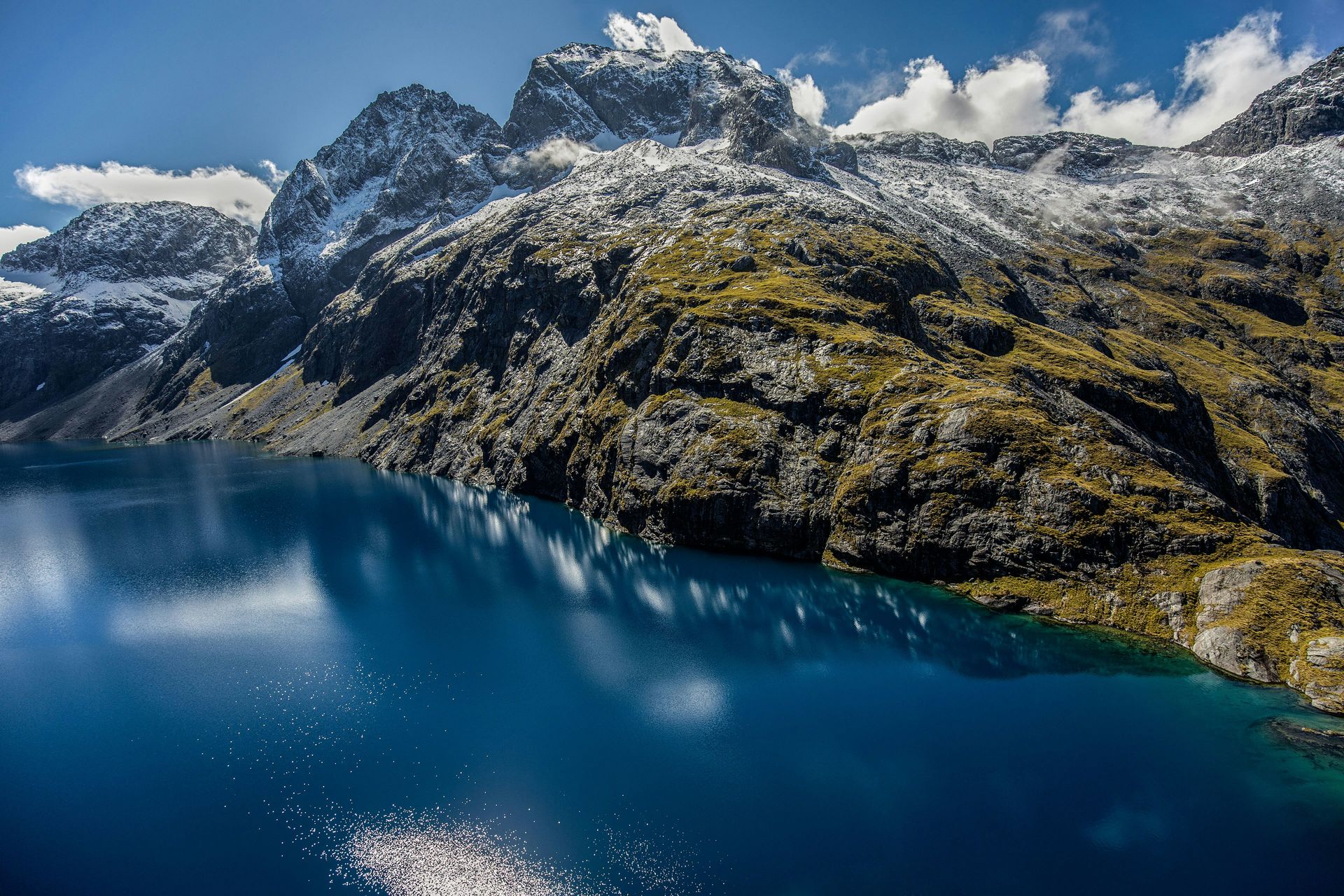
Occupying the southwestern corner of New Zealand's South Island, Fiordland National Park is the country's largest national park, covering over 4,600 square miles. The park forms a major part of the Te Wahipounamu UNESCO World Heritage area, recognized for its glaciated landforms and ancient temperate rainforests. The landscape features 14 sea fjords, known locally as sounds, carved into sheer granite sea cliffs during successive ice ages. Milford Sound and Doubtful Sound are the most prominent, where vertical rock faces rise more than 3,900 feet directly from deep ocean waters, adorned with temporary waterfalls during heavy rain events.
The climate in Fiordland is exceptionally wet, receiving between 200 and 300 inches of rainfall annually depending on elevation. This constant deluge feeds lush beech and podocarp rainforests that cling to steep mountain walls. A unique phenomenon known as a tannin stain occurs where freshwater runoff carrying organic compounds from the forest floor floats on top of the denser ocean saltwater in the fjords. This dark surface layer blocks sunlight, allowing deep-sea marine life, including black coral trees usually found hundreds of feet deep, to thrive at shallow depths near the surface.
Fiordland's extreme isolation has allowed ancient endemic species to survive in near-total protection. The park hosts rare flightless birds such as the takahe, once thought extinct until rediscoveries in the mid-20th century, and the nocturnal, critically endangered kakapo parrot. Introduced mammalian predators, like stoats and possums, pose the greatest ecological threat to these native species. Extensive trapping programs and predator-free island sanctuaries within the fjords are maintained by conservation authorities to ensure the survival of New Zealand's vulnerable avian fauna.
Jiuzhaigou National Park, China
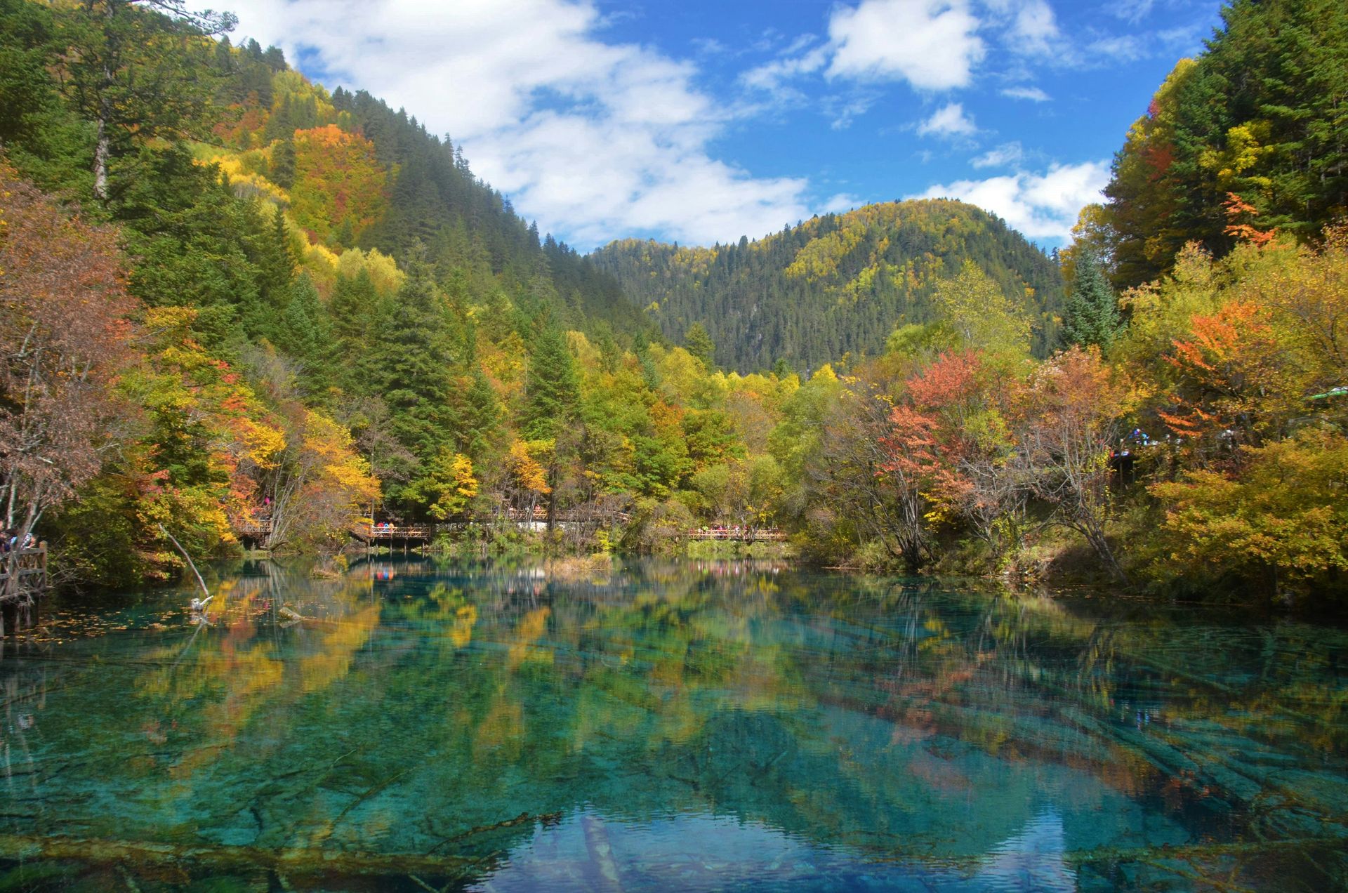
Say Wah Lee / Unsplash
Situated in the Min Mountains of northern Sichuan province, Jiuzhaigou National Park stretches across 280 square miles of steep valleys and karst mountain formations. Known as the Valley of Nine Villages in reference to the Tibetan settlements located along its length, the park lies on the edge of the Tibetan Plateau. The region is famous for its multi-tiered waterfalls, snow-capped peaks, and more than 100 high-altitude, multicolored lakes. These lakes were formed by ancient glacial activity and sealed over millennia by natural calcium carbonate travertine dikes.
The water in Jiuzhaigou's lakes is renowned for its clarity and vivid turquoise, emerald, and deep blue colors. High concentrations of dissolved calcium carbonate render the water so clear that submerged fallen trees and structural travertine formations are visible dozens of feet beneath the surface. Microscopic algae and aquatic vegetation, combined with varying lake depths and mineral deposits, alter the light reflection, creating dynamic visual shifts throughout the seasons. Five Flower Lake and Mirror Lake represent primary examples of these unique hydrologic environments.
Ranging in elevation from 6,500 to 14,800 feet, Jiuzhaigou encompasses broad leaf forests, mixed conifer stands, and alpine meadows. The dense bamboo understory provides vital habitat for endangered mammals, including the giant panda and the golden snub-nosed monkey, though sightings are rare due to the rugged terrain. Park management uses an extensive network of elevated wooden boardwalks and zero-emission shuttle buses to move millions of annual visitors through fragile travertine valleys, effectively preventing soil compaction and water contamination.
Serengeti National Park, Tanzania
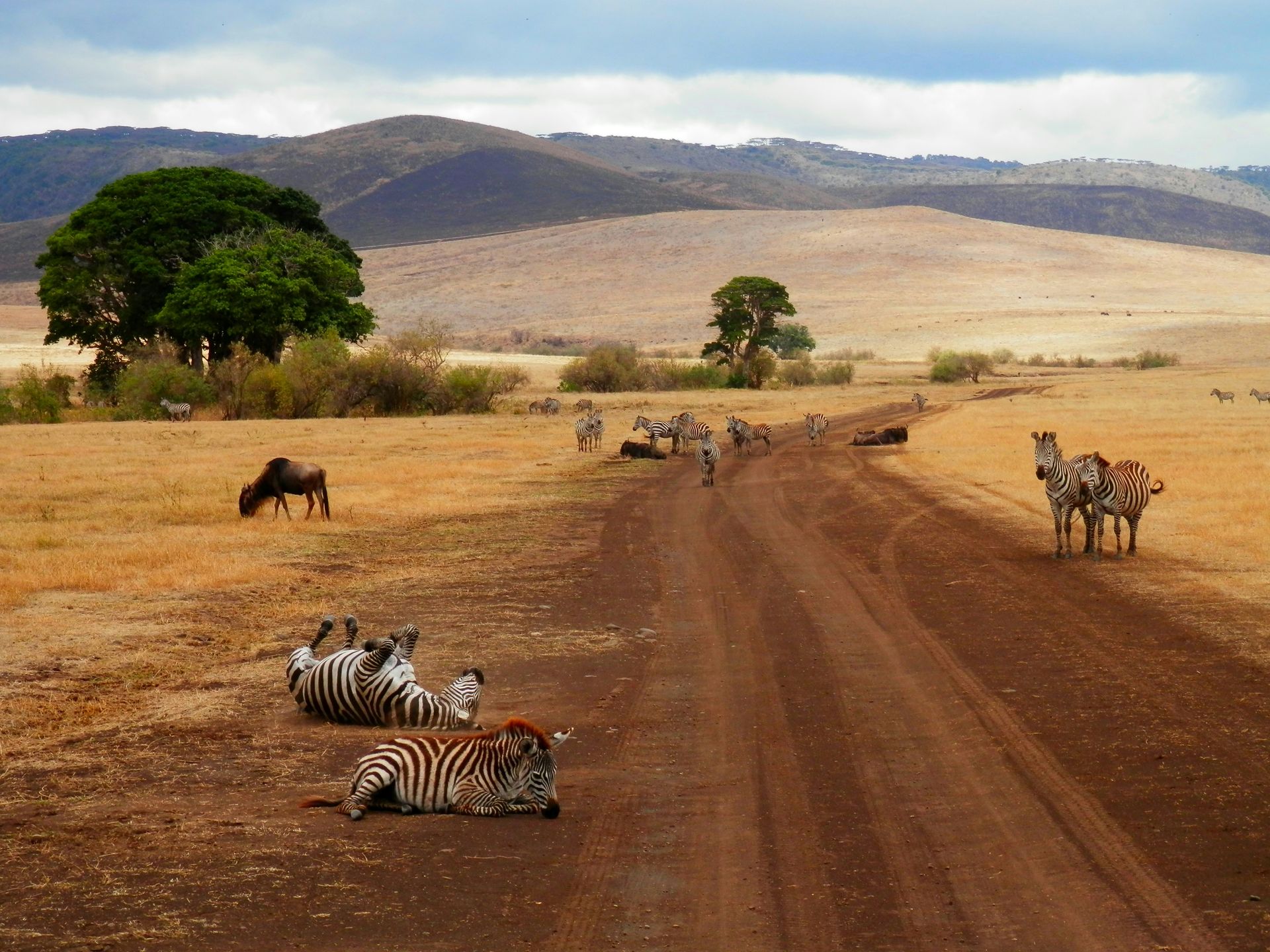
Chema Photo / Unsplash
Spanning nearly 5,700 square miles in northern Tanzania, Serengeti National Park encompasses one of the oldest and most complex savanna ecosystems on Earth. The park's name originates from the Maasai word siringet, meaning the place where the land runs on forever, describing the vast, treeless grassland plains that dominate the southern region. These plains sit atop thick layers of volcanic ash deposited millions of years ago by eruptions from nearby Rift Valley volcanoes, creating nutrient-rich soils that support dense, high-protein grasses ideal for large grazing mammals.
The Serengeti is world-famous for hosting the Great Migration, an annual circular movement of over 1.5 million wildebeest, 250,000 zebras, and hundreds of thousands of gazelles. Driven by rainfall patterns and the search for fresh pasture, this massive herd traverses the ecosystem between Tanzania and Kenya's Maasai Mara. Crossing treacherous rivers like the Mara and Grumeti, the animals face predation from Nile crocodiles and major land carnivores. This continuous movement fuels a complex food web that supports the highest concentration of large predators in Africa, including lions, leopards, cheetahs, and spotted hyenas.
Beyond the open grasslands, the park transitions into acacia woodlands, riverine forests, and isolated granite outcrops known as kopjes. Kopjes act as ecological islands, providing shade, freshwater pockets, and elevated vantage points for hunting predators. The park's climate is tropical and marked by distinct wet and dry seasons, which dictate animal distribution across the landscape. Anti-poaching patrols and community-based conservation initiatives are essential to maintaining the integrity of this contiguous ecosystem.
Yosemite National Park, United States
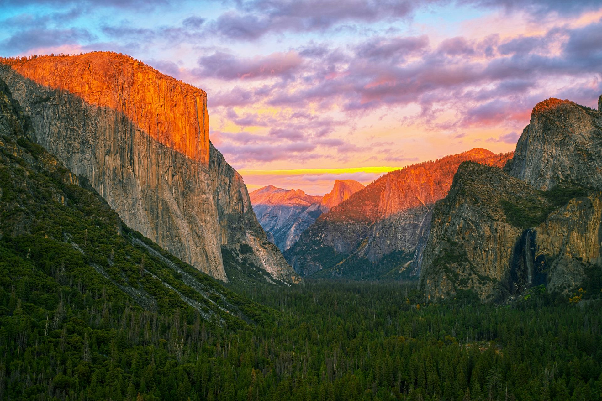
Anshul Jain / Unsplash
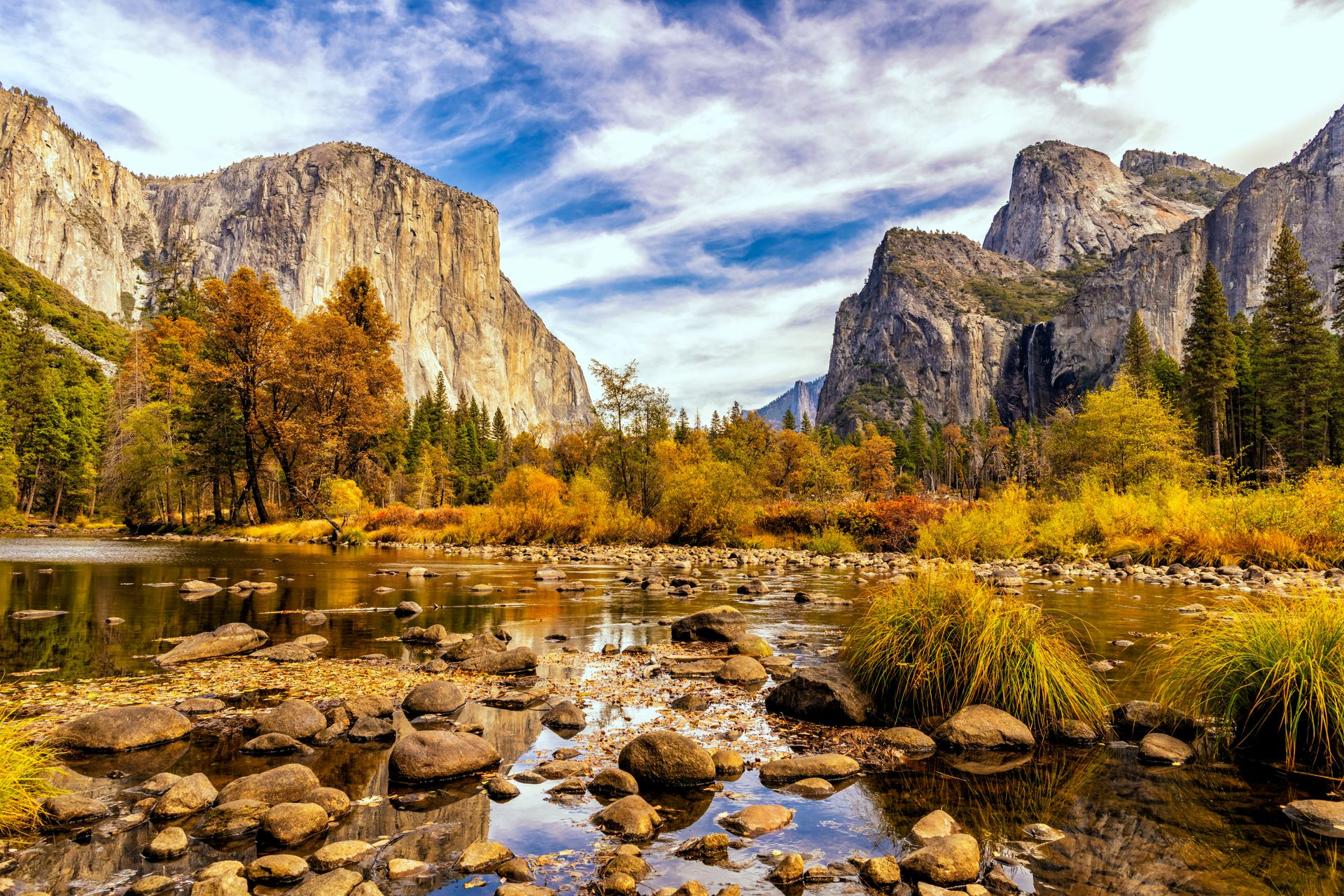
Located in the Sierra Nevada mountains of California, Yosemite National Park covers 1,187 square miles of granite cliffs, deep valleys, ancient giant sequoias, and high-alpine wilderness. Yosemite Valley, a glacier-carved canyon roughly eight miles long and one mile wide, forms the visual core of the park. Iconic granite monoliths like El Capitan, which rises over 3,000 feet vertically from the valley floor, and Half Dome showcase the sheer scale of intrusive igneous rock formations shaped by tectonic forces and polished by prehistoric glaciers.
The park is home to some of the tallest waterfalls in North America, fed by seasonal snowpack melting in the high country during spring and early summer. Yosemite Falls drops a total of 2,425 feet in three distinct stages, while Ribbon Fall and Bridalveil Fall plunge over sheer granite precipices directly into the Merced River drainage. In addition to its glaciated valleys, Yosemite preserves three groves of ancient giant sequoia trees, including the Mariposa Grove. These massive trees can live for over 3,000 years, reaching trunk diameters exceeding 25 feet.
Yosemite's elevation ranges from 2,000 feet near the western entrance to over 13,000 feet at Mount Lyell, encompassing five distinct vegetation zones. Oak woodlands give way to dense mixed-conifer forests of ponderosa pine and sugar pine, eventually shifting to subalpine lodgepole pine and exposed alpine meadows. The park hosts abundant wildlife, including American black bears, mule deer, and peregrine falcons that nest on vertical granite faces. Conservation challenges center on managing intense summer visitor traffic and mitigating the risk of catastrophic wildfires in drought-stressed forests.
Plitvice Lakes National Park, Croatia
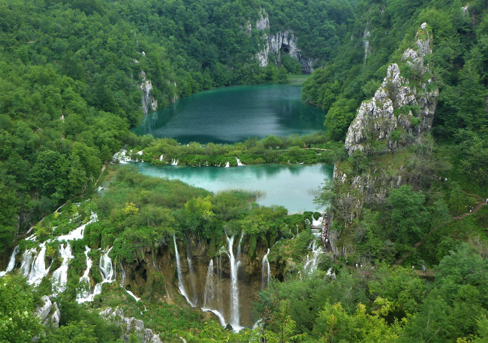
Jean Giroux / Unsplash
Situated in the mountainous karst region of central Croatia near the Bosnian border, Plitvice Lakes National Park is the oldest and largest national park in the country, covering roughly 114 square miles. Designated a UNESCO World Heritage site in 1979, the park is famous for its 16 terraced lakes joined by a cascading series of waterfalls and caves. These bodies of water are divided geographically into the Upper Lakes and Lower Lakes, separated by natural barriers composed of travertine, a porous limestone deposited by aquatic plants and microorganisms over thousands of years.
The hydrologic system relies on ongoing biochemical processes. As water flows through the limestone karst landscape, it absorbs dissolved calcium carbonate. Mosses, algae, and bacteria colonize the riverbeds, trapping the mineral particles and building natural travertine dams that grow by roughly half an inch each year. The water continually changes color from brilliant turquoise to deep blue and emerald green depending on the quantity of minerals, organo-chemical compounds, and the angle of sunlight hitting the lake beds.
Surrounding the lake complex are dense beech, fir, and spruce forests that represent some of the most intact primeval woodlands in Southern Europe. These quiet forests provide critical sanctuary for large European mammals that require extensive territorial ranges, including the Eurasian brown bear, gray wolf, and Eurasian lynx. To preserve the delicate travertine dams from mechanical erosion and chemical alteration, swimming in the lakes is strictly prohibited, and visitors navigate the water system via wooden boardwalks that suspended above the travertine barriers.
Vatnajökull National Park, Iceland
Jean Vella / Unsplash
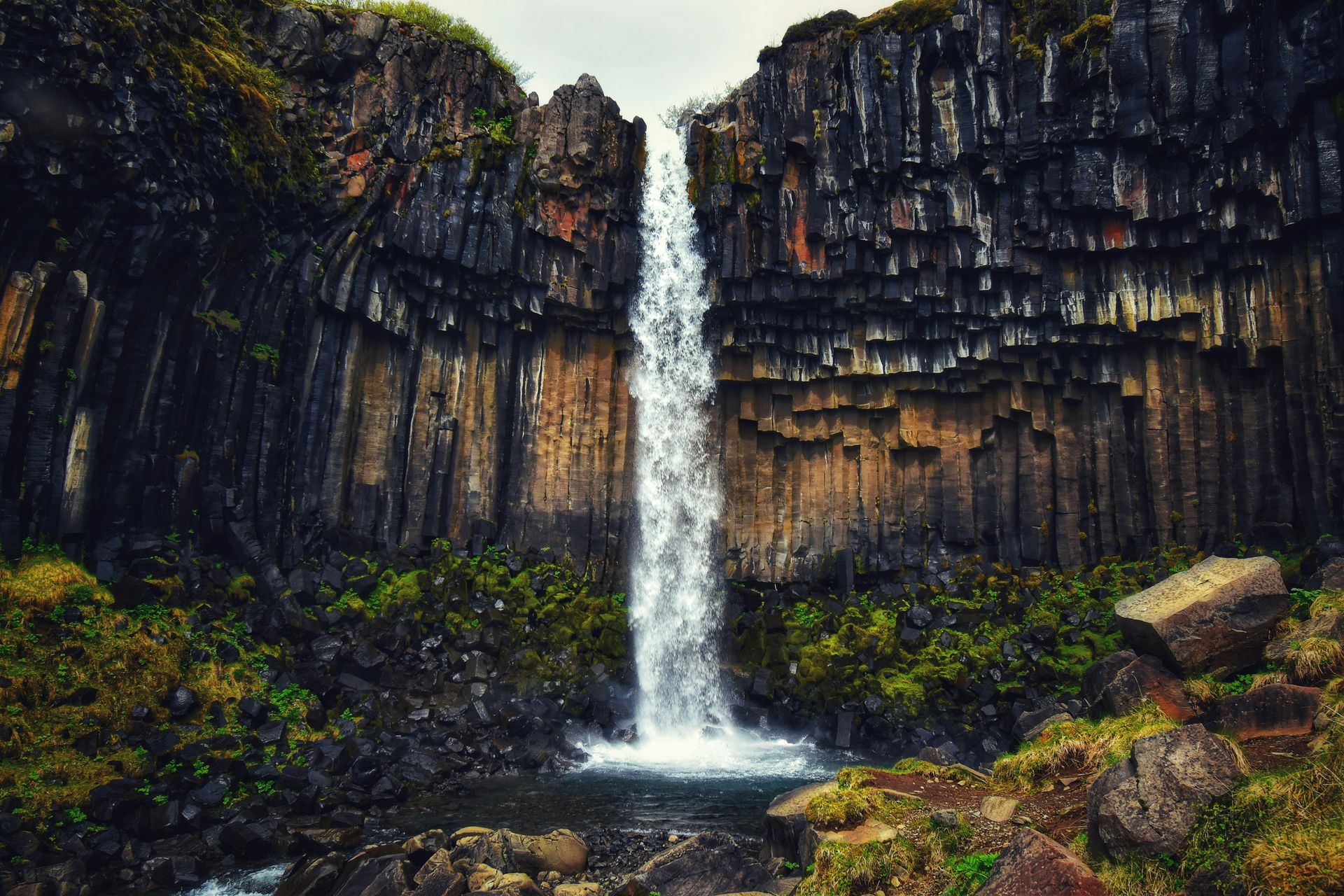
Covering approximately 5,400 square miles, or nearly 14 percent of Iceland's total landmass, Vatnajökull National Park is one of the largest national parks in Europe. The park is anchored by the Vatnajökull ice cap, a massive ice sheet averaging 1,300 feet in thickness. The defining feature of Vatnajökull is its dramatic collision of sub-glacial volcanic activity and ice, a phenomenon known as fire and ice. Active volcanoes like Bárðarbunga and Grímsvötn lie directly beneath the ice cap, periodically erupting to melt vast quantities of ice and create catastrophic glacial outburst floods, known as jökulhlaups.
The southern edge of the park features outlet glaciers that flow down from the main ice cap toward the Atlantic coast. Glacial lagoons, most notably Jökulsárlón, form at the terminus of these ice tongues, where massive icebergs break off and float toward the sea. These icebergs, sculpted into smooth shapes and displaying vivid shades of deep sapphire blue, drift onto black basalt sand beaches. Beneath the surface of the glaciers, seasonal ice caves form as summer meltwater flows through the ice, leaving behind translucent blue ice tunnels that freeze solid during winter months.
The park encompasses a wide variety of tundra landscapes, from black volcanic ash deserts and basalt canyon networks to lush birch woodlands at Skaftafell. The Jökulsárgljúfur canyon in the northern sector contains Dettifoss, one of the most powerful waterfalls in Europe by volume. Vatnajökull serves as an active natural laboratory for glaciologists and geologists studying glacier retreat, volcanic systems, and sub-glacial biological activity in extreme environments.
Fuji-Hakone-Izu National Park, Japan
Apisatjapong / Pexels
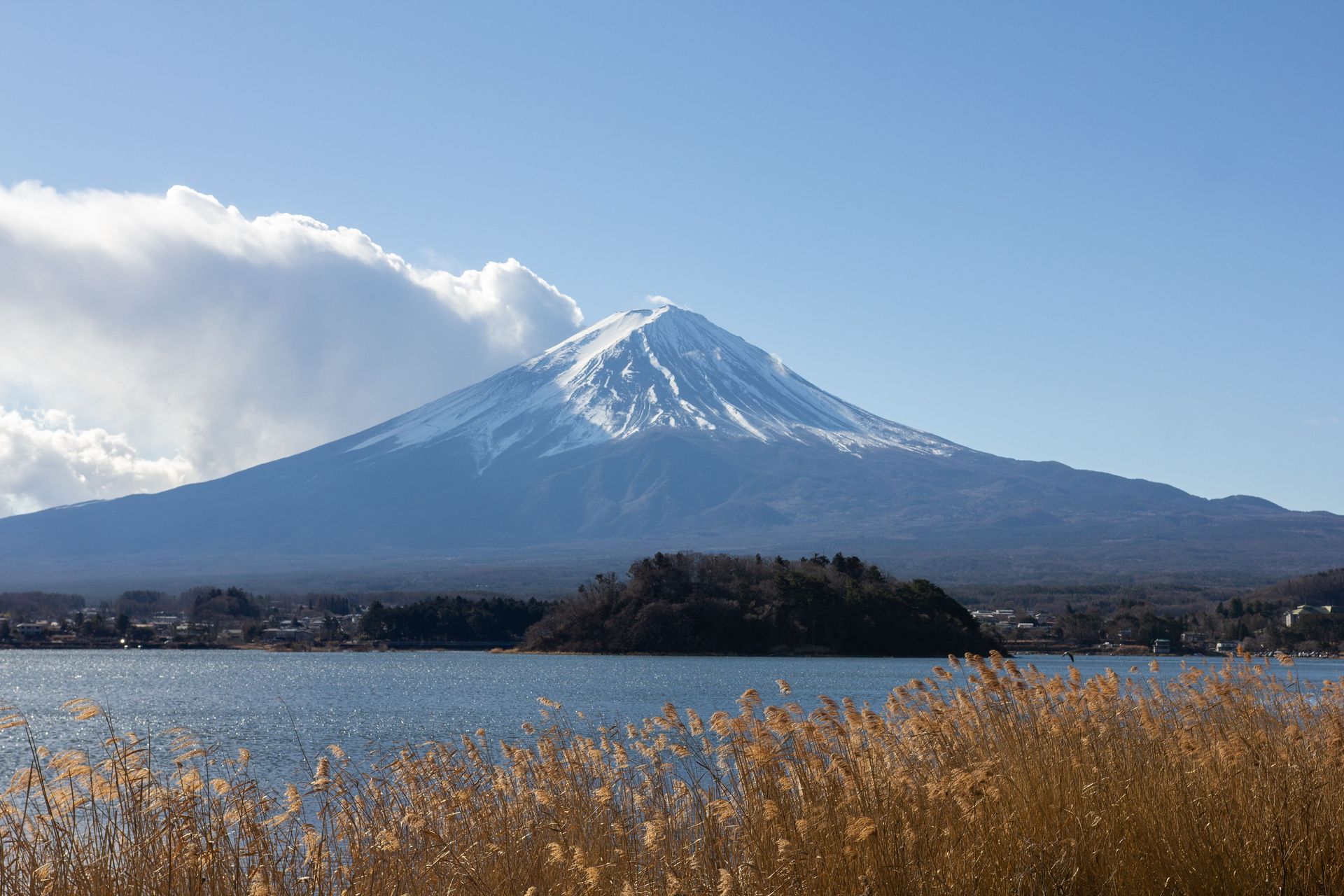
Stretching across four distinct geographical regions in central Honshu, Fuji-Hakone-Izu National Park covers over 470 square miles of volcanic terrain, hot springs, deep lakes, and coastal islands. The focal point of the park is Mount Fuji, an active stratovolcano rising to 12,388 feet, making it the highest peak in Japan. Mount Fuji's near-perfect symmetrical cone, capped with snow for much of the year, has made it a cultural and spiritual symbol for centuries, as well as a UNESCO World Cultural Heritage site.
The park is geologically active, positioned along the Pacific Ring of Fire where three tectonic plates converge. Surrounding Mount Fuji are the Fuji Five Lakes—including Lake Kawaguchiko and Lake Yamanaka—which were formed when lava flows dammed local rivers during historical eruptions. To the south lies the Hakone caldera, a volcanic collapse crater filled with geothermal hot springs, fumaroles, and Lake Ashi. Further south, the park extends into the Izu Peninsula and the volcanic Izu Islands, where sub-tropical coastal ecosystems meet marine trenches.
Due to its proximity to Tokyo, Fuji-Hakone-Izu is the most visited national park in Japan. The varying elevations support diverse ecological communities, from coastal evergreen forests and temperate deciduous woods on lower slopes to hardy alpine shrubs near the summits. The summer climbing season draws hundreds of thousands of hikers to Mount Fuji's trails, requiring intensive mountain management, trash removal programs, and erosion control measures along the volcanic ash paths to protect the fragile alpine environment.
Iguazú National Park, Argentina
Mauro Mathys / Unsplash
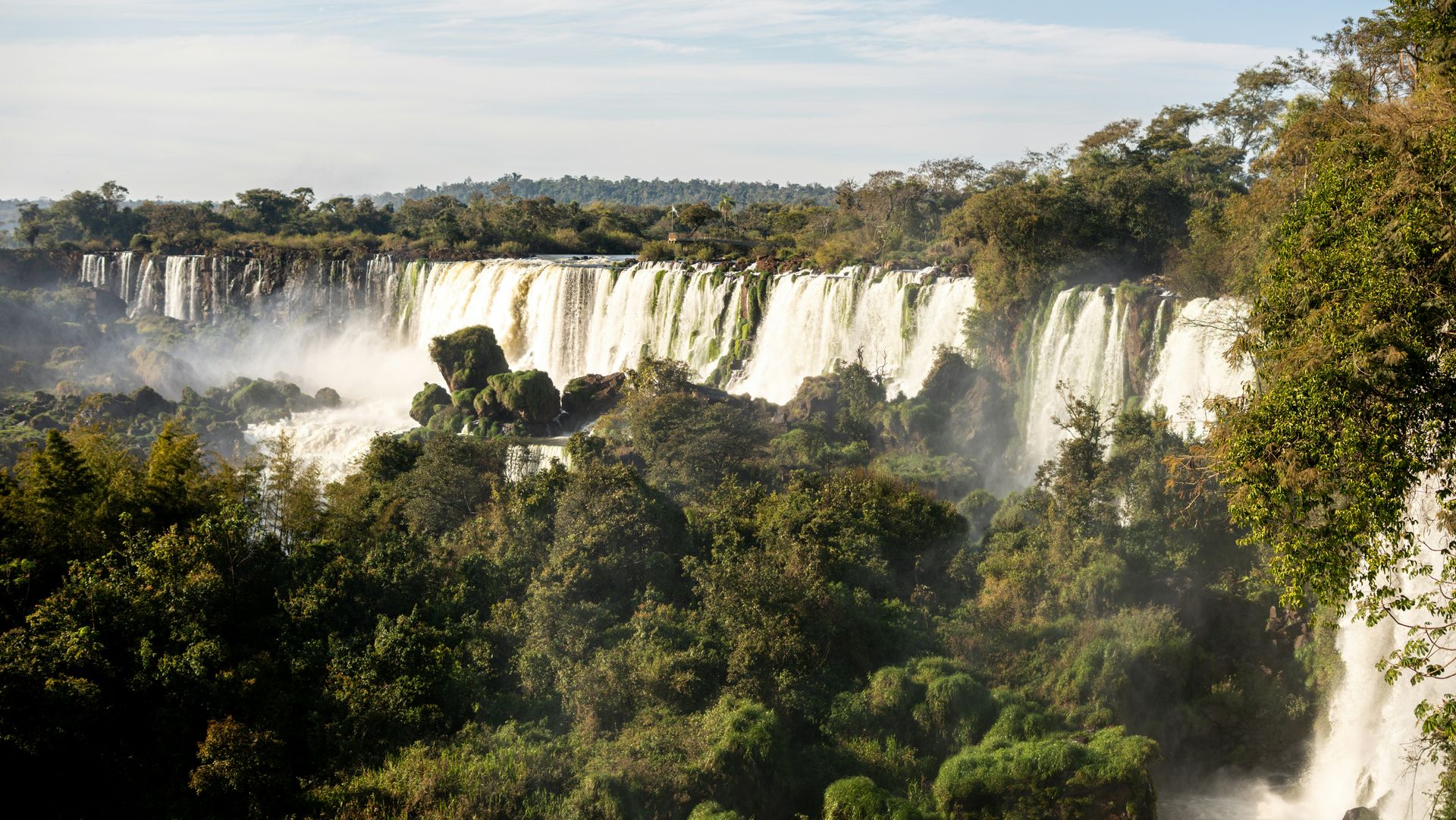
Located in the northeastern corner of Argentina's Misiones province, bordering Brazil, Iguazú National Park protects 260 square miles of pristine Paranaense sub-tropical rainforest. The primary attraction of the park is Iguazú Falls, a massive cataract system extending along a crescent-shaped cliff edge for nearly two miles. Comprising roughly 275 individual waterfalls separated by rocky islands, the falls drop up to 269 feet into the Iguazú River below. The most dramatic drop is the Devil's Throat (Garganta del Diablo), a narrow horseshoe-shaped chasm where over half of the river's water plunges with immense force.
The constant spray generated by the falls creates a humid microclimate, supporting lush vegetation and specialized plant communities along the riverbanks. Epiphytes, orchids, bromeliads, and tree ferns blanket the forest canopy, while the spray zone harbors rare aquatic plants like Podostemaceae, which cling to submerged rocks beneath the rushing water. The park's interior contains some of the last remaining intact stretches of Interior Atlantic Forest, a highly threatened biome that once spanned large portions of coastal South America.
This dense jungle habitat supports exceptional biodiversity, including over 2,000 plant species, 80 mammal species, and 400 bird species. South American jaguars, pumas, ocelots, and South American tapirs roam the forest interior, while habituated coatis, toucans, and brilliant morpho butterflies are frequently spotted near visitor pathways. Extensive elevated walkways are used throughout the park to keep visitors above sensitive forest floors and wetland habitats, minimizing physical disruption to native wildlife corridors.