
From Venice's Grand Canal to the three sheer Dolomite rock towers that define the Alps at their most dramatic
Stefano Casarini / Unsplash
Italy’s beauty problem is one of abundance: there are too many extraordinary places to see in a single trip, or several trips, or over a lifetime of dedicated travel. The country holds more UNESCO World Heritage sites than any other nation on earth, which is one quantitative expression of a qualitative reality that every visitor encounters immediately: the density of cultural, architectural, and natural beauty in Italy is unlike anywhere else. A 20-minute walk through central Rome passes more historically significant structures than most cities contain in their entirety. A drive through the Val d’Orcia in Tuscany produces a continuous landscape of such composed beauty that it is difficult to believe the rolling hills and cypress rows were not arranged deliberately for the aesthetic pleasure of passing observers.
The range of what Italy offers is also exceptional. The Byzantine mosaics of Ravenna’s sixth-century basilica and the volcanic black-sand beaches of the Aeolian Islands are both in Italy, separated by 600 miles of peninsula, and entirely different in every characteristic except the beauty they produce in the people who encounter them. The cave hotels of Matera, carved into a hillside that has been inhabited since the Paleolithic, and the Gothic marble facade of Milan’s cathedral are both in Italy. The country contains multitudes, and the visitor who approaches it with specific intention, mountain lakes, baroque stone carving, and ancient Greek temples, will find the specific thing in better form than anywhere else in the world.
The 10 destinations below appear in Travel + Leisure, drawn from a list of 35 covering all 20 of Italy’s regions. They span the full length of the peninsula and include both the most celebrated and some of the most overlooked, covering Venice and Rome alongside Ravenna’s mosaics and Basilicata’s cave city.
Henrique Ferreira / Unsplash
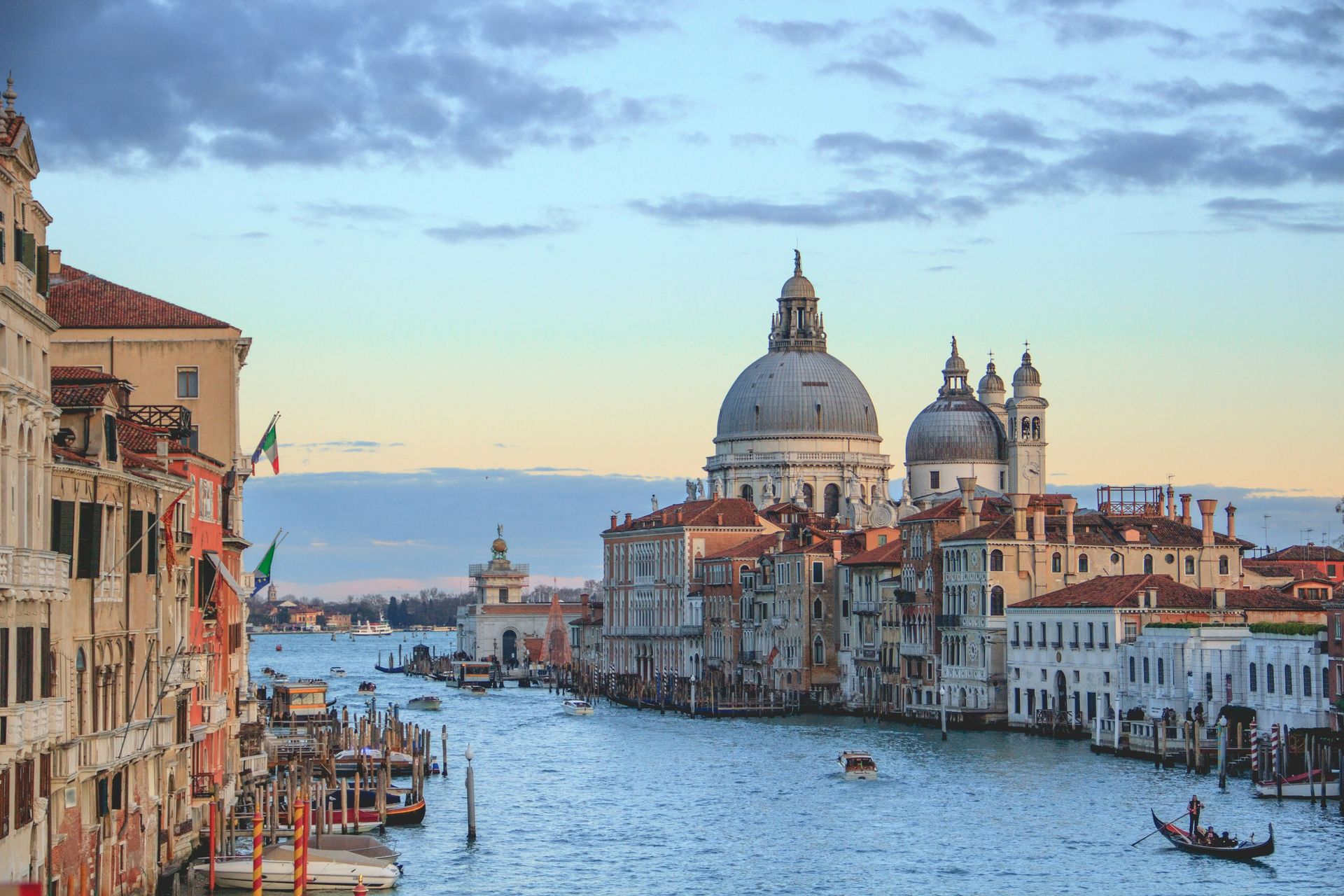
Venice is the city that the most jaded traveler cannot dismiss. The crowds are real, the tourist restaurants are mediocre, and the acqua alta flooding is increasingly disruptive. None of this changes the fundamental reality that the Grand Canal, the wide, serpentine waterway that divides the city and serves as its main artery, is one of the most extraordinary urban environments ever created, and that no photograph or description or prior visitor’s account prepares the first-time visitor for the experience of arriving by boat and watching the palaces slide past on both sides of the water. The canal’s 3.8-kilometer length is lined with more than 170 buildings spanning the 13th through 18th centuries, offering a continuous architectural survey of Venetian building culture over 500 years.
The gondola ride is the obvious tourist activity, and it is obvious for a reason: the canal’s perspective from water level, looking up at the palazzo facades and the laundry strung between windows and the cats on the stone steps leading down to the water, is not available from the bridges or the embankments in the same terms. The sunset hour on the canal gives the best light, with the western sky turning the palazzo facades orange and the water reflecting the color back. The Rialto Bridge and the Ca’ d’Oro palazzo are the canal's two most photographed structures, and both are best seen at off-peak hours or from a moving vaporetto, not amid the foot traffic at the busier crossing points.
The canal’s morning atmosphere, before the day-tripper crowds arrive from the mainland, gives Venice its most specifically beautiful quality: the water traffic of supply boats, the fish market on the Rialto bank, and the mist that sits on the lagoon in the early hours give the canal a working city character that the afternoon’s tourist saturation replaces with something closer to a theme park. Booking accommodation inside the old city, not on the mainland, makes this specific version of Venice available to the visitor.
doozydoom / Unsplash
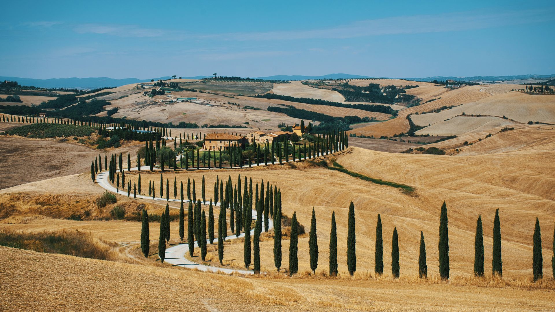
The Val d’Orcia is the part of Tuscany that the rest of the world has decided represents Italy: the rolling hills, the isolated farmhouses on cypress-crowned ridgelines, the vineyards in precise geometric rows, the poppy fields in May, and the ochre and sienna palette of the earth in summer. The valley, a UNESCO World Heritage cultural landscape, spreads across the territory south of Siena toward Monte Amiata, and its specific quality is the experience of a landscape that has been managed for beauty and agricultural productivity simultaneously over centuries, producing a countryside whose every element is both functional and visually perfect.
The hill towns that anchor the valley, Montalcino, Pienza, and Montepulciano, give the landscape its human counterparts: medieval and Renaissance towns perched on hilltops above the valley floor where the local agricultural products, Brunello di Montalcino, Pecorino di Pienza, and Vino Nobile di Montepulciano, are produced at a quality that gives the food and wine program its most complete regional expression. A tasting circuit through the valley’s osterias and cantinas gives the visit an edible dimension whose quality matches the visual.
The photography from the Val d’Orcia requires early rising: the morning light between October and May produces the mist that sits in the valley hollows while the hilltops are already lit, creating the layered visual quality that makes the most celebrated Val d’Orcia photographs distinctive. The summer midday heat flattens the light and removes the atmospheric depth that gives the landscape its painterly quality, and the spring and autumn shoulder seasons give the valley its best photographic and experiential conditions. The San Quirico d’Orcia gardens, the Horti Leonini, give the valley’s most formally cultivated landscape dimension alongside the agricultural countryside, and the thermal baths at Bagno Vignoni, a medieval village whose central piazza is an ancient hot spring pool, give the Val d’Orcia its most specifically medicinal and historically unusual single architectural stop within an otherwise agricultural circuit.
Sterling Lanier / Unsplash
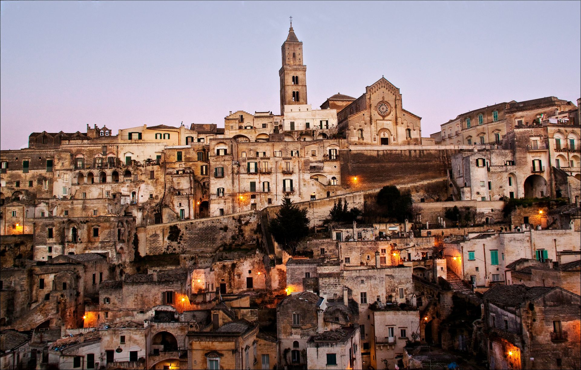
Matera is one of the most unusual cities in Europe: a settlement carved into the ravines of a limestone plateau in the southern region of Basilicata, whose cave dwellings, the sassi, have been continuously inhabited since the Paleolithic period. The UNESCO World Heritage designation reflects the specific archaeological and cultural significance of a habitation site whose depth of history, tens of thousands of years of continuous human occupation in the same cave system, makes it one of the oldest continuously inhabited settlements on earth. The sassi were considered an embarrassment by the Italian government in the postwar period, their inhabitants forcibly relocated to modern housing on the plateau above, and then rediscovered and reclassified as a heritage treasure in the decades that followed.
The cave hotels that now occupy the most dramatic sections of the Sassi give the visitor a specific accommodation experience whose physical environment, carved stone walls, ancient cisterns converted to swimming pools, and cave ceilings whose irregular surfaces catch the candlelight in ways that flat walls cannot, make staying in Matera as compelling as visiting it. The view from Piazzetta Pascoli at night, looking across the ravine to the illuminated cave city on the opposite face, gives the visit its most sustained visual impact: the sassi extend across the ravine in a formation that is simultaneously ancient and apparently impossible, a city built into a cliff.
The churches cut into the rock, the rock-carved cisterns whose engineering solved the desert water problem for millennia, and the cave paintings visible in some of the more ancient sections give the archaeological program a depth appropriate to a site whose human history predates Rome by thousands of years. The James Bond film that used Matera’s streets as a set gave the city its most recent burst of international attention, but the city’s qualities need no fictional endorsement: they are entirely their own, rooted in a geological and human history whose specific density no production design can replicate.
stefan_fotos / Wikimedia Commons (CC BY-SA 2.0)
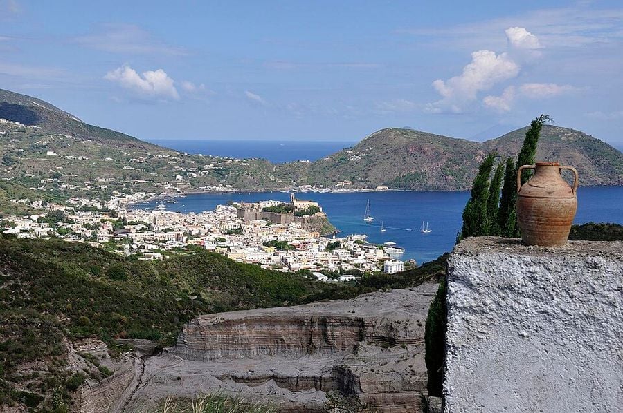
The seven Aeolian Islands in the Tyrrhenian Sea north of Sicily give the Italian island experience its most volcanically dramatic version: Stromboli, the most active of the group, erupts with regularity visible from the sea, and the night cruise that approaches the island during an eruption gives the observer a direct encounter with geological process at a scale and immediacy that volcanic landscapes accessible only by daylight do not provide. The islands were formed by the same volcanic activity that continues on Stromboli and Vulcano, and the black sand beaches, the sulfurous hot springs, and the pumice formations that distinguish the Aeolian coast from the white-sand Mediterranean norm are all expressions of the same geological character.
Salina, the greenest of the islands and the one whose water supply supports genuine agriculture, gives the Aeolian wine program its most complete form: the Malvasia delle Lipari, the sweet dessert wine produced from the malvasia grape grown on Salina’s terraced vineyards, is one of Italy’s most distinctively regional wines and is available in the island’s restaurants and cantinas in a form specific to the production of this particular island. Panarea, the smallest of the inhabited islands, gives the summer social program its most concentrated form, with Cala Junco’s clear water and the island’s position as the Aeolian equivalent of Capri for the Italian summer scene.
The larger islands, Lipari and Vulcano, provide the practical tourism infrastructure at its most developed: Lipari offers the widest choice of accommodation and ferry connections, and Vulcano’s therapeutic sulfur mud pools offer the wellness program's most geologically specific option. The smaller islands, Alicudi and Filicudi, are among the most genuinely remote inhabited locations in Italy, and the stillness they offer gives the visitor who makes the less convenient ferry journey a quality of quiet specific to places where the tourism economy has not yet reorganized the entire texture of daily island life around the needs and expectations of visitors.
Pascal Reusch / Wikimedia Commons (CC BY-SA 3.0)
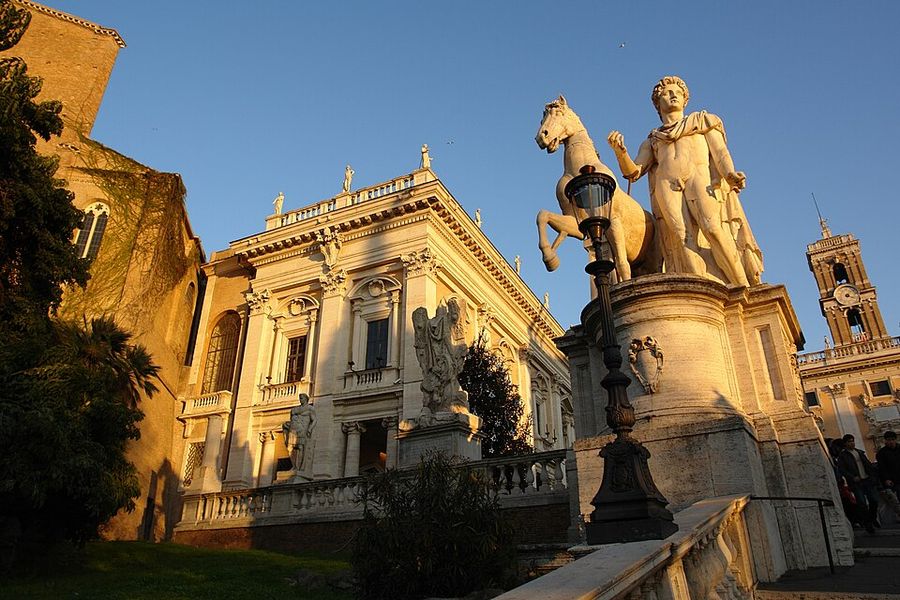
The view from the back of the Palazzo Senatorio on the Capitoline Hill is one of the world's great urban panoramas, and it is free. The Roman Forum spreads out below, with its specific archaeology: the Temple of Saturn, the Arch of Septimius Severus, the Via Sacra, and the House of the Vestal Virgins. Beyond it, the Palatine Hill rises on the right while the Colosseum appears in the near distance at an angle that gives the entire ensemble its most legible spatial relationship. The view from the street-level approaches to the Colosseum, surrounded by tourist coaches and souvenir vendors, gives no sense of how these monuments relate to each other across the landscape, and the Capitoline view restores that spatial comprehension.
The staircase to the Capitoline, the Cordonata designed by Michelangelo, gives the approach its own architectural character: the gentle ramp, passable on horseback, leads through the twin equestrian statues and up to the piazza whose pavement design, also by Michelangelo, gives the hilltop its geometric organization. The Capitoline Museums on the piazza are among the oldest public museums in the world, opened in 1471. The piazza's center is home to the bronze equestrian statue of Marcus Aurelius, the original housed in the museum, and the outdoor version, a copy, gives the space its most celebrated single object.
The evening visit gives the Capitoline its most atmospheric conditions: as the light shifts toward sunset and the floodlighting begins to illuminate the Forum ruins below, the Forum takes on a gold-orange quality specific to the Roman travertine and the summer evening light together. The Forum at night, viewed from above and not walked through at street level, gives the ruins a visual completeness that the navigable pathways through the site, with their explanatory signs and fences, disrupt by proximity. The Vittoriano monument, visible beyond the Forum from the Capitoline, the massive white marble structure whose scale dominates the Roman Forum’s northern edge, is the panorama's most contentious architectural element and the most useful reminder that Rome’s builders never stopped layering their own ambitions onto the ancient city.
Luca Severin / Unsplash
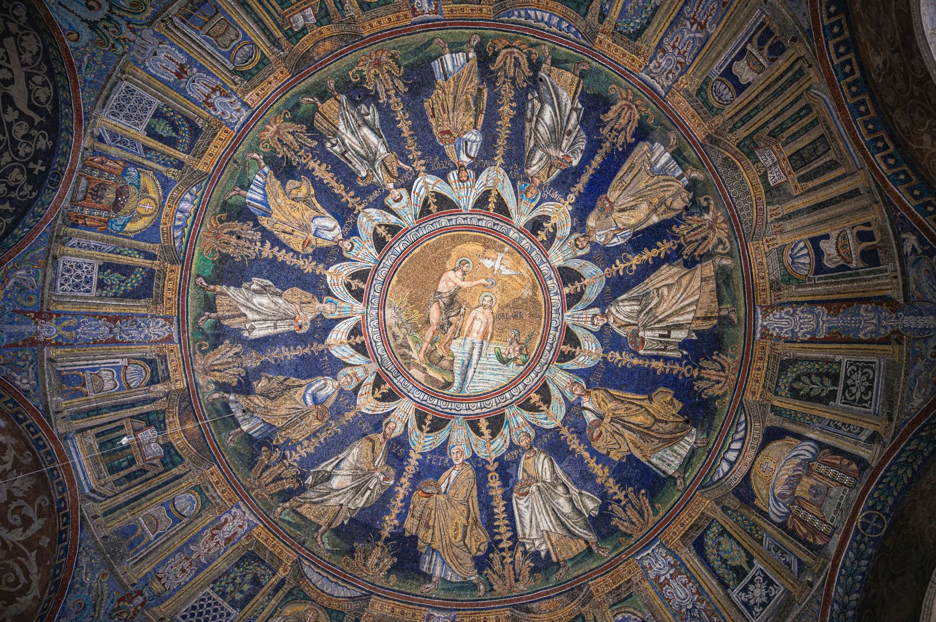
The Basilica di San Vitale in Ravenna is a sixth-century church whose interior contains what many art historians consider the most extraordinary Byzantine mosaics in existence: the apse mosaic depicting Emperor Justinian and Empress Theodora in full imperial regalia flanked by their courts, and the ceiling and wall mosaics covering every surface in a program of gold and colored tesserae whose density and quality surpasses anything produced by the Byzantine tradition elsewhere. The church was built when Ravenna was the capital of the Byzantine Exarchate, and the mosaics were made by craftsmen working at the height of the Byzantine artistic tradition, giving them a technical quality that subsequent centuries and their deteriorating materials have not replicated.
The light that enters the San Vitale through the alabaster windows gives the mosaic a specific illumination: the translucent stone filters the daylight to a warm, diffuse quality that the gold tesserae reflect back in a shimmer whose effect at different times of day changes the mosaic’s character completely. The morning visit, when the eastern light enters through the apse windows, gives the Justinian and Theodora panels their most dramatic illumination. The hand of God emerging from the clouds to stop Abraham’s sacrifice of Isaac, depicted in the lunettes above, gives the mosaic program its most narratively dramatic single panel.
The Ravenna mosaic complex, which includes San Vitale, the Mausoleum of Galla Placidia, Sant’Apollinare Nuovo, and several other sites under a single UNESCO designation, offers a full-day program whose cumulative mosaic exposure is unlike anything available elsewhere in Western art. The Mausoleum of Galla Placidia in particular, a small cruciform building whose deep blue star-field ceiling is the most intimate of the Ravenna mosaic interiors, gives the complex its most emotionally concentrated single space. The city of Ravenna itself, with its medieval center and its special place in northern Italian literary history as the site of Dante's exile and death, provides the visit with a cultural context beyond the mosaics.
Freysteinn G. Jonsson / Unsplash
Lecce is a city in the heel of Italy’s boot whose building material, a soft golden limestone called pietra leccese, gives the baroque architecture for which the city is celebrated its specific visual character: the stone is soft enough to carve with extraordinary precision when freshly quarried and then hardens in the open air, allowing the Lecce craftsmen of the 17th and 18th centuries to execute an elaboration of surface decoration on the city’s churches, palaces, and civic buildings that the harder stone of northern Italian baroque cities would not permit. The facade of the Basilica di Santa Croce, the most extreme example of the Lecce style, covers every available surface with a figural and foliate program whose density approaches the sculptural more than the architectural.
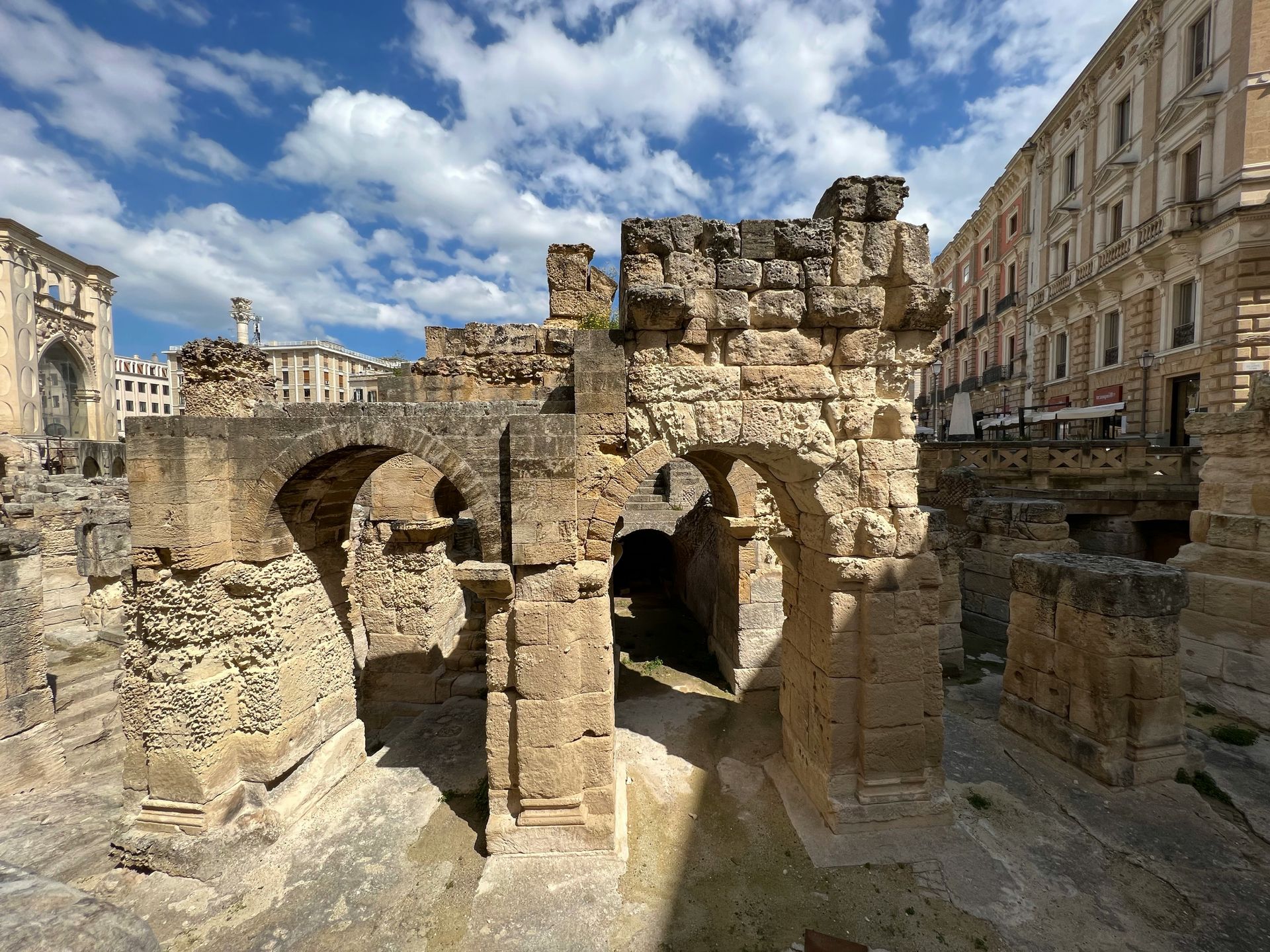
The historic center’s scale gives the visitor a navigable baroque environment: the churches, the Piazza del Duomo, the Roman amphitheater partly excavated in the town center, and the carved city gates are all within walking distance of each other, and the golden light that the pietra leccese reflects in the late afternoon gives the city a specifically warm visual atmosphere in the hours before sunset. The Roman amphitheater, built in the first century and seating up to 25,000 spectators, gives the Lecce visit an archaeological dimension that predates the baroque by 1,500 years and sits in the heart of the shopping district as a matter of course.
The Puglia landscape surrounding Lecce gives the city its broader travel context: the trulli of Alberobello, the white-washed cliff town of Ostuni, the seaside village of Polignano a Mare, and the beaches of the Salento peninsula are all accessible within a day’s drive and give the Lecce base its most complete program for exploring the southeastern Italian landscape that the Slow Food movement and the agriturismo culture have made one of Italy’s most rewarding culinary and agricultural regions to visit and eat through in any season of the year.
Tom Podmore / Unsplash
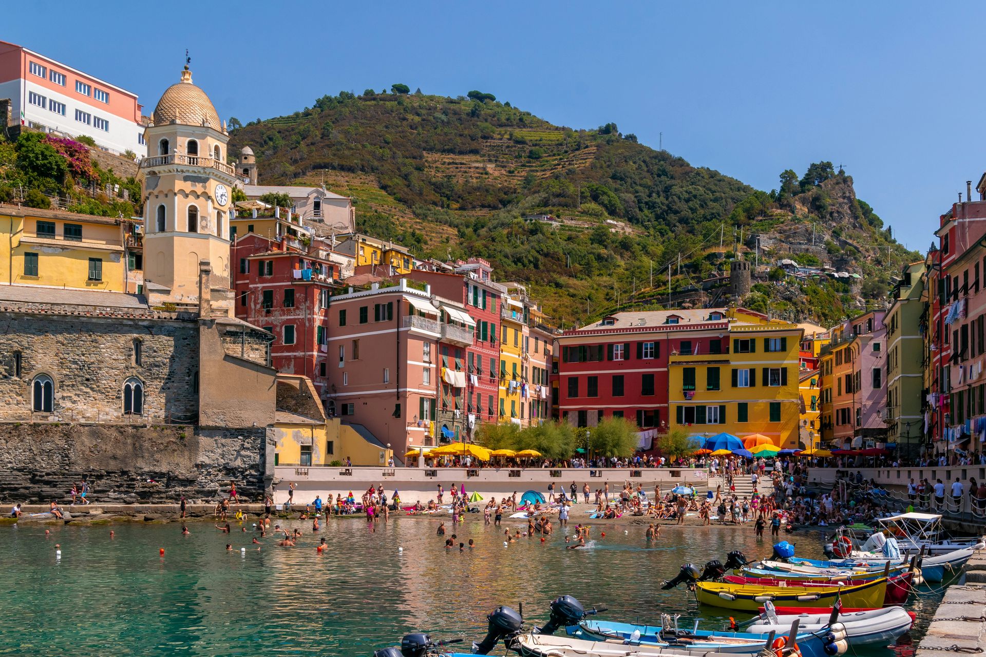
The Sentiero Azzurro, the Blue Path that connects the five villages of the Cinque Terre along the Ligurian coast, gives the hiker access to the most concentrated stretch of Italian coastal scenery accessible on foot: the terraced vineyards that cover the vertiginous cliffs above the Ligurian Sea, the colored facades of the villages visible from the trail above, and the Mediterranean scrub that fills the slopes between the cultivated terraces give the walk a visual richness that no single stationary viewpoint in the Cinque Terre provides in the same continuous form. The two-mile section between Vernazza and Monterosso al Mare is the most scenic and the most popular, and the trail conditions it produces, crowded in season and occasionally damaged by weather, reflect the same overtourism pressure that affects the villages below.
The approach from Vernazza as the starting point gives the walk its best directional logic: the village’s tower and church dome are visible behind as the trail climbs, and the sea views open progressively above Punta Mesco before the descent toward Monterosso reveals the long beach of the Cinque Terre’s largest village. The Mediterranean macchia, the dense aromatic scrub of rosemary, lavender, and wild fennel, gives the trail its scent as much as its visual character, and the smell of the heated Mediterranean scrub in the summer afternoon is a specific sensory memory of this coast.
The early morning departure from Vernazza, before the organized tour groups have begun the climb, gives the trail its best conditions: the light comes from the east across the sea, the path is quiet, and the villages below are still in the morning routine of fishing boats and espresso, not the tourist economy that the midday hours produce. The descent into Monterosso and the beach lunch that follows give the walk its most satisfying conclusion. The Cinque Terre National Park’s management of the trail system, which includes booking requirements during peak season, provides the visitor with a planning tool for avoiding the congestion generated by the trail’s popularity on summer weekends, and the early departure from Vernazza remains the single most effective crowd management strategy available.
Samuele Errico Piccarini / Unsplash
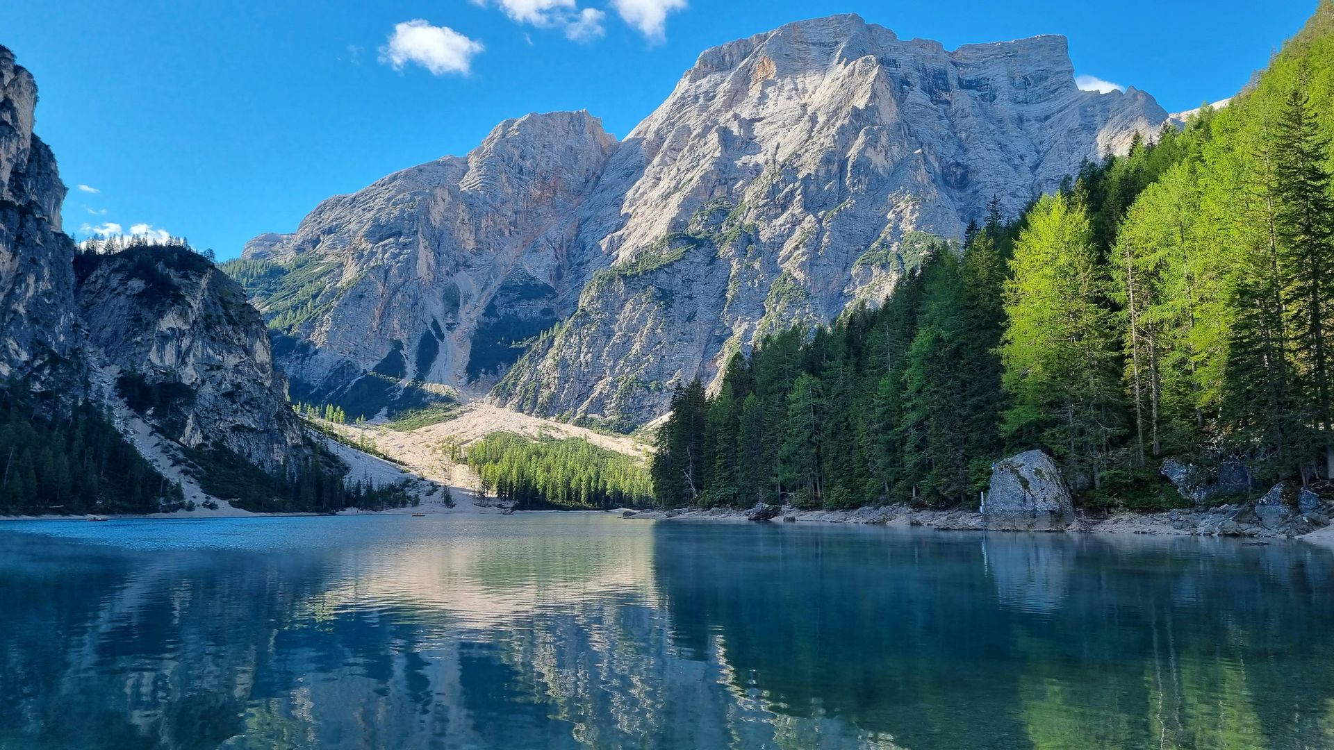
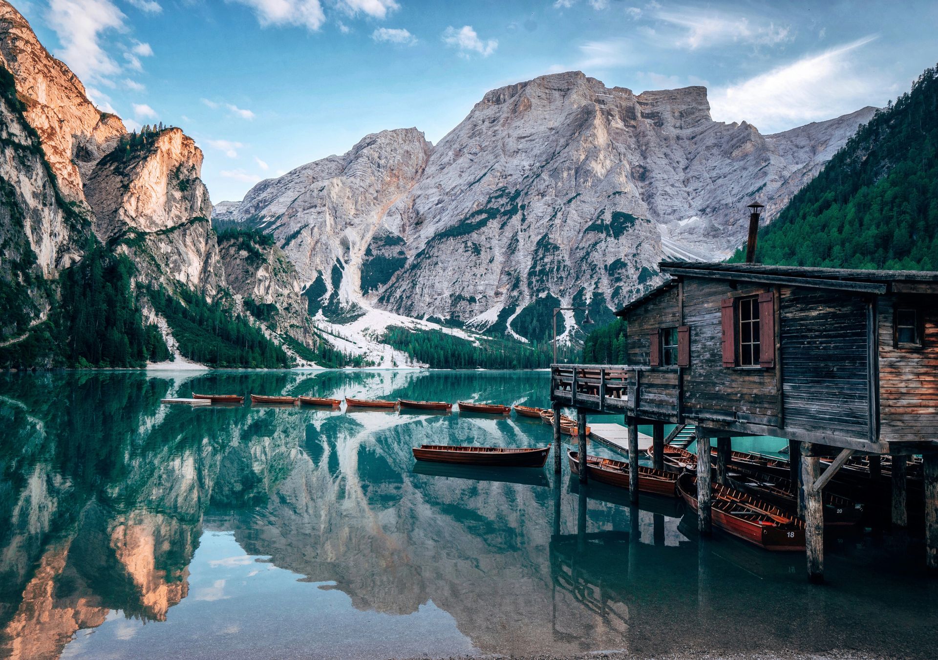
Lago di Braies in South Tyrol is the lake that has appeared in more alpine photography than almost any other body of water in Europe: the still blue-green surface reflecting the craggy Dolomite peaks above, the small wooden boat dock on the shore, and the mountain backdrop whose symmetry and scale give the scene a composed quality that photographers have documented from every available angle. The lake sits at 4,900 feet in the Fanes-Senes-Braies Nature Park, and the hiking trails that circumnavigate the shore and climb the surrounding ridges offer an active program for those who find the lakeside viewing insufficient after the first photographs.
The trail around the lake takes about two hours at a comfortable pace, giving a continuously varying perspective on the water and the surrounding peaks, and the section at the lake’s far end, where the stream that feeds the lake emerges from a canyon between the Dolomite walls, gives the walk its most dramatically enclosed moment. The rifugio at the lake shore gives the lunch program a specific alpine format: the Südtirol culinary tradition, with its canederli, speck, and Lagrein wine, gives the meal a specifically northern Italian alpine character that differs from the pasta and Barolo of the regions to the south.
The summer months bring significant visitor numbers to Lago di Braies, and the car park at the lake closes once capacity is reached on busy days, requiring a shuttle or an early arrival to guarantee access. The early morning visit, when the first light hits the Dolomite peaks, the lake surface is still calm, and before the tour groups arrive, offers the lake its most photogenic and least crowded conditions. The autumn, when the larch trees above the lake turn golden in the weeks after the summer season ends, gives a second photographic opportunity specific to the Dolomite seasonal calendar, whose October light and the reflected gold of the larches in the lake surface give the scene a visual character entirely different from the summer’s blue-green and gray palette.
Sebastian Knoll / Unsplash
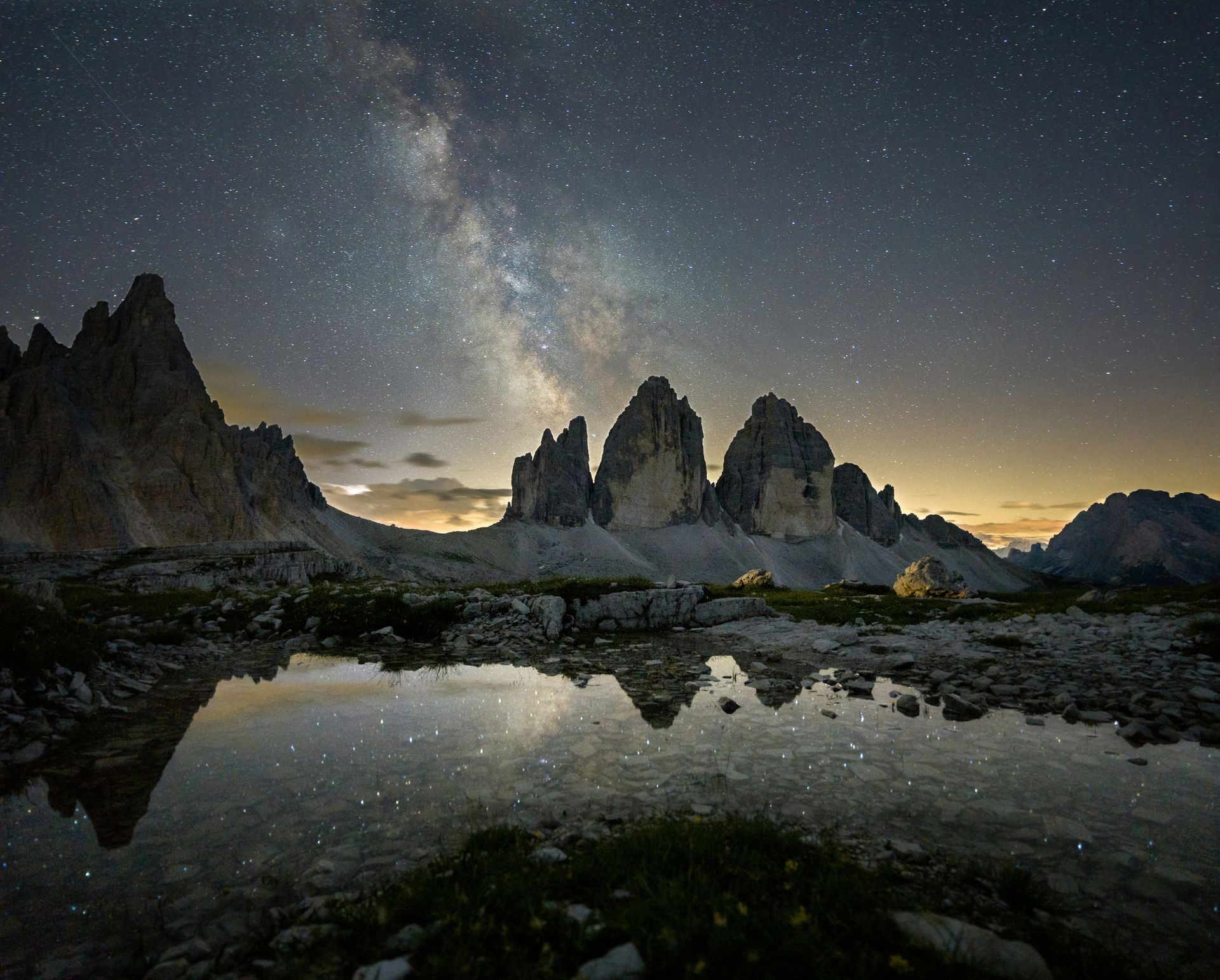
The Tre Cime di Lavaredo, three conjoined rock towers rising above the Dolomite plateau on the border of South Tyrol, Trentino, and Veneto, are the single most photographed geological formation in Italy and among the most recognizable in the Alpine world. The three peaks, Cima Piccola at 9,003 feet, Cima Grande at 9,839 feet, and Cima Occidentale at 9,517 feet, rise vertically from the surrounding plateau in a configuration that gives them a visual drama out of proportion to their altitude: the perpendicular north faces, dropping sheer for 500 meters, give the peaks a quality more like architecture than geology. The north face of Cima Grande is one of the classic routes in European climbing, and the history of mountaineering attempts on these walls gives the peaks a cultural weight in the climbing world that the hiker viewing them from the trail below can feel without sharing.
The Tre Cime di Lavaredo loop, a moderate circular hiking route of approximately 10 kilometers that circumnavigates the three peaks, gives the non-climber the most complete ground-level engagement with the formation: the trail moves around all three sides of the peaks, giving views from the south, the east, and the dramatically different north face perspective, and the rifugi positioned on the loop give the three-to-five-hour walk its rest and refreshment points. The Rifugio Locatelli on the north side, with the Tre Cime visible above and the Cadini di Misurina peaks in the distance, gives the mid-walk lunch its most sustained alpine view.
The road to the Auronzo refuge at the base of the loop, the highest paved road in the Dolomites at 8,100 feet, gives the drive from the valley floor its own scenic program: the ascent through the switchbacks above Misurina gives progressive views across the Dolomite plateau and, on clear days, to the Ortler and Bernina massifs on the Austrian and Swiss borders. The summer season brings heavy vehicle traffic to the Auronzo road, and the early morning arrival that the Lago di Braies visit also applies here: the peaks in the first light, before the midday crowd, and the trail is quiet enough to hear the marmots in the meadows below the path.