From Gros Morne's exposed Earth's mantle to Québec City's fortified walls, the only intact ones in North America
-1920x1081.jpg)
Rich Martello / Unsplash
Canada is the world’s second-largest country, and its scale is the first thing that complicates trip planning. The geographic range runs from Atlantic iceberg alleys in Newfoundland to Pacific archipelagos in British Columbia, from polar bear congregation grounds on Hudson Bay to ancient volcanic rock on the Newfoundland coast. The country holds the world’s highest tides, the aurora capital of the world, and the only fortified city walls in North America north of Mexico. The beauty takes entirely different forms depending on where you are: turquoise methane-bubble ice on an Alberta lake, orange exposed Earth’s mantle in Gros Morne, 52-foot tidal swings in New Brunswick that alternately reveal and swallow the seafloor.
Visiting Canada’s most extraordinary places requires genuine planning. Churchill, Manitoba, is most practically reached by a 45-hour VIA Rail train from Winnipeg or a direct flight. Fogo Island needs the ferry from Farewell, Newfoundland. Haida Gwaii has limited rental cars, and the article specifically flags this. These aren’t logistical obstacles so much as part of the proposition: the places that take the most effort to reach tend to offer experiences that aren’t available anywhere else.
The 10 destinations below appear in Lonely Planet, scouted by Canada-based writer Jennifer Bain across all 10 provinces and three territories, covering the country from the Atlantic to the Pacific to the Arctic.
A note on planning: Canada rewards specificity. Deciding whether you’re after aurora viewing, wildlife, coastal scenery, geological formations, or city culture determines the itinerary more than any other factor. Most of these destinations are best visited with a minimum of two nights, and some, Churchill and Gros Morne especially, deserve more. The distances between regions are real and should be respected and not underestimated. Flying between regions is often the most practical option for trips covering more than two destinations.
Carol Fung / Unsplash
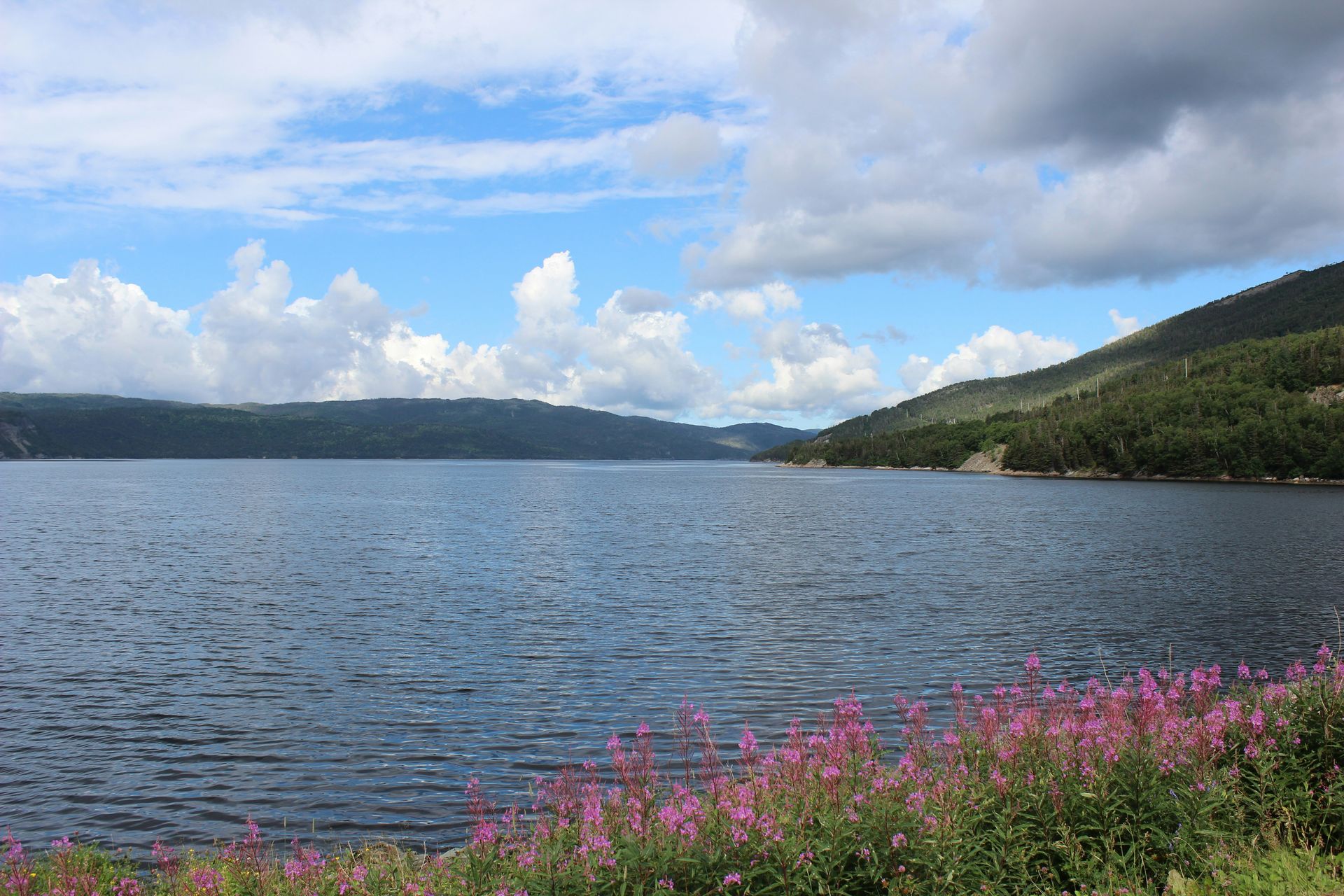
Gros Morne is the only place in Canada where you can walk on the Earth’s exposed mantle. The Tablelands, a flat, orange landscape in the park’s southern section, are composed of peridotite rock that was forced to the surface by tectonic collision 470 million years ago. The rock’s high iron and magnesium content makes the soil toxic to most plants, which is why the Tablelands look the way they do: bare, orange, and completely unlike anything around them. The contrast between the barren peridotite surface and the surrounding green Newfoundland forest makes the geological story legible without knowing any geology. UNESCO designated the park a World Heritage Site for its geological significance as much as its beauty, and the two are inseparable here.
The Gros Morne Mountain hike, a challenging ascent to 2,644 feet, finishes at a summit with views across the Gulf of St. Lawrence and the Long Range Mountains. Western Brook Pond is the park’s other major attraction: a landlocked freshwater fjord whose 550-foot cliffs rise directly from the still water of a glacially carved lake. BonTours operates boat trips through the pond between May and October, and the vertical scale, the silence, and the peculiarity of fjord-like cliffs in a freshwater inland lake make it one of the more unusual landscape experiences in Canadian national parks.
Moose are dense along the park’s roads, making wildlife encounters essentially guaranteed on any driving day. The park’s dual appeal, exceptional geology for those who want it and exceptional scenery for those who don’t, makes it one of the most genuinely versatile destinations in Atlantic Canada.
The park is in western Newfoundland, accessible by road from Deer Lake, which has an airport with connections to Halifax and Toronto. Rocky Harbour is the main service town inside the park boundary, with accommodation, restaurants, and a visitor center. Most visitors spend two to three nights, which is enough time for the Tablelands, Western Brook Pond, and the Gros Morne Mountain hike if the weather cooperates.
-1920x1291.jpg)
Nick Bertrand / Unsplash
Fogo Island has 2,200 residents and is one of the most architecturally discussed hotels in North America. The Fogo Island Inn put the island on the global radar of design and architecture enthusiasts, but the island’s actual character predates and extends well beyond the Inn. This is outport Newfoundland: shed parties, strong quilt and knitting culture, lobster bought directly from the fish plant, and people who are genuinely pleased to have visitors. The Inn is worth knowing about. The island works without it.
The Joe Batt’s Point Trail leads to a statue of the great auk, the black-and-white seabird hunted to extinction in 1844. Its last known individuals were killed on Eldey Island in Iceland, and the Fogo memorial gives the trail an elegiac quality that sits quietly alongside the coastal scenery. Fogo Island Boat Tours runs puffin colony excursions to the offshore rocks where Atlantic puffins nest in summer. The puffin’s orange beak and black-and-white plumage make it immediately recognizable, and the boat tour gets close enough to the nesting colonies that the encounter feels genuinely intimate, not distant wildlife observation.
The Lonely Planet article recommends pairing Fogo with Twillingate, the iceberg-viewing capital of Iceberg Alley. Each spring, bergs calve from Greenland’s glaciers and drift south on the Labrador Current past Twillingate’s headlands, some reaching the height of a 15-story building. Fogo’s community character, paired with Twillingate’s iceberg season, makes for a complete northeastern Newfoundland itinerary.
Fogo is reached by ferry from Farewell on the main island, a 45-minute crossing. The ferry runs multiple times daily in summer and less frequently in winter. The island has limited accommodation options, so booking ahead is necessary during the June to August peak. The Fogo Island Inn is the most internationally known, but far from the only place to stay. July and August are the busiest months. Puffin season, lobster, and long northern evenings make midsummer the most complete Fogo experience, though shoulder season visits in June and September are quieter and easier to book.
chensiyan / Wikimedia Commons (CC BY-SA 4.0)
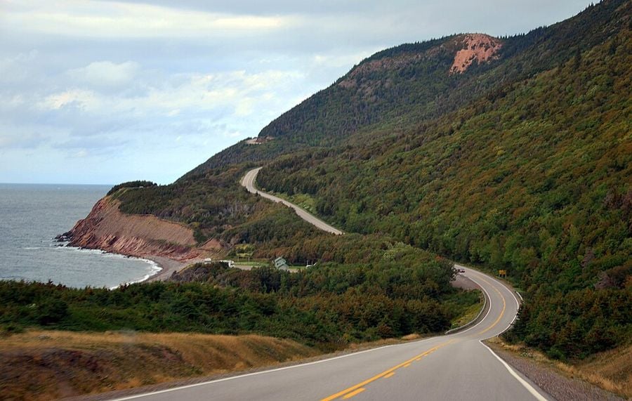
The Cabot Trail is a 185-mile circuit of Cape Breton Island’s northern highlands, consistently ranked among the world’s most scenic drives. The route follows the coastline high above the Gulf of St. Lawrence and the Atlantic, with the ocean visible from most of the drive and changing dramatically with the weather and the light. Doing the circuit twice in opposite directions is a reasonable strategy: the views shift enough between clockwise and counterclockwise that the return leg doesn’t feel repetitive.
The Skyline Trail in Cape Breton Highlands National Park is the drive’s best single hike. The out-and-back trail ends at a headland cliff with a viewing platform looking west over the ocean, and the sunset from this spot is photographed so frequently that it has become the visual shorthand for the Cabot Trail in most travel coverage. Moose are common on the trail’s forest sections. The gondola at Cape Smokey offers an aerial perspective of the coastline that no roadside pullout can match.
The communities along the trail give the drive a cultural dimension that pure scenic routes don’t. Chéticamp is the center of Cape Breton’s Acadian community, with its own distinct food culture and a living tradition of traditional music. The Mi’kmaw First Nations communities, including Wagmatcook and Membertou, maintain an Indigenous cultural presence that extends the trail’s historical depth well beyond the colonial era. The Cape Breton fiddle tradition, with its Celtic roots and regional style, is audible in local pubs and cultural centers along the route. Halifax is about three and a half hours from the trail’s southern end, making the Cabot Trail accessible as a weekend trip for visitors flying into Nova Scotia.
The trail has no single best season, though fall, when the highlands turn, is the most photographed. Summer offers the most reliable weather and the longest daylight. Spring brings whale sightings off Pleasant Bay before most tourists arrive. The communities along the route are small enough that accommodation fills quickly in summer, and booking two to three months ahead is standard practice for peak season.
Peter Lloyd / Unsplash
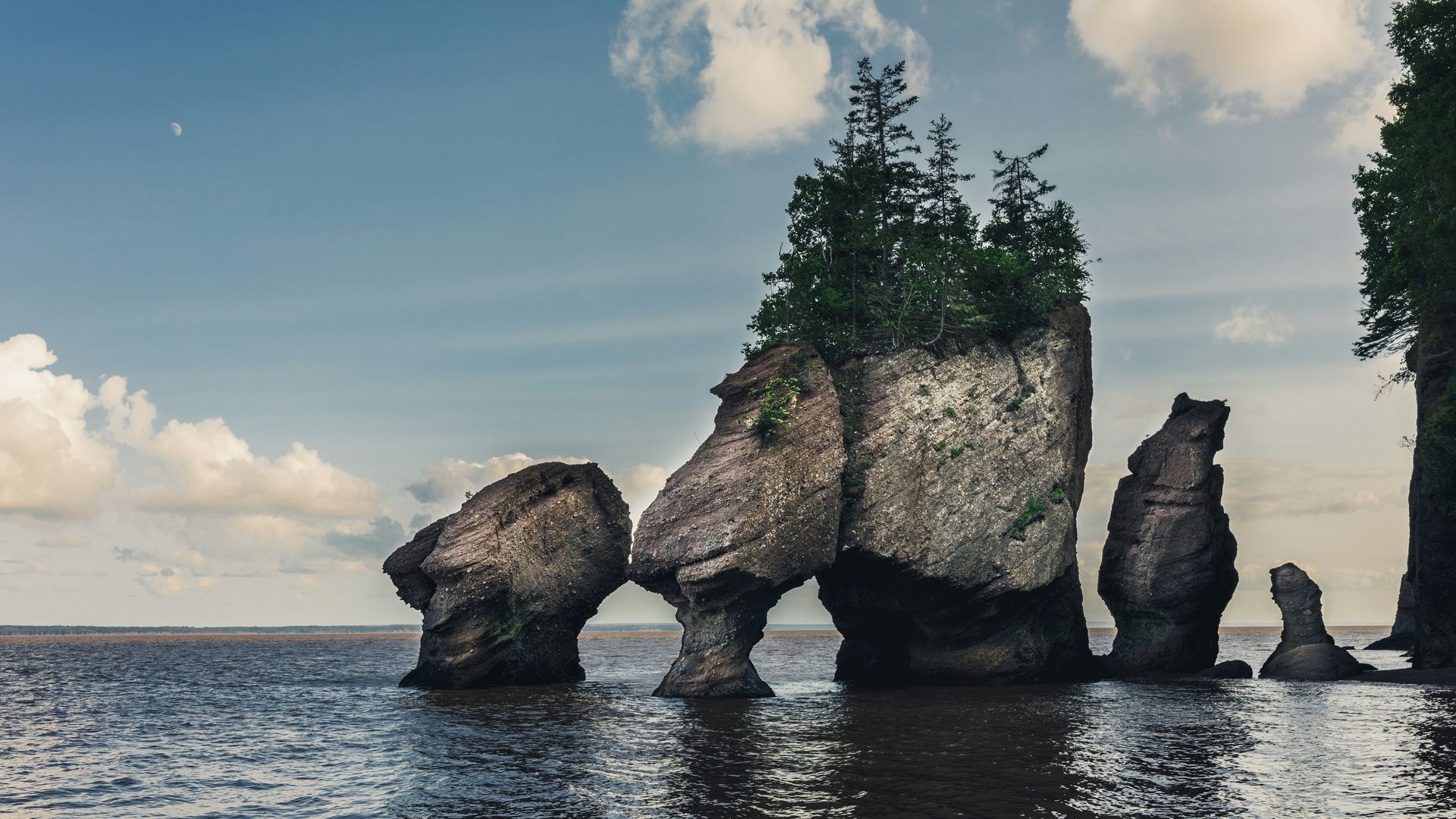
The Bay of Fundy’s tides are the highest in the world. The funnel shape of the bay amplifies tidal forces, raising the water level by up to 52 feet twice a day, moving 160 billion tonnes of seawater in and out with each cycle. The practical consequence at low tide is that you can walk on the ocean floor, an experience whose strangeness never quite normalizes, regardless of how many times you’ve read the statistic beforehand.
Hopewell Rocks Provincial Park is the best single location to experience the tides. The flowerpot sea stacks, named for their narrow bases and rounded tops, rise from the bay floor at low tide as free-standing rock formations you can walk among and touch. At high tide, the same formations are submerged up to 40 feet deep, and Baymount Outdoor Adventures offers guided kayaking sessions at high tide that let you paddle around the tops of the same rocks you walked between hours earlier. The dual-activity program, walking the floor at low tide and kayaking at high tide, requires checking the tide tables and timing your visit accordingly. The park posts the daily schedule, and planning around it is worth the effort.
The reversing falls at Saint John extend the Bay of Fundy experience into the city: the tidal force pushes the Saint John River backward upstream twice daily, creating a hydraulic phenomenon visible from a public viewing area on the waterfront. It’s less dramatic than Hopewell Rocks but makes for a worthwhile stop if you’re passing through.
The Bay of Fundy is most logically visited from Moncton or Saint John, both of which have airports. Hopewell Rocks is about 35 minutes from Moncton. The park charges admission and has a visitor center with tide tables posted. The best approach is to arrive at low tide, walk the ocean floor for two to three hours, eat lunch, and then book the high-tide kayak session in the afternoon.
Emily Hon / Unsplash
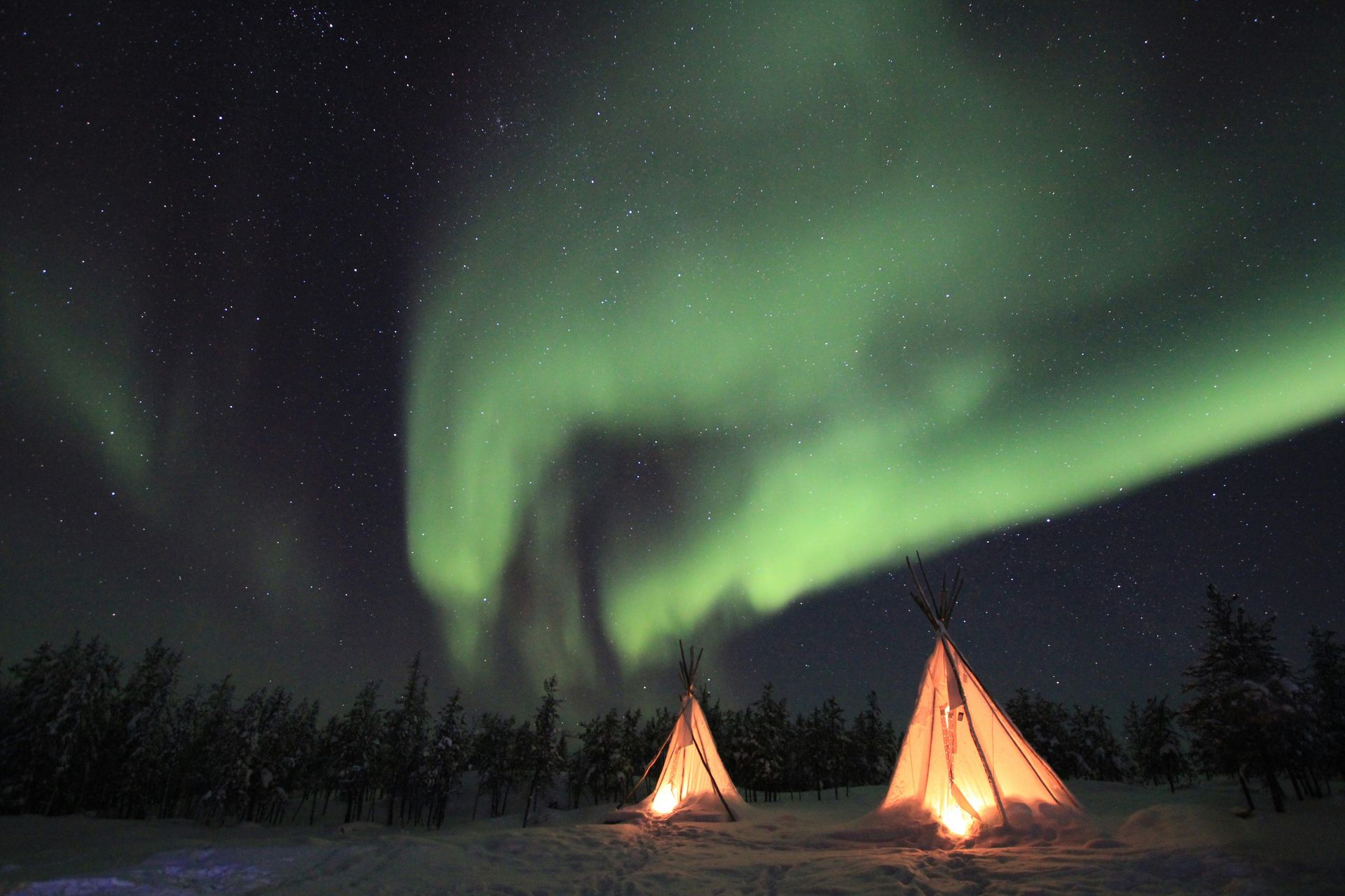
Yellowknife sits directly under the auroral oval, the band of maximum aurora activity that encircles the Earth’s magnetic poles. The city sees the northern lights up to 240 nights per year, more than any other populated place in Canada, which is why it is known as the “Aurora Capital of the World.” There are two aurora seasons: fall, from August to October, and winter, from December to April, each with different atmospheric and daylight conditions.
Aurora viewing from Yellowknife comes in several formats. Van-based chase tours follow the aurora’s movement across the sky and can cover significant ground if the display is active in a particular direction. Dogsled tours offer a slower, quieter approach whose pace suits the contemplative quality of a good aurora display. Snowmobile excursions cover more ground faster. Aurora Village, an Indigenous-owned facility outside the city, offers a fixed viewing platform with heated teepees, the most comfortable option for visitors who’d rather not be moving around in sub-Arctic temperatures. The Yellowknife River stays open water adjacent to a frozen bay in some conditions, creating a reflection surface that doubles the aurora display for photographers who know where to set up.
Clear skies and darkness are the two non-negotiable viewing conditions, and the Yellowknife area’s sub-Arctic latitude and minimal light pollution make Yellowknife, Canada’s most consistently reliable location for both. The city’s established aurora tourism infrastructure, including guided tours, photo workshops, and aurora alert apps, makes the experience more accessible than it would be in a more remote northern location.
Yellowknife is a proper city of about 20,000 people with hotels, restaurants, and a functioning urban infrastructure. The aurora season tours are well organized and competitively priced relative to other aurora destinations. Flights from Edmonton are about 90 minutes. The most practical approach for a first visit is a three to four-night stay in winter, long enough to get at least one or two clear nights, which is a reasonable statistical expectation in the Yellowknife area.
Dan Bolton / Unsplash
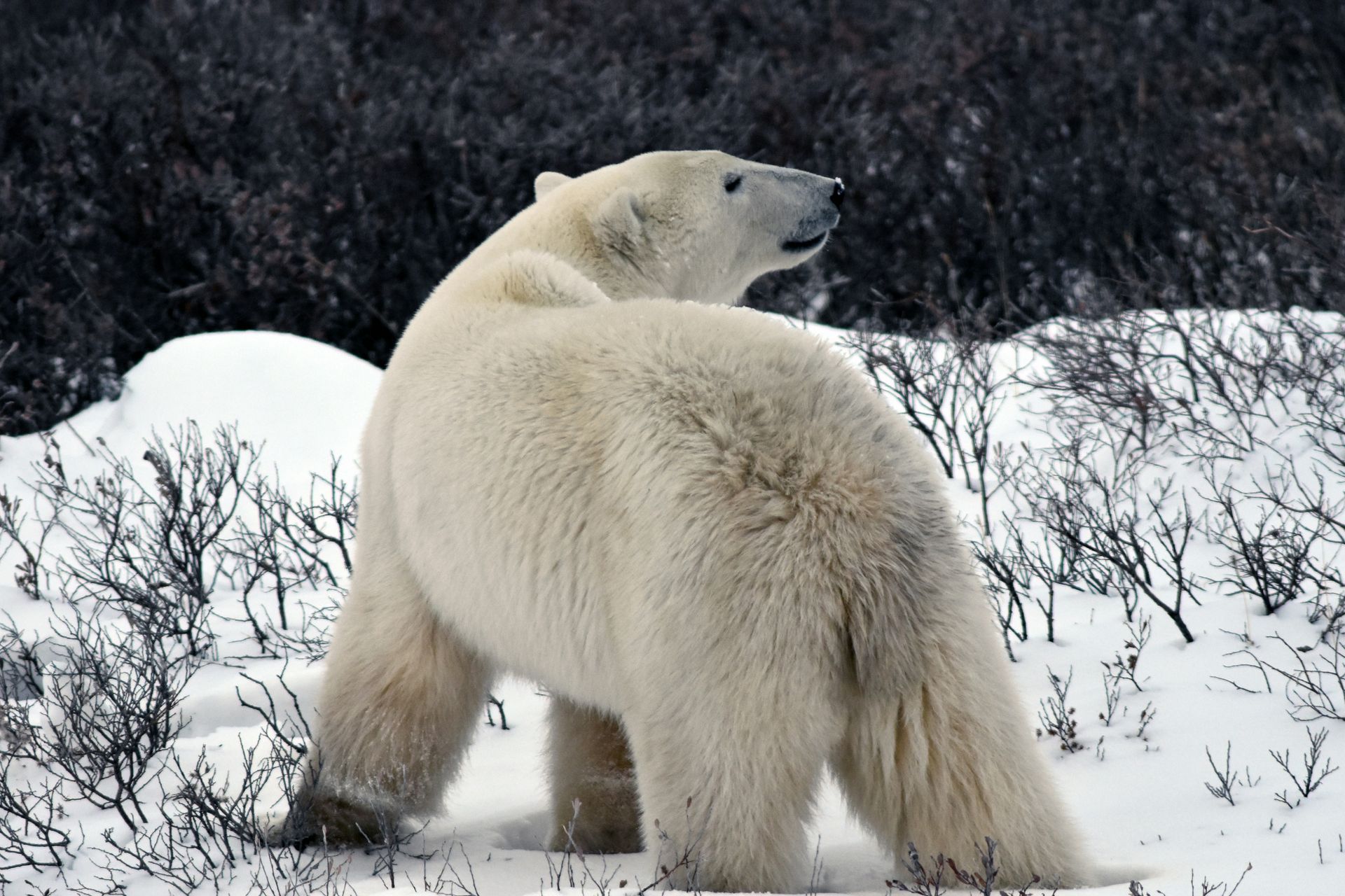
Churchill draws roughly 600 polar bears to its surrounding coastline each fall. The bears congregate along Hudson Bay’s western shore, waiting for the sea ice to freeze, at which point they move onto the ice to hunt ringed seals. The window between October and early November, when the bears are present but the ice hasn’t yet formed, is when Churchill becomes the most accessible polar bear-viewing destination on Earth.
Frontiers North Adventures operates the Tundra Buggies that define the Churchill polar bear experience: purpose-built vehicles with elevated platforms and large windows that allow passengers to observe bears from close range without endangering either party. The bears investigate the vehicles with apparent curiosity, sometimes standing against the side to get a better look, which produces the kind of close-range encounter that’s not available at any other bear viewing destination. SeaWalls Churchill, a public art project, has covered the town’s buildings with murals depicting polar bears and Arctic wildlife at a scale and quality that makes the between-excursion walking tour worth doing.
Summer brings a different wildlife program. Thousands of beluga whales enter the Churchill River estuary each July and August, and kayak tours and boat trips provide access to pods habituated to human presence, making close encounters common. The beluga is a distinctive animal, with its white coloration, flexible neck, and sociable behavior, and the Churchill summer visit is one of the few places where sustained close-range beluga contact is reliably possible. Getting to Churchill takes commitment: either fly from Winnipeg or take the VIA Rail train, a 45-hour journey. The remoteness is appropriate. This is genuinely the edge of inhabited Canada.
Churchill has a small selection of hotels and lodges, and accommodation books out months in advance for the October and November polar bear season. Tour operators like Frontiers North Adventures handle most logistics, including airport transfers and daily tundra buggy scheduling. The town’s infrastructure is small but established, and the locals are accustomed to visitors whose primary purpose is wildlife.
Ric Matkoski / Unsplash
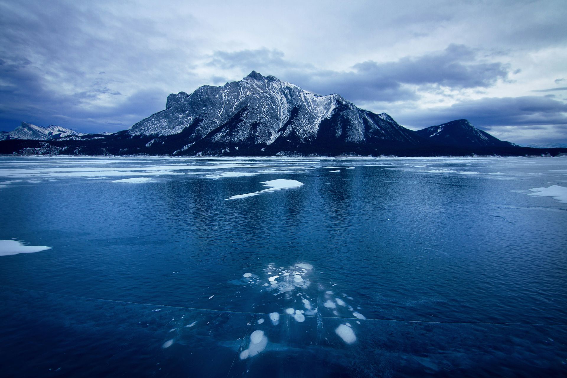
Abraham Lake is an artificial reservoir in the Alberta foothills, and between December and March, its ice surface becomes one of the most photographed winter landscapes in Canada. Methane produced by decomposing organic matter on the lake bed rises through the water and freezes at successive depths as temperatures drop, creating stacked columns of white spheres suspended in the lake’s clear turquoise ice. The effect is visible from the surface because the ice is unusually transparent, and the frozen bubbles, some the size of dinner plates and others small and clustered, create a visual pattern that looks designed, not geological.
The optimal viewing window is the early freeze, before snowfall covers the surface and obscures the bubbles. December visits typically offer the clearest ice. By late winter, the snow cover makes the bubble formations harder to see, though the ice remains thick enough for walking. Nordegg Adventures offers guided ice walks and Nordic skating programs for visitors who are less confident about assessing ice thickness and route safety on their own, which is a reasonable precaution on a lake whose freeze conditions vary across the surface.
The Canadian Rockies provide the backdrop. The lake sits at the eastern edge of the foothills, close enough to the mountains that the Icefields Parkway is a plausible add-on to the same trip. The Abraham Lake ice formations are ephemeral by definition, gone with the spring thaw, which is most of what makes the December-March window worth planning a trip around.
Abraham Lake is about two and a half hours west of Red Deer on Highway 11. The closest town with accommodation is Nordegg, which has limited options, or Rocky Mountain House, about 45 minutes further east. The lake is accessible by car, and the bubble formations are visible from the road in places, though reaching them requires walking out onto the ice. Nordegg Adventures can advise on current ice conditions and safe access points. The lake is large, and the ice thickness varies, so local knowledge matters more here than at established skating destinations.
Credit: Destination Canada
Grasslands National Park protects one of the last large intact samples of mixed-grass prairie in North America. The ecosystem that once covered much of the Great Plains has been almost entirely converted to agriculture, and the park’s East Block $SQ preserves a piece of what the pre-colonial grassland actually looked like. It’s also the starting point for the Valley of 1000 Devils Trail, a 7-mile hike that descends from the prairie surface into the eroded coulees and hoodoo formations of the badlands below, a landscape transition that feels like moving between two different geological eras within a single walk.
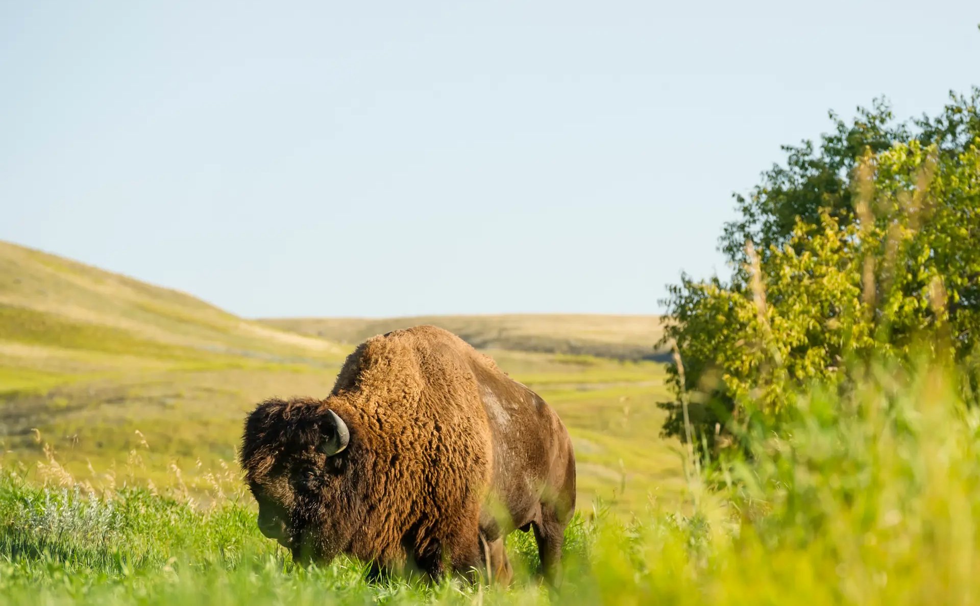
The West Block, two hours from the East Block, is where the bison herds roam. Plains bison were reintroduced to Grasslands after being extirpated from the prairie, and the herds have grown to the point where they’re a reliable sighting. The black-tailed prairie dog colony in the West Block is one of the few remaining in Canada. Prairie dogs live in large social burrows and post sentinels at the entrance holes who give warning calls when predators approach, a behavior that’s genuinely interesting to watch once you know what you’re seeing.
The park is remote. There are no hotels near the East Block, and services concentrate in the small town of Val Marie. The Parks Canada Rock Creek Campground offers oTENTik structures and hybrid tent and A-frame cabin units that can be reserved in advance. The night sky here is exceptional: the Saskatchewan grasslands are far enough from any significant light sources that the Milky Way is visible with the naked eye on a clear night, which, on its own, justifies the camping option.
Grasslands is one of the least-visited national parks in Canada, which is part of its appeal. The Val Marie area, the closest town to the East Block, has a handful of guesthouses and one small hotel. The Parks Canada visitor center in Val Marie is the best starting point, with current trail conditions, wildlife sightings, and campground availability. The Valley of 1000 Devils Trail requires solid footwear and several hours. Start early in hot weather.
Jason Ng / Unsplash
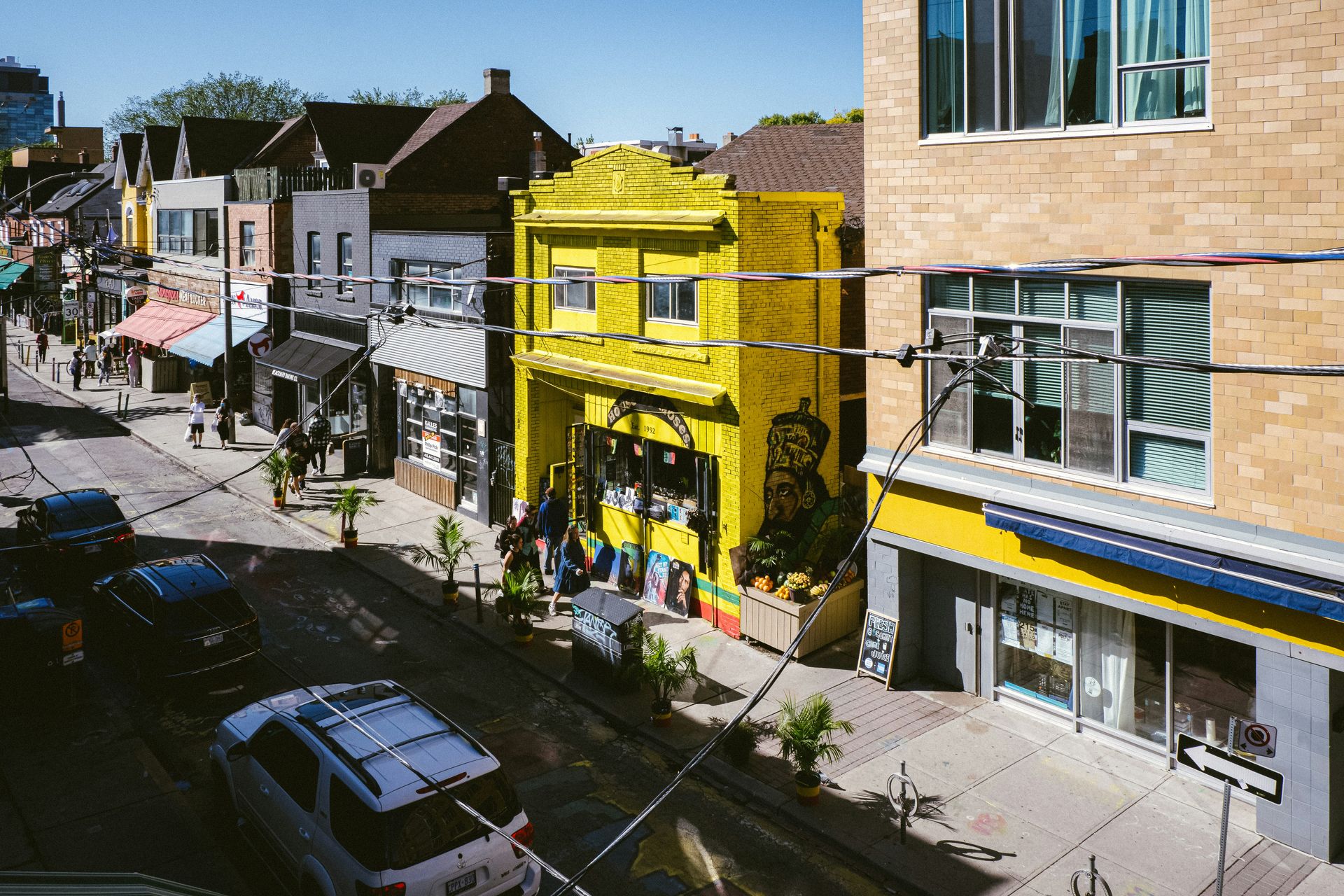
Kensington Market is the Toronto neighborhood that has most successfully resisted commercial standardization. There are no chains. The commercial district is built around cheesemongers, Latin grocery stores, vintage clothing shops, and independent food stalls, with the market’s deliberate character maintained through community organization and relatively stable tenancy. Courage My Love, the vintage clothing landmark at the heart of the neighborhood, has been open since 1975 and remains the most historically established single shop in the area.
The food options are genuinely diverse and reflect the neighborhood's immigration history. The Chilean corn pie at Jumbo Empanadas and the birria tacos at Gus Tacos are specifically recommended, and the Latin grocery stores stock ingredients for cuisines that other Toronto neighborhoods don’t have in the same concentration. The secondhand shops are worth browsing slowly: each has its own sourcing specialty, and the density of options within a few walkable blocks is unusual for a Canadian city.
On weekends, the market’s core streets become pedestrian-only, and the public space fills with buskers, food vendors, and the general social activity of a neighborhood that treats the street as a shared living room. Kensington is best understood as a participation experience, not a sightseeing one. The point is to wander, buy something unexpected, eat something unfamiliar, and spend longer than planned. Toronto has other shopping districts, but none with this specific mix of independence, diversity, and street-level vitality.
Kensington is walkable from most downtown Toronto hotels in about 20 minutes, or accessible by streetcar. The neighborhood is at its most active on Saturday mornings, when the street vendors set up and the pedestrian-only streets fill. The Sunday farmers' market runs seasonally. Adjacent Chinatown, immediately to the east, offers significantly more food options and is worth folding into the same afternoon. The Baldwin Steps, a staircase at the eastern edge of Kensington that climbs to Bloor Street, provides a useful orientation point and a shortcut to the Annex neighborhood, which has its own bookshops and cafes worth exploring after the market.
-1920x1304.jpg)
BIPIN SAXENA / Unsplash
Québec City has the only remaining fortified city walls in North America north of Mexico. The walls encircle Old Québec, the historic upper town, and walking its 3-mile perimeter is the most direct way to understand the city’s physical character and its military history. The fortifications include bastions, gates, and cannon embrasures, the working infrastructure of a colonial defensive system that was genuinely functional for two centuries. Parks Canada leads guided wall tours, and the views from the ramparts across the Plains of Abraham and the St. Lawrence River make the walk rewarding on purely visual terms, regardless of the history.
The four historic gates, Porte Saint-Louis, Porte Saint-Jean, Porte Kent, and Porte Prescott, mark the original entry points through the walls and remain in use as pedestrian thoroughfares. Inside the walls, the cobblestone streets of Old Québec lead to the Fairmont Le Château Frontenac, the château-style hotel that dominates the city’s skyline and is reputedly the world’s most photographed hotel. Whether or not that’s literally true, its copper-roofed towers are sufficiently striking that the building earns its prominence. Umbrella Alley, where hundreds of colorful umbrellas hang above a narrow pedestrian street, has become one of the most photographed streetscapes in the city.
The Hôtel de Glace, about 30 minutes from the city, is North America’s only ice hotel. It’s rebuilt from scratch each winter using ice and snow from the surrounding area, with a new architectural design each season. The rooms are cold by definition, kept at about -5°C, and sleeping there requires a sleeping bag rated for the temperature. It’s a seasonal experience available roughly from January through March, and it’s the most distinctly Canadian overnight option at any urban destination on this list.
Québec City is well served by flights from Toronto, Montreal, and some American cities. The old walled city is compact and walkable, and most of the major attractions are within the fortification perimeter. The best base is inside the walls or immediately adjacent to them, eliminating the need for transit and keeping the neighborhood’s atmosphere accessible at all hours. Winter visits, roughly December through March, add the ice hotel as an option and the city’s famous Winter Carnival to the calendar.
