
The most breathtaking places to visit in South America right
From Machu Picchu's cloud-draped ruins to Iguazu's nearly 300 waterfalls spanning two miles of the Argentina-Brazil border
Matheus Oliveira / Unsplash
South America resists the kind of summary that makes a continent feel manageable. The geography alone defies easy categorization: the world’s largest tropical rainforest, the world’s largest salt flat, the world’s highest navigable lake, the world’s largest waterfall system, and a mountain range that runs the full length of the western coast all exist within the same landmass. The cultures built across this terrain are equally varied — Incan ruins preserved at altitude, colonial Spanish cities on Caribbean coastlines, wine regions producing some of the world’s most sought-after red varieties, and Amazonian ecosystems that scientists continue to document with new species every year.
Travel across South America rewards both the adventurer and the urban explorer, often within the same trip. A week in Peru can move from Lima’s sophisticated food scene through the Sacred Valley’s Andean villages to the altitude of Machu Picchu without once repeating an experience. A trip to Argentina can pair Buenos Aires’s late-night tango culture with the Mendoza wine country and the glaciers of Patagonia in a sequence that crosses three entirely different landscapes and registers of South American life. The continent’s scale means that most visitors choose a region rather than attempting the whole, which gives each trip a focus that the breadth of South America can only partially satisfy.
The destinations below appear in Travel + Leisure, informed by the expertise of Harry Hastings, founder and director of Plan South America, and Emmanuel Burgio, president of luxury travel company Blue Parallel, both of whom have spent decades coordinating travel across the continent. The selection covers the full geographic and experiential range of South America across 10 destinations that each represent something the continent does at its most distinctive.
1. Machu Picchu anchors Peru’s Incan heritage in one of the world’s most spectacular settings
-1920x1272.jpg)
Eddie Kiszka / Unsplash
Machu Picchu sits on a ridge where the Peruvian Andes descend toward the Amazon $AMZN Basin, in a position that places the 15th-century Incan ruins above the cloud line on most mornings, surrounded by peaks and valleys that the civilization deliberately chose rather than by accident. The site carries UNESCO World Heritage status and the distinction of being the best-preserved major Incan ruin accessible to visitors, with stone terraces, temples, and agricultural platforms intact enough that the function of each section is legible to a guided visit and suggestive to an unguided one. The true purpose of the site remains debated — a royal estate, a religious center, and a military outpost all have archaeological support, which gives Machu Picchu an interpretive openness that the physical completeness of the ruins amplifies.
The setting’s visual impact is consistent across conditions. On clear days, the surrounding peaks frame the ruins in a panorama that photographs universally and reads even more forcefully in person. On foggy mornings, the mist that rises from the valleys below and drifts through the terraces gives the site a quality that clear-sky visits do not produce: the ruins appear and disappear as the cloud moves, which gives the architecture a drama that the weather collaborates in rather than diminishes. Both conditions are genuinely worth experiencing, and visitors who arrive expecting the clear-sky postcard and end up with fog often find the atmospheric version more memorable.
The Inca Trail that connects the Sacred Valley to Machu Picchu gives hikers who book far enough in advance the most complete approach to the site: a multi-day walk through Andean terrain, past smaller ruins, that deposits arrivals at the Sun Gate above the site in the early morning. The alternative approach by train and bus from Aguas Calientes, shown below, provides visitors without the time, physical conditioning, or advance booking for the trail with a fully practical way to reach the same destination.
2. Torres del Paine National Park gives Patagonia its most dramatic wilderness experience
Olga Stalska / Unsplash
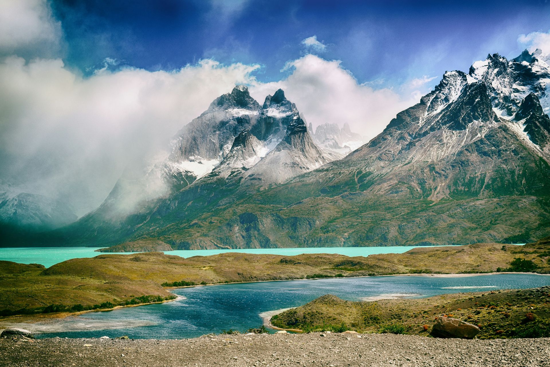
Torres del Paine in Chile’s Patagonia region concentrates the landscape elements that make the southern tip of South America one of the world’s most compelling wilderness destinations into a single national park: granite towers rising thousands of feet above glacial lakes, glaciers descending from the Southern Patagonian Ice Field, and valleys and moorland that guanacos, pumas, Andean condors, and Chilean flamingoes inhabit at visible densities. Hastings recommends visiting in April or late November, when the landscape holds color, weather conditions are relatively stable, and trail crowds are thinner than in the peak summer months.
The hiking infrastructure within Torres del Paine gives visitors access to terrain that would otherwise require specialist expedition planning. The W Trek, named for the shape its route traces across the park’s primary landmarks, covers the towers, the Grey Glacier, and the Valle del Francés in a multi-day circuit that mountain huts and campsites along the route make accessible to hikers without advanced wilderness experience. The longer O Circuit extends the route around the full park, adding the park’s more remote eastern and northern sections that the W Trek’s visitor concentration never reaches.
Wildlife encounters in Torres del Paine happen without the managed distance that national parks in heavily touristed regions often impose. Guanacos graze within meters of the main trail. Andean condors with wingspans exceeding nine feet soar above the towers with a regularity that rewards patient observation from the viewpoints below. The pumas that inhabit the park have become increasingly habituated to human presence in recent years, giving patient wildlife watchers genuine sightings of one of the Americas’ apex predators in its natural habitat.
3. Iguazu Falls spans the border between Argentina and Brazil as the world’s largest waterfall system
Jamie Dantas / Unsplash
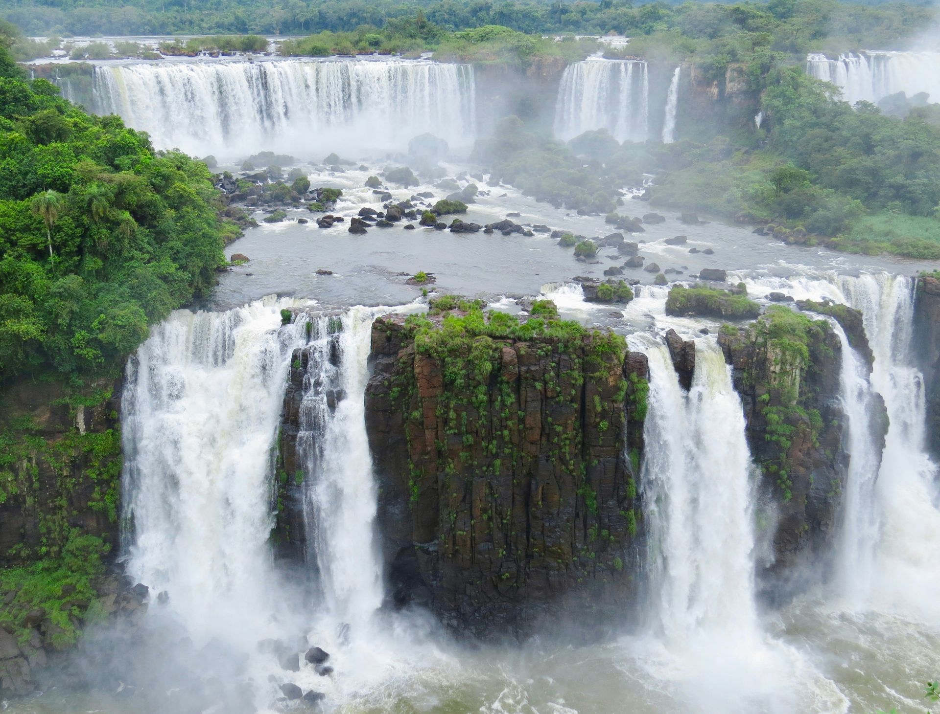
Iguazu Falls comprises nearly 300 individual waterfalls spread across almost two miles of the Iguazu River, making it the world’s largest waterfall system by width — three times wider than Niagara and with individual falls reaching 270 feet. The scale of the system defies the single-viewpoint experience that most famous waterfalls offer: walking the Argentine side’s trail network brings visitors to the edge of the falls at multiple points, including the Garganta del Diablo, the Devil’s Throat, where the river’s full volume collapses into a narrow horseshoe and produces a cloud of mist visible for miles. The Brazilian side gives a panoramic perspective that the Argentine side, positioned within the falls, cannot match.
The subtropical rainforest that surrounds the falls on both sides of the border gives the system an ecological context that amplifies the waterfall’s visual impact. Jaguars, caimans, tapirs, ocelots, and howler monkeys inhabit the surrounding forest, and coatis — raccoon-like mammals that have become entirely accustomed to visitor presence — move freely through the walkways and lookout platforms. The combination of one of the world’s most powerful natural waterfalls and an intact subtropical forest makes Iguazú Falls a destination where the environment beyond the falls is as rewarding as the falls themselves.
Visiting both sides of the falls requires crossing between Argentina and Brazil, which the proximity of the two national parks makes straightforward for visitors who plan accordingly. Each country’s park charges a separate entry fee, and the visitor experience differs enough between the two that most serious visitors to Iguazú spend at least one day on each side.
4. Buenos Aires sustains a cultural and social energy that few cities in the world approach
Andrea Leopardi / Unsplash
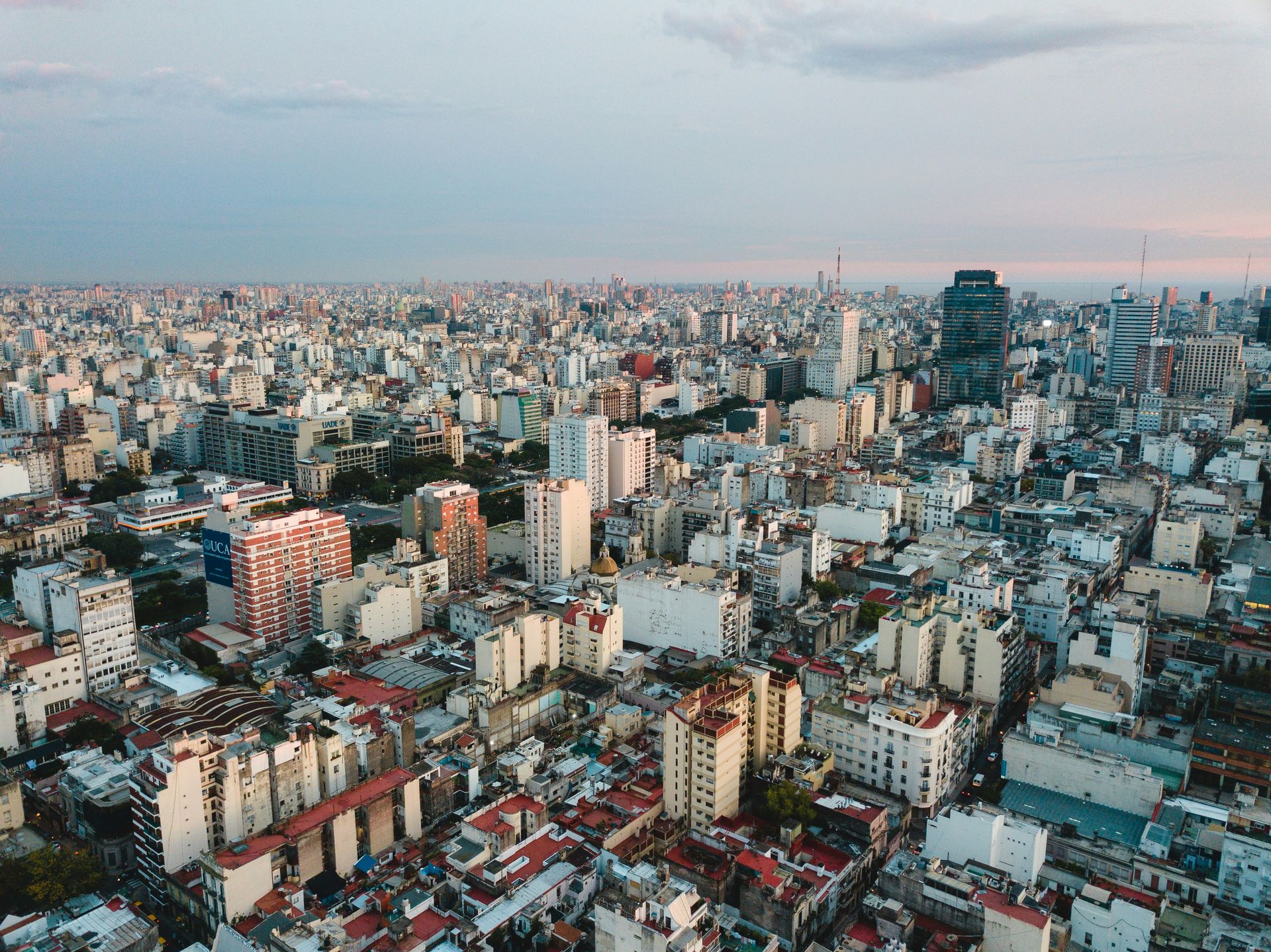
Buenos Aires operates on a schedule that the rest of the continent does not share: restaurants fill after 10 p.m., tango milongas run until dawn, and the café culture that gives porteños — Buenos Aires residents — their reputation for unhurried conversation extends the day in both directions without apparent exhaustion. Harry Hastings describes Rio de Janeiro as thoroughly intoxicating, but Buenos Aires produces its own version of that quality through culture and architecture rather than landscape, with 19th-century Parisian boulevards, the colorful La Boca neighborhood, and a theater and music scene centered on Corrientes Avenue that gives the city a cosmopolitan density specific to its history as a major immigration destination.
The Plaza de Mayo in the city center, flanked by buildings including the Casa Rosada presidential palace, gives Buenos Aires a civic heart whose political weight is inseparable from Argentine history: the square has hosted the demonstrations, confrontations, and celebrations that have defined the country’s political life across more than two centuries. The San Telmo neighborhood’s Sunday market draws vendors and buyers from across the city into a street-level cultural event that the neighborhood’s 19th-century architecture frames without making it feel historical. The Palermo neighborhood gives visitors access to local café life and restaurants at a remove from the tourist density that the center’s major sights generate.
Tango, the dance and musical form that Buenos Aires produced and still performs at the highest level, gives the city a cultural offering specific to this place in a way that few cities can claim for a cultural form. Attending a milonga — a tango social dance event — gives visitors an encounter with the dance as a living practice rather than a performance, which is the version of tango that the city’s reputation rests on.
5. The Galápagos Islands hold the wildlife encounters that inspired Darwin’s theory of evolution
Heidi Bruce / Unsplash
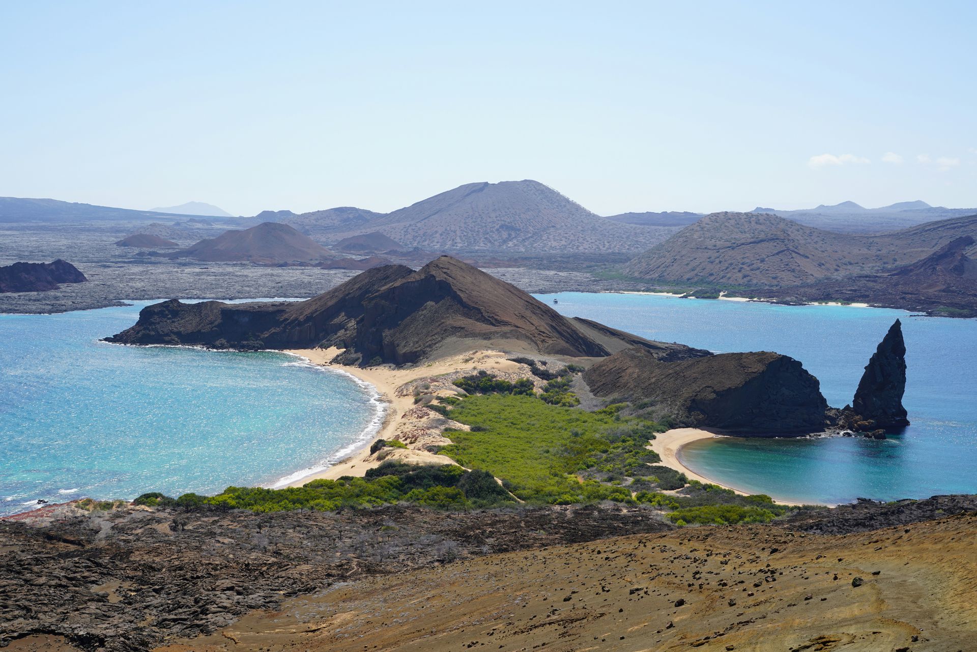
The Galápagos Islands, an Ecuadorian archipelago in the Pacific, offer wildlife encounters unlike any other on Earth, thanks to the animals’ indifference to human presence. Marine iguanas swim in the surf and bask on volcanic rock within arm’s reach of visitors. Sea lions rest on beaches and pontoons without acknowledging the people who walk around them. The finches whose beak variation across islands provided Darwin with his key evidence for natural selection still inhabit the same islands in species-specific configurations that guided visits make legible. Giant tortoises, the emblematic animals of the archipelago, live on several of the islands in populations that conservation efforts have stabilized after the near-extinction events of the 18th and 19th centuries.
The isolation that produced the Galápagos’s unique fauna — the islands have never been connected to the South American mainland — also explains the wildlife’s behavioral indifference to human observers. These animals evolved without land predators, which removed the flight response that characterizes wildlife in continental ecosystems. The result is a natural environment where the standard distance required for wildlife viewing elsewhere collapses, giving visitors direct proximity to animals that no safari, no nature reserve, and no managed wildlife encounter in any other destination can replicate.
Visiting the Galápagos requires a licensed tour operator and entry permits that limit visitor numbers to what the park authority determines the ecosystem can absorb. The permit system and the tour requirement give the islands a visitor management structure that the UNESCO World Heritage designation reinforces, and the result is a natural environment whose carrying capacity the visitation limits have protected from the degradation that unrestricted tourism has produced at comparable sites elsewhere.
6. Salar de Uyuni gives Bolivia a natural wonder with no equivalent anywhere on Earth
Samuel Scrimshaw / Unsplash
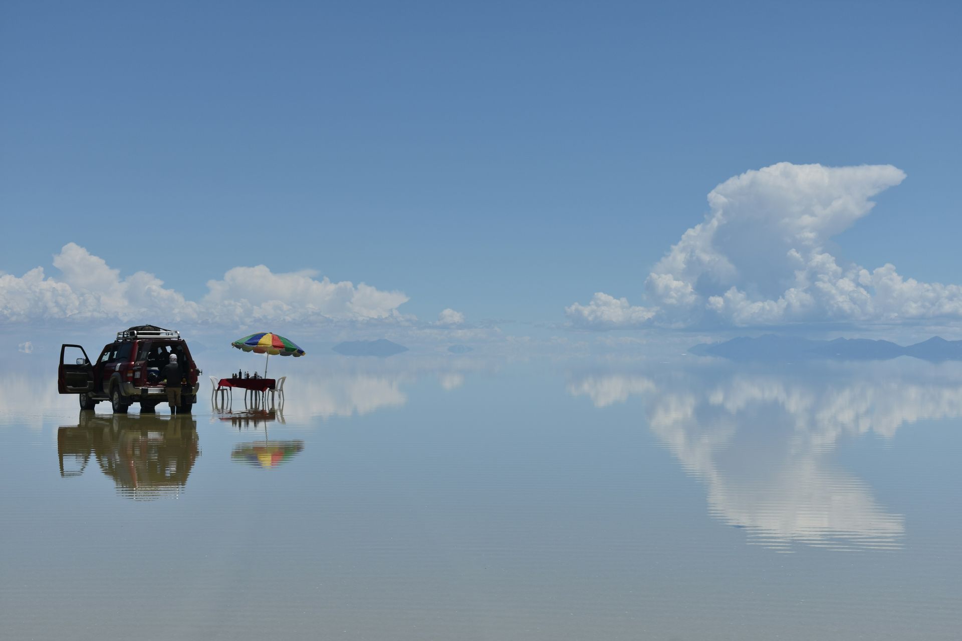
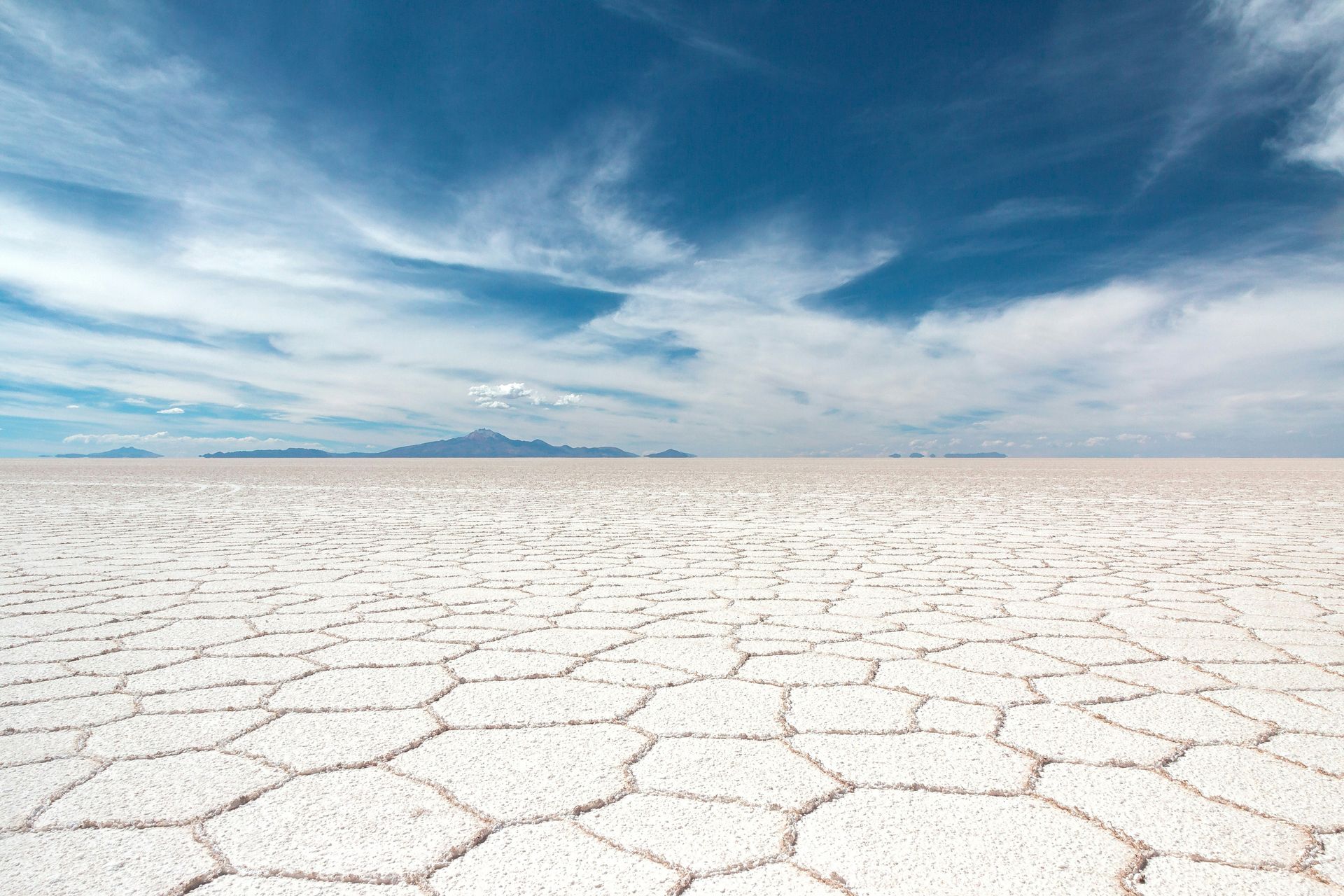
The Salar de Uyuni is the world’s largest salt flat, covering more than 4,000 square miles of the Bolivian altiplano at an elevation above 11,000 feet. The surface that prehistoric lake evaporation left behind — a crystallized crust of salt patterned with hexagonal formations that extend to the horizon in every direction — produces a visual environment that the human eye’s expectation of terrain does not initially process correctly. The flatness is absolute in a way that most flat landscapes are not: the salt flat eliminates the topographic variation that even the most level plains contain, which gives the environment a quality of optical infinity that photographs circulate widely without fully conveying.
During the rainy season, a thin layer of water covers portions of the salt flat, producing a mirror effect that reflects the sky with such precision that the boundary between the surface and the air above it becomes invisible. The photographs produced under these conditions have circulated globally and have given the Salar de Uyuni an international visual profile disproportionate to Bolivia’s broader travel recognition. The dry season produces the salt’s crystallized surface patterns without the mirror effect, which gives visitors in different seasons a fundamentally different visual encounter with the same place.
Beyond the salt flat itself, the surrounding altiplano gives a Salar de Uyuni visit additional geological content: the Train Cemetery on the outskirts of Uyuni town holds rusting 19th-century steam locomotives abandoned when the mining economy they served collapsed, active geysers at the nearby Reserva Nacional de Fauna Andina Eduardo Avaroa reach their most vigorous output in the early morning, and flamingo colonies inhabit the red and green lagoons scattered through the reserve terrain.
7. Maipo Valley produces Chile’s most celebrated wines in the shadow of the Andes
Jens Peter Olesen / Unsplash
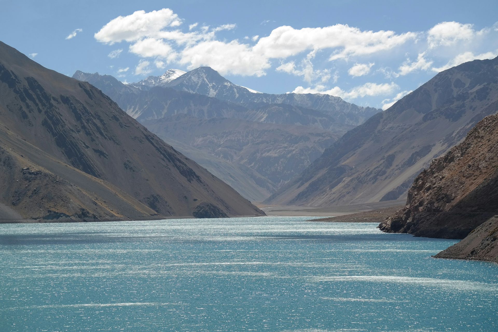
The Maipo Valley, the wine region closest to Santiago and one of Chile’s most historically significant, holds more than 7,300 acres of vineyards against a backdrop of snow-capped Andes peaks, with more than half of that acreage dedicated to cabernet sauvignon and cabernet blends that the valley’s combination of elevation, temperature range, and soil composition produces at a quality level that has attracted sustained international attention. Vines were first planted in the valley in the 1500s, giving Maipo’s wine culture a depth of history that newer South American wine regions do not share.
The wine-tasting infrastructure that Maipo has developed around its major producers gives visitors access to cellars, vineyards, and enologists at estates that have built their reputations over multiple generations. The estates closest to Santiago are reachable as day trips from the capital without a car, though having transport gives visitors the flexibility to move between producers at the pace the tasting and vineyard visits reward. The Andes backdrop that frames virtually every view within the valley gives the wine country a visual context that European wine regions, however historically rich, cannot replicate.
The proximity to Santiago gives the Maipo Valley logistical accessibility that Chile’s more remote wine regions, including the Colchagua and Casablanca valleys, do not offer to visitors based in the capital. A day trip from Santiago that combines a winery visit, a vineyard walk, and lunch at a producer's restaurant adds a wine culture dimension to a South American itinerary without requiring a separate regional trip.
8. Rio de Janeiro pairs beaches and iconic landmarks with one of the world’s most dramatic urban settings
gustavo nacht / Unsplash
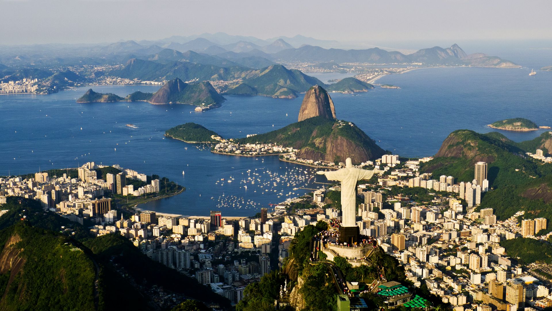
Rio de Janeiro’s setting is what Harry Hastings describes as the most dramatic of any city he knows: a metropolitan area of millions built around granite peaks, white-sand beaches, and a bay whose geography makes the city simultaneously dense and open, contained and exposed to the sea. Sugarloaf Mountain, accessible by cable car from the Urca neighborhood, offers visitors a perspective on Copacabana, the bay, and the surrounding peaks that the city’s streets cannot capture in a single frame. The 98-foot Christ the Redeemer statue on Corcovado mountain, visible from most of the city’s neighborhoods, gives Rio a landmark whose scale the surrounding terrain makes possible and whose visibility makes the city's skyline immediately recognizable.
The beaches that define Rio’s international identity — Copacabana and Ipanema most prominently — function as social spaces as much as swimming destinations. The activity that unfolds on the sand and along the beachfront promenade at any hour of the day represents a cross-section of carioca life, the term Rio residents use for their own culture, that the more tourist-concentrated areas of the city do not replicate in the same register. Beach volleyball, footvolley, vendors, musicians, and the particular beach fashion that Rio has exported globally all make the beachfront a primary cultural experience rather than incidental scenery.
Carnival, the annual celebration that peaks in Rio in February or March, depending on the calendar, gives the city a seasonal dimension that visitors who time their trip around it encounter as an overwhelming and genuinely transformative event. The samba schools that spend the entire year preparing for the Sambadrome parade produce performances of costume, choreography, and music at a scale and precision that the category of parade does not begin to describe accurately.
9. Perito Moreno Glacier gives Patagonia an accessible encounter with the Southern Patagonian Ice Field
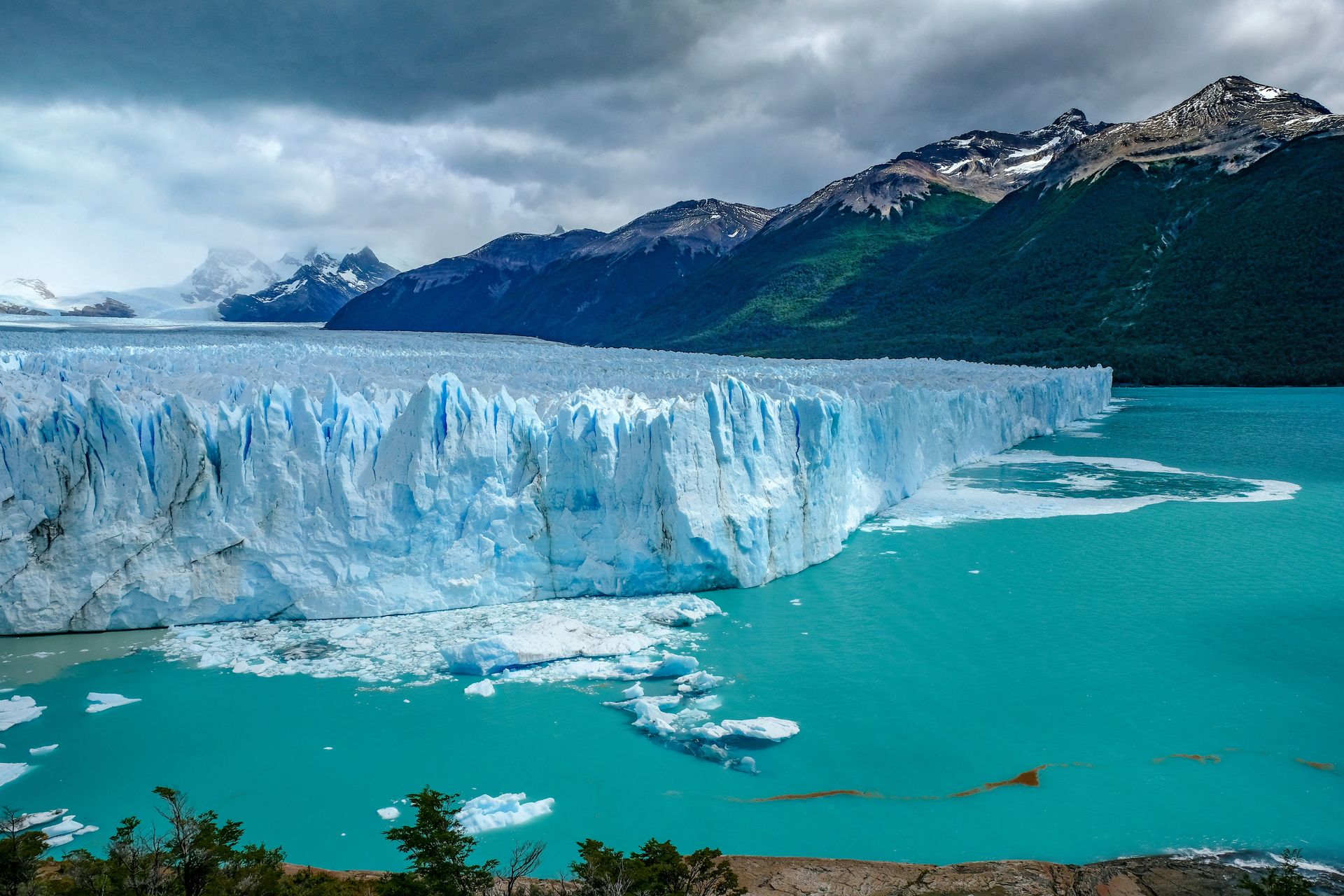
Hans-Jürgen Weinhardt / Unsplash
The Perito Moreno Glacier in Argentina’s Los Glaciares National Park advances toward Lake Argentino at a rate that makes it one of the few glaciers in the world that is neither retreating significantly nor stable — a geological anomaly in the current period of global glacial retreat that gives the glacier a scientific significance alongside its visual drama. The ice wall that faces Lake Argentino reaches 255 feet above the waterline, with the underwater portion extending further below, and spans approximately 100 square miles. The sound of the glacier, which produces deep cracking and groaning as the ice moves and the face periodically calves into the lake, adds an acoustic dimension that the visual spectacle alone does not prepare visitors for.
Burgio describes the ice-trekking excursion that guides lead on the glacier’s surface as an encounter with towering ice peaks, huge crevasses, turquoise meltwater creeks, and icy lagoons created by the glacier’s topography. The approach by boat across the bay gives the ice wall’s scale a distance reference that the shore viewpoints, positioned below the face, do not provide in the same way. Both the on-glacier experience and the boat crossing give Perito Moreno a range of access levels that make the glacier appropriate for visitors with different physical abilities and appetites for direct engagement.
The Los Glaciares National Park location gives Perito Moreno accessibility from the town of El Calafate, the regional hub whose infrastructure supports the glacier’s visitor volume. The town’s proximity to the glacier — roughly an hour by road — makes day trips from El Calafate practical and gives visitors who allocate a single day to the glacier enough time to cover both the shore viewpoints and the ice trekking if both are booked in advance.
10. Mendoza pairs Argentina’s finest wine country with Andes access and city culture
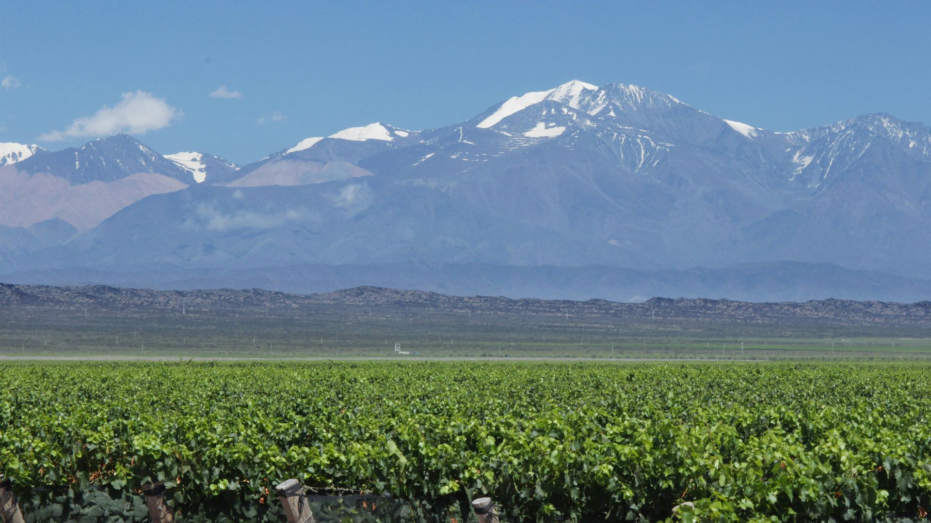
celso costa / Unsplash
Mendoza sits in the foothills of the Andes at an elevation that gives the wine region its distinctive temperature range — warm days and cool nights that preserve the acidity and aromatics of the malbec grape, which the region has made its signature variety. Burgio recommends visiting the vineyards and wineries of the Luján de Cuyo and Uco Valley sub-regions, specifically, with private tours and tastings conducted by enologists and vineyard owners who give wine education a depth that standard cellar-door tastings at major estates do not. On foot, horseback, or bicycle, the vineyard landscape of Mendoza gives the wine country experience a physical dimension that pure tasting-room visits cannot provide.
The Andes backdrop that the Mendoza wine country faces on clear days gives the region a visual drama unusual in wine country worldwide. The peaks of Aconcagua, the highest mountain in the Americas, are visible from the vineyards on the clearest days, and the snow line that defines the mountains’ upper reaches provides a water source for the irrigation systems that Mendoza’s arid climate makes essential to the vineyards below. The relationship between the mountains and the wine is not incidental: the meltwater that the Andes supply gives the regional wine its specific character as much as the soil and the grape varieties do.
Beyond the wine, Mendoza’s Calle Aristides Villanueva gives the city a nightlife and restaurant district where cooking classes and the preparation of Argentinian steak and empanadas connect more actively to the local food culture than restaurant dining alone. The shopping on Avenida Las Heras for fine leather goods gives the city a retail dimension specific to Argentina’s leather-craft tradition, and the combination of wine, food, mountain scenery, and city culture gives Mendoza a completeness as a destination that pure wine-country destinations, however appealing, do not always achieve.