
From Nicaragua's volcano surfing on loose black gravel to a Panama summit above two oceans, five Central American volcanoes worth the climb
Credit: Visit Centroamerica
Once considered a gateway to hell by early European explorers, the Central American Volcanic Arc now functions as a genuine playground for adrenaline seekers and volcano enthusiasts traveling from around the world. This chain of dormant and occasionally active volcanoes runs along the spine of the Central American isthmus, creating a varied landscape that offers adventure travelers a genuine backdrop for hiking, birdwatching, and even volcano surfing across five distinct countries.
Some volcanoes on this list reward a single, focused day trip, while others demand a multiday commitment that involves overnight ascents and considerable physical endurance. Travelers $TRV can tackle several volcanoes on a single regional trip or take them on one at a time, and each destination offers a distinctly different adventure despite sharing the same volcanic origin within the broader chain.
The five volcanoes below appear in Lonely Planet's guide to the most thrilling volcano adventures in Central America. They range from a straightforward summit hike rewarding travelers with sweeping views to a distinctly unusual sport that trades ocean waves for loose volcanic gravel entirely. Guatemala, El Salvador, Costa Rica, Panama, and Nicaragua each contribute one entry, giving travelers a genuine reason to plan a broader regional trip that connects several distinct volcanic landscapes across the isthmus. Elevation, hike duration, and required fitness level all vary considerably among entries, so travelers should match a specific volcano to their physical readiness before committing to a particular ascent. Guided tours remain mandatory or strongly recommended at nearly every stop on this list, reflecting how seriously local authorities take visitor safety around active or recently active volcanic terrain scattered throughout the region's considerable mountain chains, since a single moment of carelessness on unstable ground can turn a memorable adventure into a genuine emergency.
Conor Murphy / Unsplash
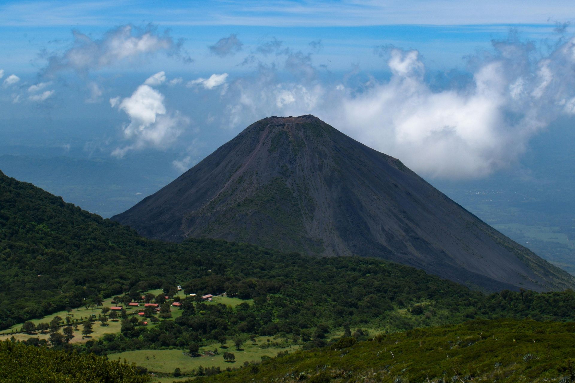
The Santa Ana Volcano, also known as Ilamatepec, is El Salvador's highest volcano, rising to 7,812 feet above sea level and serving as the country's third-highest point. The volcano sits less than an hour from the capital city of San Salvador, giving travelers notably convenient access without needing to venture far from the country's main transportation hub.
Santa Ana's crater ranks among the largest in the world, and the volcano's last eruption occurred in 2005, a relatively recent event that continues to shape how park authorities manage visitor access today. Guided tours remain mandatory for the popular four-hour hike to the summit, a policy that reflects both safety considerations and the considerable value of local knowledge navigating the volcano's varied terrain.
Reaching the top rewards hikers with sweeping views across Lake Coatepeque, a crater lake formed by a separate ancient volcanic collapse, alongside distant views stretching toward the Pacific Ocean. This particular pairing of a considerably large crater and far-reaching summit views gives Santa Ana real standing among the region's most rewarding single-day volcano hikes.
El Salvador's considerable position along the broader Central America Volcanic Arc means Santa Ana sits within a notably dense cluster of peaks, giving ambitious hikers the option to combine multiple volcano visits on a single regional trip. Lake Coatepeque itself draws considerable numbers of visitors regardless of the volcano hike, since the crater lake's turquoise water and lakeside restaurants have made it a popular weekend destination for Salvadorans and tourists alike. Travelers $TRV should book a guided tour well ahead of a planned hike, since limited daily permits and mandatory guide requirements can leave latecomers without a spot on busier weekends. The trail's considerable exposure to loose volcanic rock and ash means sturdy hiking boots outperform lighter sneakers across most of the route toward the summit. Booking through the park's official visitor center directly often secures a spot faster than going through a third-party agency.
cyph3r / Wikimedia Commons (CC BY-SA 2.0)
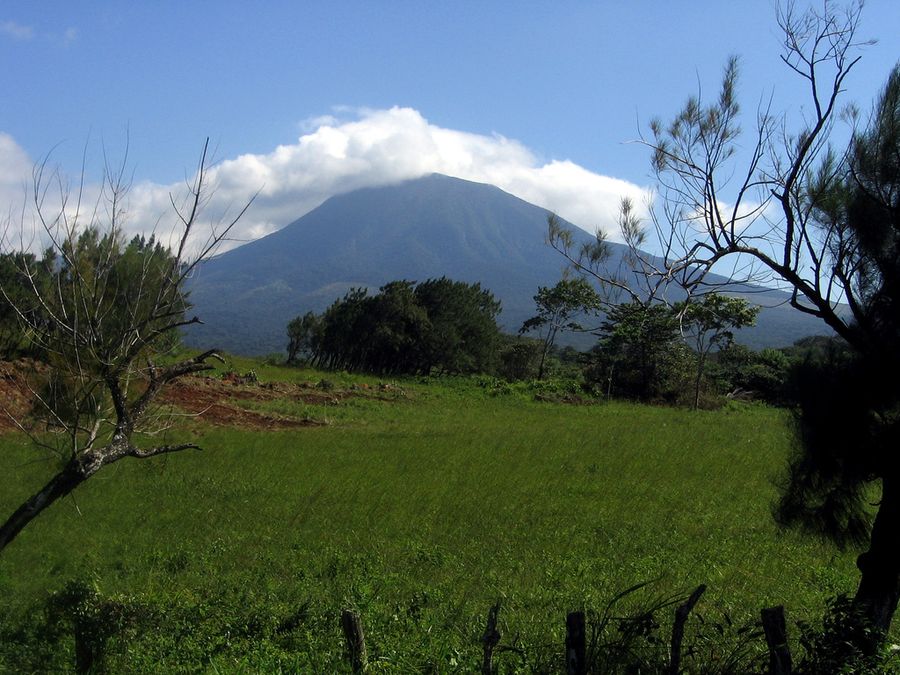
Situated within a 54-square-mile national park, Volcán Rincón de la Vieja, whose name translates to "old lady's nook," sits an hour and a half from the town of Liberia in northwestern Costa Rica. Eruptions in 2021 closed off hikes to the volcano's 6,217-foot summit. However, shorter hiking loops remain open throughout the park, including routes to other regional peaks, such as Volcán Santa María, which stands at 6,286 feet.
Travelers $TRV uninterested in a strenuous summit push can instead relax at the park's considerable collection of thermal springs, long believed to hold genuine healing properties among local communities. Many of these springs are easily reached by hiking, giving less adventurous visitors genuine access to the park's natural features without demanding the physical commitment of a full volcano ascent.
Numerous Liberia-based tour companies offer trips to both the national park and its considerable thermal spring network, giving travelers genuine flexibility in how they experience the area regardless of fitness level or specific time constraints. This particular pairing of restricted summit access and abundant lower-elevation attractions gives Rincón de la Vieja real appeal for a considerably broader range of visitors than a typical summit-focused volcano destination.
The park's considerable biodiversity, supported by its volcanic soil and varied elevation, gives nature-focused travelers additional reason to explore beyond simply the thermal springs, since the surrounding forest holds genuine wildlife diversity worth a dedicated day of exploration. The park's considerable volcanic activity throughout its history has shaped much of the surrounding Guanacaste region's landscape, including hot springs, fumaroles, and mud pots that reflect ongoing geothermal activity beneath the surface. Travelers should check current trail closures directly with the park before arrival, since ongoing volcanic activity has periodically restricted access to certain sections beyond simply the main summit route. Bringing swimwear along makes the most of a visit, since several of the thermal pools sit right along the shorter, more accessible hiking loops throughout the park.
Halbinger / Wikimedia Commons
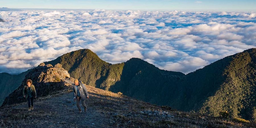
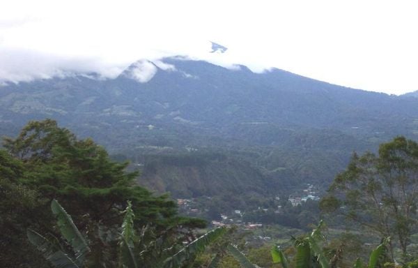
Barú Volcano is Panama's highest peak at 11,398 feet, located in the Chiriquí Highlands as a dormant volcano with seven distinct craters across its considerable summit area. Parque Nacional Volcán Barú functions as a genuine birdwatching paradise, home to roughly 250 recorded bird species, including the elusive resplendent quetzal, a strikingly colored bird considered sacred by ancient Maya and Aztec cultures.
Two separate routes lead to the volcano's summit, and the path departing from Boquete is the easier option, though it still demands a notably strenuous five- to six-hour climb from the park gate to the summit. The alternative route, departing from the town of Volcán, suits only experienced mountaineers given its considerably more demanding terrain and technical difficulty.
The full trek takes 10 to 12 hours round trip, and a popular option among experienced hikers is to start a guided night ascent timed to reach the summit at dawn, rewarding climbers with spectacular sunrise views across the surrounding highlands. The dry season, running from January through April, offers the most reliable conditions for attempting the climb.
Barú's considerable elevation reportedly makes it the only point in Panama from which both the Pacific and Caribbean coastlines become visible simultaneously on an unusually clear day, giving the summit real significance beyond simply its considerable birdwatching reputation. The nearby town of Boquete has grown into a major hub for coffee production, and many farms throughout the surrounding highlands offer tours that explain how the volcanic soil contributes to the region's internationally recognized coffee quality. Travelers $TRV attempting the night ascent should pack considerable warm layers, since summit temperatures can drop sharply overnight even though the surrounding lowlands stay warm throughout the day. Bringing binoculars considerably improves the birdwatching experience, since many of the park's most notable species stay perched high in the surrounding canopy. Early morning hours tend to reward patient birdwatchers the most, since many species are more active before the day's heat fully sets in.
NicaPlease / Wikimedia Commons (CC BY-SA 3.0)
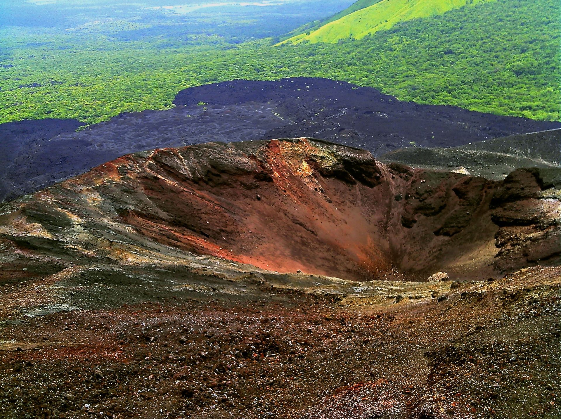
Just 160 years old, Cerro Negro is the youngest volcano in Central America, and this Nicaraguan peak, located just outside the colonial city of León, is among the region's most active. The volcano reaches 2,388 feet in height, considerably shorter than most other peaks on this list, though its relative youth and considerable ongoing activity give it a distinctly different geological character.
Despite the volcano's active status, a growing subset of travelers hop onto specially designed boards and speed down Cerro Negro's black gravel slopes, a practice known as volcano surfing or volcano boarding. This particular activity trades the water of traditional surfing for loose volcanic rock, replacing ocean spray with plumes of ash kicked up during the descent, delivering what many participants describe as a genuine mix of pure joy and considerable risk-taking.
Several agencies throughout the León area offer guided tours that combine a hike up the volcano with the boarding descent itself, giving travelers a structured, considerably safer way to attempt the activity than by venturing out independently. This particular pairing of considerable novelty and relative accessibility gives Cerro Negro real standing as one of the region's most unusual adventure activities.
Cerro Negro's considerable youth as a volcano, having formed well within recorded human history, gives geologists genuine ongoing interest in studying its eruption patterns, since the peak offers a rare opportunity to observe a volcanic landform still actively developing. Volcano boarding as an organized activity reportedly traces back to the early 2000s, when a group of travelers and local guides began experimenting with modified boards built to handle the loose volcanic gravel covering Cerro Negro's slopes. Travelers $TRV should wear protective clothing and goggles during the descent, since loose volcanic gravel can kick up far more debris than a typical sand-based boarding surface would. Renting protective gear directly through a tour operator usually costs less than purchasing equipment independently beforehand for a single descent.
Dimitry B / Unsplash
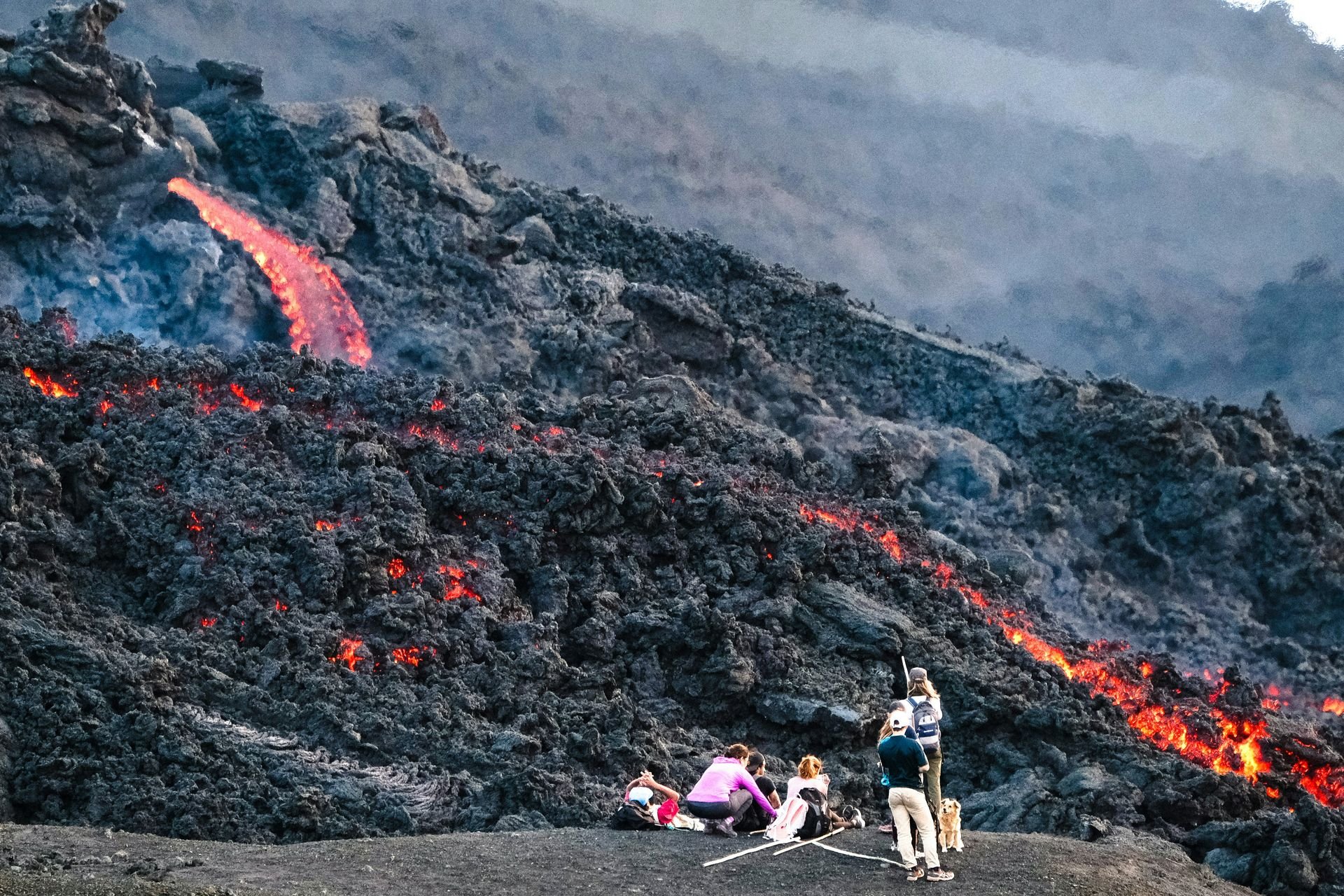
Travelers $TRV hoping for the real-deal volcano experience, complete with fresh lava and smoking sulfur, find exactly that at Pacaya in Guatemala. Though Pacaya ranks as one of Central America's most active volcanoes, its typical small eruptions of ash generally pose no direct threat to visitors, and various hiking tours offer travelers the chance to roast marshmallows over the considerable heat radiating from the volcanic rock itself.
Pacaya stands 8,373 feet tall and sits roughly a 1.5-hour drive from the colonial city of Antigua, giving travelers notably convenient access from one of Guatemala's most popular tourist bases. A hike to the summit takes about two hours, and the considerable views from the top stretch toward neighboring Agua volcano and the distant waters of Lago de Atitlán.
Travelers not in the mood for a full hike can instead rent horses for the ascent, giving less physically active visitors genuine access to the same considerable views without demanding a strenuous climb. This particular flexibility gives Pacaya real appeal across a considerably wide range of fitness levels and travel preferences.
Pacaya's long history of small, frequent eruptions has made it one of the most closely monitored volcanoes in Central America, providing scientists with a valuable ongoing case study of how active volcanic systems behave over sustained periods of continuous activity. Pacaya's considerable eruption history includes a major event in 2010 that forced the temporary closure of Guatemala City's international airport, demonstrating how even a relatively modest volcano can disrupt infrastructure well beyond its immediate surroundings. Travelers should check current volcanic activity advisories before booking a tour, since access to the closest viewing points can change depending on the volcano's activity level at any given time. Bringing sturdy shoes matters here too, since the volcanic rock underfoot stays uneven and occasionally sharp throughout much of the ascent. Bringing a few marshmallows along turns the hike into a considerably more memorable stop once reaching the warmest sections of exposed rock.