
The 8 most scenic ocean cruises in the world
From Norway's fjords to Antarctica's icebergs, these scenic ocean cruises sail past coastlines that no road, railway, or runway can reach
Credit: Enrique / Pexels
A cruise ship has one advantage that no other form of travel can match: the vantage point. It can sit a few hundred meters from a glacier as it calves into the sea, thread between granite peaks that rise straight out of the water, or hold position off a coastline with no road within a hundred miles. That perspective is the entire case for scenic ocean cruises — voyages built around the water and the coastline itself, not a checklist of ports connected mainly by convenience.
The eight routes below were chosen for that reason and no other. They are not ranked by luxury, price, or onboard amenities. Some, like the classic Bergen to Kirkenes run along Norway's coast, began as working transport routes before tourism ever entered the picture. Others, like the passage through the Antarctic Peninsula, exist only because ships can go where no other vehicle can follow. What they share is a coastline, strait, or archipelago that rewards being seen from a deck rather than a map.
Geography sets a hard limit on how many places qualify. A route earns a spot here because the terrain along it — a fjord wall, a barrier reef, a chain of volcanic islands — is dramatic enough to be the point of the trip, not a backdrop to it. That rules out plenty of well-traveled itineraries that are pleasant without being visually exceptional.
Several of these routes also sit inside protected landscapes: national parks, UNESCO World Heritage sites, or waters where ship size and passenger numbers are limited by international agreement. That protection is part of why the scenery holds up. A reader planning a trip around any one of these eight should expect the itinerary, season, and ship size to shape the experience as much as the destination itself, and each entry below covers the specifics needed to understand what that particular stretch of water actually offers.
Norway's Bergen to Kirkenes coastal route
Credit: Enrique / Pexels
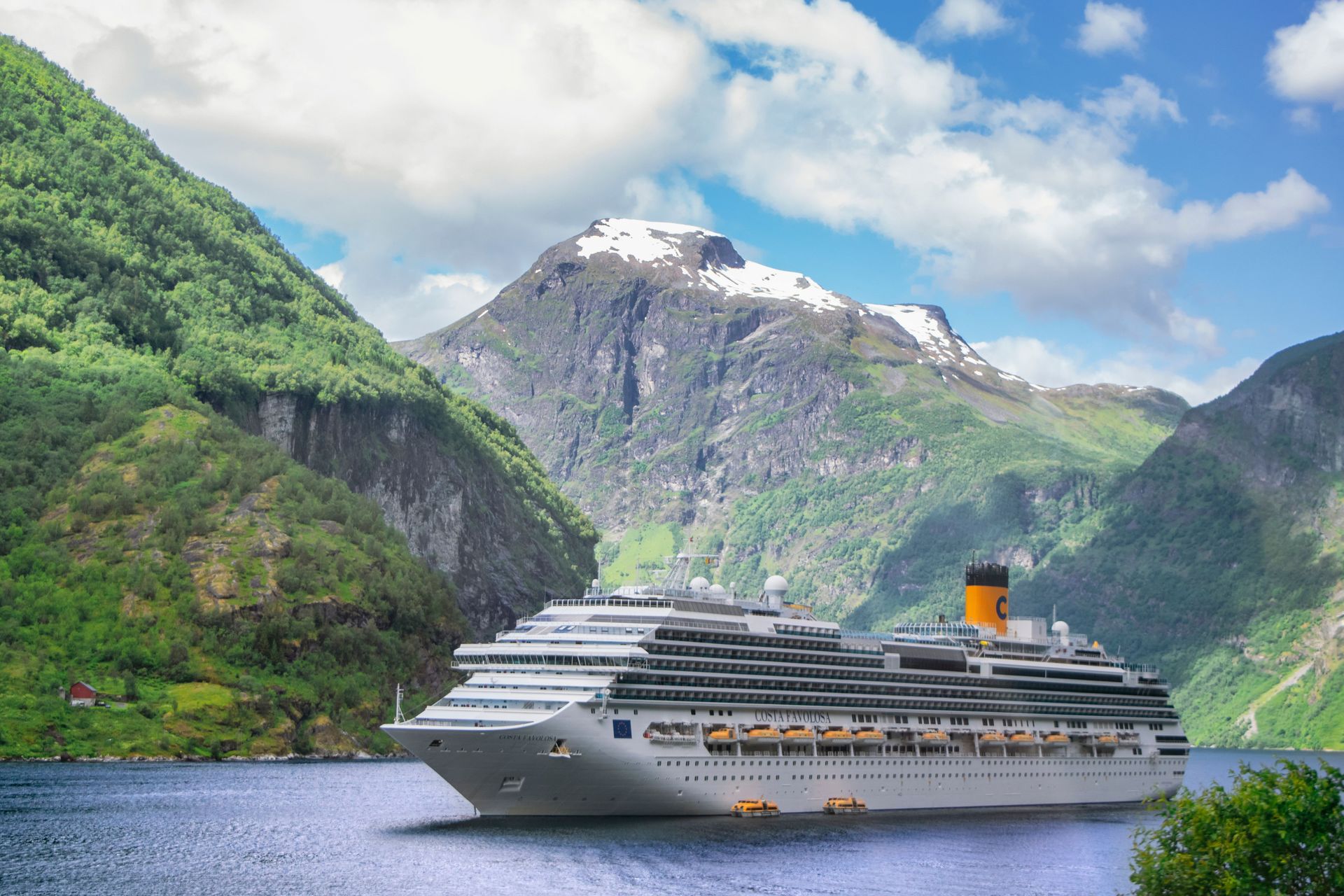
The classic Norwegian coastal voyage between Bergen and Kirkenes calls at 34 ports along a shoreline that has no continuous road system north of Trondheim. The route has run continuously since 1893, when it was created to speed mail delivery to remote fishing communities, and it still carries locals, cargo, and cars alongside passengers today.
The scenery shifts dramatically over the six to seven days it takes to sail north. Southern Norway is green, settled, and sheltered by skerries. Farther north, the coast turns rugged and the ports space out, culminating in a call at Honningsvåg, the gateway to the North Cape, one of the northernmost points in Europe reachable by ship.
Two fjords along the route carry UNESCO World Heritage status: Geirangerfjord and Nærøyfjord, both part of the West Norwegian Fjords designation given in 2005. Geirangerfjord in particular narrows to under a kilometer in places, with waterfalls including the Seven Sisters dropping directly into the water beside the ship's path.
The voyage also crosses the Arctic Circle, marked with an onboard ceremony on many sailings, and passes through the Lofoten Islands, a chain of jagged peaks rising from the sea that is often cited as one of the most photographed stretches of coastline in Scandinavia. Southbound sailings tend to pass the Lofoten Islands and Helgeland coast in daylight, while northbound sailings favor daylight views of Geirangerfjord and the cities of Ålesund and Trondheim, so direction matters for anyone booking specifically for scenery.
Because the ships still function as a real transport link, port stops range from ten-minute cargo calls to multi-hour stops in cities like Tromsø. That mix of working ferry and scenic cruise is part of what distinguishes this route from more conventional cruise itineraries.
Alaska's Inside Passage
Credit: Raymond / Pexels
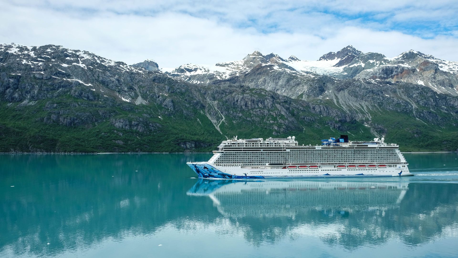
The Inside Passage is a sheltered, island-protected sea route running roughly from Washington state's Puget Sound north to Skagway, Alaska, and it owes its calm water to a nearly continuous barrier of islands that blocks open ocean swell. That shelter is what allows large ships to sail close to shorelines, glaciers, and wildlife that would otherwise be inaccessible.
Tracy Arm, a narrow fjord south of Juneau, cuts nearly 30 miles into the Coast Mountains and ends at twin tidewater glaciers, Sawyer and South Sawyer, that calve directly into the water. Many ships anchor near the face and lower smaller excursion boats to get closer, since the ice and shifting shallows near the glacier limit how far larger vessels can go.
Glacier Bay National Park and Preserve, a designated UNESCO biosphere reserve, protects another stretch of tidewater glacier coastline farther north, and the National Park Service caps the number of large ships allowed to enter on any given day to limit disturbance to the bay's marine mammals, including humpback whales and Steller sea lions.
Port towns along the route add cultural and historical texture to the scenery. Ketchikan sits at the southern end and holds the largest collection of standing totem poles in the world. Sitka, farther north, was the capital of Russian Alaska before the 1867 purchase and retains onion-domed St. Michael's Cathedral as a reminder of that period. Skagway, the route's northern terminus for most cruise itineraries, was the main gateway to the Klondike gold rush of 1897 to 1898, and its false-front downtown buildings are largely preserved from that era.
The main sailing season runs from May through September, when daylight hours are long and most wildlife, including breeding humpback whales, is present in the channels.
The Antarctic Peninsula
Credit: Frans van Heerden / Pexels
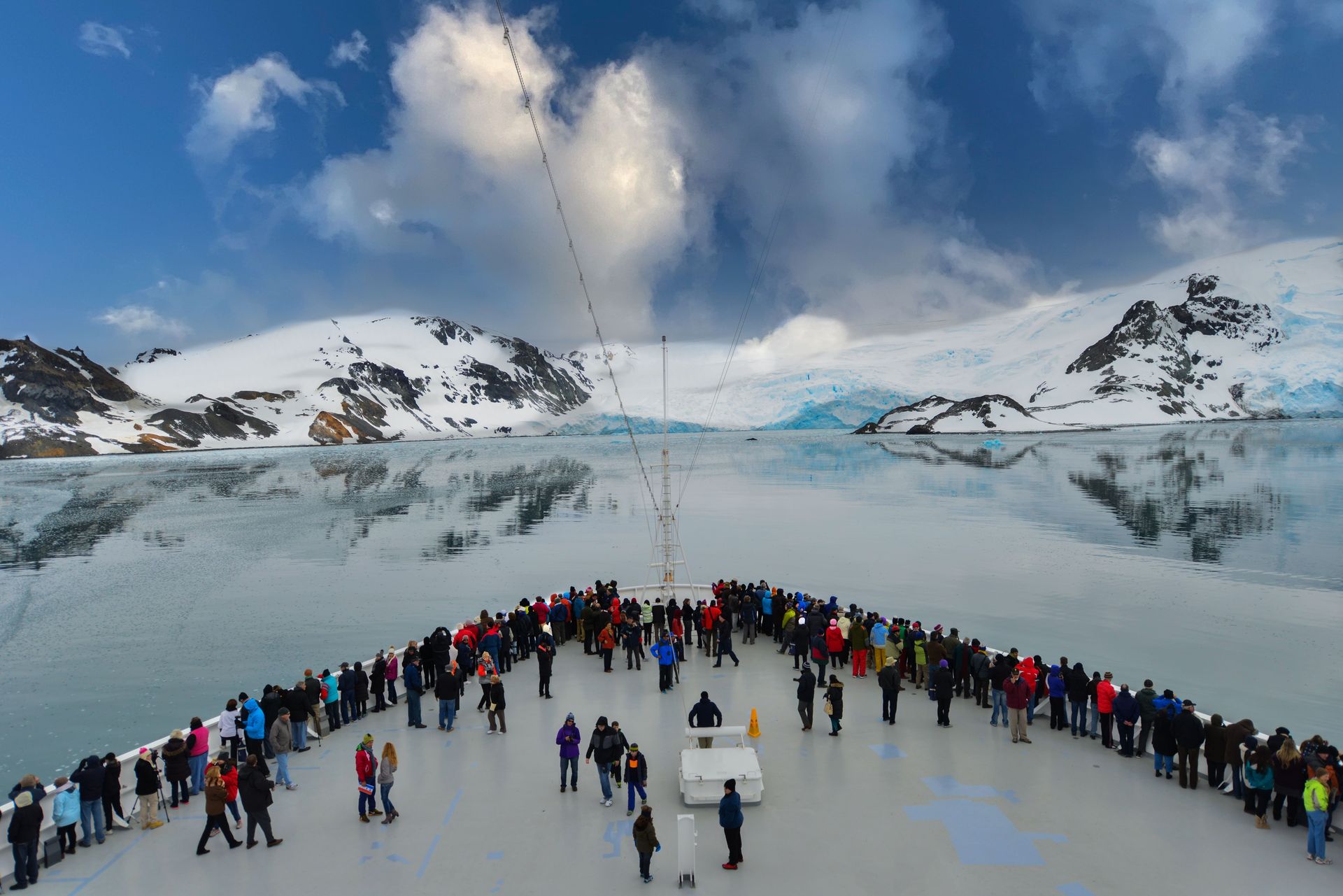
The Antarctic Peninsula is the only ocean cruise route on this list where the coastline itself is a continent with no permanent population, and reaching it requires crossing the Drake Passage, a notoriously rough 500-mile stretch of open water between Cape Horn and the South Shetland Islands. Most voyages depart from Ushuaia, Argentina, the southernmost city in the world.
Once past the Drake, ships enter sheltered channels where the scenery changes completely. The Lemaire Channel, a narrow passage flanked by steep cliffs and known informally among crew as Kodak Gap $GPS, is often the visual high point of the voyage, with icebergs frequently blocking the route depending on ice conditions that year. The Gerlache Strait offers a wider but equally dramatic corridor between mountainous islands and the peninsula itself.
Wildlife viewing is built into the itinerary in a way most cruises cannot match. Gentoo, chinstrap, and Adélie penguins nest in colonies numbering in the thousands on exposed rock, and humpback and minke whales are commonly sighted feeding in the nutrient-rich waters near the ice edge.
The International Association of Antarctica Tour Operators limits shore landings to ships carrying 500 or fewer passengers, and only 100 people are permitted ashore at any single landing site at a time. That rule shapes which ships operate here and means larger ocean liners can sail past the peninsula's scenery but cannot put passengers on land.
The season runs from November through March, the Southern Hemisphere summer, when pack ice recedes enough for ships to navigate the channels and penguin chicks are present at rookeries along the coast.
Chile's Patagonian fjords and Cape Horn
Credit: Andre Ulysses De Salis / Pexels
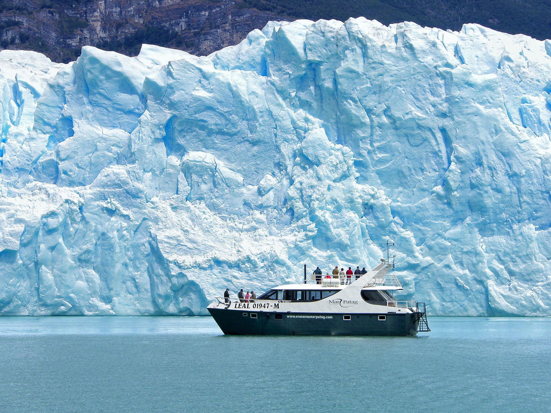
The Chilean fjords stretch roughly 1,000 miles between Puerto Montt and Punta Arenas, threading through a maze of channels carved by glaciers that once covered the entire region. Unlike Norway's fjords, much of this coastline remains uninhabited, with dense temperate rainforest running down to the waterline in places no road has ever reached.
The centerpiece for most itineraries is Glacier Alley, a stretch of the Beagle Channel within Alberto de Agostini National Park where five named glaciers, including Romanche, Alemania, and Italia, descend from the mountains close enough to the channel that ships slow to allow viewing from the deck.
Cape Horn itself marks the southernmost point of South America and the dividing line between the Pacific and Atlantic Oceans, a headland historically feared by sailors for the violent weather where the two oceans meet. Many itineraries include a landing, weather permitting, at the small Chilean naval station and lighthouse there, though conditions frequently make landing impossible.
The route also passes through the Strait of Magellan, first navigated by Ferdinand Magellan's expedition in 1520, and the town of Punta Arenas, one of the southernmost cities in the world and a common embarkation point for both Patagonian fjord cruises and Antarctic voyages.
Because the fjords sit in the lee of the Andes, weather changes quickly, and captains frequently adjust the route in real time based on wind and ice conditions. The main season runs from October through March, mirroring the Southern Hemisphere summer used for Antarctic sailings, and some operators combine both regions into a single extended voyage.
New Zealand's Fiordland
Credit: Nick Sarvari / Unsplash
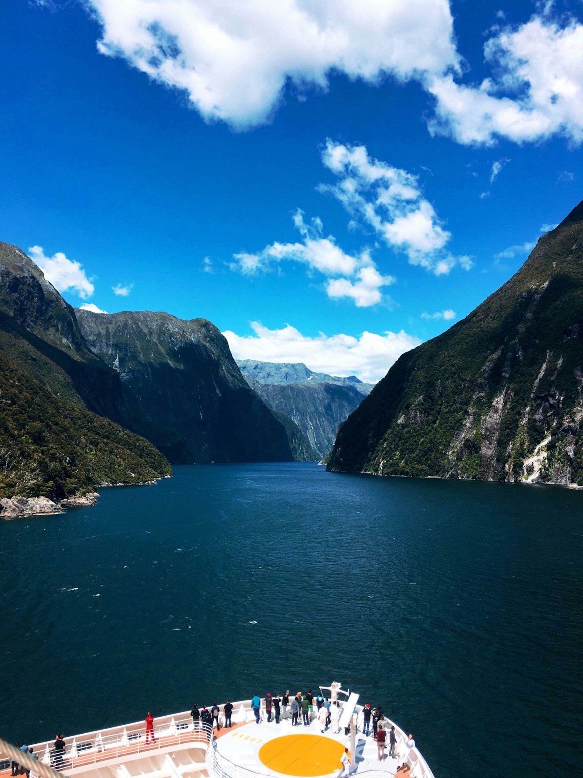
Milford Sound, technically a fjord rather than a true sound, is the most visited scenic waterway in New Zealand's Fiordland National Park, part of the Te Wahipounamu UNESCO World Heritage area on the South Island's southwest coast. Mitre Peak rises 1,692 meters directly from the water beside the sound's narrow entrance, one of the steepest coastal rock faces reachable by ship anywhere in the world.
Fiordland receives among the highest rainfall totals of any inhabited region on Earth, with parts of the park recording more than 6,000 millimeters annually. Rather than detracting from the scenery, that rainfall creates temporary waterfalls that appear on the sound's cliff faces within hours of heavy rain, on top of the permanent falls like Lady Bowen and Stirling that run year-round.
Doubtful Sound, farther south and larger than Milford, sees a fraction of the visitor traffic because it is reachable only by a boat crossing of Lake Manapouri followed by a road transfer, which keeps large cruise ships from entering as frequently. Its greater isolation means longer stretches without another vessel in sight and a higher chance of spotting Fiordland crested penguins or New Zealand fur seals along the cliffs.
Both sounds sit within rainforest that runs directly to the waterline, with beech and podocarp trees rooted in thin soil clinging to near-vertical rock, a phenomenon locally called a tree avalanche when a section loses its grip and slides into the water.
The main cruise season runs from October through April, and ships typically time their passage through Milford Sound for morning hours, before afternoon wind patterns can make the entrance choppier.
Croatia's Dalmatian Coast
Credit: Tom Fournier / Pexels
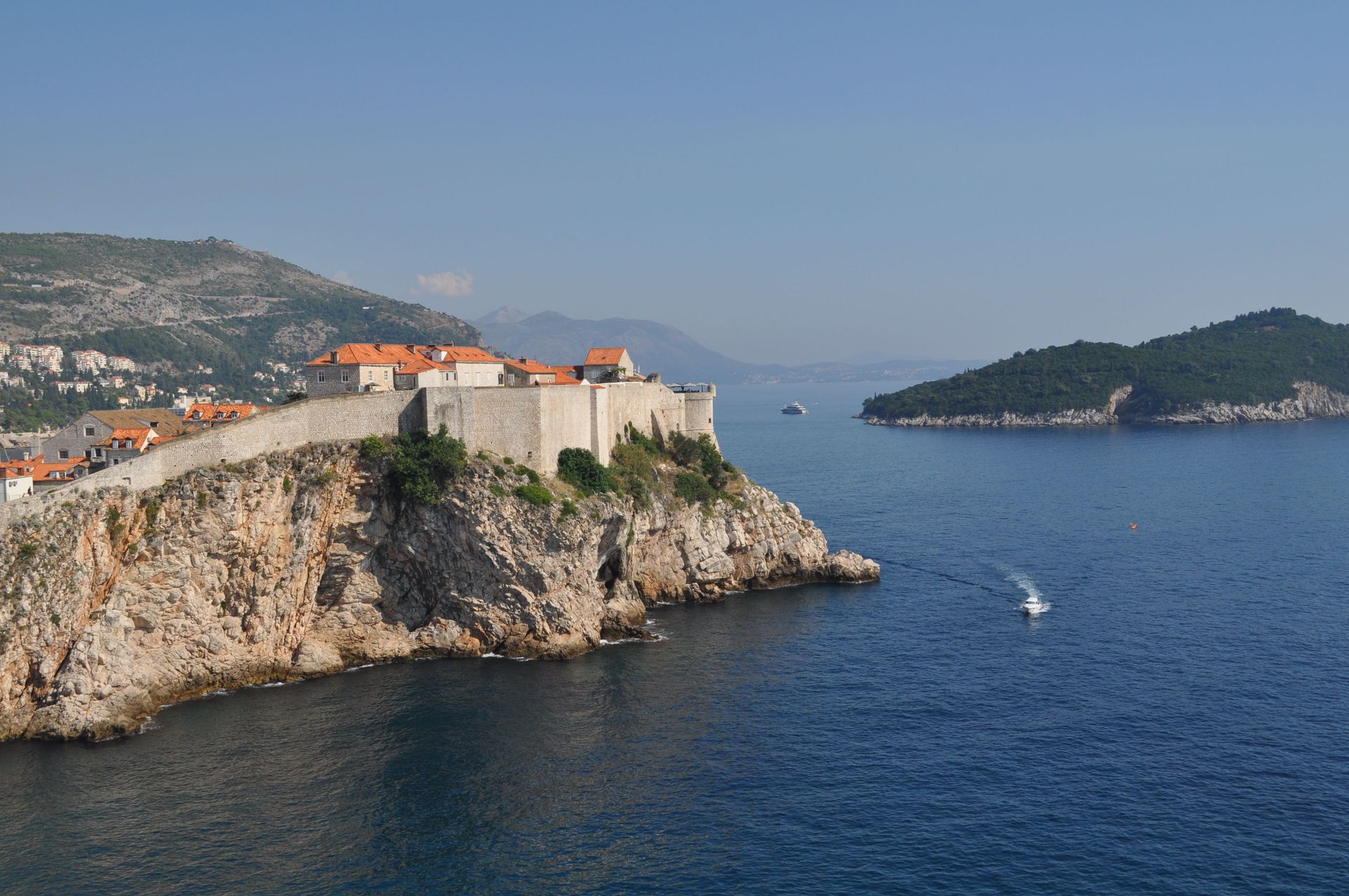
Croatia's Dalmatian Coast runs along the eastern Adriatic Sea and is defined by more than 1,000 islands and islets scattered between the mainland and open water, giving ships constant shelter and a coastline that changes character every few hours of sailing. Dubrovnik, at the coast's southern end, is a walled medieval city whose limestone ramparts and terracotta rooftops have made it a UNESCO World Heritage site since 1979.
Farther north, the island of Hvar combines lavender fields and a fortified hilltop with some of the clearest water in the Adriatic, while Korčula's old town, built on a small peninsula, is often compared to a miniature version of Dubrovnik without the crowds. Split, a larger mainland port, is built directly into and around the fourth-century palace of the Roman emperor Diocletian, which still forms the core of the modern city.
The Kornati archipelago, a national park made up of nearly 90 mostly uninhabited islands, offers a different kind of scenery: stark white limestone islands rising sharply from dark blue water, with almost no vegetation to soften the rock. Sailing through the Kornati channels at low speed is one of the few times on a Dalmatian itinerary when the ship, rather than a port, is the main event.
Because the Adriatic is relatively calm and the islands are close together, this route is popular with smaller ships and traditional wooden sailing vessels as well as larger ocean cruisers, giving travelers a wider range of ship sizes to choose from than most of the other routes on this list. The main season runs from April through October.
The Greek Isles
Credit: Tom Fournier / Pexels
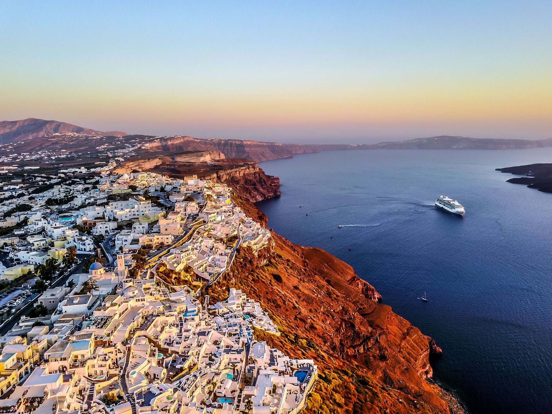
The Cyclades island group in the Aegean Sea is anchored by Santorini, a crescent-shaped island formed by the collapse of a volcano during the Late Bronze Age eruption around 1600 BC, which left behind the caldera that ships now sail directly into. The town of Fira sits more than 300 meters above the water on the caldera's rim, and the approach by sea, with whitewashed buildings stacked along the cliff edge, is one of the most recognizable images in Mediterranean cruising.
Mykonos, a short sail from Santorini, offers a flatter, more exposed coastline of its own, with windmills overlooking the harbor and an old town of narrow whitewashed lanes originally designed to break up wind and confuse pirate raiders. Between the two, smaller islands such as Naxos and Paros add quieter harbors and less commercialized villages to a typical itinerary.
The Aegean's meltemi wind, a strong, dry northerly that builds through the summer months, shapes both the sailing conditions and the landscape, having scoured many of the smaller islands down to bare rock and scrub over thousands of years. That same wind is why many operators schedule Cyclades sailings for the shoulder months of May, June, September, and October, when conditions are calmer than in the peak of summer.
Because the islands sit close together, itineraries in this region tend to involve more short daytime sailings and overnight stays in port rather than long stretches of open water, which suits travelers who want more time ashore between scenic approaches rather than extended time at sea.
French Polynesia's Society Islands
Credit: Tom Donders / Unsplash
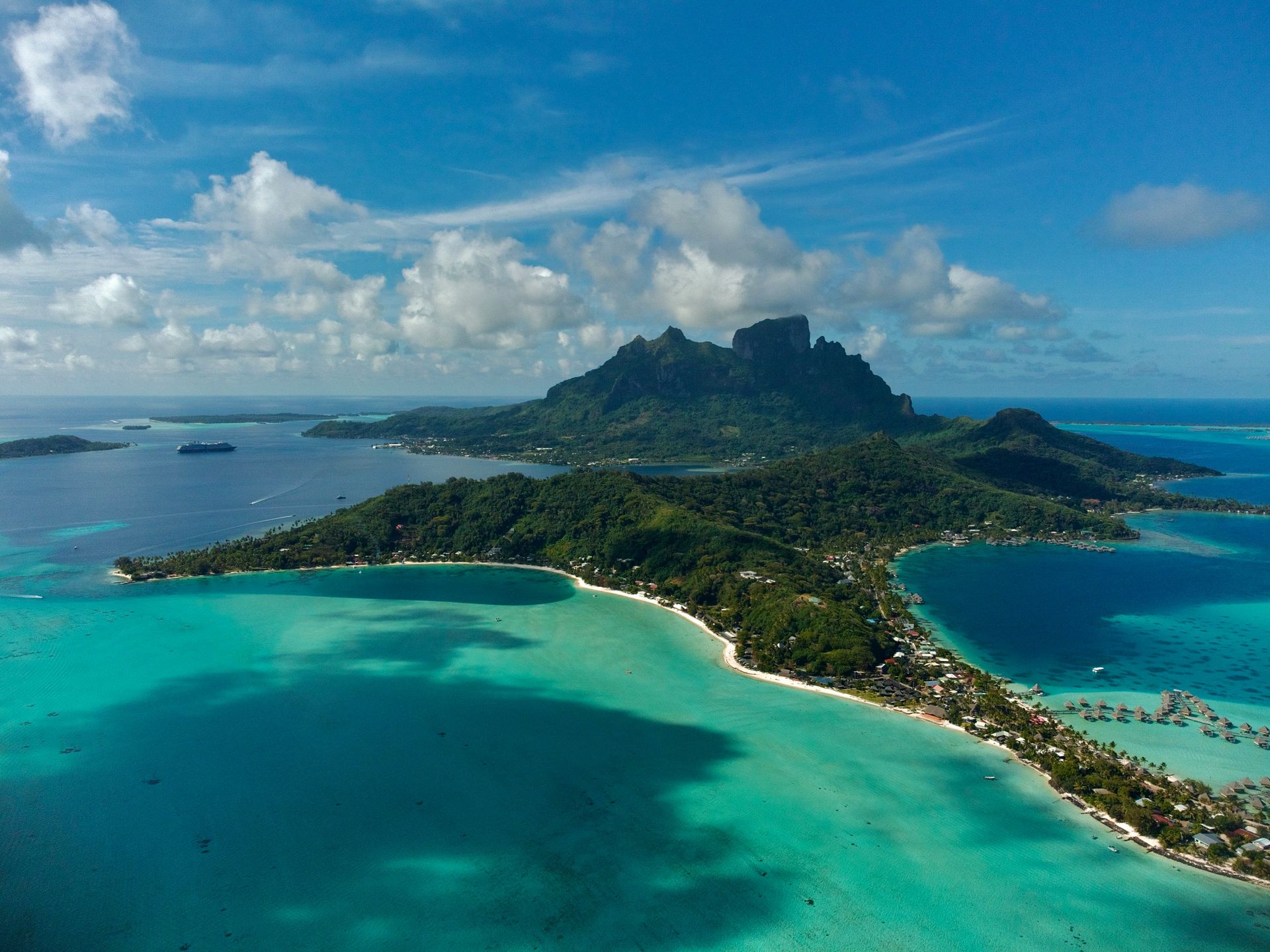
The Society Islands, anchored by Tahiti, Moorea, and Bora Bora, sit inside some of the most protected lagoon water found anywhere in the Pacific, ringed by barrier reefs that keep the interior nearly flat even when open ocean swell is running outside. Bora Bora's lagoon, encircling the extinct volcanic peaks of Mount Otemanu and Mount Pahia, is shallow enough in places that its color shifts from deep blue to pale turquoise within a few boat lengths.
Because the islands are volcanic in origin and relatively young in geological terms, their peaks remain sharp and dramatic rather than worn down, in contrast to older, more eroded island chains elsewhere in the Pacific. Moorea's twin bays, Cook's Bay and Opunohu Bay, are separated by a jagged ridge that was reportedly one inspiration for the fictional Bali Hai in the musical South Pacific, and ships entering either bay pass directly beneath those peaks.
Paul Gauguin Cruises, a Ponant subsidiary, has operated a single ship purpose-built for these shallow lagoons since 1998, sailing year-round out of Papeete on itineraries of seven to 14 nights that also reach the Tuamotu atolls and, on longer sailings, the Marquesas Islands farther northeast. Other lines operate seasonal sailings through the region as well, typically timed to French Polynesia's dry season from May through October.
Because the lagoons are shallow and reef-protected, larger oceangoing ships generally anchor offshore and tender passengers in rather than docking directly, which keeps the scenery close to the water uninterrupted by port infrastructure.