From a manatee spring an hour from Tampa to a remote island only reachable by boat where Civil War prisoners once lived
Christopher Osten / Unsplash
Florida’s most visible attractions have a well-documented crowd problem. The theme parks require multi-day planning, early arrival, and a tolerance for lines that make the experience feel transactional. The famous beaches at South Beach, Clearwater, and Fort Lauderdale are genuinely beautiful, but shared with a visitor volume that makes the word “escape” feel imprecise. The spring breakers, the snowbirds, and the summer families compress into the same coastal corridor, and the same calendar peaks, and the Florida that exists outside that corridor remains largely invisible to the tourist who arrives with a list sourced from the same publications that everyone else consults.
That other Florida is real and substantial. It includes a manatee sanctuary an hour north of Tampa, where the animals live year-round in a natural spring. It includes a national park accessible only by boat or seaplane that protects one of the world’s most significant coral reef systems on a remote island 70 miles west of Key West. It includes a botanical garden in Miami’s Coconut Grove whose collection of tropical plants from Southeast Asia, the Caribbean, and Central America occupies the bayfront property of a botanist who spent his career bringing the world’s plant life to South Florida. The crowds that consume the headline Florida did not find these places, and the visitor willing to look past the standard itinerary finds them in approximately the condition that Florida’s natural and cultural assets deserve.
The 10 attractions below appear in Travel + Leisure, drawn from a list of 20 hidden gem Florida attractions outside the main tourist circuit. Each can be visited without the advance reservation systems and crowd-management logistics that the state’s most popular destinations require as a precondition for a visit.
Credit: Florida State Parks
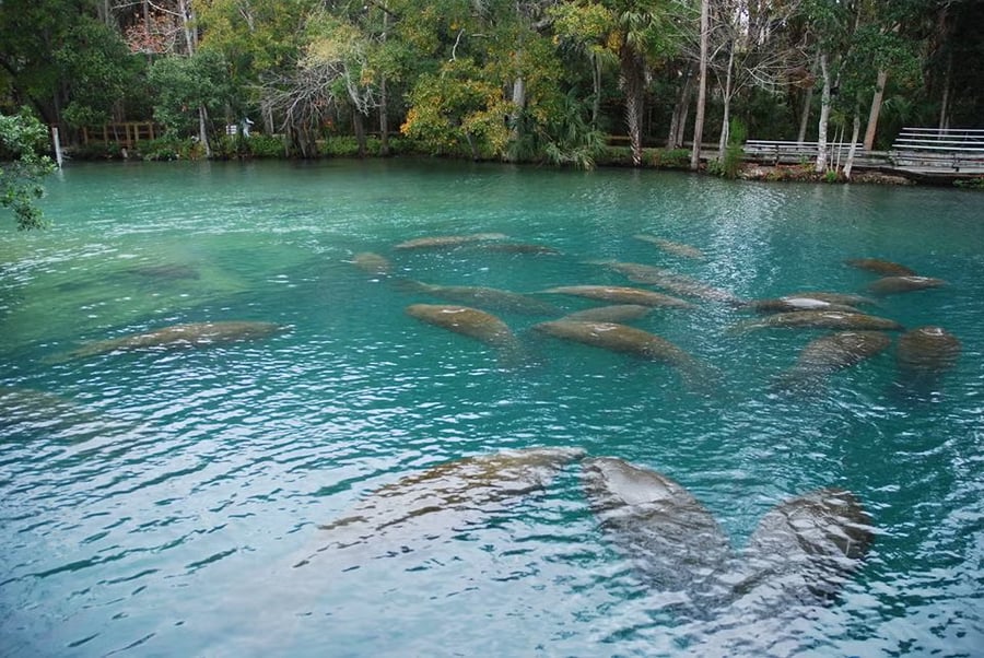
Ellie Schiller Homosassa Springs Wildlife State Park, located about an hour north of Tampa, gives the Florida wildlife park its most unusual single credential: a natural spring deep enough and warm enough to support a year-round manatee population whose educational program at the Fish Bowl underwater observatory allows visitors to observe the animals from below the waterline in a way that no other facility in the state provides. The park’s spring is one of the finest natural springs in Florida, and the clarity of the water that flows from the limestone aquifer gives the underwater view its specific quality.
The wildlife program extends well beyond the manatees: whooping cranes, endangered Florida panthers, black bears, bobcats, alligators, and red wolves are all present within the roughly 200-acre park, giving the visit a species diversity whose range reflects the park’s mission as a rehabilitation and refuge facility, not purely a tourist attraction. The 1.10-mile elevated boardwalk trail, the boat tours, and the 0.75-mile Pepper Creek Trail provide the visit's physical program beyond the observatory, and the birding along the creek trail offers an avian-focused program with habitat-specific native species, many of which are among Florida’s most sought-after birds.
The park’s proximity to Tampa gives it a day trip accessibility that the more remote wildlife refuges in the state cannot match, and the hour’s drive north from the city gives the visit a sense of distance from the urban environment that is proportionate to the wildness of the animal encounters that await. The spring’s constant temperature of 72 degrees gives the manatees a year-round refuge specific to the geothermal stability of Florida’s aquifer system, and that stability gives the park a guarantee that the manatees are present regardless of season. The park’s location in Homosassa, in the Nature Coast region that extends north from Tampa along the Gulf, gives the day trip a coastal character specific to the undeveloped stretch of Florida that the Gulf Coast resort corridor has not absorbed.
Credit: U.S. Fish & Wildlife Service
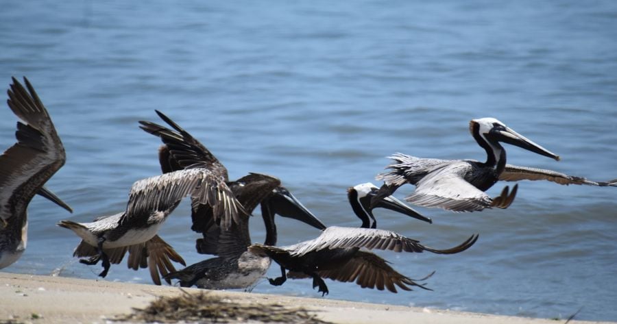
Pelican Island National Wildlife Refuge holds a specific historical credential that most of the people who drive past it on the Treasure Coast have never been told: established in 1903 by President Theodore Roosevelt, it is the first national wildlife refuge ever designated in the United States, and its founding gave the American conservation movement its most significant federal institutional precedent. The refuge protects a barrier island near Vero Beach, whose mangrove and salt marsh habitats provide more than 130 bird species with nesting and feeding environments specific to the Indian River Lagoon system’s extraordinary ecological productivity.
The 5,400-acre refuge offers two three-mile loop trails and a 500-foot accessible observation tower, whose views of the lagoon, the island, and the surrounding habitat make it the wildlife-watching program's most concentrated single vantage point. The bird species the observation tower puts within binocular range include brown pelicans, tricolor herons, reddish egrets, and wood storks, and the seasonal cycling of species through the lagoon system gives the return visitor a different bird list each month. The accessibility of the observation tower enables the refuge to offer a wildlife-viewing program appropriate for visitors of varying mobility levels, a quality that the more physically demanding refuge trails cannot provide.
The relative obscurity of Pelican Island compared to the Everglades and the state’s more marketed wildlife destinations gives the refuge a unique quiet, appropriate to both the wildlife and the visitor whose primary interest is the undisturbed natural environment. The lagoon’s position on the Atlantic Flyway, one of the four major North American migratory bird routes, gives the October to April migration season a bird diversity that peaks well above the breeding season’s resident population. The Indian River Lagoon, whose ecological health has made it one of the most biodiverse estuaries in the Northern Hemisphere, provides the Pelican Island visit with a water context that sustains the bird populations the refuge protects.
Bryan Goff / Unsplash
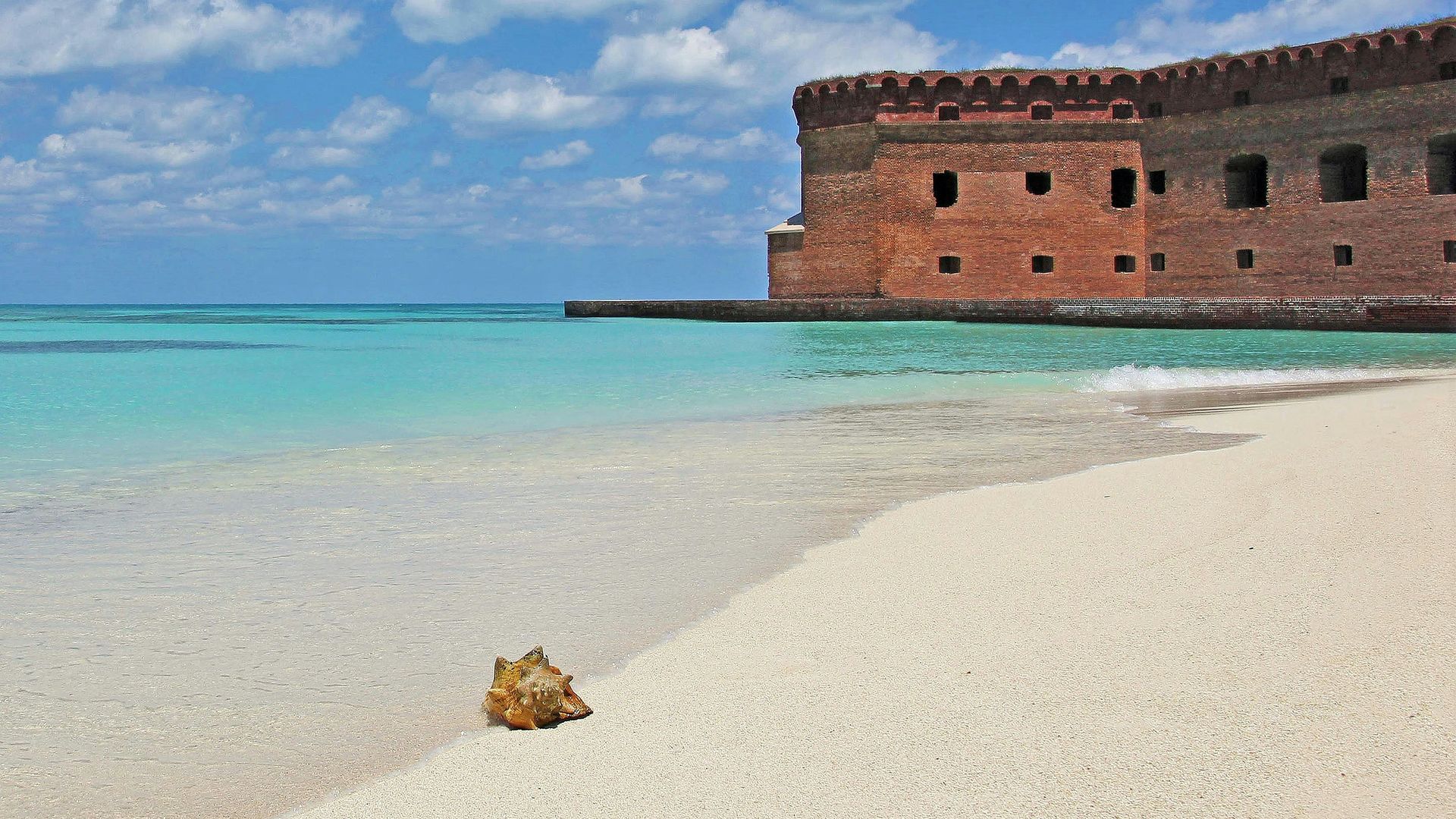
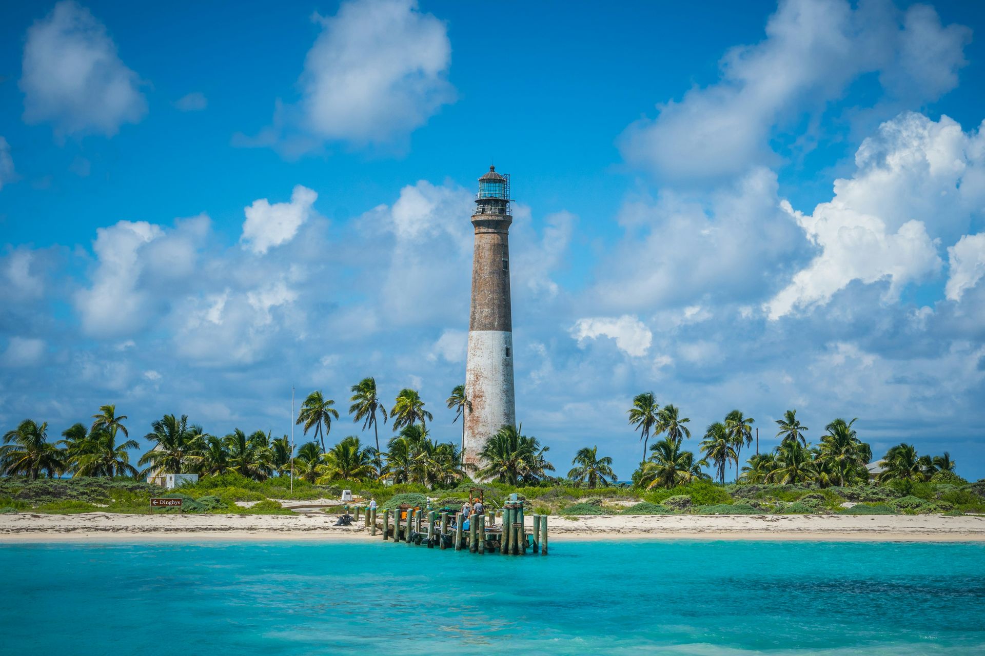
Dry Tortugas National Park occupies a chain of seven small coral islands 70 miles west of Key West in the Gulf of Mexico, and its accessibility is limited to boat or seaplane only, filtering its visitor population to those specifically motivated by what the park offers: the 19th-century Fort Jefferson, one of the largest brick masonry structures in the Americas. The park also offers coral reef snorkeling,, whose water clarity and marine diversity reflect its position as one of the healthiest reef systems in North American waters, and its remoteness, which makes the crowd problem endemic to every other Florida beach destination structurally impossible. The ferry from Key West takes roughly two and a half hours, and the seaplane takes 40 minutes, and either journey gives the arrival at the island a sense of genuine distance from the mainland.
Fort Jefferson’s construction history is itself a monument to the ambition and the miscalculation of 19th-century American military planning: begun in 1846 and still incomplete at the time of its abandonment in 1874, the fortress used 16 million bricks and was designed to control the Straits of Florida at the passage between the Gulf of Mexico and the Atlantic. It served as a prison during the Civil War, most famously for Dr. Samuel Mudd, who set John Wilkes Booth’s broken leg after Lincoln’s assassination. The fort’s walls rise 50 feet above the moat, whose clear waters give the snorkeling its most accessible starting point.
Camping at Dry Tortugas, one of the most logistically demanding and rewarding camping experiences in the continental United States, requires bringing all fresh water, food, and supplies by ferry, since the island has no facilities or fresh water. The coral reef that surrounds the Garden Key anchorage gives the snorkeler an underwater landscape whose fish species diversity, including parrotfish, angelfish, and grouper, reflects the reef’s protected status and the corresponding absence of the fishing pressure that has degraded the reefs closer to the Florida mainland.
Credit: National Tropical Botanical Garden
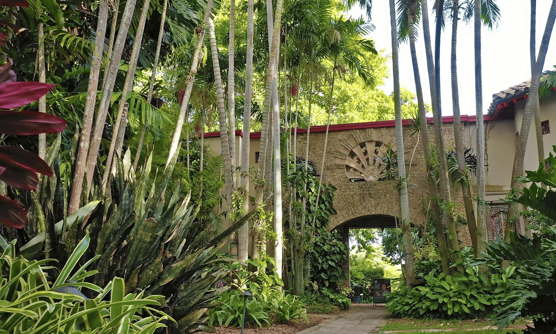
The Kampong is a 9-acre botanical garden in Miami’s Coconut Grove neighborhood on the shore of Biscayne Bay, part of the National Tropical Botanical Garden network, and it gives the Miami visitor a garden experience whose specific historical provenance and plant collection quality set it apart from the generic botanical garden visit. The property was the home and personal garden of Dr. David Fairchild, a botanist who spent decades traveling the world in the early 20th century collecting plant specimens and introducing them to American cultivation. His collection, assembled from Southeast Asia, the Caribbean, Central and South America, and other tropical regions, gives the Kampong its extraordinary depth: palms, fruit trees, and flowering shrubs from the world’s most diverse botanical regions grow on the bayfront property whose setting amplifies the garden’s tropical character.
The garden’s guided tours give the visit a botanical depth specific to a collection whose individual plants have provenance stories connecting them to specific field collections in specific countries and decades. The self-guided stroll through the property gives the visitor who prefers unmediated exploration the colors, textures, and scents of a tropical garden at its peak of South Florida’s growing season, and the bay views from the garden’s waterfront sections give the visit a coastal setting whose combination with the garden’s botanical density is specific to this Coconut Grove address.
The Kampong’s position in Coconut Grove, one of Miami’s oldest and most architecturally distinctive neighborhoods, gives the garden visit a broader neighborhood context whose canopied streets, independent restaurants, and bayfront parks give the full day trip a character distinct from the Art Deco South Beach experience that most Miami visitors exhaust before looking further. The garden operates on limited hours, and advance reservations are recommended, giving the visit a planned and purposeful character that the truly spontaneous day trip cannot always accommodate from a same-morning impulse decision. But the modest planning effort rewards the visitor with access to one of Miami’s most genuinely distinctive and botanically significant properties.
Credit: Devil's Den Spring
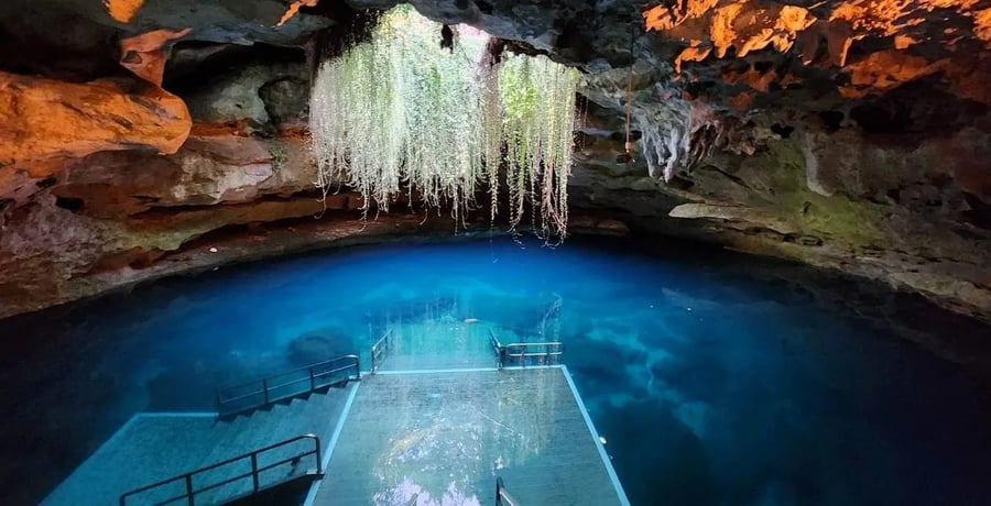
Devil’s Den Spring is a natural spring inside a limestone cave in Levy County, whose unique geological and historical character sets it apart among Florida’s hundreds of natural springs. The spring maintains a year-round water temperature of 72 degrees, and the crystal clarity of the cave’s water gives the diving and snorkeling a visibility that the surface springs with their algae and tannic inputs cannot reliably provide. The cave’s name comes from early settlers who observed steam rising from the underground opening and concluded, reasonably enough given the apparent source of the vapor, that they were looking at smoke from below.
The Pleistocene-era fossils found at the site give the cave its most remarkable historical credential: mastodon teeth, giant ground sloth bones, and other megafauna remains have been recovered from the cave floor, offering snorkelers the unique experience of swimming above a paleontological site whose ice-age deposits are visible through the clear water. The fossil record found here reflects the extraordinary biological richness of Florida during the Pleistocene, when the state’s land area was significantly larger, and its fauna included species that have been extinct for 10,000 years.
The year-round accessibility and the cave’s private operation, which requires advance reservations and limits the number of visitors at any given time, give Devil’s Den a crowd profile that the state’s public springs cannot control in the same terms. The cave opening above, through which sunlight enters at specific angles in the morning, gives the snorkeler a photographic environment whose interplay of light and water has made Devil’s Den one of the most photographed underwater sites in the southeastern United States. The Gainesville area, about 30 miles east of Devil’s Den, gives the trip a base city with university-town amenities and the Santa Fe River’s additional spring-fed swimming and paddling opportunities within a very short and scenic drive from the cave entrance on the local County Road 336 that serves Levy County’s rural interior.
Jacksonville Beach Moms / Unsplash
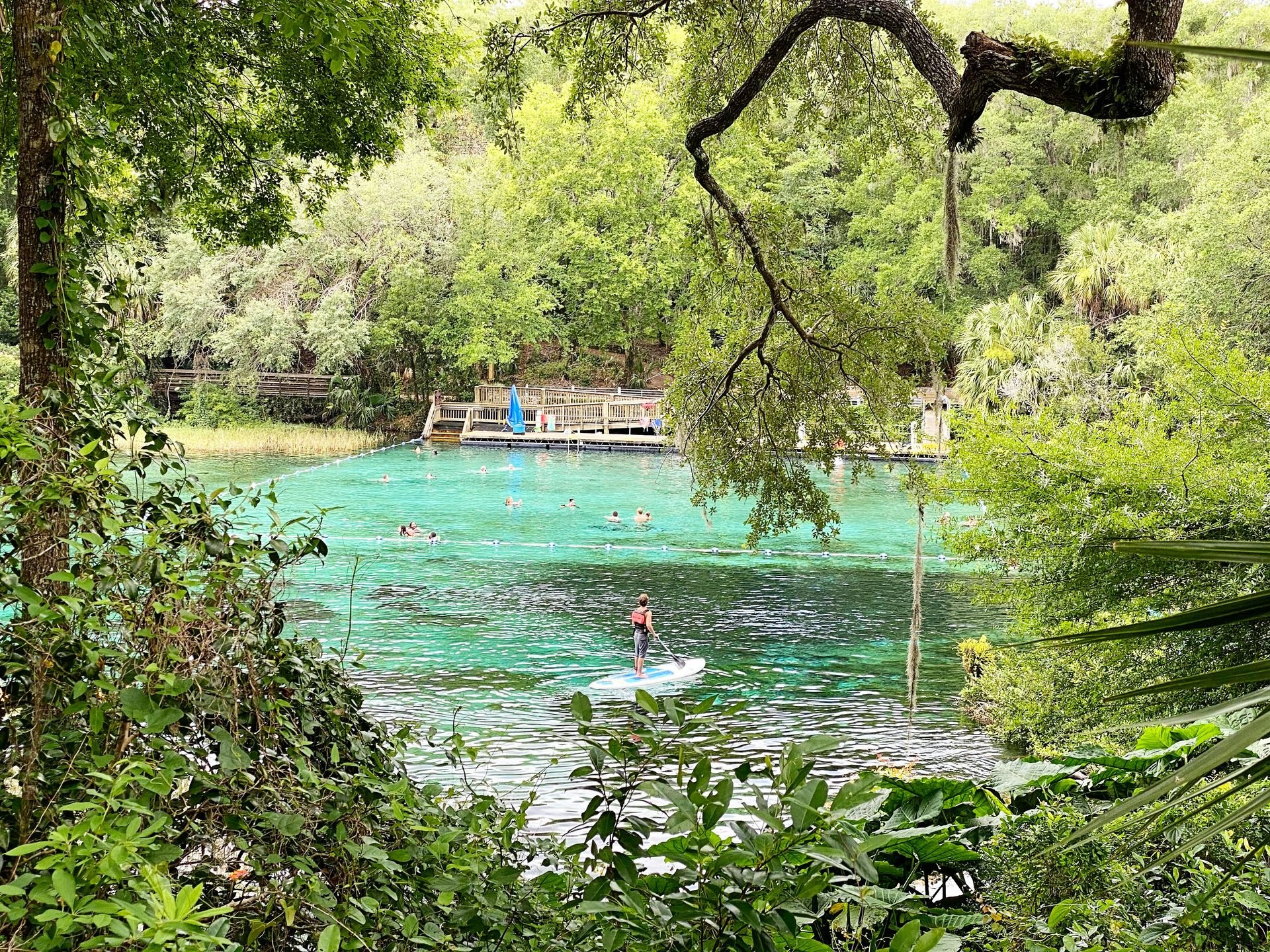
Rainbow Springs State Park is located in Dunnellon, about a 90-minute drive from both Tampa and Orlando, and gives the central Florida visitor a natural swimming hole whose historical and ecological depth exceeds the generic “swimming hole” designation in important ways. The springs that give the park its name have been visited by humans for thousands of years: Florida’s Indigenous Timucua people left stone tools, arrowheads, and other artifacts at the site, giving the park a cultural history specific to the spring’s role as a landmark and gathering point in the pre-contact landscape. The spring’s water maintains an average temperature of 72 degrees throughout the year, giving the park a swimming season that extends across every month of the Florida calendar.
The clear water, whose blue-green color reflects the limestone aquifer system that feeds the spring, gives the snorkeling a visibility specific to the spring’s geological source. The tubing section, open seasonally, offers the recreational program a unique Florida spring experience, with its slow current and spring water clarity, providing the casual visitor with the most accessible way to experience the water. Paddling along the spring run offers the more active visitor a wildlife-watching program, with alligators, turtles, and river otters inhabiting the aquatic vegetation along the banks.
The park’s weekend capacity limits, which can result in closure when the maximum visitor count is reached during summer peak hours, add a planning consideration that the midweek visit eliminates. The park’s management recommendation to plan for a weekday visit reflects the spring’s genuine popularity among Central Florida residents who know about it, and the popularity’s specific concentration on summer weekends and holidays reflects the spring’s accessibility from both Tampa and Orlando. The Rainbow River, which flows from the springs, gives the park its most distinctive water feature: a 5.7-mile river whose clarity and current provide the kayak and canoe program with a linear water journey specific to Florida’s spring-fed river ecosystem.
Credit: Caladesi Island State Park
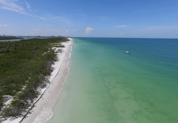
Caladesi Island State Park sits just north of Clearwater Beach and offers the Tampa Bay Area visitor a beach experience whose unique quality depends on the ferry or private boat, the only access route required. The island’s accessibility filter, which eliminates the possibility of a casual drive-up visit, gives Caladesi a crowd profile specific to the motivated visitor who plans the trip, books the ferry from Honeymoon Island State Park, and commits the time required to reach and enjoy a beach that is otherwise indistinguishable from the managed natural barrier island it has been for its entire history.
The island’s mangrove forest, accessible by kayak rental from the island’s facilities, provides the water-based program with a coastal ecosystem exploration focused on the mangrove’s role as a nursery habitat for the Gulf of Mexico’s fish population. The nature trails give the terrestrial program a bird-watching and wildlife-viewing component, with ospreys, egrets, blue herons, and dolphins, that provides the island with a wildlife density consistent with an island whose human pressure is limited by its ferry-only access. The beach itself, on the Gulf-facing side, gives the swimmer and the sunbather the white sand and clear water of the Gulf Coast at its most undeveloped and quiet.
The island’s designation as a Florida state park provides it with the protection and management infrastructure that undeveloped barrier islands without state park status lack, and the park’s facilities, including restrooms and kayak rentals, provide a baseline amenity that the truly primitive island experience does not. Ferry access, managed facilities, and genuine natural quality together give Caladesi a unique niche as an easy-to-enjoy natural beach that requires only slightly more planning than a developed resort beach but offers a significantly different experience. The island’s proximity to the heavily visited Clearwater Beach, just south across the Dunedin Pass, gives the contrast its most direct available form: two beaches separated by a short stretch of water whose crowd levels differ by an order of magnitude.
Credit: Visit Florida
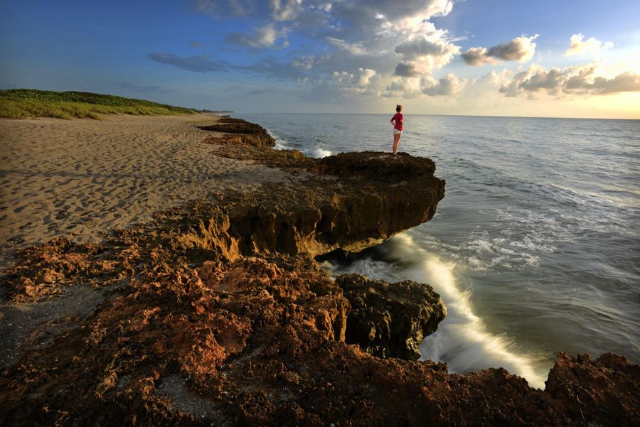
Blowing Rocks Preserve, located on Jupiter Island on the southeastern coast of Florida, about 30 minutes from West Palm Beach, is the sea turtle conservation program's most publicly accessible single site in Florida. The preserve has been a sea turtle nesting site and a scientific study location since the 1980s, when biologists began providing systematic assistance to nesting leatherback, loggerhead, and green sea turtles, whose return to this beach each season provides the conservation program with its data foundation. The guided turtle walks available during nesting season, from May through October, give the visitor a direct, carefully managed encounter with the nesting process, whose scientific value to biologists is the primary reason the program operates.
The blowing rocks that give the preserve its name are a limestone formation specific to the Anastasia Formation, an ancient reef rock that underlies much of the southeastern Florida coast. The specific phenomenon occurs when waves driven by storms or high tides press water through the limestone’s solution holes and crevices with enough force to expel it skyward in geysers that can reach 50 feet. The spectacle is weather-dependent, making the high-surf days, whose conditions produce the most dramatic blowing events, the optimal visiting time for the visual program alongside the sea turtle ecology.
The preserve’s management by The Nature Conservancy gives it a conservation credential that the state park system’s more generalizable management cannot match in the same terms for a site whose primary ecological value is the sea turtle nesting beach. The preserve’s limited parking, which is intentional, and the absence of the commercial development that surrounds most public beach access points on the southeast Florida coast give Blowing Rocks a distinct character, with its undeveloped setting both a functional requirement and its primary aesthetic quality. The Jonathan Dickinson State Park, immediately to the north, provides the Blowing Rocks visit with a natural companion, with mangrove river tours and hiking trails that extend the day trip program beyond the preserve itself.
Credit: U.S. Fish & Wildlife Service
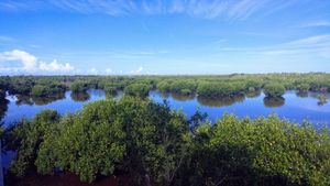
Ten Thousand Islands National Wildlife Refuge occupies the coastal mangrove territory at the northwestern edge of the Everglades system, on the Naples side of the state’s southwestern tip, and gives the visitor who approaches the Everglades from the Gulf Coast a wildlife refuge experience that the main Everglades National Park entrance on the eastern side of the system does not provide in the same mangrove-and-island terms. The refuge’s vast mangrove forests, brackish marshlands, and the mosaic of small islands whose count gives the refuge its evocative name create a habitat whose specific ecological character supports a wildlife inventory that includes American alligators and the rarer American crocodile, Florida panthers, West Indian manatees, river otters, bottlenose dolphins, and more than 200 species of migratory birds.
The kayaking and canoeing program provides the refuge's most productive access: the waterways between the mangrove islands offer paddlers a close-range wildlife-viewing environment, with stillness reachable by kayak through channels too shallow for motorboats, providing alligator and bird encounters at their most intimate. The fishing, for which the Ten Thousand Islands system is regionally celebrated for its snook, redfish, and tarpon populations, gives the angler a public-access fishery whose productivity reflects the habitat health that the refuge designation protects.
The refuge’s position near Naples, one of Florida’s most expensive and tourist-focused coastal cities, gives it proximity to a large visitor population whose awareness of the refuge is disproportionately low given its quality. The Florida Panther National Wildlife Refuge, adjacent to the Ten Thousand Islands system, gives the broader protected area a combined footprint whose conservation significance extends well beyond the boundary of either individual unit. The Marco Island community and the city of Naples, both within 30 minutes of the refuge’s primary access points, offer a civilized end-of-day program, with restaurants and accommodations that provide a comfortable, well-provisioned base for the multi-day Everglades region itinerary.
Credit: Florida State Parks
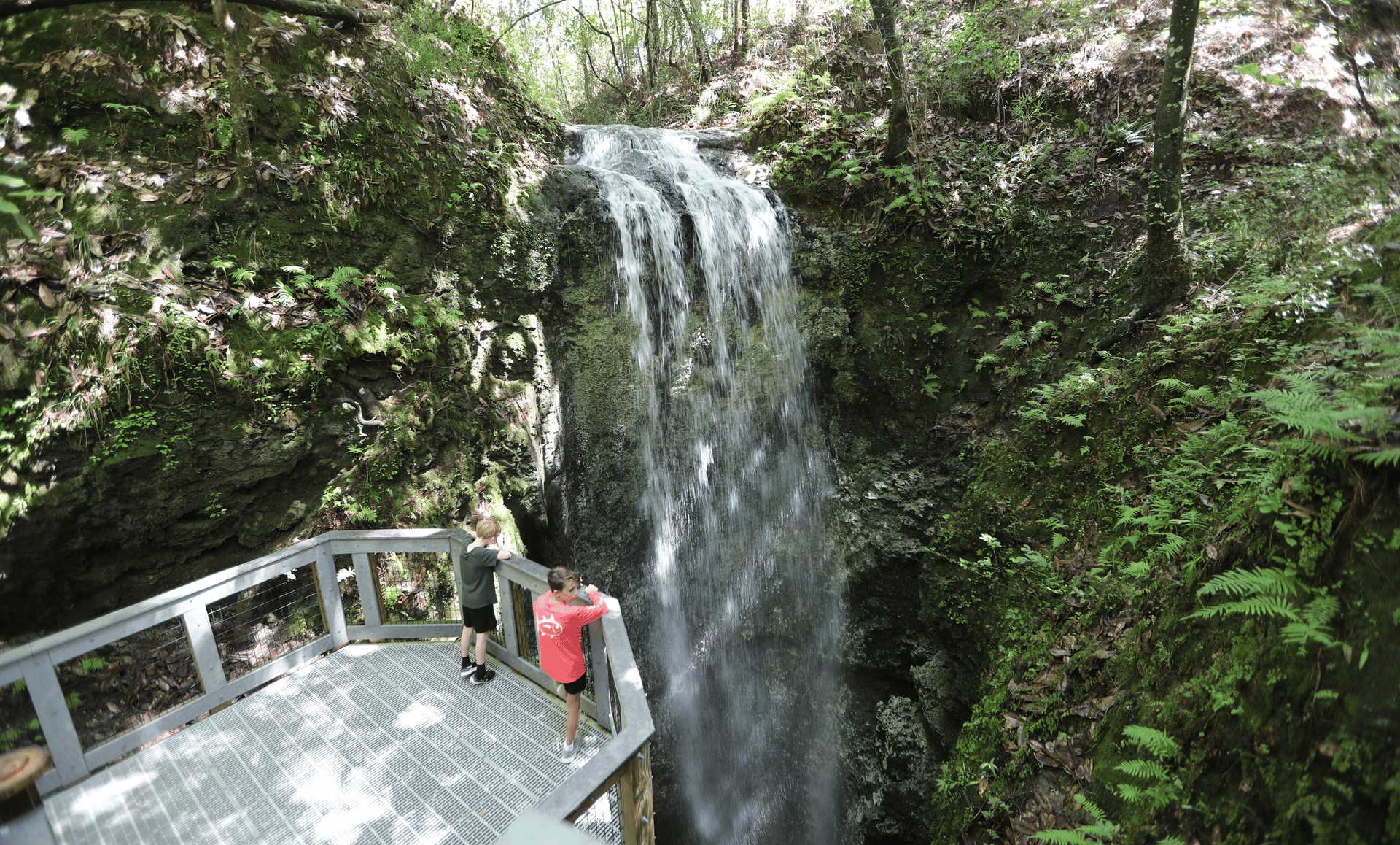
Falling Waters State Park is located about a 90-minute drive northwest of Tallahassee in the Florida Panhandle and contains the state’s highest waterfall, a geological formation whose existence in a state whose topography is defined by flatness gives it a specific and genuine surprise value. The waterfall descends 73 feet into a circular sinkhole whose 100-foot depth and 20-foot diameter give the cascade a containment characteristic of the karst limestone geology of the Florida Panhandle, where sinkholes that punctuate the landscape give the underground drainage system its most visible surface expression. The water descends, swirls along the sinkhole’s walls, and disappears into the cave system below, without a visible exit, giving the waterfall a mystery specific to karst hydrology, whose underground channels carry the water through pathways invisible from the surface.
The boardwalk trail system gives the visitor two perspectives on the falls: the upper boardwalk section, which stays drier and gives the overhead view of the cascade into the sinkhole, and the lower section, which descends toward the sinkhole’s base and gives the closest view at the cost of a light spray of water from the falls. The waterfall’s volume varies with rainfall, giving the wet season visit a more dramatic cascade than the dry season equivalent, but the sinkhole’s form and the water’s disappearance give the year-round visit its geological interest independent of the flow volume.
The park’s location in the Florida Panhandle, which is geologically, ecologically, and culturally distinct from the peninsula’s more visited regions, gives the Falling Waters visit a context specific to the Panhandle’s rolling hills, longleaf pine forests, and creek-cut terrain. The park’s other amenities, including swimming in Sink Creek, fishing, and picnic areas, provide a day trip program that extends beyond the waterfall’s specific geological spectacle. The Panhandle’s rolling terrain, whose pine forests and creek-cut ravines distinguish it from the flat interior of the Florida peninsula, gives the Falling Waters visit a landscape context specific to this geologically distinct corner of the state.
