
20 mountain ranges and the best ways to experience them
From the Himalayas to the Andes, these 20 mountain ranges offer some of the world's most compelling landscapes — and very different ways to engage with them
Credit: Chris Medina, Pexels
Mountains shape the planet's climate, define national borders, and anchor cultures that have evolved over millennia in their shadows. They are among the most visited natural environments on Earth, yet most people encounter only a fraction of what they offer. A peak seen from a car window and a peak climbed on foot are not the same mountain. The range of ways to engage with high-altitude terrain — trekking, skiing, cultural immersion, wildlife watching, road trips, river journeys — means that almost any traveler can find a meaningful entry point, regardless of fitness level or experience.
The 20 ranges in this list were chosen for geographic diversity, cultural significance, and the depth of experience available to visitors. They span six continents and include both the world's highest summits and ranges that have been overlooked in favor of more famous neighbors. Some are defined by extreme altitude; others by their ecological richness, their role in human history, or the sheer variety of terrain they contain.
A few principles guided the selection. First, the best way to experience a mountain range is rarely the most obvious one. The Himalayas are not just for high-altitude trekkers — the foothills contain some of the world's most biodiverse forests and oldest pilgrimage routes. The Rockies are not just for skiers — their canyon systems, hot springs, and Indigenous heritage sites reward slower travel. Second, infrastructure matters. Some of the world's most dramatic ranges are effectively inaccessible without significant logistical investment. Where that is the case, this guide explains the realistic options.
Third, mountain ecosystems are under pressure from warming temperatures, glacial retreat, and increasing visitor numbers. Several ranges on this list have seen measurable changes in their snowpack, treeline, and wildlife populations over the past few decades. Visiting thoughtfully — respecting trail limits, supporting local economies, and choosing operators with genuine environmental commitments — is not a luxury consideration. It is increasingly the difference between a range that remains viable for future visitors and one that does not.
This list is not a ranking. The Himalayas are not "better" than the Drakensberg; they are simply different in scale, character, and what they ask of the people who visit them. Each range here has something that cannot be found anywhere else. The goal of this guide is to help readers understand what that thing is — and how to get close to it.
1 / 20
The Himalayas, South Asia
Credit: Rick McCharles, Flickr
The Himalayas contain 14 of the world's 15 highest peaks, including Everest at 8,849 meters, and stretch across five countries — India, Nepal, Bhutan, Tibet, and Pakistan. They are the youngest major mountain range on Earth in geological terms, still rising as the Indian subcontinent continues its collision with the Eurasian plate. That youth is visible in the sharpness of the peaks and the frequency of seismic activity.
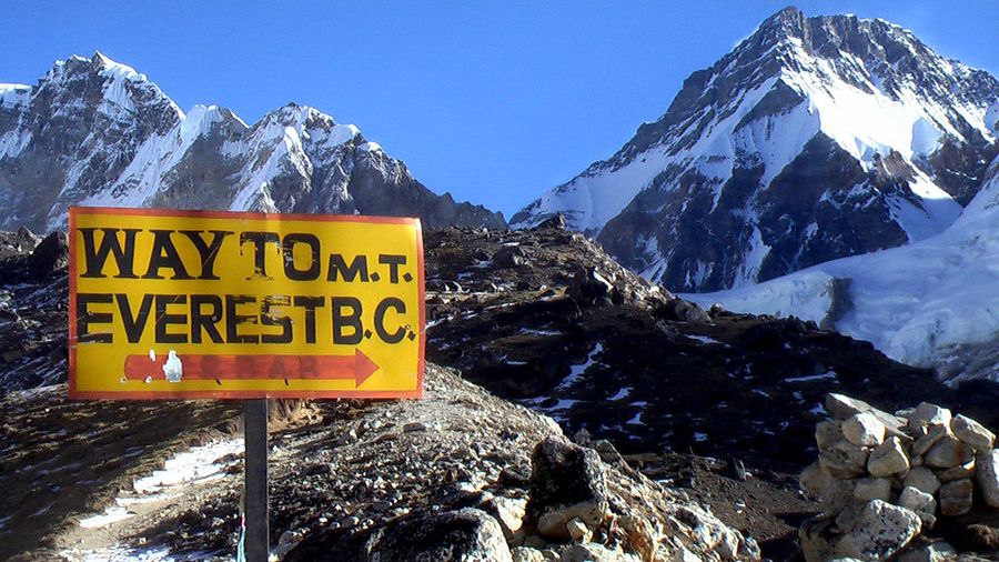
The most common approach for international visitors is through Nepal, which offers a well-developed trekking infrastructure. The Everest Base Camp trek, which takes roughly 12 to 14 days from Lukla, is the most famous route and draws tens of thousands of trekkers each year. It reaches an altitude of 5,364 meters at Base Camp, high enough to cause altitude sickness in visitors who ascend too quickly. The Annapurna Circuit, a longer and more varied route at lower maximum elevations, is often preferred by trekkers who want a fuller picture of Nepali landscape and village life.
Less visited but equally compelling are the treks in the Langtang Valley, just north of Kathmandu, which was heavily affected by the 2015 earthquake and has since been rebuilt. Langtang offers easier logistics, quieter trails, and access to rhododendron forests, yak pastures, and Tamang cultural heritage. For those interested in Tibetan Buddhism, the route to the sacred Gosaikunda Lakes passes through terrain that has been a pilgrimage destination for centuries.
Bhutan restricts visitor numbers through a daily fee system, which limits overcrowding but makes access expensive. The Druk Path Trek, connecting Paro and Thimphu, passes through forest and high-altitude lakes with views of Himalayan peaks and is manageable for moderately fit walkers. The Snowman Trek, running through Bhutan's remote north, is one of the most difficult trekking routes in the world and is completed by only a small number of people each year due to its length, altitude, and unpredictable weather.
India's Himalayan states — Himachal Pradesh, Uttarakhand, and Ladakh — offer alternatives that are less crowded than Nepal and reward visitors with distinct landscapes. Ladakh's high desert plateau, at an average elevation of around 3,500 meters, has a stark, lunar quality quite different from the forested valleys further south. The road journey from Manali to Leh crosses five high passes and is itself one of the great mountain drives.
The best time to visit most Himalayan regions is from late September to early November, when the monsoon has cleared and skies are stable, or from April to early June before the monsoon arrives. Winter closures affect many high routes. Acclimatization is essential — ascending too fast at any altitude above 3,000 meters carries real risk.
2 / 20
The Andes, South America
Credit: Chris Medina, Pexels
The Andes run for roughly 7,000 kilometers along the western edge of South America, making them the longest continental mountain range on Earth. They pass through seven countries — Venezuela, Colombia, Ecuador, Peru, Bolivia, Chile, and Argentina — and reach their highest point at Aconcagua in Argentina, which at 6,961 meters is the tallest peak outside Asia.
The range's ecological variety is extraordinary. The northern Andes, near the equator, contain the páramo — a high-altitude grassland ecosystem found almost nowhere else on Earth, characterized by strange, slow-growing plants adapted to daily temperature swings from near-freezing at night to warm sunshine during the day. Colombia's Cocora Valley, in the coffee-growing region near Salento, offers one of the most accessible introductions to Andean highland landscapes, with wax palms — the world's tallest — rising from green hillsides.
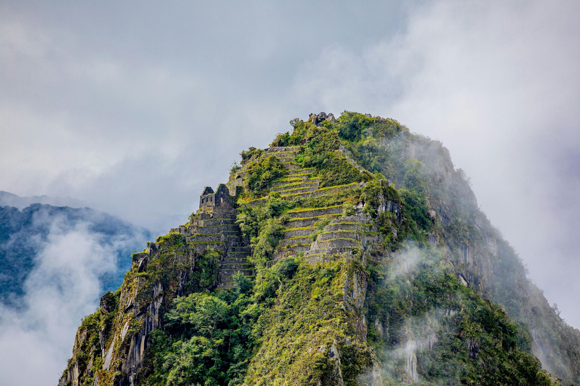
Peru's section of the Andes contains both the most visited and some of the least visited terrain in the range. The Inca Trail to Machu Picchu, which requires advance reservation and is limited to 500 people per day (including guides and porters), passes through cloud forest and high-altitude grassland before descending to the famous citadel. The Salkantay Trek, a longer alternative that is not subject to the same permit system, reaches higher elevations and offers better views of glaciated peaks.
The Cordillera Blanca in northern Peru contains more than 30 peaks above 6,000 meters, including Huascarán, Peru's highest mountain, and is centered on the town of Huaraz. This area draws serious mountaineers but also offers excellent day hiking and multi-day treks for non-technical visitors. The Laguna 69, a glacially fed turquoise lake at 4,600 meters, is reachable on a strenuous day hike and is one of the more visually distinctive destinations in the Andes.
Bolivia's Cordillera Real, accessible from La Paz, offers a compact group of glaciated peaks above a city that is itself one of the world's highest capitals. The Huayna Potosí, at 6,088 meters, is one of the most accessible technical climbs in the Andes and can be attempted by non-expert climbers with proper guide support and acclimatization.
In Patagonia, shared between Chile and Argentina, the southern Andes take a very different form — jagged granite towers, massive ice fields, and unpredictable weather. Torres del Paine in Chile and Los Glaciares in Argentina are the two major parks in this region. The W Trek in Torres del Paine, taking four to five days, is one of the most logistically accessible routes in the region, with hut accommodation available along the trail.
3 / 20
The Alps, Europe
Credit: Leona Augusto, Pexels
The Alps stretch across eight countries — France, Switzerland, Liechtenstein, Germany, Austria, Slovenia, Italy, and Monaco — and have been a center of European mountain culture since long before the modern tourism industry. The range contains more than 80 peaks above 4,000 meters, with Mont Blanc, on the French-Italian border, reaching 4,808 meters as the highest.
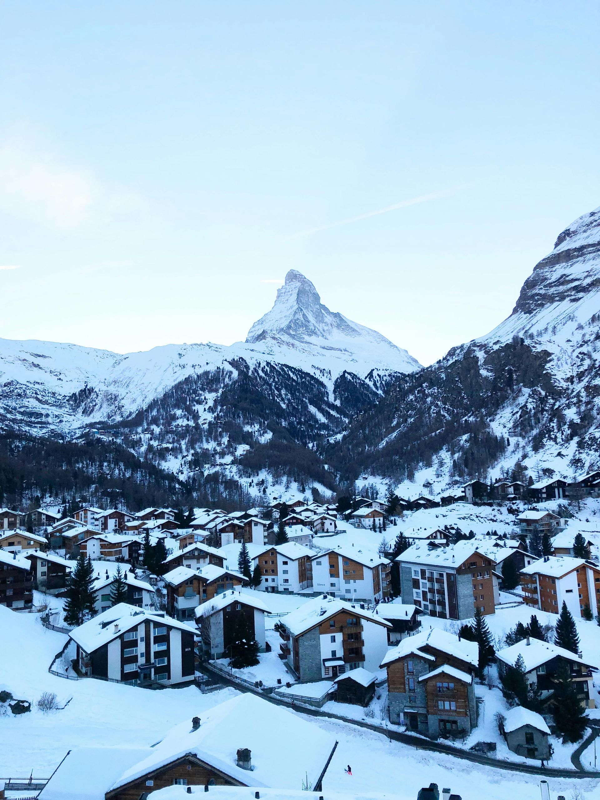
Skiing remains the dominant visitor activity in winter, with resorts ranging from the mass-market to the exclusive. Chamonix in France, Zermatt in Switzerland, and Cortina d'Ampezzo in Italy are among the best-known. Each has developed a distinct character over generations of tourism. Zermatt, car-free and dominated by views of the Matterhorn, is often cited as the model for what an alpine resort can be when aesthetics and infrastructure are managed carefully. Val d'Isère and Verbier are popular with British visitors and have significant off-piste terrain for more experienced skiers.
In summer, the Alps support one of the world's most developed long-distance hiking networks. The Tour du Mont Blanc, an 11-day circuit around the Mont Blanc massif passing through France, Italy, and Switzerland, is the most-walked multi-day route in Europe and requires advance hut booking during July and August. The Via Alpina, a set of five routes crossing the entire Alpine arc, provides options for walkers who want to spend weeks or months in the range.
The Alps also offer a different kind of cultural experience. The Bernese Oberland in Switzerland contains not just the Eiger, Mönch, and Jungfrau peaks but also towns like Grindelwald and Lauterbrunnen with deep traditions of cheese-making, woodworking, and pastoral farming. The trains that access the Jungfraujoch — the highest railway station in Europe at 3,454 meters — represent a kind of mountain access that requires no physical preparation whatsoever.
Climbing culture in the Alps has a history stretching back to the 18th century, when the first ascent of Mont Blanc in 1786 by Jacques Balmat and Michel-Gabriel Paccard is conventionally taken as the birth of mountaineering as a sport. The Haute Route, a ski touring traverse from Chamonix to Zermatt, covers roughly 180 kilometers through high-mountain terrain and is considered one of the great ski touring routes in the world.
The shoulder seasons — May to June and September to October — are often the best times to visit for those who want to avoid summer crowds and high accommodation prices while still benefiting from stable weather and open trails.
4 / 20
The Rocky Mountains, North America
Credit: clement fusil, Unsplash
The Rocky Mountains extend roughly 4,800 kilometers from northern British Columbia to New Mexico, passing through some of the least densely populated terrain in North America. The range is not a single geological unit but a collection of distinct mountain systems that share a broadly similar origin in the Laramide orogeny, a period of mountain-building that ended around 35 to 80 million years ago.
The most visited section is in Colorado, where the Rockies contain 53 peaks above 14,000 feet — known locally as "fourteeners" — that draw a significant hiking and climbing community. Mount Elbert, at 4,401 meters, is the highest peak in the range. The challenge culture around Colorado's fourteeners has produced a well-established community of summit seekers, with detailed trail information, permit systems for popular peaks, and a tradition of early starts to avoid afternoon thunderstorms.
Yellowstone and Grand Teton national parks in Wyoming represent a different kind of Rocky Mountain experience. Yellowstone, the world's first national park established in 1872, sits on one of the largest volcanic systems on Earth. Its geothermal features — geysers, hot springs, mud pots — are the most visible expression of that geology, but the park also supports one of the largest intact temperate ecosystems in the world, including wolf packs that were reintroduced in 1995 and have since reshaped the park's ecology in measurable ways.
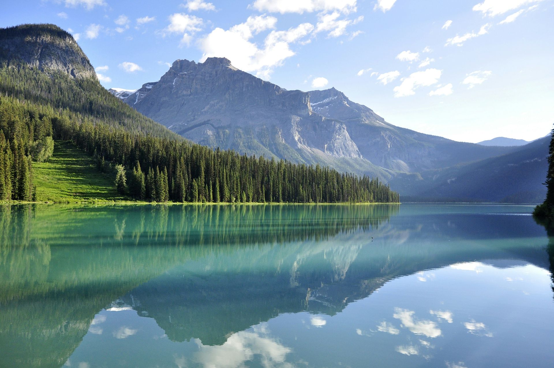
The Canadian Rockies, centered on Banff and Jasper national parks in Alberta, offer dramatic scenery at lower overall elevation than the Colorado Rockies but with a greater sense of wilderness. The Icefields Parkway, a 232-kilometer highway between Banff and Jasper, passes through terrain with glaciers, turquoise glacially fed lakes, and high mountain passes. The Athabasca Glacier, part of the Columbia Icefield, can be accessed on foot — though its position has retreated significantly over the past century.
New Mexico's Sangre de Cristo Mountains, at the southern end of the Rockies, have a character entirely different from the northern range — semi-arid, culturally tied to both Indigenous and Spanish colonial heritage, and home to Taos Pueblo, a continuously inhabited village that has stood for around 1,000 years. The Wheeler Peak area near Taos offers hiking above treeline in a region most visitors associate with art and culture rather than mountains.
Winter sports in the Rockies are served by resorts in Colorado (Aspen, Vail, Breckenridge, Telluride), Utah (Alta, Snowbird, Park City), and Wyoming (Jackson Hole), each with distinct terrain and culture.
5 / 20
The Karakoram, Pakistan and India
Credit: Raj Kumar Lohana, Pexels
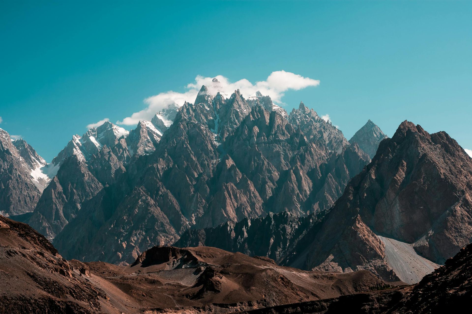
The Karakoram contains the highest concentration of extreme peaks anywhere on Earth. Four of the world's 14 eight-thousanders — K2, Broad Peak, Gasherbrum I, and Gasherbrum II — are within a compact area accessible from Pakistan's Gilgit-Baltistan region. K2, at 8,611 meters, is the second-highest mountain in the world and is widely considered the most technically difficult of the eight-thousanders to climb.
The standard approach for visitors is via Skardu, reached by flight from Islamabad, followed by a jeep journey to Askole and then a multi-day walk to the Baltoro Glacier and Concordia — the junction of several glaciers where the great peaks become visible simultaneously. This walk to Concordia, technically a trek rather than a climb, is one of the most dramatic experiences available to non-mountaineers in any mountain range. The scale of the terrain — the Baltoro Glacier alone is 57 kilometers long — is difficult to convey in photographs.
The Karakoram Highway, which links Pakistan to China over the Khunjerab Pass at 4,693 meters, is one of the engineering achievements of the 20th century. Built between 1959 and 1979 by Pakistani and Chinese workers, the road follows the ancient Silk Road route through Gilgit and Hunza. The Hunza Valley, with its apricot orchards and views of Rakaposhi, is often photographed but rewards slower visits that engage with the Burusho people who have lived there for centuries.
The Pakistani Karakoram is significantly less touristed than comparable mountain regions in Nepal, partly due to historical concerns about security and partly due to the logistics involved. Those concerns have diminished in recent years, and visitor numbers have grown, but the infrastructure remains limited compared to the Himalayas. This works in the range's favor for those who come prepared — trails are quieter, landscapes less disturbed, and interactions with local communities more authentic.
In summer, temperatures at base camp elevations (around 5,000 meters) are manageable during the day but drop sharply at night. The climbing season runs from June to August. July and August bring the most stable weather but also the greatest risk of rockfall and serac collapse on the high routes.
6 / 20
Patagonia (Andes of Southern Chile and Argentina)
Credit: Mario La Pergola, Unsplash
Patagonia occupies the southern tip of the Andes and comprises a region of roughly 1 million square kilometers shared between Chile and Argentina. It is not a separate range from the Andes but a distinct geographic and climatic zone where the mountains meet the Southern Ocean and the terrain is shaped as much by wind, ice, and water as by tectonic forces.
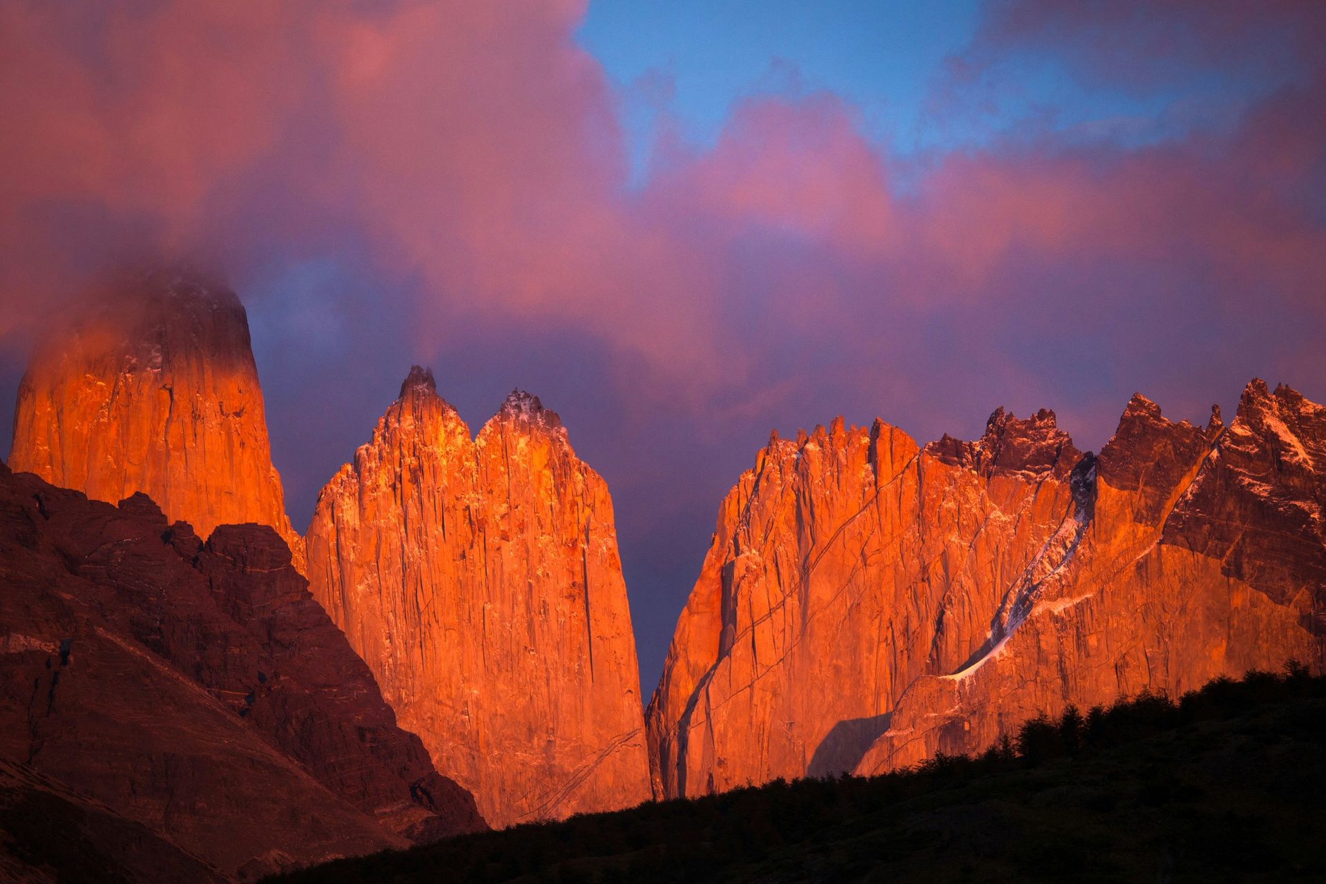
The defining characteristic of Patagonian weather is its variability. Storms can arrive within minutes, transform a clear mountain day into a whiteout, and disappear just as quickly. Wind speeds in the exposed sectors of Torres del Paine regularly exceed 100 kilometers per hour. This makes planning difficult and gear selection critical, but it also creates a landscape of extraordinary drama — when the light breaks through, the granite towers of the Paine massif and the Fitz Roy range near El Chaltén can appear almost impossibly vivid.
Torres del Paine National Park in Chile is the most visited destination in the region. The W Trek, covering about 80 kilometers over four to five days, passes the three towers that give the park its name, the Grey Glacier, and the Valley of the French. The O Circuit, which adds the back side of the massif, is roughly twice as long and significantly less crowded. Both routes use a system of refugios — mountain huts with bunk beds and meals — that makes the logistics manageable without camping gear.
El Chaltén in Argentina, a small mountain town established in 1985 partly to assert Argentine territorial claims, is the base for trekking around the Fitz Roy massif. The peaks here — Fitz Roy, Cerro Torre, and their neighbors — are among the most technically demanding rock and ice climbs in the world and have been central to the development of alpine-style climbing since the 1950s. Day hikes from town to viewpoints at Laguna de los Tres and Laguna Torre are accessible to ordinary walkers.
Los Glaciares National Park, which includes El Chaltén, also contains the Perito Moreno Glacier — one of the few glaciers in the world that is not currently in net retreat. Boat tours and boardwalk access allow close inspection of the glacier's 60-meter ice face, which periodically calves enormous blocks into the lake below.
7 / 20
The Atlas Mountains, North Africa
Credit: Paul Macallan, Unsplash
The Atlas Mountains run for approximately 2,500 kilometers across Morocco, Algeria, and Tunisia, separating the Mediterranean coast and the Sahara Desert. The range contains distinct subranges — the High Atlas, Middle Atlas, and Anti-Atlas in Morocco, and the Tell Atlas and Saharan Atlas in Algeria. Toubkal, in Morocco's High Atlas, reaches 4,167 meters and is the highest peak in North Africa.
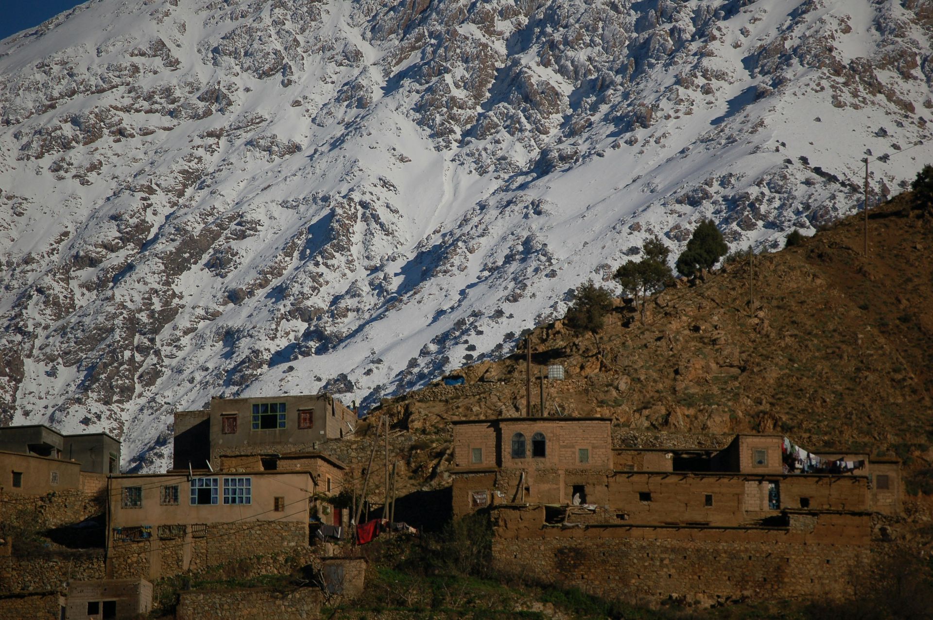
For most international visitors, the Moroccan High Atlas is the accessible entry point. Jebel Toubkal can be summited in two days from the village of Imlil, which is about 90 minutes from Marrakech. The route is non-technical — no ropes or special equipment are required outside of winter — but it is a genuine mountain ascent, reaching elevations where altitude can affect visitors not acclimatized to high terrain. The approach through Imlil and the Ait Mizane Valley passes through Berber villages where traditional architecture, terraced agriculture, and mule transport have changed little in form over generations.
The Toubkal National Park, established in 1942, contains several refuges that allow multi-day traverses of the High Atlas. The longer routes connecting Toubkal with neighboring valleys and villages are less frequented than the summit route and provide a fuller picture of the range's variety — cedar forests at middle elevations, rocky plateaus near the summits, and cultivated valleys below.
The Middle Atlas, north of Marrakech, is lower, forested, and home to Barbary macaques — the only wild primate species found in Africa north of the Sahara and the only wild population outside of Gibraltar. The cedar forests around Azrou attract these monkeys and offer a quite different mountain experience from the bare rock and altitude of the High Atlas.
In winter, the High Atlas receives significant snowfall, and basic ski infrastructure exists at Oukaimeden, at around 2,650 meters — the highest ski resort in Africa, though with limited development compared to European alpine resorts. The combination of skiing with proximity to Marrakech has attracted some interest, though the resort is primarily used by Moroccans rather than international winter sports visitors.
The cultural dimension of an Atlas visit is inseparable from the landscape. The Amazigh (Berber) people of the mountains have maintained a distinct language, architecture, and social structure through centuries of outside influence, and many High Atlas villages function today much as they have for generations.
8 / 20
The Sierra Nevada, U.S.
Credit: Jezael Melgoza, Unsplash
The Sierra Nevada runs for about 640 kilometers through eastern California, from the Mojave Desert in the south to the Cascades in the north. The range is a single tilted block of granite, steep on its eastern side and gently sloping to the west, and its western slopes catch moisture from Pacific storms that the eastern side — which falls away sharply into the Great Basin desert — does not.
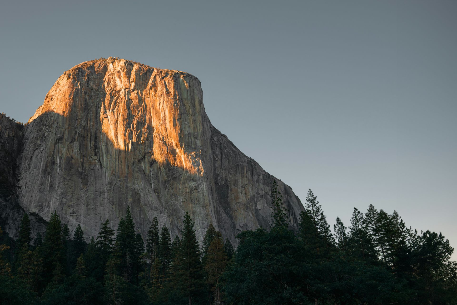
Yosemite Valley, on the western slope of the Sierra Nevada, is one of the most photographed landscapes in North America. The valley was carved by glaciers into the granite batholith, leaving vertical walls of rock — El Capitan and Half Dome among them — that now define the rock-climbing culture of the range. El Capitan, a 900-meter vertical granite wall, has been at the center of free climbing development since the 1950s, and the first free solo ascent by Alex Honnold in 2017 was one of the most widely covered mountaineering achievements in recent decades.
Sequoia and Kings Canyon national parks, south of Yosemite, protect the largest trees on Earth by volume — giant sequoias that can live for over 3,000 years and reach heights of more than 80 meters. The General Sherman Tree, in Sequoia National Park, is the largest known living tree by volume. The parks also contain the Sierra High Route, a cross-country traverse of roughly 320 kilometers that is largely off-trail and intended for experienced wilderness travelers.
The John Muir Trail, one of the most celebrated long-distance hiking routes in the U.S., runs 340 kilometers from Yosemite Valley to Mount Whitney, the highest point in the contiguous U.S. at 4,421 meters. It requires permits, which are heavily oversubscribed for summer departures from Yosemite and require entry in a lottery.
Winter in the Sierra Nevada is defined by snowfall that can exceed 15 meters in a single season at some elevations. Lake Tahoe, on the Nevada-California border, is surrounded by ski resorts including Palisades Tahoe (formerly Squaw Valley), which hosted the 1960 Winter Olympics. The range also feeds the water systems that supply much of California's agricultural sector, making its snowpack a closely watched economic indicator.
9 / 20
The Caucasus, Georgia and Russia
Credit: Supanut Arunoprayote. , Wikimedia Commons / CC BY 4.0
The Caucasus Mountains form the border between Europe and Asia, stretching from the Black Sea to the Caspian Sea across Georgia, Russia, Armenia, and Azerbaijan. Mount Elbrus, on the Russian side of the range, reaches 5,642 meters and is the highest peak in Europe by the most commonly used definition. The Greater Caucasus — the main ridge — is matched to the south by the Lesser Caucasus, a separate system of lower ranges.
Elbrus is a dormant volcano and its flanks are relatively gentle for its elevation, making it a more achievable high-altitude summit than technically difficult peaks of comparable height. The standard route from the south uses a gondola system to around 3,800 meters before climbers continue on foot or by snowcat. Despite the relative accessibility of the route, altitude remains a serious challenge, and proper acclimatization over several days at elevation is essential for a safe summit attempt.
Georgia offers the most developed tourism infrastructure in the Caucasus region. The Svaneti region, in the northwest of the country, is considered one of the most intact examples of medieval mountain culture in Europe — stone defensive towers dating from the 9th to 12th centuries dot the landscape, and the Svan people have maintained a distinct language and cultural tradition for centuries. The village of Mestia is the main base, accessible by road or small aircraft, and provides access to the Koruldi Lakes viewpoint and multi-day trekking routes.
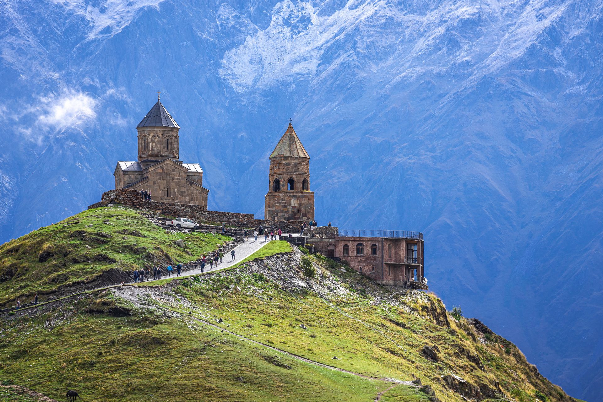
The Kazbegi region, in northeastern Georgia near the Russian border, centers on Stepantsminda, where the Gergeti Trinity Church sits dramatically above the Terek River at 2,170 meters with the glaciated peak of Mount Kazbek behind it. Kazbek, at 5,047 meters, can be climbed by experienced mountaineers. The hike to the church is a popular day excursion from Tbilisi.
The Caucasus represent a frontier of international tourism in the sense that they remain far less visited than comparable European ranges. Infrastructure has improved significantly in Georgia over the past decade but is variable — excellent in some areas, minimal in others. For visitors comfortable with some logistical uncertainty, the combination of mountain scenery, cultural depth, and relatively low visitor numbers is a compelling combination.
10 / 20
The Drakensberg, Southern Africa
Credit: Arthur Hickinbotham, Unsplash
The Drakensberg — from the Afrikaans for "Dragon's Mountains" — form the eastern escarpment of the southern African plateau, running for roughly 1,000 kilometers through South Africa and Lesotho. The highest peaks, including Thabana Ntlenyana at 3,482 meters, are in Lesotho. The range is not geologically young; the basalt that caps the escarpment was laid down by volcanic activity around 180 million years ago.
The Drakensberg is designated a UNESCO World Heritage Site, primarily for its collection of San rock art — an estimated 35,000 individual paintings in more than 600 sites across the range. The San people, hunter-gatherers who inhabited the area for thousands of years, produced images of animals, human figures, and ritual scenes that constitute one of the world's most significant bodies of rock art. Many sites require a guide to locate and access.
The range is also notable for its grassland and wetland ecology. The uKhahlamba-Drakensberg Park, which protects the South African section, supports populations of Cape vulture, bearded vulture (lammergeier), and numerous endemic plant species. The wetlands feed the rivers that supply much of KwaZulu-Natal province's water.
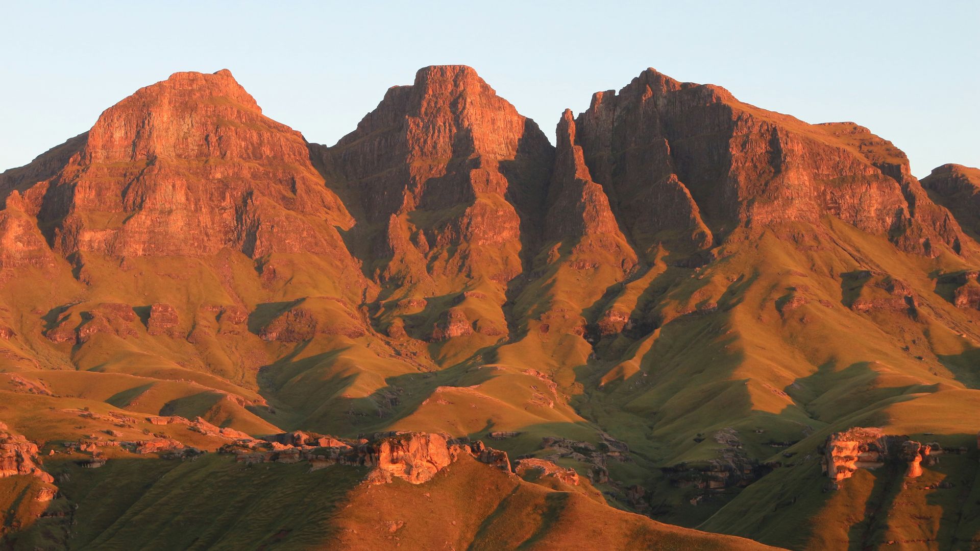
Hiking in the Drakensberg is well-organized by South African National Parks and the Ezemvelo KZN Wildlife authority. The range is divided into several sections — Giant's Castle, Royal Natal, the Amphitheatre, and the southern Drakensberg — each with a distinct character. The Amphitheatre, a basalt wall roughly 5 kilometers wide and 600 meters high in Royal Natal National Park, is the most photographed feature in the range and can be seen from the valley floor.
The Drakensberg Grand Traverse, a multi-week hike covering the entire high escarpment, is one of the most demanding long-distance routes in Africa, requiring navigation skills and the ability to manage weather that can shift from clear to dangerously cold and wet within hours. Most visitors to the Drakensberg experience it through shorter day hikes or overnight routes, which are abundant and generally well-marked.
Access from Durban, the nearest large city, takes approximately three hours by road to the main northern sections. Accommodation ranges from basic camping to comfortable lodges in the foothills.
11 / 20
The Pyrenees, France and Spain
Credit: SilBaBum _, Pexels
The Pyrenees form a natural border between France and Spain for roughly 430 kilometers, from the Atlantic coast near Bayonne to the Mediterranean near Perpignan. Andorra, a small independent state, sits within the range. The highest peak, Aneto, reaches 3,404 meters and is in the Spanish Aragonese Pyrenees.
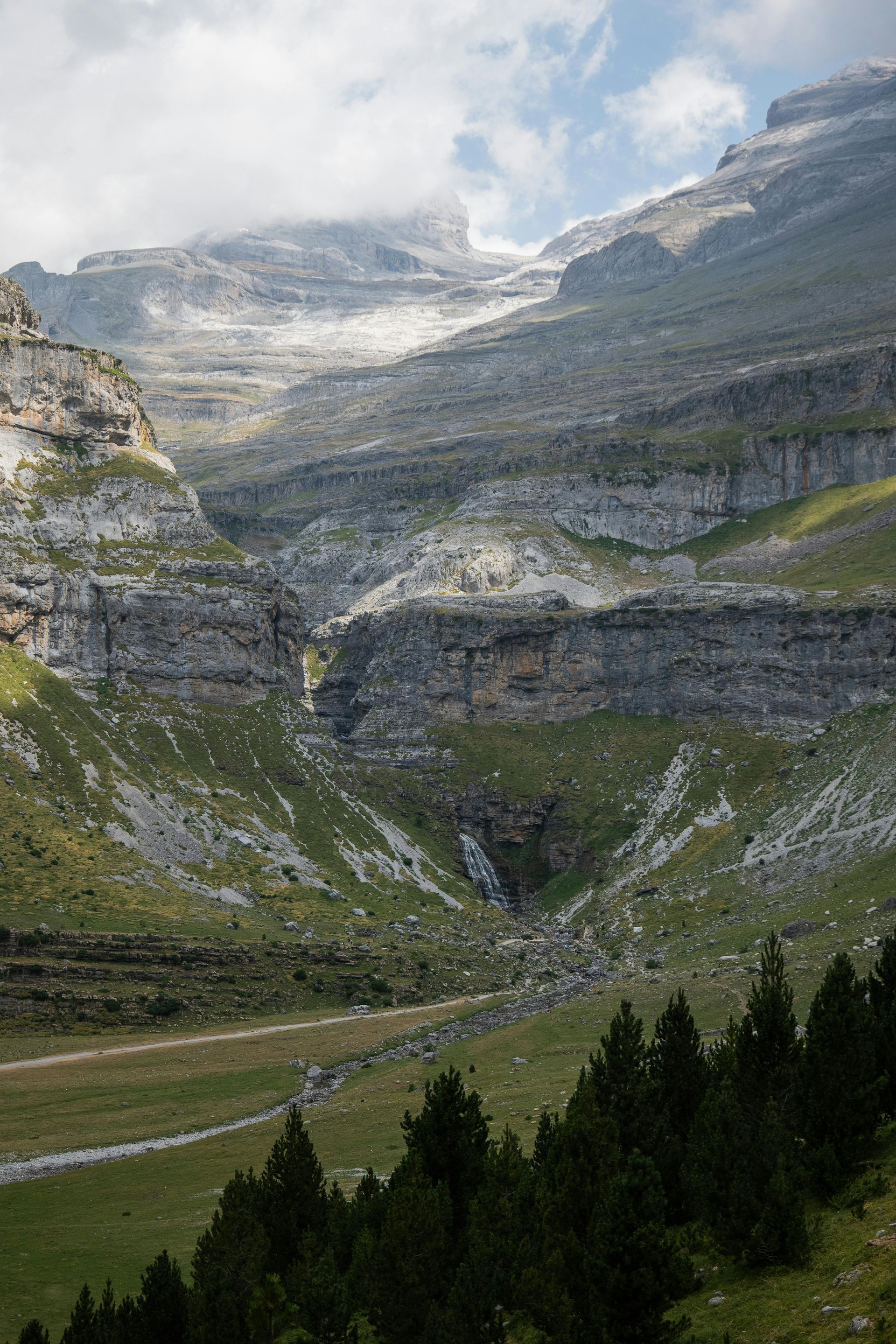
The range is less visited than the Alps but supports a rich variety of landscapes and cultural traditions that reward careful exploration. The Spanish side is generally drier and more rugged; the French side wetter and more forested. The central massif, around the Parque Nacional de Ordesa y Monte Perdido in Spain and the Parc National des Pyrénées in France, contains the most dramatic scenery — deep canyons, waterfalls, glacial cirques, and meadows that support brown bear and Pyrenean chamois.
The Haute Route Pyrénéenne, a 45- to 50-day traverse of the entire range, is one of the longest and most varied mountain trekking routes in Europe. It is more demanding than the Tour du Mont Blanc due to its length, navigation challenges, and the remoteness of some sections. Most walkers attempt shorter sections rather than the full traverse.
The Camino de Santiago, while primarily a pilgrimage through the Spanish interior, crosses the Pyrenees at Roncesvalles on its most popular route — the Camino Francés — and the mountain section on the first day is one of the most memorable parts of the entire walk. The crossing from Saint-Jean-Pied-de-Port over the Pyrenees in good weather is a genuine mountain experience; in bad weather, it can be genuinely hazardous, and the alternative valley route via Valcarlos is used when conditions are severe.
Winter sports in the Pyrenees are centered on resorts in the Aragonese and Catalan Pyrenees in Spain, including Baqueira-Beret, and in the French departments of Hautes-Pyrénées and Ariège. The skiing terrain is generally lower in elevation than the Alps, which makes it more weather-dependent, but several resorts offer reliable conditions during core winter months.
The Pyrenean culture — Basque, Catalan, Aragonese, and Béarnais — is as varied as the landscape and worth engaging with separately from the scenery.
12 / 20
The New Zealand Alps, New Zealand
Credit: Pakata Goh, Unsplash
The Southern Alps run for roughly 500 kilometers along the spine of New Zealand's South Island. They are geologically active — rising at around 10 millimeters per year and eroding at a similar rate — and contain the largest area of permanent ice and snow in the Southern Hemisphere outside Antarctica. Aoraki/Mount Cook, at 3,724 meters, is the highest peak in the country and has cultural significance for the Ngāi Tahu iwi, who consider the mountain sacred.
The range defines the weather patterns of the South Island. The prevailing westerly winds drop enormous amounts of rain and snow on the west coast — Fiordland, in the southwest, receives among the highest annual rainfalls anywhere on Earth — while the east coast, in the rain shadow, is relatively dry. The difference between the two sides of the range is one of the most dramatic ecological contrasts in the world.
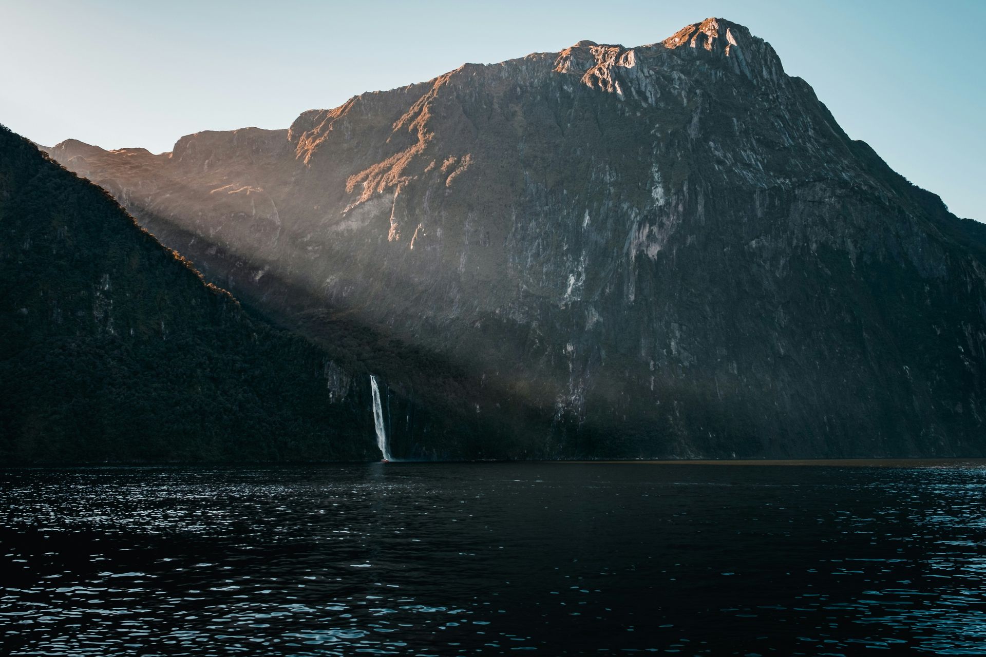
Fiordland National Park, which covers the southwestern corner of the South Island, contains the most visited sections of the New Zealand Alps for trekkers. The Milford Track, a four-day walk from Lake Te Anau to Milford Sound, is limited to 90 independent walkers per day and has been described as one of the finest walks in the world. The Routeburn Track, connecting the Fiordland and Mount Aspiring national parks, is similarly managed and passes through alpine terrain above the treeline.
The Aoraki/Mount Cook area offers glacier travel as a genuine visitor activity. The Tasman Glacier, New Zealand's longest at roughly 23 kilometers, has retreated significantly due to warming temperatures but still supports glacier walking and ski plane tours. The Mueller Glacier has largely converted to a proglacial lake.
Ski areas on the east side of the Southern Alps — Treble Cone, Cardrona, and the Remarkables near Queenstown — operate on terrain that offers excellent snowfall in good years but can be unreliable in warm winters. Heli-skiing in the backcountry is well-developed around Queenstown and Wanaka, with access to terrain that no road or lift could reach.
13 / 20
The Ethiopian Highlands, Ethiopia
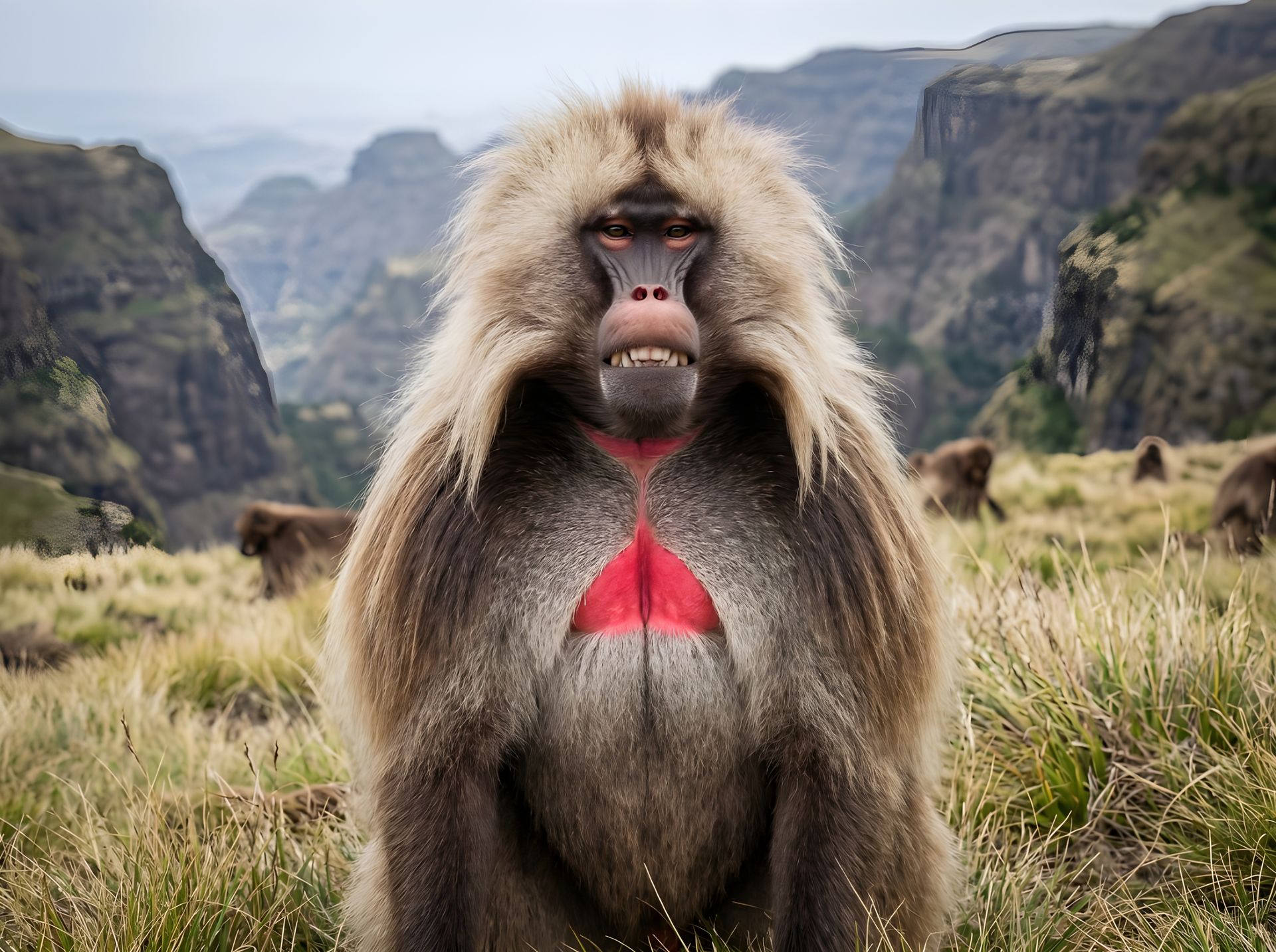
Credit: GabruPawPixels, Pixabay
The Ethiopian Highlands form the largest continuous area of high terrain in Africa, covering much of central and northern Ethiopia. The range is sometimes called the "Roof of Africa," though this name is also applied to the Drakensberg and Kilimanjaro. The Simien Mountains in the north of the country contain Ras Dashen, the highest peak in Ethiopia at 4,550 meters.
The Simien Mountains National Park is a UNESCO World Heritage Site and one of Africa's most ecologically distinctive landscapes. The plateau, which sits at around 3,000 to 4,500 meters, is deeply cut by erosion into dramatic escarpments and isolated pinnacles. The park supports the gelada — a large ground-dwelling primate found only in the Ethiopian highlands — in populations that number in the hundreds of thousands, making it one of the best places in the world to observe primates in their natural habitat. Ethiopian wolves, one of the world's rarest canids, also live in the highland grasslands, though in much smaller numbers.
Trekking in the Simien Mountains requires a scout — a mandatory local guide who is both a cultural resource and, in some areas, an armed escort due to historical security concerns that have largely but not entirely dissipated. Routes from Debark, the park entry point, range from one-day walks to multi-week traverses, with basic camps and lodges along the main routes.
The Bale Mountains, in southeastern Ethiopia, offer an alternative that is less visited than the Simien and contains the largest expanse of Afroalpine habitat in Africa. The Sanetti Plateau, at around 4,000 meters, is the best place to see Ethiopian wolves and also supports the mountain nyala, an antelope endemic to the Ethiopian highlands.
Lalibela, in the Amhara region, is not a mountain destination in the trekking sense but sits at 2,500 meters and contains the rock-hewn churches carved from the highland basalt in the 12th century — a feat of construction that remains one of the most remarkable in the world and is deeply embedded in the Ethiopian Orthodox Christian tradition.
14 / 20
The Hindu Kush, Afghanistan and Pakistan
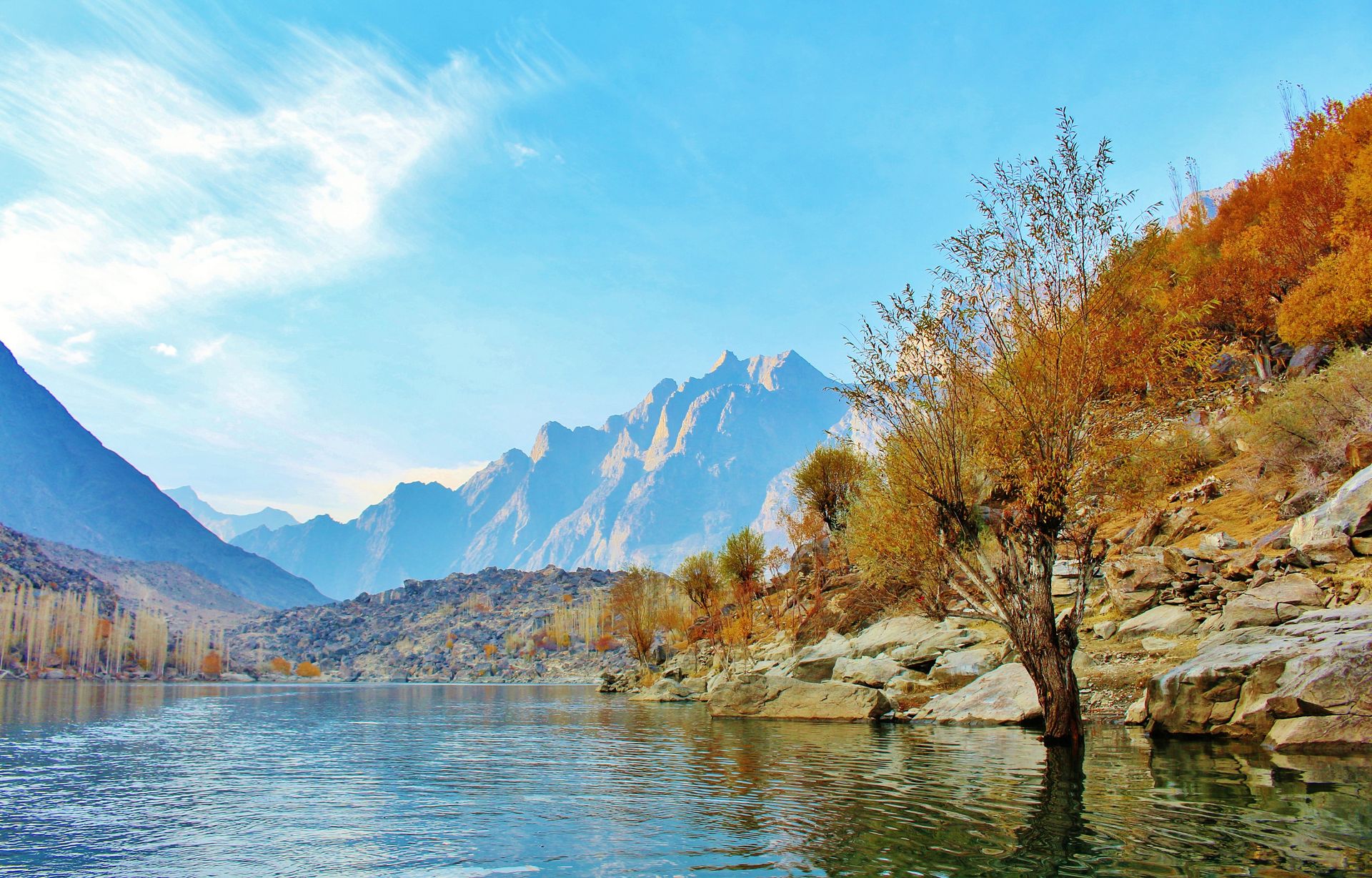
Credit: Abdullah_Shakoor, Pixabay
The Hindu Kush extends for about 800 kilometers from central Afghanistan into northern Pakistan, where it meets the Karakoram and the Himalayas in one of the most complex mountain junctions on Earth. The highest peak is Tirich Mir in Pakistan, at 7,708 meters. The name Hindu Kush may derive from a Persian phrase meaning "kills the Hindus," a reference to the historic difficulty of crossing the range.
Access to the Afghan section of the Hindu Kush has been effectively closed to international tourism since the late 1970s, and remains so under current conditions. The Pakistani section, in the Chitral and Dir districts of Khyber Pakhtunkhwa, is accessible and contains some of the most striking mountain scenery in the country.
Tirich Mir and its neighboring peaks attract a small number of mountaineering expeditions each year. The Chitral Valley, at lower elevations, is home to the Kalasha people — a small indigenous community of around 4,000 people who practice a polytheistic religion distinct from the surrounding Muslim culture and maintain festivals and traditions that have been the subject of anthropological study for over a century.
The Shandur Pass, at 3,734 meters on the road between Chitral and Gilgit, hosts an annual polo tournament between teams from Chitral and Gilgit in July, played at what is described as the highest polo ground in the world. The event draws visitors from across Pakistan and a small number of international travelers.
The Wakhan Corridor, a narrow strip of Afghan territory extending east to the Chinese border, was historically one of the Silk Road's most important mountain routes and contains the Afghan Pamirs. Travel here is not currently possible under ordinary conditions, but the cultural and geographic history of the corridor — used by Marco Polo, who described the wild sheep that still bear his name — gives it a significance beyond what current access allows.
15 / 20
The Scandinavian Mountains, Norway and Sweden
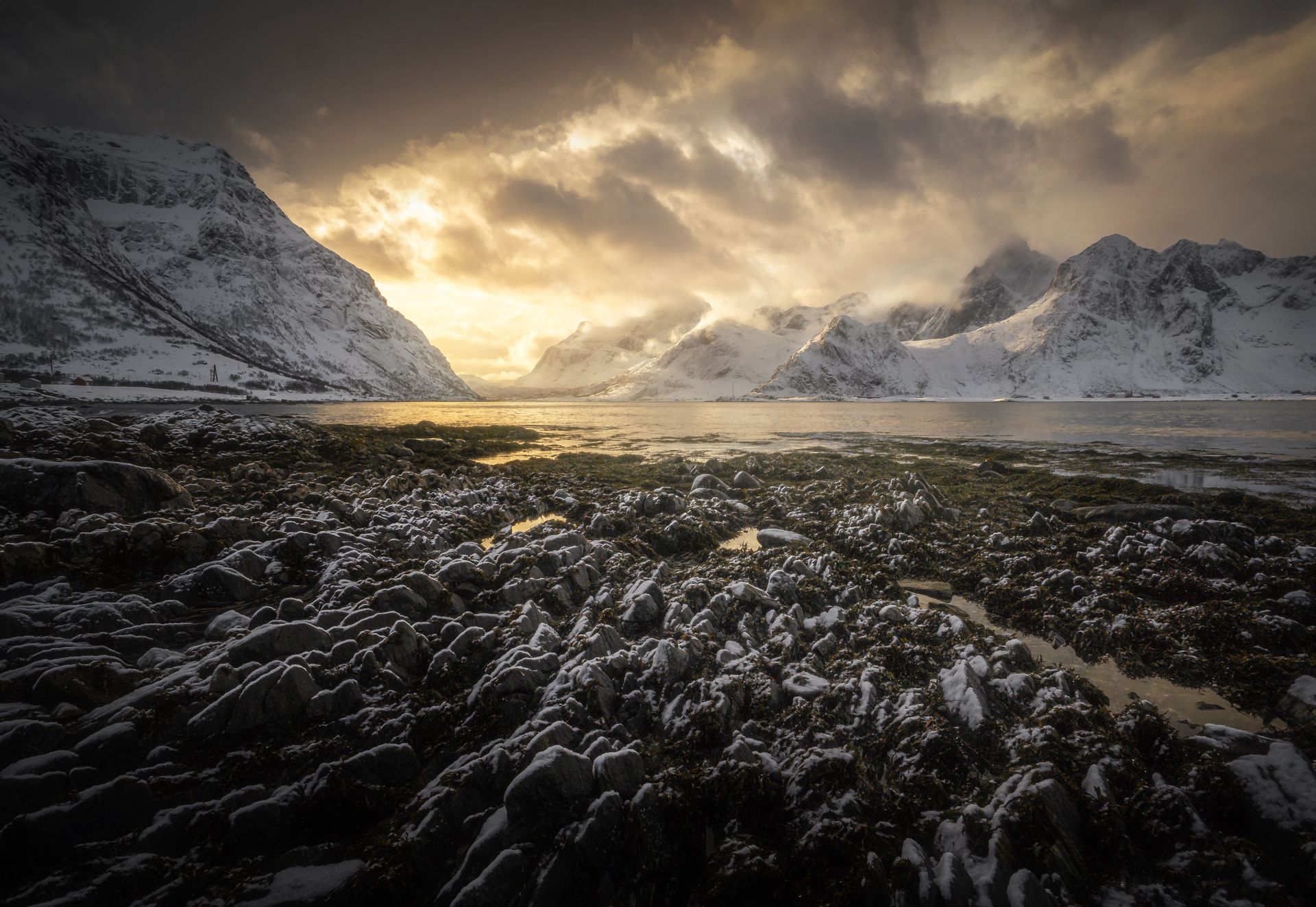
Credit: Elisabetta_Miele, Pixabay
The Scandinavian Mountains, also called the Scandinavian Alps or Scandes, form the spine of the Scandinavian Peninsula, running through Norway and Sweden for about 1,700 kilometers. The highest peak is Galdhøpiggen in Norway, at 2,469 meters — modest by Himalayan or Andean standards but significant for the latitude, which sits well above the Arctic Circle for much of the range's northern extent.
The experience of these mountains is defined as much by light as by altitude. In summer, above the Arctic Circle, the sun does not set for weeks. In winter, it does not rise. This creates ecosystems and cultural adaptations unlike those found in mountain ranges at lower latitudes. The Sámi people, who have herded reindeer across the Scandinavian uplands for centuries, developed a relationship with the land shaped by these extreme seasonal rhythms.
Norway's fjords are the result of glacial action on the western slopes of the Scandinavian range — valleys carved deep into the rock and later filled by the sea. Sognefjord, at 204 kilometers the longest fjord in Norway and the world, can be explored by boat, kayak, or along the walking trails on its rim. Hiking in Jotunheimen National Park, which contains Galdhøpiggen and most of the highest peaks, is served by the Hytte network — a system of staffed mountain huts run by the Norwegian Trekking Association that provides accommodation and meals along marked routes.
The Lofoten Islands, off the northwest coast of Norway, sit on the edge of the Scandinavian range where the mountains meet the Arctic Ocean. The combination of steep peaks, fishing villages, and northern lights makes Lofoten one of the most photographed landscapes in Europe. Skiing in Lofoten, accessible from the sea and often combined with boat travel, has developed a following among those seeking an alternative to traditional resort skiing.
Sweden's Kungsleden — "the King's Trail" — runs for 440 kilometers through Swedish Lapland from Abisko to Hemavan, passing through Sarek National Park, one of the most remote wilderness areas in Europe, where no marked trails or staffed huts exist within the park boundaries.
16 / 20
The Cascade Range, U.S. and Canada
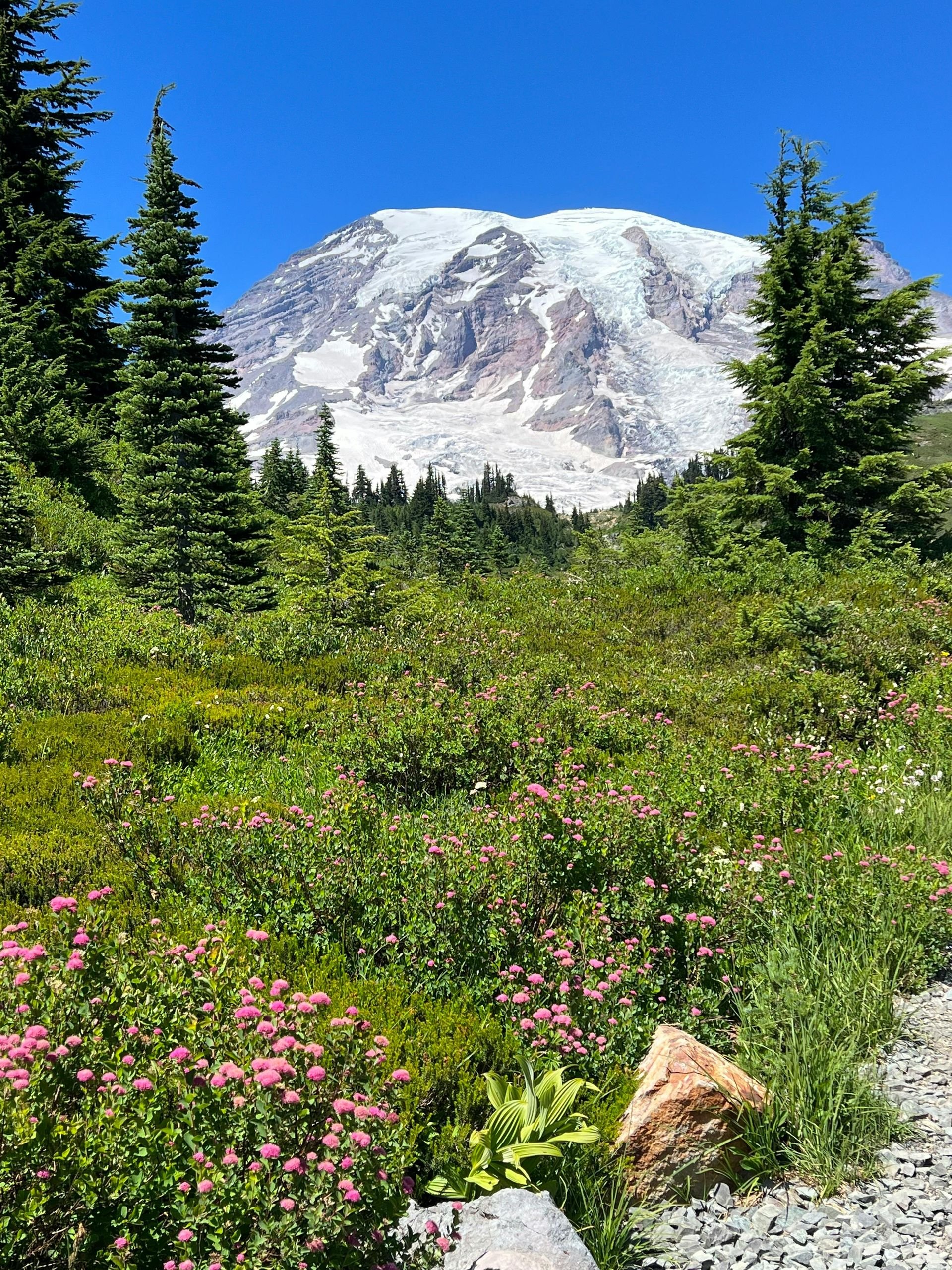
Credit: Elizabeth Carbajal, Pexels
The Cascade Range runs for about 1,100 kilometers from British Columbia through Washington state and Oregon to northern California, where it meets the Sierra Nevada. The range contains the densest concentration of active and potentially active volcanoes in the contiguous U.S., including Mount St. Helens, which erupted in 1980 in the most destructive volcanic event in U.S. history.
Mount Rainier, in Washington state, at 4,392 meters, is the highest peak in the range and the most glaciated mountain in the contiguous U.S., with roughly 25 named glaciers. It is also considered one of the most dangerous volcanoes in the world due to the large population living in its potential lahar paths — rivers of volcanic debris and melted ice that could travel as far as Puget Sound in an eruption scenario. Despite this, it is a heavily visited national park and a popular mountaineering objective.
Crater Lake, in Oregon, occupies the caldera of Mount Mazama, a volcano that collapsed inward around 7,700 years ago after a major eruption. The lake, at 592 meters deep, is the deepest in the U.S. and is notable for the clarity and blue intensity of its water, which has no inlet rivers. It is surrounded by a road that can be driven as a loop in summer.
The North Cascades, in northern Washington state near the Canadian border, contain more than 300 glaciers and a landscape that has been described as the "American Alps." The area is less visited than other sections of the Cascades due to limited road access and limited infrastructure, which preserves a sense of remoteness that is increasingly rare in the western U.S.
Mount Hood in Oregon, at 3,426 meters, is one of the most climbed glaciated peaks in the U.S. — more than 10,000 people attempt the summit each year. The timberline Lodge on its flanks, built by craftspeople during the New Deal era in the 1930s, is one of the best-preserved examples of that period's rustic mountain architecture.
British Columbia's Mount Garibaldi, near Whistler, and the surrounding provincial park offer an accessible but relatively quiet alternative to the crowded U.S. Cascades.
17 / 20
The Tian Shan, Central Asia
Credit: Musab S, Pexels
The Tian Shan — "Celestial Mountains" in Mandarin — extends for roughly 2,500 kilometers across Kyrgyzstan, Kazakhstan, China's Xinjiang region, and a small portion of Tajikistan. The highest peak is Jengish Chokusu (also called Pobeda or Victory Peak) on the Kyrgyz-Chinese border, at 7,439 meters.
Kyrgyzstan is the most accessible country from which to explore the range, and its tourism infrastructure has grown significantly since the country gained independence in 1991. The capital, Bishkek, sits at the northern edge of the range, and the Issyk-Kul basin — a high-altitude lake of 6,236 square kilometers, the second-largest alpine lake in the world after Titicaca — is the most visited tourist destination in the country. The lake does not freeze in winter due to its mineral content and is warmer than most lakes at its elevation (1,607 meters).
The Central Tian Shan, near the Chinese border, contains some of the most remote terrain in the range. Khan Tengri, a pyramid of marble and granite reaching 7,010 meters, is considered one of the most aesthetically perfect peaks in Central Asia. Expeditions to Khan Tengri and Jengish Chokusu depart from a base camp on the Inylchek Glacier, one of the longest non-polar glaciers in the world.
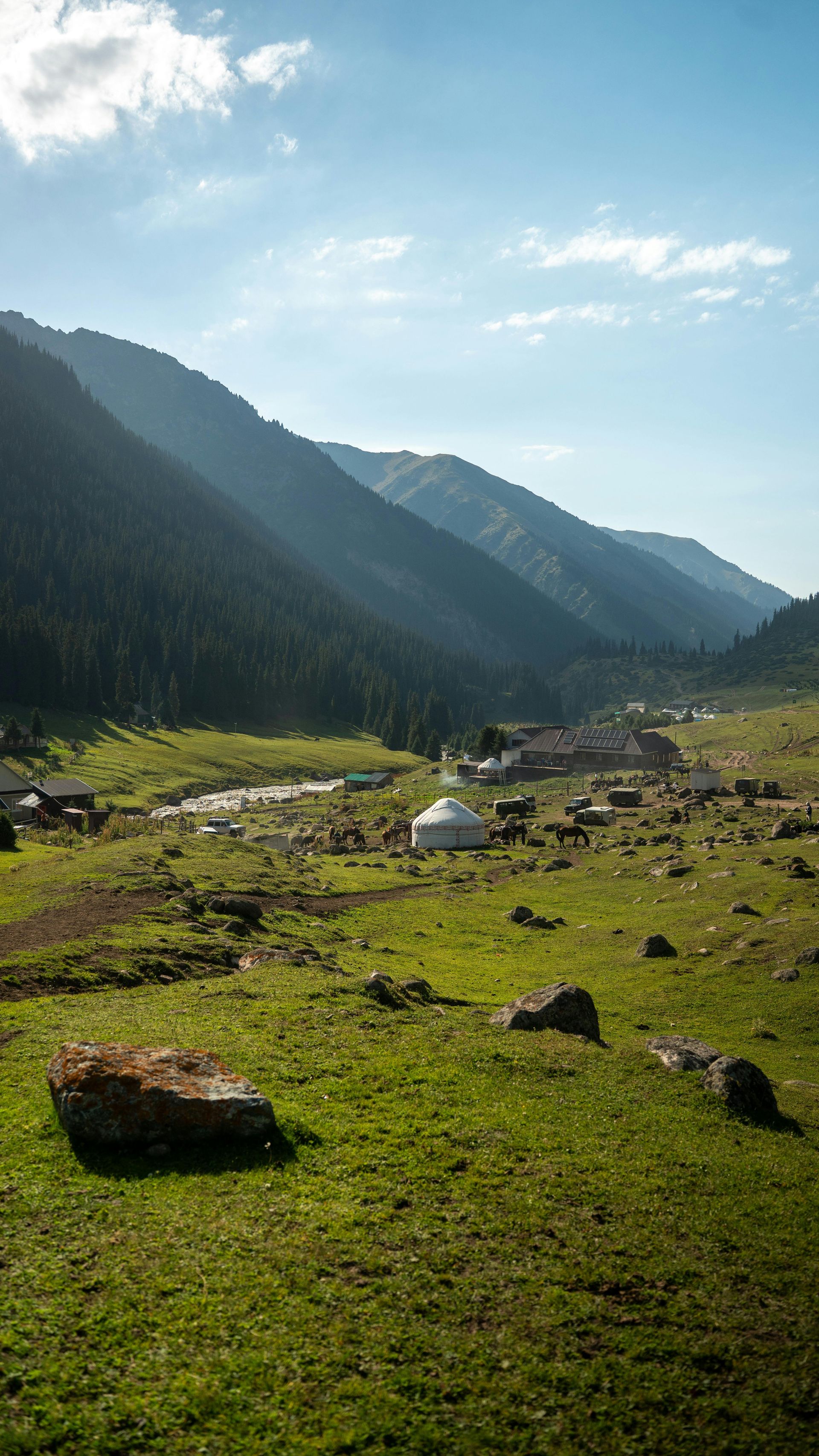
The tradition of nomadic pastoral life in Kyrgyzstan has been better preserved here than in most of Central Asia, partly due to Kyrgyzstan's mountainous terrain, which resisted the collectivization policies of the Soviet era to some extent. Yurt stays with nomadic families in the Song-Kol and Kochkor areas provide access to a way of life organized around seasonal altitude migration that has changed remarkably little in its fundamentals.
The Kyrgyz Epic of Manas, one of the longest oral epics in any language, is set in this landscape and is central to national identity. Performances of Manas by professional manaschi — storytellers who memorize thousands of verses — remain an active cultural tradition.
18 / 20
The Zagros Mountains, Iran and Iraq
Credit: Alexander Popovkin, Pexels
The Zagros Mountains form the largest mountain system in Iran and Iraq, extending for roughly 1,500 kilometers from the Turkish and Armenian borders in the northwest to the Strait of Hormuz in the southeast. The highest peak in the Iranian section is Zard Kuh, at approximately 4,548 meters. The range is the geological result of the Arabian plate's collision with the Eurasian plate, a process that also produced the Himalayas and is still ongoing.
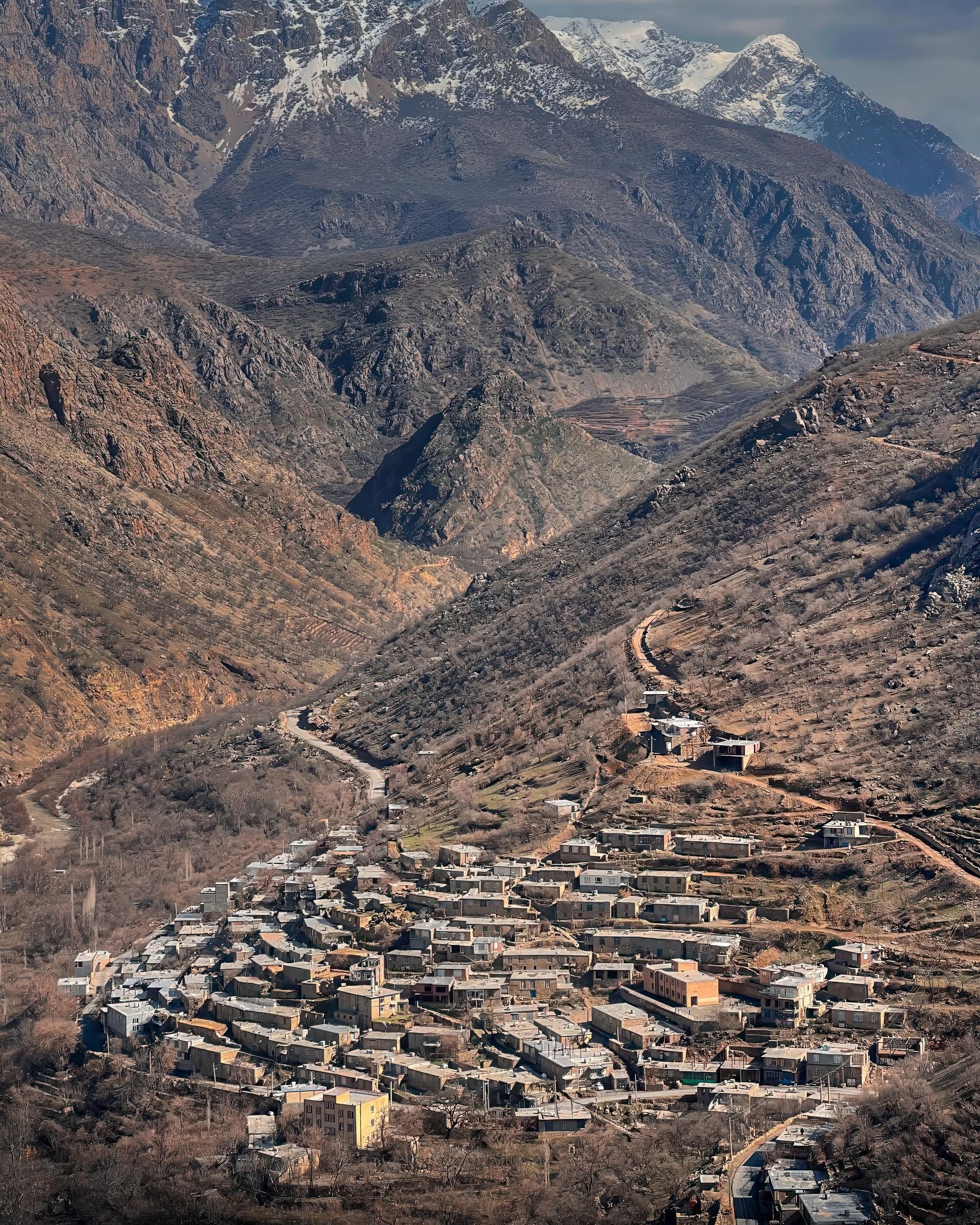
The Zagros are the heartland of the Kurdish people in Iran and Iraq, as well as home to several other ethnic groups including the Lur and Bakhtiari. The Bakhtiari are one of the largest semi-nomadic groups remaining in Iran, and their biannual migration — moving herds of cattle, sheep, and goats across the Zagros to seasonal pastures — has been the subject of documentary film since the 1920s.
Iran's Zagros region contains several well-preserved historical sites alongside the mountain scenery. Bisotun, a UNESCO World Heritage Site in the Kermanshah province, features a large rock relief and trilingual cuneiform inscription commissioned by the Achaemenid king Darius I around 500 BCE. The inscription, in Old Persian, Elamite, and Babylonian, was key to the decipherment of cuneiform script in the 19th century.
The ski resort at Dizin, northwest of Tehran in the Alborz range (which is closely associated with the Zagros system), is the largest in Iran and operates at elevations between 2,650 and 3,600 meters. Iranian mountain culture, particularly around Tehran, has produced a large and active hiking community — the trails above Tehran on the Alborz range are heavily used by the city's population throughout the year.
Access for international visitors has been affected by the political climate surrounding Iran and the sanctions environment, though tourism has been possible at various points and the country has made deliberate efforts to attract visitors interested in its cultural and natural heritage.
19 / 20
Mount Kenya and the Rwenzori, East Africa
Credit: Just Simon, Pexels
East Africa's equatorial mountains — Mount Kenya and the Rwenzori range on the Uganda-Democratic Republic of Congo border — represent a very different kind of alpine experience from temperate-zone ranges. Both straddle the equator and yet support permanent glaciers, though those glaciers have retreated dramatically over the past century.
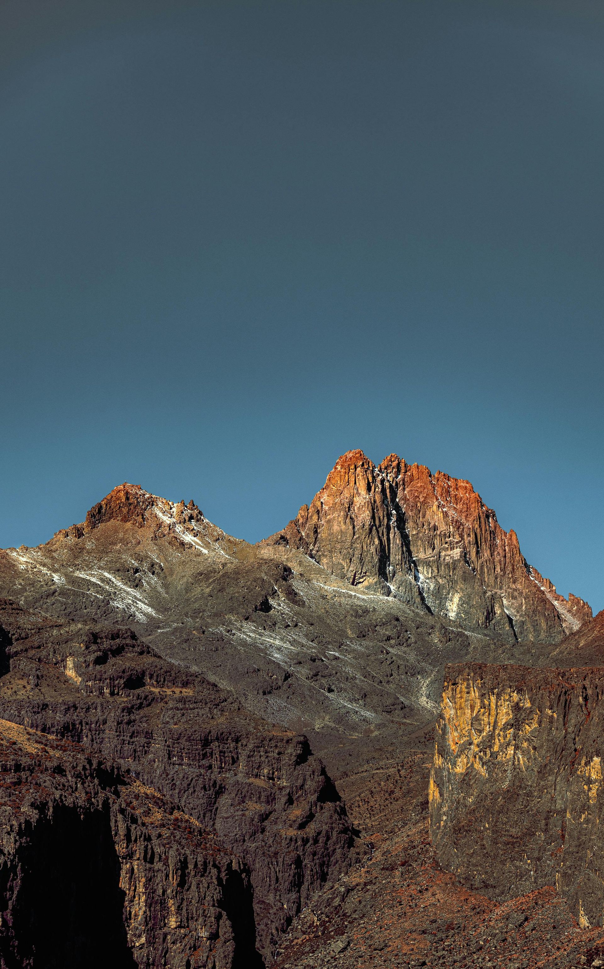
Mount Kenya, at 5,199 meters the second-highest peak on the African continent, has three summits: Batian, Nelion, and Point Lenana. Batian and Nelion require technical climbing skills and ropes. Point Lenana, at 4,985 meters, is accessible to well-acclimatized walkers on a standard route and is the target for most trekkers on the mountain. The Sirimon and Chogoria routes are the most popular approaches and can be combined into a traverse. The mountain is surrounded by Mount Kenya National Park, which protects forest, bamboo, and heathland ecosystems below the moorland and rock zones.
The Rwenzori — the "Mountains of the Moon" referenced by Ptolemy and sought for centuries by European geographers attempting to locate the source of the Nile — are wetter and more ecologically complex than Mount Kenya. The central peaks, including Margherita Peak at 5,109 meters on the border between Uganda and the DRC, are within Rwenzori Mountains National Park. The park is UNESCO-listed partly for its unusual high-altitude vegetation zones, which include giant heathers, lobelias, and groundsels — plants that grow to enormous sizes in the equatorial alpine environment due to conditions not found at comparable altitudes elsewhere.
Trekking in the Rwenzori takes a minimum of six days for the main circuit and involves navigation through near-constant moisture — the range receives rain on most days of the year, fed by the Congo Basin's moisture. Proper waterproof equipment is not optional. Guides and porters from the local Bakonzo community are required for all trekking routes.
Both mountains offer the experience of moving through multiple distinct ecological zones — tropical forest, bamboo, heathland, moorland, and glacier — within a single ascent, a compression of altitude and ecosystem that few other mountains in the world can match.
20 / 20
The Dolomites, Italy
Credit: Valdemaras D., Unsplash
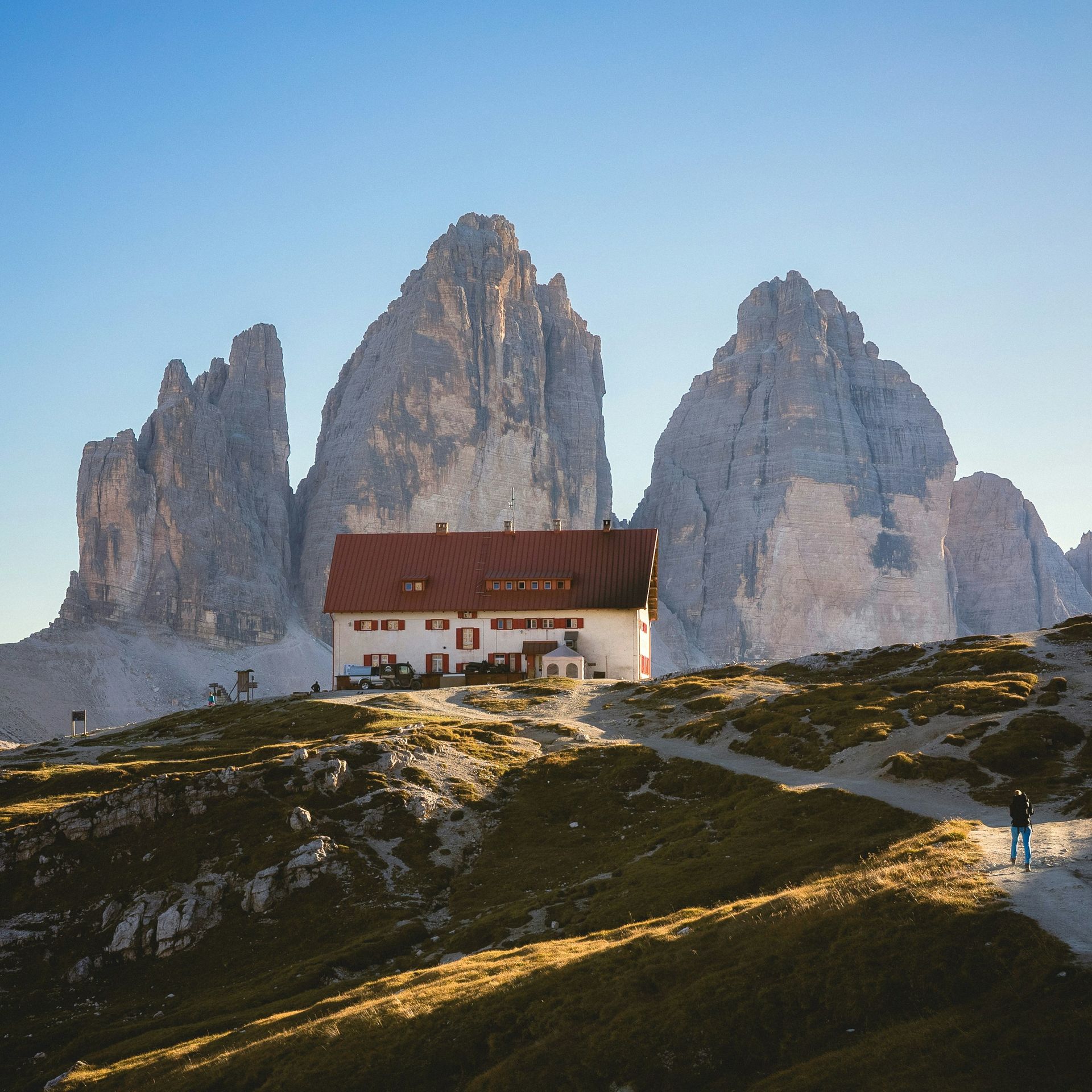
The Dolomites occupy the northeastern corner of Italy, in the provinces of Trentino, South Tyrol, and Belluno. They are part of the broader Alps system but are geologically and visually distinct — composed of dolomite rock rather than granite or schist, they have eroded into pale, vertical towers and massifs that turn pink and orange at sunset in a phenomenon the region calls "enrosadira."
The area was a contested frontier between Italy and Austria-Hungary during World War I, and the evidence of that conflict remains embedded in the landscape. The Lagazuoi mountain, above the Falzarego Pass, was tunneled extensively by Italian troops, who dug galleries from which they could observe and attack Austrian positions on the ridge above. These tunnels can still be walked today, a form of historical immersion rarely available in other mountain regions.
The Via Ferrata network — fixed iron rungs, cables, and ladders attached to rock faces — was developed partly during the war to move troops across terrain that would otherwise require technical climbing skills. Today it forms one of the most extensive adventure infrastructure systems in any mountain range, allowing ordinary walkers with a harness and via ferrata kit to access routes that would otherwise be the preserve of experienced rock climbers.
The Alta Via routes — particularly Alta Via 1 and Alta Via 2 — are multi-day trekking routes across the Dolomites served by rifugi, mountain huts that provide dinner, beds, and breakfast. Alta Via 1 covers roughly 120 kilometers from Braies Lake to Belluno; Alta Via 2, slightly more demanding, traverses more remote terrain. Both can be walked in around 10 to 14 days.
Cortina d'Ampezzo, which hosted the 1956 Winter Olympics and is scheduled to co-host the 2026 Winter Olympics with Milan, is the major resort town of the Italian Dolomites. Its skiing terrain is interconnected with several neighboring valleys through the Dolomiti Superski pass system, which covers more than 1,200 kilometers of piste across 12 valleys.
The Dolomites were designated a UNESCO World Heritage Site in 2009, recognized for both their geological significance and their landscape value. This designation has increased visitor numbers significantly, and the busiest areas — Tre Cime di Lavaredo, Lago di Braies — are heavily crowded in July and August, making shoulder-season visits considerably more rewarding.