
Bioluminescent tides, heat lightning, the specific angle of the midnight sun — the phenomena that summer's heat and light make possible and no other season can produce
Stein Egil Liland / Pexels
Most seasonal weather is a matter of degree rather than kind: winter is colder, spring is wetter, autumn brings more wind, but the same basic categories of weather occur year-round with varying intensity. A smaller set of natural phenomena are different: they depend on a specific combination of heat, solar angle, and seasonal biological timing that genuinely does not exist outside of summer, making them not merely more common in summer but physically impossible to produce in any other season.
The mechanisms behind these phenomena vary considerably — some are atmospheric, some are astronomical, some are biological — but each one requires a specific summer condition (peak solar radiation, extended daylight length, seasonal water temperature, or a biological cycle timed to summer specifically) that has no equivalent in the other three seasons, distinguishing this list from phenomena that are simply more frequent or more intense during summer months.
Each entry covers the phenomenon, the specific mechanism that makes it summer-dependent, and where or when it is most reliably observed.
Bbadgett / Wikipedia (CC BY-SA 3.0)
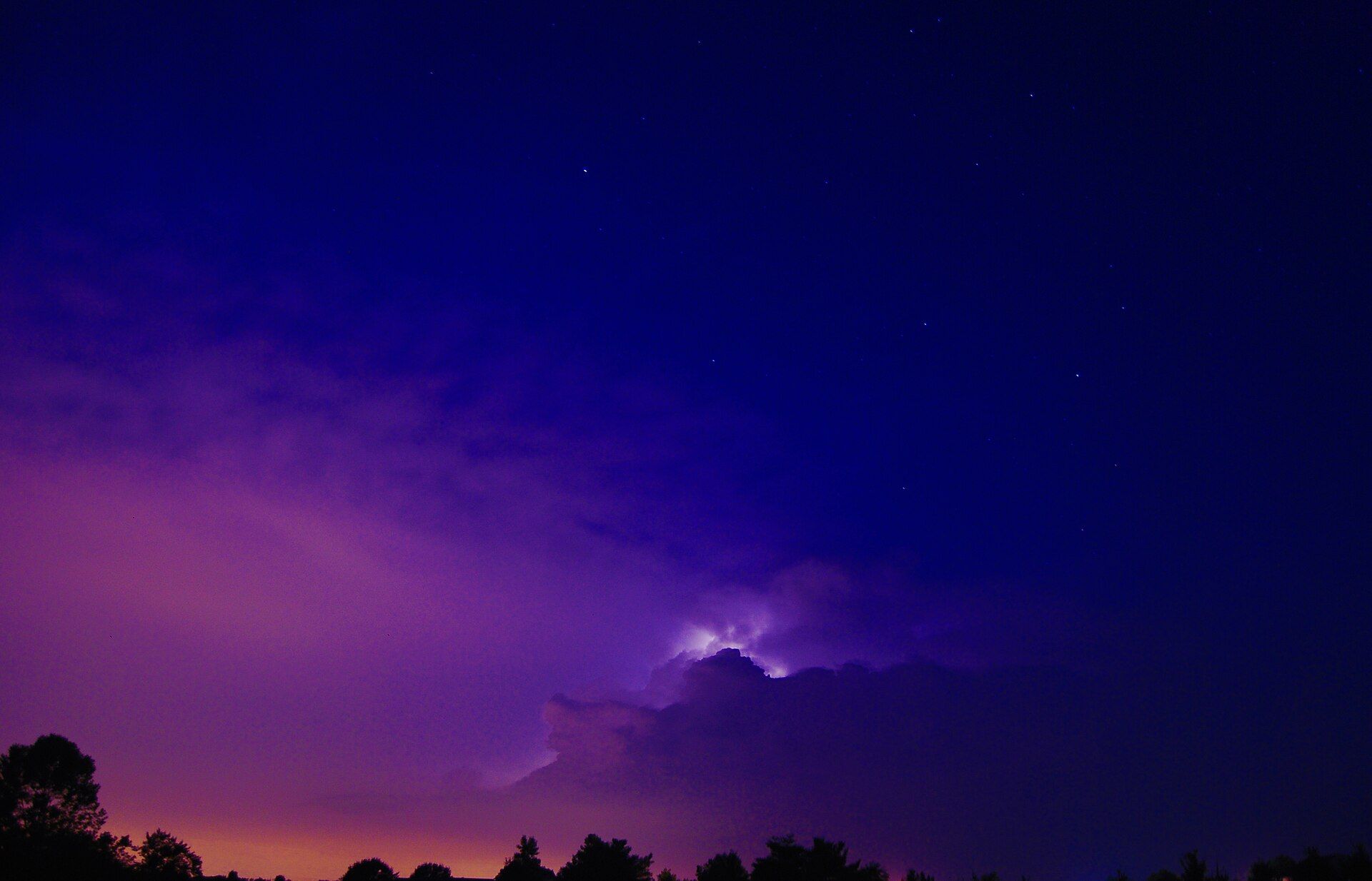
Heat lightning — the popular term for distant lightning visible on the horizon without any accompanying thunder — is not, despite the informal name and folk belief, a distinct type of lightning produced specifically by heat; it is ordinary lightning from a thunderstorm far enough away (commonly 10 miles or more) that the sound of thunder has dissipated or refracted away before reaching the observer, while the light itself, visible over a much longer distance, still reaches the eye.
The phenomenon is specifically associated with summer because summer's atmospheric conditions — greater heat and humidity, producing the convective instability that generates thunderstorms — make isolated, distant thunderstorm activity considerably more common during summer evenings than during other seasons, when large-scale frontal systems (more typical of winter storm patterns) tend to produce more widespread rather than isolated, visible-at-a-distance storm activity.
The specific viewing conditions that make heat lightning most visible are a clear, humid summer evening with a distant storm cell over open terrain or water, where the lack of obstruction allows the lightning's light to be seen across the many miles of distance that would otherwise make the storm itself invisible, producing the silent, flickering horizon glow that gives the phenomenon its evocative but scientifically imprecise popular name.
Chasing Lyu / Pexels
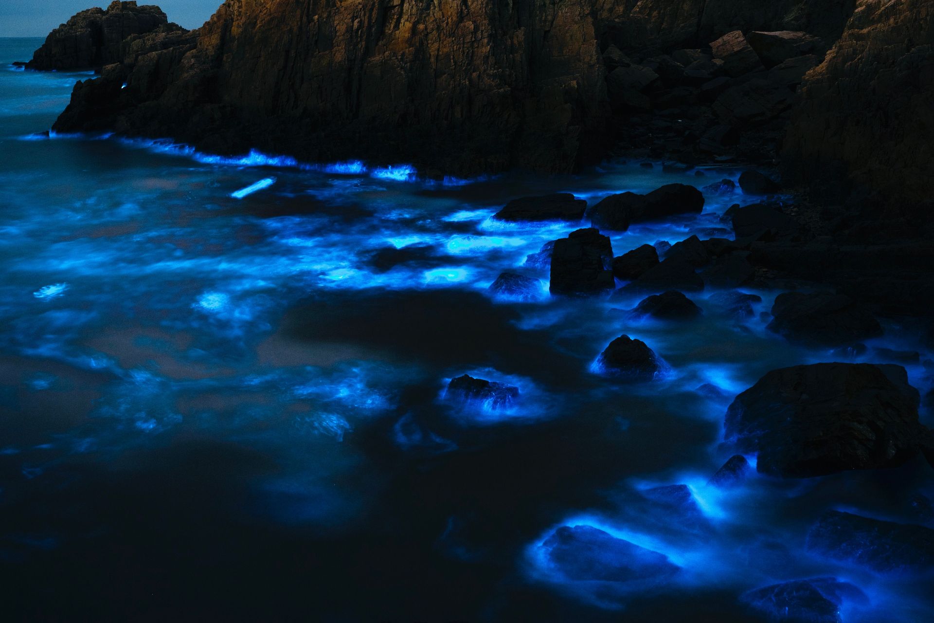
Bioluminescent tides — ocean water that glows blue when disturbed by waves, swimming, or boat movement — occur when dinoflagellates (single-celled marine organisms) bloom in sufficient concentration in coastal waters and are mechanically triggered to emit light through a chemical reaction involving the compound luciferin, the same general bioluminescent mechanism used by fireflies and various deep-sea creatures.
The phenomenon is specifically dependent on summer water temperature and light conditions: the dinoflagellate species responsible for the most visible and widely documented bioluminescent tides (including the blooms regularly observed off the coast of San Diego and in certain bays in Puerto Rico) require warm water temperatures and specific nutrient conditions that align with summer ocean conditions in temperate and subtropical coastal waters, making the blooms a seasonally restricted event rather than a year-round possibility even in locations where they reliably recur.
The specific viewing conditions require a dark, moonless night (artificial and natural light both wash out the relatively faint bioluminescent glow) combined with physical disturbance of the water — waves breaking on shore, a hand or paddle moving through the water, a fish swimming beneath the surface — that mechanically triggers the dinoflagellates' light-producing chemical reaction, making a calm, dark summer night with an active bloom the specific combination required to observe the phenomenon at its most visible.
Jędrzej Koralewski / Pexels
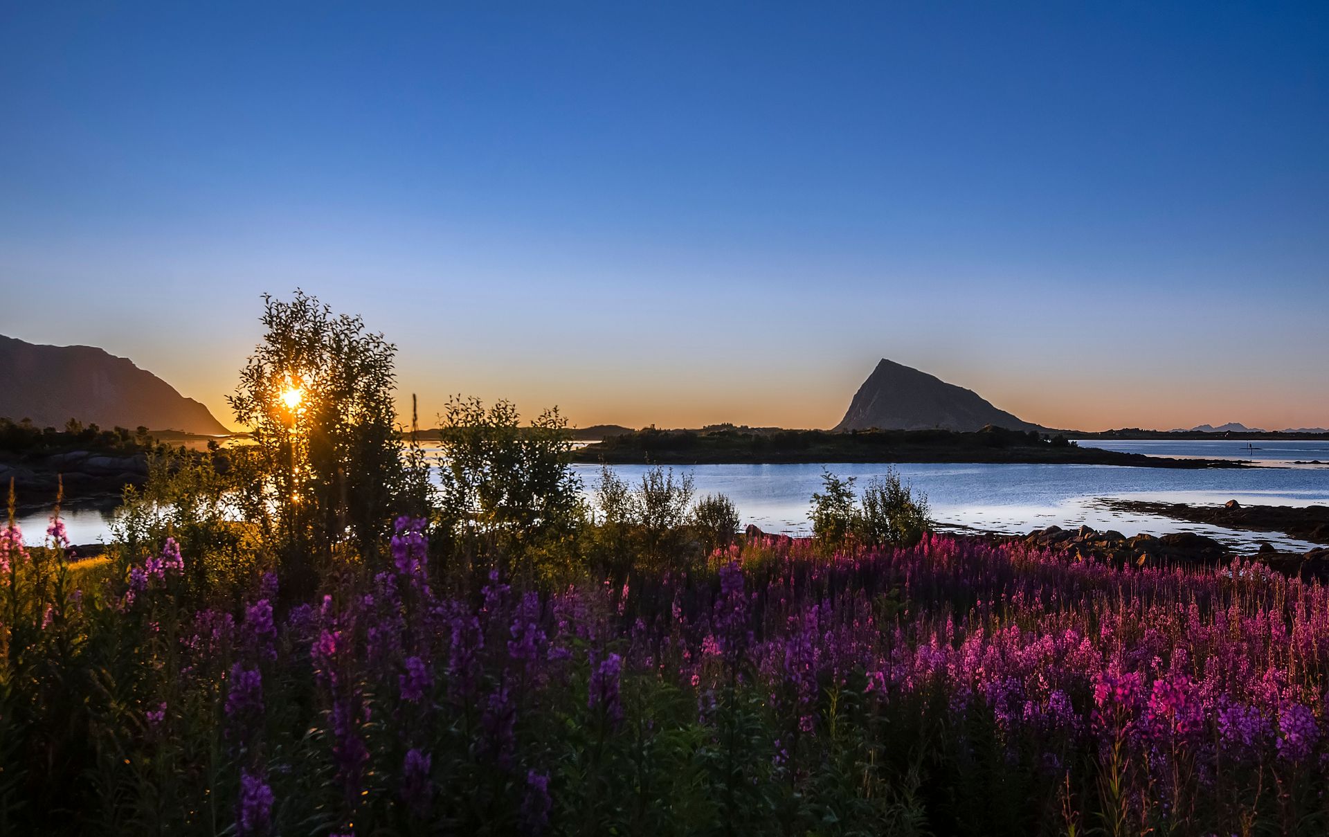
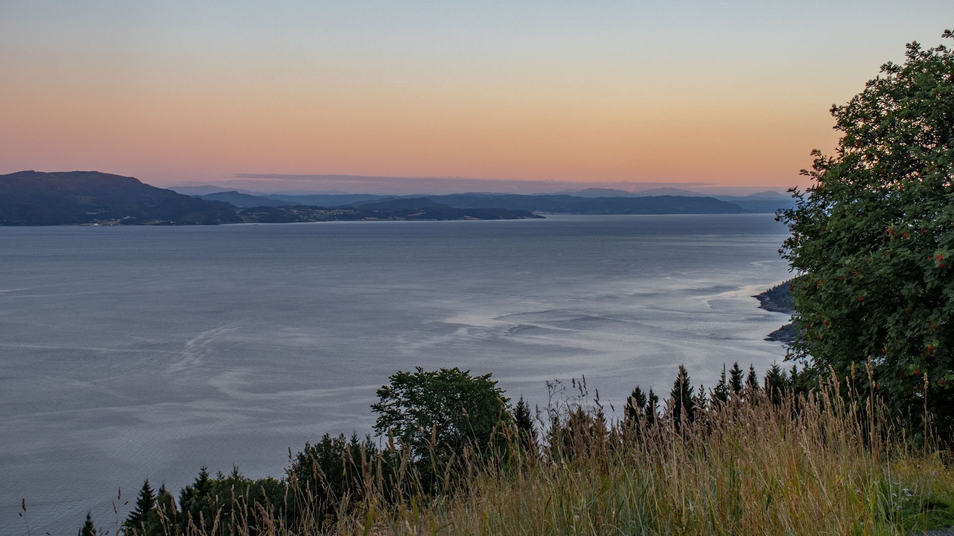
The midnight sun — the sun remaining visible above the horizon at local midnight — occurs only within the Arctic and Antarctic Circles during their respective hemisphere's summer, a direct consequence of the Earth's axial tilt, which causes the polar regions to receive continuous or near-continuous sunlight for a period surrounding the summer solstice, when that hemisphere's pole is tilted most directly toward the sun.
The specific astronomical mechanism is straightforward once understood: at latitudes within the Arctic Circle (approximately 66.5 degrees north) or Antarctic Circle (66.5 degrees south), the sun's apparent path during the summer solstice period does not dip below the horizon at all, producing 24-hour daylight for a period that extends longer the closer a location is to the actual pole, from a single day at the Arctic Circle itself to approximately six months of continuous daylight at the North or South Pole.
Locations including northern Norway, northern Alaska, and Svalbard have built specific tourism identities around the midnight sun phenomenon, and the experience of genuine, sustained daylight at an hour when darkness would ordinarily be expected produces a specific disorientation that most visitors describe as one of the more genuinely strange sensory experiences available in travel, since it contradicts a lifetime of ingrained expectation about when darkness should occur regardless of location.
-900x675.jpg)
U.S. Fish and Wildlife Service Headquarters / Wikimedia Commons
Fire whirls — rotating columns of flame that form when intense heat from a wildfire creates a localized updraft strong enough to develop rotational wind motion, producing a genuine tornado-like vortex composed partly or entirely of fire — require the specific combination of extreme dry heat, low humidity, and sufficient fuel load that summer wildfire conditions in dry regions (the western United States, Australia, parts of the Mediterranean) reliably produce and that essentially do not occur outside of the hot, dry fire seasons associated with summer and early autumn in fire-prone climates.
The mechanism requires a large, intense fire to generate enough localized heat to produce a strong updraft, combined with specific wind shear conditions that impart rotational spin to the rising column of hot air and flame — a combination of factors severe enough that fire whirls, while more common in significant wildfires than popular awareness suggests, remain a relatively rare and specifically documented phenomenon even within the broader category of extreme wildfire behavior.
The largest and most extensively documented fire whirl in recorded history occurred during the 2018 Carr Fire in California, where investigators determined that the fire whirl reached wind speeds comparable to an EF-3 tornado, a severity that led fire behavior researchers to specifically study and reclassify the event's mechanics, illustrating that the phenomenon, while summer-and-fire-season dependent, can reach a scale of destructive intensity comparable to conventional severe weather tornadoes despite its entirely different generative mechanism.
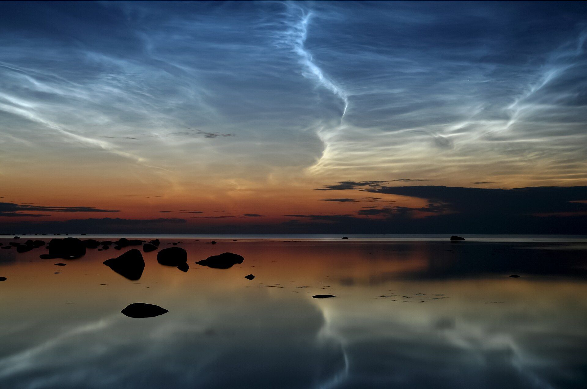
Ireen Trummer / Wikimedia Commons (CC BY-SA 4.0)
Noctilucent clouds — thin, wispy, electric-blue clouds visible against a darkening sky shortly after sunset or before sunrise — form in the mesosphere, an extremely high atmospheric layer approximately 50 miles above the Earth's surface, far higher than conventional weather clouds, and require a combination of extremely cold mesospheric temperatures (counterintuitively, the mesosphere is coldest during summer due to the specific atmospheric circulation patterns at that altitude) and sufficient water vapor and dust particles for ice crystals to form and become visible when illuminated by sunlight from below the horizon.
The specific summer dependency is genuinely counterintuitive: while surface temperatures peak in summer, the mesosphere at high latitudes reaches its coldest temperatures during the same summer months, a consequence of the specific large-scale atmospheric circulation pattern that transports mesospheric air poleward and causes it to cool through expansion during summer — meaning the phenomenon depends on a seasonal atmospheric mechanism that operates in the opposite temperature direction from the surface conditions most people associate with summer.
Noctilucent clouds are visible primarily at high latitudes (typically above 50 degrees, in locations including the UK, Scandinavia, and the northern United States and Canada) during the weeks surrounding the summer solstice, and the phenomenon has become measurably more frequently observed and more widely reported over recent decades, a trend that some atmospheric scientists have linked to increased mesospheric water vapor potentially associated with climate-related changes in atmospheric composition, making the clouds a subject of ongoing scientific monitoring beyond their visual novelty.
-1920x1276.jpg)
National Marine Sanctuaries / Wikimedia Commons
Coral spawning — the mass, synchronized release of eggs and sperm by entire reef systems, occurring across multiple coral species simultaneously within a narrow window of just a few nights per year — is triggered by a specific combination of water temperature, lunar cycle timing, and day length that aligns with summer conditions in most reef systems, producing one of the most precisely synchronized reproductive events in the natural world.
The Great Barrier Reef's mass coral spawning event, among the most extensively studied examples, typically occurs across a small number of nights following the November full moon (during the Southern Hemisphere's late spring transitioning into summer), when water has warmed sufficiently and the specific combination of moonlight cues and water temperature threshold triggers the near-simultaneous release of reproductive material across vast areas of reef, producing a visually striking underwater "snowstorm" of pink and orange egg-sperm bundles rising through the water column.
The precision of this synchronization — countless individual coral colonies across a reef system releasing reproductive material within the same narrow window of one or two nights — depends on the specific summer water temperature threshold being reached at the same time that the lunar cycle produces the correct moonlight conditions, a combination that occurs reliably only once annually and that would not produce the same synchronized result if either the temperature or lunar timing element were shifted to a different season.
-1920x1641.jpg)
NASA Goddard Space Flight Center / Wikimedia Commons
A derecho — a widespread, long-lived, fast-moving band of severe thunderstorm wind damage, distinguished from a tornado by its straight-line rather than rotational wind pattern — requires a specific combination of extreme atmospheric instability and a sustained line of thunderstorms that summer's peak heat and humidity conditions produce far more reliably than any other season, making derechos a phenomenon overwhelmingly concentrated in the warm-season months across the regions where they most commonly occur, particularly the American Midwest and Great Plains.
The mechanism requires a bow-shaped line of thunderstorms sustaining itself over a long distance (by definition, a derecho's damage path must extend at least 240 miles) through a self-reinforcing process in which the storm's own downdraft winds interact with the surrounding atmospheric instability to maintain and even accelerate the wind damage as the system travels, a process that depends on the specific high atmospheric moisture and instability that summer heat produces and that dissipates quickly once the extreme instability driving it is no longer present.
The August 2020 Midwest derecho, one of the most damaging in recorded American history, produced wind speeds comparable to a major hurricane across a path extending from South Dakota to Ohio, causing billions of dollars in damage primarily to agricultural crops in Iowa at the peak of the summer growing season — a specific timing coincidence that compounded the storm's economic impact, since the same summer conditions that produced the derecho's extreme winds also happened to align with the period when standing crops were most vulnerable to wind damage.