Salt flats, hoodoos, painted deserts, bristlecone forests — the landscapes so strange that NASA and Hollywood use them as stand-ins for other worlds
Stephen Leonardi / Pexels
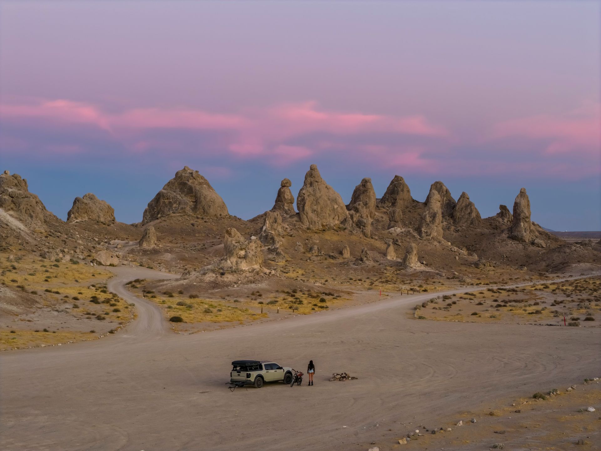
The American West contains some of the strangest landscapes on the planet — not strange in a subjective, purely aesthetic sense, but strange in the specific and measurable sense that geologists, film location scouts, and NASA researchers have all independently arrived at the same conclusion: these places do not look like the rest of Earth. They look like the surface of Mars, the plains of a fictional desert planet, or a landscape assembled by a production designer trying to signal "alien" to an audience.
This is not a coincidence. The geological processes that produced the American West's most extreme landscapes — evaporating ancient lakebeds, volcanic activity, extreme erosion in a specific arid climate, mineral deposits that produce colors that do not occur in wetter climates — are the same processes that geologists study on Mars and other planetary bodies precisely because Earth has so few places where those processes are visible at this scale and this accessibility. NASA has used several of the locations in this list to test Mars rovers, train astronauts, and calibrate the instruments that will eventually study genuinely extraterrestrial terrain, specifically because the terrestrial analog is so close to the real thing.
Each entry in this list covers what makes the landscape look otherworldly, the specific geological mechanism that produced it, and — where relevant — its documented use by NASA, film productions, or scientific research as a stand-in for someplace that is not Earth.
Tristan Rosen / Pexels
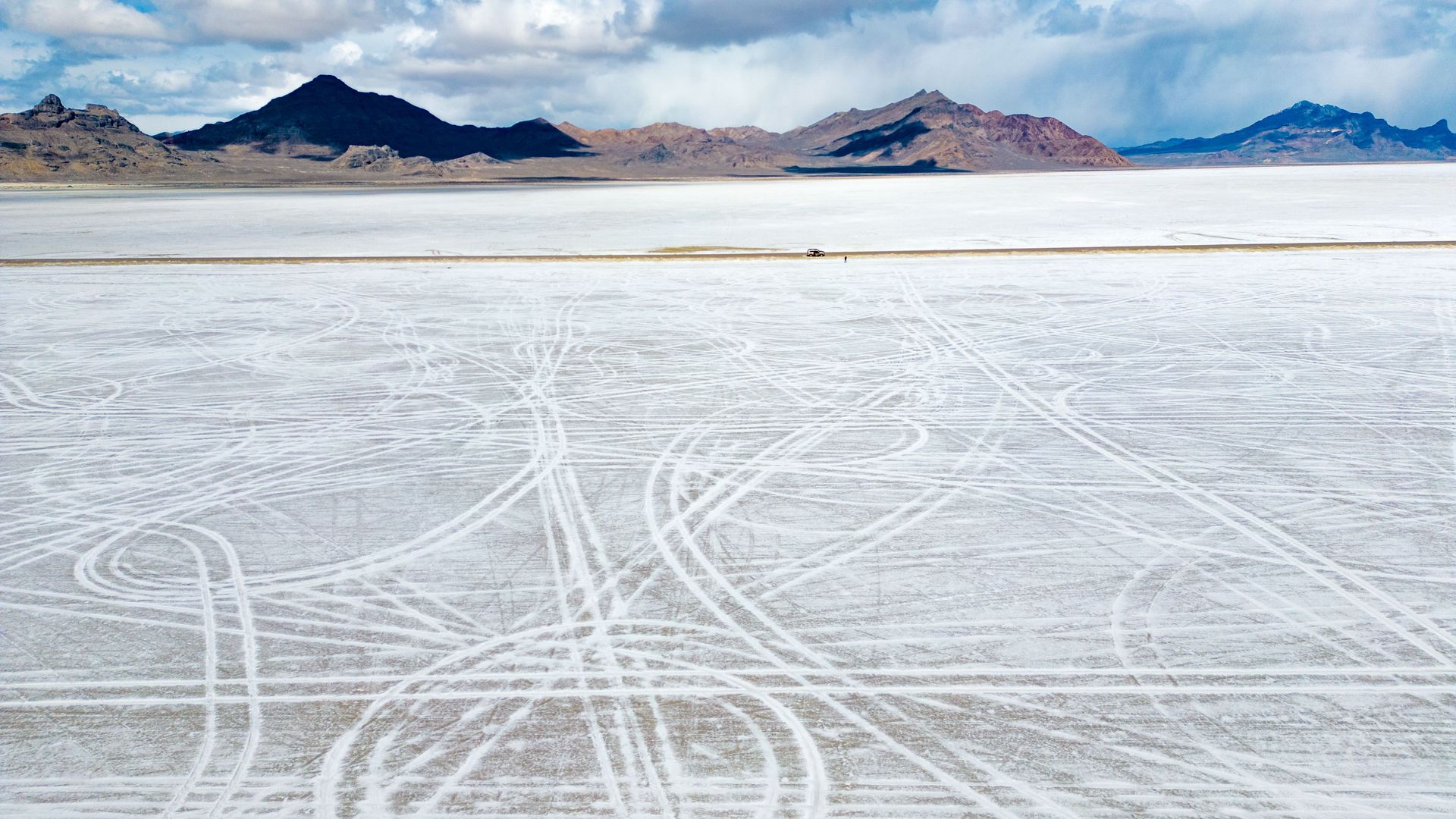
The Bonneville Salt Flats — a 30,000-acre expanse of blindingly white salt crust so flat and so featureless that it has been used to set land speed records since the 1930s — is the remnant of Lake Bonneville, a Pleistocene-era lake that once covered much of present-day Utah and evaporated over thousands of years, leaving behind a mineral crust of almost pure sodium chloride up to five feet thick in places.
The flats are flat enough and reflective enough that the horizon appears to curve visibly on a clear day, and the total absence of vegetation, structures, or elevation change produces the specific disorienting effect of a landscape with no reference points — drivers testing land speed vehicles have described the difficulty of judging distance and speed on a surface this uniform. The salt crust's whiteness under direct desert sun produces a glare intense enough to require sunglasses even on overcast days.
The flats have been used as a filming location for numerous science fiction productions specifically because the landscape requires no visual effects work to look extraterrestrial — the surface already resembles the salt pans that exist on Mars, and the total absence of any recognizable Earth landmark (no trees, no hills, no buildings) allows the location to read as alien without alteration.
Intricate Explorer / Pexels
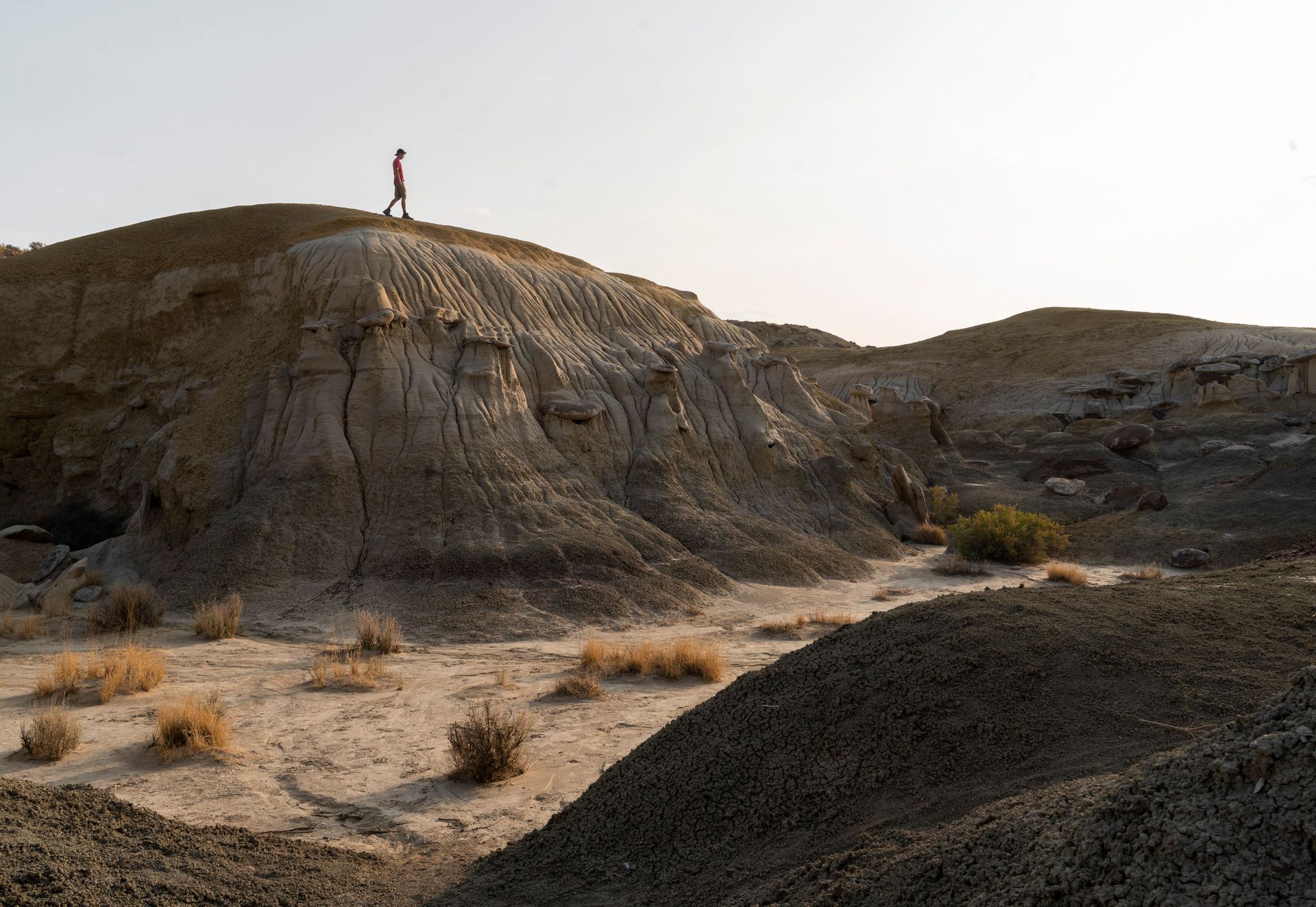
The Bisti Badlands, a 45,000-acre wilderness area in northwestern New Mexico, contains one of the most concentrated collections of hoodoos — tall, thin rock spires formed by differential erosion of soft sandstone and shale — anywhere in the American Southwest, including formations so specifically strange in shape that they have earned individual names: the Cracked Eggs (a field of round, striped boulders that resemble a cluster of dinosaur eggs split open), the Alien Throne, and the Stone Wings.
The formations result from the differential erosion of alternating layers of soft and hard rock deposited approximately 70 million years ago in what was then a coastal swamp environment at the edge of an ancient inland sea. Softer layers erode faster than harder capstones, producing the mushroom-shaped and spire formations that give the badlands their alien appearance, and the process continues today, meaning the landscape is measurably different than it was a generation ago and will continue changing.
The wilderness has no marked trails, no facilities, and no cell service, requiring visitors to navigate by landmark and GPS — a specific logistical difficulty that has kept visitor numbers low relative to the area's visual distinctiveness and has preserved a level of genuine solitude increasingly rare in accessible Southwestern landscapes.
Stephen Leonardi / Pexels
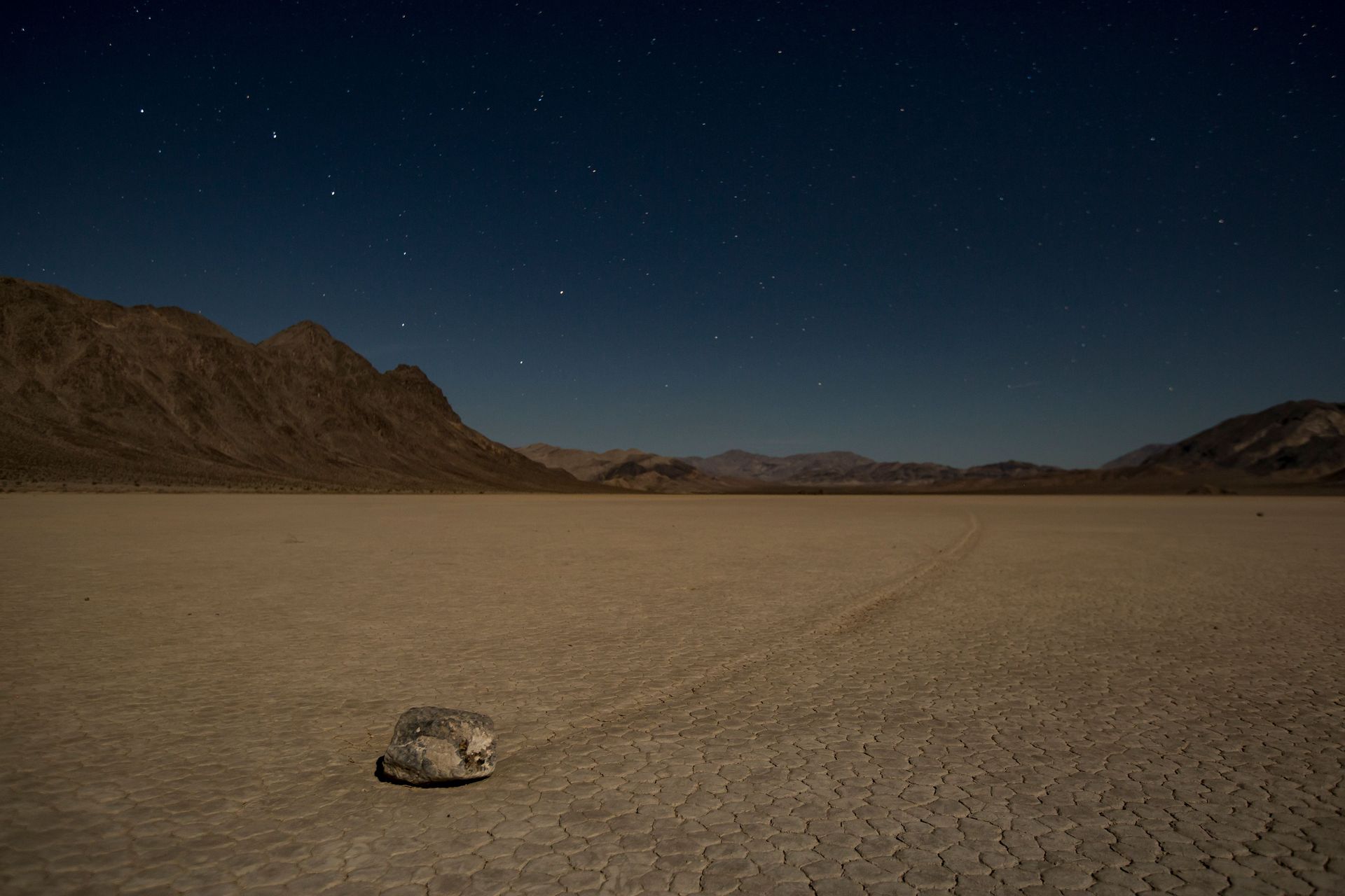
Racetrack Playa, a dry lakebed in Death Valley National Park, is famous for its sailing stones — rocks weighing up to 700 pounds that leave visible trails across the playa's cracked, mud-tile surface despite no one having directly witnessed the movement for over a century of documented observation. The mystery was resolved scientifically only in 2014, when researchers using time-lapse photography and GPS-tagged rocks documented that thin sheets of ice, formed on rare winter nights when the playa floods and freezes, are pushed by light wind, carrying the embedded rocks across the mud in a process that requires a specific and rare combination of conditions to occur.
The playa itself — a flat, cracked expanse of dried mud extending for miles, ringed by mountains, with almost no vegetation — has the specific visual quality of a landscape from which all conventional geographic features have been removed, leaving only the rocks and their trails as evidence that anything has happened there at all.
The remoteness of the location — a rough, unpaved road requiring high-clearance or four-wheel-drive vehicles, with no services for dozens of miles — has kept visitor numbers low despite the site's fame, and NASA researchers have studied the sailing stones phenomenon partly because similar processes are hypothesized to be possible on other icy planetary bodies in the solar system.
Matt W / Pexels
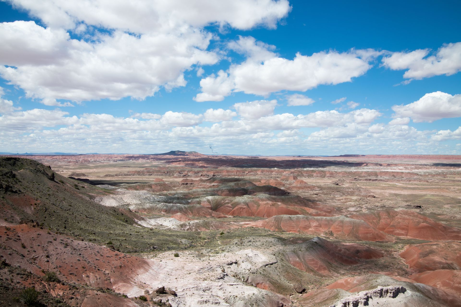
The Painted Desert, stretching across more than 90,000 acres of northeastern Arizona within and around Petrified Forest National Park, derives its name from the visible banding of red, orange, pink, gray, and lavender rock layers that reflect the specific mineral content and oxidation state of sediments deposited over 200 million years ago during the Late Triassic period, when the region was a river floodplain rather than the arid desert it is today.
The specific color variation is produced by iron and manganese compounds in the rock, whose oxidation states — determined by the specific conditions present when each layer was deposited — produce different colors: red and orange from oxidized iron, purple and blue-gray from reduced iron and manganese compounds, a color palette that changes visibly throughout the day as the angle of sunlight shifts and that intensifies dramatically at sunrise and sunset.
The badlands terrain surrounding the colored layers has been eroded into a landscape of low, banded hills and shallow gullies almost entirely without vegetation, producing views across the painted layers that extend for miles without a single tree or structure to break the specific chromatic banding that gives the desert its name — a visual effect that photographs consistently fail to fully capture because the color shifts are partly a function of the viewer's changing position and the sun's movement.
Mattingly Marinaccio / Pexels
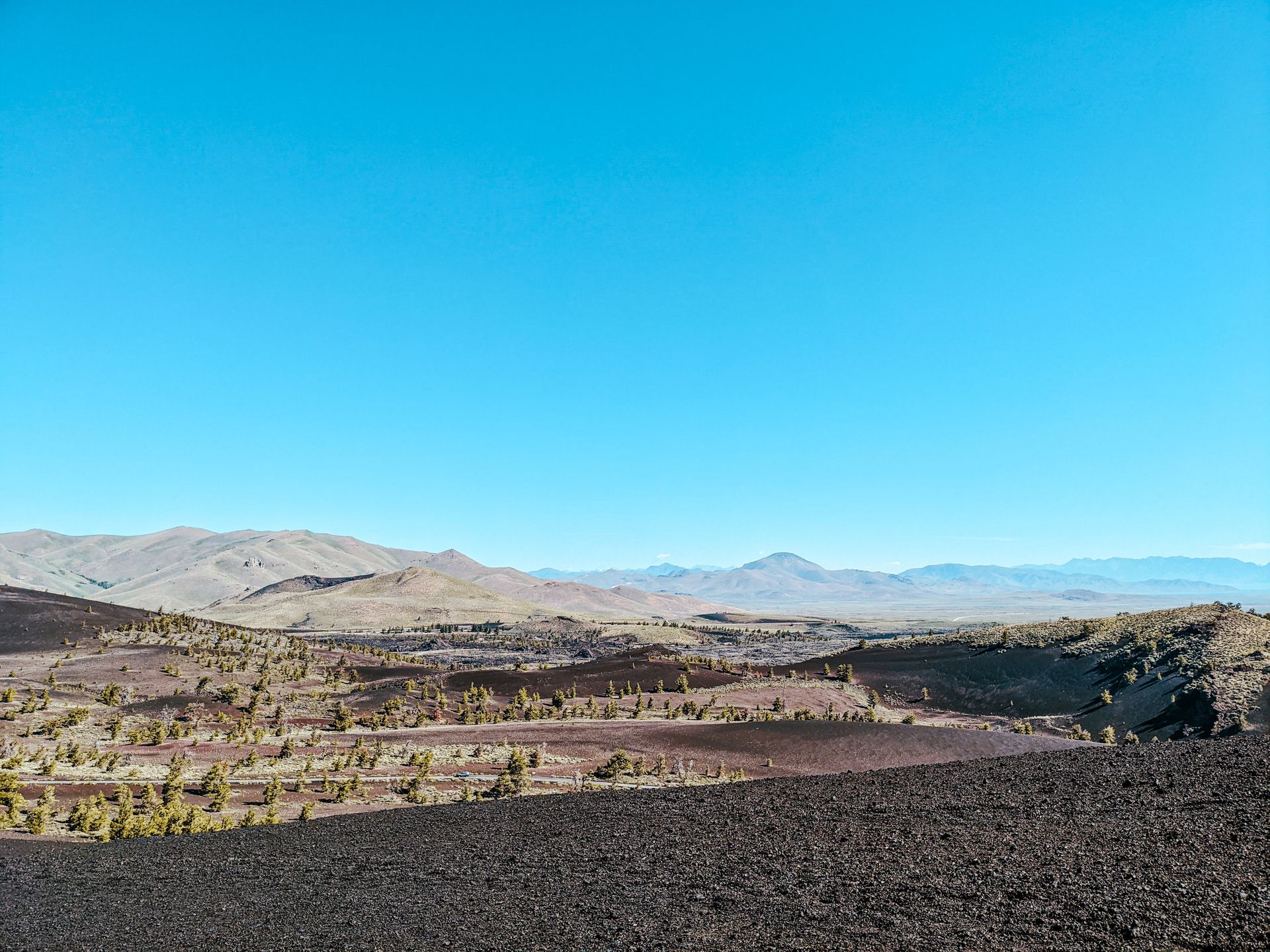
Craters of the Moon National Monument, a vast field of volcanic terrain in south-central Idaho, is composed of lava flows, cinder cones, and volcanic fissures produced by eruptions along the Great Rift, a series of deep cracks in the Earth's crust that have produced periodic volcanic activity over the past 15,000 years, most recently approximately 2,000 years ago.
The landscape's specific resemblance to the actual lunar surface is not incidental to its name: NASA astronauts from the Apollo program trained at Craters of the Moon in the 1960s specifically because the volcanic terrain — the texture of the hardened lava (both the smooth, ropy pahoehoe type and the rough, jagged aa type), the cinder cones, and the general absence of vegetation across large sections of the monument — provided the closest terrestrial analog available for the geological features astronauts would encounter and need to identify on the lunar surface.
The monument contains lava tube caves formed when the outer surface of a lava flow cooled and hardened while molten lava continued flowing beneath it, eventually draining away and leaving hollow tunnels that visitors can explore, some containing year-round ice formations from trapped cold air, adding a specific additional layer of strangeness to a landscape already unlike anywhere else in the contiguous United States.
Stephen Leonardi / Pexels
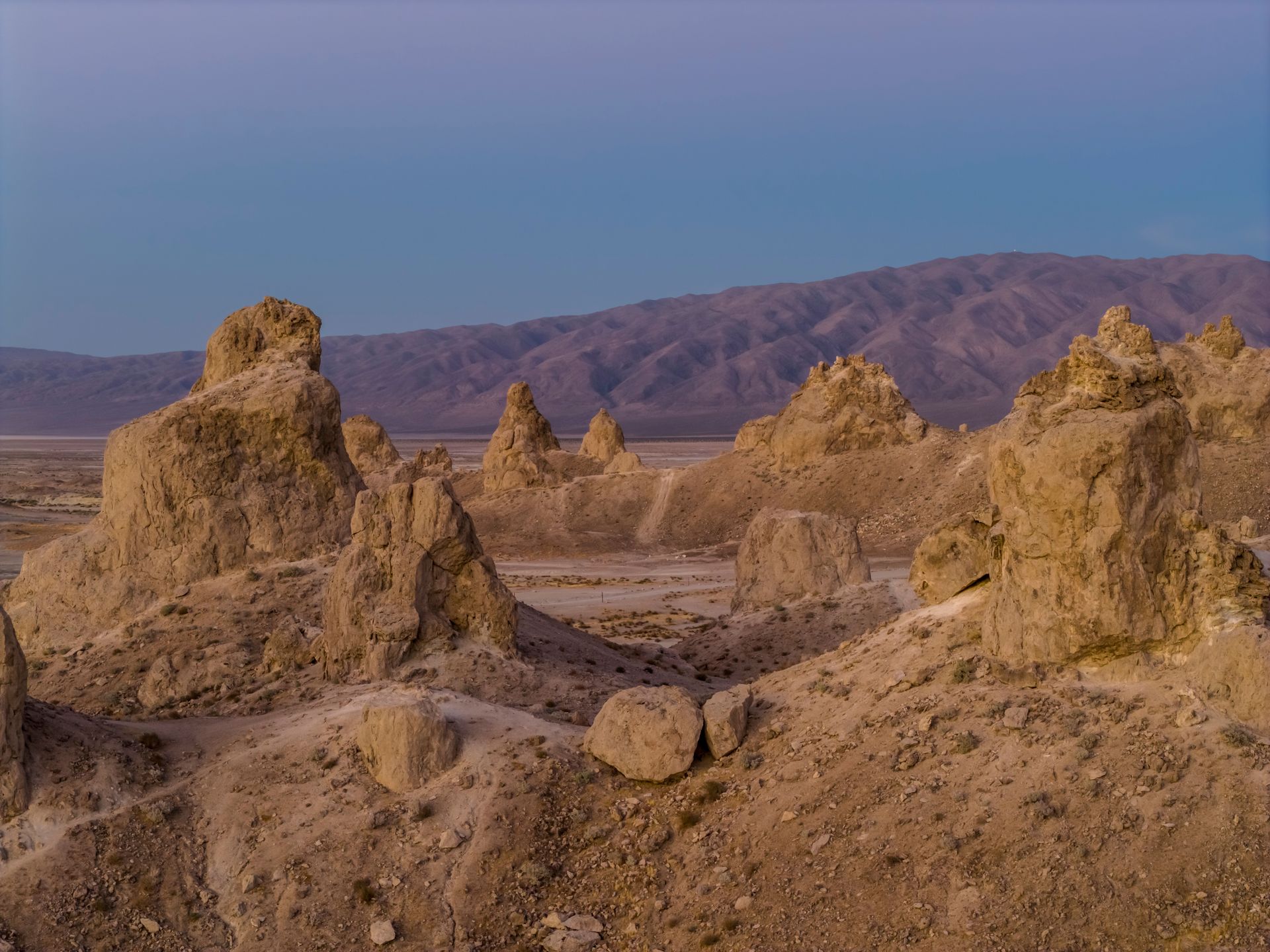
The Trona Pinnacles, more than 500 tufa spires rising up to 140 feet from the dry bed of Searles Lake in California's Mojave Desert, formed underwater between 10,000 and 100,000 years ago through the precipitation of calcium carbonate around underwater springs, a process similar to the formation of the tufa towers at Mono Lake but producing a significantly denser concentration of formations across a specific, relatively compact area.
The spires' current above-ground exposure is the result of the lake's evaporation over the millennia since their underwater formation, leaving a field of calcified towers standing in what is now a dry, cracked lakebed with an appearance so specifically alien that the location has been used in numerous science fiction and fantasy film productions requiring an extraterrestrial landscape, including planetary surface scenes that required no digital alteration to read convincingly as another world.
The formations' varying shapes — some tall and spire-like, others squat and irregular — reflect the specific conditions (spring flow rate, water chemistry, depth) present at each formation site during the underwater growth period, producing a field with genuine morphological diversity rather than a uniform, repetitive landscape, which adds to the sense that the terrain was produced by an unfamiliar and specifically non-terrestrial process even though its formation is entirely explicable through documented Earth geology.
Janine Sprout / Wikimedia Commons (CC BY-SA 4.0)
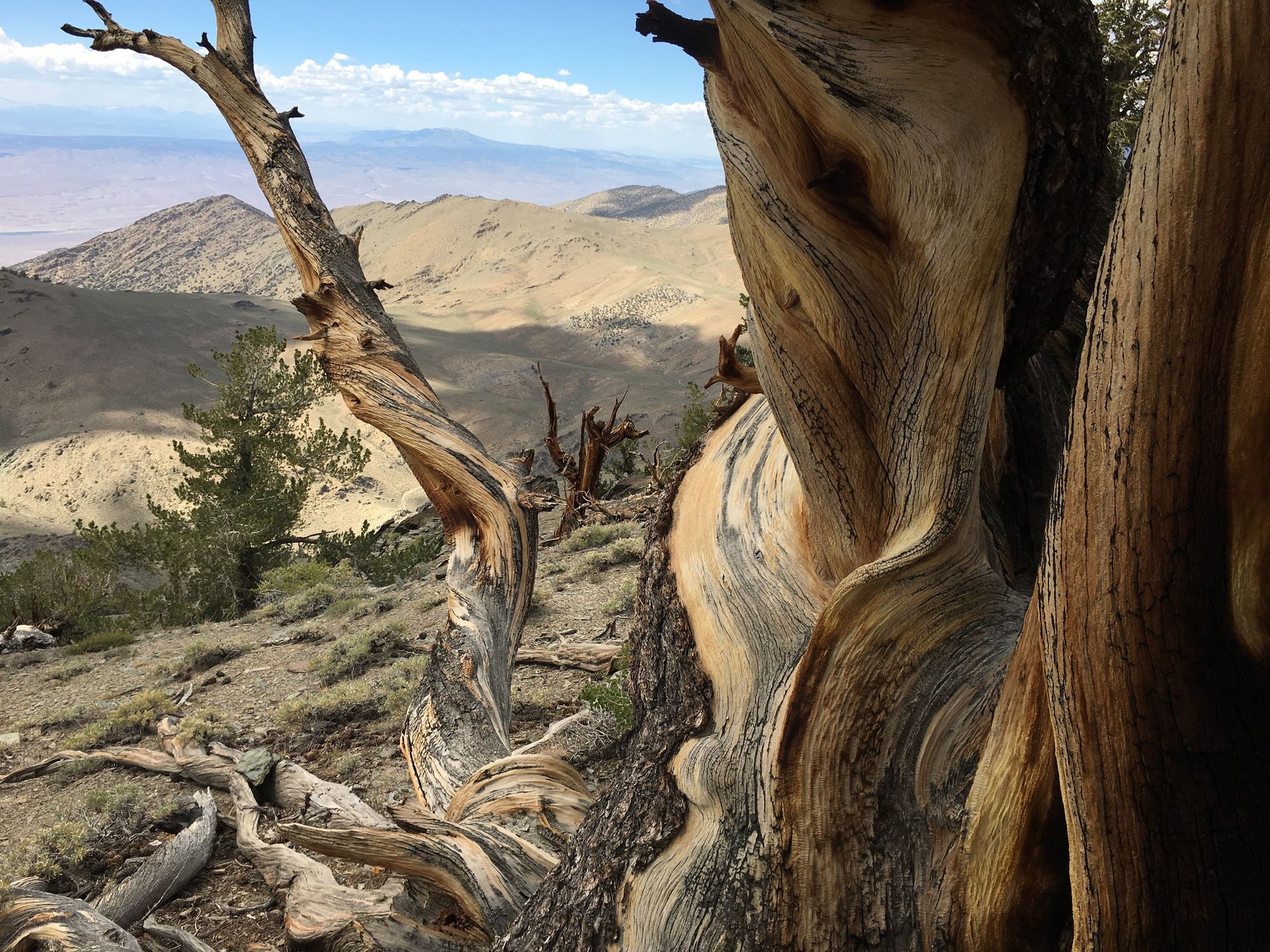
The Ancient Bristlecone Pine Forest, in the White Mountains of eastern California, contains individual trees exceeding 4,800 years old — among the oldest living non-clonal organisms on Earth — growing in a high-altitude, harsh, dolomite-soil environment so inhospitable that the trees' extreme longevity is itself a product of the stress: bristlecone pines in more favorable conditions grow faster and die younger, while the specific combination of high altitude, minimal precipitation, extreme temperature variation, and poor soil at this location produces extraordinarily slow growth that correlates with extraordinary lifespan.
The trees themselves have a specific visual character that contributes to the location's otherworldly quality: ancient bristlecones are often mostly dead, with only a narrow strip of living bark connecting root to branch, twisted by wind and time into forms that look more like sculpture than living plant material, silver-gray wood exposed and polished by millennia of wind-driven ice crystals.
The high-altitude setting (the forest sits above 10,000 feet) combines with the sparse, dolomite-derived white soil and the twisted, ancient trees to produce a landscape that reads as simultaneously alive and fossilized — living organisms that predate the pyramids of Giza, growing in conditions so extreme that almost nothing else can survive there, in a setting whose stark, bright, wind-scoured character contributes to a sense of genuine temporal as well as visual dislocation from anywhere else most visitors have been.
MICHAEL MCGARRY / Pexels
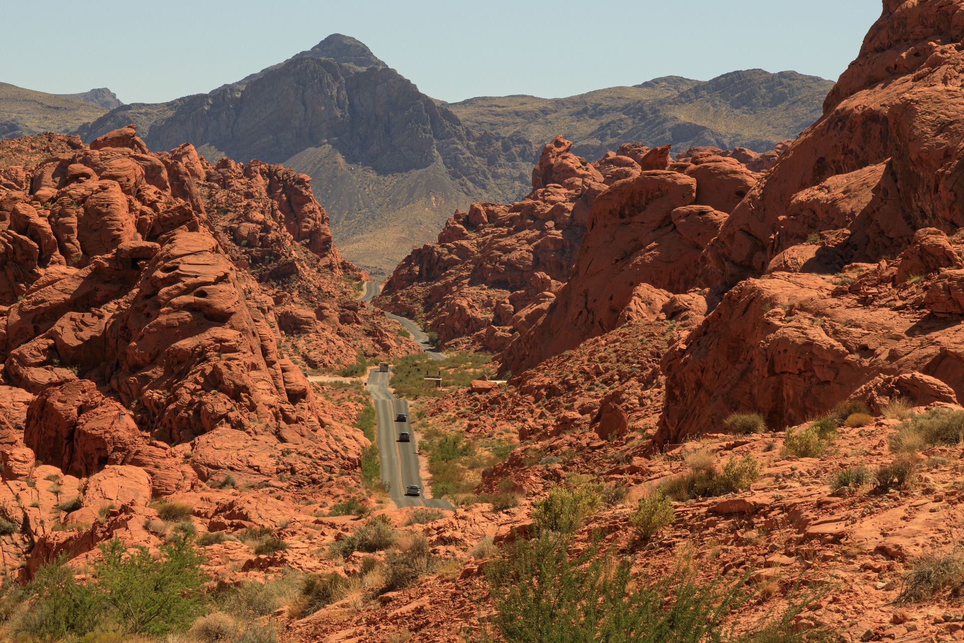
Valley of Fire, Nevada's oldest and largest state park, contains red Aztec sandstone formations up to 150 million years old, sculpted by wind and water erosion into shapes — arches, slot canyons, and formations with names like the Fire Wave (a striated, undulating rock surface of alternating red and white bands) — whose specific coloration and texture have made the park one of the most consistently used Nevada and Southwest filming locations for productions requiring a Mars-like or otherwise alien terrestrial surface.
The park's red coloration comes from iron oxide within the ancient sand dunes that were compressed into sandstone over millions of years, and the specific banding patterns visible in formations like the Fire Wave reflect the changing wind and water conditions present during the original dune deposition — each band a record of a specific ancient environmental moment, now exposed by subsequent erosion.
The park's proximity to Las Vegas (under an hour's drive) makes it one of the more accessible entries on this list, and its combination of dramatic red rock scenery with actual functioning cinematic history — it has appeared in numerous films specifically chosen for Mars or alien-planet sequences — gives visitors the specific experience of recognizing landscape features from films they have already seen, encountered now as an actual physical place rather than a backdrop.
Jeremy C. Munns / Wikimedia Commons
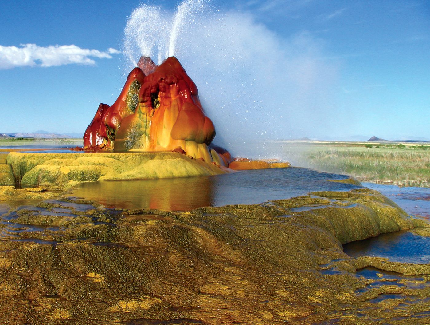
Fly Geyser, on private land in Nevada's Hualapai Flat, is a small but visually extraordinary cone-shaped geothermal feature that did not exist in its current form before 1964, when a geothermal energy company drilling a test well accidentally struck a pocket of geothermal water, and the poorly capped well allowed mineral-rich hot water to continuously flow and deposit calcium carbonate, building the growing, multicolored mineral cone that exists today.
The cone's vivid green and red coloration comes from thermophilic algae that thrive in the specific mineral-rich, continuously wet conditions the geyser produces, creating a color palette that appears almost artificially vivid against the surrounding flat, dry desert terrain — a small, actively growing geological feature whose specific origin story (an accidental industrial creation rather than a purely natural process) distinguishes it from every other entry on this list.
Fly Geyser sits on privately owned land and access is restricted to guided tours organized through the Burning Man organization, which owns the surrounding property — a specific access limitation that has kept the site relatively unfamiliar to the general public despite its visual distinctiveness, and that requires advance planning for travelers specifically interested in seeing it in person rather than in photographs.
Dennis George / Pexels
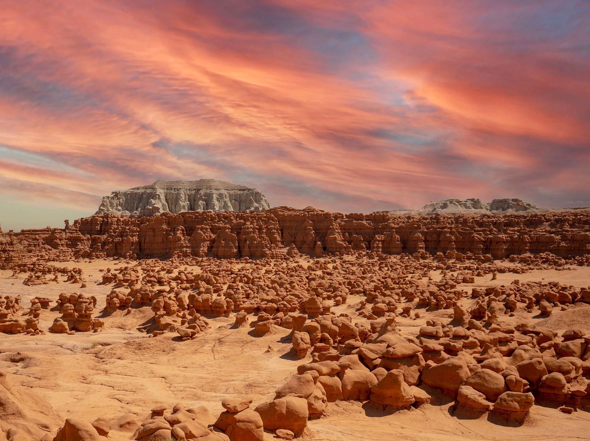
Goblin Valley, in south-central Utah, contains thousands of mushroom-shaped hoodoos — locally called "goblins" — packed densely across a valley floor in a concentration and scale that distinguishes it from other hoodoo formations in the region: rather than isolated spires scattered across a landscape, Goblin Valley presents a dense field of thousands of small to medium formations, most under 15 feet tall, extending across the valley floor closely enough together that walking among them produces the specific sensation of moving through a crowd of silent, twisted figures.
The goblins formed from Entrada Sandstone deposited approximately 170 million years ago, with harder caprock protecting softer sandstone beneath it from erosion at a differential rate that produced the mushroom shape common to hoodoo formations generally, but the specific density and small individual scale of the formations at Goblin Valley — thousands of distinct shapes rather than a smaller number of large spires — is what gives the park its specifically crowded, almost populated visual character that other hoodoo fields lack.
The park has no marked trails through the main goblin field, and visitors are permitted to walk freely among the formations rather than being restricted to a boardwalk or defined path — an unusual degree of access for a geological feature of this fragility, one that allows visitors to experience the density and scale of the formations directly rather than only from a designated overlook, and that has made the park a specific favorite for photographers seeking compositions that convey the sheer number of individual goblin formations within a single frame.
