A look at the worlds most forbidden locations and the specific pathways scientists researchers and military personnel use to gain access
Credit: Michael Major for Crop Trust / Wikipedia (CC BY-SA 2.0)
Global travel networks connect almost every major city on Earth, making the physical world seem more accessible than at any other point in human history. Satellite imagery and digital mapping allow people to view remote landscapes from desktop computers. Yet a significant number of geographical coordinates remain entirely off-limits to standard commercial aviation, maritime shipping, and leisure tourism. These forbidden zones are not merely distant or inconvenient to reach. They are actively guarded by sovereign governments, international treaties, or strict environmental protocols that penalize unauthorized entry. The reasons for these restrictions vary from the preservation of fragile ecosystems to the maintenance of high-level national security infrastructure.
Gaining legal access to these restricted zones requires specialized pathways that bypass conventional travel documentation. The individuals who successfully set foot in these areas are rarely tourists. They are typically research scientists, defense personnel, indigenous caretakers, or state officials operating under precise mandates. To enter, these professionals must navigate complex bureaucratic networks, pass rigorous psychological and physical screenings, or secure unique diplomatic credentials. In many cases, access is granted only for a specific duration to accomplish a highly defined objective, such as collecting biological samples or repairing critical hardware.
Examining how people reach these forbidden destinations offers insight into the mechanisms of global governance, security, and scientific inquiry. It demonstrates how international bodies and national governments balance human curiosity against the absolute necessity of isolation. For some locations, preservation means total exclusion, as human presence introduces pathogens or physical degradation that could destroy thousands of years of history. For others, isolation ensures that geopolitical intelligence remains secure from foreign surveillance. Understanding these entry requirements shifts the focus from the mystery of the locations to the rigorous protocols that keep them isolated. This list details 20 restricted sites across the globe and outlines the precise mechanisms that authorized visitors used to secure their entry.
Credit: Michael Major for Crop Trust / Wikipedia (CC BY-SA 2.0)
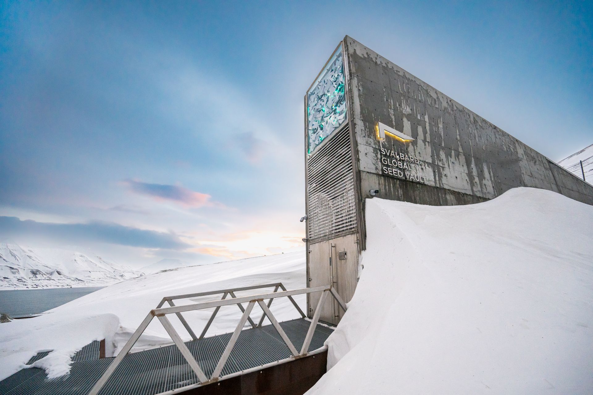
The Svalbard global seed vault sits deep inside a sandstone mountain on the remote Norwegian island of Spitsbergen. The facility serves as a secure backup system for the world crop diversity, housing more than 1,000,000 distinct seed samples. This facility is built to withstand tectonic activity, rising sea levels, and nuclear disasters. The primary goal of the vault is to safeguard agricultural history against global crises — a mission that requires strict security. No tourists or casual visitors are allowed past the entrance structure that juts out from the snow-covered mountain side.
Access to the internal chambers is limited to a small group of authorized individuals who manage the repository. The Nordic Genetic Resource Center handles the daily operations and coordinates the deposit of new seed samples. Technicians and scientists who work for this organization gain entry to monitor temperature levels and verify the structural integrity of the vault. These individuals must use specialized security keys and pass through multiple electronic gates to reach the deep storage rooms. The interior is kept at a constant temperature of minus 18 degrees Celsius, requiring workers to wear heavy Arctic gear during their shifts.
Global dignitaries and official deposit delegations can also secure access during scheduled seed deposits. These events occur only a few times each year when institutions send duplicates of their collections to Svalbard. Representatives from international genebanks accompany their shipments to ensure proper handling. These visitors must obtain clearance from the Norwegian ministry of agriculture and food well in advance of their arrival. They travel to the Longyearbyen airport on commercial flights before taking specialized vehicles up the mountain side. Once inside, they are escorted by security personnel through the 130-meter tunnel that connects the entrance to the three main vault chambers. Security teams verify credentials at every stage of the journey. Workers log every sample box manually to maintain an uncompromised chain of custody.
Credit: Polihale / Wikipedia (CC BY-SA 3.0)
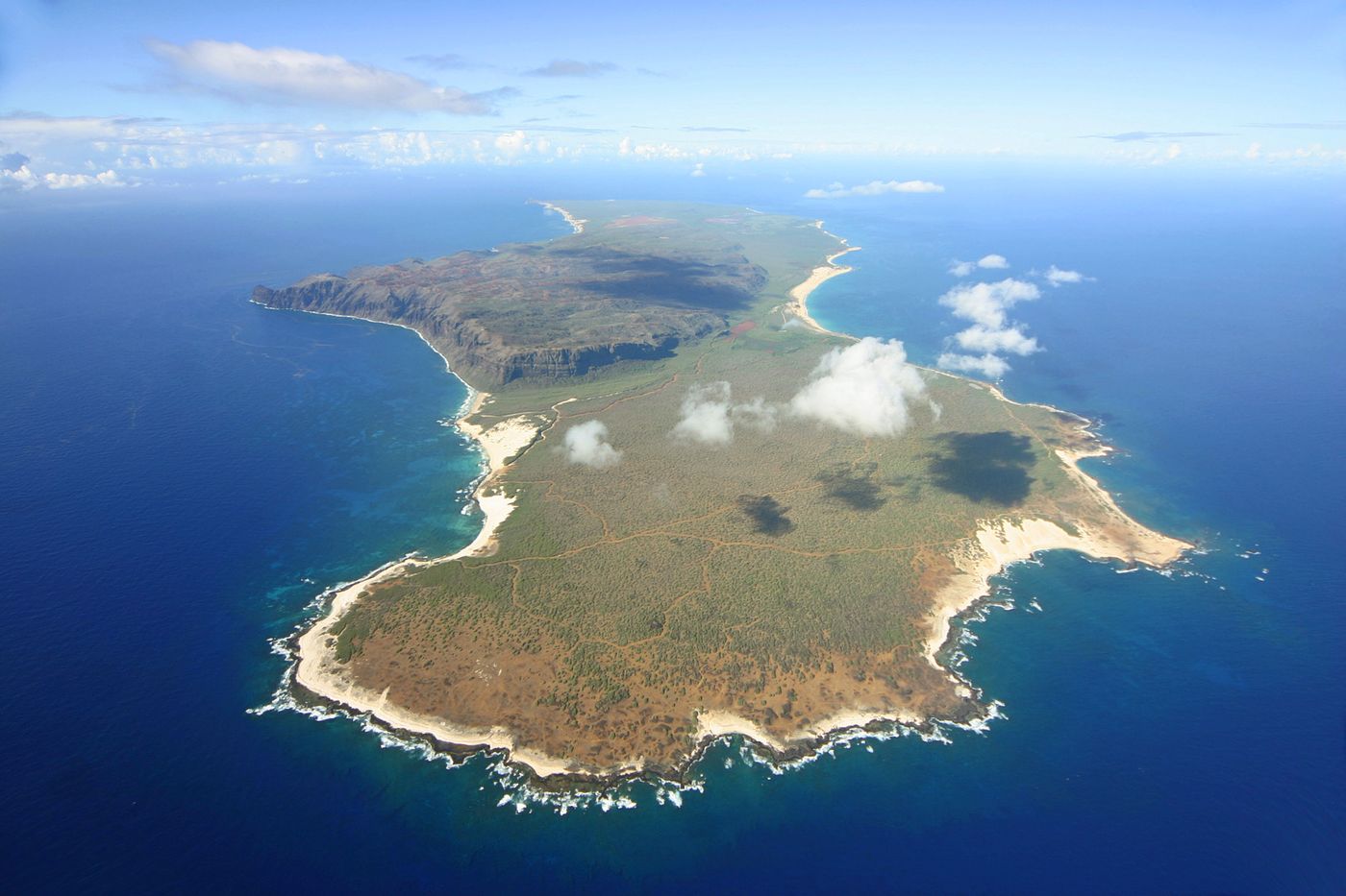
Niihau is the smallest inhabited island in the Hawaiian chain and remains largely cut off from the modern world. The island has been privately owned by the Robinson family since 1864, when they purchased it from the Kingdom of Hawaii. The owners established a policy of isolation to preserve the traditional Hawaiian language and culture of the local residents. There are no paved roads, telephone lines, or hotels on the land. The public cannot board a boat or plane to visit the island without explicit permission.
The most common way people legally visit Niihau is by booking a highly restricted helicopter tour operated by the island owners. These aerial tours depart from the nearby island of Kauai and fly over the interior landscapes of Niihau. The helicopter lands on a remote, uninhabited beach for a brief period, allowing passengers to walk along the shoreline. Visitors on these excursions are strictly forbidden from interacting with the small population of native residents who live in the main village. This rule prevents the introduction of outside illnesses and minimizes disruption to the community daily life.
Another specific pathway to the island is through government and military contracts. The U.S. Navy uses certain unpopulated areas of Niihau for radar testing and defensive training operations. Personnel involved in these programs must receive security clearances and official authorization from both the military and the Robinson family. These workers fly to the island on private aircraft and remain within designated military zones. Contractors must follow strict environmental protocols to ensure they do not disturb the local wildlife, including endangered Hawaiian monk seals that rest on the beaches.
A few individuals gain entry by receiving personal invitations from the Robinson family or the residents themselves. These invitations are exceptionally rare and typically extended to healthcare workers, educators, or structural engineers who provide essential services to the island. Anyone entering under these circumstances must travel by boat from Kauai, navigating rough ocean channels to reach the small landing sites. They must bring all their own supplies, as the island lacks stores and public utilities, relying entirely on solar power and rainwater collection systems.

Credit: Prefeitura Municipal de Itanhaém / Wikipedia (CC BY 2.5)
Ilha da Queimada Grande lies roughly 33 kilometers off the coast of the state of Sao Paulo, Brazil. The island is known globally for its dense population of golden lancehead vipers, a venomous snake species found nowhere else on earth. Because of the danger posed by these reptiles, the Brazilian government banned public access to the island decades ago. The Brazilian navy strictly enforces this restriction, patrolling the surrounding waters to prevent unauthorized vessels from docking along the rocky shoreline.
Biologists and research scientists comprise the primary group of people who legally set foot on the island. These individuals must submit detailed research proposals to the Chico Mendes Institute for Biodiversity Conservation, the federal agency overseeing protected areas. The approval process is rigorous, requiring scientists to demonstrate that their study cannot be conducted anywhere else. Researchers must also prove they have adequate medical training and carry specific antivenom kits to treat potential snakebites. A doctor must accompany any expedition that receives clearance to land on the island.
The Brazilian navy also sends personnel to the island for maintenance purposes. Workers must periodically service the automated lighthouse that has operated on the island since the 1920s. Before the automation of the light, a full-time keeper lived on the island, but the station was abandoned after snakes entered the residence. Today, maintenance crews arrive by naval helicopters or specialized boats to conduct rapid repairs. These individuals wear heavy protective gear, including thick leather boots and puncture-resistant clothing, to shield themselves from snakes hanging from the dense forest canopy.
Documentary film crews occasionally obtain rare permits to capture footage of the ecosystem. These media teams must partner with official scientific institutions and pay significant administrative fees to secure their clearance. They operate under the direct supervision of government observers who monitor every movement on the island. The crews must adhere to strict time limits, often leaving the island before sunset to minimize the risk of accidents during the nighttime hours when the snakes are most active.
Credit: toshihiko tanaka / Pexels
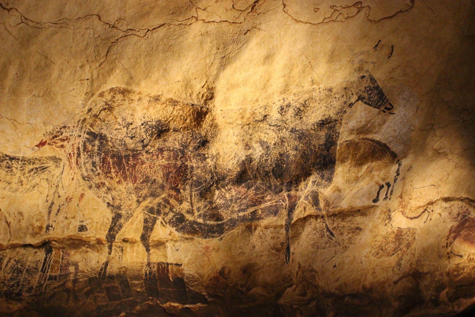
The Lascaux caves in southwestern France contain some of the most famous Paleolithic wall paintings in existence. Discovered in 1940, the site was initially opened to the public, attracting thousands of visitors every week. The high volume of human traffic quickly altered the cave microclimate, introducing carbon dioxide, humidity, and heat. These environmental changes caused the growth of destructive mold, fungi, and lichen on the ancient artwork. To preserve the paintings, the French government closed the complex permanently in 1963.
Entry is now restricted to a handful of preservation experts, scientists, and technicians who monitor the cave environment. These individuals must receive direct authorization from the French ministry of culture and a specialized scientific committee. The selection process is strict, ensuring that only individuals with necessary conservation projects can enter. Workers must wear sterilized protective suits, rubber boots, and face masks to prevent the introduction of organic matter or external microbes into the subterranean chambers.
The individuals who enter the caves do so under tight time constraints. Maintenance crews and monitoring teams are often limited to a few hours of access per week or month to keep the temperature stable. They use special cold-light systems that do not generate heat or promote biological growth on the stone surfaces. These experts check the automated climate control systems, collect air samples, and carefully treat any signs of microbial recurrence on the walls. The data they collect is used to manage the replica sites that tourists visit nearby.
A small number of specialized international scholars may gain entry for major academic assessments. These researchers must submit comprehensive proposals detailing how their observation will advance global archaeological knowledge without endangering the site. They are escorted at all times by official curators who oversee every step taken within the narrow stone passages. No photography equipment that utilizes high-intensity flash units is permitted inside, as the intense light can cause irreversible damage to the prehistoric pigments.
Credit: Collective - Video of Vatican Television Center / Wikimedia Commons (CC BY 3.0)
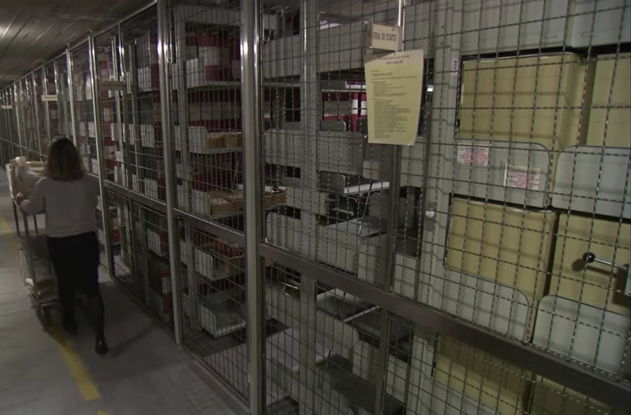
The Vatican Apostolic Archives contain centuries of historical documents, papal correspondence, and state papers maintained by the Holy See. While the institution is no longer officially called the secret archives, the facility remains highly restricted to the general public. Casual tourists, casual history enthusiasts, and journalists are denied entry into the underground repository. The restrictions exist to protect fragile parchment documents from physical wear and to maintain the privacy of historical diplomatic communications.
Qualified scholars in the fields of history and theology represent the primary group permitted to enter the archives. To gain access, an applicant must possess a university degree or an equivalent level of academic qualification from a recognized institution of higher learning. The researcher must submit an official letter of recommendation from an established historical institute or a university professor. This documentation must explicitly state the purpose of the research and explain why the specific Vatican documents are necessary for the project.
Once an academic receives an official admission card, they must follow a strict protocol to examine the materials. Scholars enter the Vatican through designated security checkpoints and proceed directly to the reading rooms. They are not allowed to browse the shelves or enter the underground storage bunkers known as the bunker. Instead, researchers must review specific indices and request individual documents through an automated catalog system. The archive staff retrieves the requested folders and delivers them to the reading rooms under constant surveillance. Scholars are forbidden from bringing pens, ink, or scanning equipment into the study areas, relying instead on laptops or pencils to take notes.
The number of researchers admitted each day is limited to roughly 60 individuals to ensure proper supervision and document care. Access is also restricted based on the historical era of the documents, as the Vatican releases materials in chronological blocks based on the tenure of specific popes. Scholars tracking recent historical events must wait until the current pope authorizes the opening of specific archival sections, a process that requires years of cataloging and preparation by the resident archivists.
Surtsey Island is a volcanic landmass located off the southern coast of Iceland that formed during an eruption starting in 1963. The island serves as a pristine natural laboratory for scientists studying how plants, insects, and animals colonize new land without human interference. To prevent the accidental introduction of foreign seeds, bacteria, or organic materials, the Icelandic government declared Surtsey a restricted nature reserve. No tourists or unauthorized boats are permitted to land on the volcanic shores.
Certified ecologists, geologists, and botanists are the only individuals permitted to visit Surtsey. The Surtsey Research Society manages the application process and grants permits to a small number of scientists each year. These researchers must demonstrate that their presence will not alter the natural progression of the ecosystem. Before departure, every team member must undergo a thorough decontamination process. Security officials check clothes, bags, and scientific equipment to ensure no hidden seeds or soil particles are transported to the island.
The scientists who reach Surtsey travel by helicopter or specialized inflatable boats from the mainland. Once on the island, they live in a small, basic wooden cabin that serves as the only structure on the landmass. Researchers must follow strict rules regarding waste disposal, ensuring that all human waste and garbage are packed up and transported back to the mainland. While walking across the island to monitor bird populations or plant growth, scientists must step carefully along designated routes to avoid compressing the soil or disturbing nesting sites.
The visits are typically brief, lasting only a few days during the summer months when weather conditions permit safe transit and observation. During these windows, researchers catalog new plant species that have arrived via ocean currents or bird droppings. They also track the breakdown of volcanic rock into fertile soil. Any scientist who discovers an unauthorized plant, such as a tomato plant that grew from a stray seed left by an early researcher, must immediately remove it to preserve the absolute integrity of the ecological study.
Diego Garcia is an atoll located in the central Indian Ocean that serves as a highly strategic military outpost. The island is part of the British Indian Ocean Territory but is leased to the U.S. military for naval and air operations. In the late 1960s and early 1970s, the resident population was relocated to make way for the construction of the base. Today, the island features long runways, deep-water port facilities, and advanced communications tracking infrastructure, making it entirely off-limits to commercial flights and yachts.
The population of Diego Garcia consists entirely of military personnel and authorized defense contractors. To reach the island, individuals must be assigned to active duty at the base or hired by corporations managing facility logistics. Travelers $TRV must secure specific security clearances from both the U.K. Foreign Office and the U.S. military command before boarding transport flights. These flights depart from designated military hubs, such as Singapore or Japan, using chartered military aircraft rather than commercial airlines.
Commercial yacht crews navigating across the Indian Ocean can only anchor near Diego Garcia under extreme emergency conditions. If a vessel suffers catastrophic structural failure or runs out of water, the captain must contact the British representative on the island via marine radio to request emergency docking privileges. If permitted to anchor, the crew members are restricted to their vessel or a small, designated section of the beach. They are monitored by military patrols and must depart as soon as repairs are completed or the emergency resolves.
The island isolation requires strict logistical planning for all incoming personnel. Civil engineers, culinary staff, and medical professionals who support the base must contract with approved defense firms for tours of duty lasting several months. They live in military barracks and have access only to authorized recreational zones within the base perimeter. No family members or civilian guests are permitted to accompany workers, ensuring that the population remains strictly tied to the operational readiness of the defense installation.
Credit: François Guerraz / Wikimedia Commons (CC BY-SA 3.0)
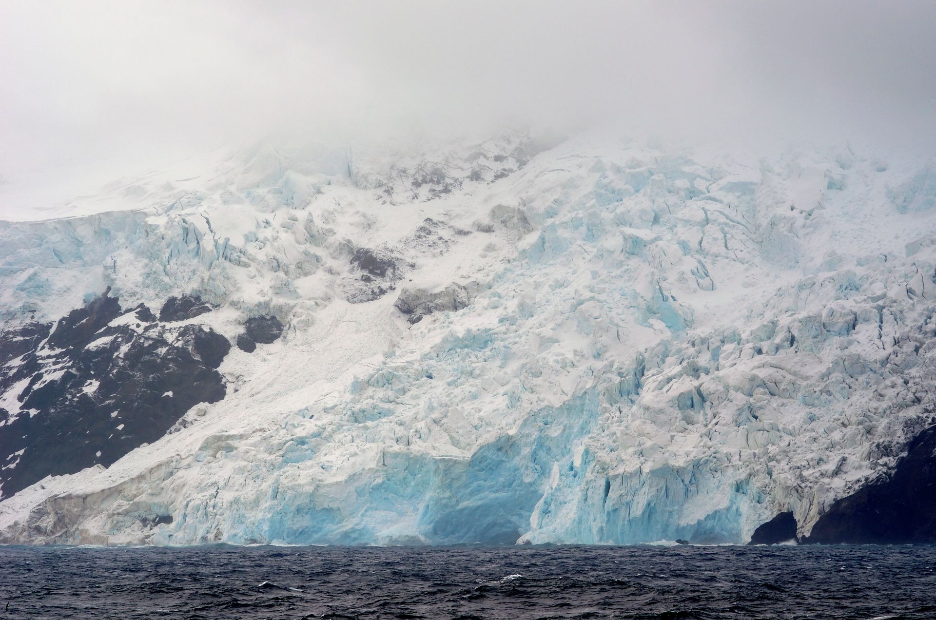
Bouvet Island is an uninhabited sub-Antarctic volcanic island located in the South Atlantic Ocean, making it the most isolated island on Earth. The territory belongs to Norway and is covered almost entirely by glaciers, with steep stone cliffs dropping directly into rough, freezing seas. The island lacks any natural harbors, rendering standard boat landings nearly impossible. The Norwegian Polar Institute manages the island as a nature reserve, restricting access to protect the breeding grounds of fur seals and penguins.
Scientific research teams represent the primary group that has successfully landed on Bouvet Island. These expeditions are organized by government agencies or international polar research bodies to study climate patterns, volcanic activity, and marine biology. To reach the island, scientists must travel aboard specialized icebreakers or polar research vessels capable of navigating the stormy waters of the Southern Ocean. Once the ship arrives off the coast, researchers do not use boats to reach land. Instead, they utilize shipboard helicopters to fly onto the flat surface of the island glaciers.
Extreme amateur radio operators, known as DXers, have also organized rare expeditions to Bouvet Island. These hobbyists travel to remote locations to establish radio contact with operators around the world. To secure a permit from the Norwegian authorities, these groups must demonstrate exceptional survival training, provide detailed logistics plans, and fund their own transport. They spend years raising hundreds of thousands of dollars to charter private expedition vessels. Upon arrival via helicopter, they set up temporary tents on the ice, operating radio equipment for a few days under sub-zero temperatures before packing up all equipment.
The extreme weather conditions mean that many planned expeditions fail before anyone can land. Sudden blizzards and high winds frequently ground helicopters, forcing ships to wait off the coast for weeks or abandon the mission entirely. The individuals who successfully step onto the island must be prepared for complete self-sufficiency, carrying emergency shelters, satellite communication gear, and enough food supplies to survive prolonged isolation if weather conditions prevent a helicopter from returning to the main ship.
Credit: Aleksei / Алексей Simonenko / Симоненко / Unsplash
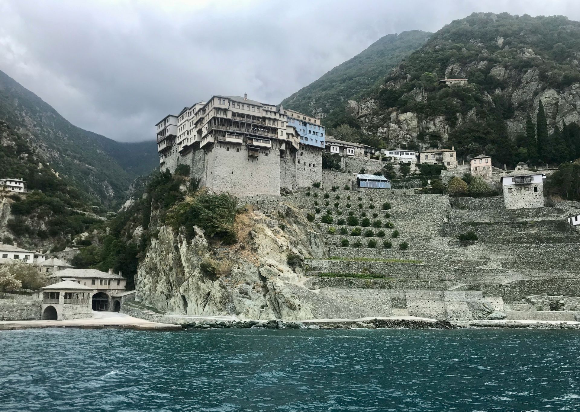
Mount Athos is an autonomous monastic state located on a peninsula in northeastern Greece. The region is home to 20 Eastern Orthodox monasteries and has enjoyed a special self-governing status for centuries. One of the strictest rules governing Mount Athos is the total ban on female visitors, a regulation that extends to female domestic animals as well. This prohibition has been enforced for over 1,000 years to preserve the monastic focus on spiritual isolation. Even male visitors cannot simply walk into the territory; they must navigate a formal permit process.
Male pilgrims and secular visitors must secure a specialized entry permit called a diamonitirion before arriving. The Mount Athos Pilgrims Bureau in Thessaloniki manages the distribution of these documents. The office issues only a limited number of permits each day, with a small quota reserved for non-Orthodox visitors. Applicants must submit copies of their passports and state the specific dates of their intended visit months in advance. Once approved, visitors travel to the gateway towns of Ouranoupoli or Ierissos to collect their paper permits.
Access to the peninsula itself is restricted to maritime travel. There are no public roads connecting Mount Athos to the rest of Greece, so visitors must board authorized ferry boats to reach the monastic ports. Upon landing, travelers must present their permits to religious police officers who monitor the docks. Visitors move between the monasteries on foot or via small, shared vans operated by the monks. They are expected to follow the daily schedule of the monasteries, eating meals in silence and attending long religious services that begin well before sunrise.
Academic researchers who wish to study the vast collections of medieval manuscripts housed in the monastic libraries face additional bureaucratic steps. They must obtain official recommendation letters from their home universities and secure specific clearance from the Greek Ministry of Foreign Affairs. These scholars are granted permission to access the archival rooms for limited hours each day, working under the direct supervision of a designated monk archivist who ensures the delicate ancient texts are handled with extreme care.
Credit: Makemake / Wikimedia Commons (CC BY-SA 3.0)
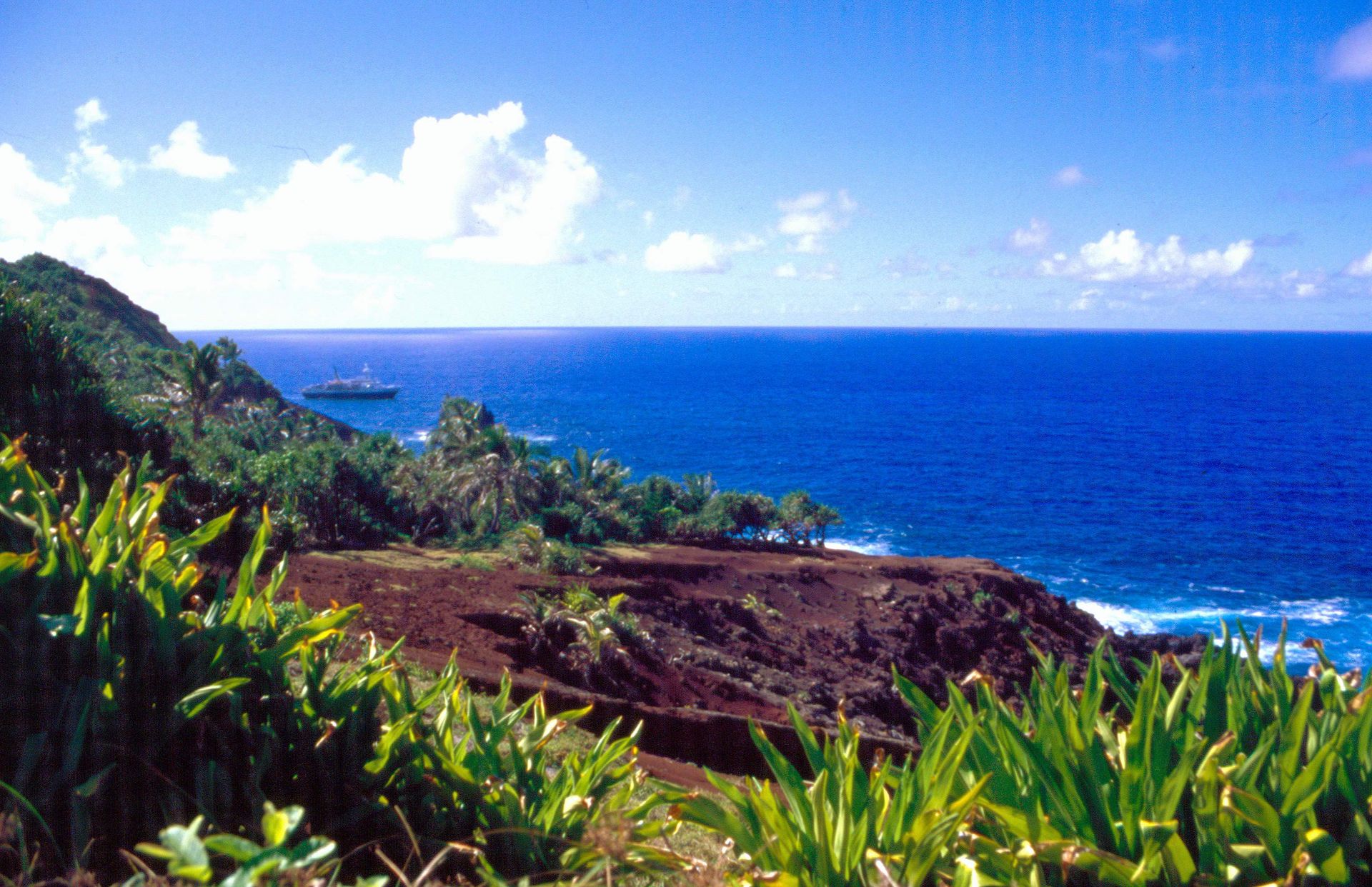
Pitcairn Island is a tiny British Overseas Territory located in the southern Pacific Ocean, famous for being the refuge of the HMS Bounty mutineers. The island has a population of fewer than 50 residents and is one of the most remote inhabited places on earth. Pitcairn features no airport or airstrip, meaning it is impossible to reach the territory by plane. The rugged terrain and steep cliffs provide no flat land for aviation infrastructure, forcing anyone who wishes to visit to undertake a long ocean voyage.
The most reliable pathway to Pitcairn Island is via the dedicated government supply vessel, the MV Silver Supporter. This passenger and cargo ship operates on a scheduled route from the island of Mangareva in French Polynesia, which has the nearest airport. Travelers $TRV must first fly into Tahiti and then take a domestic flight to Mangareva. From there, they board the supply ship for a 32-hour journey across open ocean. The ship makes this run only a couple of times each month, meaning visitors must plan their stay around the vessel schedule.
Upon reaching Pitcairn, landing on the island presents a significant physical challenge. The supply ship anchors off Bounty Bay because there is no deep-water harbor for large vessels. Visitors and cargo must transfer to large aluminum longboats operated by experienced local islanders. These longboats navigate the rolling ocean swells and breakwaters to reach a small concrete jetty. Visitors must secure an entry visa or passenger landing permit from the Pitcairn Island Office, which requires proof of medical evacuation insurance due to the complete lack of advanced medical facilities on the island.
Independent yachts can also request permission to anchor in the bay, but crews must contact the island authorities well in advance to obtain clearance. The local government monitors all approaching maritime traffic via radio tracking systems. Yacht passengers must pay landing fees and follow specific bio-security regulations to ensure no foreign insects or plant pests are brought ashore. Due to unpredictable weather and rough sea states, yachts are often forced to stay offshore, waiting for days until conditions become safe enough for a longboat transfer.
Credit: Mads Eneqvist / Unsplash
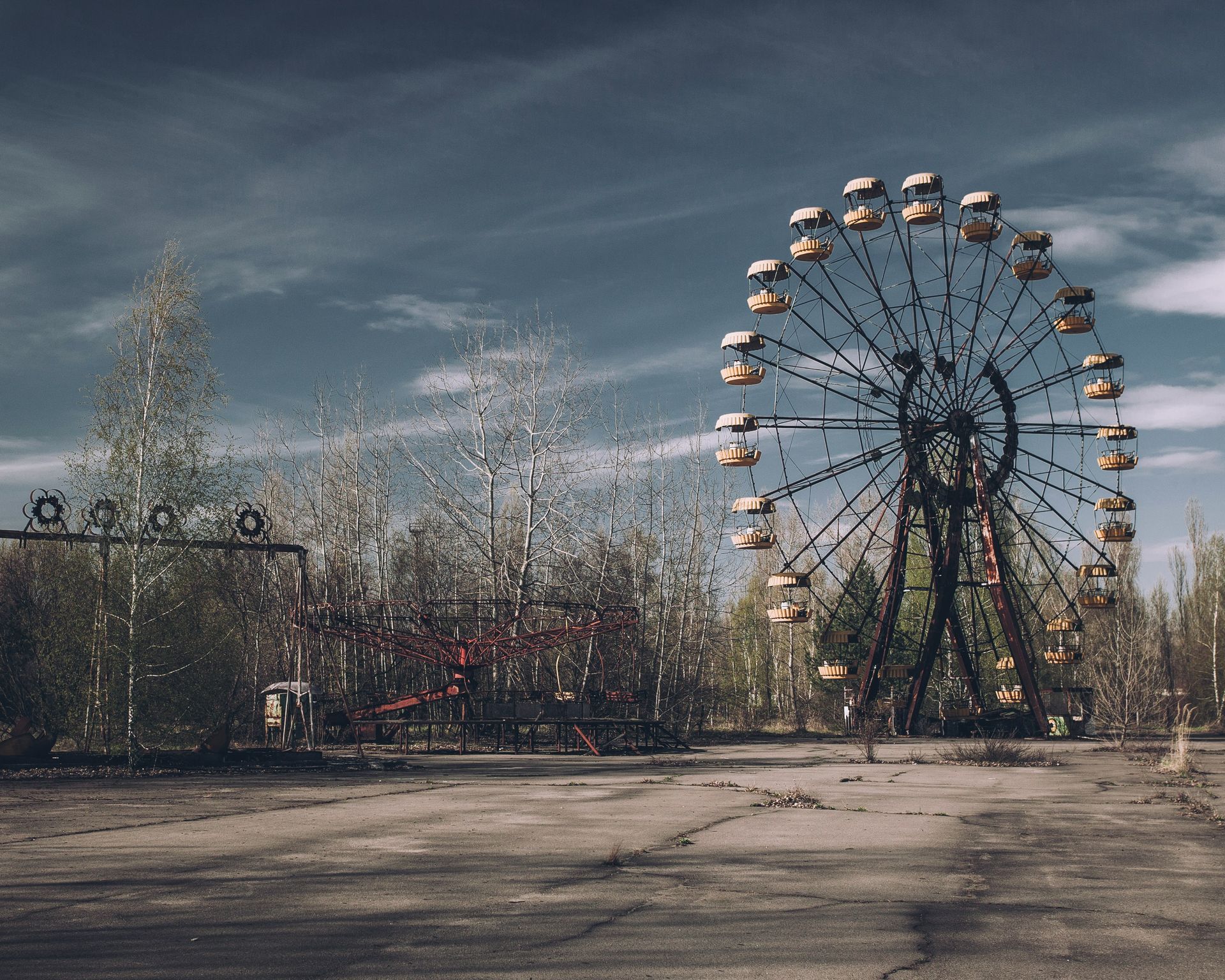
The Chernobyl exclusion zone is a designated area covering roughly 2,600 square kilometers around the site of the 1986 nuclear power plant disaster in Ukraine. Following the explosion of reactor four, the Soviet government evacuated the population and established a militarized perimeter to contain radioactive contamination. While radiation levels have decayed in certain sectors, large areas remain dangerous for long-term human habitation. The zone is heavily guarded by Ukrainian security forces who operate checkpoints along the perimeter.
The primary method used by individuals to legally enter the zone is through licensed tour operators authorized by the government agency managing the exclusion zone. These companies handle the complex bureaucratic paperwork required to secure individual day passes. Visitors must provide their passport details days in advance for background checks by state security services. Upon arrival at the Dytyatky checkpoint, guards verify individual identification against the pre-approved manifest before allowing vehicles to pass into the outer ring of the zone.
Scientific researchers and engineers utilize a different pathway to secure long-term access to the interior sectors. These specialists are tasked with monitoring radiation levels, studying the effects of radiation on local wildlife, or managing the containment structures over the damaged reactor. To enter, these professionals must hold credentials from recognized research institutions or engineering firms contracted by the state. They carry specialized radiation dosimeters at all times and must undergo radiation screening at multiple internal checkpoints when moving between different contamination zones.
The individuals working inside the zone follow strict operational schedules to limit their cumulative radiation exposure. For example, workers at the waste management facilities often work on alternating shifts, spending 15 days inside the zone followed by 15 days of mandatory rest outside. They must eat only in designated clean cafeterias where food is brought in from uncontaminated regions. Every vehicle leaving the zone must pass through automated washing stations to remove radioactive dust from tires and chassis before entering public roads.
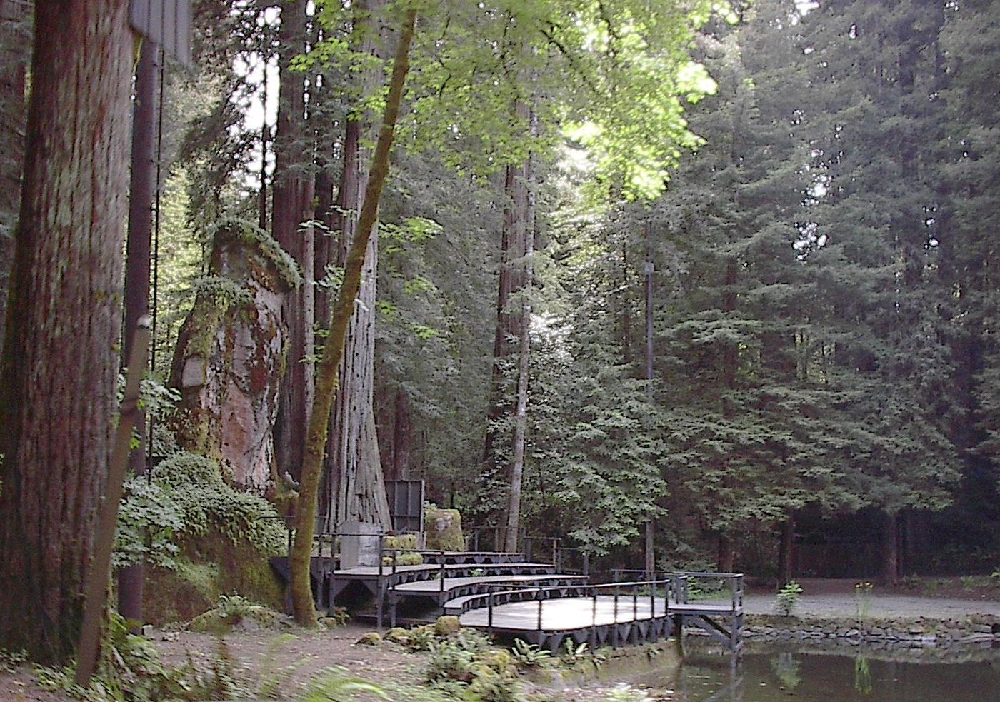
Credit: Aarkwilde / Wikipedia (CC BY-SA 3.0)
Bohemian Grove is a 2,700-acre campground located in Monte Rio, California state, belonging to a private San Francisco-based men art club known as the Bohemian Club. Every summer, the club hosts a two-week encampment that attracts prominent global figures, including politicians, corporate executives, military leaders, and media moguls. The entire perimeter is heavily secured by private security guards, local law enforcement, and federal agencies when high-ranking officials are present, making unauthorized entry highly difficult.
The only legitimate way to enter Bohemian Grove during the summer encampment is as a member or an officially invited guest. Membership in the club is restricted to men and involves a long waiting list that can span decades. Prospective members must be nominated by multiple current members and pay significant initiation fees. The roster is filled with individuals of substantial economic or political influence. Members are permitted to invite personal guests to the encampment, but these individuals must be vetted by the club management before receiving an entry pass.
Staff members and service contractors represent another group that gains legal entry to the grounds. The club hires hundreds of temporary workers each year to handle catering, maintenance, security, and theatrical production for the encampment events. These employees must undergo detailed background checks before they are permitted on the property. Once hired, staff members are issued specific identification badges and are forbidden from bringing cameras, recording devices, or smartphones into the grove to protect the privacy of the club members.
The security perimeter around the redwood grove is monitored continuously during the gathering. Private guards patrol the fence lines on foot and utilize motion sensors and security cameras to detect trespassers. Anyone caught attempting to infiltrate the property without authorization is detained immediately and turned over to the Sonoma County sheriff office for trespassing charges. The strict enforcement of these rules ensures that the discussions and rituals occurring within the grove remain completely hidden from public view.
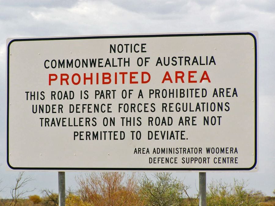
Credit: Kr.afol / Wikimedia Commons (CC BY-SA 3.0)
The Woomera Prohibited Area is a massive military testing range located in the outback of South Australia, covering over 122,000 square kilometers. It is the largest land-based weapons testing facility in the world, managed by the Australian Department of Defence. The zone is used for testing aerospace systems, rockets, and electronic warfare equipment. Because of the frequent danger posed by live weapons testing and unexploded ordnance, the entire region is closed to standard public access and entry without authorization is a federal offense.
Defense personnel, aerospace engineers, and scientific researchers gain access by participating in authorized military or space research programs. Companies and international partners, such as the U.S. military or global aerospace firms, must secure official permits to utilize the testing range. Individual workers must obtain high-level security clearances and complete specialized safety briefings regarding unexploded ordnance. These personnel travel into the area via military transport or through monitored access roads, remaining within strictly defined test zones during scheduled operation windows.
Certain civilians, such as pastoralists and mining operators, can secure restricted access to specific sectors of the area. The government grants specialized leases and access deeds that allow sheep farming or mineral exploration within designated zones. These individuals must coordinate their movements closely with the Woomera Test Range integration office. Before any weapons test occurs, the military notifies all leaseholders to evacuate their properties or remain inside reinforced shelters. The residents must use specific radio frequencies to report their locations and ensure they are well clear of the active target zones.
The Stuart Highway passes directly through a portion of the Woomera Prohibited Area, offering the only way for standard motorists to traverse the region. Drivers must remain strictly on the paved highway and are forbidden from pulling off into the surrounding terrain. The military installs prominent warning signs along the roadside, advising travelers not to leave the road due to the risk of encountering hidden explosives. During active testing windows, the government temporarily closes the highway entirely, blocking traffic with manned security gates until the danger passes.
-1920x877.jpg)
Credit: z tanuki / Wikimedia Commons (CC BY 3.0)
The Ise Grand Shrine is a Shinto shrine complex located in the city of Ise in Mie Prefecture, Japan. Dedicated to the sun goddess Amaterasu, the shrine is considered one of the most sacred sites in the Shinto religion. The main structures are rebuilt every 20 years to symbolize the Shinto concepts of renewal and the impermanence of all things. The core buildings are hidden behind a series of four tall wooden fences, entirely obscuring the structures from public view. Ordinary visitors are only allowed to stand outside the outermost fence.
The individuals who legally pass beyond the wooden fences are restricted to members of the Japanese imperial family and high-ranking Shinto priests. The head priest or priestess of the shrine must be a member of or connected to the imperial lineage, appointed by the emperor to oversee the sacred rituals. These spiritual leaders undergo extensive ritual purification processes before entering the inner sanctums. They dress in traditional white silk robes and follow precise historical protocols when walking through the sacred gates to present offerings of food and cloth to the deity.
Architects and master carpenters who are selected to rebuild the shrine every 20 years also secure access to the inner enclosures. These craftsmen must belong to specialized guilds that have preserved ancient wood-working techniques for generations. To enter the site, the workers must be officially vetted by the shrine administration and undergo purification rituals led by the priests. They work without modern power tools or metal nails, using intricate interlocking wood joints to assemble the buildings. Their presence within the inner fences is strictly limited to the duration of the reconstruction process.
The security surrounding the inner structures is maintained by a dedicated force of shrine guards and local police. Surveillance cameras and motion detectors monitor the fence lines to prevent any unauthorized scaling of the wooden barriers. Tourists can view the outer thatched roofs from designated viewing areas, but taking photographs of the inner structures is completely banned even from outside the fences. This maintains the sanctity and privacy of the religious rites performed within the central compounds.
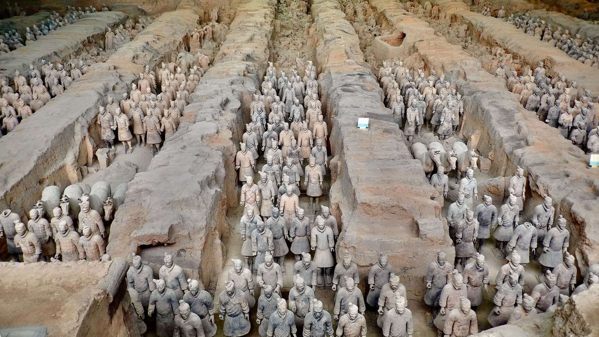
Credit: TonyNojmanSK / Pexels
The tomb of Qin Shi Huang, the first emperor of China, lies beneath a large burial mound in the Lintong District of Xi'an. While the famous Terracotta Army surrounding the burial site has been excavated and opened to global tourism, the central tomb chamber itself remains completely unopened and restricted. The Chinese government has prohibited excavation of the main burial structure to protect the artifacts from atmospheric damage and because of historical records detailing toxic traps, including rivers of liquid mercury flowing through the chamber.
The small group of individuals who gain access to the immediate vicinity of the tomb mound consists of elite archaeologists and preservation scientists working for the Chinese Academy of Social Sciences. These experts do not enter the central burial chamber, but they conduct remote sensing operations and drill narrow core samples from the surrounding soil. To receive authorization for these peripheral studies, researchers must secure high-level permits from the State Administration of Cultural Heritage. The government requires extensive proof that the proposed testing will not disturb the structural integrity of the mound.
The technicians who analyze the soil samples must follow rigorous scientific protocols to monitor mercury levels around the site. They use advanced spectroscopic equipment to track toxic emissions rising from the interior chambers, confirming the accuracy of ancient historical descriptions. These workers wear specialized respiration masks and protective clothing when operating near the testing shafts to avoid inhaling hazardous vapors. Their access is tightly scheduled, and all data collected is classified as state property, requiring official clearance before any findings can be published in international journals.
The physical security around the burial mound is managed by state security guards who monitor the perimeter 24 hours a day. The entire hill is fenced off, and unauthorized individuals face immediate arrest if they attempt to climb the structure or conduct independent digging. By maintaining a strict ban on excavation, the government ensures that the central chamber remains completely sealed until future technologies emerge that can guarantee the preservation of the organic materials and ancient treasures contained within.
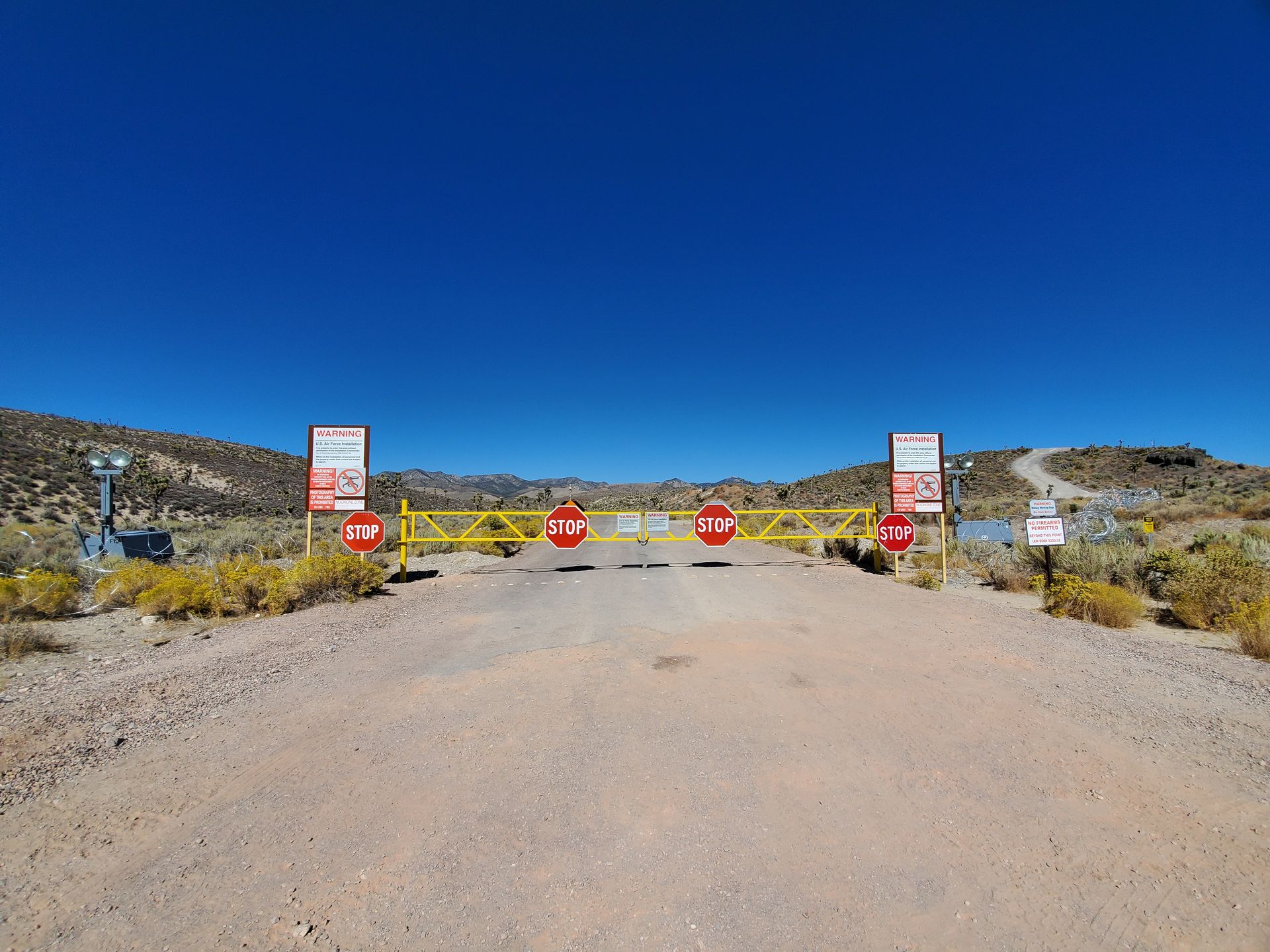
Credit: David James Henry / Wikimedia Commons (CC BY-SA 4.0)
Area 51 is the popular name for a highly classified U.S. Air Force facility located within the Nevada Test and Training Range. The facility primary purpose is the development and testing of experimental aircraft and weapons systems, meaning its existence was not officially acknowledged by the government until 2013. The airspace above the facility is completely restricted to commercial and private aviation, and the surrounding desert landscape is patrolled by private security contractors and military personnel.
The only individuals who enter Area 51 are military personnel, intelligence officers, and civilian defense contractors who hold top-secret security clearances. To gain access, workers must be assigned to specific classified programs managed by the Department of Defense or agencies like the Central Intelligence Agency. The vetting process for these clearances involves extensive background checks, polygraph examinations, and interviews with associates. Anyone approved for entry is bound by strict non-disclosure agreements that carry severe federal prison sentences if violated.
The method of transport into the facility is highly regulated to maintain secrecy. Most civilian workers do not drive to the site through the desert checkpoints. Instead, they board unmarked passenger aircraft operating out of a restricted terminal at Harry Reid International Airport in Las Vegas. These flights, using the call sign Janet, transport hundreds of workers daily directly to the Groom Lake airstrip inside the facility. The windows of these aircraft remain covered during certain portions of the flight, and workers are dropped off directly inside secure hangars to prevent satellite surveillance.
The ground perimeter is monitored by camouflaged security guards who drive unmarked trucks along the border hills. They utilize high-tech surveillance systems, including ground-embedded motion sensors, thermal imaging cameras, and long-range listening devices to detect approaching civilians. Anyone who crosses the prominent warning signs marking the boundary is immediately detained by the contractors and handed over to the local county sheriff, resulting in heavy fines and potential arrest.
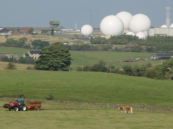
Credit: Malcolm Street / Wikimedia Commons (CC BY-SA 2.0)
RAF Menwith Hill is a large military base located in North Yorkshire, U.K., that serves as a critical electronic monitoring and intelligence-gathering station. The site is easily recognized by its numerous large, spherical radomes, which shield powerful satellite tracking dishes from weather and visual surveillance. The facility is operated jointly by the British Royal Air Force and the U.S. National Security Agency, making it a key component of global intelligence networks. The public is entirely banned from entering the heavily fenced installation.
The population inside RAF Menwith Hill consists of intelligence analysts, cryptographic experts, and military communications personnel from both the U.S. and the U.K. To work at the facility, individuals must secure the highest levels of national security clearance, such as Top Secret Positive Vetting in the U.K. or Single Scope Background Investigation in the U.S. The approval process requires detailed scrutiny of financial records, foreign travel history, and personal relationships to eliminate any risk of espionage or intelligence leaks.
Personnel who receive clearance enter the facility through fortified gates staffed by armed Ministry of Defence Police officers. Inside the complex, movement is controlled by biometric security scanners and electronic key cards that restrict access to specific operations rooms based on individual project clearance. Analysts work in windowless environments, processing intercepted communications and satellite telemetry data. They are subject to continuous internal monitoring, and all electronic communications entering or leaving the facility are logged and audited by security teams to prevent unauthorized data dissemination.
The external security around the station involves multiple layers of razor-wire fencing, perimeter cameras, and automated intrusion detection systems. Regular patrols are conducted by armed police officers who monitor the public roads surrounding the base. Protesters and independent journalists frequently gather outside the main gates, but they are strictly monitored and barred from crossing the boundary lines. Any attempt to film or photograph the internal security infrastructure can result in immediate detention under national security legislation.
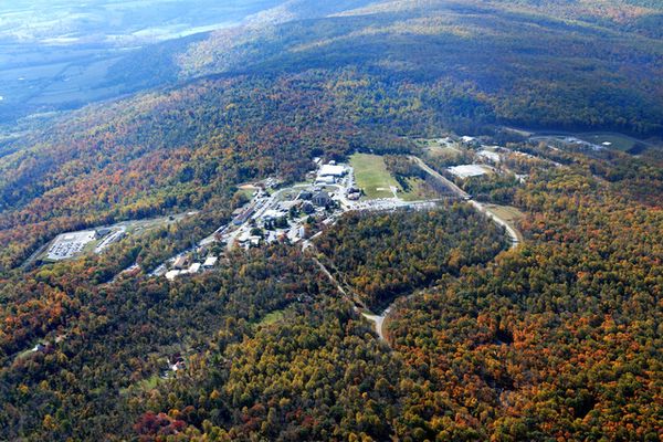
Credit: NARA & DVIDS Public Domain Archive / Karen Nutini / FEMA via National Archives
The Mount Weather Emergency Operations Center is a major command facility located in the Blue Ridge Mountains of Virginia state. Managed by the Federal Emergency Management Agency, the site serves as the primary continuity of government facility designed to house high-ranking officials during national emergencies, such as nuclear war or catastrophic cyberattacks. The complex includes both an above-ground administrative campus and a massive underground bunker carved into the mountain rock, completely closed to public access.
Access to Mount Weather is restricted to essential federal employees, emergency management specialists, and top-tier government officials who hold specific roles in national security planning. To work at the center, personnel must maintain high-level security clearances and undergo regular drills to simulate rapid evacuation scenarios. These workers are responsible for maintaining the communications networks, power generators, and life-support systems that would sustain the underground population for months during a major national crisis.
During a real or simulated emergency, the pathway to the facility involves secure government transportation. High-ranking officials, including cabinet secretaries and congressional leaders, are transported to the site via military helicopters or armored vehicle convoys operating under armed escort. Upon arrival, these individuals must pass through fortified gates and biometric checkpoints before entering the underground bunker tunnels. The interior of the bunker features self-contained housing units, medical clinics, and broadcasting studios, allowing the leadership to govern the nation from complete isolation.
The facility is protected by a dedicated police force that patrols the mountain perimeter on a continuous basis. The above-ground visible structures are surrounded by high-security fencing, razor wire, and advanced surveillance cameras that feed into a central monitoring station. Unauthorized vehicles attempting to approach the entrance gates along the rural mountain roads are turned back immediately by armed guards. The strict secrecy surrounding the internal layouts and operational protocols ensures that the facility remains protected against external threats.
-1920x2692.jpg)
Credit: Vivek Doshi / Unsplash
North Sentinel Island is one of the Andaman Islands in the Bay of Bengal, legally administered by India. The island is inhabited by the Sentinelese, an indigenous people who have violently rejected contact with the outside world for centuries. To protect the population from fatal modern illnesses to which they have no immunity and to prevent violent conflict, the Indian government established a nine-kilometer exclusion zone around the island. It is illegal for anyone to approach the shoreline or anchor boats nearby.
The only individuals who have legally landed on North Sentinel Island and interacted with the population are anthropological teams led by the Anthropological Survey of India during the late 20th century. Led by researchers like T.N. Pandit, these official expeditions required explicit authorization from the central government of India and the Andaman administration. The teams traveled to the island aboard naval vessels and approached the beaches using small rowboats. They brought gifts, such as coconuts and plastic buckets, to establish peaceful contact with the residents from a distance.
These anthropological missions were conducted under strict protocols to minimize risk. The researchers remained on the beaches for limited periods and avoided entering the interior forests where the community dwellings were located. Armed naval personnel accompanied the scientists to provide security, though they were instructed not to use force unless absolutely necessary. After a series of contacts in the early 1990s, the Indian government decided to halt all expedition permits, concluding that further contact was detrimental to the tribe survival and safety.
Today, the exclusion zone is patrolled continuously by the Indian Coast Guard and naval vessels using radar and aerial surveillance. Any unauthorized vessels, such as illegal fishing boats or adventurous travelers attempting to reach the island, are intercepted immediately and the operators face severe prison sentences under the Andaman and Nicobar Islands Protection of Aboriginal Tribes Regulation. The government maintains a policy of eyes-on, hands-off, observing the island from a safe distance to ensure the tribe remains undisturbed.
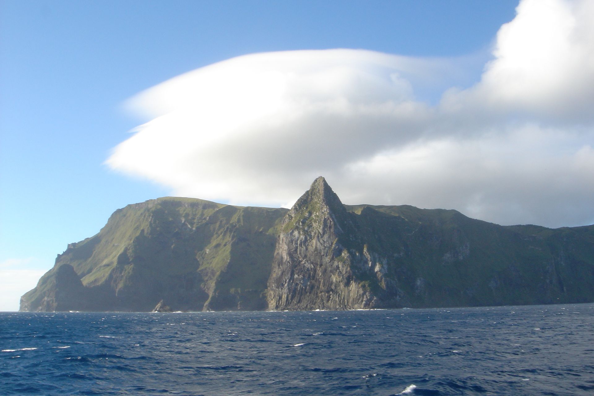
Credit: Ron Van Oers / Wikimedia Commons (CC BY-SA 3.0 IGO)
Inaccessible Island is a volcanic island located in the South Atlantic Ocean and is part of the British overseas territory of Tristan da Cunha. The island is a designated World Heritage Site and wildlife reserve, renowned for its unique bird species, including the Inaccessible Island rail, the smallest flightless bird in the world. The terrain is defined by steep cliffs that rise directly from the sea, making physical access difficult. The local government strictly regulates entry to prevent the introduction of invasive species.
To legally visit Inaccessible Island, travelers must first secure an official permit from the Tristan da Cunha Island Council. The application process requires visitors to state a clear scientific or educational purpose for their journey, as purely recreational tourism is rarely approved. Applicants must also provide proof of comprehensive medical evacuation insurance, given the extreme isolation of the archipelago. Once the permit is granted, travelers must book passage on one of the few fishing vessels or research ships that sail from Cape Town, South Africa, a journey that takes roughly six days.
Upon arriving at the main island of Tristan da Cunha, visitors cannot proceed to Inaccessible Island alone. They must hire authorized local guides from the resident community to accompany them on the remaining 40-kilometer boat journey. These guides are essential for navigating the unpredictable sea conditions and identifying the few narrow rocky ledges where landing is physically possible. Once ashore, visitors must follow strict biosecurity checks, scrubbing their boots and gear to ensure no foreign seeds or insects are released into the delicate island ecosystem.
The duration of stays on Inaccessible Island is typically short, often limited to a single day due to the complete lack of permanent shelters or infrastructure. Visitors must pack out every piece of waste they generate and are forbidden from lighting fires or disturbing the nesting colonies of seabirds. If weather conditions deteriorate suddenly, which happens frequently in the roaring forties region of the South Atlantic, the local guides will order an immediate evacuation to prevent the group from becoming stranded on the rocky shores.
